The base map is provided by OpenTopoMap’s volunteer servers.
Glaciation of the Wind River Mountains
___ Glacial Features
___ Rock Exposure Ages Determined by Cosmogenic Isotope Dating
___ Complications of Beryllium-10 Dating
___ Exposure Ages of Pinedale Moraines
___ Exposure Age of “Titcomb Lakes” Moraine
___ Exposure Ages of “Temple Lake” and “Alice Lake” Moraines
___ Exposure Ages of Glacier Retreat East of the Continental Divide
___ Exposure Ages of Moraines in Stough Creek Basin
___ Little Ice Age Glaciation
___ Summary of Pond History
Fish-stocking Zooicide in the Wind River Mountains
___ What Is Fish-stocking?
___ Why Is Fish-stocking Needed?
___ How Extensive Has Fish-stocking Been in the Western United States?
___ How Extensive Has Fish-stocking Been in the Wind River Mountains?
___ If the stocked fish die without establishing a reproducing population, can previously eliminated invertebrate species recover?
___ What happens when fish become residents of a previously fishless lake in the Wind River Mountains?
___ What experimental evidence can be used to determine the effects of fish-stocking on fairy shrimp?
___ What other experiments with fish and invertebrates can be used to infer what happened to fairy shrimp in stocked lakes?
___ Zooicide in the Wind River Mountains
Bivouac Lake
Atlantic Sunny Bench Pond
Below “Windy Lake” Pond
“Upper Silas Lake” Southwest Pond
“Fremont Lake” Moraine Pond
Buttress Pond
Little Sandy Overlook Pond
“Coon Lake” South Pond #1
“Coon Lake” South Pond #2
“Coon Lake” South Pond #3
Cliff Edge Pond
“Coon Lake” South Pond #4
“Coon Lake” South Pond #5
Big Stough East Pond
Medina Mountain Ponds
Silas Headwall Lake
Silas Cornice Chute Lake
Cinquefoil Pond
Stough Below the Moraine Pond
Boulder Bog Pond
Deep Cirque Overlook Pond
Shoal Lake Northwest Pond
Hill 10,646 East Pond
Hill 10,646 South Pond
East Side Cirque Pond
Hidden Snowbank Pond
Jim Creek Saddle Pond
Jim Creek First Pond
Spot 10,672 Pond
Peak 11,246 South Pond
Peak 11,107 Northeast Pond
Wind River Peak Ponds
Little Stough West Pond
Stough Off Channel Pond
Lower Indian Pass Lake
Jackson Peak Pond
Little Deep Pond
Upper Indian Pass Lake
Upper Sand Pond
Lower Sand Pond
Indian Basin 11218 Pond
Indian Basin First Pond
Elephant Head Lake
Sand and Boulder Pond
Green Island Pond
“Island Lake” Pond #1
“Island Lake” Pond #2
“Island Lake” Pond #3
“Island Lake” Pond #4
“Island Lake” Pond #5
What Can We Learn from the Ponds in the Wind River Mountains?
The Wind River Mountains are the highest and largest mountain range with the most glaciers in Wyoming, although the Laramie Mountains are longer (visual estimates of 1:500,000-scale map of state). They are 170 km (105 miles) long from the US 26 crossing of the continental divide at Togwotee Pass to the Wyoming 28 crossing of the divide at South Pass. The Wind River Mountains are 60 km (37 miles) wide at their mid-section from the lower end of “Fremont Lake” at the edge of the Green River Basin to the upper end of Bull Lake at the edge of the Wind River Basin. At their north end, they give way to the Gros Ventre Mountains to the west and the Absaroka Mountains to the north. At the south end, the Wind River Mountains become more and more subdued until they are lost in the low hills and ridges of the South Pass area and the Antelope Hills.
The elevation range of the Wind River Mountains is about 2,000 m (6,560′). Gannett Peak has an elevation 4,207 m (13,804′) and there are several other peaks above 4,000 m (13,120′), such as Wind River Peak 68 km (42 miles) to the southeast. Elevations along the base of the range are variable. “Fremont Lake” at the base of the mountains on the west side is 2,260 m (7,410′) while “Bull Lake” on the east side is 1,770 m (5,810′). 55 km (34 miles) to the southeast of “Bull Lake”, the mouth of Sinks Canyon is at 2,260 m (7,410′). South of “Fremont Lake” on the west side, “Boulder Lake” is at an elevation of 2,222 m (7,290′) and the mouth of Big Sandy River is at 2,304 m (7,560′). On the northeastern side of the range, the slope up to the divide is more or less continuous. On the southwestern side of the divide, however, there is commonly a sharp rise from the Green River Basin, then a more horizontal but still quite rugged area up to 12 km (7.5 miles) wide (e.g., Pine Mountain to “Lower Jean Lake”) between the elevations of 3,000 m (9,840′) and 3,500 m (11,480′), and finally another rise to the highest peaks and ridges near the Continental Divide.
The average annual precipitation on the Wind River Mountains prior to 1986 was greater than 40 inches (102 cm), as water, according to Pochop and others (1989). Mean Annual Precipitation according to the Wyoming Climate Atlas by the Water Resources Data System and State Climate Office at http://www.wrds.uwyo.edu/sco/climateatlas/precipitation.html, Parameter-Elevation Regressions on Independent Slopes Model, PRISM, with 1971-2000 data at very widely spaced weather stations (I have eyeballed the values from a very small scale map with 11 precipitation bins marked with indistinct colors and further obscured by a shaded relief base map):
31″-40″ (79-102 cm) up to maybe 51″-60″ (130-152 cm) on the crest
Much of the Wind River Mountains is above timberline where the vegetation is dominantly alpine tundra. With decreasing elevation, trees become abundant, starting with white pine krummholz and proceeding downward through full-size white pine, fir, spruce, douglas fir, and lodgepole pine. Lush meadows are common. Sagebrush is abundant in the foothills.
The Wind River Indian Reservation occupies a part of the Wind River Mountains. The reservation is approximately a rectangle with west-east and north-south boundaries. The southwestern corner of this rectangle is truncated at the Continental Divide, where it lies between the Fitzpatrick and Popo Agie wildernesses. The reservation boundary along the divide is 16 km (10 miles) long and the reservation expands northeastward from there to cover approximately 1,994 square kilometers (770 square miles) of the mountain range, including foothills. For comparison, this area is 15% larger than that of the Bridger Wilderness alone, which doesn’t include foothills.
The Wind River Mountains are a paradise of public lands for hikers. The car-tethered masses are drawn to the scenic wonders of Teton and Yellowstone National Parks farther to the northwest. There are no roads through the Wind River Mountains south of Union Pass, near the northern end. The only choices are to walk or ride a horse. The Bridger-Teton National Forest manages the mountains to the southwest of the Continental Divide and the Shoshone National Forest manages the mountains to the northeast. Probably 75% (EIGWUU) of the National Forest lands in the mountains are Wilderness Areas totaling about 2,947 square kilometers (1,138 square miles) (as stated on U.S. Forest Service recreation maps): the Bridger Wilderness on the Bridger-Teton and the Fitzpatrick and Popo Agie wildernesses on the Shoshone. Other than a few parcels of private land along the upper Green River north of Pinedale, there are no private in-holdings. Non-tribal members who want to visit or cross the Wind River Indian Reservation must purchase a trespass permit.
Black bears and grizzly bears roam throughout the Wind River Mountains. Black bears were never extirpated from the Wind River Mountains. Grizzly bears have spread southward from Yellowstone National Park over the last 30 years or so. Neither the U.S. Forest Service nor the Wyoming Game and Fish Department provide information on bear populations, where they are most common, sightings, or attacks. Carrying bear spray is advised. Visit https://www.fs.usda.gov/r04/bridger-teton/safety-ethics/be-bear-wise-keep-bears-wild-people-safe for more about bears. The Bridger-Teton National Forest requires that off-road campers secure all food and any other items that may attract bears in bear-resistant containers or in bags hung at least 10′ (3 m) above the ground. The June 14, 2023 order by the Forest Supervisor is at https://www.fs.usda.gov/r04/bridger-teton/alerts/food-storage-blackrock-jackson-pinedale-greys-river-big-piney-ranger. At the same time, WGF allows hunters to set bear baits. In 2025, black bear seasons in the Bridger Wilderness (Area 19) were May 1 – June 15 and August 1-31. If you notice something that smells like rotten meat or a dead animal, do not linger.
Glaciation of the Wind River Mountains
Glacial Features
Rock Exposure Ages Determined by Cosmogenic Isotope Dating
Complications of Beryllium-10 Dating
Exposure Ages of Pinedale Moraines
Exposure Age of “Titcomb Lakes” Moraine
Exposure Ages of “Temple Lake” and “Alice Lake” Moraines
Exposure Ages of Glacier Retreat East of the Continental Divide
Exposure Ages of Moraines in Stough Creek Basin
Little Ice Age Glaciation
Summary of Pond History
Glacial Features
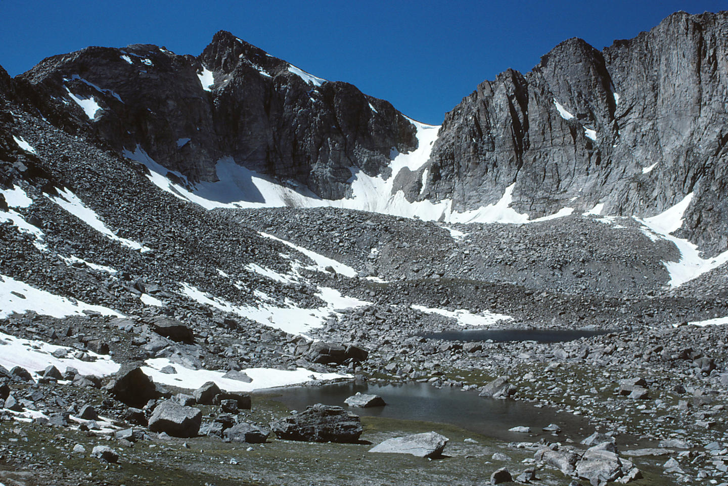
Glaciers have played a major role in creating an abundance of potential fairy shrimp habitat in the Wind River Mountains. The landscape is a wonderland of heart-stopping cliffs, compelling cirques, deep u-shaped valleys, polished knobs of bedrock, daunting piles of boulders, and incredible vistas. Static water bodies though are limited to the flatter areas. Cirques, the floors of valleys, benches on the canyon walls left by successive glacial advances, and glacial gouges between the major canyons are all important sites for ponds. The highest density of ponds seems to be in a broad, rugged upland southwest of the high peaks and of the Highline and Fremont trails, generally. Have a look at “Ross Lake” to see what only glaciers can do.
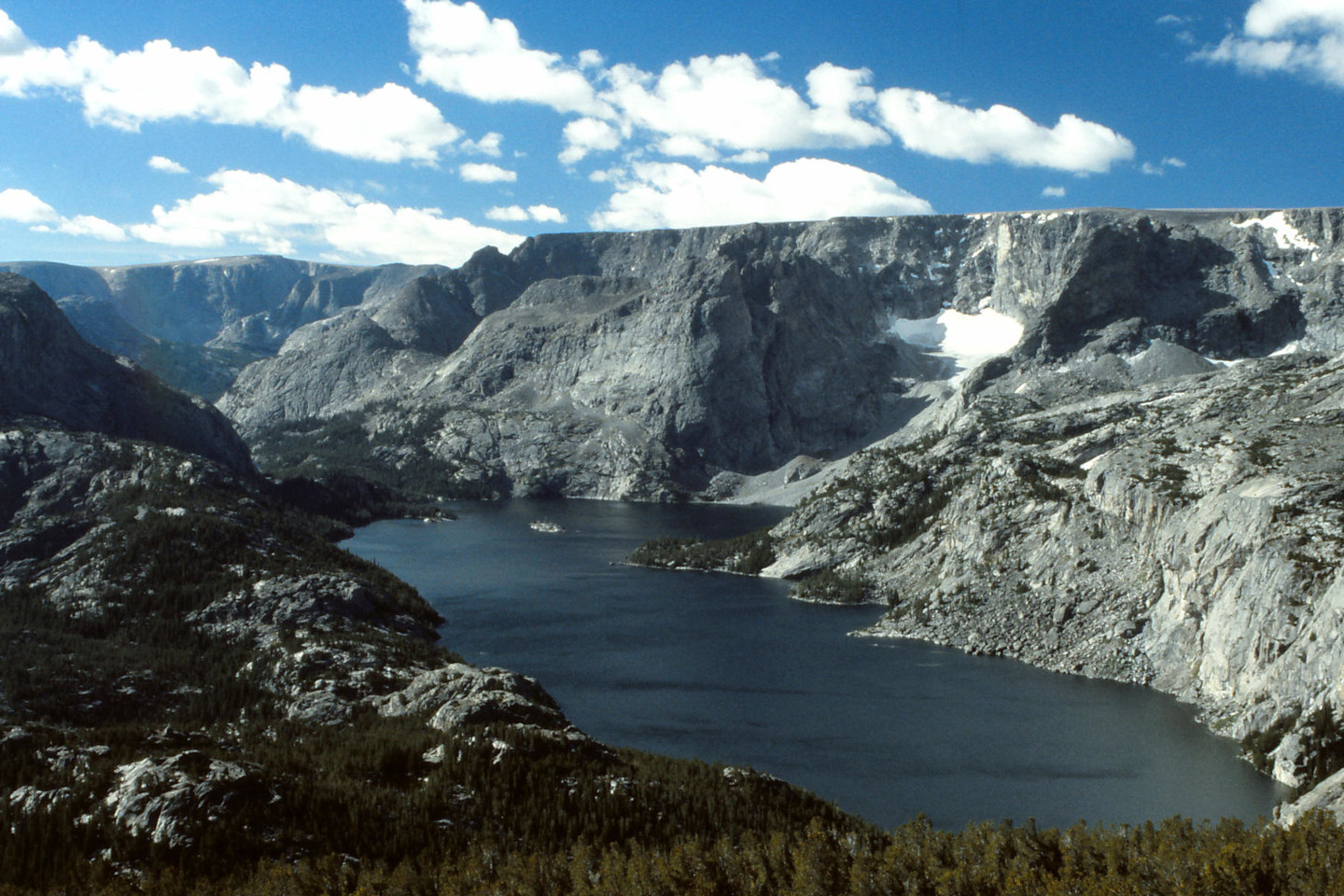
The narrow glacial canyon of “Ross Lake”. The valley glacier that formed “Ross Lake” didn’t head straight down hill toward the Wind River Basin. It started out headed east but then turned sharply to the north to follow a zone of weakness in the bedrock. But gravity wanted it to go down hill more. The ice spilled out of the valley where “Ross Lake” now lies and cut a broad path through the rock where West Torrey Creek now flows. The outlet of the lake is on the far side of the bare rock hill at lower left.
Of course, all these glacial features were previously covered by ice. The ice had to melt before the fairy shrimp could arrive. When the ice melted has important implications for the timing and rate of pond colonization by fairy shrimp. The earlier the ice melted, the more likely a pond has been colonized. However, colonization also depends on the dispersal rate and the dispersal rate depends on the activities of the dispersing animals and the presence of habitats favorable for those animals. Habitats could change with climate fluctuations after the ice melted and predators could eliminate fairy shrimp from previously colonized ponds but those are second-order effects. The ice had to melt first.
Earth has experienced several glaciations in the last million years but only the most recent in the Wind River Mountains is relevant for the current distribution of fairy shrimp there. The last major glacial advance in the Wind River Mountains is marked topographically and geomorphologically by Pinedale moraines. Moraines are piles of angular boulders, cobbles, gravel, sand, and finer material that were pushed down or across slopes by the leading and lateral edges of glaciers. They are called Pinedale because a prominent such moraine formed around “Fremont Lake”, near Pinedale. Moraines are usually ridges with arcuate or linear forms mimicking the former ice margins and have heights up to a few tens of meters (up to a few 100 feet) (Schaller and others, 2009). Pinedale moraines have been identified in several valleys of the Wind River Mountains. The term Pinedale has also been applied to glacial features elsewhere in the western United States that are approximately the same age as the Pinedale moraines in the Wind River Mountains (e.g., Young and others, 2011a).
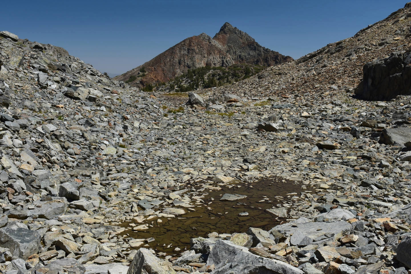
The loose rock in this photograph is part of a moraine above Upper “Par Value Lake” in the East-Central Sierra Nevada. Here, the moraine does not form a narrow ridge but is more a broad mass with local ridges (at left) and troughs (center, with “Par Value” 2nd West Pond).
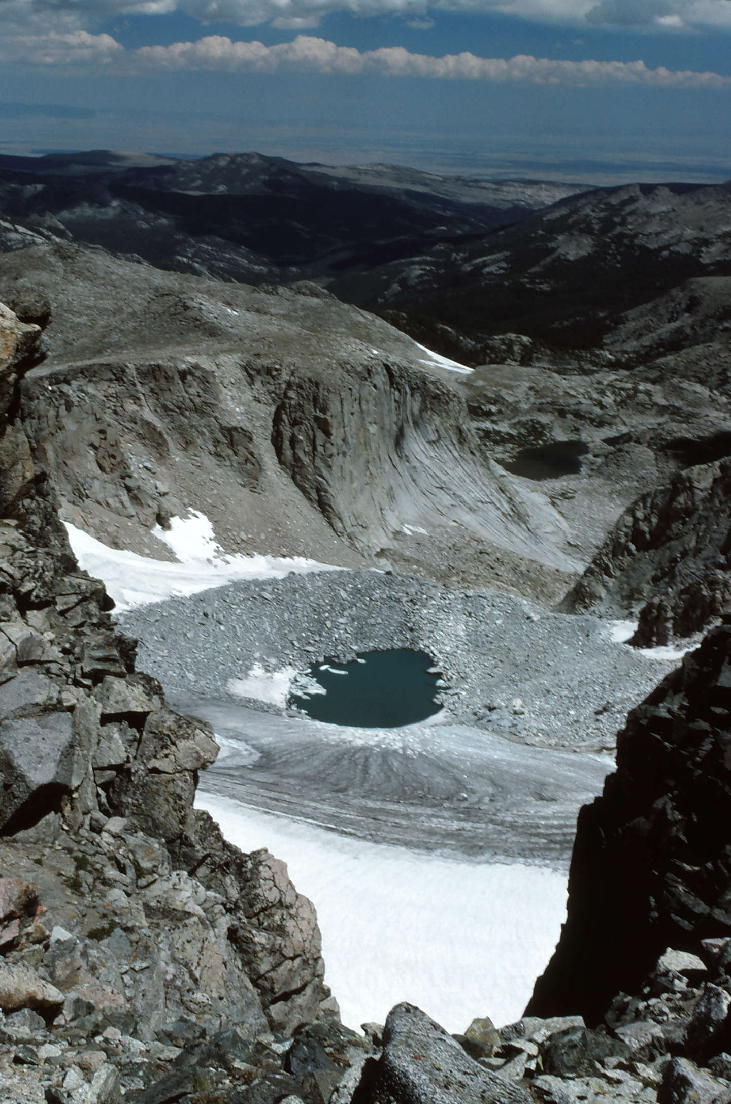
Here’s an arcuate moraine below Wind River Peak that has only recently been revealed by the retreating ice. The lowest part of the glacier is covered by rock debris that may be from rock falls and slides or that was previously buried in the ice.
Moraines can be used as time markers. Glaciers moving down valley destroy any existing moraines they cross. Consequently, the moraine that is the farthest down the valley is the oldest and any other moraines get younger up the valley. These recessional moraines represent minor pulses of glaciation during the overall retreat or a more limited advance after a retreat. The lateral moraines on valley walls are older at the top. Once the ice starts melting, lateral moraines formed by minor subsequent glacial pulses are lower on the valley walls because the glacier is thinner. Typically, the youngest moraines are near the bowl-like cirques at the upper ends of glacial valleys. Or they may form below shadowed cliffs without a bowl. In addition to relative position, the angularity of the rocks on a moraine, the steepness of the piles, and the depths of soil can be used to determine relative moraine ages. Older moraines have more rounded boulders and deeper soils due to weathering and their slopes are shallower due to erosion (Schaller and others, 2009).
Back to Glaciation of the Wind River Mountains
Rock Exposure Ages Determined by Cosmogenic Isotope Dating
While relative ages of moraines are helpful, absolute ages are necessary to determine fairy shrimp colonization rates. And now we have them thanks to super-precise instruments and analytical techniques developed by the mid-1980s (Bierman and others, 2002). Earth’s surface receives a continuous shower of cosmic rays. When cosmic rays collide with atoms, the ensuing reactions result in the formation of various nuclides. “Nuclide” seems to be jargon for an atom that started off as a fragment of a nucleus. The nuclide most commonly used for dating geological surfaces is beryllium-10. The most common isotope of beryllium is beryllium-9. Beryllium-10 has 4 protons and 6 neutrons and is produced in greatest abundance by the splitting of silicon-28 (14 protons and 14 neutrons) and of oxygen-16 (8 protons, 8 neutrons) by those cosmic rays that are fast neutrons. Cosmic ray muons can also cause reactions that produce beryllium-10. However, muon production rates are so low that they can usually be ignored (Balco and others, 2008). Nonetheless, some labs include muon production rates in their calculations (e.g., Bierman and others, 2002). Using equations for how much beryllium-10 is produced by cosmic rays over time and for how much beryllium-10 is lost due to radioactive decay over time, how long a rock has been exposed at the surface can be calculated. These exposure ages indicate when the glacier above the rock melted away.
Quartz is the most commonly analyzed mineral for cosmogenic nuclide dating (Bierman and others, 2002). It has relatively high beryllium-10 production rates because it is composed of silicon and oxygen but it also has a few impurities. Quartz is a common mineral that occurs in many rocks, most notably granite and sandstone. Serendipitously, granite and similar rocks are commonly exposed in the glaciated mountain ranges of the western United States.
Radioactive cosmogenic isotopes of aluminum, chlorine, and carbon have also been used for exposure dating, as summarized in the table of Radioactive Cosmogenic Isotopes for Exposure Age Determinations. Stable cosmogenic isotopes such as helium-3, xenon-131, and neon-21 have been used to determine ages of young volcanic flows with low potassium concentrations that make them unsuitable for potassium-argon dating. They have also been used to determine exposure ages of 3 billion year old shale in Swaziland, of alluvial diamonds in Zaire, and of desert pavement in the western U.S. (Cerling and Craig, 1994).
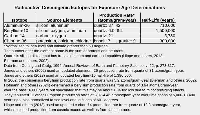
For exposure age studies, chlorine-36 concentration has generally been measured in rocks rather than in individual minerals. Unlike minerals, rocks don’t have fixed concentrations of potassium, calcium, and chlorine, the sources of cosmogenic chlorine-36. Consequently, the concentrations of potassium, calcium, and nonradioactive chlorine in the rock must be measured before an exposure age can be calculated. By analyzing calcium-rich plagioclase and potassium-rich sanidine in independently dated volcanic flows, Schimmelpfennig and others (2011), determined chlorine-36 production rates of 42 atoms/gram-year for calcium and 125 atoms/gram-year for potassium. The source cited by Cerling and Craig (1994) for the chlorine-36 production rates from basalt and granite in the table above estimated calcium production rates of 76 atoms/gram-year and potassium production rates of 106 atoms/gram-year (Schimmelpfennig and others, 2011, Table 1). These production rates, combined with the much smaller production rate of chlorine-36 from chlorine-35 by capture of thermal neutrons, can be multiplied by the concentrations of calcium and potassium in a rock sample to derive the chlorine-36 production rate for the rock.
The flux of cosmic rays is attenuated as it passes through atmosphere, ice, and rock somewhat in proportion to the density of the medium transited. Atmospheric attenuation is weak and a large proportion of cosmic rays make it through. Ice 5.5 m (18′) thick blocks most cosmic rays and renders the beryllium-10 production rate negligible (Fabel and Harbor, 1999). A rock thickness of 45 cm absorbs about half of the fast neutrons (Bierman and others, 2002). Below a depth of 175 cm (69″) in rock, the production rate of beryllium-10 is only 5% of the rate at the surface (Fabel and Harbor, 1999).
Rocks that have never been at the surface have negligible beryllium-10. Rocks that have been buried for a long time also have negligible beryllium-10. After about 7 million years, the concentration of beryllium-10 is reduced to about 3% of its starting value due to radioactive decay. Glaciers rip up and scour the rocks beneath them. If a glacier removes 2 m (6.6′) or more of rock, the rock remaining at the surface below the glacier will have negligible beryllium-10. If the glacier is thick enough to block cosmic rays, the rock underneath it will continue to lack beryllium-10. Once the ice melts, though, the surface rock will begin to accumulate beryllium-10 due to cosmic ray impacts on silicon and oxygen atoms. The math is complicated but the date when the ice melted can be calculated using the cosmogenic production rate and the half-life of radioactive decay (Cerling and Craig, 1994). Due to the slow cosmogenic production rate, it takes more than decades to accumulate a measurable amount of beryllium-10. For what it’s worth, Jones and others (2025) reported a beryllium-10 date of 0 years with an uncertainty of 30 years. Beryllium-10 dating works better for time spans of a thousand to a few hundred thousand years (Bierman and others, 2002). Dating exposure more than a few million years ago is dubious. Over such long time spans, rocks are likely to have complex and unknowable histories of burial, which blocks cosmic rays, and erosion, which removes rock that has been exposed to cosmic rays (Fabel and Harbor, 1999).
Back to Glaciation of the Wind River Mountains
Complications of Beryllium-10 Dating
Beryllium-10 dating is complicated by several processes. First, one needs an estimate of the local production rate of beryllium-10. This usually requires comparing beryllium-10 dates to dates obtained by other methods. This has been done at only a few sites globally (Hofmann and others, 2024). Assuming that a study area has the same production rate, after appropriate scaling, as that measured at a site far away adds uncertainty to the results of dating. For example, Hoffman and others (2024) determined a production rate in the Black Forest of Germany that was 89% of the nearest previously determined production rate in Switzerland. They attributed the difference to thin soil, moss, and shrubs blocking more cosmic rays from the boulders at the German site than at the Swiss site.
Another factor that has to be taken into account is geometric shielding of cosmic rays (Fabel and Harbor, 1999). The same areas on horizontal or inclined rock surfaces will not be impacted by the same flux of cosmic rays. Most researchers sample the most horizontal surfaces they can find (e.g., Dahms and others, 2018). The blocking of low-angle cosmic rays by mountains, trees, and other elevated objects has to be considered. Hippe and others (2013) estimated topographic shielding factors of 0.821-0.993 for 12 samples in the Gotthard Pass area of Switzerland. A factor of 1.0 would indicate no shielding.
To allow comparisons of exposure ages at different locations, scaling by elevation accounts for variable cosmic-ray attenuation in the atmosphere and scaling by latitude accounts for variations in cosmic ray flux due to Earth’s dipole geomagnetic field (Bierman and others, 2002). The orientation and strength of the dipole field varies with latitude. Latitude scaling alone though ignores changes in the orientation and strength of the geomagnetic field over time (e.g., polar wander, dipole weakening, and reversal). Desilets and Zreda (2006) proposed corrections for temporal changes in the geomagnetic field. Hippe and others (2013) did not consider changes in geomagnetic field intensity over time but Hofmann and others (2024) did. Cosmic ray fluxes also vary with solar flares, the decadal solar cycle, and other heliospheric and galactic properties over centuries and millennia (Desilets and Zreda, 2003). If such variations cancel out over thousands of years, they can be ignored in studies of Earth’s most recent major glaciation.
In addition to the physical processes that affect the accumulation of beryllium-10 in a rock, there are geological processes to consider. A sample used to determine the time when ice melted off a rock must not have been buried or eroded since the ice melted. Burial reduces the beryllium-10 exposure age by blocking cosmic rays. Erosion, even of a few centimeters, also reduces the exposure age by removing the parts of the rock that were impacted by the most cosmic rays (Fabel and Harbor, 1999). In sampling moraines for dating, glaciologists choose the biggest boulders that rise the farthest above the adjacent moraine in order to avoid the effects of burial (e.g., “only tall boulders should be sampled”, James and others, 2002). Boulders higher than slope wash would also avoid erosion. In contrast, low boulders on the slopes of moraines could have been buried and then more recently exposed by erosion of overlying moraine material. In sampling bedrock, outcrops that rise well above surrounding rock debris and soil are less likely to have been buried than low lying outcrops. Glaciers themselves provide key clues for avoiding eroded bedrock. In scraping the underlying rock, they leave smoothly polished surfaces, striations gouged by rocks embedded in the lowest layer of ice, and chatter marks or crescentic fractures caused by plucking chunks off the underlying rock (e.g., Figure 2 in Hippe and others, 2013). If these features are present, erosion since the ice melted off must have been minimal. Quartz veins are good sample sites as quartz is one of the hardest and least easily eroded minerals.
In spite of the care taken to minimize the possibilities of burial and erosion effects, many studies of glacial exposure ages have reported young outliers that could be due to burial or erosion. For example:
- Of 10 samples from a transect of striated bedrock above Fordyce Creek on the west side of the Sierra Nevada, the uppermost yielded an anomalously young age of 8,400 years (standard deviation 1,600 years, James and others, 2002). The next lower sample, which would have been exposed more recently as the glacier melted, had an age of 16,800 years (standard deviation 1,600 years) and a sample from the bottom of the valley had an age of 14,700 years. The outlier was “interpreted as the result of postglacial burial or nivation”.
- Phillips and others (2009) reported 2 anomalously young samples in their study of moraines on the east side of the Sierra Nevada: 6,600 years (BPCR91-2) vs. a mean of 17,600 years (standard deviation 800 years) for the other 6 samples from one site and 10,400 years (BPCR90-23) vs. a mean of 17,900 years (standard deviation 700 years) for the other 4 samples from another site.
- Young and others (2011a) excluded a young outlier age of 13,500 years from a Pine Creek valley, Colorado, cluster averaging 15,800 years (standard deviation 400 years, n=6) due to suspected burial.
- Rood and others (2011) found no young age outliers for the northern lobe of a Tioga moraine at Sonora Junction on the east side of the Sierra Nevada but 1 each for the Tioga southern lobe and for a Tenaya moraine: 16,300 years vs. a mean of 19,200 years (standard deviation 600 years, n=6) and 3,300 years vs. 8 other samples ranging from 16,700 to 24,000, respectively. 10 boulders from a Tahoe moraine had exposure ages ranging from 57,000 years to 115,000 years after excluding 2 old outliers. Rood and others (2011) assumed most of the scatter was due to burial or erosion and chose the 3rd oldest age of 115,700 years as the most reliable. Rood and others (2011) further presented all their exposure ages calculated with possible erosion rates of 0, 0.6, and 3.1 meters/million years. They considered the 0.6 rate the most plausible “average” erosion rate for all samples. That rate would result in 1-1.5 cm (0.4-0.6″) of erosion over the 18,000-25,000 year range of the exposure ages. Table 1 of Rood and others (2011) presents previously published ages for 8 other Sierra Nevada glacial features and some appear to have young outliers or mixed populations.
- One of the erratic boulders in the lower Kogalu River valley on Baffin Island had an anomalously young age of 10,500 years (standard deviation 600 years) whereas 12 other ages scatter from 11,900 to 23,900 years (Briner and others, 2005). A cobble south of the outer Eglinton Fiord with an age of 29,500 years (standard deviation 800 years) was also considered a young outlier compared to other samples from the same area (Briner and others, 2005).
- Among 18 data sets with more than 5 samples each from the western United States shown in Figure 1 of Marcott and others (2019), 6 have 1 or 2 young outliers.
- In a review of 24 glaciation dating studies involving 638 boulders, Putkonen and others (2003) found that the difference between the youngest and oldest boulders at a single site averaged 38% of the maximum age, after removal of author-identified outliers. This is more than 3 times the average estimated uncertainties of 12%. How many sites were likely to have young outlier ages could not be determined as I was unable to find the “Appendix” online.
Burial and erosion effects can be detected by discrepancies between exposure ages determined using 2 different radioactive cosmogenic isotopes. The concentration of the isotope with the shortest half-life declines faster after burial or during erosive stripping and this results in a younger exposure age than that of the longer-lived isotope. Interpretation is non-unique but curve-plotting techniques illustrate the possibilities and, combined with geologic knowledge of the site, provide plausible explanations (Fabel and Harbor, 1999). Trial-and-error and Monte Carlo simulations can also yield useful results (e.g., Hippe and others, 2013, and Jones and others, 2023, respectively).
Hippe and others (2013) determined exposure ages of bedrock rather than of moraine boulders using beryllium-10 and carbon-14. They considered erosion unlikely due to well preserved glacial features on rock surfaces but found that 6 of 9 samples had carbon-14 ages 6-20% lower than beryllium-10 ages, which could be due to burial. By assuming 100 cm of snow cover for 6 months every year for the past 11,700-15,900 years, discrepancies between the beryllium-10 and carbon-14 ages were reduced to 2-12% and 2 of the carbon-14 ages were then greater than the beryllium-10 ages.
Back to Glaciation of the Wind River Mountains
Jones and others (2023) used Monte Carlo simulations to unravel the exposure histories of bedrock adjacent to the Kokanee Glacier in the Selkirk Mountains, British Columbia, and to Mammoth Glacier in the Wind River Mountains, Wyoming. Bedrock samples were collected less than 200 m from 2018 or 2020 ice margins, respectively, and up slope of the most recent moraine. Multiple simulations of the beryllium-10 and carbon-14 ages indicated the most likely scenario for the Kokanee Glacier was exposure from 11,000 to 7,000 years and then burial by the glacier from about 6,000 years ago to less than 100 years ago. In contrast, Mammoth Glacier did not cover the adjacent bedrock until about 1,000 years ago when it advanced during the Little Ice Age.
The studies of Hippe and others (2013) and Jones and others (2023) illustrate the possibilities for interpreting somewhat complex exposure histories involving burial by comparing the ages of 2 different radioactive cosmogenic isotopes. The simulations of Jones and others (2023) also included the effects of subglacial erosion.
A more inscrutable geologic problem is inheritance. If a rock was exposed before it was covered by a glacier, it would have accumulated beryllium-10. For glaciations younger than a few hundred thousand years, most of that inherited beryllium-10 would still be present when the rock was sampled. More beryllium-10 means an older calculated age and that misleading age could be tens of years or several times as old as the actual exposure age depending on how long the rock was exposed before the glacier buried it and how much of the upper surface of the rock the glacier has scraped off. In fact, several studies have reported anomalously old ages that were explicitly or implicitly interpreted to be due to inheritance. For example:
- A sample from an outcrop that was glacially rounded by the Tioga 3 glacier on the east side of the Sierra Nevada gave an anomalously old age of 21,200 years (BPCR91-11) whereas nearby samples from a Tioga 3 moraine had a mean exposure age of 15,200 years (standard deviation 1,000 years, n=5) (Phillips and others (2009). This was interpreted to mean that the Tioga 3 glacier did not remove all of the outcrop that had been exposed before the Tioga 3 advance.
- Rood and others (2011) considered ages of 21,200 and 22,000 years to be outliers compared to a mean age of 19,200 years (standard deviation 600 years, n=6) for a Tioga moraine at Sonora Junction, in the Sierra Nevada. For the widely scattered ages of 10 boulders of a Tahoe moraine, they excluded old outliers of 148,200 and 159,500 years as the next youngest age was 115,700 years (standard deviation 3,600 years). Table 1 of Rood and others (2011) presented previously published ages for 8 other Sierra Nevada glacial features and some appear to have old outliers or mixed populations.
- Briner and Gifford (2005) found a few old outliers in the exposure ages of various glacial features on the west side of Baffin Island, Canada. Samples from the Patricia Bay moraine gave an average exposure age of 12,500 years (standard deviation 700 years, n=3) and an outlier age of 18,000 years. An outlier of 26,200 years occurred among erratic boulders of the Upper Kogalu River valley, which had a mean exposure age of 13,000 years (standard deviation 1,000 years, n=5). In the Lower Gallup River valley, erratic boulders had exposure ages which clustered at 15,000 years and 24,000 years (sample uncertainties 2,100 years or less, n=13) but there were 2 outliers with ages of 50,500 years and 73,900 years.
- Among 18 data sets with more than 5 samples from the western United States shown in Figure 1 of Marcott and others (2019), 4 have 1 or 2 old outliers.
- In a review of 24 glaciation dating studies, Putkonen and others (2003) found that the respective authors identified 2% of the exposure ages of 638 boulders as too old due to inheritance.
Matthews and others (2017) found no evidence of inheritance in cobbles below a couple of glaciers in Norway. A moraine cobble (maximum length 20 cm, 7.9″) collected 100 m (330′) from the front of a small glacier had a beryllium-10 age of 99 years with an uncertainty of 98 years (2 standard deviations of beryllium-10 analytical error and production rate). A sample of 75 pebbles (sizes 2-13 cm, 0.8-5.1″) collected from a moraine that became ice-free approximately 50 years ago adjacent to another glacier was found to have minimal inheritance (Matthews and others, 2017). The beryllium-10 age of the combined pebbles was 368 years with 90 years as 2 standard deviations of the beryllium-10 analytical error and production rate. Bedrock at both sites was exposed for up to 4,000 years since about 10,000 years ago when the glaciers in southern Norway had disappeared (Matthews and others, 2017). From this, the authors gallantly concluded that warm-based glaciers “are likely to have had their pre-deglaciation cosmogenic signals zeroed” by erosion (Matthews and others, 2017).
However, the study of Jones and others (2023) (see above) can be recast as a study of inheritance. Bedrock samples adjacent to Kokanee and Mammoth glaciers should have had beryllium-10 exposure ages of less than 100 years based on historical evidence of recent glacier shrinkage. In fact, beryllium-10 ages at Mammoth were 5,309-9,307 years (excluding a young outlier) and those at Kokanee were 2,572-5,562 years. Cosmogenic carbon-14 ages were significantly younger but still too old. 6,000 years of glacial action at Kokanee and 1,000 years at Mammoth didn’t come close to zeroing out inherited beryllium-10. Moreover, Jones and others (2023) calculated bedrock abrasion (i.e., without plucking) rates of 20 cm (7.9″) per thousand years at the moderately sloping Mammoth Glacier and 4 cm (1.6″) per thousand years at the steeper Kokanee. At those rates, it would take a glacier 10,000-50,000 years to abrade the 2 m (6.6′) of rock that could contain inherited beryllium-10 if it had been previously exposed (see above).
My sampling of less than about 15 articles is but a small, non-representative sample of the glacier dating literature. No doubt, there are many studies other than those mentioned here that found no evidence of burial, erosion, or inheritance in the sampled rocks.
Back to Glaciation of the Wind River Mountains
Exposure Ages of Pinedale Moraines
A good starting point for beryllium-10 exposure ages of moraines in the Wind River Mountains is Young and others (2011b). Those authors compiled close to 100 ages for moraines in Colorado, the Wallowa Mountains in Oregon, the Uinta Mountains in Utah, Teton and Yellowstone National Parks, and the Wind River Mountains. To achieve comparability, all ages were recalculated with the same production rates and scaling factors. This is important to the deglaciation timing arguments of Young and others (2011a). It also “corrects” previously published ages for terminal Pinedale moraines as production rates and scaling factors have been progressively refined. Individual boulders from terminal Pinedale moraines yielded exposure ages of 22,700, 24,300, and 24,700 years ago at “Fremont Lake”; 20,500 and 24,700 years at nearby “Soda Lake”; and 21,800 and 22,100 years at nearby “Half Moon Lake” (Young and others, 2011b, Table DR-1). For analytical uncertainty, standard deviations of 700 years were reported. All 3 “Fremont Lake” dates are within analytical error of the 24,300 years median and have a mean of 23,900 years. The “Soda Lake” and “Half Moon Lake” age pairs each have an age that is well below the “Fremont Lake” median and could be due to erosion or burial. Including the other 2 ages in the “Fremont Lake” mean doesn’t change much and seems arbitrary.
Boulders on a terminal Pinedale moraine at “Bull Lake” on the Wind River Indian Reservation east of the Wind River Mountains had beryllium-10 ages of 16,000-23,000 years ago (Phillips and others, 1997, abstract only). These ages were said to be “nearly identical” to ages for the Pinedale moraine at “Fremont Lake”. Presumably, the maximum age of 23,000 years would still be consistent with the “Fremont Lake” mean after correction. Ages much younger than 23,000 years must apply to recessional (see below) rather than terminal moraines.
On the southeastern flank of the Wind River Mountains south of the Wind River Indian Reservation, a terminal Pinedale moraine has been dated at the mouth of North Popo Agie River canyon. Boulders on the moraine at Pine Bar Ranch gave ages of 22,500 and 23,300 years ago with standard deviations of 2,300 years (Dahms and others, 2018). Both are within analytical uncertainty of the “Fremont Lake” mean but a mean of 22,900 years is more appropriate for this site.
Dating of recessional moraines up valley from the terminal Pinedale moraines at “Fremont Lake” documents a period of retreat lasting 4,000 years. Recessional moraine boulders near “Fremont Lake” had beryllium-10 ages of 16,300, 17,600, 17,700, 17,800, 18,100, 18,200, 18,600, 18,700, 19,100, and 19,100, years ago (Young and others, 2011b, Table DR-1). The locations of the moraines and how far they are from the terminal moraine are not known as only the abstract of the source of the dates is available (Gosse and others, 1995, abstract only). During this time, the glacier that formed the terminal moraine could have retreated the 14 km (8.4 miles) to the north end of “Fremont Lake” and then some distance up the deep valleys of Pine Creek and Fremont Creek. Other valley glaciers draining the rugged upland southwest of the high peaks could have retreated up the deep, u-shaped valleys of “Willow Lake” and Bluff Park Creek, “New Fork Lake” and New Fork River, Porcupine Creek, and Green River above “Lower Green River Lake”. Concurrently, ice and snow would have melted off the uplands to some extent, perhaps revealing “Bridger Lakes”, “No Name Lakes”, “Thomson Lakes”, and others by about 16,000 years ago. Slopes of the higher hills probably rose above the remaining ice.
Back to Glaciation of the Wind River Mountains
Exposure Age of “Titcomb Lakes” Moraine
The next time marker up hill from Pinedale recessional moraines is the inner “Titcomb Lakes” moraine between upper and lower “Titcomb Lakes”. Gosse and others (1995, abstract only) published beryllium-10 ages of 11,400-13,800 years ago. The recalculated individual boulder ages are 12,000, 12,000, 12,600, 12,700, 12,800, 12,900, 13,200, 13,200, and 13,500 (standard deviations of 400 years for all) (Young and others, 2011b, Table DR-1). The mean is 12,800 years. The difference between the oldest and youngest of 1,500 years exceeds analytical uncertainty and suggests the mean would be more precise (and maybe more accurate) if the 2 youngest ages were omitted. Doing so would give a mean of 13,000 years. Dahms and others (2018) reported a recalculated mean of 13,300 years. This could be 13,500 years if Dahms and others (2018) included the 2 youngest ages.
Titcomb Basin is the first flat spot west of the Continental Divide between Mt. Wilson and Fremont Peak and the moraine is about 3 km (1.8 miles) below the 1966 terminus of Twins Glacier. The location of a moraine this high in the mountains indicates that almost all of the Wind River Mountains had become ice-free by about 13,300 years ago. The glaciers remaining at that time were tucked up close to both sides of the Continental Divide but were more extensive than their mid-20th century areas.
Upper Indian Pass Lake has fairy shrimp and is in a different drainage only 2,200 m (7,220′) southeast of lower “Titcomb Lake”. It has an elevation of 3,355 m (11,010′) compared to 3,223 m (10,575′) for lower “Titcomb Lake”. Although a little higher than the dated moraine, it was probably also uncovered by 13,300 years ago because there is no glacier, or even a cirque, above it. There are just the exposed southern and western flanks of Fremont Peak and Jackson Peak, which are not conducive to permanent ice. Indian Basin is entirely free of fish. I found fairy shrimp in 4 of 11 ponds in Indian Basin. 3 are appreciably higher than Upper Indian Pass Lake. Assuming they were all ice-free by 12,000 years ago (i.e., melt-off of Cirque of the Towers, see below), the implied colonization rate is 3.0% of available ponds per 1,000 years, averaged over the whole period. That seems pretty slow but I haven’t read of any other colonization rates that I can compare it to.
Back to Glaciation of the Wind River Mountains
Exposure Ages of “Temple Lake” and “Alice Lake” Moraines
Glaciers melted off the southwestern Wind River Mountains a little earlier. Dahms and others (2018) reported beryllium-10 ages for boulders on “Temple Lake” moraines from Marcott (Ph.D. dissertation, 2011) of 12,400, 14,300, 14,800, 15,500, 15,700, 15,800, and 16,500 years with standard deviations of 1,200-1,600 years. Excluding 12,400 years, a mean age of 15,300 years was favored by Dahms and others (2018). The difference between the 13,300 age of the “Titcomb Lakes” moraine and the 15,300 age of the “Temple Lake” moraine could reflect real geographic variability. “Temple Lake” and lower “Titcomb Lake” are approximately the same elevation (3,246 m vs. 3,223 m) and the “Temple Lake” moraine is barely 1,500 m (4,920′) below the 1968 Temple Peak glacier (based on 1968 aerial photographs for the 7.5-minute topographic quadrangle). Earlier glacial retreat at “Temple Lake” is nevertheless plausible because its ice-shed is much smaller than that of “Titcomb Lakes”.
“Coon Lake”, south of Wind River Peak, is more exposed to sunshine and at about the same elevation as “Temple Lake”, 3,210 m (10,530′). It, and the fairy shrimp ponds to the south (e.g., Little Sandy Overlook Pond map) could have melted off by 15,300 years ago too.
There is one more time marker southwest of the Continental Divide, a moraine above the “Temple Lake” moraine. This moraine impounds “Alice Lake”, which is in contact with the Temple Peak glacier on the 7.5-minute topographic quadrangle (1968 aerial photographs and “limited revisions” based on 1989 photos). “Alice Lake” is labeled in Figure 1 of Zielinski and Davis (1987). I haven’t found ages for this moraine but Dahms and others (2018) correlated exposure ages of 13,200-13,900 years for moraines in Stough Creek Basin to those of the “Alice Lake” moraine. In a confusing twist, Dahms and others (2018) also considered ages of 9,900-13,600 as correlative with the exposure age of the “Alice Lake” moraine. In any case, given the high elevation of “Alice Lake”, most of the ponds west of the Divide from “Little Sandy Lake” to “North Fork Lake” that were not in close proximity to the Divide were likely free of ice by 13,550 years ago (middle of 13,200 and 13,900 range). This exposure age conveniently matches the 13,300 years age for exposure of “Titcomb Lakes” and, by implication, most other ponds in the northern Wind River Mountains not adjacent to current glaciers. Accordingly, Dahms and others (2018) correlated the “Titcomb Lakes” moraine age with the “Alice Lake” moraine age (although they used the term alloformation).
Back to Glaciation of the Wind River Mountains
Exposure Ages of Glacier Retreat East of the Continental Divide
Boulders in Sinks Canyon in the southeastern Wind River Mountains near Lander were interpreted as belonging to distinct Pinedale recessional moraines. The 2 boulders farthest downstream gave beryllium-10 ages of 19,700 and 21,400 years ago and were estimated to be 1.1 km (0.7 mile) upstream of an ill defined terminal moraine (Dahms and others, 2018). 2 boulders 1.5 km (0.9 mile) farther upstream gave ages of 18,700 and 20,100. Standard deviations were 1,800-2,100 years. Because the terminal moraine at Pine Bar Ranch was approximately 22,900 years old, the boulder with the 18,700 age indicates glacier retreat was well underway within 4,000 years of the terminal moraine melting off. At “Fremont Lake”, the oldest recessional boulder age of 19,100 years ago pegs significant glacial retreat within 5,000 years of terminal moraine exposure but the relevant distances are not available.
The retreat of the glacier up Sinks Canyon and the Middle Popo Agie River valley is further constrained by beryllium-10 ages on glacially polished and striated bedrock surfaces on the canyon walls. A sample 6 km (3.6 miles) up valley from the inferred position of the terminal Pinedale moraine in Sinks Canyon and about 100 m (330′) above the valley floor had a beryllium-10 exposure age of 15,400 years (standard deviation 1,700 years) (Dahms and others, 2018). The glacier had melted off Buttress Pond by then as the pond is down the valley from the sample and well up on the canyon wall. Fairy shrimp could not have arrived at “Poison Lake” Outlet Pond by 15,400 years ago as the pond is something like 22 km (13.2 miles) upstream from the dated bedrock. The other ponds in the Middle Popo Agie River drainage south and east of Wind River Peak, including the “Ice Lakes” ponds would likely also have been covered by ice then (e.g., Wind River Peak Ponds, “Ice Lakes” ponds).
Exposure ages for moraine boulders high in the North Popo Agie River drainage attest to a very different glacial history. A boulder in Lizard Head Meadows had a beryllium-10 age of 17,600 years ago (standard deviation of 1,700 years) (Dahms and others, 2018). This location is less than 5 km (3 miles) from the Continental Divide and implies that the valley glacier in the North Popo Agie Canyon had retreated 27 km from its terminal moraine in 4,000 years (Dahms and others, 2018). Such rapid melting could have exposed many lakes, such as those in “Smith Lake” Creek Canyon and High Meadow Creek Canyon by 17,600 years ago. Given the different retreat rates of the Middle and North Popo Agie glaciers, speculating on when various upland ponds and lakes melted off is problematic.
About 2 km farther up valley from Lizard Head Meadows, boulders on the moraine below “Lonesome Lake” yielded ages of 15,100 and 16,100 years ago (standard deviation of 1,600 years, mean 15,600 years) (Dahms and others, 2018). That this was the lower end of the North Popo Agie glacier while the Middle Popo Agie glacier still extended almost all the way to Sinks Canyon is surprising, to me. Dahms and others (2018) suggested the different behaviors of the glaciers could be due to different ice-shed areas or topography.
The glaciers’ last stand up against the Continental Divide circling Cirque of the Towers was also dated by Dahms and others (2018). 2 boulders on a moraine below the southern headwall of the Cirque gave beryllium-10 ages of 11,200 and 12,300 years ago (standard deviations of 1,100 and 1,300 years, mean 11,750 years). These ages are 1,000 or more years younger than those from the “Titcomb Lakes” moraine. The dated boulders were at 3,225 m (10,580′). The fairy shrimp-hosting Bivouac Lake has an elevation of 3,334 m (10,940′) and has a similar topographic setting (Bivouac Lake map). It is immediately below the Continental Divide at Atlantic Peak but is below an east-facing slope rather than a north-facing slope. More sun exposure may cancel out effects of the higher elevation. Fairy shrimp have maybe had 11,750 years to get there.
If they hadn’t melted off by 15,300 years ago, the ponds in the vicinity of “Coon Lake” (Little Sandy Overlook Pond map) would certainly have melted off by 11,750 years ago.
Back to Glaciation of the Wind River Mountains
Exposure Ages of Moraines in Stough Creek Basin
In a serendipitous coincidence, Dahms and others (2018) provided ages on boulders in Stough Creek Basin (Deep Cirque Overlook Pond map) that constrain the appearance of fairy shrimp ponds that I visited there. Samples of glaciated bedrock and lateral moraine boulders along a west-east transect between Footprint Lake and Shoal Lake (Dahms and others, 2018, did not use these Wyoming Game and Fish Department names) give a somewhat consistent pattern of beryllium-10 ages decreasing with elevation on both sides of the basin as the ice melted down. A sample on the hill south of Cutthroat Lake at about 3,330 m (10,830′) gave an exposure of 14,800 years ago (standard deviation of 1,400 years) while a lower one just east of the creek gave 12,500 years ago (standard deviation of 1,300 years) (Dahms and others, 2018). This indicates the ice melted off the fairy shrimp-hosting Shoal Lake Northwest Pond and Stough Off Channel Pond by about 12,500 years ago and off East Side Cirque Pond at some time between 12,500 and 14,800 years ago. The transect extends west of these points up the ridge north of Deep Cirque Overlook Pond. The bedrock samples on the ridge above the pond had exposure ages of 18,300 and 18,400 years ago (standard deviations 1,800 and 2,000 years). Even though this indicates Deep Cirque Overlook Pond could have been colonized much earlier than Stough Off Channel Pond, that seems unlikely. With the large lakes in Stough Creek Basin still covered by ice, what bird or other animal dispersal agent would want to visit the basin?
Moving up canyon (Cinquefoil Pond map), boulders on a moraine south of Stough Below the Moraine Pond gave exposure ages of 12,700 and 13,600 years ago (standard deviations 1,200 and 1,500 years, mean 13,150) (Dahms and others, 2018). Although it is difficult to tell from the small-scale map in Figure 6 of Dahms and others (2018), I think these boulders are from the small moraine close to the pond and not from the monster moraine farther south (see photo below). Boulders on the smaller moraine below and north of the pond were found to have beryllium-10 ages of 13,900 and 17,200 years ago (standard deviations of 1,500 and 1,700 years). The older age could be due to inheritance of beryllium-10 in a boulder that tumbled off a cliff above the glacier and ended up on the moraine next to boulders that had been below the ice. The younger age fits better with the 2 ages for the moraine less than 200 m (660′) away on the other side of Stough Below the Moraine Pond and with the absence for such old ages for the moraines above Footprint Lake (Deep Cirque Overlook Pond map) (additional ages in Dahms and others, 2018). Either way, Cinquefoil Pond would have been ready for its fairy shrimp by 13,150 years ago and Boulder Bog Pond perhaps a little sooner.
That ice remained on the floor of the basin at 12,500 years ago indicates that it had become stagnant and detached from nearby cirque glaciers. Dahms and others (2018) suggested the Stough Creek Basin glacier became detached from the glaciers overlying Canyon Lake and Stough Below the Moraine Pond by 16,000 years ago and remained stagnant until melting off by about 12,500 years ago. Such stagnant ice would have impeded colonization of ponds above the valley floor even if they were not covered by ice.
The pond in the middle distance is Stough Below the Moraine Pond. The nearer pond at left is Cinquefoil Pond. 3 moraines are visible. The low ridge of rock on the near side of Stough Below the Moraine Pond is the oldest. 2 boulders from there have exposure ages of 13,900 and 17,200 years ago. The darker, higher ridge of rock on the far side of the pond has boulders that were exposed 12,700 and 13,600 years ago. There is a small snowbank at the bottom of the left end of this 2nd moraine. There is a pond-like depression behind the 2nd moraine but I didn’t find any water in it. The very high, steep pile of rock behind the 2nd moraine is the 3rd and youngest moraine. Aerial imagery of The National Map currently shows a partially ice-covered pond behind the 3rd moraine. The 3rd moraine may have taken its final form at the end of the Little Ice Age (see below).
As reviewed by Dahms (2002), some Wind River Mountains moraines were attributed to glacial advances between 10,000 and 2,000 years ago. Some of these attributions have been contradicted by more recent beryllium-10 dating (Dahms, 2002). After obtaining pre-10,000 years exposure ages on the “Alice Lake” age-correlative moraines in Stough Creek Basin and Cirque of the Towers, Dahms and others (2018) noted “it is possible that evidence no longer exists for early- to mid-Holocene glacial events in the southern Wind River Range” (i.e., 10,000-5,000 years ago). This is consistent with Jones and others’ (2023) finding that bedrock adjacent to Mammoth Glacier had been buried by ice only for the last 1,000 years since 11,000 years ago (see above).
Back to Glaciation of the Wind River Mountains
Little Ice Age Glaciation
The Little Ice Age cooling from about 1200 (or 1300, according to others) to 1850 was sufficient to spur glacial advances world wide (Lowell, 2000). Little Ice Age advances in the Wind River Mountains appear to have been minor in that they did not override “Alice Lake” or “Titcomb Lakes” moraines. The Little Ice Age moraine below Mammoth Glacier is less than 500 m (1,640′) from the 2002 ice margin (Davies, 2011). Mammoth is southwest of Gannett Peak and is the largest glacier west of the Continental Divide.
In some cases, the Little Ice Age moraines are coincident with 1930 ice margins. According to Pochop and others (1989), “Dinwoody and Gannett Glaciers had readvanced by 1930 to their positions at the end of the Little Ice Age (Denton, 1975)”. I haven’t tried to find Denton’s book to verify this. Gannett Glacier is the largest in the range. An advance up to 1930 could have been caused by increased precipitation even as temperatures warmed. Pochop and others (1989) mapped the glaciers’ retreat from 1950 to 1983 using aerial and ground photographs. The 3 lobes of Gannett Glacier retreated 200 m (660′), 360 m (1,180′), and 500 m (1,640′) and the main lobe of Dinwoody Glacier pulled back 220 m (720′) during the period, as measured by me on Figures 2 and 3 of Pochop and others (1989, p. 5, p. 7). My measurements are subjective and I excluded a shallowly covered ridge that melted off between 1966 and 1983. Because tree ring data indicate that the period 1942-1954 was “especially favorable” for growth (Pochop and others, 1989) (i.e., wet), the 1950 glacier margins were probably close to those of 1930 and, hence, to the maximum advance of the Little Ice Age.
Recent work by Jones and others (2023) provides more information on the Little Ice Age extent and subsequent retreat of Mammoth Glacier. First, their maximum Little Ice Age extent of the glacier is slightly larger than that of Davies (2011) so that the retreat from the maximum to the 1966 ice margin (from topographic maps) was 560 m (1,840′) and that to the 2021 ice margin (based on satellite imagery) was 1,000 m (3,280′) (as measured by me from their Figure 1). Second, these distances indicate average retreat rates of 4.8 m (16′) per year from 1850 to 1966 (or 15.6 m, 51′, per year from 1930 to 1966) and 55 m (180′) per year from 1966 to 2021. The finding that bedrock adjacent to the 2021 ice margin of Mammoth Glacier was exposed for 10,000 of the last 11,000 years (Jones and others, 2023) indicates that all but a few, if not all, glaciers had disappeared from the Wind River Mountains prior to Little Ice Age glaciation.
The Little Ice Age glaciers necessarily destroyed any ponds that were previously up hill from the current positions of their terminal moraines. Due to the retreat of glaciers in the Wind River Mountains since 1930, or before, and especially in the last 30 years, there are current ponds behind some Little Ice Age moraines. They or may not have been there before the Little Ice Age advances. Examples include ponds at the head of Atlantic Canyon above Upper Saddlebag Lake (photo), at the head of Stough Creek Basin, North of Lizard Head Peak, below Knifepoint Glacier, below Lower Fremont Glacier, below the remaining pieces of Sacajawea Glacier, where the northern part of Minor Glacier used to be, and “Iceberg Lake”, which has doubled in size and now occupies what was the northern third of Sawtooth Glacier. These ponds were identified using aerial imagery and topography of The National Map. The first 3 are located on massive piles of rock rubble at the heads of cirques; the others are where glaciers were previously shown on 7.5-minute topographic quadrangles. The location of the pond north of the glacier north of Wind River Peak is both (see below). Ponds that were adjacent to ice shown on the 1960s topographic maps may also be impounded by Little Ice Age moraines. Such ponds include the previously mentioned “Iceberg Lake”, and ponds adjacent to Mammoth and Stroud glaciers. For these ponds, any pre-Little Ice Age fairy shrimp populations were lost and the colonization clock has been reset to as recently as 1930.
The small pond north of Wind River Peak between a glacier and its moraine. The fact that the pond is still in contact with the glacier suggests that retreat from the moraine was recent, possibly since 1930. There is no moraine above the one below the pond. Therefore, the moraine probably formed during the Little Ice Age.
Back to Glaciation of the Wind River Mountains
Summary of Pond History
To summarize the pond history of the Wind River Mountains based on beryllium-10 dating of glacial materials, essentially all of the mountains were covered by ice at the maximum extent of the Pinedale glaciation about 23,000 years ago. Glaciers had begun to retreat by about 19,000 years ago. Lower elevation lakes on the west side of the divide, like “Fremont Lake”, “Willow Lake”, and “Half Moon Lake” had been deglaciated by this time or soon after. Glaciers in different valleys retreated at different rates: 27 km by 17,600 years ago in North Popo Agie River valley but only 6 km by 15,400 years ago in Middle Popo Agie River valley. By 15,600 years ago, the North Popo Agie glacier had retreated another 2 km (1.2 miles) to above “Lonesome Lake”. At about the same time, glaciers had melted off “Temple Lake” on the west side of the divide. Quite a few ponds had probably been exposed by this time but identifying which ones is guess work. At 13,300 years ago, glaciers had pulled back from high elevation lakes like “Titcomb Lakes” and “Alice Lake” and probably from most other lakes and ponds in the range. Retreat from a well shaded Cirque of the Towers moraine at 11,750 years ago signaled melt off for essentially all Wind River Mountains ponds.
Glaciers in the Wind River Mountains expanded during the Little Ice Age but they didn’t get far. Where measured, Little Ice Age moraines are not more than 1 km (0.6 mile) below early 2000s ice margins. Regardless of when glaciers reached their maximum extents, they may have remained close to those limits until about 1930. Only a few ponds could have been affected by the Little Ice Age advance.
Ponds above Little Ice Age moraines may not be ready for fairy shrimp yet. High elevations and possible contacts with ice would keep water temperatures low. Fairy shrimp can hatch at 5 C (“Temperature Effects on Fairy Shrimp Hatching” on the Resting Eggs of Fairy Shrimp and Their Hatching page) but their growth is slow and they may not produce many eggs (“Temperatures of Fairy Shrimp Habitats” on the Habitats of Fairy Shrimp page).
The recent trend of warming temperature and decreasing ice cover at least since 1930 would be good for fairy shrimp colonization as higher ponds become warmer and additional ponds form in the footprints of disappearing glaciers, such as “Iceberg Lake” and the one below Knifepoint Glacier. There is also the possibility of negative impacts due to warming if that allows invasions by frogs, salamanders, or other predators. Although a warming climate could be good for fairy shrimp, it is bad for pikas, which are cute and furry and and have a squeaky voice.
All in all, glaciation has made the Wind River Mountains a great place for fairy shrimp. The huge negative impact is that the scenery attracts people and people have stocked the lakes with fish.
Back to Glaciation of the Wind River Mountains
Fish-stocking Zooicide in the Wind River Mountains
What Is Fish-stocking?
Why Is Fish-stocking Needed?
How Extensive Has Fish-stocking Been in the Western United States?
How Extensive Has Fish-stocking Been in the Wind River Mountains?
If the stocked fish die without establishing a reproducing population, can previously eliminated invertebrate species recover?
What happens when fish become residents of a previously fishless lake in the Wind River Mountains?
What experimental evidence can be used to determine the effects of fish-stocking on fairy shrimp?
What other experiments with fish and invertebrates can be used to infer what happened to fairy shrimp in stocked lakes?
Zooicide in the Wind River Mountains
What Is Fish-stocking?
Fish-stocking is the dropping of 1 or more live fish into a body of water. Fish management agencies typically dump a couple hundred to a few thousand, small (7-18 cm, 2-7″) fish at a time into a mountain lake from a helicopter. The dumped fish are species that people like catching and are usually obtained from a state-supported fish hatchery. They are exotic to the receiving lake unless the fish management agency is trying to restore a native species that was wiped out by exotic fish. Larger fish that don’t need to grow as much before they become “catchable” are dumped in some cases. Most mountain lakes that are currently being stocked in the western United States are stocked repeatedly on periodic (e.g., every 2-4 years) or irregular schedules because the fish populations don’t reproduce. Individuals have also stocked lakes on their own initiative using the means at their disposal. Before helicopters, this included packing large cans of water with fish on horses. Individuals have also dumped bait fish, such as minnows, into lakes rather than carry them home or back to their water body of origin.
The effects of fish-stocking extend beyond the lakes where the fish were dropped. If one lake in a basin with several lakes above the fish-blocking topography were stocked, the fish would move to adjacent lakes through connecting streams to the extent possible. Those lakes could also be considered “stocked”.
Back to Fish-stocking Zooicide in the Wind River Mountains
Why Is Fish-stocking Needed?
Most of the lakes and ponds in the Wind River Mountains are above waterfalls or steep rapids that fish cannot climb. Their natural states were fishless. Most people don’t value naturalness. They value well known and accepted recreational activities like fishing. Native aquatic invertebrates may just be creepy creatures to them. Lakes with fish might even seem more natural because lowland lakes and reservoirs all have fish. When questioned about their recreational activities, people who reply “I went fishing” are likely to garner more respect and be more likely to elicit a favorable reply than those who reply “Oh, I hiked around and admired the scenery”.
State governments have been responsible for most stocking in the United States. In the early days, private individuals stocked fish wherever they wanted to. At least in Wyoming, it is now illegal to stock fish without the authorization of the Wyoming Game and Fish Department. Violators can be punished by a fine of up to $10,000 and by up to 1 year in jail (2025 Fishing Regulations). There is no down side for states; they can’t be held responsible for wrecking ecosystems. Only if a species involved is threatened or endangered does the Endangered Species Act come into play. That Act is not relevant for naturally fishless alpine lakes because fish don’t eat birds or pikas and federal and state agencies generally don’t look beyond vertebrates.
The States’ goal for fish-stocking was and is to attract tourists who will spend money in the nearby towns and to satisfy the demands of residents who are now accustomed to fishing in alpine lakes. People who fish at stocked lakes are blithely unaware of the economic and environmental costs of fish-stocking. They paid only for a fishing license which costs the same regardless of where they fish. Most don’t even know if a lake was stocked. They almost certainly don’t know or care what animals lived in the lake before it was stocked.
Back to Fish-stocking Zooicide in the Wind River Mountains
How Extensive Has Fish-stocking Been in the Western United States?
A 1988 compilation of estimates supplied by fish and wildlife agencies in the western United States (Colorado and states west) indicated that of approximately 16,000 mountain lakes, 60% (9,600) have fish but less than 5% (800) had fish before fish-stocking began (Bahls, 1992). Even lakes with native fish have been stocked so fish and wildlife managers thought that only 1% (160) of lakes have only native fish. Larger lakes are more likely to sustain populations of exotic trout. Fish and wildlife managers guessed that less than 5% of lakes larger than 2 hectares (5 acres) and deeper than 3 m (10′) remained free of fish.
Back to Fish-stocking Zooicide in the Wind River Mountains
How Extensive Has Fish-stocking Been in the Wind River Mountains?
The story of fish-stocking in the Wind River Mountains begins with Finis Mitchell, although there may have been others. Finis Mitchell enjoyed fishing. He also loved hiking and riding and climbing the peaks of the Wind River Mountains. He started a fishing camp at “Mud Lake” on Big Sandy Creek in 1930. By then, he already knew most of the high elevation lakes lacked fish. For the benefit of his customers, other anglers in Wyoming, and maybe, in his mind, for the benefit of all humanity, he started the arduous task of stocking lakes by horseback. By his own account, Mr. Mitchell stocked 314 lakes with 2.5 million fingerlings (from the story at www.wyohistory.org/encyclopedia/finis-mitchell-mountaineer; this account is consistent with what I remembered from reading a book about Finis Mitchell in the 1980s). Mr. Mitchell ultimately received numerous awards for his work popularizing the Wind River Mountains and its newly fabulous fishing.
Finis Mitchell’s efforts were hugely successful. The stocked trout populations thrived. At some point, Wyoming legislators noticed and provided money for WGF to stock even more lakes. By the 1970s, helicopters were being used. Employees of the Wyoming Game and Fish Department (WGF) were well aware of the effects of fish-stocking. In the 1980s, some in the Lander office told me that trout grew to huge sizes in the first few years after the first stocking event. They attributed the monstrous sizes to the abundance of invertebrate food. They did not know of any current or pre-stocking fairy shrimp populations.
Of “over 2,000 glacial carved lakes, ponds, and potholes” in the Bridger Wilderness, more than “500 are known to support fish” (Wyoming Game and Fish Department, 2013, Bridger Wilderness, A Guide to the Fishing Lakes). The Fitzpatrick and Popo Agie wildernesses have additional ponds, though probably less than 2,000 (EIGWUU). The WGF listed fish in ponds as small as 2 acres (0.8 hectares) (e.g., Lost Lake, WGF name, in the Boulder Creek drainage). A 2-acre square is small, only 295 feet (90 m) on a side. This illustrates the current pervasiveness of fish in the Wind River Mountains.
Use of helicopters for fish-stocking in the mountains of Wyoming has not been controversial but it conflicts with part of the Wilderness Act. Most of the alpine terrain in the Wind River Mountains has been designated as Wilderness by Congress. Although helicopters aren’t generally allowed in Wilderness Areas, Congress avoided angering states by including the following language in the Wilderness Act of 1964: “Nothing in this Act shall be construed as affecting the jurisdiction or responsibilities of the several States with respect to wildlife and fish in the national forests”. Such internal contradictions are a common feature of U.S. legislation. Congress could not even agree on the purpose of the act so it punted its responsibility and let the land management agencies take the crossfire from the public: “wilderness areas shall be devoted to the public purposes of recreational, scenic, scientific, educational, conservation, and historical use.” Although preserving native species might be included in the category “conservation”, it obviously doesn’t stand a chance against recreational and historical fishing.
Many of the Wind River Mountains’ alpine lakes are on the Wind River Indian Reservation. As the Northern Arapaho and Eastern Shoshone tribes evidently prefer fishing to admiring native aquatic species, aquatic invertebrate populations there have fared no better. WGF’s offer to stock the Reservation’s alpine lakes by helicopter was too good to pass up. The state got another draw for rich tourists and the tribes got new unsustainable fish populations for tribal members to exploit and the opportunity to collect trespass/fishing license fees from non-tribal members.
Back to Fish-stocking Zooicide in the Wind River Mountains
If the stocked fish die without establishing a reproducing population, can previously eliminated invertebrate species recover?
Insect species that have aquatic larvae commonly have adults that can fly. If fish wiped out a population in 1 lake, a surviving population in a non-stocked, non-connected lake or pond could recolonize it. Early success would depend on the source lake and the stocked lake being within the normal flying range of the adults of the species. If no populations of a species survive in a lake nearby, maybe gravid flying adults could be blown in by a storm. Depending on the frequency of such events, it could be a very long time before the stocked lake is recolonized. Knapp and others (2001) found that many clinger-swimmer insect species recovered after fish died out in stocked lakes and noted that mayflies can “disperse tens of kilometers”. Caddisflies didn’t do so well.
For crustaceans that produce resting eggs, like fairy shrimp and cladocerans, eggs remaining on the lake bottom could hatch and re-establish a population that had been eliminated by fish provided that sufficient eggs remain viable after the fish die out. Some resting eggs that are 15 years old can be hatched. It all depends on how long the fish live and how long the eggs remain viable under local conditions. The copepod Hesperodiaptomus shoshone and the cladoceran Daphnia middendorffiana reappeared in stocked lakes in the Sierra Nevada that became fishless but Knapp and others (2001) ignored rare species like fairy shrimp.
At “Bighorn Lake” in Banff National Park, Canada, the cladoceran Daphnia middendorffiana reappeared a year after trout were removed by gill-netting (Parker and others, 2001). It must have hatched from eggs that were about 30 years old. The copepod Hesperodiaptomus arcticus had not recovered within 3 years and its eggs were not found in the lake sediment (Parker and others, 2001). Daphnia pulex reappeared in “Snowflake Lake”, also in Banff National Park, even before the last brook trout died in 1984 (McNaught and others, 1999). H. arcticus remained absent through 1991. H. arcticus did recover after stocked fish died out in “Pipit Lake”, also in Banff National Park (Parker and others, 1996). H. arcticus eggs were common in the sediment of that lake. Eggs collected from sediments as deep as 5 cm (2.0″) hatched in the laboratory. It was inferred that a larger population of egg-eating amphipods in “Snowflake Lake” than in “Pipit Lake” accounted for the disappearance of eggs there although a smaller pre-stocking egg reserve was also possible (Parker and others, 1996).
The reappearance of Daphnia melanica in a Sierra Nevada lake within a year of trout removal was also attributed to resting eggs (Latta and others, 2010, abstract only).
If the fish live longer than the eggs of fairy shrimp remain viable, then a new population could only be established by recolonization (see Fairy Shrimp Dispersal and Colonization). Recolonization rates are not known. I have yet to find any estimates in the scientific literature.
The key is dispersal. In deserts, resting eggs can be carried to new ponds from dried pond bottoms by wind. Recolonization of alpine lakes would almost certainly require animal dispersal agents. Resting eggs could conceivably get stuck in marmot fur at a nearby lake with fairy shrimp and be carried to the newly fish-free lake. The probability of that happening is, no doubt, low. If marmots never walk into lakes, the probability is 0. Birds can also be dispersal agents and would be the only likely agent if the nearest possible egg source is many kilometers away. The probability of bird dispersal is also low and could be driven lower by another factor – how many lakes still have fairy shrimp. Recolonization by bird dispersal almost requires that the bird, such as a duck, eat a female with an egg-filled ovisac in the source lake and defecate in the recipient lake. The more eggs defecated into the recipient lake, the more likely recolonization will be successful. If an area has lots of lakes with fairy shrimp or other invertebrate duck food, then ducks are likely to visit the area and stop at several lakes to find the most food. If an area has only a few lakes with duck food, ducks may not bother to visit the area at all. Recolonization then becomes exceedingly rare. My 2 estimates of the frequency of fairy shrimp ponds, 10% in 1 area and 16% in another (see What Can We Learn from the Ponds in the Wind River Mountains?) are not encouraging. Worse, I visited more than 90 ponds before I found ducks staying at a lake with abundant invertebrate duck food, Lower Indian Pass Lake.
Back to Fish-stocking Zooicide in the Wind River Mountains
A related question is: Would fish management agencies continue to stock a lake with a non-reproducing fish population? The answer to that question is Damn Right! WGF even gloats over how much re-stocking it does. It tries to gain the public’s admiration, and maybe more funding, by posting numbers and sizes of fingerlings dropped in stocking events on its web page. You can even download a spreadsheet with stocking by fish species, county, or lake. Fish stocking reports are at https://wgfapps.wyo.gov/FishStock/FishStock, which is a form with drop-down menus. Results of fish surveys and photos of big trout held by a smiling employee are routinely published by WGF online. A 2019 newsletter for the Lander office has “Wind River Helicopter Stocking” on page 1. 73,365 golden, cutthroat, rainbow, brook, and tiger trout were dropped in 28 lakes in National Forest Wilderness Areas and in 12 lakes in the Wind River Indian Reservation (wgfd.wyo.gov/WGFD/media/content/PDF/Fishing/LR_ANGLERNEWS_2019.pdf). The article noted that “[m]ost wilderness lakes support wild, naturally reproducing fish populations” but that the stocked lakes do not and must be stocked every 2-4 years. Does that mean fish are dying faster than people can catch them?
WGF also has an online map that identifies which species of fish have been caught at which lakes. For the lake guide, go to https://wgfd.wyo.gov/fishing-boating/places-fish-wyoming and click on the link to the “Interactive Wyoming Fishing Guide”. Click on the lake for a pop-up with lake depth and fish species. If you want to find fairy shrimp, you could use the map to identify lakes to avoid.
WGF doesn’t just restock lakes to keep the fish numbers up. It also tries to keep body sizes up. “Tiger trout were stocked in Upper Silas Lake in 2014, 2016, and 2018 to improve a stunted brook trout population. The goal of stocking tiger trout in Upper Silas Lake is to reduce the number” of brook trout by predation and thereby increase the sizes of the survivors “as well as create a tiger trout fishery.” (“Tiger Trout in the Wind River Mountains”, June 26, 2020 news release by the Lander Regional Office; https://wgfd.wyo.gov/Regional-Offices/Lander-Region/Lander-Region-News/Tiger-trout-in-the-Wind-River-Mountains) The productivity of some high mountain lakes is evidently so low that brook trout don’t have enough to eat. Even so, they keep reproducing. Consequently, some lakes have lots of small brook trout, which people don’t like.
Small trout are not restricted to the Wind River Mountains or to Wyoming. Idaho has the same problem. “Brook trout also can become so abundant that the size of fish in the population becomes stunted and unappealing to anglers. . . . One new tool that biologists with the Idaho Department of Fish and Game have been investigating is stocking alpine lakes with super-male brook trout”. Super-male individuals have 2 Y chromosomes and consequently produce only male offspring (https://idfg.idaho.gov/blog/2021/08/can-super-male-brook-trout-improve-angling-alpine-lakes). Without females, the brook trout populations decline. Individual fish have more to eat and get bigger. Of course, if the population gets dangerously low, it would be restocked with fish raised at state expense.
In Banff National Park, Canada, brook trout in “Bighorn Lake” had very slow growth rates (Parker and others, 2001). Older individuals became large but were in “poor” condition. Parker and others (2001) noted “Severe emaciation of unexploited salmonids in alpine systems has been reported elsewhere”. This government perpetuation of failed fish ecosystems for recreational purposes makes the Endangered Species Act seem almost rational.
The answer to the original question above is “probably not”. WGF’s commitment to restocking and the spread of fish from stocked lakes to others via connecting streams would seem to make re-establishment of eliminated invertebrate populations very difficult. Rarity or lack of dispersal agents for fairy shrimp eggs such as birds impose further severe constraints on recolonization.
In the Sierra Nevada, the return of mountain yellow-legged frogs to some alpine lakes that previously had fish without assistance is considered a big success (Knapp and others, 2001). The presence of a lake with frogs within 1 km (0.6 mile) of the “stocked-now-fishless” lake was the determining factor. What are the determining factors for fairy shrimp?
Back to Fish-stocking Zooicide in the Wind River Mountains
What happens when fish become residents of a previously fishless lake in the Wind River Mountains?
No studies of the impacts of fish-stocking on native aquatic communities in the Wind River Mountains have been done. However, lakes and biota in the Sierra Nevada of California are similar to those in the Wind River Mountains (EIGWUU). Several relevant studies have been done there. Results of some of those studies are summarized in “Fish-stocking Zooicide in the Sierra Nevada” on the east-central Sierra Nevada page.
Back to Fish-stocking Zooicide in the Wind River Mountains
What experimental evidence can be used to determine the effects of fish-stocking on fairy shrimp?
In the absence of biological surveys of the lakes in the Wind River Mountains, experiments which have added or removed fish from water bodies with large invertebrates and monitored the results provide evidence for what the effects of fish-stocking could have been.
At least 2 field studies and 1 laboratory study have been conducted with fairy shrimp. A field experiment using six 3 m by 6 m (9.8-19.7′) constructed ponds in the Central Valley of California added 12 adult mosquitofish to each of 3 ponds with hundreds of fairy shrimp of the species Linderiella occidentalis (Leyse and others, 2004). The ponds had previously been inoculated with zooplankton collected from natural ponds that lacked fairy shrimp in order to provide algae, etc., for the fairy shrimp and alternative food for the fish. Mosquitofish were added on January 24 and surviving fairy shrimp were counted on March 3. Survival was 17% in the ponds with fish and 64% in the control ponds without fish (p = 0.025). Aquatic insects that were in the zooplankton inoculations such as Chironomidae (midges), Corixidae (water boatmen), Coleoptera (maybe dytiscids), and Notonectidae (backswimmers) were also impacted. Their total mean abundances were 20.3 in fish ponds and 160 in control ponds (Leyse and others, 2004).
It is reasonable to conclude that the fish ate lots of both fairy shrimp and aquatic insects. Fairy shrimp were also likely eaten by predatory aquatic insects but could have died from other causes, too. If one simplistically assumes that the 36% of fairy shrimp that did not survive in the control ponds were consumed by predators other than fish and the same 36% were naturally consumed in the fish ponds, then 3 fish ate 47% of the fairy shrimp originally present in the pond in a little over a month. Although the feeding behaviors and preferences of bottom-feeding mosquitofish differ from those of the trout species added to the Wind River Mountain lakes, the results of this experiment indicate that populations of fairy shrimp and aquatic insects would have been reduced by stocked fish. The death rate would have been dependent on how many fish were added, how big the lake was, and the overall abundance of fish food.
Another field experiment involving fairy shrimp and mosquitofish was conducted in the very different environment of northeastern Algeria. 24 natural, temporary ponds with diameters of 2.5-17.7 m (8-58′) and depths of 20-157 cm (7.9-62″) at the edge of Mekhada marsh were stocked with 0, 8, 16, or 80 mosquitofish (6 ponds for each treatment) in December after the ponds filled naturally with water (Haiahem and others, 2017). 5 monthly zooplankton samples were subsequently collected and densities were determined for Anostraca, Cladocera, Ostracoda, and calanoid and cyclopoid copepods. In ponds with 16 or 80 mosquitofish, no fairy shrimp survived long enough to be present in the first sample. In ponds with 0 and 8 fish, fairy shrimp densities were 3 (units unknown) at 1 month and decreased almost linearly to 0 at 4 months or 3 months, respectively. Calanoid copepods fared almost as badly. Although all the ponds, regardless of fish numbers, had about 100 (units unknown) calanoids after 1 month, densities decreased sharply to about 0 after 2 months.
In contrast, cladocerans and cyclopoid copepods had low densities in months 1 and 2, high densities in month 3, and then a decrease to near 0 in month 5. At the month 3 peak, densities of cladocerans in the fishless pond were almost 20 (units unknown) and about 6 in the ponds with 80 mosquitofish (densities estimated from graph by me). The month 3 peaks could be the result of the removal of calanoid predators in months 1 and 2. The rapid elimination of fairy shrimp could reflect the fishes’ preference for large animals because adult fairy shrimp are larger than adult cladocerans and copepods. Whatever the cause, the experiment confirms the incompatibility of mosquitofish, at least, and fairy shrimp. Different experiences of calanoid and cyclopoid copepods may or may not be due to size preferences. Animal lengths were not reported.
Laboratory experiments which were done in conjunction with the field experiments of Leyse and others (2004), provide better insight into size, or other, preferences by mosquitofish. They placed 15 fairy shrimp and 15 cladocerans (genus Daphnia), copepods, water boatmen, or mosquito larvae into large aquarium tanks after measuring lengths. 1 mosquitofish was let loose in the tank. Mean fairy shrimp lengths (10.3 mm, 0.41″, in 1998 and 7.7 mm, 0.30″, in 1999) were at least 30% longer than the mean lengths of the next longer species. In 1998, significantly (p < 0.001) more fairy shrimp than cladocerans were eaten in 30 minutes but the mosquito larva or copepod victims were not significantly less than eaten fairy shrimp. In 1999, significantly more fairy shrimp were eaten than cladocerans (p < 0.001), mosquito larvae (p < 0.001), and water boatmen (p < 0.001), which averaged only 3.5 mm (0.14") long. The different results for 1998 and 1999 could be related to fish hunger. Fish were not fed for 12 hours prior to the 1998 experiments and not fed for 24 hours prior to the 1999 experiments (Leyse and others, 2004). These results indicate that fairy shrimp do poorly in the presence of smaller alternate prey for fish.
That’s it for experiments with fish and fairy shrimp.
Another experiment using mosquitofish and 12 experimental ponds in southern California is worth mentioning although it did not involve fairy shrimp. Tadpoles and backswimmers (genera Buenoa, Notonecta), which are relatively large as aquatic invertebrates go, were eliminated by mosquitofish over a period of 10 months but remained in the control ponds (Hurlbert and Mulla, 1981, abstract only). Populations of smaller Daphnia pulex and a species of Ceriodaphnia were also eliminated. Although the propensity of mosquitofish to eat relatively small vertebrates and relatively large invertebrates out of existence was confirmed by the experiment, food preference by size was not mentioned in the abstract.
Back to Fish-stocking Zooicide in the Wind River Mountains
What other experiments with fish and invertebrates can be used to infer what happened to fairy shrimp in stocked lakes?
in the Klamath Mountains, California
A 4-year experiment with 16 natural subalpine lakes in the Klamath Mountains involving brook and rainbow trout but no fairy shrimp found dramatic differences in the numbers of individuals of various benthic invertebrate species between fishless lakes and regularly stocked lakes (see Abundances of Invertebrates in Fishless and Stocked Lakes in the Klamath Mountains, below) (Pope and Hannelly, 2013). Although the experiment also included 4 lakes where stocking had been discontinued and 4 where trout had been removed, those data are not shown in the table. In many cases, taxa were more than 5 times more abundant in the fishless lakes than in the stocked lakes. Whirligig beetles, chaoborids, 1 genus of mayflies, and 1 family of caddisflies were entirely eliminated or were never present in the stocked lakes. Size preferences remain unknown as mean body lengths were not reported. Pope and Hannelly (2013) did not compare abundances for specific taxa but did find that abundances of the clinger-swimmer group (e.g., dytiscids, backswimmers, and probably damselflies, dragonflies, water boatmen, and whirligig beetles), of caddisflies, and of chironomids were significantly (p <0.05) greater in fishless lakes than in stocked lakes, fish removal lakes, or stocking-discontinued lakes. Environmental variables such as the abundance of aquatic vegetation and of wood can account for some of the differences in species abundances. If trout can have such large effects on several clinger-swimmer species, the prospects for fairy shrimp are not good.
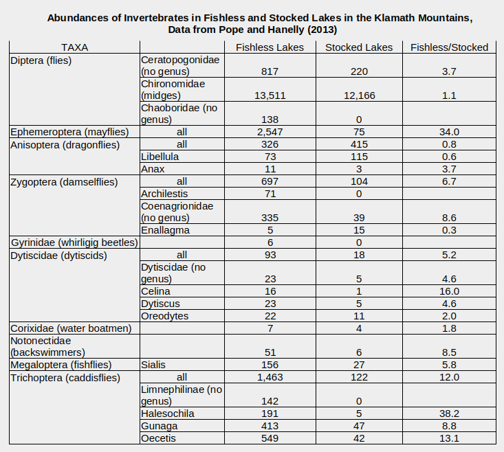
Lakes where stocking stopped or fish were removed are not included in the table. Many taxa have been omitted.
Numbers are total individuals collected twice each year for 3 years, assuming the pre-treatment year was not included.
Pope, K.L., and Hannelly, E.C., 2013, Response of benthic macroinvertebrates to whole-lake, non-native fish treatments in mid-elevation lakes of the Trinity Alps: Hydrobiologia, v. 714, p. 201-215.
in British Columbia, Canada
The effects of fish stocking on populations of cladocerans, copepods, and chaoborids were monitored in 3 lakes in the University of British Columbia Research Forest (Northcote and others, 1978). 2 small lakes were stocked with either cutthroat trout or dolly varden while a third lake served as a control. It all got off to a bad start for the invertebrates. Lengths and weights of “cutthroat trout and Dolly Varden increased greatly in the formerly fishless lakes compared to the donor lake, some individuals more than tripling their weight by the end of their first summer after [autumn] transfer”. This is similar to what WGF employees in Lander told me about the success of fish-stocking in the Wind River Mountains. The older, larger larvae (3rd and 4th instars) of Chaoborus americanus and Chaoborus trivvitatus were essentially eliminated within 9 months of the first introduction of fish and brief reappearances were extinguished by the end of 12 months. Younger, smaller larvae persisted. Chaoborid larvae are 4-20 mm (0.16-0.79″) long (Borkent, 1979, p. 136). Conversely, densities of the cladoceran Daphnia rosea and the copepod Diaptomus kenai were somewhat greater in the stocked lakes than in the fishless control lake after both the first and second years of stocking. In all lakes, Daphnia rosea was less than 2.1 mm (0.08″)long and Diaptomus kenai less than 2.8 mm (0.11″).
Northcote and others (1978) also analyzed fish stomach contents. In the summer after the first autumn stocking, more mature C. americanus larvae accounted for 50% of the cutthroats’ diets, by volume, and were found in 75% of the stomachs examined. The cutthroats and dolly vardens also ate appreciable volumes of Daphnia rosea and Diaptomus kenai but that had less impact on their populations. Near elimination of predatory C. americanus larvae by the fish probably allowed D. rosea and D. kenai densities to remain as high as before stocking in spite of fish predation.
The results of Northcote and others (1978) indicate that cutthroat and dolly varden in the UBC Research Forest have a strong preference for large prey. It would be reasonable to assume that all the fairy shrimp that hatch in 1 year would be eaten over the course of a summer. The question of whether the fairy shrimp would have time to reproduce remains open.
Back to Fish-stocking Zooicide in the Wind River Mountains
in Banff National Park, Alberta, Canada
Several studies have documented the effects on zooplankton of stocking 3 alpine lakes in Banff National Park with brook, cutthroat, and rainbow trout in the 1960s. Zooplankton samples were collected regularly until 1979, in 1984, and again in the early 1990s.
“Snowflake Lake” (7.1 hectares, 17.5 acres; depth 12.5 m, 41′) was stocked in 1960-1966. No Hesperodiaptomus arcticus, a calanoid copepod, individuals were found in May 1967 (McNaught and others, 1999). The cladoceran Daphnia pulex was last collected in October 1968. The amphipod Gammarus lacustris, went missing in 1966 although small numbers could have survived by hiding out in peat deposits along part of the shoreline (McNaught and others, 1999). Consistent with preferential consumption of larger individuals and with removal of the predatory H. arcticus, populations of the smaller copepods Diaptomus tyrelli and Acanthocyclops vernalis (both less than 2 mm, 0.08″) increased until 1972. At that time, the even smaller cyclopoid copepod Diacyclops bicuspidatus thomasi (less than 1.3 mm, 0.05″) was the only copepod or cladoceran caught. D. bicuspidatus became rare after 1975 but returned as part of the 1990s fishless community. The fish didn’t reproduce and the population collapsed by 1977. A single brook trout was caught in 1984 (McNaught and others, 1999).
Now for a brief digression on fish-stocking affecting not only zooplankton but also phytoplankton. The effects of stocking “Snowflake Lake” cascaded down to the phytoplankton. Pre-stocking biomasses were not measured. During the years with significant trout populations, Cyanophyta, Cryptophyta, and Chlorophyta were the most abundant phytoplankton (McNaught and others, 1999). Diatoms were also present and, during 2 years, cyanobacteria. The rotifer grazers during this period were the genera Kellicottia and Synchaeta. They could proliferate due to the continued absence of H. arcticus and other predatory copepods. After the fish die-off, early 1990s samples found a different phytoplankton community. Cryptophyta and diatoms remained but Cyanophyta and Chlorophyta were rarely collected while Pyrrhophyta, Chrysophyta, and Bacillariophyta jumped into the spotlight. These changes were facilitated by the changing of the rotifer guard from the genera Kellicottia and Synchaeta to Keratella and Polyarthra (McNaught and others, 1999).
“Pipit Lake” (11 hectares, 27 acres; depth 20 m, 66′) was stocked in 1964-1966. Hesperodiaptomus arcticus was eliminated by 1967 (Parker and others, 1996). Daphnia middendorffiana was also eliminated but its last year was not given. The stocked fish didn’t reproduce. No fish were caught in 1984.
“Bighorn Lake” (2.1 hectare, 5.2 acres; depth 9.2 m, 30′) was stocked in 1965-1966. Hesperodiaptomus arcticus was collected in 1966 but not in subsequent years although the next zooplankton sample was evidently in 1971 (Parker and others, 2001). Daphnia middendorffiana was first caught in 1998, after fish removal had started. D. middendorffiana must have been eliminated in 1965 because its eggs were found in the lake sediment. As in “Snowflake Lake”, populations of smaller species followed the removal of larger species by fish predation. Acanthocyclops vernalis appeared in the early 1970s. After a sampling gap, Diacyclops bicuspidatus and rotifers were common in the early 1990s.
The rapid disappearances of large copepods and cladocerans from 3 lakes in Banff National Park confirms the deadliness of fish-stocking. They are small compared to fairy shrimp. Once eliminated, they didn’t appear in subsequent samples until fish were removed or died off. That suggests that those hatching from eggs while fish were present were eaten so quickly that the population could not reproduce. It’s hard to imagine fairy shrimp doing any better.
in “Lake Lenore”, Washington
Cutthroat trout introduced into a fishless lake in Washington “selectively consumed larger individuals” of “Chaoborus flavicans [Insecta: order Diptera, family Chaoboridae], Hyalella azteca [Crustacea: class Malacostraca, order Amphipoda], and Callibaetis sp. [Ephemeroptera – mayflies]” (Luecke, 1990, abstract only). “Densities of dominant macroinvertebrates declined in profundal and pelagic regions but not in littoral [near-shore] regions”. Populations of the preferred prey species were apparently not eliminated by trout predation, just reduced. They probably took refuge in aquatic vegetation near the shore. Such vegetation is not available to aquatic invertebrates in alpine lakes although rocks and gravel might provide refuge for some.
in the Sierra Nevada, California
Populations of the cladoceran Daphnia melanica were extirpated from 2 lakes by introduced trout (Latta and others, 2010, abstract only). As the name suggests, this species is darkly colored and consequently more visible than usually translucent cladocerans. Length was not mentioned in the abstract.
Back to Fish-stocking Zooicide in the Wind River Mountains
Zooicide in the Wind River Mountains
This small collection of experiments combined with the large number of post-stocking field studies in “Fish-stocking Zooicide in the Sierra Nevada” on the east-central Sierra Nevada page strongly supports the conclusion that the introduction of trout into the alpine lakes of the Wind River Mountains resulted in the extermination of many populations of various aquatic invertebrate species, including fairy shrimp. Although the exterminations cannot be catalogued because they occurred before the native populations were known, over 500 lakes and ponds have been stocked in the Bridger Wilderness alone (Wyoming Game and Fish Department, 2013, Bridger Wilderness, A Guide to the Fishing Lakes). The vast majority of those 500 had populations of invertebrates before fish were introduced. While the highest, coldest lakes may have been too cold for invertebrates (e.g., Silas Headwall Lake), WGF is unlikely to have stocked those because they wouldn’t be suitable for fish. The work of Knapp and others (2001) and Bradford and others (1998) in the Sierra Nevada show that mayflies, dytiscids, water boatmen, backswimmers, caddisflies, large copepods, and large cladocerans can all be severely affected by fish predation (killed off Sierra Nevada invertebrates). Parker (2008) (killed off Lassen Volcanic National Park invertebrates), Pope and Hannelly (2013) (killed off Klamath Mountains invertebrates), and Schilling and others (2009) (killed off Maine invertebrates) generally confirmed the results in the Sierra Nevada and added dragonflies, damselflies, whirligig beetles, and chaoborids to the list, although I haven’t seen those in the Wind River Mountains. The case for mayflies is less clearcut. For mayflies, fish effects likely depend on species and aquatic vegetation, which is absent in alpine lakes.
Fish-stocking is a human choice. Although the earliest fish-stockers could conceivably plead ignorance, the effects are quite obvious without any scientific study or education. Alpine lakes with fish have no, or very few, visible swimming animals other than fish. Most alpine lakes without fish have 1 or more species of visible swimming animals. Killing most or all of a population of an invertebrates species is analogous to massacring a lot of people according to their race or ethnic group. I call this zooicide. Using fish to do the killing is no different than using a virus, poison gas, or bombs. Justifying the zooicide by claiming that people will derive more enjoyment from stocked lakes is like justifying genocide by claiming that those carrying out the genocide will enjoy living on the lands of those killed. Killing populations of many species at the same time has no parallel in human history so I’ll leave it at zooicide. The zooicide is not over. Continued fish-stocking prevents the eliminated species from ever returning to their home waters.
Most Americans wouldn’t think of protecting any animal or plant population from urban, suburban, ex-urban, agricultural, industrial, transportation, energy, mining, or gravel pit development or from military training so the zooicide of aquatic invertebrate populations by fish-stocking for recreational development is vanishingly insignificant. After all, fish have to eat. What’s the problem?
Fish in alpine lakes are invasive – like zebra mussels in the Great Lakes or Burmese pythons in Florida. In natural ecosystems with fish, fish and their prey are in a dynamic balance. The fish don’t routinely eat prey populations out of existence. That is what introduced fish have done in alpine lakes around the world.
Introducing an alien predator into an ecosystem that lacks such predators can have far-reaching consequences. For example, the illegal stocking of “Yellowstone Lake” with exotic lake trout halved the population of native cutthroat trout, forced bears and eagles to seek prey other than spawning cutthroat, caused otters to eat more amphibians, reduced osprey nests to a tenth of what they were, and also halved osprey nesting success (Koel and others, 2019). The remaining ospreys were flying to other lakes for fish.
Pigs introduced into Hawaii have no natural predators. As a result, feral pigs have changed the landscape and the biota (www.biisc.org/pest/feral-pigs-in-hawaii/). Their rooting for earthworms and other food destroys native plants, which have no defenses against large herbivores, and accelerates erosion. Their wallowing creates depressions where water collects and mosquitoes thrive. The mosquitoes transmit diseases to native birds, which have no resistance. So many native birds have died that they are rarely seen anymore. The pigs consume agricultural crops and wreck fields, spread invasive plants, and eat amphibians, other small animals, and ground-nesting birds’ eggs and chicks (www.hawaiiungulates.com/feral-pigs). In a direct affront to their human enablers, packs of pigs uproot gardens and so intimidate people that they are afraid to get out of their cars (www.civilbeat.org/2023/08/feral-pigs-are-increasingly-running-wild-in-some-oahu-neighborhoods/).
The fish-stocking zooicide is not likely to lead to anything so serious but it is important to know that it is happening. Without an understanding of fish-stocking zooicide, the disappearances of mountain yellow-legged frogs and garter snakes from many Sierra Nevada lakes (Pacific Southwest Research Station, 2003) and the avoidance of lakes with fish by flamingos (Hurlbert and others, 1986) and ducks (McParland, 2005) would seem utterly mysterious. With an understanding of fish-stocking zooicide, you would know that to find fairy shrimp, water boatmen, amphipods, dytiscids, large copepods, mayflies, and even ducks and finches in the Wind River Mountains, you are better off going to lakes without fish.
Back to Fish-stocking Zooicide in the Wind River Mountains
Bivouac Lake (Lander Ranger District, Shoshone National Forest; Popo Agie Wilderness)
___This map is a screenshot of The National Map (Go to The National Map). The U.S. Geological Survey generally does not copyright or charge for its data or reports (unless printed). A pond location is indicated by an “X”, which corresponds to the coordinates given in the data spreadsheet. Labels in quotations are from 7.5-minute topographic quadrangles.
___Red lines are the U. S. National Grid with a spacing of 1,000 m and intersection labels consisting of the UTM zone (e.g., 11S, 12T), a 2-letter 100-km square designation (e.g., LC, XN), and a 4-digit number. The first 2 digits of the number represent the 1,000-meter Easting and the second 2 digits the 1,000-meter Northing, as seen in the example Easting and Northing. Unlike latitude and longitude, the National Grid is rectilinear on a flat map, the units of abscissa and ordinate have equal lengths, and the units (meters) are measurable on the ground with a tape or by pacing.
___There is no private or state land on this map. All the lands are public.
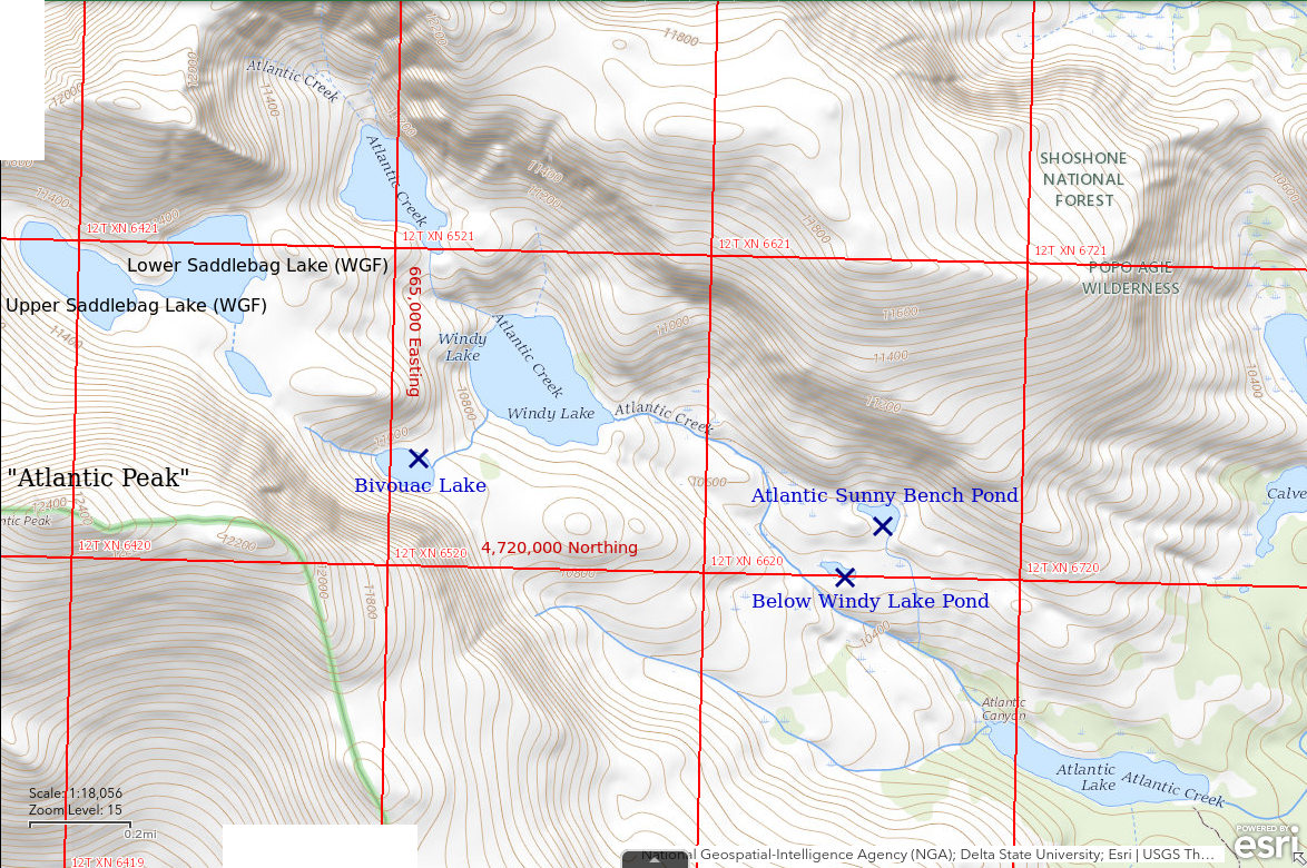
Bivouac Lake is in Atlantic Canyon 32 km (20 miles) southwest of Lander. It is at the base of the cliffs on the northeast side of Atlantic Peak. It has an oval shape with a length of 190 m and width of 100 m (620′ x 330′) as shown on the 7.5-minute topographic quadrangle. Snowbanks on the cliff rubble west of the lake persist into September in most years. My first night at the lake was an uncomfortable bivouac but WGF refers to the lake as Icicle Lake (see In The Beginning for more details).
Bivouac Lake is isolated from the fish in “Windy Lake” below and from Lower Saddlebag Lake (name used by WGF) above by steep streams. A 2019 newsletter for the Lander office of the WGF proclaimed that Lower Saddlebag Lake, and several others, had 16-19-inch golden trout (wgfd.wyo.gov/WGFD/media/content/PDF/Fishing/LR_ANGLERNEWS_2019, pdf, p.3). The Department’s online “Fish Stocking Report” indicates that Lower Saddlebag Lake was again stocked with golden trout in July 2020, 748 of them.
Big fish in Upper and Lower Saddlebag lakes create a precarious situation for the fairy shrimp in Bivouac Lake. The fishing opportunity would attract people to the area. One or more of them might be perturbed by the lack of fish in Bivouac Lake and decide to transfer a few from Lower Saddlebag Lake or “Windy Lake”. Given the success of fish in Lower Saddlebag Lake, WGF itself might decide to give Bivouac Lake a try. Just drop a few in as the helicopter heads back down the canyon. What’s there to lose?
There is a hiking trail to the eastern end of “Atlantic Lake”. An angler’s trail follows the south side of the lake to the west end. From “Atlantic Lake”, it is about 2,600 m (8,530′) laterally and 215 m (700′) up to Bivouac Lake. The trail to “Atlantic Lake” can be reached from the “Fiddlers Lake” or the “Louis Lake” trailheads. The “Fiddlers Lake” route is better although it fords Atlantic Creek. There is little change in elevation. There is also a jeep trail more than 6 miles long to “Christina Lake” from the “Louis Lake” road. It was terrible in the 1980s. The jeep trail intersects the hiking trail at the eastern end of “Christina Lake”. From “Christina Lake”, “Atlantic Lake” is only 2,600 m (8,530′) away and only 90 m (300′) up. For most people, the hike from “Fiddlers Lake” would take half a day. If you are pressed for time, a round trip in one day is possible. A camp site at “Atlantic Lake” would be more uncomfortable than one at Bivouac Lake or Lower Saddlebag Lake.
Exposure Age: Glacial ice probably melted off Bivouac Lake about 11,750 years ago, the same time that ice melted off a moraine on the south side of Cirque of the Towers (Dahms and others, 2018).
Elevation: 3,334 m (10,939′)
August 8, 1985
This was my first sighting of fairy shrimp, I didn’t know what they were, didn’t collect any data, and didn’t take any notes.
- Fairy shrimp.
September 3, 1986
The high lake level, snowbanks on the west side of the lake more extensive than in August of last year, and a glorious profusion of wildflowers all suggest this is a relatively wet year.
- 100 m x 190 m based on the 7.5-minute quadrangle; greater than 200 cm depth.
- Clear water.
- Relatively large fairy shrimp (4 specimens 22-23 mm); didn’t think of noting presence of eggs but they are in the photographs.
- Caddisfly larvae (Trichoptera), mayfly larvae (Ephemeroptera), wriggly larvae, possibly cladocerans.
Specimens were identified as Branchinecta coloradensis by DB (archive #DB-749).
Lower and Upper Saddlebag Lakes (names used by WGF) are above Bivouac Lake but since Lower Saddlebag is now periodically stocked with fish (see zooicide), there’s no point creating separate entries for them. Nonetheless, it is likely that they hadn’t had fish for a decade or so before 1987. WGF employees in the Lander office had told me that Lower Saddlebag Lake had been stocked with fish but that they had died off. I got the impression the die off was many years previously. As part of my job for the Shoshone National Forest in 1985, I had collected biological samples from Lower Saddlebag Lake with a plankton net. On 3 trips, I never saw fairy shrimp there. On this visit, I walked the shores of Lower Saddlebag and adjacent Upper Saddlebag lakes looking for fairy shrimp and didn’t see any. I also didn’t see any fish so they really did die off. The absence of fairy shrimp from a newly fish-free lake, whenever that was, next to a lake with fairy shrimp suggests colonization isn’t speedy.
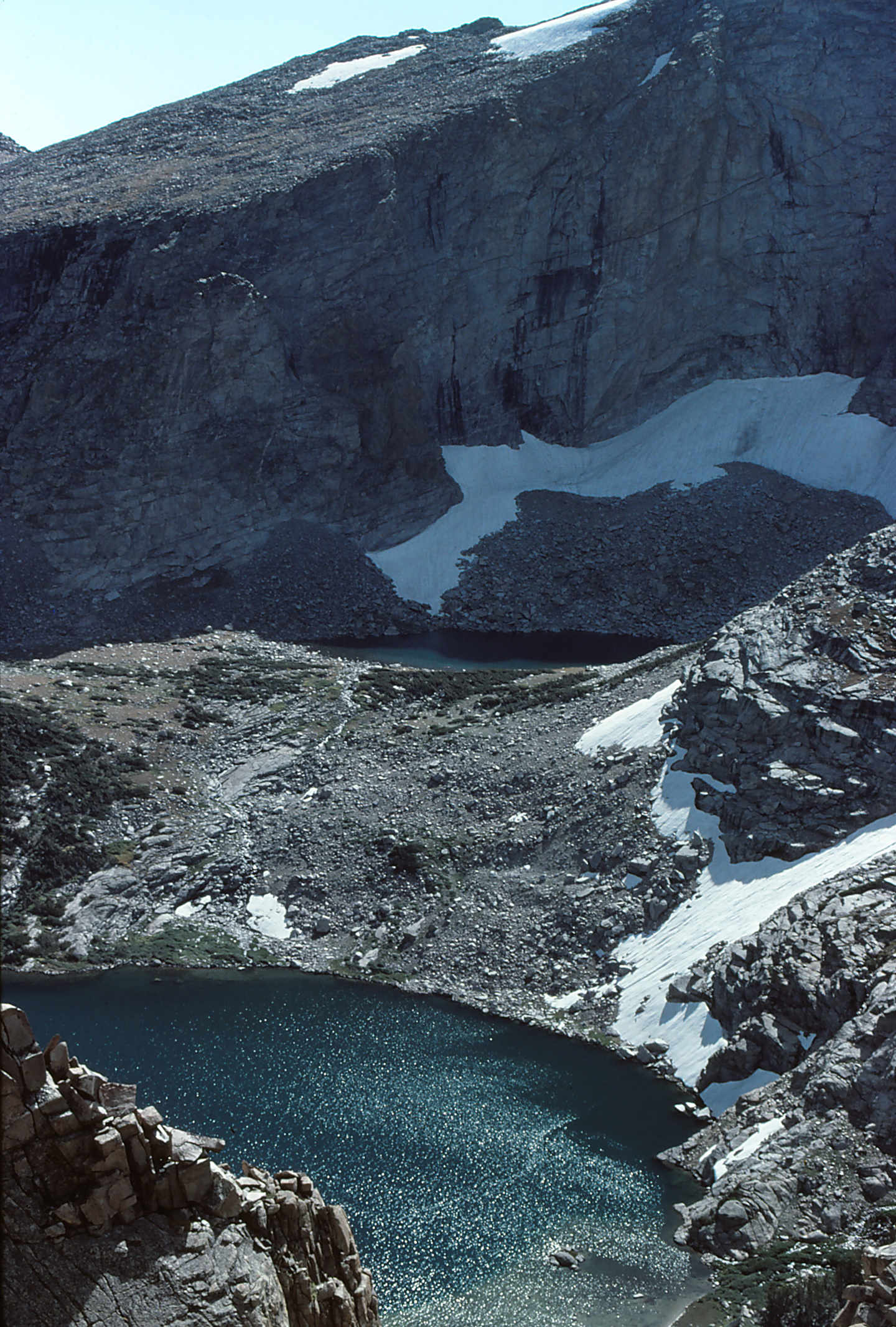
Bivouac Lake in the shadow of Atlantic Peak (off upper right corner of photograph), looking southwest. The lower lake, “Windy Lake”, has been stocked with fish.
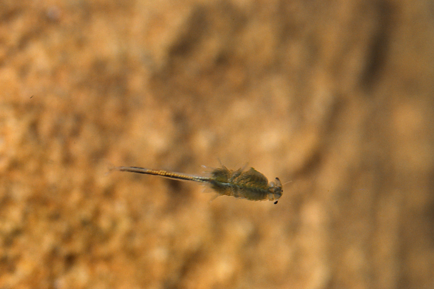
A female fairy shrimp in Bivouac Lake. It has a single row of pale yellowish-brown eggs in its ovisac and 2 rows of white eggs closer to its thorax, presumably in its oviducts.
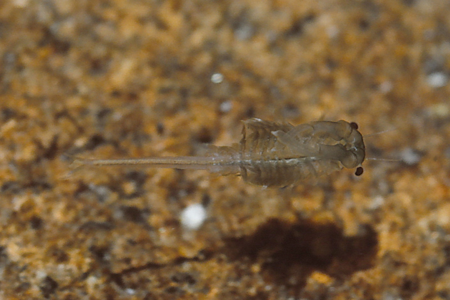
Closeup of a male fairy shrimp in Bivouac Lake. Pale food in the lower intestine can be seen through the transparent abdomen. This male has large antennae II that extend backward from the head over the legs and are so long that they cross about 2/3 of the way down the thorax. For more about the anatomy of fairy shrimp, see Anatomy of Fairy Shrimp.
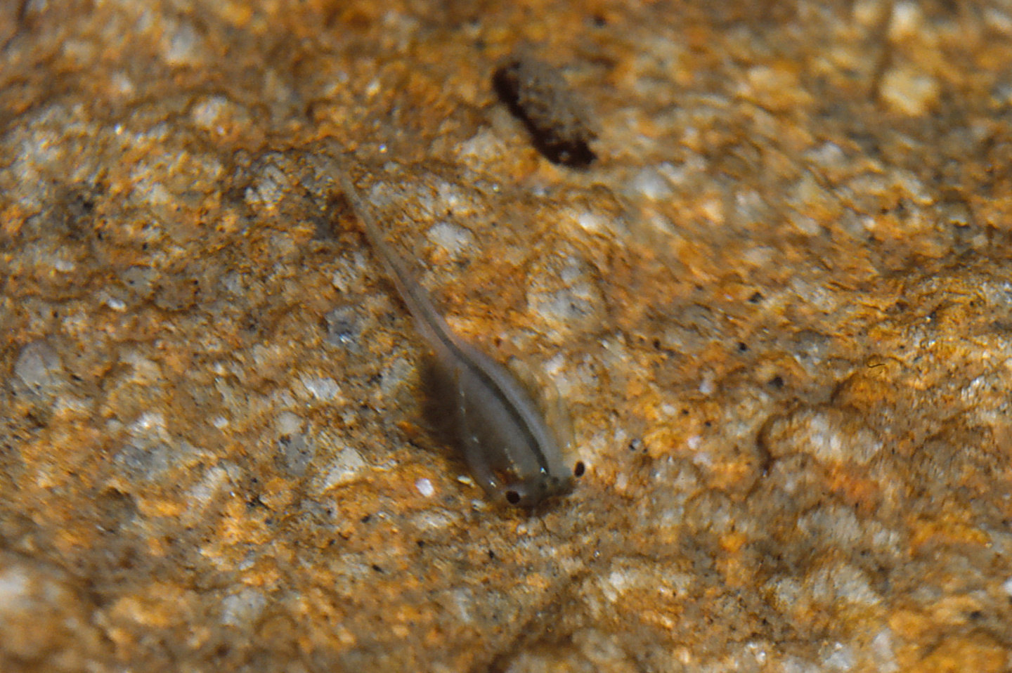
A fairy shrimp scraping the rock in Bivouac Lake. This fairy shrimp is uncharacteristically back side up with its legs apparently scraping the granite on the floor of the lake for food. The antennae II of this male are splayed to the sides of the body and stretched over the back to keep them out of the way. There does not appear to be much in the way of food items on the rock surface. Is this behavior a sign of a shortage of phytoplankton food? There is a caddisfly larval case of stuck-together sand grains near the top of the photograph. The larva may or may not still be living in it.
August 12, 1987
I know the lake has fairy shrimp but do they hatch every year? Was I just lucky in 1985 and 1986?
- 100 m x 190 m based on The National Map; depth greater than 200 cm.
- Clear water; 9 C at 0730, 12 C at 1330.
- Pale green fairy shrimp 12-18 mm long with males bigger than females; most abundant in deeper water among boulders on southwest side of lake; most females have single row of white eggs.
- Mayflies and mayfly larvae (Ephemeroptera), caddisfly larvae (Trichoptera), large red copepods and smaller black ones.
Specimens were identified as Branchinecta coloradensis by DB.
The fact that fairy shrimp in Bivouac Lake hatched 3 years in a row is good evidence that populations can live in large, permanent alpine lakes in the Wind River Mountains with no need for seasonal drying. It also means fairy shrimp probably inhabited many permanent alpine lakes and ponds in the Bighorn Mountains and Snowy Range before they were stocked with fish, as well.
One possible argument against a widespread pre-stocking distribution of fairy shrimp is that colonization may have been hindered by large lake sizes. Maybe females and males hatched from a small number of introduced eggs wouldn’t have been able to find each other in order to reproduce.
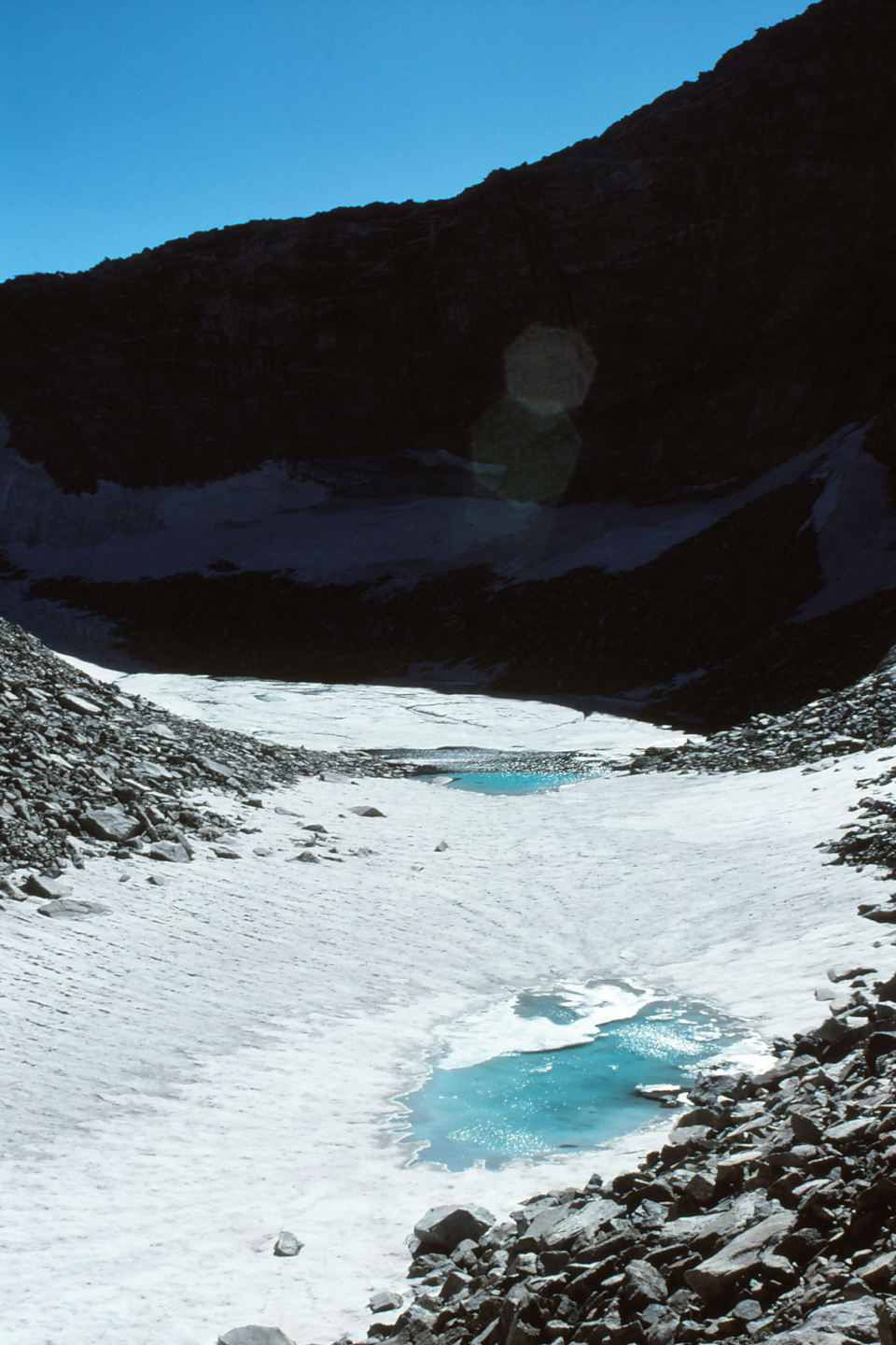
Pond behind the moraine (Little Ice Age?) above Upper Saddlebag Lake at the head of Atlantic Canyon. Being mostly frozen in mid-August, it is not yet ready for fairy shrimp.
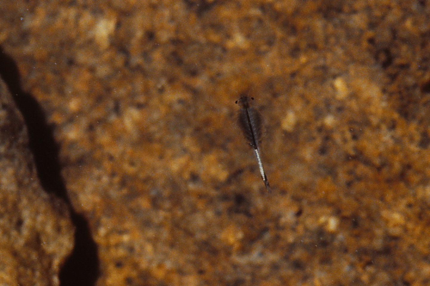
A female fairy shrimp with white eggs in Bivouac Lake.
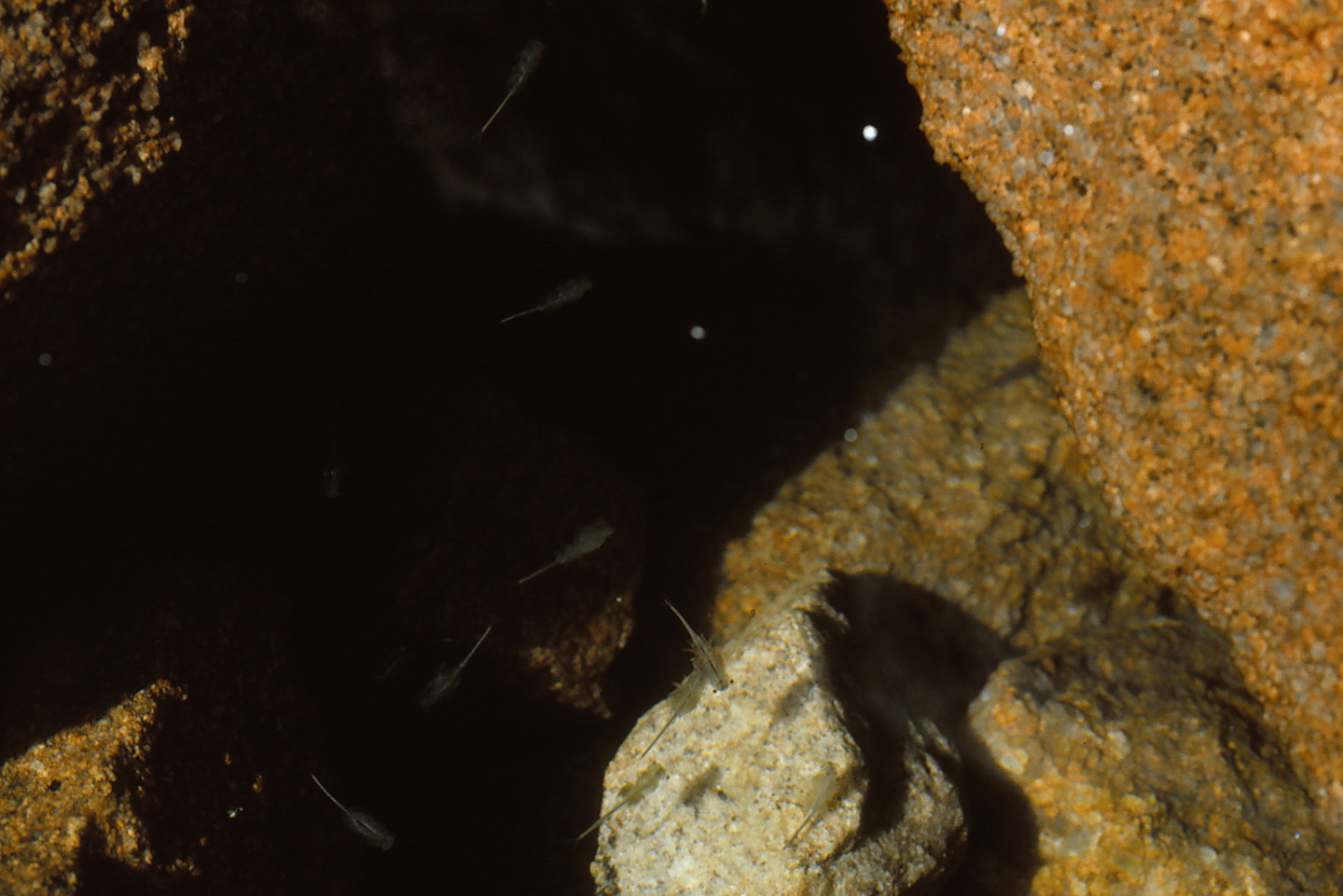
Several fairy shrimp swimming among the boulders in Bivouac Lake.
August 13, 1993
I plan to do some searching in Stough Creek Basin and couldn’t resist stopping here to check on the fairy shrimp.
- 100 m x 190 m based on The National Map; greater than 200 cm depth.
- Water is clear.
- Sparse fairy shrimp about 20 mm long, not easy to find; eggs present.
- Other animals not noted.
This population seems to hatch every year so Bivouac Lake can wipe away the fairy shrimp blues if you aren’t having any luck elsewhere.
Atlantic Sunny Bench Pond (Lander Ranger District, Shoshone National Forest; Popo Agie Wilderness)
Atlantic Sunny Bench Pond is 1,400 m (4,590′) east of Bivouac Lake at the base of the northeastern wall of Atlantic Canyon. The location is about halfway between “Windy Lake” and “Atlantic Lake”. It is on a topographic bench with a good southern exposure. The size on the 7.5-minute topographic quadrangle is 150 m x 85 m (490′ x 280′).
For access, see Bivouac Lake. There is no trail to this pond but it can be reached by a cross-country hike from “Atlantic Lake”.
Elevation: 3,215 m (10,547′)
September 4, 1986
It’s on the way down from Bivouac Lake.
- 85 m x 150 m based on 7.5-minute quadrangle; depth “shallow” (according to my notes).
- Water “scummy”.
- No fairy shrimp.
- Other animals not noted.
Below “Windy Lake” Pond (Lander Ranger District, Shoshone National Forest; Popo Agie Wilderness)
Below “Windy Lake” Pond is 200 m southwest of Atlantic Sunny Bench Pond. It is 70 m (230′) northeast of Atlantic Creek, where there are parts of a trail created by those fishing in “Windy Lake”. Below “Windy Lake” Pond is 115 m x 50 m (380′ x 165′) on the 7.5-minute topographic quadrangle.
For access, see Bivouac Lake. There is no trail to this pond but it can be reached by a cross-country hike from “Atlantic Lake”. It is easy to find while hiking down from Atlantic Sunny Bench Pond but would not be visible to someone hiking along the creek.
Elevation: 3,201 m (10,503′)
September 4, 1986
Stopped at this pond on the way down from Atlantic Sunny Bench Pond.
- 50 m x 115 m based on the 7.5-minute quadrangle; depth “shallow” (according to my notes) but not estimated.
- Water “scummy” (according to my notes).
- No fairy shrimp.
- Other animals not noted.
“Upper Silas Lake” Southwest Pond (Lander Ranger District, Shoshone National Forest; Popo Agie Wilderness)
___This map is a screenshot of The National Map (Go to The National Map). The U.S. Geological Survey generally does not copyright or charge for its data or reports (unless printed). A pond location is indicated by an “X”, which corresponds to the coordinates given in the data spreadsheet. Labels in quotations are from 7.5-minute topographic quadrangles.
___Red lines are the U. S. National Grid with a spacing of 1,000 m and intersection labels consisting of the UTM zone (e.g., 11S, 12T), a 2-letter 100-km square designation (e.g., LC, XN), and a 4-digit number. The first 2 digits of the number represent the 1,000-meter Easting and the second 2 digits the 1,000-meter Northing, as seen in the example Easting and Northing. Unlike latitude and longitude, the National Grid is rectilinear on a flat map, the units of abscissa and ordinate have equal lengths, and the units (meters) are measurable on the ground with a tape or by pacing.
___There is no private or state land on this map. All the lands are public.
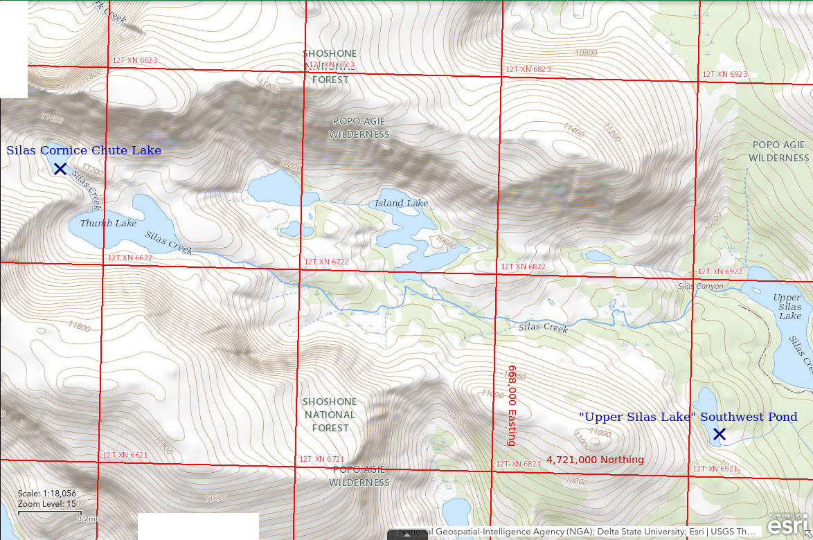
“Upper Silas Lake” Southwest Pond is on a bench on the south side of Silas Canyon about 300 m (980′) southwest of the southern part of “Upper Silas Lake”. Its dimensions on the 7.5-minute topographic quadrangle are about 290 m x 120 m (950′ x 390′).
There is a trail to “Upper Silas Lake” from the “Fiddlers Lake” trailhead. The Silas Canyon trail turns off the “Atlantic Lake”/”Christina Lake” trail east of “Lower Silas Lake” only about 2 km (1.2 miles) from the trailhead. The pond is a cross-country hike from the lower end of “Upper Silas Lake”.
Elevation: 3,142 m (10,308′)
September 4, 1986
The out-of-the-way location looks promising and this pond, like Bivouac Lake, may be cooler than average due to the cliff to the southwest.
- 120 m x 290 m based on the 7.5-minute quadrangle; depth not estimated.
- Water clear.
- No fairy shrimp.
- Big fish.
The outlet from “Upper Silas Lake” Southwest Pond drops 37 m (120′) in 170 m (560′) so it’s doubtful that fish could have gotten here on their own. It’s also doubtful that WGF would bother stocking a pond this small. This is likely the result of fish-stocking by individuals. I had also seen fish in the lower of the “Calvert Lakes”, which is only a little bigger.
“Fremont Lake” Moraine Pond (Pinedale BLM Office)
___This map is a screenshot of The National Map (Go to The National Map). The U.S. Geological Survey generally does not copyright or charge for its data or reports (unless printed). A pond location is indicated by an “X”, which corresponds to the coordinates given in the data spreadsheet. Labels in quotations are from 7.5-minute topographic quadrangles.
___As of April 2025, the National Grid overlay with red lines in UTM coordinates does not load in The National Map.
___Gray shading represents private and state lands as traced from the PAD-US 4.0 – Federal Fee Managers layer of The National Map.
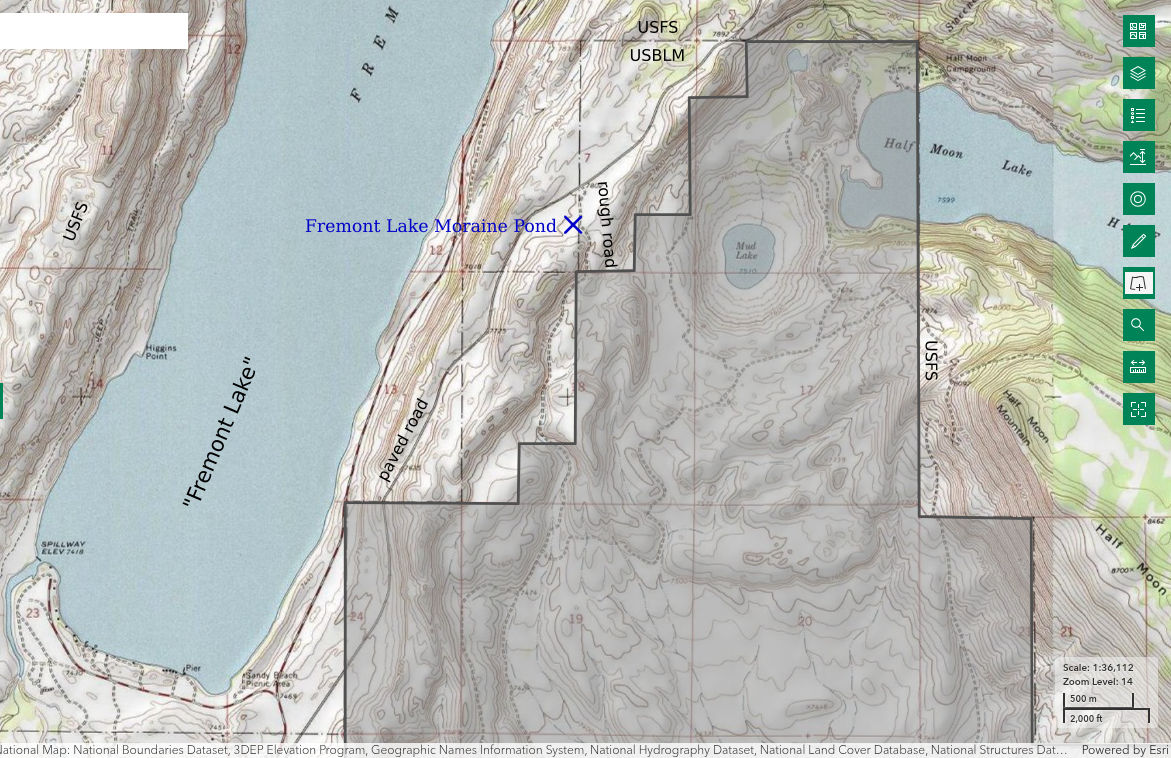
“Fremont Lake” Moraine Pond is about 9 km (6 miles) northeast of Pinedale on the southeast side of the road to “Half Moon Lake” and Elkhart Park trailhead, the most popular entry to the Bridger Wilderness. It is near a road that turns south off the Elkhart Park road west of “Mud Lake”. It is near the crest of the massive moraine that rings the southern part of “Fremont Lake”.
“Fremont Lake” Moraine Pond is not shown on the 7.5-minute topographic quadrangle and is not evident on USGS imagery of The National Map. Consequently, the location on the map above and the coordinates in the data spreadsheet may be off by 200 m (660′).
“Fremont Lake” Moraine Pond is easily reached from Pinedale. Take Sublette County Road 111 northeast from the east end of Pinedale. At the Y-junction just south of “Fremont Lake”, take the right fork rather than the left fork, which goes to “Fremont Lake” and Sandy Beach. There should be a sign to “Half Moon Lake” or Elkhart Park. About 2.9 miles from the Y, turn south onto an unimproved road at the National Forest boundary, which may or may not be marked. Drive about 200 m (660′), park, and start looking around. The official highway map of Wyoming indicates the road to Elkhart Park is now paved.
Exposure Age: Exposure ages for 3 boulders on the Pinedale moraine at “Fremont Lake” averaged 23,900 years ago (recalculated by Young and others, 2011b). “Fremont Lake” Moraine Pond would have been exposed earlier if it is on older “Bull Lake” moraine material.
Elevation: 2,383 m (7,818′)
May 20, 1987
I don’t have a map but NPPWOPII.
- Size and depth not estimated.
- Water clear with brown tint.
- Green fairy shrimp about 25 mm long seem to be treading water more than swimming; females have white or yellow eggs.
- Other animals not noted.
June 18, 1987
The fairy shrimp in this pond looked like a different species than what I saw in Bivouac Lake and “Coyote Lake” (Antelope Hills) so I came back to collect specimens. There are grass and rushes growing in the water and abundant green algae along the north shore.
- 10 m x 30 m; depth probably at least 50 cm.
- Water clear and dark brown; 19 C.
- Fairy shrimp 25-30 mm long with deep brownish-green color and yellow eyes; seem to be treading water more than swimming and occasionally scrape the pond bottom or rise to the water surface; females have yellow eggs.
- Many small and few large backswimmers (sub-order Heteroptera, family Notonectidae), small and large dytiscid larvae (order Coleoptera, family Dytiscidae), water boatmen (sub-order Heteroptera, family Corixidae), beetles, blue dragonflies, some brown zooplankton less than 2 mm (copepods?), red and round possible water mites.
Specimens were identified as Streptocephalus seali by DB (archive #DB 801-813, which includes specimens from other ponds).
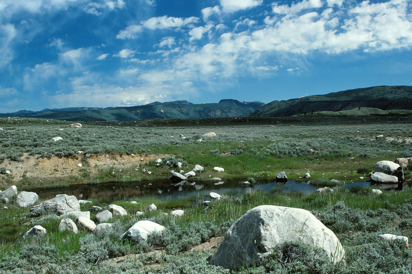
Looking north across “Fremont Lake” Moraine Pond. “Fremont Lake” is out of sight in the valley in the middle distance.
A female fairy shrimp in “Fremont Lake” Moraine Pond with yellow eggs. Unlike the other species I have seen, this one has yellow eyes. The yellow thing at the end of the abdomen between the cercopods is not a tail, it is a mucilaginous string of food that hasn’t fallen off yet.
A fairy shrimp in “Fremont Lake” Moraine Pond. This one doesn’t have eggs or anything that looks like an ovisac so it is probably a male. It is not just the dark body color and yellow eyes that makes this look like a different species than the one in Bivouac Lake. It is also the kidney rather than round shape of the eyes, the curved cercopods, and the inconspicuous antennae II in mature males.
A dytiscid larva (order Coleoptera, family Dytiscidae) on the bottom of “Fremont Lake” Moraine Pond. The end of the abdomen characteristically turns up toward the water surface and helps make these larvae easy to identify. Dytiscid larvae are predators of fairy shrimp.
August 14, 2025
After finishing a backpacking trip from the Elkhart Park trailhead, I stopped here on the way out to collect GPS coordinates as my previous estimate of the location was highly uncertain. I found the actual location of this rock pool is 193 m southwest of that previous estimate. The coordinates in the spreadsheet on the Data page and the maps have been updated. A more accurate location may be of interest to anyone interested in Streptocephalus seali as Denton Belk’s identification of that species here was the first in Wyoming. Considering the general lack of interest in aquatic invertebrates though, the species may not yet have been found anywhere else in the state. To help anyone trying to find the road to the pond, my odometer measured 6.0 miles from US 191 in Pinedale to the turn-off.
- Dry.
- By pacing, the dimensions of dried mud are about 7 m by 15 m, which are smaller than the 10 m by 30 m dimensions of water estimated on June 18, 1987.
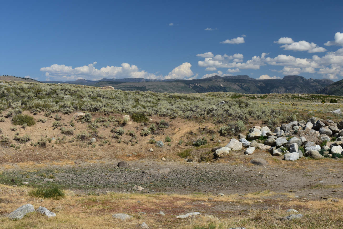
This view of “Fremont Lake” Moraine Pond is in the same direction as the June 18, 1987 photograph but from a position closer to the pond. Nonetheless, the mountains on the horizon beyond “Fremont Lake” (out of sight) are the same and the general appearance of the pond is quite similar. The pile of rocks on the far side of the pond is more recent. I was previously uncertain about the origin of the pond but the extensive disturbance around the pond and the lack of other ponds in the vicinity now suggest that it is anthropogenic.
Buttress Pond (Lander Ranger District, Shoshone National Forest)
___This map is a screenshot of The National Map (Go to The National Map). The U.S. Geological Survey generally does not copyright or charge for its data or reports (unless printed). A pond location is indicated by an “X”, which corresponds to the coordinates given in the data spreadsheet. Labels in quotations are from 7.5-minute topographic quadrangles.
___Red lines are the U. S. National Grid with a spacing of 1,000 m and intersection labels consisting of the UTM zone (e.g., 11S, 12T), a 2-letter 100-km square designation (e.g., LC, XN), and a 4-digit number. The first 2 digits of the number represent the 1,000-meter Easting and the second 2 digits the 1,000-meter Northing, as seen in the example Easting and Northing. Unlike latitude and longitude, the National Grid is rectilinear on a flat map, the units of abscissa and ordinate have equal lengths, and the units (meters) are measurable on the ground with a tape or by pacing.
___There is private land north of the green line at the extreme upper right. All other lands are public.
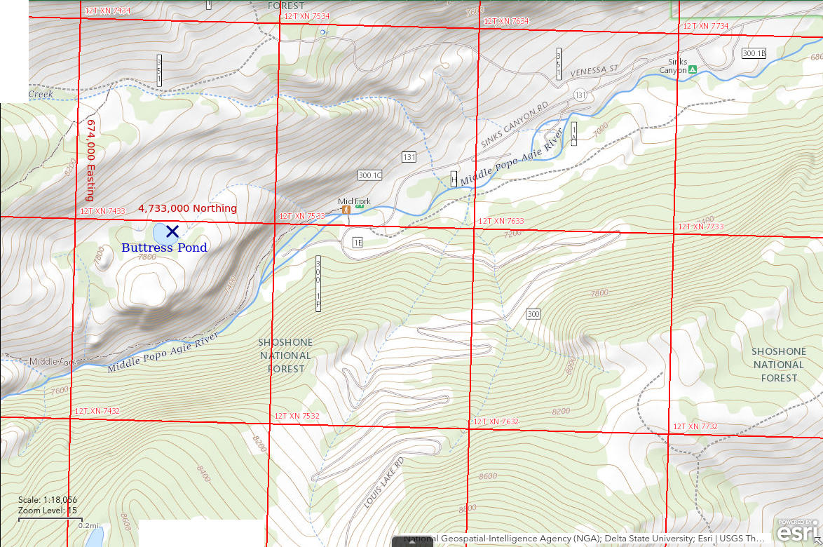
Buttress Pond is the name Arthur Shoutis used for the pond (see In The Beginning for details). It may be in common use as the Buttress is a climbing spot. The pond is on the back (north) side of a mass of rock that juts out from the north wall of Sinks Canyon and looms nearly vertically over the Middle Fork Popo Agie River. The pond is about 900 m (2,950′) west of the Middle Fork Popo Agie River trailhead. Except for the north shore, the pond is within a grove of conifers. On The National Map, the pond is 125 m long and 90 m (410′ x 295′) wide.
Buttress Pond is a steep climb from the Middle Fork trail. The Middle Fork trailhead is next to the Bruce Picnic Ground at the end of the paved Sinks Canyon road (Wyoming 131) southwest of Lander. I don’t remember the route we took to the pond but there wasn’t anything technical.
Exposure Age: The glacier in Sinks Canyon melted off Buttress Pond by 15,400 years ago because Buttress Pond is down valley from and higher above the valley floor than a bedrock sample with that age (Dahms and others, 2018).
Elevation: 2,358 m (7,737′)
May 22, 1987
Arthur Shoutis thought he had seen fairy shrimp in this pond previously so we went to see if they had hatched this year.
- Pond about 100 m long; depth at least 50 cm.
- Clear to slightly murky brownish water.
- No fairy shrimp.
- Abundant amphipods; a puddle in the marsh west of the pond had dytiscid larvae (order Coleoptera, family Dytiscidae) and backswimmers (sub-order Heteroptera, family Notonectidae).
July 6, 1987
I came back to take a longer look at the aquatic life and maybe find fairy shrimp this time.
- Size and depth not estimated.
- Water clarity not estimated..
- No fairy shrimp.
- Abundant amphipods of many sizes, abundant snails up to 25 mm across, caddisfly larvae (Trichoptera) with towering cases, dytiscid larvae (order Coleoptera, family Dytiscidae), damselfly larvae, a dragonfly as big as a hummingbird, a few fat salamander larvae.
Little Sandy Overlook Pond (Pinedale Ranger District, Bridger-Teton National Forest; Bridger Wilderness)
___This map is a screenshot of The National Map (Go to The National Map). The U.S. Geological Survey generally does not copyright or charge for its data or reports (unless printed). A pond location is indicated by an “X”, which corresponds to the coordinates given in the data spreadsheet. Labels in quotations are from 7.5-minute topographic quadrangles.
___Red lines are the U. S. National Grid with a spacing of 1,000 m and intersection labels consisting of the UTM zone (e.g., 11S, 12T), a 2-letter 100-km square designation (e.g., LC, XN), and a 4-digit number. The first 2 digits of the number represent the 1,000-meter Easting and the second 2 digits the 1,000-meter Northing, as seen in the example Easting and Northing. Unlike latitude and longitude, the National Grid is rectilinear on a flat map, the units of abscissa and ordinate have equal lengths, and the units (meters) are measurable on the ground with a tape or by pacing.
___There is no private or state land on this map. All the lands are public.
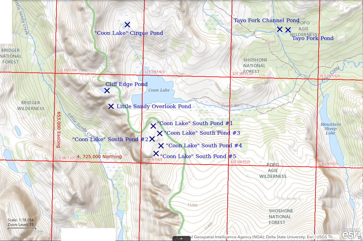
Little Sandy Overlook Pond is 36 km (22 miles) southwest of Lander on the west side of the continental divide about 250 m (820′) west of “Coon Lake”. It is perched on the edge of the 230 m (750′) cliff dropping down into Little Sandy Creek canyon. Because it is on the west side of the divide, it is in the Bridger-Teton National Forest rather than the Shoshone National Forest.
Although the water of Little Sandy Overlook Pond is not visible on USGS imagery of The National Map, the location is tightly constrained by the greenery and bare rock in photograph Little Sandy Overlook Pond 1987-08-10, #3112, and the topography.
Little Sandy Overlook Pond is close to “Coon Lake”. “Coon Lake” can be reached from the Worthen Meadows trailhead by following the trail over Roaring Fork Mountain to Tayo Park and then ascending Tayo Creek to past “Poison Lake”. Above “Poison Lake”, the trail shown on the recreation map of the southern half of the Shoshone National Forest turns north toward “Tayo Lake”. An informal trail continues to the west up the hill to “Coon Lake”.
Exposure Age: Glacial ice on “Coon Lake” and the nearby ponds could have melted off about 15,300 years ago, when the moraine at “Temple Lake”, which is slightly higher and more shaded, was exposed (Dahms and others, 2018). If not then, then certainly by 11,750 years ago, when ice melted off the moraine on the southern slope of Cirque of the Towers.
Elevation: 3,206 m (10,517′)
August 9, 1987
I saw a couple of people fishing at “Coon Lake” so there was no point stopping there. I continued to the end of the lake and approached the cliffs of Little Sandy Creek canyon. The view is beyond my expectations – the canyon is a spectacular glacier-carved trench. But, oh, there is a pond at the top of the cliff. I’m pooped and I haven’t found a place to pitch my tent yet but I have to look.
- Fairy shrimp.
August 10, 1987
Found some other fairy shrimp ponds today. It’s time to document this one.
- Pond 25 m x 10 m; depth possibly up to 100 cm.
- Water is clear; 14 C at 1915 with air temp about 10 C.
- Abundant brownish-green fairy shrimp with males larger than females; most females have single row of white eggs in ovisac.
- Black beetles, caddisfly larvae (Trichoptera), both larger black and smaller reddish brown copepods.
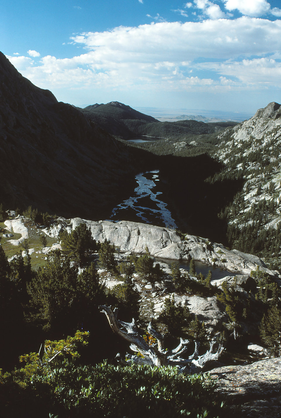
Little Sandy Creek canyon in the morning light, with Little Sandy Overlook Pond in the foreground at the edge of the precipice. The high-water mark on the rocks is about 15 cm above the current water level. “Little Sandy Lake” is in the sunlight beyond the shadowed canyon.
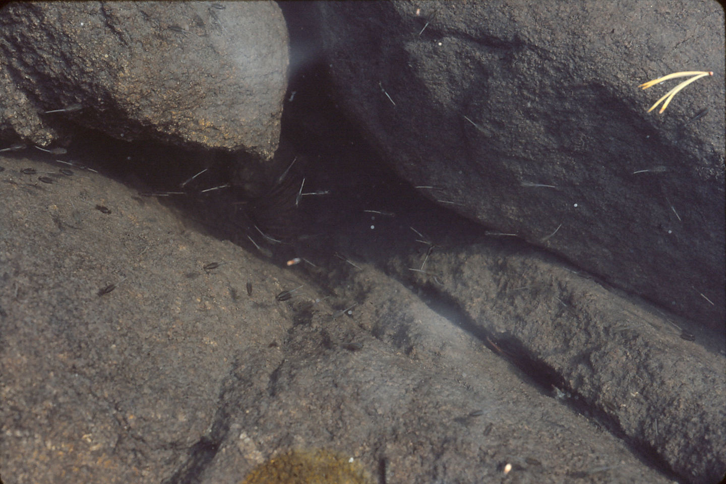
Numerous fairy shrimp swimming among the boulders in Little Sandy Overlook Pond. Floating pine needles for scale.
August 21, 1989
1987 was a good year for fairy shrimp in the ponds by “Coon Lake” so what about this year?
- Size and depth not estimated.
- Water clarity not noted.
- No fairy shrimp.
- Large black copepods.
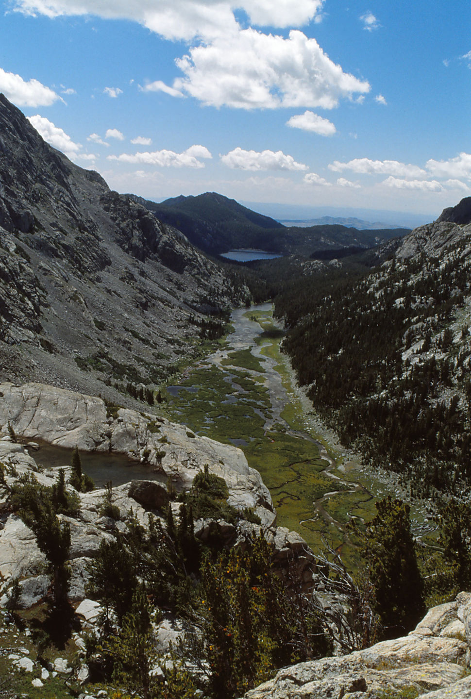
Little Sandy Overlook Pond from edge of the cliff by Cliff Edge Pond. I couldn’t find any fairy shrimp this time. The water level is a little lower but there is still plenty. This is a sunnier view of Little Sandy Creek canyon.
August 30, 2006
Not much luck with my tour of the Wind River Peak Ponds so it’s time to check on these southwest of “Coon Lake”.
- Size and depth not estimated.
- Water clarity not noted.
- No fairy shrimp.
- Backswimmers.
“Coon Lake” South Pond #1 (Pinedale Ranger District, Bridger-Teton National Forest; Bridger Wilderness)
Little Sandy Overlook Pond map
“Coon Lake” South Pond #1 is about 550 m (1,800′) southeast of Little Sandy Overlook Pond and 250 m (820′) south of “Coon Lake”. It is among 5 ponds south of “Coon Lake” that were visited in my search for fairy shrimp. The ponds are south of the hill marking the continental divide south of “Coon Lake”. The rocky terrain slopes gently toward Little Sandy Creek canyon for about 350 m (1,150′) before dropping off a 230 m (750′) cliff. Pond #1 is in a draw between the 2 summits of the small hill 200 m (660′) south of the shore of “Coon Lake”.
Although not mapped, the location for “Coon Lake” South Pond #1 could be identified with reasonable certainty on the USGS imagery of The National Map in spite of the dark water vs. dark vegetation ambiguity. Location accuracy is probably better than 25 m (80′).
For access, see Little Sandy Overlook Pond.
Exposure Age: Glacial ice on “Coon Lake” and the nearby ponds could have melted off about 15,300 years ago, when the moraine at “Temple Lake”, which is slightly higher and more shaded, was exposed (Dahms and others, 2018). If not then, then certainly by 11,750 years ago, when ice melted off the moraine on the southern slope of Cirque of the Towers.
Elevation: 3,257 m (10,685′)
August 10, 1987
The small hill south of “Coon Lake” is an obvious place for a nice view but, even better, it’s got puddles. Pond #1 is a puddle that it is partly dry.
- 15 m long; depth 30 cm between the rocks.
- Water is clear; 14 C at 1745.
- Abundant greenish-brown fairy shrimp with males (18-20 mm) larger than females (17-19 mm); most females have eggs in up to 3 rows in long ovisacs; counted 30-40 eggs in collected specimens.
- Black beetles, a dytiscid larvae (order Coleoptera, family Dytiscidae) as big as my forefinger, small backswimmers (sub-order Heteroptera, family Notonectidae), red spheres that may be water mites, many black ostracods(?) less than 1 mm, black copepods and other small zooplankton.
Specimens were identified as Branchinecta coloradensis by DB.
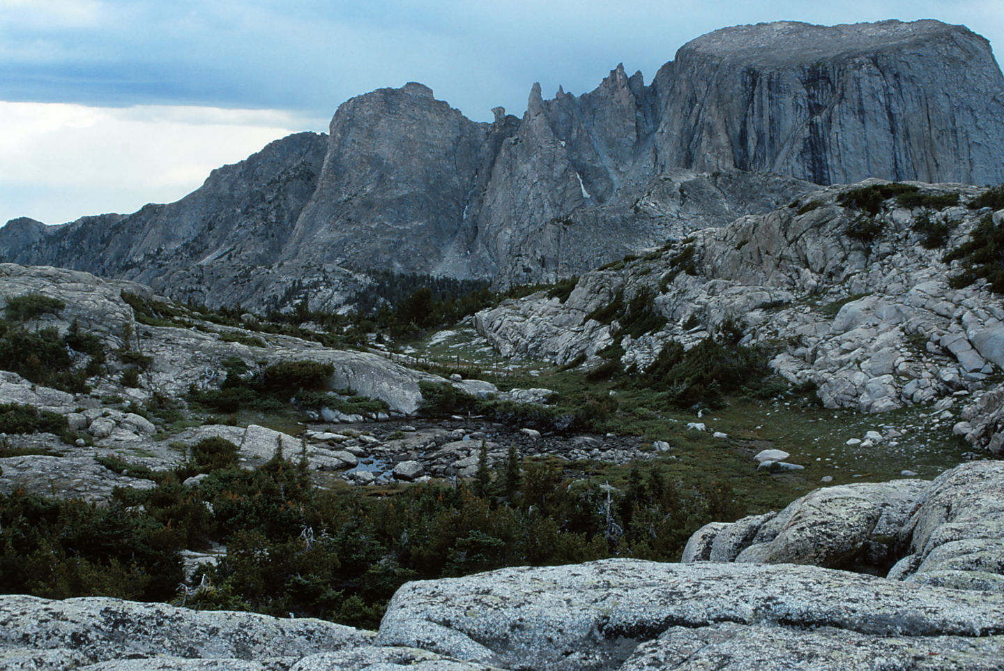
The puddle of water at center is “Coon Lake” South Pond #1. The cliffs in the distance are on the far side of Little Sandy Creek canyon. The peak at right has what I call a tilted aircraft carrier shape, which is rather common in the Winds.
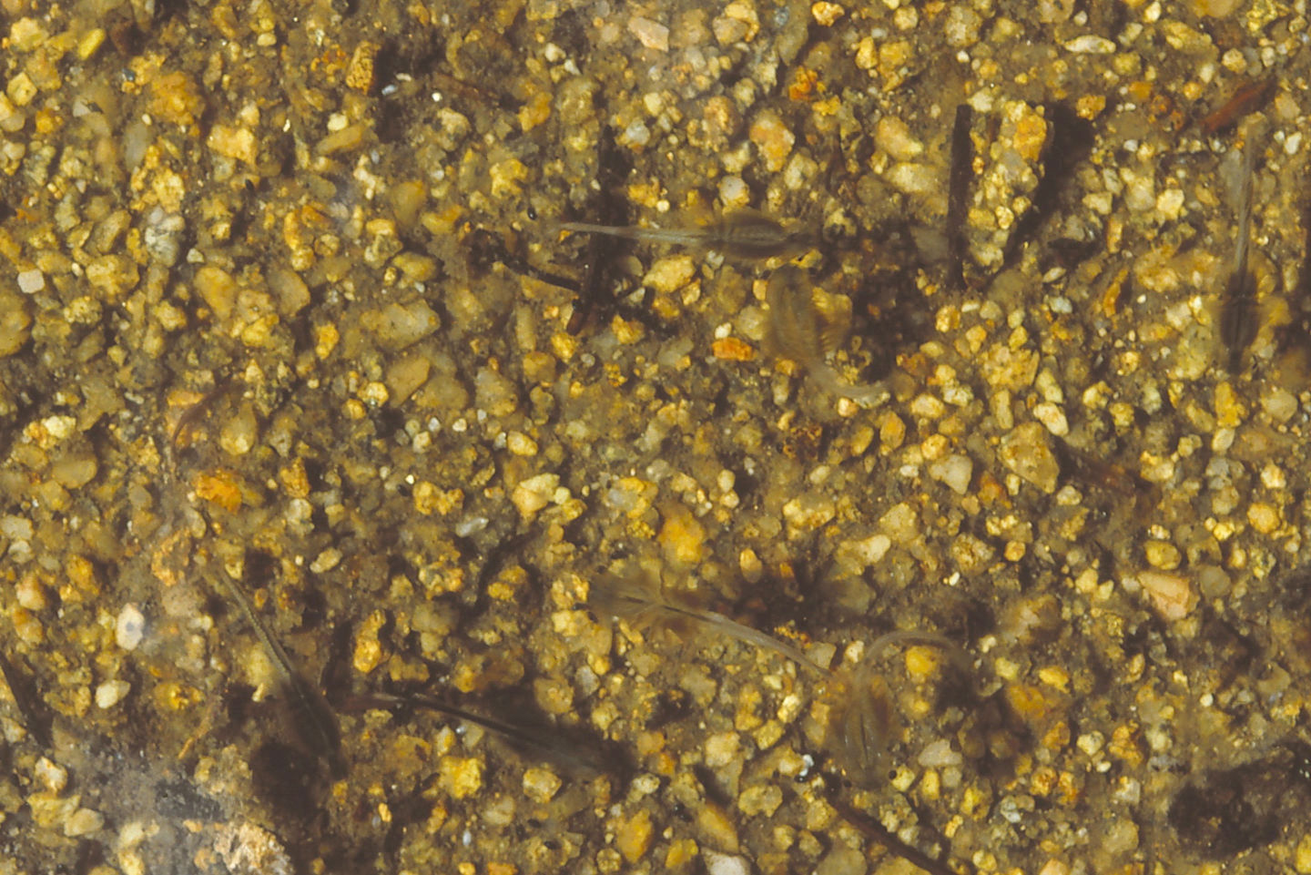
Darkly colored fairy shrimp in “Coon Lake” South Pond #1.
August 21, 1989
The water level looks very low.
- Size and depth not estimated.
- Water clarity not noted.
- Large dark green fairy shrimp; eggs not noted.
- No other animals noted.
August 30, 2006
This doesn’t look good.
- Dry.
“Coon Lake” South Pond #2 (Pinedale Ranger District, Bridger-Teton National Forest; Bridger Wilderness)
Little Sandy Overlook Pond map
“Coon Lake” South Pond #2 is south of the hill marking the continental divide south of “Coon Lake” and about 150 m (490′) south of “Coon Lake” South Pond #1. It is one of the 5 ponds south of “Coon Lake” that were visited in my search for fairy shrimp. Pond #2 is on the north side of a small knob and on the west side of a closed contour shown on the 7.5-minute topographic quadrangle.
“Coon Lake” South Pond #2 is not visible on USGS imagery of The National Map but topography constrains location accuracy to within about 50 m (165′).
For access, see Little Sandy Overlook Pond.
Exposure Age: Glacial ice on “Coon Lake” and the nearby ponds could have melted off about 15,300 years ago, when the moraine at “Temple Lake”, which is slightly higher and more shaded, was exposed (Dahms and others, 2018). If not then, then certainly by 11,750 years ago, when ice melted off the moraine on the southern slope of Cirque of the Towers.
Elevation: 3,254 m (10,677′)
August 10, 1987
Like Pond #1, Pond #2 has a high-water mark about 15 cm above the current water level. However, it is deeper.
- About 30 m long; depth maybe up to 80 cm.
- Clear to slightly murky water.
- Fairy shrimp smaller than in Pond #1, with males larger than females; some females have single row of white eggs.
- Black beetles, abundant tiny red copepods.
August 21, 1989
Water levels are down but Pond #1 has fairy shrimp so maybe this one does too.
- Size and depth not estimated.
- Water clarity not noted.
- Small fairy shrimp; eggs not noted.
- No other animals noted.
August 30, 2006
The water level is very low.
- Size and depth not estimated.
- Water clarity not noted.
- Fairy shrimp.
- Beetles.
“Coon Lake” South Pond #3 (Pinedale Ranger District, Bridger-Teton National Forest; Bridger Wilderness)
Little Sandy Overlook Pond map
“Coon Lake” South Pond #3 is on the east side of the hill marking the continental divide south of “Coon Lake” and about 100 m (330′) southeast of “Coon Lake” South Pond #1. It is the largest of the 5 ponds south of “Coon Lake” that were visited in my search for fairy shrimp. “Coon Lake” South Pond #3 is northeast of, and at about the same elevation as, Pond #2.
“Coon Lake” South Pond #3 is not visible on USGS imagery of The National Map but topography constrains location accuracy to about 100 m (330′).
For access, see Little Sandy Overlook Pond.
Exposure Age: Glacial ice on “Coon Lake” and the nearby ponds could have melted off about 15,300 years ago, when the moraine at “Temple Lake”, which is slightly higher and more shaded, was exposed (Dahms and others, 2018). If not then, then certainly by 11,750 years ago, when ice melted off the moraine on the southern slope of Cirque of the Towers.
Elevation: 3,250 m (10,661′)
August 10, 1987
There is a light sprinkle and the threat of heavy rain so I’d better hurry up with this pond.
- 13 m x 35 m; depth probably 50 cm.
- Clear to slightly murky, brownish water.
- Abundant brown fairy shrimp 12-14 mm long, with males larger and more abundant than females and some smaller females; some females have single row of white eggs; some fairy shrimp turn over and scrape the rock from time to time.
- Black beetles, large black copepods and smaller zooplankton, greenish-black ostracods(?) less than 1 mm.
Specimens were identified as Branchinecta coloradensis by DB.
I spotted 1 male with short antennae II which is probably not Branchinecta coloradensis like those in “Coon Lake” South Pond #1. It could be Branchinecta paludosa (BTANSD) like those in “Coyote Lake” (Antelope Hills).
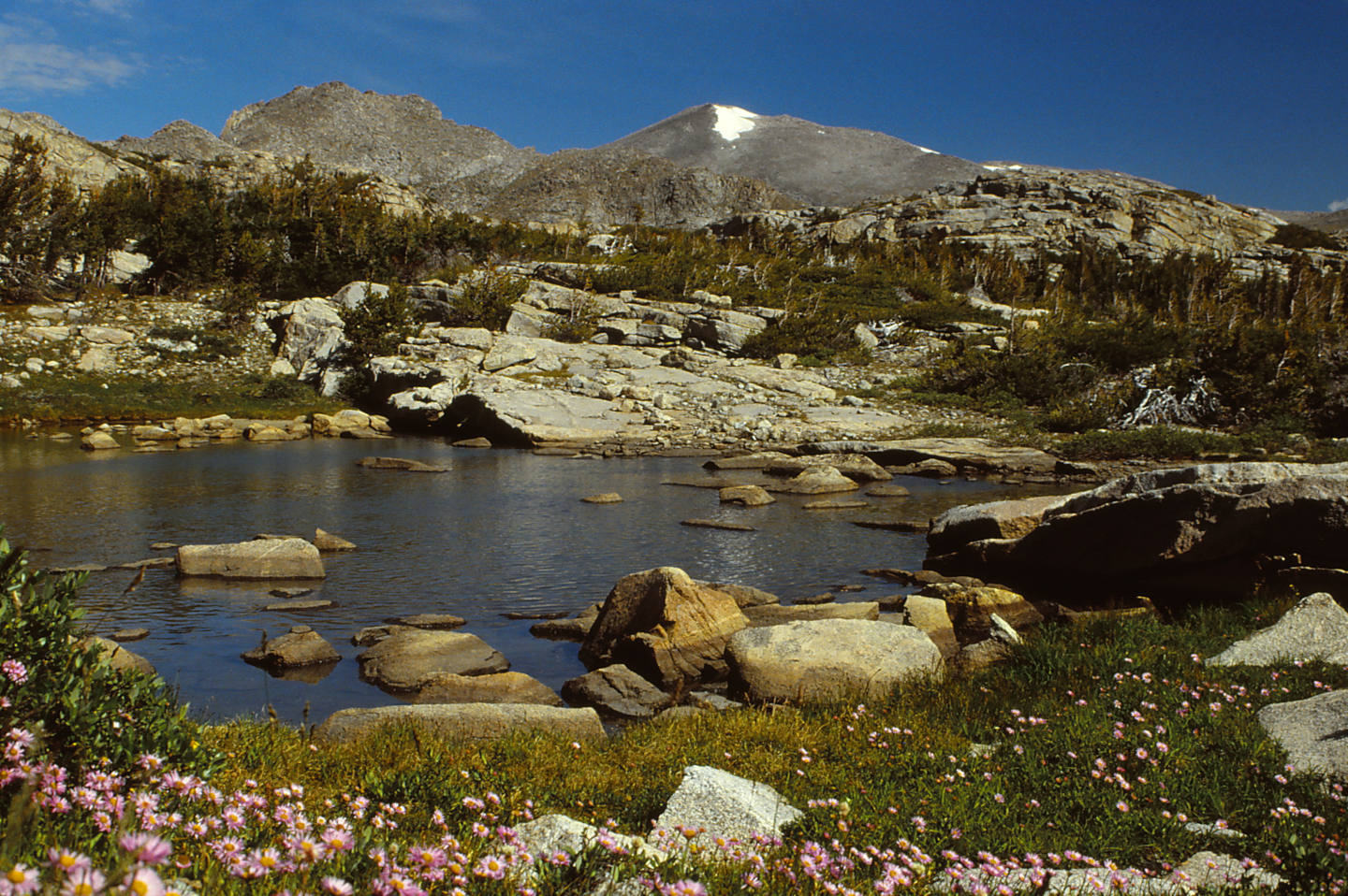
“Coon Lake” South Pond #3, looking north. The peak with the snowbank is Wind River Peak. I came back the next morning to take this photograph and check out a few more ponds before hiking over to Bivouac Lake.
An abundance of fairy shrimp in “Coon Lake” South Pond #3. The high density of fairy shrimp may be partly due to the shrunken volume of water as the level has clearly dropped.
August 30, 2006
I haven’t definitely found “Coon Lake” South Pond #3 today but that is probably because it is dry, like “Coon Lake” South Pond #1.
- Dry.
Cliff Edge Pond (Pinedale Ranger District, Bridger-Teton National Forest; Bridger Wilderness)
Little Sandy Overlook Pond map
Cliff Edge Pond is about 300 m (980′) west of “Coon Lake” and about 250 m (820′) north of Little Sandy Overlook Pond. It is on a bench with a small south-facing cliff to its immediate north and the big cliff into Little Sandy Creek canyon to its south and west. Cliff Edge Pond may have an outlet to the southeast at high water but there is no indication of an inlet. The pond is 80 m (260′) long on the 7.5-minute topographic quadrangle.
For access, see Little Sandy Overlook Pond.
Exposure Age: Glacial ice on “Coon Lake” and the nearby ponds could have melted off about 15,300 years ago, when the moraine at “Temple Lake”, which is slightly higher and more shaded, was exposed (Dahms and others, 2018). If not then, then certainly by 11,750 years ago, when ice melted off the moraine on the southern slope of Cirque of the Towers.
Elevation: 3,251 m (10,667′)
August 11, 1987
Yet another pond near “Coon Lake” and this one is the biggest yet.
- 45 m x 75 m; depth possibly 200 cm.
- Clear greenish water; 8 C at 0715.
- No fairy shrimp.
- Amphipods, black beetles (one holding remains of amphipod), caddisfly larvae (Trichoptera), relatively big black copepods, smaller zooplankton.
August 21, 1989
Another year, another chance for fairy shrimp.
- Size and depth not estimated.
- Water clarity not noted.
- No fairy shrimp.
- Amphipods, black beetles.
August 30, 2006
One of the few “Coon Lake” ponds with water this year so WIDLA.
- Size and depth not estimated.
- Water clarity not noted.
- No fairy shrimp.
- Backswimmers, amphipods.
“Coon Lake” South Pond #4 (Pinedale Ranger District, Bridger-Teton National Forest; Bridger Wilderness)
Little Sandy Overlook Pond map
“Coon Lake” South Pond #4 is about 250 m south of “Coon Lake” South Pond #1. The pond is among 5 ponds south of “Coon Lake” that were visited in my search for fairy shrimp. Pond #4 is in the draw between the small hill south of “Coon Lake” and the big ridge leading up to Mt. Nystrom. It is southeast of Pond #2 and northeast of Pond #5.
“Coon Lake” South Pond #4 is not visible on USGS imagery of The National Map but topography constrains location accuracy to about 100 m (330′).
For access, see Little Sandy Overlook Pond.
Exposure Age: Glacial ice on “Coon Lake” and the nearby ponds could have melted off about 15,300 years ago, when the moraine at “Temple Lake”, which is slightly higher and more shaded, was exposed (Dahms and others, 2018). If not then, then certainly by 11,750 years ago, when ice melted off the moraine on the southern slope of Cirque of the Towers.
Elevation: 3,241 m (10,633′)
August 11, 1987
Being in the draw, Pond #4 could receive some runoff from surrounding slopes but it is rather small.
- Pond about 25 m long; depth not estimated.
- Clear water.
- Sparse but relatively large fairy shrimp, with males larger and more abundant than females; most females have eggs.
- Other animals not noted.
August 30, 2006
- Dry.
“Coon Lake” South Pond #5 (Pinedale Ranger District, Bridger-Teton National Forest; Bridger Wilderness)
Little Sandy Overlook Pond map
“Coon Lake” South Pond #5 is about 325 m (1,070′) south of “Coon Lake” South Pond #1 and 100 m (330′) southwest of “Coon Lake” South Pond #4. It is among 5 ponds south of “Coon Lake” that were visited in my search for fairy shrimp. Pond #5 is in a marshy bog southwest of Pond #4 and closer to the cliff into Little Sandy Creek canyon.
“Coon Lake” South Pond #5 is not visible on USGS imagery of The National Map but topography constrains location accuracy to about 100 m (330′).
For access, see Little Sandy Overlook Pond.
Exposure Age: Glacial ice on “Coon Lake” and the nearby ponds could have melted off about 15,300 years ago, when the moraine at “Temple Lake”, which is slightly higher and more shaded, was exposed (Dahms and others, 2018). If not then, then certainly by 11,750 years ago, when ice melted off the moraine on the southern slope of Cirque of the Towers.
Elevation: 3,233 m (10,606′)
August 11, 1987
This pond looks like it could get flushed out during spring runoff but WIDLA.
- Pond 15 m long; depth less than 30 cm.
- Clear water.
- No fairy shrimp.
- Other animals not noted.
August 30, 2006
This makes for 4 out of 7 “Coon Lake” ponds dry this year.
- Dry.
Big Stough East Pond (Lander Ranger District, Shoshone National Forest; Popo Agie Wilderness)
Big Stough East Pond is in a marsh on the small hill about 150 m (820′) east of Big Stough Lake (WGF name). Big Stough Lake is the northernmost large lake of the “Stough Creek Lakes”.
Stough Creek Basin can be reached from the Worthen Meadow trailhead. On the west side of Roaring Fork Mountain, there is a trail junction with one trail continuing to the west to Middle Fork Popo Agie River and Tayo Park and one trail going south into Stough Creek Basin. The first large lake on the trail to the south is Big Stough Lake. The most direct route to Big Stough East Pond is to ford the outlet on the north edge of Big Stough Lake and continue almost due east for about 150 m (820′).
Elevation: 3,208 m (10,525′)
August 11, 1987
The pond is very small and shallow and partially overgrown. I’m looking for an easy way up Roaring Fork Mountain but NPPWOPII.
- Size not estimated; depth not estimated.
- Water clarity not noted.
- Fairy shrimp.
- Other animals not noted.
Medina Mountain Ponds (Pinedale Ranger District, Bridger-Teton National Forest; Bridger Wilderness)
___This map is a screenshot of The National Map (Go to The National Map). The U.S. Geological Survey generally does not copyright or charge for its data or reports (unless printed). A pond location is indicated by an “X”, which corresponds to the coordinates given in the data spreadsheet. Labels in quotations are from 7.5-minute topographic quadrangles.
___Red lines are the U. S. National Grid with a spacing of 1,000 m and intersection labels consisting of the UTM zone (e.g., 11S, 12T), a 2-letter 100-km square designation (e.g., LC, XN), and a 4-digit number. The first 2 digits of the number represent the 1,000-meter Easting and the second 2 digits the 1,000-meter Northing, as seen in the example Easting and Northing. Unlike latitude and longitude, the National Grid is rectilinear on a flat map, the units of abscissa and ordinate have equal lengths, and the units (meters) are measurable on the ground with a tape or by pacing.
___There is no private or state land on this map. All the lands are public.
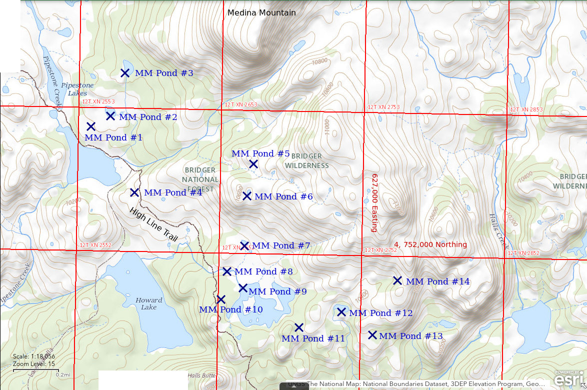
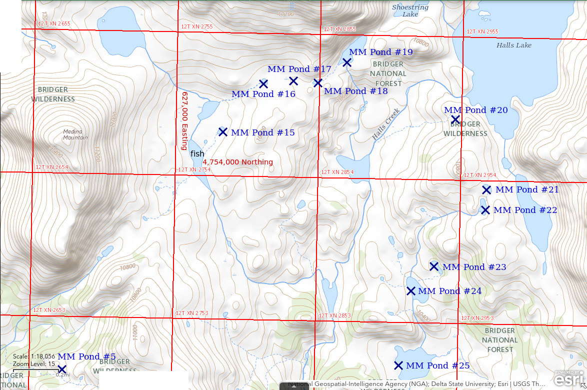
Medina Mountain Ponds comprise several ponds generally south or east of Medina Mountain and also west of “Pipestone Lakes” and south of “Halls Lake”. They are within 3 km (2 miles) of the summit of Medina Mountain. Medina Mountain is 34 km (21 miles) east of Pinedale.
Medina Mountain Ponds were selected by virtue of their having a low probability of fish. Most of the ponds are less than 50 m (165′) across. Most of the ponds are not connected to streams or are on streams separated from larger lakes that could have fish by steep topography. According to the Wyoming Game and Fish Department’s 2013 “Bridger Wilderness, A Guide to the Fishing Lakes” (17 p.), “Halls Lake”, “Pipestone Lakes”, and “Howard Lake”, all have fish. Any pond on a stream connected to those lakes would have a high risk of fish. To maximize search time, no notes were taken except at 2 of the ponds with fairy shrimp.
Most ponds are shown on the 1938, 1:62,500-scale, Mt. Bonneville 15-minute topographic quadrangle, which I had in the field. Only 2 (#4 and #14) are not shown. 4 (#1, #10, #13, and #17) of the Medina Mountain Ponds ponds shown on the 15-minute quadrangle are not shown on the 1981 Halls Mountain 7.5-minute quadrangle. Ponds not shown on the 1981 Halls Mountain quadrangle are also not shown on The National Map. Consequently, the locations of these 6 ponds are less certain than for the other ponds but are probably not off by more than 50 m (165′), given the topography.
Elevations of Medina Mountain Ponds are between 3,109 m (10,200′) and 3,267 m (10,720′) (using the XY tool of The National Map). These elevations are not given below but are in the data spreadsheet on the Data page. Pond sizes given below have been measured on the Halls Mountain 1:24,000-scale quadrangle where present and assumed to be less than 50 m (165′) across where not present, unless described otherwise.
The shortest route to the Medina Mountain area is from the “Boulder Lake” trailhead. To reach the trailhead, turn east onto Wyoming 353 to Big Sandy from US 191 at Boulder (12 miles southeast of Pinedale). About 2 1/2 miles east of US 191, turn north on Sublette County road 114. This road ultimately leads up the south shore of “Boulder Lake” to “Boulder Lake” Campground, Boulder Lodge, and the trailhead. There are probably signs to one or more of those landmarks. The hiking trail from “Boulder Lake” trailhead leads to “Pipestone Lakes”, where it intersects the High Line Trail. Looking at the map 25 years later, I suspect I camped somewhere along “Pipestone Lakes”.
August 19, 1989
Heavy clouds this morning and a little rain yesterday on the hike up. This is probably not a good day to hike up Medina Mountain. Guess I’ll spend the whole day looking for fairy shrimp.
- Pond #1: east of north end of lower of the “Pipestone Lakes”, shown on Mt. Bonneville but not on “Halls Lake” quadrangle, less than 50 m across, no fairy shrimp.
- Ponds #2,#3: up to 100 m across on quadrangle, no fairy shrimp.
- Pond #4: east of southeast end of lower of the “Pipestone Lakes”, not shown on either quadrangle, less than 50 m across, no fairy shrimp.
- Ponds #5,#6,#7: less than 50 m across, no fairy shrimp.
- Pond #8: on outlet of Pond #9, less than 50 m across, no fairy shrimp.
- Pond #9: lake up to 500 m across east of “Howard Lake”, no fairy shrimp.
- Pond #10: within 100 m of western shore of Pond #9, shown on Mt. Bonneville but not on “Halls Lake” quadrangle, less than 50 m across, no fairy shrimp.
- Pond #11: less than 50 m across, no fairy shrimp.
- Pond #12: up to 120 m across on quadrangle, no fairy shrimp.
- Pond #13: less than 50 m across, shown on Mt. Bonneville but not on “Halls Lake” quadrangle, no fairy shrimp.
- Pond #14: on ridge about 1,500 m northeast of southeast corner of “Howard Lake”, not shown on either quadrangle, less than 50 m across, has fairy shrimp.
- Pond #15: 1,100 m due east of summit of Medina Mountain and 170 m northeast of 600 m long lake with fish, up to 75 m across on quadrangle, has large fairy shrimp, mostly males, 1 female has eggs.
- Pond #16: semicircular pond 15 m x 25 m, water rather milky, 11 C at 1210, has fairy shrimp with females 10-12 mm and males 12-14 mm, females have eggs in oviducts or rarely in ovisacs, large black copepods, jelly-like algae(?) attached to rocks.
- Pond #17: half way between Ponds #16 and #18, shown on Mt. Bonneville but not on “Halls Lake” quadrangle, less than 50 m across, no fairy shrimp.
- Pond #18: less than 50 m across, no fairy shrimp.
- Pond #19: up to 120 m across on quadrangle, no fairy shrimp.
- Pond #20: on hill south of outlet of “Halls Lake”, less than 50 m across, no fairy shrimp.
- Pond #21: on saddle between lake south of “Halls Lake” and Halls Creek and at head of drainage tributary to Halls Creek, up to 80 m across on quadrangle, a few large green fairy shrimp about 20 mm long, 1 female has pale eggs in ovisac.
- Pond #22: pond at head of stream in drainage tributary to Halls Creek, up to 120 m across on quadrangle, no fairy shrimp.
- Pond #23: not connected to stream, up to 120 m across on quadrangle, no fairy shrimp.
- Pond #24: elliptical pond up to 200 m across on stream in drainage tributary to Halls Creek, no fairy shrimp.
- Pond #25: irregular pond up to 250 m across on stream in same drainage tributary to Halls Creek as Pond #24, no fairy shrimp.
Specimens collected from Pond #16 were identified as Branchinecta coloradensis by DB. All of the fairy shrimp observed in the Medina Mountain Ponds looked superficially like the Branchinecta coloradensis identified at Bivouac Lake and in Pond #16.
25 Medina Mountain Ponds visited, 4 had fairy shrimp.
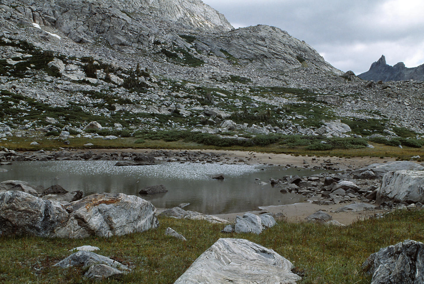
Medina Mountain Pond #16, looking east. The low water level suggests this may not be a good year to find fairy shrimp but there were some here. The rock spire in the distance may be Pipe Organ, on the continental divide east of “Halls Lake”.
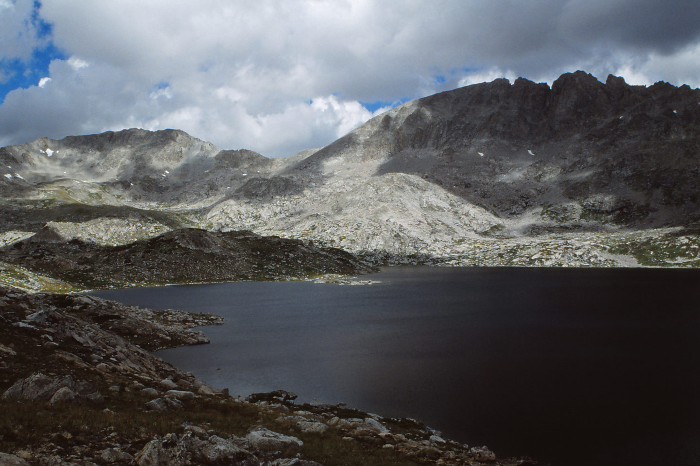
View north across the west side of “Halls Lake”. This lake has been stocked with brook trout but a few small ponds in the vicinity have fairy shrimp. Was the lake also home to fairy shrimp before 1930? The jagged mountain at right is Halls Mountain. Clouds are breaking up, I didn’t get snowed on, and I found at least a few fairy shrimp. That counts as a good day.
Silas Headwall Lake (Lander Ranger District, Shoshone National Forest; Popo Agie Wilderness)
Silas Headwall Lake is the uppermost lake of Silas Canyon, south of Cony Mountain. It is 30 km (19 miles) southwest of Lander and about 2 km (1.2 miles) north of Bivouac Lake. On the 7.5-minute topographic quadrangle, it is 300 m long and 150 m wide (980′ x 490′) with a regular oval shape. It is below a nearly vertical cliff on the east side of Roaring Fork Mountain. The lake is inaccessible to fish swimming upstream because there is no outlet. The water just drains through the boulders below the lake.
Silas Headwall Lake can be reached from the “Fiddlers Lake” trailhead. A trail up Silas Canyon branches to the northwest off the “Christina Lake” trail on the east side of “Lower Silas Lake” about 3.3 km (2 miles) from the trailhead. The trail is less used above “Upper Silas Lake” and eventually peters out but the canyon presents no major difficulties.
Elevation: 3,434 m (11,266′)
August 13, 1993
It’s mid-August but this lake looks cold. There is a big chunk of ice in the water.
- 150 m x 300 m based on the 7.5-minute quadrangle; depth at least 200 cm.
- Water is clear.
- No fairy shrimp.
- Other animals not noted (I don’t think there were any).
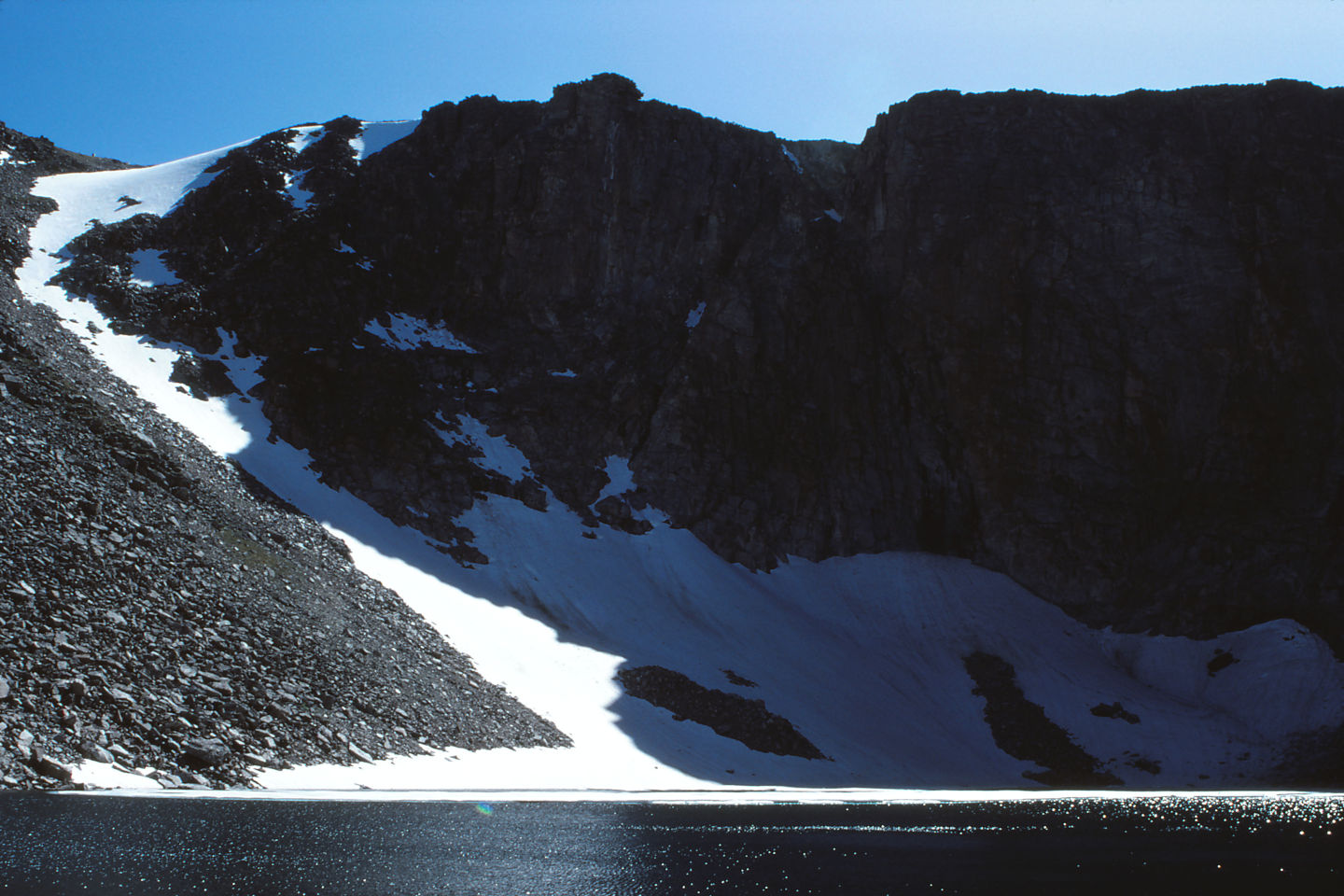
Silas Headwall Lake and the cliff on the east side of Roaring Fork Mountain. There is a considerable slab of ice floating on the water adjacent to the snowbank. Is this future fairy shrimp habitat?
Silas Cornice Chute Lake (Lander Ranger District, Shoshone National Forest; Popo Agie Wilderness)
Silas Cornice Chute Lake is about 310 m (1,020′) east of Silas Headwall Lake and is the next lake down the canyon. It is a smaller lake at 190 m x 100 m (620′ x 330′) according to the 7.5-minute topographic quadrangle. It is at the base of the cliff on the north side of Silas Canyon. There is a prominent snow-filled chute to the west of the lake with a cornice at the top of the cliff. The snow likely persists into autumn in most years. The outlet stream to “Thumb Lake” below has a steep section that probably blocks fish.
For access, see Silas Headwall Lake.
Elevation: 3,384 m (11,102′)
August 13, 1993
“Thumb Lake” below has big fish but I don’t think they can get up here.
- 100 m x 190 m based on the 7.5-minute quadrangle; depth at least 100 cm and probably more.
- Water is clear.
- No fairy shrimp.
- Amphipods.
Cinquefoil Pond (Lander Ranger District, Shoshone National Forest; Popo Agie Wilderness)
___This map is a screenshot of The National Map (Go to The National Map). The U.S. Geological Survey generally does not copyright or charge for its data or reports (unless printed). A pond location is indicated by an “X”, which corresponds to the coordinates given in the data spreadsheet. Labels in quotations are from 7.5-minute topographic quadrangles.
___Red lines are the U. S. National Grid with a spacing of 1,000 m and intersection labels consisting of the UTM zone (e.g., 11S, 12T), a 2-letter 100-km square designation (e.g., LC, XN), and a 4-digit number. The first 2 digits of the number represent the 1,000-meter Easting and the second 2 digits the 1,000-meter Northing, as seen in the example Easting and Northing. Unlike latitude and longitude, the National Grid is rectilinear on a flat map, the units of abscissa and ordinate have equal lengths, and the units (meters) are measurable on the ground with a tape or by pacing.
___There is no private or state land on this map. All the lands are public.
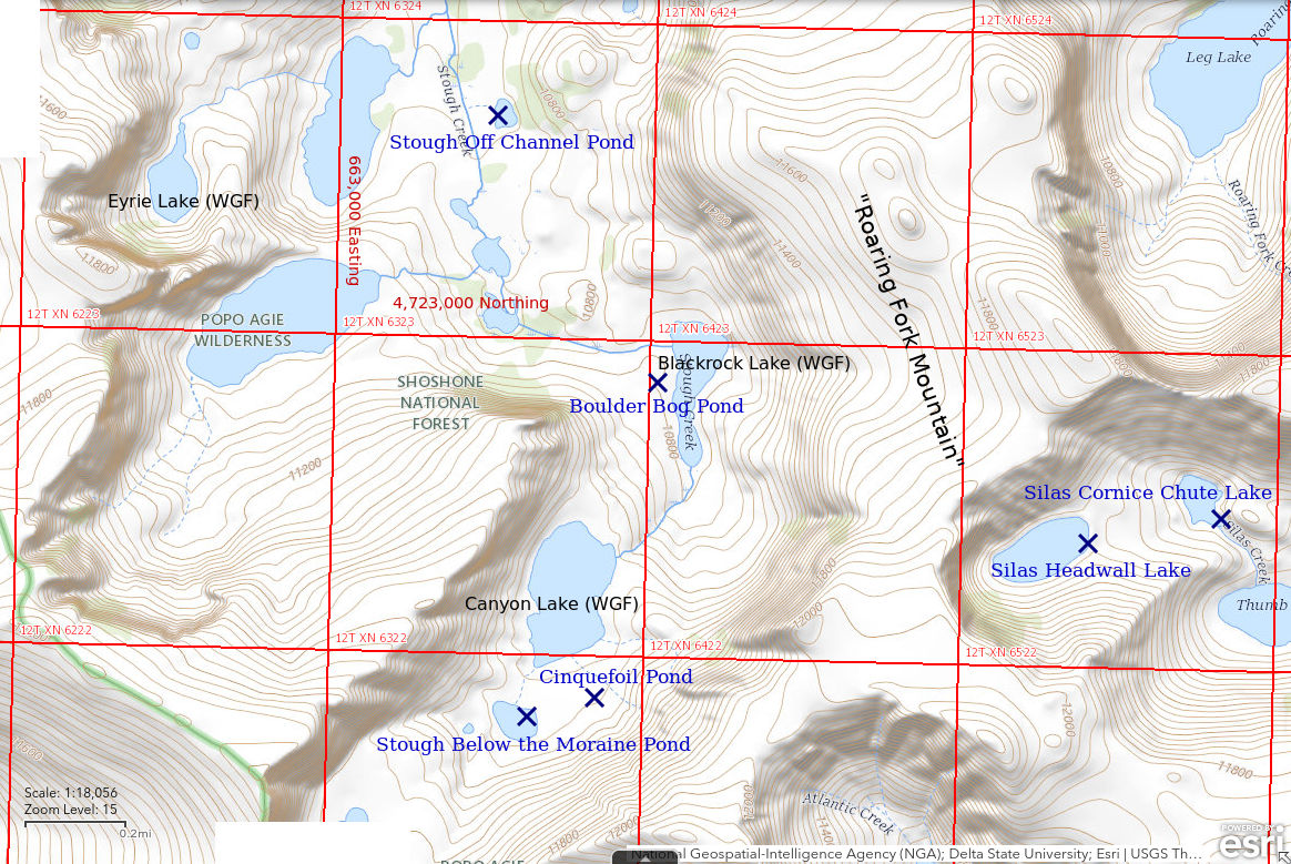
Cinquefoil Pond is about 150 m (490′) southeast of the southernmost large lake in the basin, which is called Canyon Lake by WGF. Only a trickle of water flows down the hill to Canyon Lake, which probably has fish. Although not shown on the 7.5-minute topographic quadrangle, the pond is visible on the USGS imagery of The National Map as a dark vegetated area. The grassy bench on which the pond occurs had abundant yellow cinquefoil on the first visit.
Stough Creek Basin can be reached from the Worthen Meadows trailhead. After crossing to the west side of Roaring Fork Mountain, the Roaring Fork trail meets the Stough Creek Basin trail. The Roaring Fork trail continues to the west to Middle Fork Popo Agie River and Tayo Park. Turn south and follow the Stough Creek Basin trail. From the first big lake at the north end of Stough Creek Basin, follow the main branch of Stough Creek all the way to Canyon Lake. The trail gives out somewhere short of this goal. Go around the east side of Canyon Lake to Cinquefoil Pond.
Stough Creek Basin can also be reached from the Middle Fork Popo Agie River trail, which has a trailhead at the end of the Sinks Canyon Road near Bruce Picnic Area. That route is at least 3 times longer.
Exposure Age: Cinquefoil Pond was uncovered when the glacier which had covered Canyon Lake melted back to south of Stough Below the Moraine Pond by 13,150 years ago (Dahms and others, 2018).
Elevation: 3,388 m (11,116′)
August 14, 1993
I saw amphipods in Canyon Lake. I didn’t see fish but I suspect they are there. Certainly no worries about fish here.
- About 30 m across; probably at least 50 cm deep.
- Water is clear; 11 C at 1230.
- Fairy shrimp 15-20 mm long; some females have single row of pale eggs.
- Other animals not noted.
View to the southwest across Cinquefoil Pond to Stough Below the Moraine Pond in the middle distance. Cinquefoil Pond has fairy shrimp but Stough Below the Moraine Pond does not. Could it be because Stough Below the Moraine Pond was still 4 C colder at mid-day? Note the massive moraine above Stough Below the Moraine Pond. It holds back a snow field that could also be a pond some day.
August 31, 2006
Looks almost dry.
- Size and depth not estimated.
- Water clarity not noted.
- No fairy shrimp.
- Other animals not noted.
Stough Below the Moraine Pond (Lander Ranger District, Shoshone National Forest; Popo Agie Wilderness)
Stough Below the Moraine Pond is at the southern extremity of Stough Creek Basin 31 km (19 miles) from Lander and about 2 km (1.2 miles) northwest of Bivouac Lake. It is below a 50 m (165′) high moraine that holds back a perennial snowfield but is itself bounded below by a small moraine. On the 7.5-minute topographic quadrangle, Stough Below the Moraine Pond is 120 m x 70 m (390′ x 230′). It is isolated from Canyon Lake (name used by WGF) below by the lack of an outlet.
For access, see Cinquefoil Pond. Stough Below the Moraine Pond is about 200 m (660′) southwest of Cinquefoil Pond.
Exposure Age: Stough Below the Moraine Pond was uncovered when the glacier which had covered Canyon Lake melted back to south of the pond by 13,150 years ago (Dahms and others, 2018).
Elevation: 3,386 m (11,110′)
August 14, 1993
Bigger and maybe better than Cinquefoil Pond.
- 70 m x 120 m based on the 7.5-minute quadrangle; depth probably up to 100 cm.
- Water is clear; 7 C at 1200.
- No fairy shrimp.
- Rare caddisfly larvae (Trichoptera).
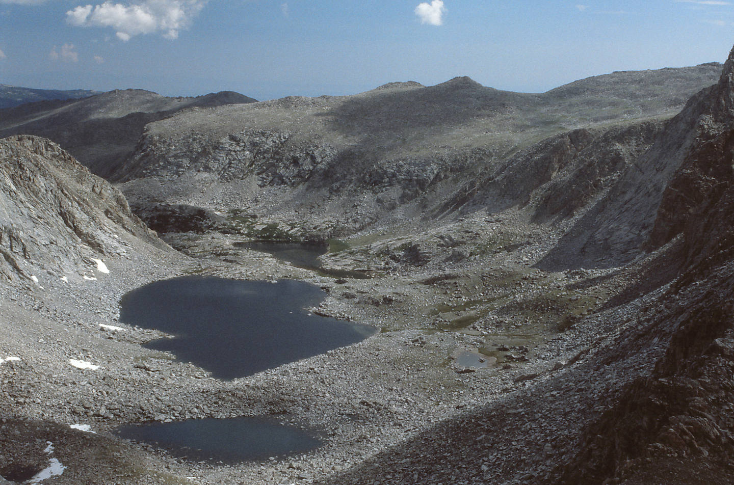
Looking down upper Stough Creek canyon with, from bottom to center, Stough Below the Moraine Pond, Canyon Lake (name used by WGF), and Blackrock Lake (name used by WGF). Cinquefoil Pond is to the right of the upper (lower in photograph coordinates) end of Canyon Lake next to the closest patch of green vegetation. The long ridge of Roaring Fork Mountain bounds the right side of Stough Creek canyon. This photograph was taken several years previously during a dry year.
August 31, 2006
Cinquefoil Pond is almost dry but this one is doing okay.
- Size and depth not estimated.
- Clear water.
- No fairy shrimp.
- Other animals not noted.
Boulder Bog Pond (Lander Ranger District, Shoshone National Forest; Popo Agie Wilderness)
Boulder Bog Pond is about 1,200 m north of Stough Below the Moraine Pond. It is on the south side of the knoll on the west side of Blackrock Lake (name used by WGF) south of the lake’s outlet. Blackrock Lake is the next lake below and to the north of Canyon Lake. The pond is in a marshy area with boulders and some smooth rock outcrops.
Boulder Bog Pond is not on the 7.5-minute quadrangle and is not visible on the USGS imagery of The National Map. The location of the pond on the Cinquefoil Pond map and in the data spreadsheet (on the Data page) may be off by 100 m (330′).
For access, see Cinquefoil Pond. Boulder Bog Pond is 1,000 m (3,280′) north of Cinquefoil Pond and on the way to that pond from the Stough Creek Basin trail.
Exposure Age: Boulder Bog Pond was exposed from beneath glacial cover between 12,500 and 13,150 years ago when samples from the floor of the basin south of Shoal Lake and from south of Stough Below the Moraine Pond were exposed, respectively (Dahms and others, 2018).
Elevation: 3,291 m (10,798′)
August 14, 1993
It’s not much of a pond but it is in a wet area that must collect considerable snow in the winter.
- About 40 m long; depth not estimated.
- Water is clear; 13 C at 1330.
- Fairy shrimp; eggs not noted.
- Other animals not noted.
August 31, 2006
This one is gone, too.
- Dry.
Deep Cirque Overlook Pond (Lander Ranger District, Shoshone National Forest; Popo Agie Wilderness)
___This map is a screenshot of The National Map (Go to The National Map). The U.S. Geological Survey generally does not copyright or charge for its data or reports (unless printed). A pond location is indicated by an “X”, which corresponds to the coordinates given in the data spreadsheet. Labels in quotations are from 7.5-minute topographic quadrangles.
___Red lines are the U. S. National Grid with a spacing of 1,000 m and intersection labels consisting of the UTM zone (e.g., 11S, 12T), a 2-letter 100-km square designation (e.g., LC, XN), and a 4-digit number. The first 2 digits of the number represent the 1,000-meter Easting and the second 2 digits the 1,000-meter Northing, as seen in the example Easting and Northing. Unlike latitude and longitude, the National Grid is rectilinear on a flat map, the units of abscissa and ordinate have equal lengths, and the units (meters) are measurable on the ground with a tape or by pacing.
___There is no private or state land on this map. All the lands are public.
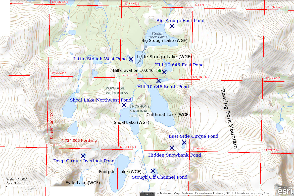
Deep Cirque Overlook Pond is in a marshy area on the hill on the west side of Stough Creek Basin about 450 m (1,480′) west of, and 100 m (330′) above, Footprint Lake (name used by WGF). It is about 2,400 m (7,870′) northwest of Stough Below the Moraine Pond. The pond is shown as an oval about 50 m (165′) long on the 7.5-minute topographic quadrangle. Deep Cirque Overlook Pond has a great view of an unusually deep and narrow cirque which holds the tear-drop shaped Eyrie Lake (name used by WGF).
For access, see Cinquefoil Pond. Instead of continuing up Stough Creek to Cinquefoil Pond, turn west south of Shoal Lake (name used by WGF) and climb the hill above Footprint Lake (name used by WGF).
Exposure Age: The exposure age of Deep Cirque Overlook Pond is best approximated by the exposure age of a rock sample that was collected on the steep slope northeast of the pond at an elevation of 3,340 m (10,958′). The 16,500 years age of that sample (Dahms and others, 2018) gives the time when the top of the glacier in Stough Creek Basin had dropped below the elevation of the pond.
Elevation: 3,351 m (10,993′)
August 14, 1993
Eyrie Lake still has floating ice but it is nice and warm in the sun here.
- 30 m across; depth not estimated.
- Water is clear; 14 C at 1440.
- Abundant fairy shrimp; eggs not noted.
- Black beetles, backswimmers(?) (sub-order Heteroptera, family Notonectidae).
August 31, 2006
Not seeing many fairy shrimp on this trip but I’m hopeful they hatched in some of the ponds where they hatched before.
- Size and depth not estimated.
- Water clarity not noted.
- Fairy shrimp.
- Backswimmers (sub-order Heteroptera, family Notonectidae), beetles.
Shoal Lake Northwest Pond (Lander Ranger District, Shoshone National Forest; Popo Agie Wilderness)
Shoal Lake Northwest Pond is in a relatively flat area on the northwest side of Shoal Lake (name used by WGF) in Stough Creek Basin and about 150 m (490′) west of the lake’s outlet.
Shoal Lake Northwest Pond is not discernible on the USGS imagery of The National Map and the flat topography makes locating it on a map difficult. As a result, the location on the Cinquefoil Pond map and in the data spreadsheet may be off by 100 m.
For access, see Cinquefoil Pond. Shoal Lake Northwest Pond is well north of Cinquefoil Pond. To go to Cinquefoil Pond, one would cross Stough Creek north of Shoal Lake and hike up the east side of the lake. To find Shoal Lake Northwest Pond, don’t cross the creek and walk southwestward while staying 50-100 m (165′-330′) from the north shore of the lake.
Exposure Age: A glacier remained on the floor of Stough Creek Basin covering Shoal Lake Northwest Pond until 12,500 years ago, based on a rock sample collected on the valley floor above (south) of Shoal Lake (Dahms and others, 2018).
Elevation: 3,225 m (10,581′)
August 14, 1993
With so many fabulous lakes and ponds in Stough Creek Basin, this is not impressive. But NPPWOPII.
- Size not noted but less than 50 m long; depth not estimated but shallow.
- Water is clear.
- Abundant fairy shrimp; eggs not noted.
- Other animals not noted.
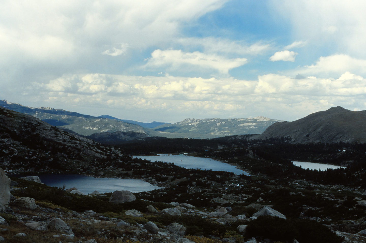
View (in a previous year) to the north across Stough Creek Basin with Shoal Lake at center, Footprint Lake at left, and Cutthroat Lake at right (names used by WGF). Shoal Lake Northwest Pond is to the upper left of Shoal Lake in a treeless area in the shadow.
Hill 10,646 East Pond (Lander Ranger District, Shoshone National Forest; Popo Agie Wilderness)
Hill 10,646 East Pond is in Stough Creek Basin about 250 m (820′) south of Big Stough Lake (name used by WGF), the northernmost large lake in the basin. It is on the east side of a hill that has a spot elevation of 10,646 feet (3,245 m) on the 7.5-minute topographic quadrangle. Its dimensions on that quadrangle are 350 m x 120 m (1,150′ x 390′). The elevation is low enough for the area to be wooded, unlike most of Stough Creek Basin.
For access, see Big Stough East Pond. Instead of crossing the outlet on the north side of Big Stough Lake, attempt to ford the creek between Big Stough Lake and Little Stough Lake. If that doesn’t look promising, you may find a better crossing between Little Stough Lake and Cutthroat Lake (names used by WGF). Go around the south side of hill 10,646 and then turn north to find the pond or go over the top for the view.
Elevation: 3,230 m (10,596′)
August 14, 1993
With the trees and milder climate here, maybe there is a different species of fairy shrimp.
- 120 m x 350 m based on the 7.5-minute quadrangle; depth not estimated.
- Water clarity not noted.
- No fairy shrimp.
- Amphipods.
Hill 10,646 South Pond (Lander Ranger District, Shoshone National Forest; Popo Agie Wilderness)
Hill 10,646 South Pond is in Stough Creek Basin next to Hill 10,646 East Pond and 480 m (1,570′) south of Big Stough Lake (name used by WGF). It is on the south side of a hill that has a spot elevation of 10,646 feet (3,245 m) on the 7.5-minute topographic quadrangle. The pond dimensions are 150 m x 50 m (490′ x 160′) on the map.
For access, see Hill 10,646 East Pond.
Elevation: 3,218 m (10,559′)
August 14, 1993
No luck in Hill 10,646 East Pond. This one is ecologically similar but WIDLA.
- 50 m x 150 m based on the 7.5-minute quadrangle; depth not estimated.
- Water clarity not noted.
- No fairy shrimp.
- Amphipods.
East Side Cirque Pond (Lander Ranger District, Shoshone National Forest; Popo Agie Wilderness)
East Side Cirque Pond is in a small cirque on the east side of Stough Creek Basin above Cutthroat Lake (name used by WGF) and about 1,450 m (4,760′) south of Big Stough Lake, the northernmost large lake in Stough Creek Basin. The pond dimensions are 110 m x 40 m (360′ x 130′) on the 7.5-minute topographic quadrangle.
For access, see Hill 10,646 East Pond. Go south along the shore of Cutthroat Lake and then follow the inlet up to East Side Cirque Pond.
Exposure Age: East Side Cirque Pond was exposed from beneath glacial cover between 14,800 and 12,500 years ago, the exposure ages for bedrock on the saddle west of the pond and on the valley floor farther west, respectively (Dahms and others, 2018).
Elevation: 3,252 m (10,671′)
August 14, 1993
Even if fish could get up the steep creek from Cutthroat Lake, this pond is likely shallow enough to freeze solid in winter.
- 50 m long; depth not estimated.
- Water is clear.
- Abundant fairy shrimp; eggs not noted.
- Abundant amphipods.
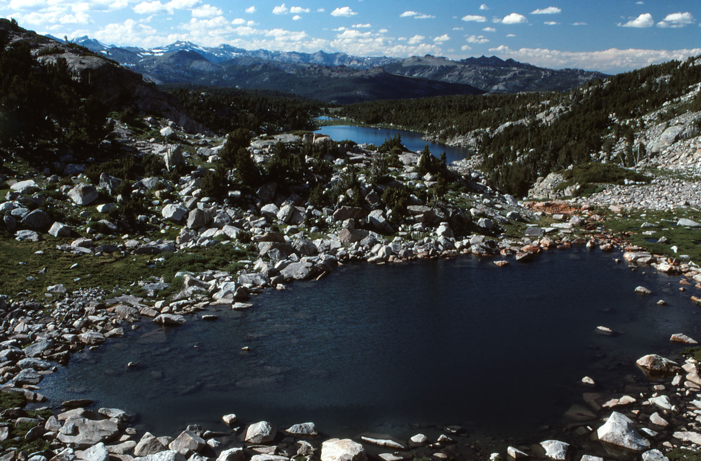
East Side Cirque Pond, looking northwest across the lower part of Stough Creek Basin. The lake in the distance is Cutthroat Lake (WGF).
Hidden Snowbank Pond (Lander Ranger District, Shoshone National Forest; Popo Agie Wilderness)
Hidden Snowbank Pond is about 1,450 m (4,760′) south of Big Stough Lake (name used by WGF) and a short distance up the hill west of East Side Cirque Pond. It is just below the saddle between 2 hills west of East Side Cirque Pond at a good location for a snow drift. It is fed by a snowbank that is visible only from the east.
Hidden Snowbank Pond is not shown on the 7.5-minute topographic quadrangle and is not visible on USGS imagery of The National Map. However, the snowbank is on the image so the location on the Cinquefoil Pond map and in the data spreadsheet (on the Data page) is probably within 50 m (165′) of the actual location.
For access, see East Side Cirque Pond. Hidden Snowbank Pond is about 150 m (490′) west of East Side Cirque Pond.
Exposure Age: Hidden Snowbank Pond was exposed from beneath glacial cover between 14,800 and 12,500 years ago, the exposure ages for bedrock on the saddle close to the pond and on the valley floor farther west, respectively (Dahms and others, 2018).
Elevation: 3,269 m (10,723′)
August 14, 1993
Looks like melting snow would keep this pond going in most years.
- 25 m long; depth not estimated.
- Water is clear; 18 C at 1700.
- No fairy shrimp.
- Black beetles.
August 31, 2006
Another one dried up. So, no, the snowbank isn’t always enough.
- Dry.
Jim Creek Saddle Pond (Pinedale Ranger District, Bridger-Teton National Forest; Bridger Wilderness)
___This map is a screenshot of The National Map (Go to The National Map). The U.S. Geological Survey generally does not copyright or charge for its data or reports (unless printed). A pond location is indicated by an “X”, which corresponds to the coordinates given in the data spreadsheet. Labels in quotations are from 7.5-minute topographic quadrangles.
___Red lines are the U. S. National Grid with a spacing of 1,000 m and intersection labels consisting of the UTM zone (e.g., 11S, 12T), a 2-letter 100-km square designation (e.g., LC, XN), and a 4-digit number. The first 2 digits of the number represent the 1,000-meter Easting and the second 2 digits the 1,000-meter Northing, as seen in the example Easting and Northing. Unlike latitude and longitude, the National Grid is rectilinear on a flat map, the units of abscissa and ordinate have equal lengths, and the units (meters) are measurable on the ground with a tape or by pacing.
___There is no private or state land on this map. All the lands are public.
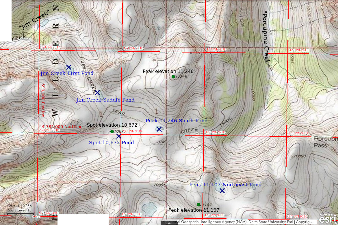
Jim Creek Saddle Pond is 38 km (24 miles) north of Pinedale and 7.7 km (5 miles) west of Squaretop Mountain. It is an elongate pond on the saddle at the head of Jim Creek, west of the peak with spot elevation 11,246 feet (3,428 m). The 7.5-minute topographic quadrangle shows it as a perennial lake about 120 m (390′) long and 40 m (130′) wide. It has no inlet and no outlet.
To reach the Jim Creek trail, turn north off US 191 6 miles west of Pinedale and follow Wyoming 352 toward “Green River Lakes” for approximately 23 miles. At the time of my visit, the little used road at Jim Creek was not well marked and there was no developed trailhead. The Jim Creek road is 2 miles north of the Boulder Creek crossing and 1 mile north of the Circle S Ranch. The Jim Creek Road climbs steeply up the hill on the north side of Jim Creek and I don’t recall how far it is passable. I vaguely remember parking at the turn-off from Wyoming 352 and hiking from there. The straight-line distance from Wyoming 352 to Jim Creek Saddle Pond is 8.6 km (5.3 miles) but the walking distance is obviously farther. The pond is less than 50 m (160′) east of the trail.
Elevation: 3,298 m (10,820′)
August 13, 2005
Just a day hike but at least I got far enough to find ponds without fish.
- 40 m x 120 m according to the 7.5-minute quadrangle; depth not estimated.
- Clear water.
- Fairy shrimp.
- Other animals not noted.
Jim Creek First Pond (Pinedale Ranger District, Bridger-Teton National Forest; Bridger Wilderness)
Jim Creek First Pond is 400 m (1,310′) northwest of, and lower than, Jim Creek Saddle Pond. It is the first, or uppermost, pond on Jim Creek. The 7.5-minute topographic quadrangle does not show a creek above it. The pond has a teardrop shape with dimensions of 100 m x 90 m (330′ x 295′) on the map.
For access, see Jim Creek Saddle Pond. Jim Creek First Pond should be visible from the trail north of Jim Creek Saddle Pond.
Elevation: 3,240 m (10,629′)
August 13, 2005
If one pond has fairy shrimp, it’s worth looking in others nearby even if I have to lose elevation to do it.
- 90 m x 100 m according to the 7.5-minute quadrangle; depth not estimated.
- Clear water.
- No fairy shrimp.
- Amphipods.
Spot 10,672 Pond (Pinedale Ranger District, Bridger-Teton National Forest; Bridger Wilderness)
Spot 10,672 Pond is southeast of Jim Creek Saddle Pond and west of Peak 11,246 South Pond in a small basin at the head of a tributary stream of Jim Creek. I don’t recall what topographic feature the spot elevation is for but it must be relatively distiinctive.
Spot 10,672 Pond is a very small pond that is not shown on the 7.5-minute topographic quadrangle and is not visible on the USGS imagery of The National Map. Consequently, its precise location is uncertain. My notes say only that it is east of spot elevation 10,672 (3,250 m) on the 7.5-minute quadrangle. My guess is that the pond is within 200 m (660′) of the spot elevation. The location uncertainty is less than that.
For access, see Jim Creek Saddle Pond. The spot elevation is less than 550 m (1,800′) west of Peak 11,246 South Pond so Spot 10,672 Pond shouldn’t be hard to find. It may be visible from the trail due to its lower elevation.
Elevation: 3,254 m (10,677′)
August 13, 2005
I probably saw the pond from the trail or I would have stayed on the trail.
- Probably less than 30 m across; depth not estimated.
- Clear water.
- Fairy shrimp.
- Other animals not noted.
Peak 11,246 South Pond (Pinedale Ranger District, Bridger-Teton National Forest; Bridger Wilderness)
Peak 11,246 South Pond is about 750 m (2,460′) southeast of Jim Creek Saddle Pond and 630 m (2,070′) south of the peak with spot elevation 11,246 feet (3,428 m). It is about 200 m (660′) north of the Jim Creek trail before it drops down into the Porcupine Creek drainage. On the 7.5-minute topographic quadrangle, the pond is 90 m x 50 m (300′ x 165′).
For access, see Jim Creek Saddle Pond. Follow the trail south from Jim Creek Saddle Pond and turn east, up the hill, when the trail turns to the south.
Elevation: 3,279 m (10,759′)
August 13, 2005
Another pond, another chance for fairy shrimp. I think I must have climbed the knoll south of the pond for the view and to see where the trail was going. The pond would be easily visible from there.
- 50 m x 90 m according to the 7.5-minute quadrangle; depth not estimated.
- Clear water.
- No fairy shrimp.
- Black diving beetles.
Peak 11,107 Northeast Pond (Pinedale Ranger District, Bridger-Teton National Forest; Bridger Wilderness)
Peak 11,107 Northeast Pond is 1,700 m (5,580′) southeast of Jim Creek Saddle Pond and 300 m (2,070′) northeast of the summit of the peak with spot elevation 11,107 feet (3,385 m). At the saddle on the Jim Creek – Porcupine Divide, a trail branches to the south off the Jim Creek trail. This trail goes over the hill with spot elevation 11,107 feet and eventually drops down into Dodge Creek. The pond is easily visible from this trail and less than 100 m (330′) north of the trail. The pond is 180 m x 90 m (600′ x 300′) on the 7.5-minute topographic quadrangle,
For access, see Jim Creek Saddle Pond. Turn off the Jim Creek trail south of Peak 11,246 South Pond and follow the trail to Dodge Creek over the hill with spot elevation 11,107 feet.
Elevation: 3,328 m (10,920′)
August 13, 2005
I was feeling pretty good about finding 2 ponds with fairy shrimp and decided to cap off the hike with a view down Porcupine Creek and over toward Squaretop Mountain. I was quite tired by the time I got a good view of Squaretop. Then I looked down into the canyon of Porcupine Creek and I saw the pond. It was quite an elevation drop but not too far away and only a short distance off the trail. I decided to go down for a look. It proved to be an exhausting day of fairy shrimping. I write this not as a complaint but as a warning. If you start searching for fairy shrimp, you, too, may end up pushing yourself to check out just one more pond, and then another until your legs turn to rubber and you end up staggering out in the dark.
- 90 m x 180 m according to the 7.5-minute quadrangle; depth not estimated.
- Clear water.
- No fairy shrimp.
- Amphipods.
Wind River Peak Ponds (Lander Ranger District, Shoshone National Forest; Popo Agie Wilderness)
___This map is a screenshot of The National Map (Go to The National Map). The U.S. Geological Survey generally does not copyright or charge for its data or reports (unless printed). A pond location is indicated by an “X”, which corresponds to the coordinates given in the data spreadsheet. Labels in quotations are from 7.5-minute topographic quadrangles.
___Red lines are the U. S. National Grid with a spacing of 1,000 m and intersection labels consisting of the UTM zone (e.g., 11S, 12T), a 2-letter 100-km square designation (e.g., LC, XN), and a 4-digit number. The first 2 digits of the number represent the 1,000-meter Easting and the second 2 digits the 1,000-meter Northing, as seen in the example Easting and Northing. Unlike latitude and longitude, the National Grid is rectilinear on a flat map, the units of abscissa and ordinate have equal lengths, and the units (meters) are measurable on the ground with a tape or by pacing.
___There is no private or state land on this map. All the lands are public.
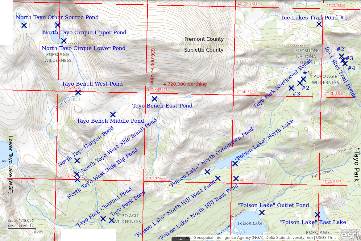
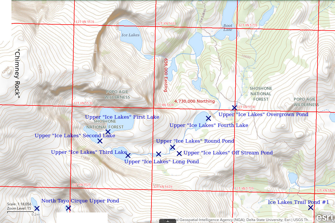
Wind River Peak Ponds are a group of ponds I visited over a couple of days to try to find as many fairy shrimp populations as possible. They are generally east and southeast of Wind River Peak, which is 35 km (21.5 miles) southwest of Lander. Most of the ponds are in the Tayo Creek drainage and north of Tayo Creek but the Upper “Ice Lakes” ponds are above the “Ice Lakes” in the Deep Creek drainage. I took minimal notes so sizes are taken from the 7.5-minute topographic quadrangle. All but 4 of the ponds are shown on that map. None of the ponds are named on the 7.5-minute quadrangle. Wind River Peak Ponds range in elevation from 3,070 m to 3,420 m (10,070-11,220′). Coordinates and elevations for each pond are given in the data spreadsheet on the Data page.
Wind River Peak Ponds are accessible from the Tayo Creek trail and the Ice Lakes trail. These trails, in turn, can be reached by way of the Middle Fork Popo Agie River trail with a trailhead at the end of the Sinks Canyon Road (Wyoming 131) or by the Roaring Fork trail with a trailhead at Worthen Meadows, which is off the “Louis Lake” Loop Road. I think I camped at Tayo Park.
August 29, 2006
This time of year is not ideal due to the shorter days but it’s probably too early for snowstorms.
- Tayo Fork Pond: about 50 m off the channel of the north fork of Tayo Creek, which is not named on the 7.5-minute quadrangle, and adjacent to Tayo Fork Channel Pond; 35 m x 120 m, no fairy shrimp.
- Tayo Fork Channel Pond: on the channel of the north fork of Tayo Creek just above the fork to Lower Tayo Lake (name used by WGF); less than 50 m across, no fairy shrimp.
- North Tayo West Side Small Pond: the smaller and northern of 2 ponds west of a split in north fork Tayo Creek above the fork to Lower Tayo Lake; likely pond size is 35 m x 70 m but there is no water.
- North Tayo West Side Big Pond: the larger and southern of 2 ponds west of a split in north fork Tayo Creek; 50 m x 110 m, no fairy shrimp.
- North Tayo Canyon Pond: on the low part of a ridge between 2 branches of north fork Tayo Creek, not shown on map so location on map and in data spreadsheet (on the Data page) could be off by 100 m; less than 30 m across, has fairy shrimp, backswimmers.
- Tayo Bench East Pond: on the wide bench half way up the north side of Tayo Creek canyon above “Poison Lake” and source of western stream to “Poison Lake” North Lake; 30 m x 100 m, has fairy shrimp.
- Tayo Bench Middle Pond: on the wide bench half way up the north side of Tayo Creek canyon above “Poison Lake”; 25 m x 70 m, no fairy shrimp.
- Tayo Bench West Pond: on the wide bench half way up the north side of Tayo Creek canyon above “Poison Lake” and on the creek from North Tayo Lower Cirque Pond; 70 m x 110 m, no fairy shrimp, amphipods, beetles.
- North Tayo Cirque Lower Pond: in the cirque at the head of north fork Tayo Creek which is east of the bigger cirque with Upper Tayo Lake (name used by WGF); 130 m x 190 m, no fairy shrimp, amphipods.
- North Tayo Cirque Upper Pond: in the cirque at the head of north fork Tayo Creek which is east of the bigger cirque with Upper Tayo Lake, and upstream from North Tayo Lower Cirque Pond; 60 m x 70 m, no fairy shrimp.
- North Tayo Other Source Pond: 350 m west of North Tayo Cirque Upper Pond and the source of another branch of north fork Tayo Creek; 60 m x 170 m, no fairy shrimp, overgrown with vegetation.
- Upper “Ice Lakes” First Lake: biggest and uppermost lake south of the named “Ice Lakes”; 270 m x 430 m, no fairy shrimp.
- Upper “Ice Lakes” Second Lake: downstream of Upper “Ice Lakes” First Lake; 100 m x 290 m, no fairy shrimp.
- Upper “Ice Lakes” Third Lake: downstream of Upper “Ice Lakes” Second Lake; 140 m x 230 m, no fairy shrimp.
- Upper “Ice Lakes” Long Pond: downstream of Upper “Ice Lakes” Third Lake; 35 m x 110 m, no fairy shrimp.
- Upper “Ice Lakes” Round Pond: downstream of Upper “Ice Lakes” Long Pond; 50 m x 60 m, no fairy shrimp.
- Upper “Ice Lakes” Off Stream Pond: 100 m east of Upper “Ice Lakes” Round Pond; pond size less than 30 m across, dry.
- Upper “Ice Lakes” Fourth Lake (has spot elevation 10,773 feet on the 7.5-minute quadrangle): downstream of Upper “Ice Lakes” Round Pond; 130 m x 240 m, no fairy shrimp, amphipods.
- Upper “Ice Lakes” Overgrown Pond: at source of stream east of Upper “Ice Lakes” stream; 60 m x 130 m, no fairy shrimp, overgrown with vegetation.
- Ice Lakes Trail Pond #1: along trail in saddle 1.4 km northwest of Tayo Park, not shown on map so location on map and in data spreadsheet could be off by 100 m; less than 30 m across, no fairy shrimp.
- Ice Lakes Trail Ponds #2, #3, #4: at upper end of stream northwest of Tayo Park; less than 30 m across, no fairy shrimp.
- Tayo Park Northwest Ponds #1, #2, #3: at upper end of eastern stream to “Poison Lake” North Lake and 1 km northwest of Tayo Park; less than 50 m across, no fairy shrimp.
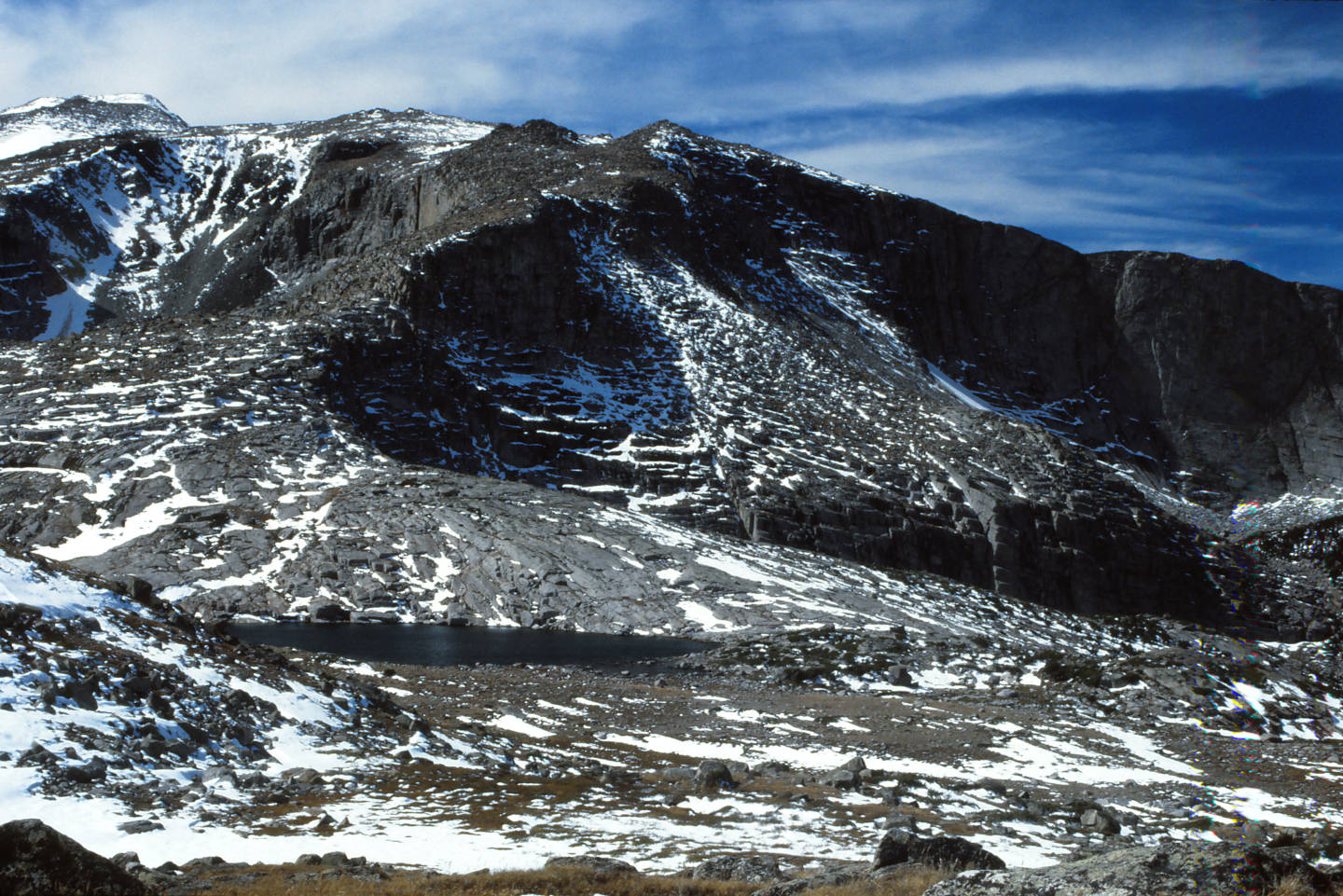
Upper “Ice Lakes” Fourth Lake on a September hike in a previous year after the first snow but before a big snow. Wind River Peak is at upper left.
August 30, 2006
- “Poison Lake” Outlet Pond: less than 100 m southeast of the outlet of “Poison Lake”, not shown on map so location on map and in data spreadsheet (on the Data page) could be off by 100 m; less than 30 m across, has fairy shrimp.
- “Poison Lake” East Lake: 650 m east of “Poison Lake”; 85 m x 170 m, no fairy shrimp.
- “Poison Lake” North Hill East Pond: on hill between “Poison Lake” and “Poison Lake” North Lake, not shown on map so location on map and in data spreadsheet could be off by 100 m; less than 30 m across, no fairy shrimp.
- “Poison Lake” North Hill West Pond: on hill between “Poison Lake” and “Poison Lake” North Lake, not shown on map so location on map and in data spreadsheet could be off by 100 m; pond area less than 30 m across but dry.
- “Poison Lake” North Lake: 800 m north of “Poison Lake”; 110 m x 410 m, no fairy shrimp.
- “Poison Lake” North Overgrown Pond: on stream west of “Poison Lake” North Lake; 50 m x 120 m, no fairy shrimp, overgrown with vegetation.
- “Coon Lake” Cirque Pond: in small cirque 600 m north of “Coon Lake”; 25 m x 100 m, no fairy shrimp (Little Sandy Overlook Pond map).
Of the 33 Wind River Peak Ponds I looked at, 3 had fairy shrimp. I noted amphipods in 3 ponds and none of those had fairy shrimp.
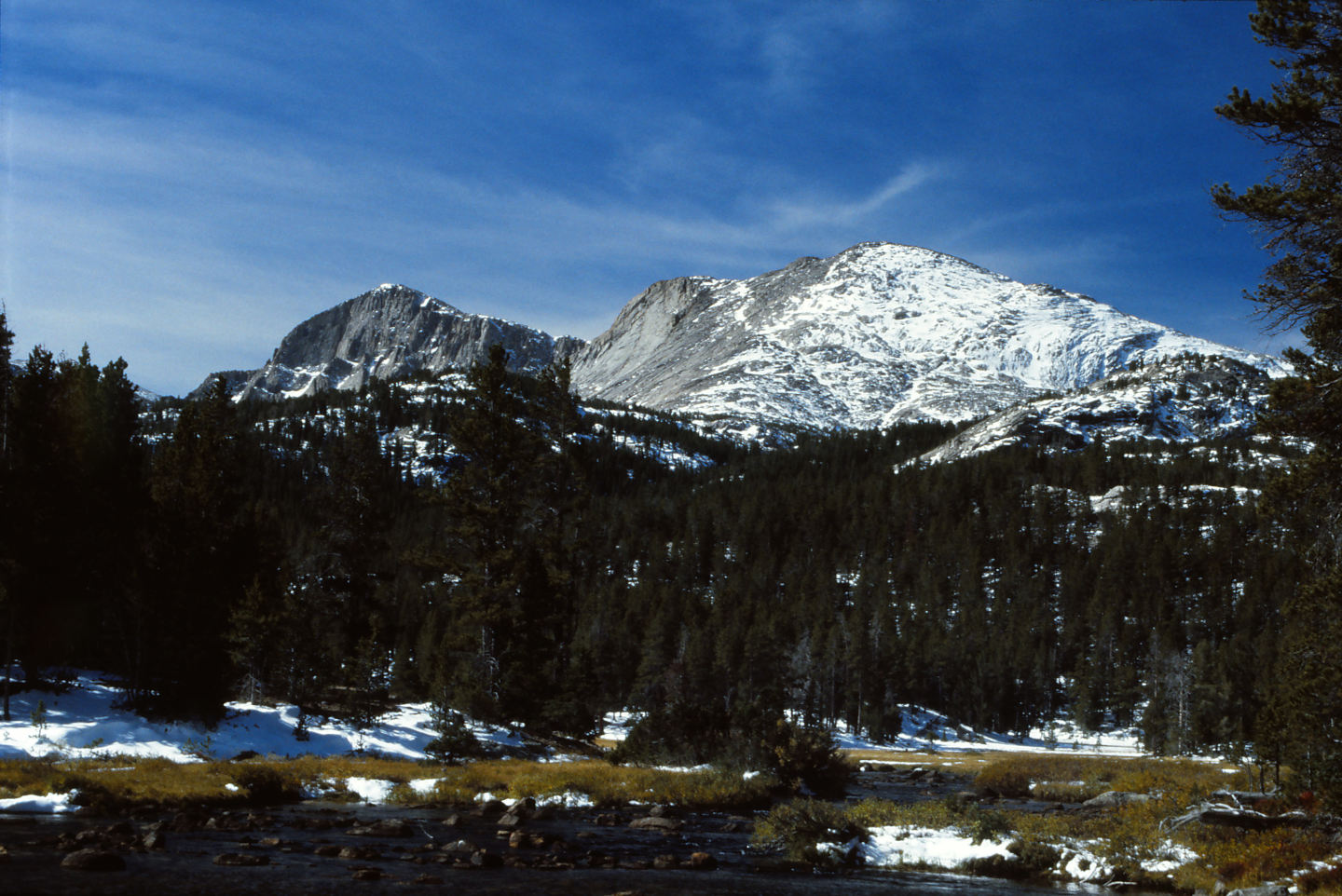
Tayo Park, which is about 1.5 km (0.9 miles) northeast of “Poison Lake” Outlet Pond. The view is to the southwest on a September day of a previous year. Mt. Nystrom in the background has new snow.
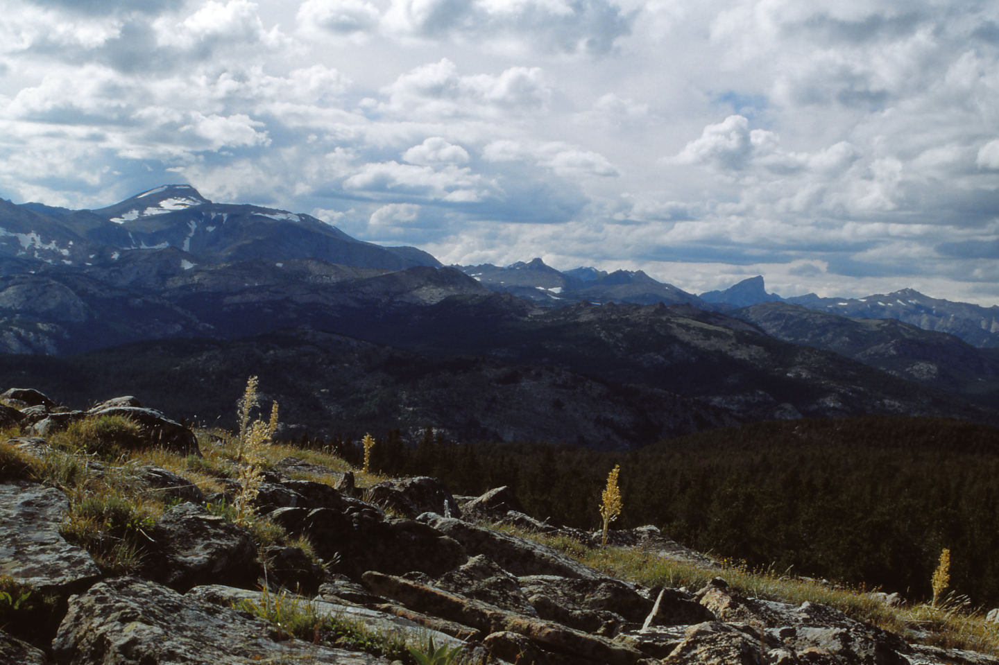
The view from Roaring Fork Mountain on the hike out to Worthen Meadow Reservoir on an August day in a previous year. Looking northwest, Wind River Peak is at left and the angular Lizard Head Peak at right. The Wind River Peak Ponds of the Tayo Creek and Deep Creek drainages that I looked at are generally in the left half of the middle distance and closer to Wind River Peak than to the photographer.
Little Stough West Pond (Lander Ranger District, Shoshone National Forest; Popo Agie Wilderness)
Little Stough West Pond is in Stough Creek Basin less than 50 m (165′) west of Little Stough Lake (name used by WGF), which is the second lake encountered along the trail into the basin from the north. Little Stough West Pond has an elongate shape and dimensions of 100 m x 35 m (330′ x 110′) on the 7.5-minute topographic quadrangle. Little Stough West Pond is not connected to Little Stough Lake.
For access, see Big Stough East Pond. Instead of going around the north side of Big Stough Lake to go to Big Stough East Pond, follow the trail along the west shore of the lake to the south.
Exposure Age: A glacier remained on the floor of Stough Creek Basin until 12,500 years ago, based on a rock sample collected on the valley floor above (south) of Shoal Lake (Dahms and others, 2018). It may also have covered Little Stough West Pond at that time or the pond could have been exposed a little earlier.
Elevation: 3,201 m (10,503′)
August 31, 2006
The pond is almost dry.
- Size and depth not estimated.
- Water is clear.
- No fairy shrimp.
- Other animals not noted.
Stough Off Channel Pond (Lander Ranger District, Shoshone National Forest; Popo Agie Wilderness)
Deep Cirque Overlook Pond map or Cinquefoil Pond map
Stough Off Channel Pond is east of Stough Creek about 525 m (1,720′) south of Shoal Lake (name used by WGF) in the northern part of Stough Creek Basin. It is east of Footprint Lake (name used by WGF). It has dimensions of 100 m x 60 m (330′ x 200′) on the 7.5-minute topographic quadrangle.
For access, see Cinquefoil Pond. Stough Off Channel Pond is about 70 m (230′) east of Stough Creek about half way between Shoal Lake and the creek’s sharp bend to the east toward Black Rock Lake (name used by WGF).
Exposure Age: A glacier remained on the floor of Stough Creek Basin covering Stough Off Channel Pond until 12,500 years ago, based on a rock sample collected on the valley floor above (south) of Shoal Lake (Dahms and others, 2018).
Elevation: 3,253 m (10,673′)
August 31, 2006
The pond doesn’t appear to be connected to Stough Creek so maybe fish can’t get here.
- Likely smaller than the 60 m x 100 m shown on the 7.5-minute topographic quadrangle; depth not estimated.
- Water is clear.
- Fairy shrimp.
- Backswimmers.
Lower Indian Pass Lake (WGF name) (Pinedale Ranger District, Bridger-Teton National Forest; Bridger Wilderness)
___This map is a screenshot of The National Map (Go to The National Map). The U.S. Geological Survey generally does not copyright or charge for its data or reports (unless printed). A pond location is indicated by an “X”, which corresponds to the coordinates given in the data spreadsheet. Labels in quotations are from 7.5-minute topographic quadrangles.
___As of April 2025, the National Grid overlay with red lines in UTM coordinates does not load in The National Map.
___There is no private or state land on this map. All the lands are public.
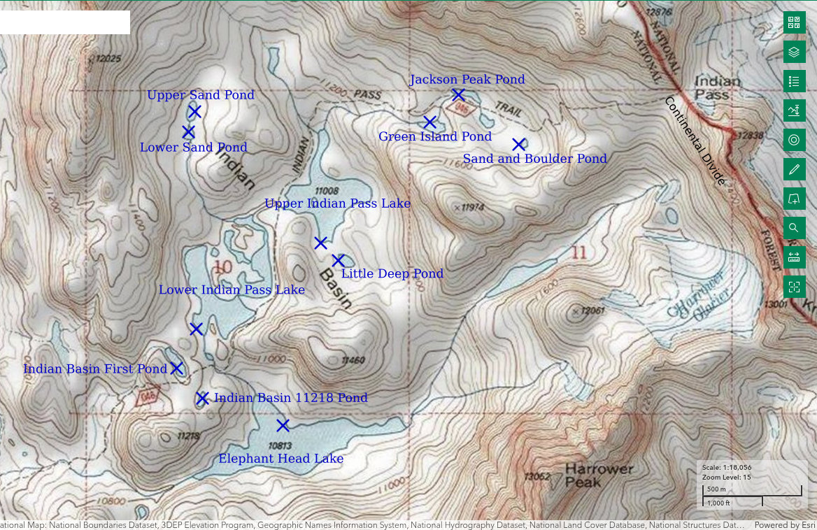
Lower Indian Pass Lake is 750 m (2,460′) southwest of Upper Indian Pass Lake (point on southwestern shore from point on southern shore), which is about in the middle of Indian Basin and 33.4 km (20 miles) northeast of Pinedale. The lake has a very irregular shape but the broadest dimensions on the 7.5-minute topographic quadrangle are 500 m by 680 m (1,640′ x 2,230′). A wide peninsula extends from the northwestern shore into the middle of the lake. There are a few ponds on the peninsula, some of which may be connected to the lake at high water. The ponds are mostly shallow (less than 100 cm, 39″) and have dimensions of a few to several tens of meters. No distinctions are made here between the aquatic communities in these ponds and that in the lake. According to the Wyoming Game and Fish Department’s online map (https://wgfd.wyo.gov/fishing-boating/places-fish-wyoming and click on the link to the “Interactive Wyoming Fishing Guide”), none of the lakes in Indian Basin have fish. Lower Indian Pass Lake is less than 20 m (65′) higher than Bivouac Lake, which is a modest size lake with fairy shrimp near the southern end of the Wind River Mountains. If fairy shrimp were widespread before fish-stocking began, there should be some in Indian Basin. The name Lower Indian Pass Lake was made up by WGF. It is 1 of 2 lakes in Indian Basin west of Indian Pass.
Lower Indian Pass Lake is in the Bridger Wilderness and can only be reached by hiking or by riding an animal. Take the Pole Creek Trail from Elkhart Park to “Eklund Lake”, turn north there, and follow the “Seneca Lake” Trail to “Island Lake”. The trail from Elkhart Park to “Island Lake” is very heavily used. There are probably 10-30 parties camped near “Island Lake” on August nights. From “Island Lake”, follow the trail to “Titcomb Lakes” around the east end of “Island Lake” and turn east onto the Indian Pass Trail about 1.2 km (0.7 mile, by trail) north of the lake. There is a sign at the trail intersection. Do not take an unsigned trail up the hill from the east shore of “Island Lake”. That trail may be a route up Elephant Head or Mount Lester. The Indian Pass Trail loops around the east side of Lower Indian Pass Lake and generally provides easy access to the water. Indian Basin gets considerably less traffic than “Titcomb Lakes”, which have been stocked with fish.
Exposure Age: Lower Indian Pass Lake was likely exposed by 13,300 years ago, when the glacier melted off “Titcomb Lakes” (age recalculated by Dahms and others, 2018; excluding the 2 youngest ages, the mean of 7 boulder ages previously updated by Young and others, 2011b, was 13,000 years).
Elevation: 3,352 m (11,000′)
August 10-12, 2025
I’ve pretty much given up on finding alpine fairy shrimp in Nevada or the Sierra Nevada of California so I decided to try my luck again amidst the fabulous scenery of the Wind River Mountains. Indian Basin has 3 large lakes that don’t have fish according to WGF’s online map and several smaller ponds. It’s worth a try.
- 500 m by 680 m (based on 7.5-minute quadrangle); depth greater than 300 cm.
- Clear water; 12 C at 1840, 14 C at 1500, 12 C at 1100, 11 C at 0745 at different locations on different days, all in 5 cm water.
- Greenish and translucent gray fairy shrimp 15-25 mm long; none seem to have eggs.
- Abundant mayfly larvae (Ephemeroptera), water boatmen only about 5 mm (sub-order Heteroptera, family Corixidae), locally abundant copepods about 1 mm, amphipods 10 mm or less, black beetles less than 10 mm, caddisfly larvae (Trichoptera), wrigglers, resident ducks, 3 species of small birds that may be black rosy finches, water pipits, and something else (observed in different locations on different days).
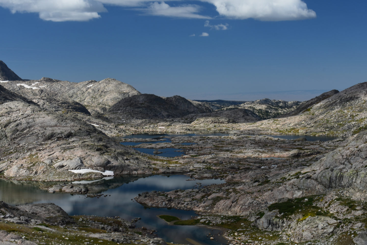
Looking down on Indian Basin from the Indian Pass Trail. Upper Indian Pass Lake is the nearer and Lower Indian Pass Lake the farther. Both lakes have irregular shapes depending on where the glacier cut deepest.
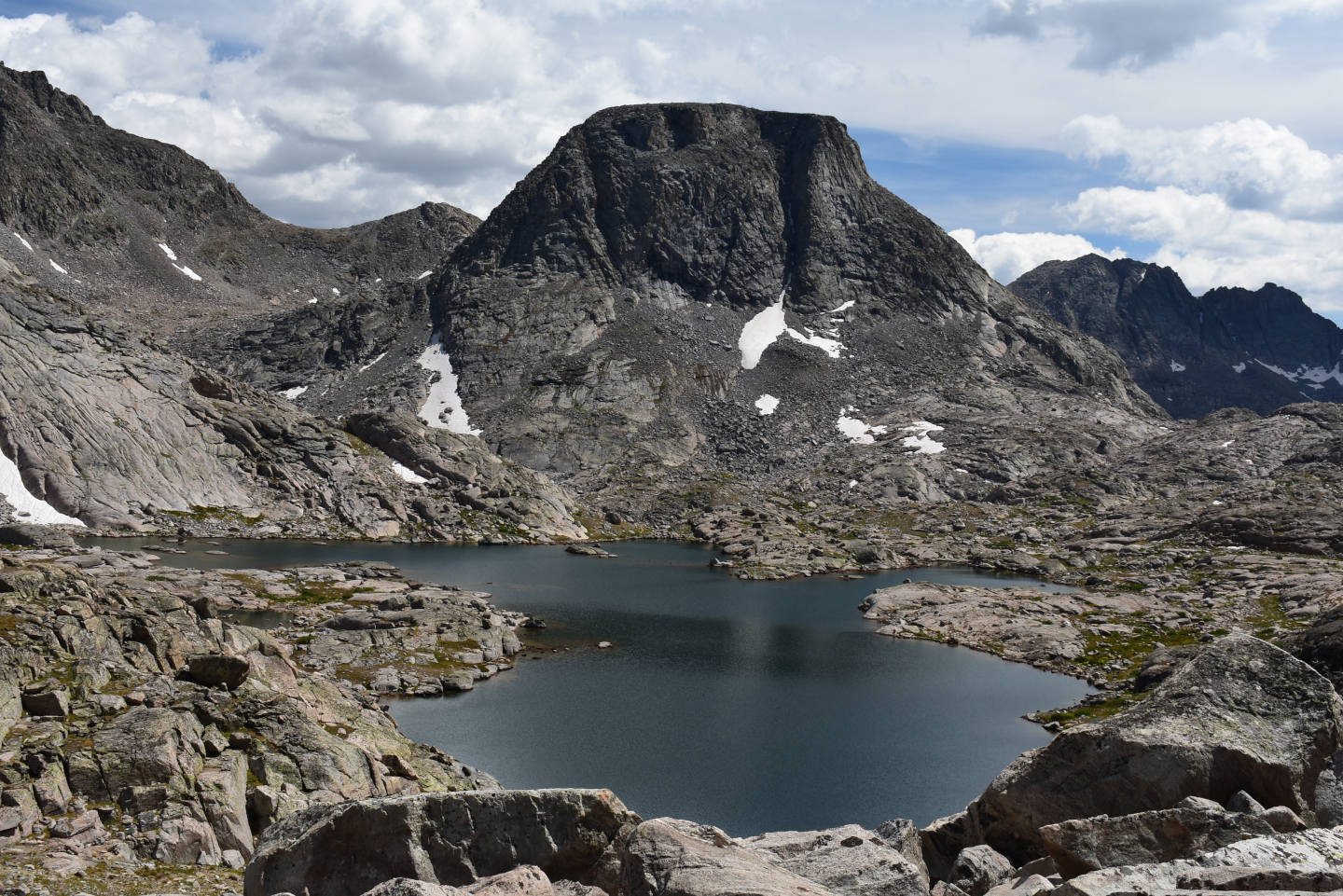
View to south across the wide southern part of Lower Indian Pass Lake with Elephant Head in the distance. The ducks I saw were always in this part of the lake. It may be that this width (80 m or more) is sufficient to alleviate anxiety about animals along the shore but the width of the eastern part is not. If so, that may limit the occurrence of resident ducks and any aquatic diversity associated with them to relatively large lakes.
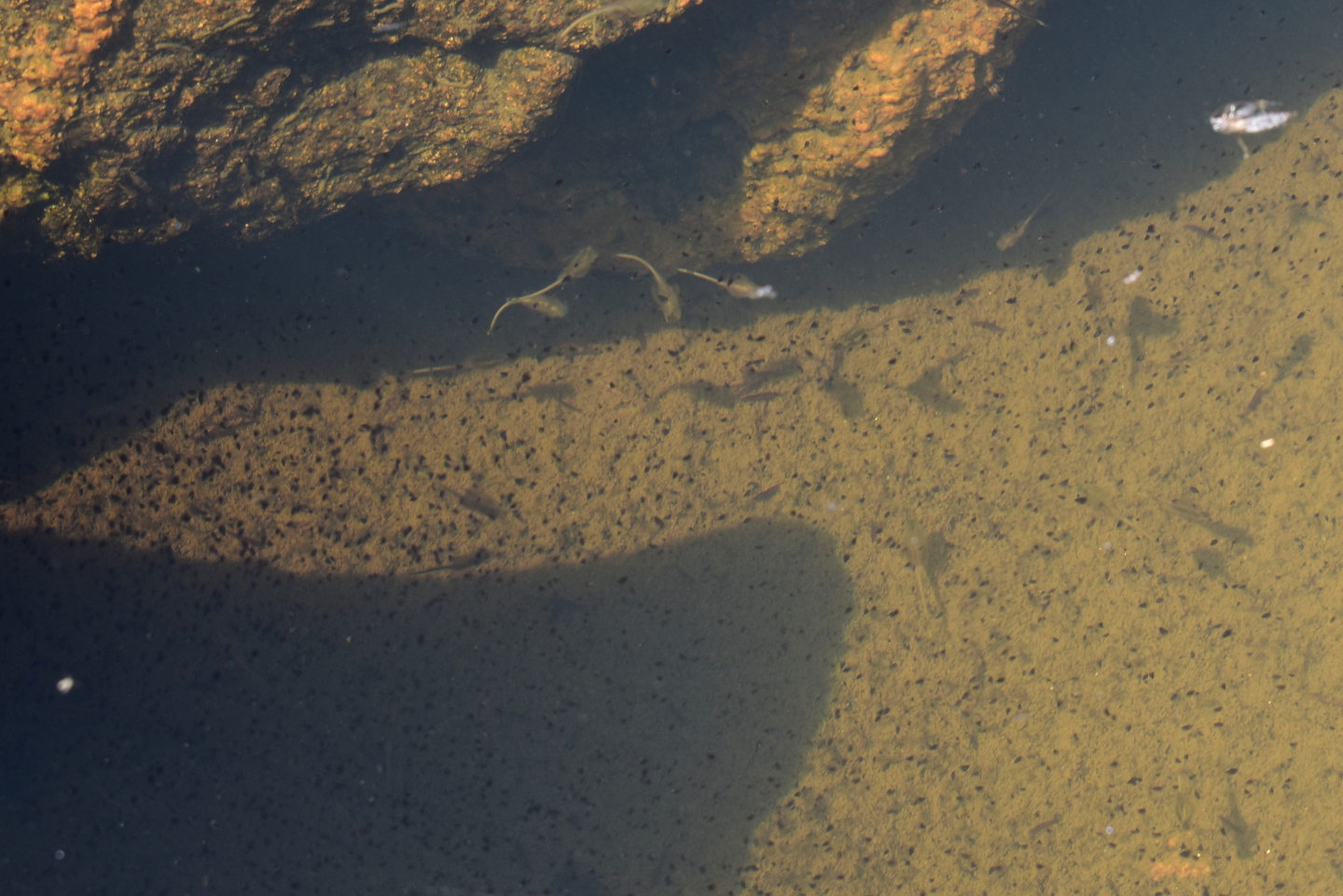
A few fairy shrimp swimming amongst lots of tiny, black copepods in Lower Indian Pass Lake.
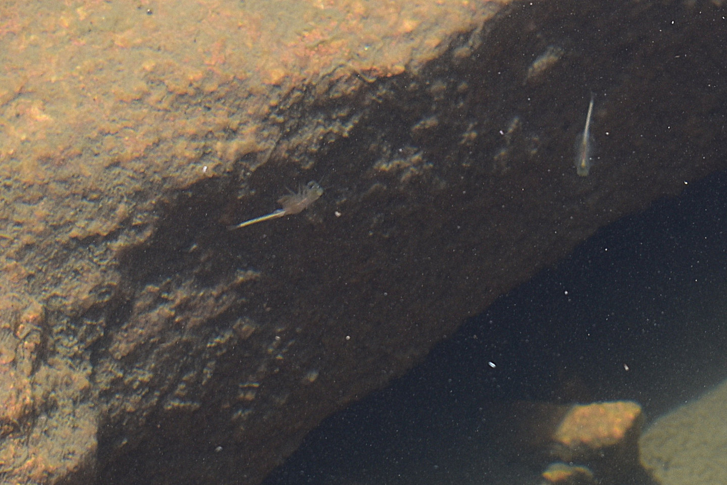
2 fairy shrimp against a boulder’s shadow in Lower Indian Pass Lake.
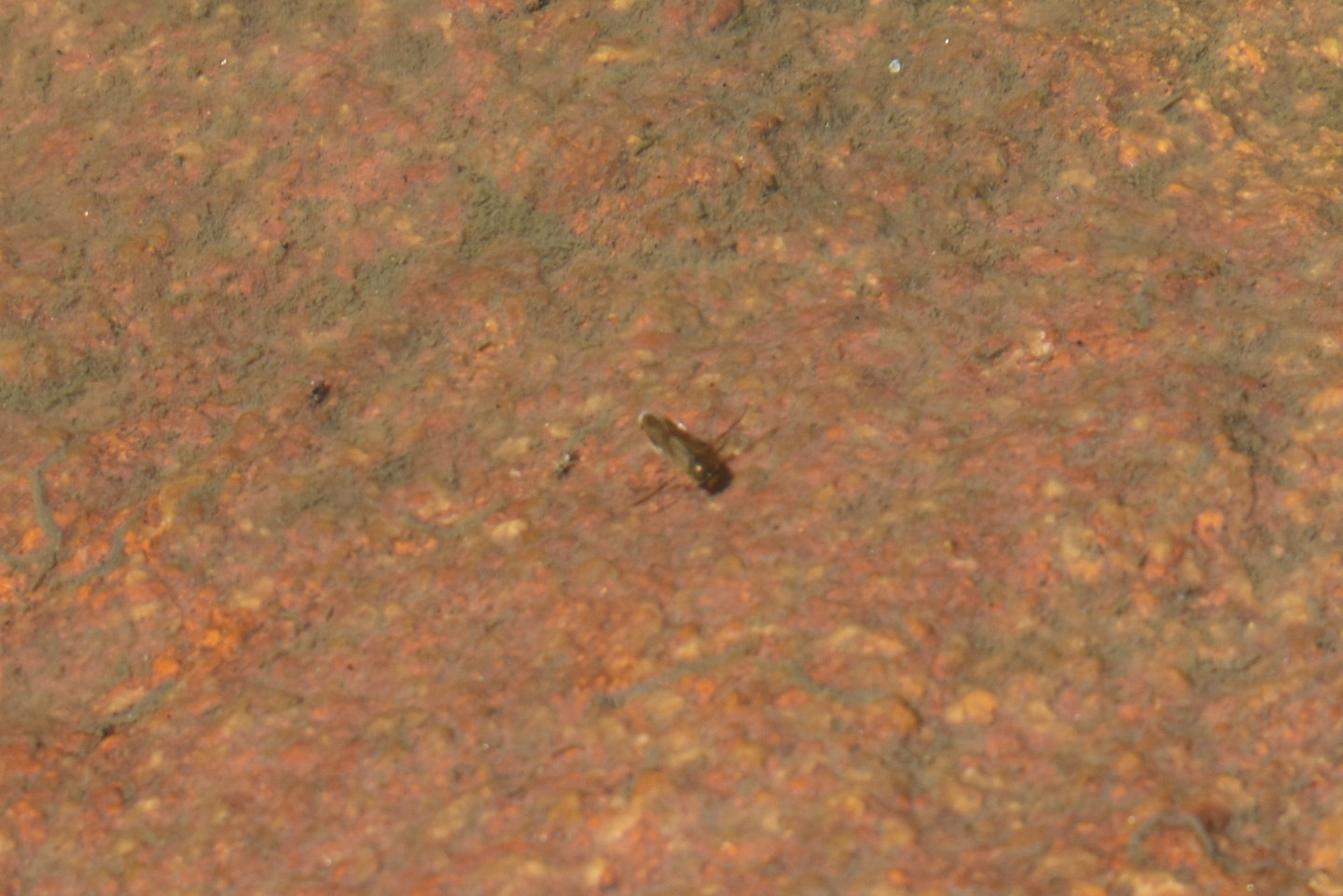
A small water boatman (sub-order Heteroptera, family Corixidae) clinging to rock in Lower Indian Pass Lake with its oar-like legs extended to the sides.
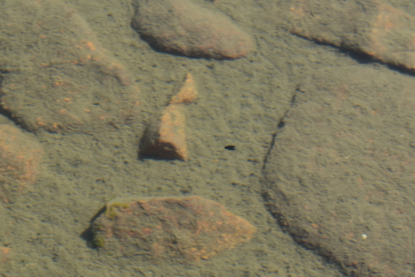
A small black beetle swimming to the left in Lower Indian Pass Lake.
A mayfly larva (Ephemeroptera) in Lower Indian Pass Lake. The mayfly larvae were hard to photograph because they swam rapidly away on my approach but this one didn’t. Contrast has been enhanced to make the 3 tail-like features that are distinctive of mayfly larvae visible but without much success.
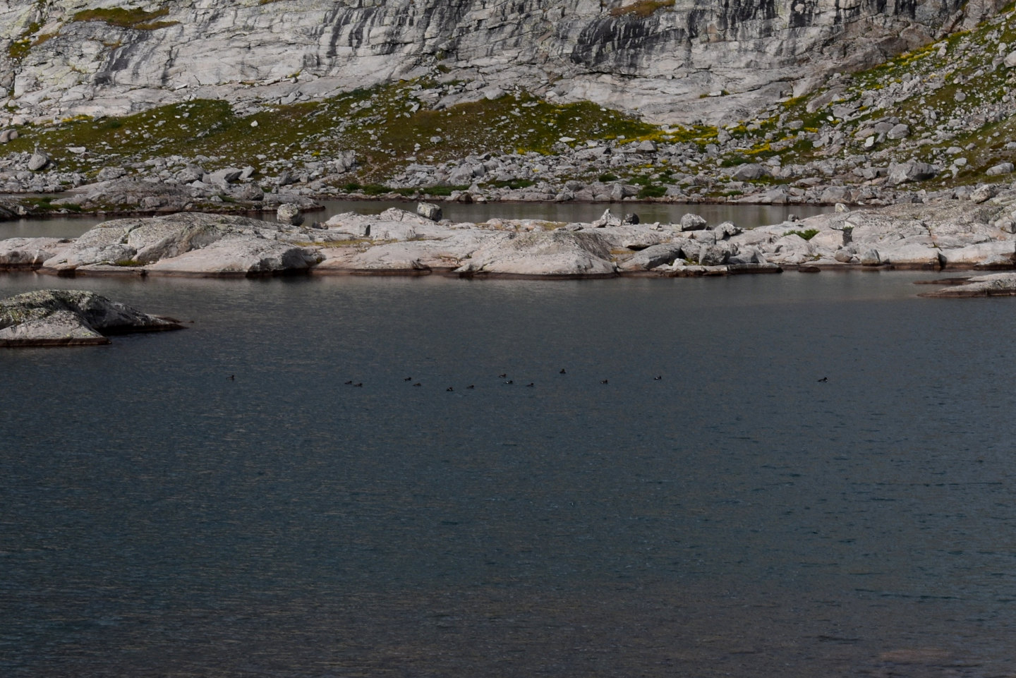
14 ducks (dark spots at center) on the water of Lower Indian Pass Lake. These ducks are not just visiting, they are living here. I saw ducks every time I walked by the lake. Ducks typically fly off when they see people. These in Lower Indian Pass Lake never flew off, or flew at all. I think ducks residing on an alpine lake in the Wind River Mountains is a rare occurrence. I have seen many alpine and subalpine lakes in the Wind River Mountains on numerous hikes but only 1 other time have I seen ducks. I saw 1 duck at “Grave Lake” but that was so unusual I remembered it. It flew off when it saw me.
It’s hard not to suppose that the presence of ducks and a diverse aquatic invertebrate fauna in Lower Indian Pass Lake are related. There is negligible vegetation in the lake. The ducks must be eating invertebrates. Ducks are known to eat fairy shrimp (e.g., Swanson, 1984; Vest and Conover, 2010). If present, the duck – aquatic diversity relation would work both ways. Avian predators can have a beneficial effect on fairy shrimp populations if not on individual fairy shrimp. After consuming egg-bearing fairy shrimp in one pond, birds may fly to another pond and defecate the eggs there. Experiments have shown that some fairy shrimp eggs recovered from bird feces hatch under favorable conditions (e.g., Figuerola and Green, 2002; Sanchez and others, 2007). How else could fairy shrimp have gotten into the alpine lakes after the glaciers retreated?
When lakes are stocked with fish, the fish eat everything that is large enough to see. Large-bodied invertebrates are eliminated or their populations are severely reduced. For examples, see “Fish-stocking Zooicide in the Sierra Nevada” on the east-central Sierra Nevada page. It’s worse in alpine lakes because there is no vegetation for aquatic species to hide in. Why do fish bother to eat flying insects that happen to alight briefly on the water surface? Or even jump out of the water to eat them? Because they have eaten almost everything in the water. If the ducks are here for the diverse aquatic invertebrates, then they would be less interested in lakes with fish elsewhere in the Wind River Mountains.
Just such a relationship has been documented in a variety of studies. Effects on large invertebrates by fish and the diet preferences of ducks differ by species though. Data from 38 small Finnish lakes ranging from clear to eutrophic revealed strong negative correlations between the number of common goldeneye (p = 0.028) or green-winged teal (p = 0.001) duck pairs at a lake and the abundance of perch in the water but not with roach or pike (Väänänen and others, 2012). Broods of these ducks also avoided lakes with perch (goldeneye p=0.008, teal p=0.060). Mallard pairs were oblivious to the effects of perch.
An early field survey in Norway found that “goldeneyes preferred lakes without fish to those with fish” (Eriksson, 1979, abstract only). Then, fish removal showed that “Cloeon larvae [i.e., mayflies], Odonata larvae [e.g., damselflies, dragonflies], water bugs [e.g., water boatmen, backswimmers], dytiscids, and Chaoborus larvae, proved sensitive to predation from fish”. “Goldeneyes increased their use of an experimental lake after fish were removed, and they used this lake more than an adjacent control lake” (Eriksson, 1979, abstract only).
In a review article, 152 cases where fish variables were used to explain duck variables, 3 cases found positive interactions and 42 found negative ones (Nummi and others, 2016). Results generally “showed that ducks in all stages of the breeding cycle may be negatively affected by fish presence, both in Europe and in North America” (Nummi and others, 2016).
McParland (2005) reviewed other examples.
- A Swedish study showed mallard pairs were more abundant at lakes with low fish densities and mallard duckings acquired more macroinvertebrate food at the lakes with the fewest fish. Long-term monitoring of Swedish lakes showed that lakes with re-established perch populations had lower abundances than before of both goldeneyes and macroinvertebrates.
- Removing fish from English gravel pit lakes resulted in more aquatic vegetation, better water clarity, more chironomids, and increased survival of tufted duck ducklings.
- Poisoning yellow perch, bluegill sunfish, and bullhead catfish in a North American prairie lake resulted in more aquatic vegetation and invertebrates and diving waterfowl numbers increased from less than 5,000 to 57,000.
- Reversing the fish-removal methodology to further substantiate fish effects, adding minnows to prairie pothole wetlands reduced aquatic insect abundances in 2 studies and in 1 of those studies the higher invertebrate densities correlated positively with body masses and growth rates of mallard ducklings.
Amphipods are the predominant food of lesser scaup in Alberta and Saskatchewan and make up 52% of the food eaten by scaup ducklings (Lindeman and Clark, 1999). Fish also eat amphipods. Analysis of data on 108 wetlands in southern Saskatchewan showed that the abundance of the amphipod Hyalella azteca had the highest correlation with the number of scaup at a wetland followed by depth, area, and the abundance of the amphipod Gammarus lacustris. Separate analyses for each of 3 eco-regions revealed that abundance of H. azteca was a strong predictor of scaup numbers in all 3 eco-regions but the quality of the wetland margin was also important in 2 (Lindeman and Clark, 1999). G. lacustris is not as common in the region and is less indicative of scaup use of wetlands.
The close association of lesser scaup and amphipods was confirmed south of the border. A survey of 286 wetlands in the upper Midwest showed that after accounting for physiographic region, the presence of lesser scaup at a wetland was most strongly correlated with amphipod density, area of open water, and turbidity (Anteau and Afton, 2009). A later study of 59 wetlands in Minnesota compared densities of 2 species of amphipods with those of 3 species of fish. Densities of G. lacustris and H. azteca had strong negative correlations with abundances of black bullhead and brook stickleback but negative and positive correlations, respectively, with fathead minnow (Carleen and others, 2024). G. lacustris wasn’t present in any of the 17 sampled wetlands with black bullhead and H. azteca was found in only 2. Over the late 20th and early 21st centuries, fish presence has increased in the region due to increased precipitation and changing land use while amphipod and lesser scaup populations have declined (Carleen and others, 2024). 84% of 168 lakes in the Prairie Potholes Region of North Dakota had fish during a 2012-2013 survey “indicating a major change to this formerly ‘fishless’ region” (McLean and others, 2016). In 2014, lakes stocked with fish by North Dakota Game and Fish Department had increased to 415 from 160 in 1988 (McLean and others, 2016). If current trends continue, the Prairie Potholes Region “may ultimately become known as the ‘fish factory’ of North America rather than its ‘duck factory’ ” (McLean and others, 2016).
So there is another effect of the fish-stocking zooicide. By wiping out visible invertebrates, stocked fish have made lakes unappealing to ducks. That is a testable hypothesis. What percentage of lakes in the Wind River Mountains with fish have resident ducks? What percentage of lakes without fish have resident ducks?
The bird at center is hard to see because it is the same dark gray color as the rock it is perching on. It may be a black rosy finch. It is common in Indian Basin, including at Lower Indian Pass Lake but this photograph is northwest of Upper Indian Pass Lake. Like the ducks, it may be here because it benefits from the aquatic diversity. The Audubon guide to North American birds doesn’t say what black rosy finches eat but gray-crowned rosy finches eat seeds and insects and are also found in alpine habitats.
In the Sierra Nevada, gray-crowned rosy finches were reliant on mayflies to feed their young. Mayfly larvae were common in fishless lakes there but generally absent in lakes with fish (Epanchin and others, 2010). 12 of 12 fishless lakes had mayflies and the average density was 46 larvae per square meter. Only 2 of 12 lakes with fish had mayflies and the average density in those 2 was 1 larva per square meter (or 6 per square meter for 2 lakes if the 10 barren lakes had been included in the calculation of the average). During mayfly hatches, rosy finches were 4 to 10 times (3 different years with different numbers of lakes) more abundant at fishless lakes than at lakes with fish. At other times, the finches could have been eating seeds and terrestrial insects and there wasn’t a significant difference between the 2 lake types. A similar dynamic could be at work in the Wind River Mountains. I don’t remember seeing small birds as abundant as those I saw in Indian Basin elsewhere in the Wind River Mountains. I did see a few adult mayflies in Indian Basin so at least some were hatching.
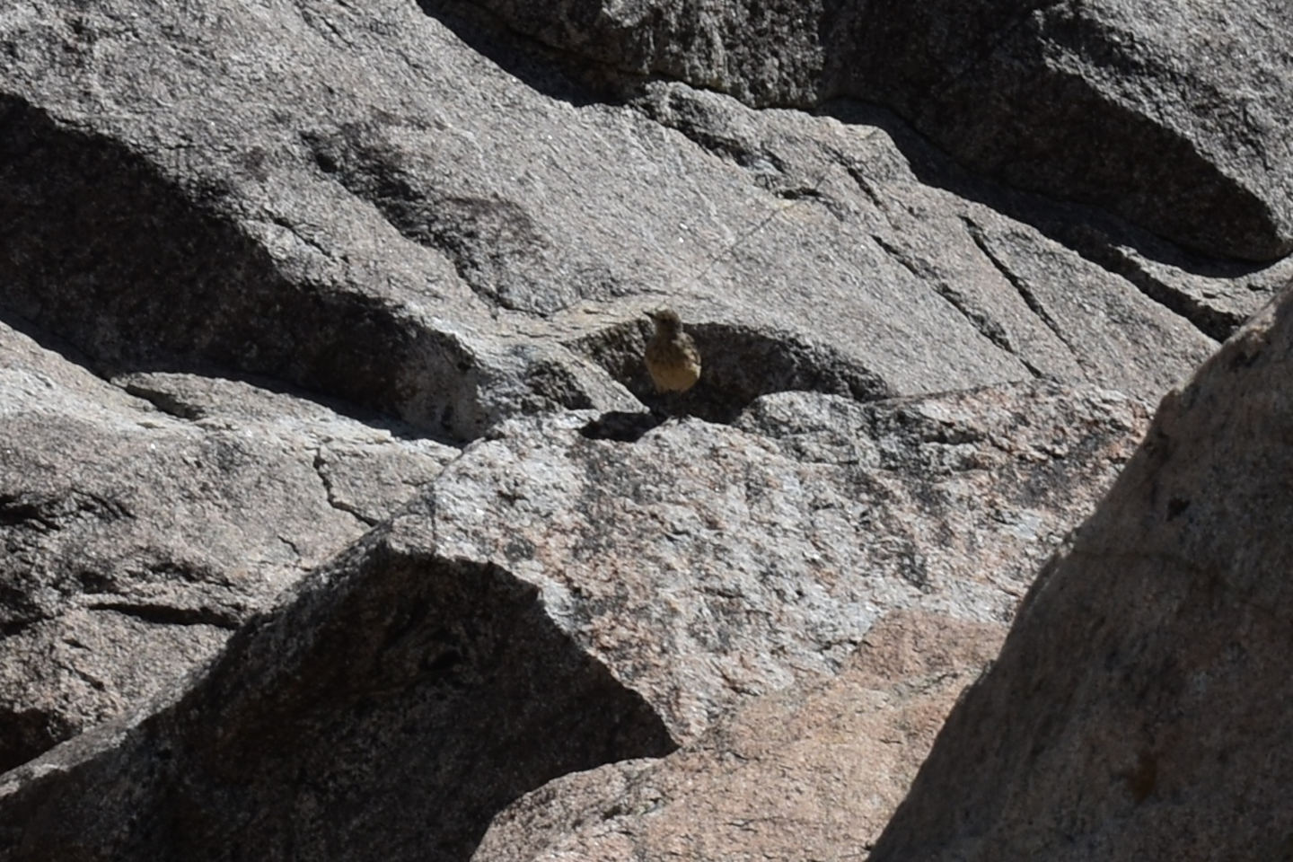
I think the bird at center is a water pipit. The Audubon guide to North American birds says they eat insects. I commonly saw these birds at Lower Indian Pass Lake but this photograph is at Little Deep Pond, which also has mayfly and caddisfly larvae. Like the ducks and black rosy finches, it may be here because of the abundant insects that have aquatic larvae and flying adults.
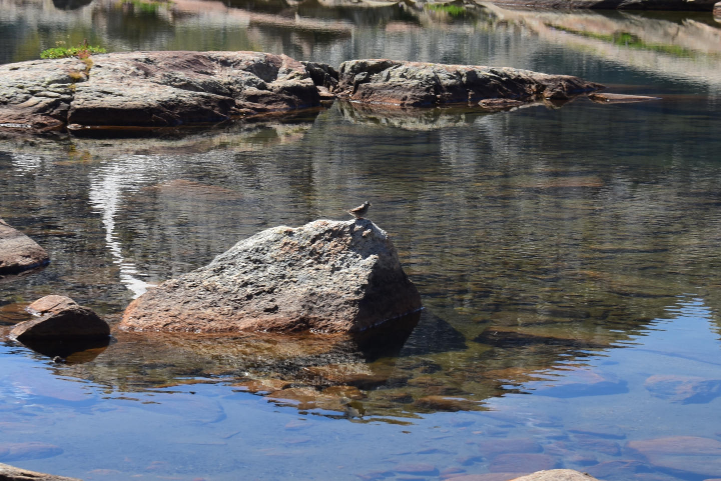
The bird at center is the third species of small bird that I saw at Lower Indian Pass Lake but I can’t identify it. Like the other birds in Indian Basin, it may prefer fishless Lower Indian Pass Lake to the more common fish-stocked lakes elsewhere in the Wind River Mountains because of the more diverse and more abundant aquatic invertebrates here.
On a more speculative note, marmots partake of insects and bird eggs in addition to the abundant vegetation in their diets (https://www.nps.gov/romo/learn/nature/marmot.htm). They too could be more abundant at lakes without fish. I saw 1 at Lower Indian Pass Lake.
Lower Indian Pass Lake Fairy Shrimp Video 2025-08-11a-rmq
For a 2-minute, 6-seconds video of fairy shrimp swimming among boulders near the shore of Lower Indian Pass Lake, click on the video player above. There is no audio. The significant differences in the lengths of the fairy shrimp indicate they hatched at significantly different times, possibly due temperature changes or to precipitation or melting events (see Resting Eggs of Fairy Shrimp and Their Hatching). The fairy shrimp appear to be swimming in various directions with little response to each other.
There are nevertheless a few examples of distinctive behaviors. In what may be precautionary predator avoidance at 0:14-0:16, a fairy shrimp in the shadow at upper left jerks and turns sharply toward the lower right for no apparent reason.
At 1:54, there is a presumably non-intentional near-collision. 1 fairy shrimp swimming to the right and 1 to the left in the shadow at right both turn toward the bottom before or when they touch and then go their separate ways. It looks as if their legs made contact during the turn. Although near-collisions suggest fairy shrimp do not sense, or attend to, the presence of other fairy shrimp nearby well, the rarity of near-collisions seems to indicate that they do okay.
There are 2 possible examples of the following movement of the mating dance (under Fairy Shrimp Reproduction on the Life Cycle of Fairy Shrimp page). At 0:57-0:58 in the shadow at right, 1 fairy shrimp turns sharply and briefly follows a fairy shrimp swimming toward the lower right and then turns away. At 1:47-1:48 a fairy shrimp following another toward the lower left emerges from the shadow at right but then turns sharply away and reverses course. Failures to detect unfertilized eggs could have caused the following fairy shrimp, if they were males, to abandon their pursuits. I didn’t see any eggs in the ovisacs of fairy shrimp in Indian Basin so it may yet be early in the reproductive cycle.
Mayfly larvae (Ephemeroptera) also make appearances in Lower Indian Pass Lake Fairy Shrimp Video 2025-08-11a-rmq: at 0:20-0:21 swimming from top to bottom and at 1:36-1:37 swimming from left edge to top center. The mayfly larvae are almost as long as the fairy shrimp, they swim faster, the rear halves of their bodies look fat due to gills protruding from their abdomens, and they wiggle from side to side as they swim. For photographs of the anatomy of mayfly larvae, see those for Par Value Long Pond” and Upper Par Value Lake, on the east-central Sierra Nevada page.
Lower Indian Pass Lake Fairy Shrimp Video 2025-08-11b-rq
For a 3-minute, 7-seconds video of fairy shrimp and lots of copepods swimming in Lower Indian Pass Lake, click on the video player above. There is no audio. At least in the plan view of the video, the fairy shrimp and copepods don’t seem to pay much attention to each other. They don’t seem to run into each other but in a few cases, copepods seem to be pushed out of the way by passage of a fairy shrimp. Fairy shrimp have been observed eating animals smaller than 0.35 mm, such as rotifers and copepod nauplii, in experiments and have consequently been called predators. Nothing suggests they are trying to eat the copepods in this video, which are about 1 mm long.
Mayfly larvae swim across the scene at 0:05-0:06 (top center), 0:57-0:59 (from lower left to right edge), 1:25-1:27 (from lower right to top center), 2:19-2:23 (along bottom), and 2:43 (from bottom center to left edge).
This video shows 2 or more fairy shrimp performing acrobatics similar to those executed by the clay-loving fairy shrimp in the opaque waters of Macari East Stop Sign Pond (“Carson Lake” Playa page; Clay Dancers of “Carson Lake” Playa on the Videos page) and one in the clear water of South Sister Hidden Camp Pond (Sweetwater Mountains page; Swimming the Sweetwater Mountains on the Videos page). In those cases, the acrobatic fairy shrimp were essentially alone but that is not the case here. The first sequence is at 0:14-0:42 (center) and involves back-flips, somersaults, and sharp, sudden changes in direction. Apparently the same fairy shrimp continues these behaviors at 1:16-1:24 near the bottom of the video. A somewhat different repertoire is displayed by what is probably a different fairy shrimp (looks smaller) at 1:42-1:50 (lower right) and again at 1:54-2:04 (left and center). It includes spinning about a vertical axis as well as sharp changes in direction and somersaults. The acrobatics don’t look like feeding. Could it be a performing art? In both cases, the performers have what appear to be short white ovisacs. If the white is due to unfertilized eggs, maybe these females are trying to attract attention for mating. If so, it doesn’t seem to be working. Other fairy shrimp swim right on by.
Lower Indian Pass Lake Fairy Shrimp Video 2025-08-11c-rq
For a 2-minute, 57-seconds video of fairy shrimp swimming in shallow water and a caddisfly larva crawling across a rock in Lower Indian Pass Lake, click on the video player above. There is no audio. The fairy shrimp in this video have a low population density and exhibit few interactions. Even without the crowds, they don’t generally swim in straight lines. One fairy shrimp makes a 180-degree loop at 2:09-2:14 but not as quickly as what I think might be precautionary predator avoidance.
There are a few examples of what may be the following behavior of the mating dance but most are so brief, it’s hard to tell. The one at 1:21-1:24 is the longest and, hence, most likely to be following. There are a few close approaches, such as the ones at 1:36 (left) and at 1:58 (left), but no collisions. Rock scraping behavior is seen at 0:58-1:02 (center), 1:04-1:07 (by a different fairy shrimp from center to right), 1:42-1:46 (left), and 1:49-1:50 (center). Bottom scraping, more generally, has been interpreted as feeding. In one case at least, it was determined that Branchinecta paludosa in the Arctic ate cyanobacteria which could only have been obtained from the mat on the bottom of the pond (Rautio and others, 2009). Branchinecta gaini individuals in Antarctica have been observed scraping visible chunks of moss from pond bottoms (Hawes, 2008). The rock surface in this video looks rather barren but maybe there are small patches of algae or bacteria.
There are a few small, black copepods in the video. Some swim short distances but others seem to cling to the rock. The stationary ones may be scraping the rock for food like the fairy shrimp. At 2:31, a copepod seems to jump out of the way as a fairy shrimp passes.
A caddisfly larva dragging its case made of sand grains across the rock makes appearances at 0:47-1:01 (lower right), 2:02-2:26 (lower right), and 2:44-2:57 (lower right).
Lower Indian Pass Lake Fairy Shrimp Video 2025-08-12a-rmq
For a 4-minute, 17-seconds video of fairy shrimp swimming in water maybe 80 cm deep near the shore of Lower Indian Pass Lake, click on the video player above. There is no audio. Some of the fairy shrimp follow relatively straight paths across the field of view but most turn by various degrees before they reach the other side. As filter feeders, they don’t need to get anywhere in a hurry. At 0:51, one fairy shrimp suddenly reverses its direction for reasons only it knows, perhaps as precautionary predator avoidance. There are possible examples of following behavior at 3:15-3:17 at left and at 3:21-3:22 at right.
Numerous amphipods are seen in this video. They are about half the length of the fairy shrimp. Their bodies have a constant width with rounded ends unlike the fairy shrimp which look fatter in front due to all their legs and thin in the rear where the legless abdomen is. Amphipods swim at an approximately constant velocity which is a little faster than most fairy shrimp. Examples are at 0.04-0.10 (from lower right to center right), 0.17-0.29 (upper right to center), 0.39-0.42 (upper left), and 0:54-1:14 (below center to upper right and back to center). 2 appear at upper and lower right at 1:43. Another 2 appear at the center of the right edge at 2:06 and then 2 more at 2:21. After that, I stopped keeping track. Although amphipods are potential predators of fairy shrimp (see the Predators of Fairy Shrimp page), those here are so much smaller than the fairy shrimp that they are probably not a threat. Greater cold tolerance could allow fairy shrimp to hatch long enough before the amphipods do that they avoid predation until after they have produced fertilized eggs and assured the next generation.
Something swims quickly from the bottom right edge toward the center at 2:53-2:54. It’s about the same size as the amphipods but it wiggles as it swims rather than remaining steady. For that reason, it is probably a mayfly larva.
Black specks that swim in to view from time to time are copepods.
Without fish, this looks like a peaceful life.
Jackson Peak Pond (Pinedale Ranger District, Bridger-Teton National Forest; Bridger Wilderness)
Jackson Peak Pond is 1,000 m (3,280′) northeast of the southern shore of Upper Indian Pass Lake, which is about in the middle of Indian Basin and 33.4 km (20 miles) northeast of Pinedale. The pond has a canoe-like shape that is 35 m wide and 160 m long (115′ x 525′) on the 7.5-minute topographic quadrangle. The pond has abundant sand. There was still a snowbank present at the west end of the pond after a normal winter and relatively dry summer in 2025. The Indian Pass Trail passes close to the southern shore of the pond. The pond is about 1 km (0.6 mile) south of the top of Jackson Peak.
For access, see Lower Indian Pass Lake. Simply continue along the trail from Lower Indian Pass Lake past Upper Indian Pass Lake and then up the hill to Jackson Peak Pond.
Exposure Age: Glacial ice melted off Jackson Peak Pond between 13,300 years ago, when “Titcomb Lakes” were exposed (age recalculated by Dahms and others, 2018; excluding the 2 youngest ages, the mean of 7 boulder ages previously updated by Young and others, 2011b, was 13,000 years), and 11,750 years ago, when the glacier in Cirque of the Towers retreated off a moraine on the southern slope (Dahms and others, 2018).
Elevation: 3,489 m (11,450′)
August 10, 2025
I needed a break on my hike up to Indian Pass so I stopped here to look for aquatic animals.
- 35 m x 160 m (based on 7.5-minute quadrangle); depth greater than 200 cm.
- Clear water; 10 C at 1315 in 5 cm water.
- No fairy shrimp.
- Abundant mayfly larvae (Ephemeroptera) of various lengths, some longer than 10 mm and a few hatched, water boatmen (sub-order Heteroptera, family Corixidae) about 5 mm, caddisfly larvae (Trichoptera).
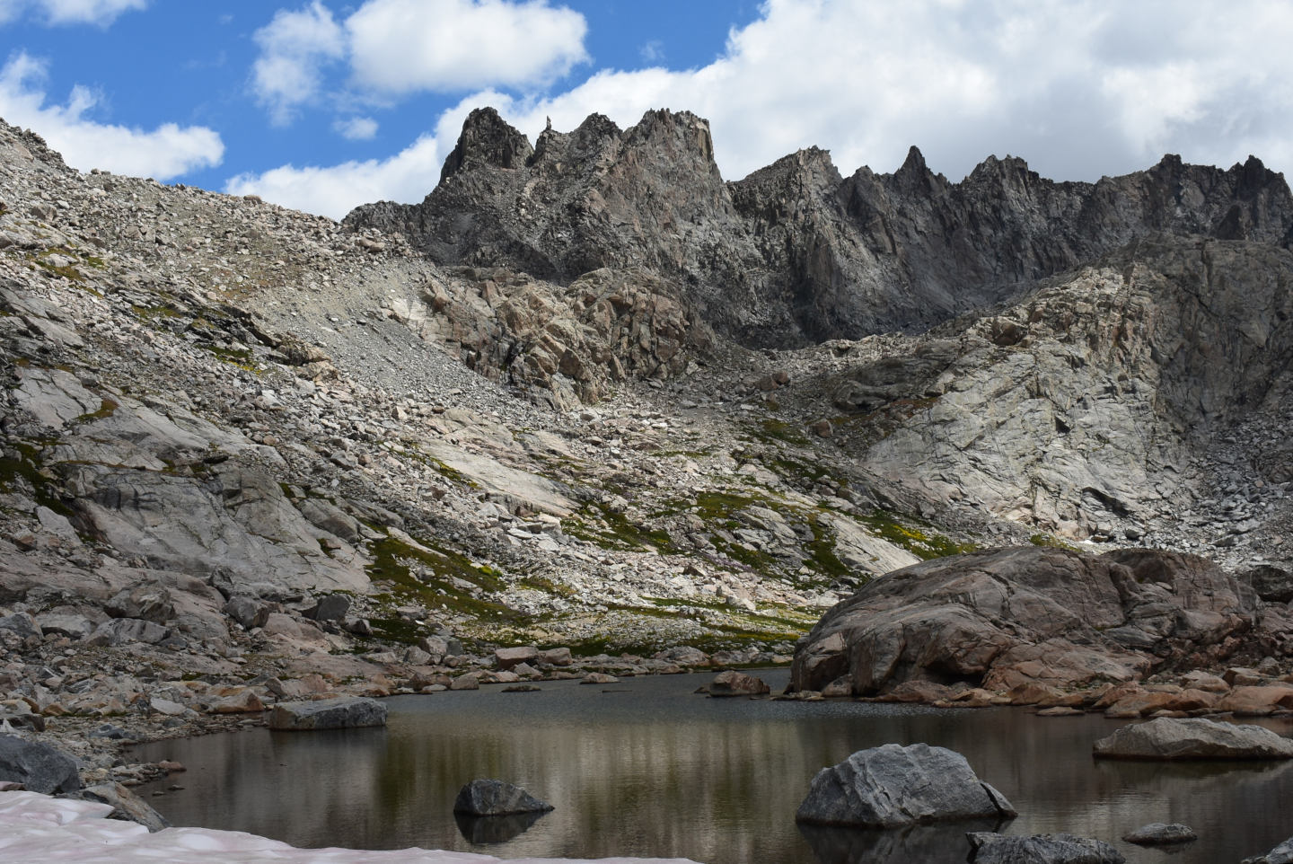
View to the east across Jackson Peak Pond with Knifepoint Mountain in the background. The snowbank I am standing on and flows off Jackson Peak has evidently kept the water cooler than all the other ponds I visited in Indian Basin.
Little Deep Pond (Pinedale Ranger District, Bridger-Teton National Forest; Bridger Wilderness)
Little Deep Pond is in the same topographic low as the south arm of Upper Indian Pass Lake, which is only 130 m (425′) away and 33.4 km (20 miles) northeast of Pinedale. In spite of its small size, only 50 m by 100 m (165′ x 330′) on the 7.5-minute topographic quadrangle, the pond looks deep, probably more than 300 cm (10′). The pond looked bigger to me than to the topographers. I estimated the size as 80 m x 120 m (260′ x 390′) in 2025. The pond bottom is sandy and rocky.
For access, see Lower Indian Pass Lake. The pond can be reached from the Indian Pass Trail by hiking over the low ridge south of Upper Indian Basin Lake.
Exposure Age: Little Deep Pond was likely exposed by 13,300 years ago, when the glacier melted off “Titcomb Lakes” (age recalculated by Dahms and others, 2018; excluding the 2 youngest ages, the mean of 7 boulder ages previously updated by Young and others, 2011b, was 13,000 years).
Elevation: 3,362 m (11,030′)
August 11, 2025
Lots of flowers and grass and some willows around this pond.
- 80 m x 120 m; depth greater than 300 cm.
- Clear greenish water; 13 C at 1130 in 5 cm water.
- No fairy shrimp.
- Abundant unusually large (1.5-2? mm) copepods, few mayfly larvae (Ephemeroptera), black diving beetles, caddisfly larvae (Trichoptera), small birds.
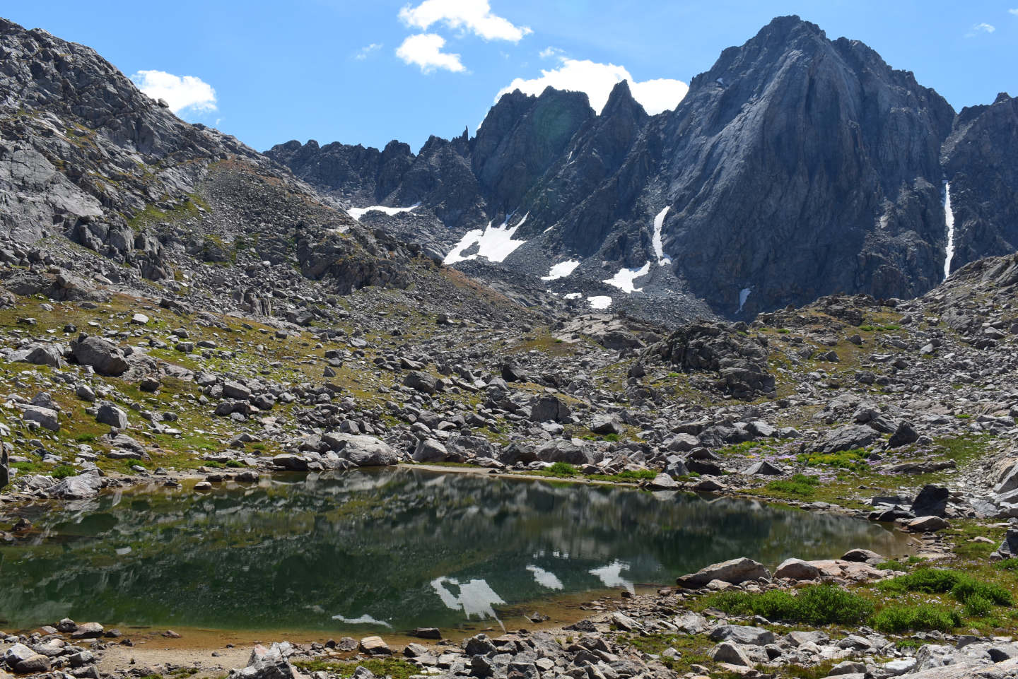
Little Deep Pond with Harrower Peak rising on the other side of the valley with Elephant Head Lake.
Upper Indian Pass Lake (WGF name) (Pinedale Ranger District, Bridger-Teton National Forest; Bridger Wilderness)
Upper Indian Pass Lake is about in the middle of Indian Basin and 33.4 km (20 miles) northeast of Pinedale. Like Lower Indian Pass Lake, the lake has an irregular shape but with a cross-like (+) form. Lengths of the arms of the cross are 440 m and 580 m (1,440′ x 1,900′) on the 7.5-minute topographic quadrangle. The widest one, the western arm, is about 130 m (425′) across. Upper Indian Pass Lake drains into Lower Indian Pass Lake. The connecting stream is flat, only about 200 m (660′) long, and could easily be traversed by fish. According to the Wyoming Game and Fish Department’s online map (https://wgfd.wyo.gov/fishing-boating/places-fish-wyoming and click on the link to the “Interactive Wyoming Fishing Guide”), neither lake has fish. The name Upper Indian Pass Lake was made up by WGF.
For access, see Lower Indian Pass Lake. The trail distance from Lower Indian Pass Lake to Upper Indian Pass Lake at the ford is less than 150 m (490′). The ford is easily crossed during low water, when numerous rocks are exposed. The Indian Pass Trail is on the western side of the lake.
Exposure Age: Upper Indian Pass Lake was likely exposed by 13,300 years ago, when the glacier melted off “Titcomb Lakes” (age recalculated by Dahms and others, 2018; excluding the 2 youngest ages, the mean of 7 boulder ages previously updated by Young and others, 2011b, was 13,000 years).
Elevation: 3,358 m (11,020′)
August 11, 2025
Access to the water from the Indian Pass Trail isn’t quite as easy here as it is at Lower Indian Pass Lake. I stopped at Little Deep Pond first so I visited the southern shore of this lake for a detailed look.
- Clear water; 13 C at 1215 in 5 cm water.
- Greenish 15-20 mm fairy shrimp.
- Mayfly larvae (Ephemeroptera), copepods, caddisfly larvae (Trichoptera), small birds.
I didn’t see as many aquatic animals or species of aquatic animals here as in Lower Indian Pass Lake but that is at least partly because I didn’t spend as much time looking. I also never saw any ducks on Upper Indian Pass Lake.
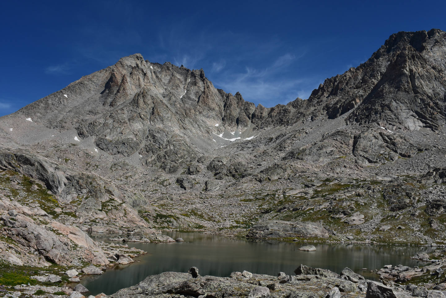
Looking north across Upper Indian Pass Lake from the south arm with Fremont Peak at left and Jackson Peak at right.
A fairy shrimp swimming near the bottom of Upper Indian Pass Lake. It is blurred due to the slow shutter speed (1/50 s).
Upper Sand Pond (Pinedale Ranger District, Bridger-Teton National Forest; Bridger Wilderness)
Upper and Lower Sand ponds are in a small, broad-bottomed valley on the west side of Indian Basin. Upper Sand Pond is 900 m (2,950′) northwest of Upper Indian Pass Lake, which is 33.4 km (20 miles) northeast of Pinedale. The lake has an elongate shape on the 7.5-minute topographic quadrangle with dimensions of 50 m by 100 m (165′ x 330′). On the ground, it now looks like it is fatter in the east-west direction, more like 100 m by 80 m (330′ x 260′). Considerable sand is exposed on the upstream side of the pond. This could account for shortening the length of the pond but not for widening it. Some change in the outlet might account for wider ponding of water.
For access, see Lower Indian Pass Lake. To reach the pond, head north from the Indian Pass Trail to the west side of Lower Indian Pass Lake before crossing the outlet of the lake. From the west side of Lower Indian Pass Lake, follow the valley up to Upper and Lower Sand Ponds. I saw a couple of hikers on this route and found pieces of an informal trail. It may be a route to Fremont Peak. In any case, it is a relatively easy climb to Upper Sand Pond although the first part of the ascent from the lake is steep. Alternatively, if descending Indian Pass Trail, continue west instead of turning south just north of Upper Indian Pass Lake. Enjoy the fields of subalpine daisy, paintbrush, elephantheads, and senecio on the hike over the low saddle to the valley with Upper Sand Pond. There are bits of what may be another route to Fremont Peak in this area.
Elevation: 3,407 m (11,180′)
August 11, 2025
I really didn’t expect to see all this sand in a high-elevation glacial terrain but such is my ignorance.
- 80 m x 100 m; depth greater than 200 cm.
- Clear water; 16 C at 1345 in 5 cm water.
- No fairy shrimp.
- Mayfly larvae and hatched mayflies (Ephemeroptera), caddisfly larvae (Trichoptera), black beetles, copepods or water mites less than 0.5 mm long, small birds.
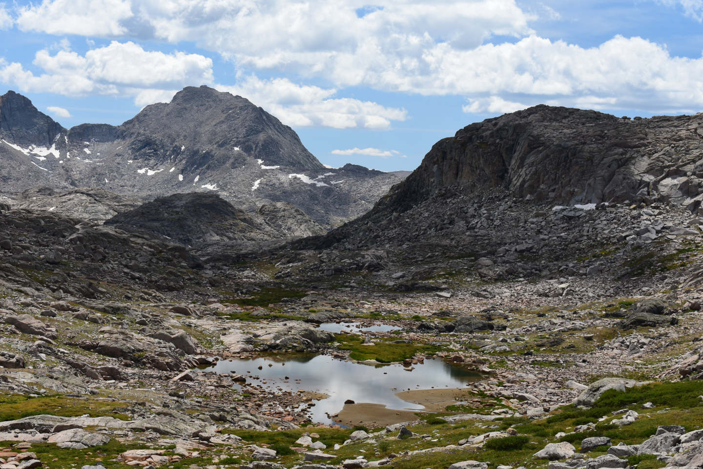
Upper Sand Pond with Lower Sand Pond barely visible a little farther down the valley. The peak in the distance may be Mt. Lester. Contrary to what is shown on the 7.5-minute topographic quadrangle, both ponds look wider than they are long. The sand is very noticeable in Upper Sand Pond.
A small beetle in Upper Sand Pond at center.
Lower Sand Pond (Pinedale Ranger District, Bridger-Teton National Forest; Bridger Wilderness)
Lower Sand Pond is a short distance downstream from Upper Sand Pond. It is about 850 m (2,460′) northwest of Upper Indian Pass Lake, which is about in the middle of Indian Basin and 33.4 km (20 miles) northeast of Pinedale. The lake has dimensions of 55 m by 65 m (180′ x 215′) on the 7.5-minute topographic quadrangle. As in the case of Upper Sand Pond, these dimensions don’t look quite right to me. I estimated 60 m by 80 m (200′ x 260′) in 2025 even though exposed water-stained rocks indicated water levels were lower than normal.
For access, see Lower Indian Pass Lake and Upper Sand Pond.
Elevation: 3,406 m (11,175′)
August 11, 2025
This looks almost like a bog of shallow water with lots of rocks sticking up. Nonetheless, there are deep spots.
- 60 m x 80 m; depth greater than 200 cm.
- Clear water; 16 C at 1415 in 3 cm water.
- No fairy shrimp
- Mayfly larvae (Ephemeroptera), caddisfly larvae (Trichoptera), wrigglers less than 5 mm long, small birds.
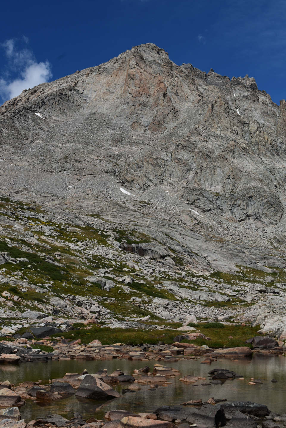
Lower Sand Pond and Fremont Peak to the north. Vegetation on the far side of the pond may have shortened its length since the aerial photographs for the 7.5-minute quadrangle were taken in 1966.
Indian Basin 11218 Pond (Pinedale Ranger District, Bridger-Teton National Forest; Bridger Wilderness)
Indian Basin 11218 Pond is 975 m (2,460′) south-southwest of Upper Indian Pass Lake near the lower, southwestern end of Indian Basin. Upper Indian Pass Lake is about 33.4 km (20 miles) northeast of Pinedale. On the 7.5-minute topographic quadrangle, the pond is 30 m by 80 m (100′ x 260′). The pond is immersed in a field of boulders. Indian Basin 11218 Pond is 275 m (900′) northeast of peak 11,218 (3,420 m).
For access, see Lower Indian Pass Lake. Indian Basin 11218 Pond is 370 m southeast of the Indian Pass Trail at its closest approach to Indian Basin First Pond but is not visible from the trail. You could hike over the small rise southeast of Indian Basin First Pond or hike up a relatively gentle slope due south from the ford of the Lower Indian Pass Lake outlet.
Exposure Age: Indian Basin 11,218 Pond could have been exposed by 13,300 years ago, when the glacier melted off “Titcomb Lakes” (age recalculated by Dahms and others, 2018; excluding the 2 youngest ages, the mean of 7 boulder ages previously updated by Young and others, 2011b, was 13,000 years). If not, it was exposed at some time before 11,750 years ago, when the glacier in Cirque of the Towers retreated off a moraine on the southern slope (Dahms and others, 2018).
Elevation: 3,355 m (11,000′)
August 11, 2025
No sand here, there’s nothing but big rocks.
- 30 m x 80 m (same as, but estimated independently of, map); depth greater than 200 cm.
- Clear, slightly greenish water; 15 C at 1545 in 5 cm water.
- Greenish fairy shrimp 20-25 mm long; no eggs.
- Common 1.5 mm copepods, black beetles about 5 mm long, caddisfly larvae (Trichoptera).
This is one of the few ponds in Indian Basin where I didn’t see mayfly larvae. I also didn’t see bird poop on the rocks.
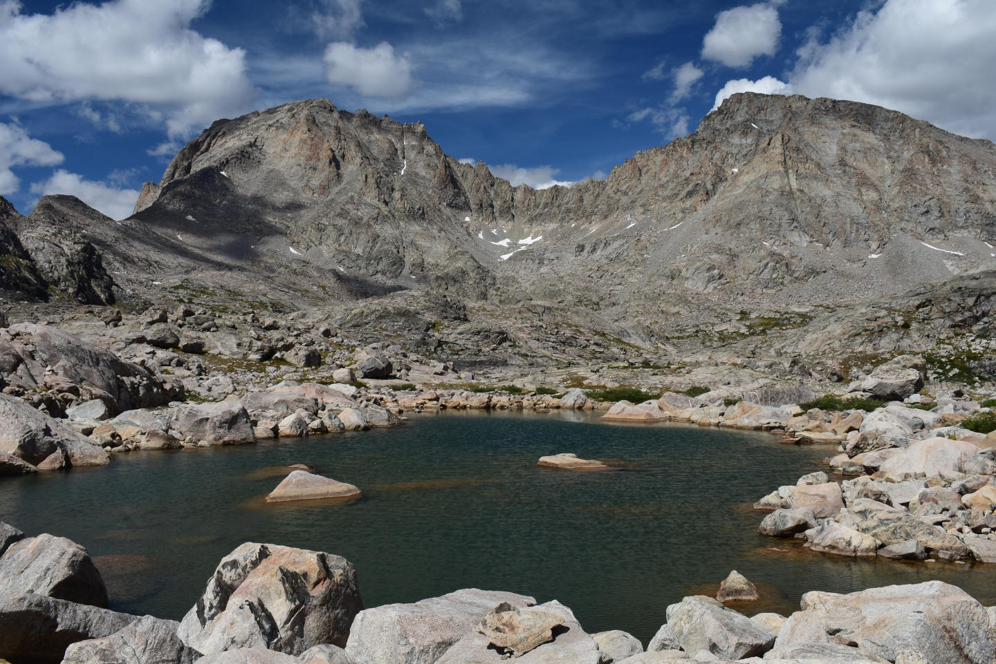
Indian Basin 11218 Pond. Fremont Peak is in the distance at left and Jackson Peak is at right. What a day!
Looking down a sloped rock surface in Indian Basin 11218 Pond at a few fairy shrimp and several copepods. There is considerable depth in this photograph. Only the shallower animals are in focus.
Indian Basin First Pond (Pinedale Ranger District, Bridger-Teton National Forest; Bridger Wilderness)
Indian Basin First Pond is 950 m (2,460′) southwest of Upper Indian Pass Lake, which is 33.4 km (20 miles) northeast of Pinedale. The pond has a sausage-like shape of 50 m by 175 m (165′ x 575′) on the 7.5-minute topographic quadrangle. The pond is in a relatively flat area at the southwestern edge of Indian Basin before a steep drop to the area north of “Island Lake”. It is the first pond encountered by those hiking up the Indian Pass Trail from the junction with the “Titcomb Lakes” Trail.
For access, see Lower Indian Pass Lake. Indian Basin First Pond is immediately north of the Indian Pass Trail where it enters Indian Basin.
Exposure Age: Indian Basin First Pond was likely exposed by 13,300 years ago, when the glacier melted off “Titcomb Lakes” (age recalculated by Dahms and others, 2018; excluding the 2 youngest ages, the mean of 7 boulder ages previously updated by Young and others, 2011b, was 13,000 years).
Elevation: 3,353 m (11,000′)
August 11, 2025
After finding fairy shrimp in Indian Basin 11218 Pond, I was optimistic about this one.
- 50 m x 175 m (based on 7.5-minute quadrangle); depth greater than 200 cm.
- Clear water; 15 C at 1630 in 5 cm water.
- No fairy shrimp.
- 1.5 mm copepods, black beetles, very small rare water boatmen (sub-order Heteroptera, family Corixidae), caddisfly larvae.
Like Indian Basin 11218 Pond, this pond also seems to lack mayfly larvae.
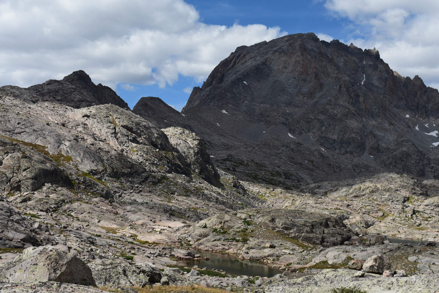
Indian Basin First Pond from well above the Indian Pass Trail and a shadowed Fremont Peak. Part of Lower Indian Pass Lake is barely visible at right.
A water boatman in Indian Basin First Pond that is so small it is almost unrecognizable. But it does have long legs sticking out to the sides.
Elephant Head Lake (WGF name) (Pinedale Ranger District, Bridger-Teton National Forest; Bridger Wilderness)
Elephant Head Lake is in a steep-walled valley below Harrower Peak and Elephant Head. Water also cascades down from Lower Indian Pass Lake. The lake is at least 50 m (165′) lower than the rest of Indian Basin. Elephant Head Lake is 930 m (3,050′) southwest of Upper Indian Pass Lake (point on northern shore from point on southern shore). Upper Indian Pass Lake is 33.4 km (20 miles) northeast of Pinedale. Elephant Head Lake is 1,100 m long on the 7.5-minute topographic quadrangle and lenticular but with an extra bulge in the middle that is about 400 m wide (1,310′ x 3,610′). Elephant Head Lake is 800 m (2,620′) north of the summit of Elephant Head and was named by WGF.
For access, see Lower Indian Pass Lake. The Indian Pass Trail turns sharply south on the east side of the ford of the outlet of Lower Indian Pass Lake to swing around a rocky knob before turning north and reaching the shore of Lower Indian Pass Lake. However, an informally marked trail turns north across the ford and crosses rock to reach Lower Indian Pass Lake. To reach Elephant Head Lake, turn south on the established trail on the east side of the ford. When you can see grassy slopes below you before the trail turns back to the north, pick your own way down to Elephant Head Lake. The descent is rather steep but the footing is good.
Exposure Age: Elephant Head Lake was likely exposed by 13,300 years ago, when the glacier melted off “Titcomb Lakes” (age recalculated by Dahms and others, 2018; excluding the 2 youngest ages, the mean of 7 boulder ages previously updated by Young and others, 2011b, was 13,000 years).
Elevation: 3,302 m (10,830′)
August 11, 2025
Elephant Head Lake is the largest in Indian Basin areally and even more so volumetrically, as the steep bordering topography suggests it is quite deep. Although lower than the rest of Indian Basin, the shore is still treeless.
- 400 m x 1,100 m (based on 7.5-minute quadrangle); depth greater than 300 cm.
- Clear water; 15 C at 1715 in 5 cm water.
- No fairy shrimp.
- Lots of 1.5 mm copepods, locally abundant 1-1.5 mm ostracods, mayfly larvae (Ephemeroptera), caddisfly larvae (Trichoptera), possibly amphipods, ducks, small birds.
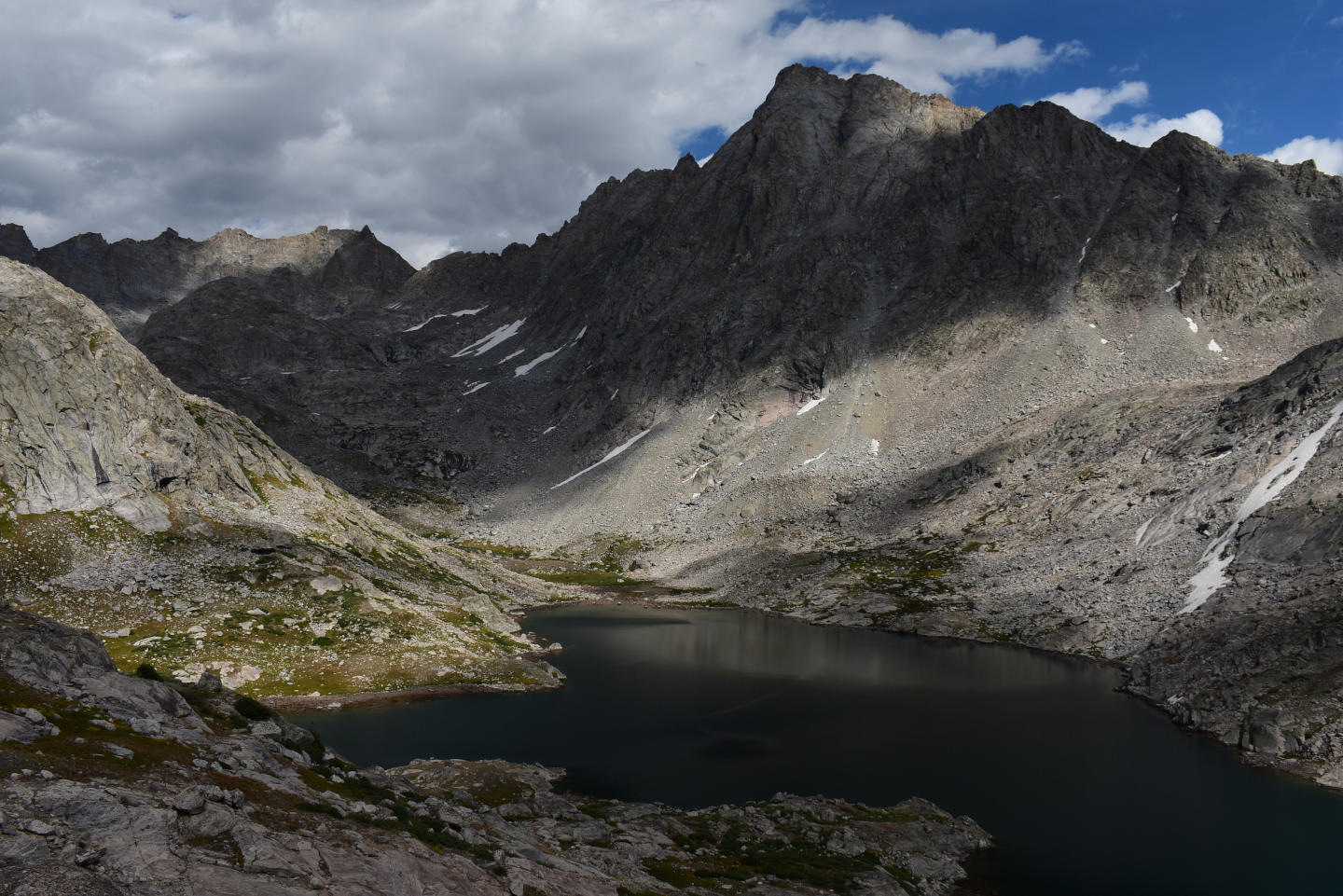
View up the valley with Elephant Head Lake. Harrower Peak is at right and Knifepoint Mountain is in the distance at left.
Lots of tiny animals in Elephant Head Lake. The red animals that are more symmetric lengthwise and widthwise are likely ostracods. Their shiny reflections appear to be due to shells. The shells are translucent as darker and lighter features can be seen within the shells. The other animals are black and lengthwise symmetric but they are wider at one end and tapered at the other end. They are likely copepods.
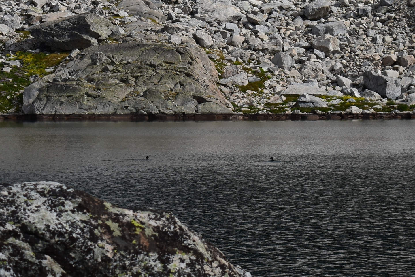
2 ducks in Elephant Head Lake. The presence of ducks here without fairy shrimp or much aquatic invertebrate diversity could disprove my hypothesis about the association of ducks with aquatic diversity and fairy shrimp colonization at Lower Indian Pass Lake. However, the large size of Elephant Head Lake may necessitate more thorough sampling than walking along a small part of the shoreline for 40 minutes or so.
Sand and Boulder Pond (Pinedale Ranger District, Bridger-Teton National Forest; Bridger Wilderness)
Sand and Boulder Pond is at the east end of a broad boggy, but rocky, area that has Jackson Peak Pond at the west end. The elevation difference between the 2 is less than 5 m (16′). It is 1,110 m (3,640′) northeast of the southern shore of Upper Indian Pass Lake, which is about in the middle of Indian Basin and 33.4 km (20 miles) northeast of Pinedale. On the 7.5-minute topographic quadrangle, Sand and Boulder Pond has dimensions of 30 m by 50 m (100′ x 165′). On my 2025 visit, I thought it was slightly larger – 40 m by 50 m (130′ x 165′). Sand and Boulder Pond is surrounded and underlain by abundant sand and boulders and a paucity of rocks of intermediate sizes.
For access, see Lower Indian Pass Lake. Continue up the Indian Pass Trail past Jackson Peak Pond. From there, you could angle off to the southeast and avoid most of the boggy area. Or, you could follow the trail across the boggy area, which has plenty of rocks and turf hummocks for stepping “stones”, but turn south to the pond before starting up the steep climb to Indian Pass.
Exposure Age: Glacial ice melted off Sand and Boulder Pond between 13,300 years ago, when “Titcomb Lakes” were exposed (age recalculated by Dahms and others, 2018; excluding the 2 youngest ages, the mean of 7 boulder ages previously updated by Young and others, 2011b, was 13,000 years), and 11,750 years ago, when the glacier in Cirque of the Towers retreated off a moraine on the southern slope (Dahms and others, 2018).
Elevation: 3,492 m (11,460′)
August 12, 2025
Given the lack of fairy shrimp in Jackson Peak Pond, this one didn’t look promising. But I had the time. WIDLA
- 40 m x 50 m; less than 150 cm deep.
- Clear water; 14 C at 1630 in 5 cm water.
- Translucent, pale gray fairy shrimp 10-15 mm long; no eggs.
- Few 10 mm mayfly larvae (Ephemeroptera) (maybe most already hatched), small birds.
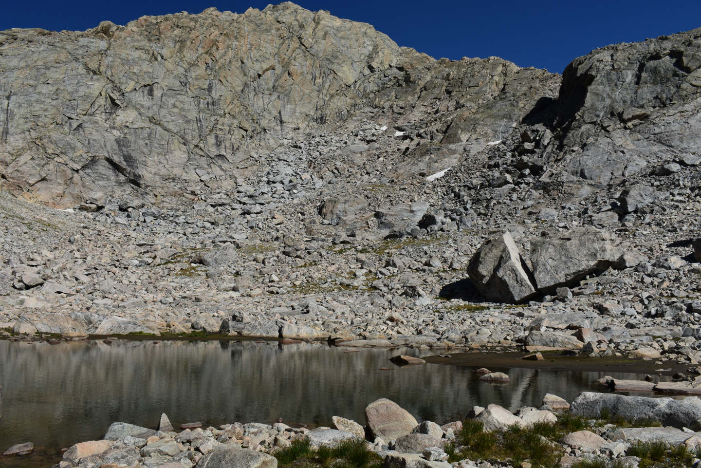
Looking north across the east end of Sand and Boulder Pond. The Indian Pass Trail climbs up the slope in the background from left to right.
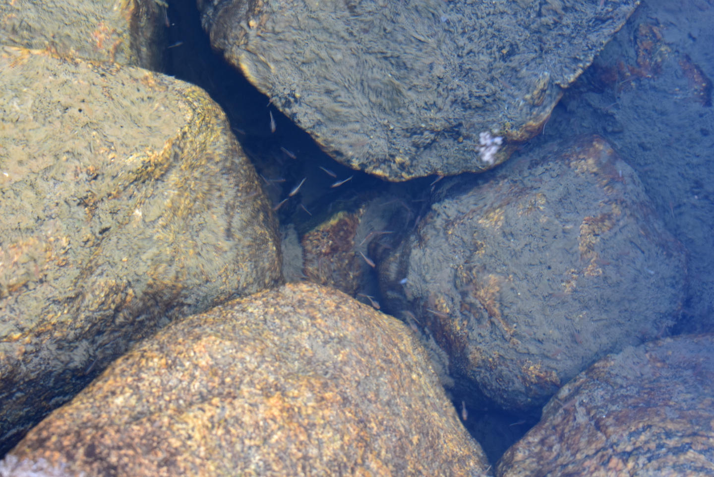
Several fairy shrimp swimming between the boulders in Sand and Boulder Pond.
Sand and Boulder Pond Fairy Shrimp Video 2025-08-12b-rmq
For a 1-minute, 11-seconds video of fairy shrimp swimming between boulders in Sand and Boulder Pond, click on the video player above. There is no audio. These fairy shrimp are a little shorter than those in Lower Indian Pass Lake and may have hatched later due to the higher elevation resulting in cooler temperatures. The swimming behavior does not appear to differ, in general, from that in Lower Indian Pass Lake. I didn’t notice any distinctive behaviors or other species in the video.
Sand and Boulder Pond Fairy Shrimp Video 2025-08-12c-rrmq
For a 3-minute, 18-seconds video of fairy shrimp swimming in deep water in Sand and Boulder Pond with both sun and shadow, click on the video player above. There is no audio. The fairy shrimp are more common at this location than at the location of Sand and Boulder Pond Fairy Shrimp Video 2025-08-12b-rmq. Most fairy shrimp are swimming well below the surface and those close to the surface are out-of-focus smudges. Curved swimming paths are more common than straight ones, even over the short distances for which most fairy shrimp remain visible. Possible exceptions are a fairy shrimp swimming toward the bottom near the center of view at 1:53-1:56, another one at 2:21-2:25 doing the same thing, and a third swimming in the opposite direction at 2:39-2:42.
The pond bottom in the sun appears to be partially covered by sheets of something that could be a bacterial or cyanobacterial mat. Unlike the Branchinecta paludosa in the Arctic that ate cyanobacterial mats (Rautio and others, 2009), those here aren’t seen feeding on the pond bottom.
Green Island Pond (Pinedale Ranger District, Bridger-Teton National Forest; Bridger Wilderness)
Green Island Pond is 170 m (560′) south of, and down hill from, Jackson Peak Pond and is fed by its outlet. The pond is 810 m (2,460′) northeast of the southern shore of Upper Indian Pass Lake. Green Island Pond has dimensions of 80 m by 150 m (260′ x 490′) on the 7.5-minute topographic quadrangle. Like other lakes and ponds in Indian Basin, its bottom has both abundant sand and abundant large rocks. What makes Green Island Pond distinctive is that is has a low island of sand with a thick cover of green grass.
For access, see Lower Indian Pass Lake. If going up the the Indian Pass Trail, follow it past the north end of Upper Indian Pass Lake. Before reaching Jackson Peak Pond, head down hill from the trail when you see the pond. If going down the Indian Pass Trail, follow it past Jackson Peak Pond and then pick your route down the grassy slope to the pond.
Elevation: 3,472 m (11,390′)
August 12, 2025
Jackson Peak Pond didn’t have fairy shrimp. Sand and Boulder Pond, which is farther upstream did. What about here?
- 80 m x 150 m (based on 7.5-minute quadrangle); depth greater than 300 cm.
- Clear water; 15 C at 1715 in 5 cm water.
- No fairy shrimp.
- Abundant mayfly larvae (Ephemeroptera), few caddisfly larvae (Trichoptera).
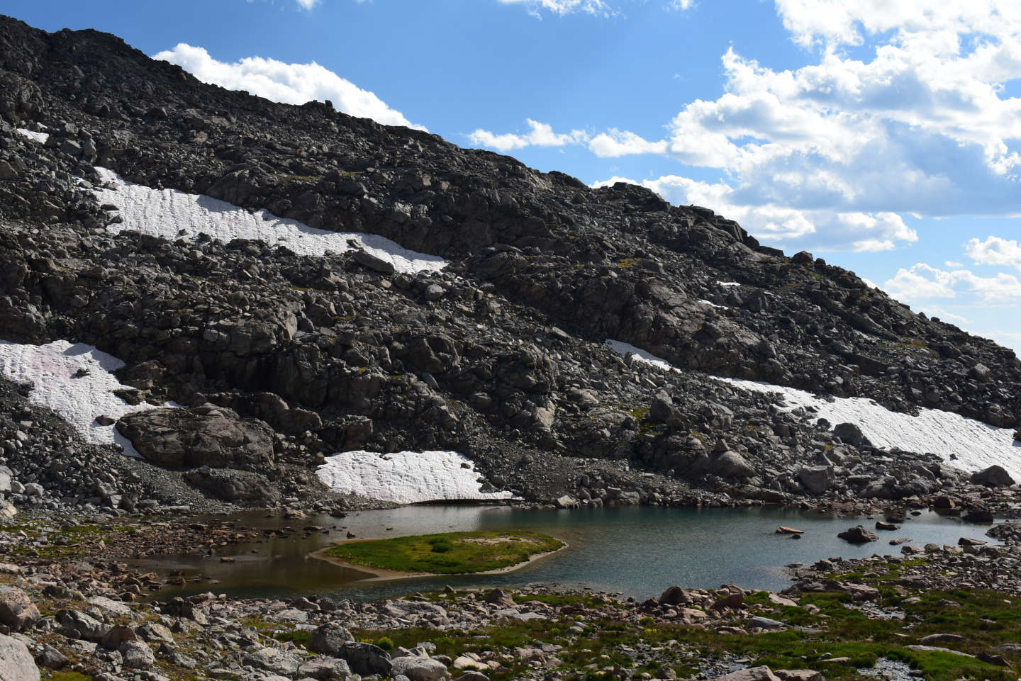
View to the south across Green Island Pond. There are still some snowbanks in the shady spots south of the pond.
“Island Lake” Pond #1 (Pinedale Ranger District, Bridger-Teton National Forest; Bridger Wilderness)
“Island Lake” Pond #1 is 1,250 m (4,100′) northwest of the northeastern corner of “Island Lake”, which is 30.5 km (18 miles) northeast of Pinedale. It is about 250 m (820′) northwest of the shore of lake 10467 and less than half that distance west of the lake above lake 10467. It is not shown on the 7.5-minute topographic quadrangle. It’s just a small pond I came across on my way from the “Titcomb Lakes” Trail to “Island Lake” Pond #2.
For access, see “Island Lake” Pond #2. “Island Lake” Pond #1 is on the northeast side of the small hill west of the lake above lake 10467 before the ascent to “Island Lake” Pond #2.
Exposure Age: “Island Lake” Pond #1 was exposed before 13,300 years ago, when the glacier melted off “Titcomb Lakes” (age recalculated by Dahms and others, 2018; excluding the 2 youngest ages, the mean of 7 boulder ages previously updated by Young and others, 2011b, was 13,000 years) but probably more recently than 16,300 years ago (Young and others, 2011b), the youngest exposure age of boulders from recessional moraines up valley from the terminal Pinedale moraine.
Elevation: 3,211 m (10,530′)
August 13, 2025
Because “Island Lake” and “Titcomb Lakes” have been stocked with fish, any water bodies connected to those lakes also have fish. Some of the other lakes in the area have also been stocked. However, there are ponds in the area that don’t have inlets or outlets on the 7.5-minute topographic map and most likely don’t have fish. I decided to visit a few north of the west end of “Island Lake”.
- 15 m x 30 m; depth uncertain but less than 200 cm.
- Clear water; 19 C at 1415 in 5 cm water.
- No fairy shrimp.
- Water boatmen (sub-order Heteroptera, family Corixidae), black beetles, caddisfly larvae.
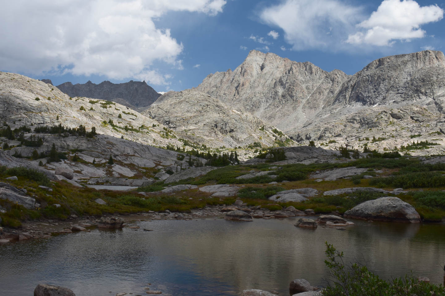
Looking east across “Island Lake” Pond #1. Water in the middle distance at left is the lake north of lake 10467. The peak at center might be Harrower Peak with Elephant Head to the right.
“Island Lake” Pond #2 (Pinedale Ranger District, Bridger-Teton National Forest; Bridger Wilderness)
___This map is a screenshot of The National Map (Go to The National Map). The U.S. Geological Survey generally does not copyright or charge for its data or reports (unless printed). A pond location is indicated by an “X”, which corresponds to the coordinates given in the data spreadsheet. Labels in quotations are from 7.5-minute topographic quadrangles.
___As of April 2025, the National Grid overlay with red lines in UTM coordinates does not load in The National Map.
___There is no private or state land on this map. All the lands are public.
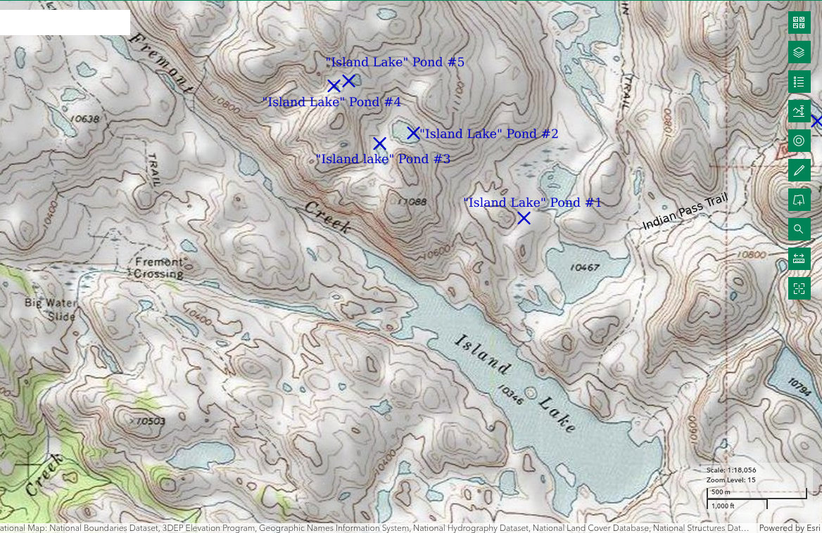
“Island Lake” Pond #2 is 1,900 m (6,230′) northwest of the northeastern corner of “Island Lake”, which is 30.5 km (18 miles) northeast of Pinedale. It is 100 m by 160 m (330′ x 525′) on the 7.5-minute topographic quadrangle. It has an outlet creek that is not shown on the topographic map. Thunderstorm activity distracted me from thinking up relevant names so this pond is just #2 in the vicinity of “Island Lake” and the 4 others are also numbered ponds.
For access, see Lower Indian Pass Lake. Before turning off the trail to “Titcomb Lakes” to go up toward Indian Pass, turn west and descend to the northeastern corner of lake 10467. I found a dry crossing of the creek there in 2025 but that may not always be the case. Continue along the north shore of lake 10467 and ford the creek from the north that drains “Titcomb Lakes”. Again, I found a dry crossing on rocks but that may not always be the case. Head northwest from the creek around the north side of a small hill and ascend the obvious valley coming down the mountain from Pond #2.
Exposure Age: “Island Lake” Pond #2 was exposed before 13,300 years ago, when the glacier melted off “Titcomb Lakes” (age recalculated by Dahms and others, 2018; excluding the 2 youngest ages, the mean of 7 boulder ages previously updated by Young and others, 2011b, was 13,000 years) but probably more recently than 16,300 years ago (Young and others, 2011b), the youngest exposure age of boulders from recessional moraines up valley from the terminal Pinedale moraine.
Elevation: 3,317 m (10,880′)
August 13, 2025
The search of Indian Basin proved to be productive but now it’s time to try a few other ponds. The ponds north of “Island Lake” don’t benefit from close proximity to the ducks and aquatic diversity of Lower Indian Pass Lake but they could still have fairy shrimp, like some other ponds scattered across the Wind River Mountains.
- 100 m x 160 m (based on 7.5-minute quadrangle); depth greater than 300 cm.
- Clear water; 14 C at 1500 in 5 cm water.
- Rare fairy shrimp about 20 mm long; no eggs.
- Caddisfly larvae (Trichoptera), there are discarded mayfly larvae (Ephemeroptera) exoskeletons on the surface of the water but I didn’t see any live larvae.
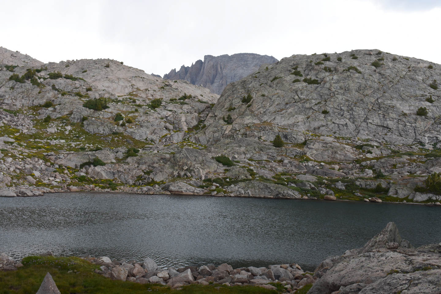
“Island Lake” Pond #2, looking north.
There is a recognizable fairy shrimp in “Island Lake” Pond #2 at center although it is blurred and out-of-focus.
“Island Lake” Pond #3 (Pinedale Ranger District, Bridger-Teton National Forest; Bridger Wilderness)
“Island Lake” Pond #3 is just 75 m (250′) west of “Island Lake” Pond #2 (shore to shore). The pond is also about 2,000 m (6,560′) northwest of the northeastern corner of “Island Lake”. Pond dimensions are 50 m by 110 m (165′ x 360′) on the 7.5-minute topographic quadrangle but looked larger on the ground in 2025. It looked almost as big as Pond #2. Maybe there is something about the rocky landscapes that distorts my perspective but I’ll call it 80 m by 140 m (260′ x 460′). “Island Lake” Pond #3 is 250 m north of peak 11088 (3,380 m).
For access, see “Island Lake” Pond #2. “Island Lake” Pond #3 is a short walk to the southwest.
Exposure Age: “Island Lake” Pond #3 was exposed before 13,300 years ago, when the glacier melted off “Titcomb Lakes” (age recalculated by Dahms and others, 2018; excluding the 2 youngest ages, the mean of 7 boulder ages previously updated by Young and others, 2011b, was 13,000 years) but probably more recently than 16,300 years ago (Young and others, 2011b), the youngest exposure age of boulders from recessional moraines up valley from the terminal Pinedale moraine.
Elevation: 3,322 m (10,900′)
August 13, 2025
The thunderstorm shower was surprisingly brief with no close lightning. Time to continue the search.
- 80 m x 140 m; depth greater than 300 cm.
- Clear greenish water; 13 C at 1600 in 5 cm water.
- No fairy shrimp.
- Unusually common amphipods up to 20 mm, 1.5 mm copepods, caddisfly larvae (Trichoptera).
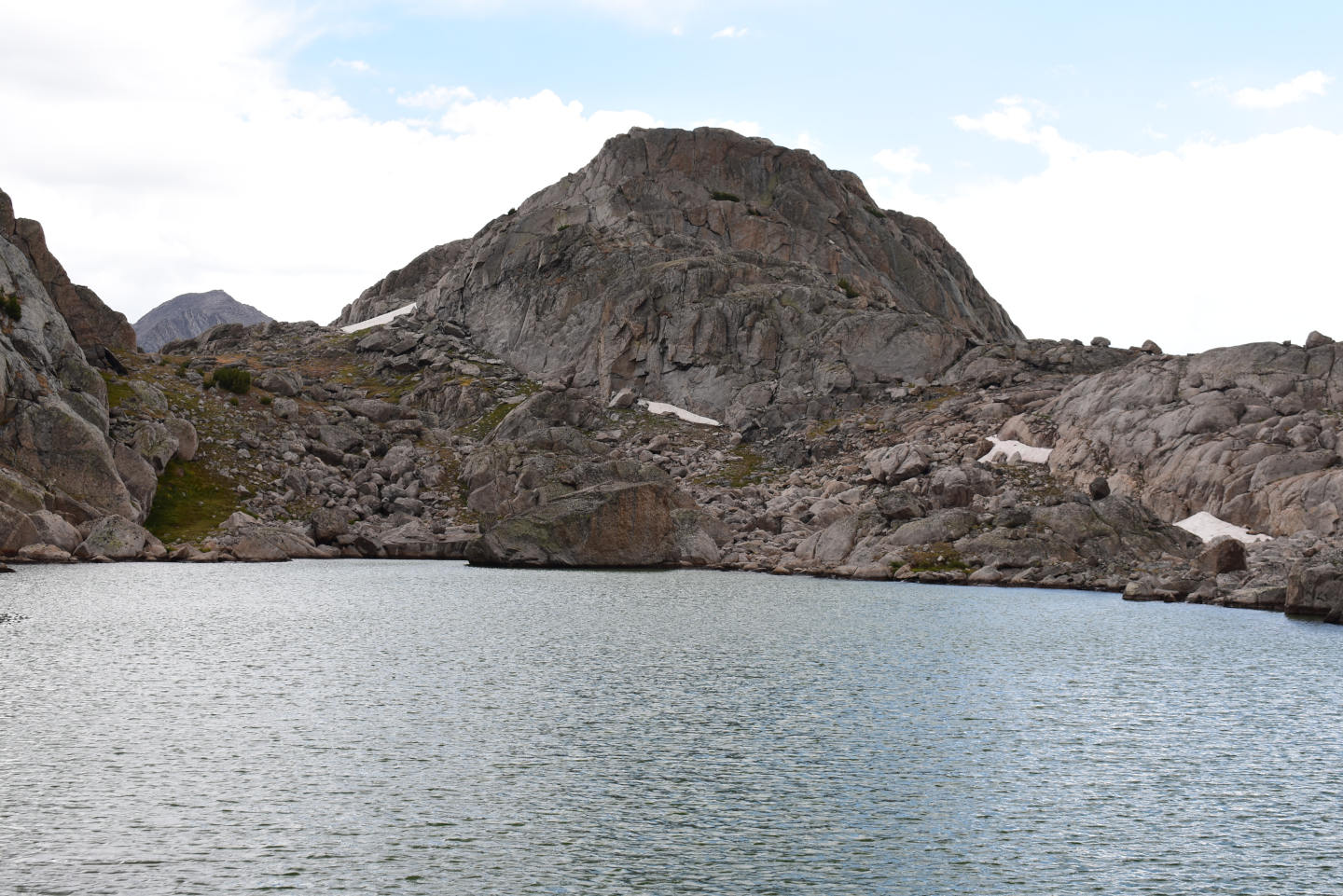
“Island Lake” Pond #3, with peak 11088 on the far side to the south.
“Island Lake” Pond #4 (Pinedale Ranger District, Bridger-Teton National Forest; Bridger Wilderness)
“Island Lake” Pond #4 is 2,350 m (7,710′) northwest of the northeastern corner of “Island Lake”. It is a small pond, almost too small to show on the topographic map. Even so, the 7.5-minute topographic map shows it with dimensions of 12 m x 25 m (40′ x 80′). As did “Island Lake” Pond #3, “Island Lake” Pond #4 looks larger on the ground, maybe 20 m by 40 m (65′ x 130′).
For access, see “Island Lake” Pond #3. The climb northwest from “Island Lake” Pond #3 is relatively easy with a grassy slope near the bottom of the steep section of rock on the west side of the slope above “Island Lake” Pond #3.
Exposure Age: “Island Lake” Pond #4 was exposed before 13,300 years ago, when the glacier melted off “Titcomb Lakes” (age recalculated by Dahms and others, 2018; excluding the 2 youngest ages, the mean of 7 boulder ages previously updated by Young and others, 2011b, was 13,000 years) but probably more recently than 16,300 years ago (Young and others, 2011b), the youngest exposure age of boulders from recessional moraines up valley from the terminal Pinedale moraine.
Elevation: 3,373 m (11,070′)
August 13, 2025
Because I started up the hill from the west side of Pond #3, I got to Pond #4 before Pond #5. Not only was the thunderstorm surprisingly brief, the sun came out again surprisingly quickly. So now I’m looking down on a small, sunny, slightly greenish, tranquil-looking pond in a little basin all by itself. It’s relatively deep and could be a nice home for fairy shrimp.
- 20 m x 40 m; depth greater than 300 cm.
- Clear, slightly greenish water; 13 C at 1700 in 5 cm water.
- No fairy shrimp.
- 1.5 mm copepods, caddisfly larvae (Trichoptera).
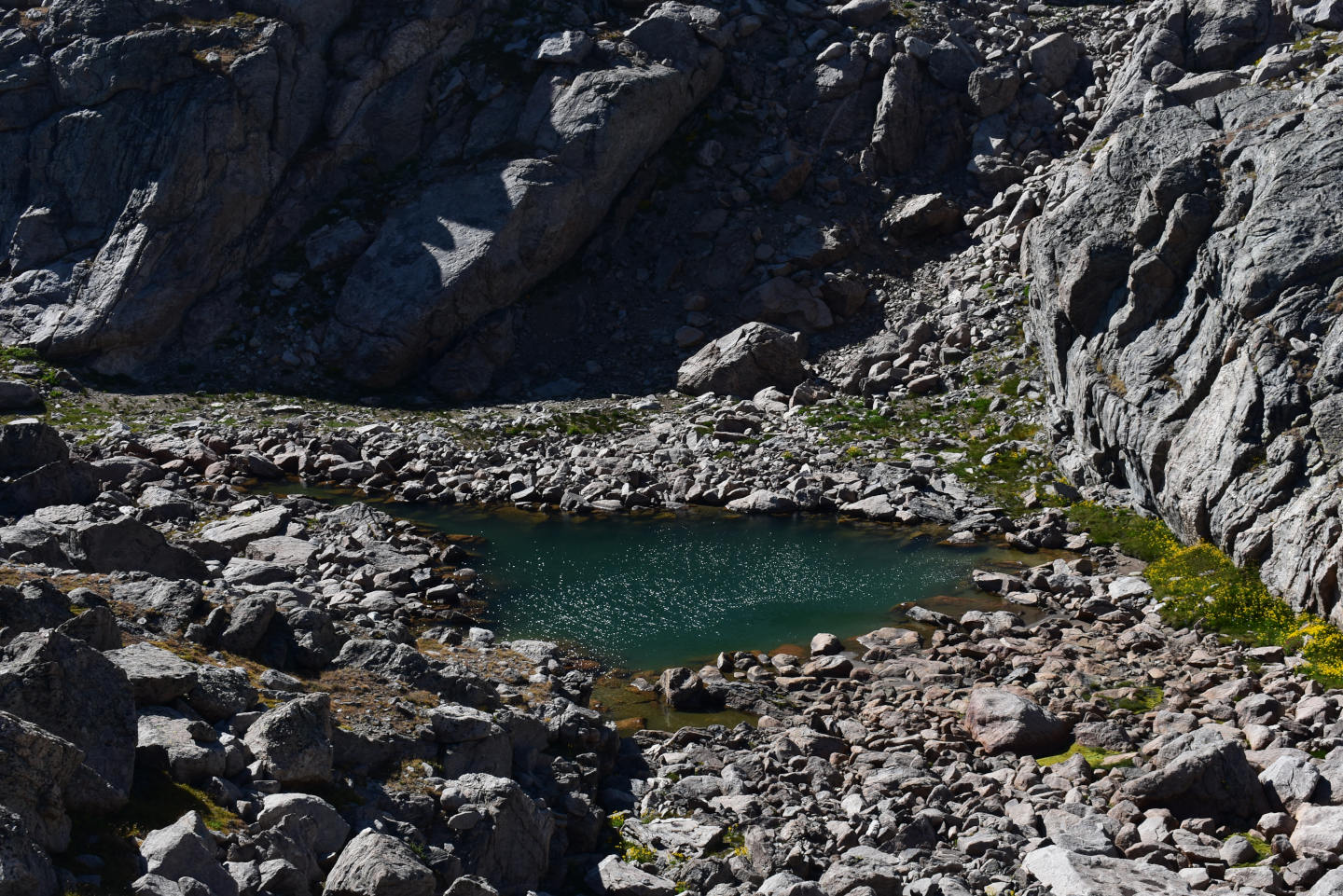
Looking down to the northwest on “Island Lake” Pond #4.
“Island Lake” Pond #5 (Pinedale Ranger District, Bridger-Teton National Forest; Bridger Wilderness)
“Island Lake” Pond #5 is only about 65 m (210′) east of “Island Lake” Pond #4. It is 2,320 m (7,610′) northwest of the northeastern corner of “Island Lake”, which is 30.5 km (18 miles) northeast of Pinedale. “Island Lake” Pond #5 is 50 m by 60 m (165′ x 200′) on the 7.5-minute topographic quadrangle. It looked a little bigger and a little rounder to me in 2025 but I won’t quibble about this one.
For access, see “Island Lake” Pond #4. “Island Lake” Pond #5 is east of “Island Lake” Pond #4 over a steep little hill.
Exposure Age: “Island Lake” Pond #5 was exposed before 13,300 years ago, when the glacier melted off “Titcomb Lakes” (age recalculated by Dahms and others, 2018; excluding the 2 youngest ages, the mean of 7 boulder ages previously updated by Young and others, 2011b, was 13,000 years) but probably more recently than 16,300 years ago (Young and others, 2011b), the youngest exposure age of boulders from recessional moraines up valley from the terminal Pinedale moraine.
Elevation: 3,380 m (11,090′)
August 13, 2025
It seems like the higher I go, the more boulders there are but getting around is not yet difficult. Fairy shrimp don’t have a problem with boulders. Here’s one more chance.
- 50 m x 60 m (based on 7.5-minute quadrangle); depth greater than 300 cm.
- Clear water; 13 C at 1715 in 4 cm water.
- Translucent, pale gray fairy shrimp 20-25 mm long; no eggs.
- 1.5 mm copepods, unusually short caddisfly larvae cases less than 10 mm.
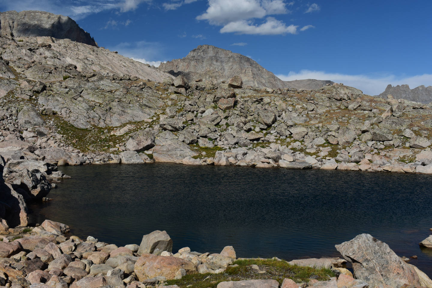
Looking northeast across “Island Lake” Pond #5. With the blue sky, you can’t even tell there was a thunderstorm. The rocks aren’t even wet.
A couple of fairy shrimp swimming in the shadow between boulders in “Island Lake” Pond #5.
What Can We Learn from the Ponds in the Wind River Mountains?
All the ponds and lakes of the Wind River Mountains, including lower elevation lakes like “Fremont Lake” and “Green River Lakes”, were covered by glaciers 25,000 years ago. Glacial ice melted off terminal Pinedale moraines, such as the one around “Fremont Lake”, about 24,000 years ago. It took about 12,000 years for almost all the ice to melt. A minority of Wind River Mountains ponds have been available for colonization by fairy shrimp for 15,500 years, the vast majority for 13,300 years, and a few of the highest or most shadowed ponds for only 11,750 years.
Fish-stocking has made the vast majority of lakes and many ponds in the Wind River Mountains uninhabitable by fairy shrimp. That still leaves hundreds of ponds and several lakes as potential fairy shrimp habitat. 78% of the wet ponds I recorded have maximum dimensions less than 155 m (510′) (a circle with a radius of 155 m is 7.5 hectares, 19 acres) and the median is 80 m (260′) (a circle with a radius of 80 m is 2.0 hectares, 5.0 acres). This is not representative of the pond size distribution in the Wind River Mountains, whatever it is. Other than 2 ponds below 2,500 m (8,200′), the elevation range of visited ponds is 3,072-3,492 m (10,080-11,460′). The median is 3,251 m (10,665′). This is also not representative of the elevations of all Wind River Mountains ponds. Except for the visits to the 2 lower elevation ponds, all of the visits were in August or early September. August is a good time to visit because by then any fairy shrimp are likely to be longer than about 15 mm. Fairy shrimp in several ponds in the southern Wind River Mountains were sexually mature, as determined by the presence of eggs, before the third week in August. Those in the slightly higher ponds in the central Wind River Mountains in 2025 were not.
In my haphazard, non-random searches for fairy shrimp, I found fairy shrimp in 29 (28%) ponds of 103 ponds (excluding 3 that were dry). These results are biased by my tendency to not record ponds where I did not see fairy shrimp. In 2 cases where I recorded every pond visited, 16% of Medina Mountain ponds and 10% of the Wind River Peak ponds had fairy shrimp. Of 16 ponds visited in fish-free Indian Basin and near “Island Lake”, 6 (38%) had fairy shrimp.
Fairy shrimp were found in 4 moderately large water bodies: “Island Lake” Pond #2 (100 m x 160 m, 330′ x 525′), Bivouac Lake (100 m x 190 m, 330′ x 620′), Upper Indian Pass Lake (440 m x 580 m, 1,440′ x 1,900′), and Lower Indian Pass Lake (500 m x 680 m, 1,640′ x 2,230′). This indicates that moderately large pond sizes do not somehow prevent colonization by fairy shrimp, such as by impeding the ability of males and females to find each other for mating. The implication is that most lakes now occupied by fish could have been previously occupied by fairy shrimp.
Of the specimens I collected from alpine habitats, DB identified only the species Branchinecta coloradensis. After the first specimens from Bivouac Lake had been identified, I usually made an effort to see if newly discovered fairy shrimp looked like those in Bivouac Lake based on observations using a binocular microscope or a 10X magnifying glass. It appeared to me that the following 13 other ponds also had B. coloradensis.
- Boulder Bog Pond
- Cinquefoil Pond
- “Coon Lake” South Pond #1
- “Coon Lake” South Pond #2
- “Coon Lake” South Pond #3
- “Coon Lake” South Pond #4
- Deep Cirque Overlook Pond
- East Side Cirque Pond
- Little Sandy Overlook Pond
- Medina Mountain Pond #15
- Medina Mountain Pond #16
- Medina Mountain Pond #21
- Shoal Lake Northwest Pond
“Coon Lake” South Pond #2 additionally had what looked to me like Branchinecta paludosa. Specimens collected from 3 of the ponds listed above were later confirmed to be B. coloradensis by DB. This preponderance of B. coloradensis differs from the Snowy Range, where B. coloradensis and B. paludosa appear to be similarly abundant (based on a sample size of 7).
Repeated observations indicate that some fairy shrimp populations hatch every year that water is available.
- Bivouac Lake in 1985, 1986, 1987, and 1993.
- “Coon Lake” South Pond #2 in 1987, 1989, and 2006.
- Deep Cirque Overlook Pond in 1993 and 2006.
Populations in other ponds hatched less regularly or I failed to see them during 1 or 2 of my visits.
- “Coon Lake” South Pond #1 – 1987 but not 1989.
- Little Sandy Overlook Pond – 1987 but not 1989 or 2006.
- Cinquefoil Pond – 1993 but not 2006.
Some ponds in alpine terrains dry up on occasion. “Coon Lake” South Pond #1, Pond #3, and Pond #4 had fairy shrimp in 1987 but were dry in 2006. Similarly, Boulder Bog Pond had fairy shrimp in 1993 but was dry in 2006. The proportion of ponds that could dry up is probably small but a dry year would reduce the chances of finding fairy shrimp.
In spite of over 12,000 years of availability, most fish-free ponds in the Wind River Mountains do not have fairy shrimp. The colonization rate for the 16 Indian Basin – “Island Lake” ponds was 3.0% per 1,000 years. This is in stark contrast to the propensity of fairy shrimp to colonize stock ponds and roadside ditches in the western United States in less than 200 years (see Fairy Shrimp Dispersal and Colonization). I found colonization rates of 0.13% and 0.54% per year for stock ponds in Wyoming and Nevada, respectively.
I did a poor job of recording animals other than fairy shrimp in Wind River Mountain ponds but some observations are better than none. Several ponds had invertebrate predators that might constrain the distribution of fairy shrimp (see Predators of Fairy Shrimp for more about these predators).
- I saw amphipods in 13 ponds and only 2 (15%) of those had fairy shrimp.
- I saw “beetles” in 16 ponds and 8 (50%) of those had fairy shrimp. I couldn’t identify the “beetles”. Some may not have been potential predators.
- I saw dytiscid larvae (order Coleoptera, family Dytiscidae) in only 3 ponds and 2 (67%) of those had fairy shrimp.
- I saw backswimmers (sub-order Heteroptera, family Notonectidae) in 7 ponds and 5 (71%) of those had fairy shrimp.
Considering the generally low occurrence rate of fairy shrimp, only amphipods look like they could be problematic. The lower elevation Buttress Pond had salamanders, in addition to other predators, and no fairy shrimp. I didn’t see frogs in the Wind River Mountains.
In spite of a century of fish-stocking that has altered the alpine ecology of the Wind River Mountains, there is yet a window into the native aquatic communities and ecologically linked terrestrial-avian communities of yore in Indian Basin. There are no fish in Indian Basin. I saw fairy shrimp in 2 of 3 lakes and the third is so big that even a sizable population could be hard to spot. 2 of 8 smaller ponds have fairy shrimp. In addition to fairy shrimp, Lower Indian Pass Lake has a vibrant community of copepods, amphipods, water boatmen, beetles, mayflies, and caddisflies, at least. Most significantly, it has the only population of summer-resident ducks that I know of on alpine lakes of the Wind River Mountains. Fairy shrimp are probably the most abundant duck food but the ducks likely eat other invertebrates as well. Mayflies are an important food for gray-crowned rosy finches in the Sierra Nevada but are generally extirpated by fish (Epanchin and others, 2010). All but 2 of the 11 water bodies I visited in Indian Basin had mayfly larvae. That may explain why black rosy finches, water pipits, and another species of small bird are more abundant in Indian Basin than anywhere else I have been in the Wind River Mountains.
There are many good reasons to visit the Wind River Mountains but you can add fairy shrimping if you need an additional nudge. Conversely, if you can’t get motivated for fairy shrimp, go to the Wind River Mountains for the scenic splendor and then have a look in a pond or 2 while you filter some water or catch your breath. The water is clear, there is no sticky mud, and many ponds are small enough for a thorough search in 15 minutes.
In the Wind River Mountains, you can choose the level of exertion for your fairy shrimp searches. There are many ponds in valleys close to trails and many more off trail and high up a mountain. “Poison Lake” Outlet Pond (Wind River Peak Ponds) and Lower Indian Pass Lake are in the easier category. To reach the fairy shrimp in Deep Cirque Overlook Pond or Tayo Bench East Pond (Wind River Peak Ponds) would require considerably more effort but they are still not that far from a trail and a decent camping spot.
Anostracan species identified by Denton Belk are:
Branchinecta coloradensis – Bivouac Lake, “Coon Lake” South Pond #1, “Coon Lake” South Pond #3, Medina Mountain Pond #16.
Streptocephalus seali – “Fremont Lake” Moraine Pond.