The base map is provided by OpenTopoMap’s volunteer servers.
Glaciation of the Bighorn Mountains
Fish-stocking Zooicide in the Bighorn Mountains
Mather Peaks South Lake
Spot 11,018 Pond
“Lost Twin Lakes” Ledge Pond
Peak 11,112 Shadow Pond
Peak 11,112 Shadow Southeast Pond
Peak 11,112 Shadow Southwest Pond
Middle Paint Rock Round Pond
Middle Paint Rock Divide Lake
“Mistymoon Lake” North Pond #1
“Mistymoon Lake” North Pond #2
“Mistymoon Lake” North Pond #3
Upper Solitude Trail East Pond
Upper Solitude Trail Middle Pond
Upper Solitude Trail West Pond
South Piney Canyon Lowest Pond
“Elk Lake”
Lower “Golden Lake”
Road 394 Bad Hill Pond
“Rainy Lake”
“Otter Lake”
“Otter Lake” Lily Pond
Little Black Trailside Pond
Kidney Pond
Moraine Crater Pond
“Mabel Lake”
“Chill Lake” #2
“Chill Lake” #3
“Chill Lakes” Unseen Pond
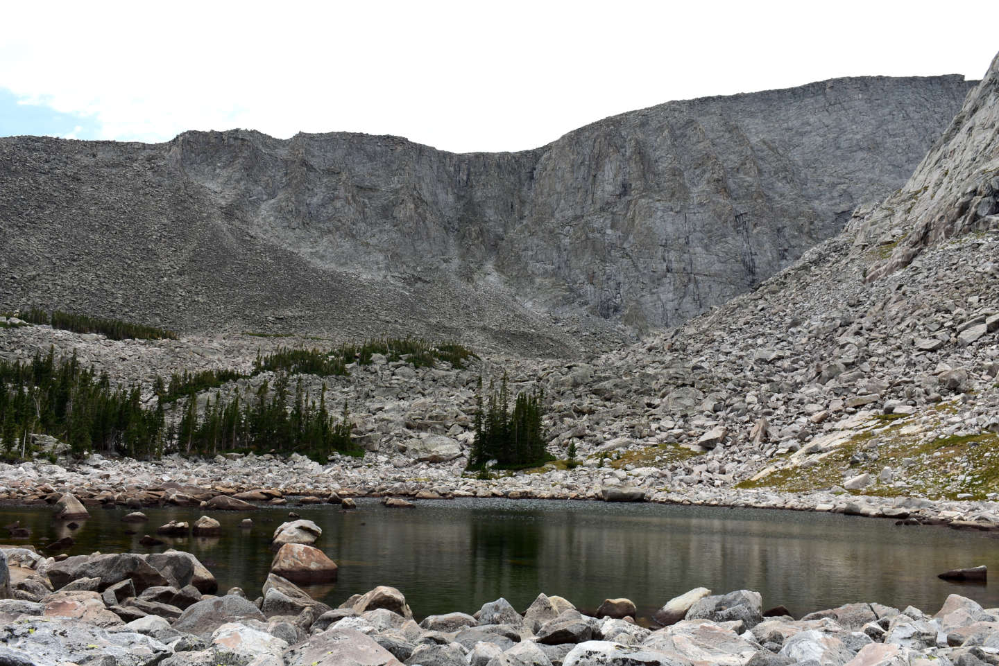
“Peggy Lake” West Pond
Peak 10,505 West Pond
“Lake Silver”
“Lake Silver” Long Pond
Peak 10,284 West Pond
Sawtooth Peak 10,570 Southwest Lake
Sawtooth West Cliffs Lake
Sawtooth East Notch Lake
Sawtooth Shallow Lake
Sawtooth Lake 10,725
Sawtooth West Side Muddy Pond
“Upper Crater Lake”
“Rainbow Lake” West Pond #1
“Rainbow Lake” West Pond #2
“Rainbow Lake” West Pond #3
Dark Dike Lake
“Rainbow Lake” East Pond #3
“Rainbow Lake” East Pond #4
Big Crack Lake
“Lake Eunice” Northwest Pond
Cliff View Lake
“Cliff Lake” Northwest Pond #1
“Cliff Lake” Northwest Pond #2
Little East Birthday Lake
East Birthday Lake
Little West Birthday Lake
West Birthday Lake
Little “Poacher Lake”
“Poacher Lake”
Cloud Peak Big Climb Lake
Cloud Peak Green Waterfall Lake
Lazy Outlet Lake
What Can We Learn from the Ponds in the Bighorn Mountains?
The Bighorn Mountains are in north-central Wyoming between the Bighorn Basin to the southwest and the Powder River Basin to the northeast. From the Wyoming – Montana border to Hazelton Peak, they are 122 km (76 miles) long. Although mountains continue into Montana as far as Bighorn Lake, the character changes with the upper ends of the more northerly flowing Big Bull Elk and Black Canyon creeks reaching very close to the border and the width of the mountain range shrinking substantially. Topographic maps also indicate the “Bighorn Mountains” continuing to the south of Hazelton Peak all the way to the eastern Owl Creek Mountains but these are just rounded hills lower than 2,500 m (8,200′). They are best considered as the “Southern Bighorn Mountains”. The northeast side of the Bighorn Mountains is everywhere steep. The southwest side of the mountains may be steep but it usually has moderate slopes, although deeply dissected by canyons. The Bighorn Mountains are generally 35-50 km (22-31 miles) wide between the major slope breaks on the northeast and southwest flanks but that depends on how far out into the basin you want to chase the ridges between the canyons on the southwest side.
At 4,013 m (13,167′), Cloud Peak is the highest peak in the Bighorn Mountains and there are many peaks higher than 3,200 m (10,500′) along the crest of the range. The core of the mountain range from Dome Peak (3,300 m, 10,830′) in the northwest to Loaf Mountain (3,573 m, 11,722′) in the southeast is glaciated and very rugged with most elevations above 2,800 m (9,190′). Outside of this core, relief is more moderate but still mostly above 2,400 m (7,870′), e.g., Burgess Junction at 2,463 m (8,082′). The northeastern edge of the mountains is approximated by the 1,400 m (4,590′) contour in the north, near Sheridan, and the 1,600 m (5,250′) contour in the south, near Buffalo. The 1,700 m (5,580′) contour may be a good guide on the southwestern flank but the moderate slopes there do not define a sharp boundary. Minimum elevations in the canyons are represented by 1,500 m (4,920′) at the mouth of Tensleep Canyon and about 1,400 m (4,590′) at the mouth of Shell Canyon, both on the west side.
Mean Annual Precipitation according to the Wyoming Climate Atlas by the Water Resources Data System and State Climate Office at http://www.wrds.uwyo.edu/sco/climateatlas/precipitation.html, Parameter-Elevation Regressions on Independent Slopes Model, PRISM, with 1971-2000 data at very widely spaced weather stations (I have eyeballed the values from a very small scale map with 11 precipitation bins marked with indistinct colors and further obscured by a shaded relief base map):
31″-40″ (79-102 cm) and maybe 41″-50″ (104-127 cm) on crest
The Bighorn Mountains have vegetation varying from sagebrush in the foothills to alpine tundra in the higher core of the range. There are extensive tracts of mature spruce-fir forest. Some are open and delightful walking and some are cluttered with downfall and also with young trees in some places. The trees thin out above 3,100 m (10,170′) and become rare above about 3,200 m (10,500′), with local variations. The lower elevations have lodgepole pine. Aspen is not common.
Frogs are a potential problem for fairy shrimp in the Bighorn Mountains. The northern leopard frog, the wood frog, and the Columbia spotted frog all have populations in the Bighorn Mountains (Estes-Zumpf and others, 2012). Although fairy shrimp and frogs co-exist in some cases, fairy shrimp are generally less common in ponds with frogs than in ponds without. Fairy shrimp seem to be more common in the Wind River Mountains, which lack frogs, than in the east-central Sierra Nevada, which have frogs. The 3 frog species in the Bighorn National Forest have been found between U.S. 14 in the north and U.S. 16 in the south. Using the figures of Estes-Zumpf and others (2012) and The National Map for elevations, I estimate that wood frog populations are present at elevations up to 2,830 m (9,285′) in the Shell Creek and South Fork Tongue River drainages. Columbia spotted frogs occur at about 2,730 m (8,855′) in the southern South Tongue River drainage. Frogs are probably not a threat to fairy shrimp in the abundant alpine ponds above 3,000 m (9,840′) but they may reduce the available “stepping stones” for bird dispersal from lower elevation ponds to higher ones.
The Bighorn National Forest includes essentially all of the Bighorn Mountains from the Wyoming – Montana border to Hazelton Peak. Private in-holdings are rare. East of the Forest boundary, the land is private or owned by the State of Wyoming with negligible public lands. Lands west of the Forest boundary are a mix of public lands managed by the BLM, private lands, and state lands. The higher elevation core of the mountain range is within the 51 km (32 miles) long Cloud Peak Wilderness Area. The Wilderness Area has several hiking trails.
Access to the higher parts of the Bighorn Mountains is provided by 3 highways: US 14 and Alternate US 14 over Granite Pass and Bald Mountain Summit, respectively, in the north and US 16 over Powder River Pass in the south. However, to reach trailheads or other areas of interest off the highways, one must rely on non-paved roads, some of which are in poor condition.
Although I remember 3 hiking trips in the Bighorn Mountains, this web page describes only one. I didn’t see fairy shrimp on the other 2 trips, didn’t record any data, and didn’t take any photographs. The only notes for the trip described here are poor. They were made on the topographic maps I carried: just an “x” on the pond and what I saw. The absence of photographs is unfortunate. I think 2007 was a time when I could not find Ektachrome, or even Kodachrome, film. Nonetheless, I think there is some value in posting my limited findings, if only to encourage others to do better.
Glaciation of the Bighorn Mountains
The glacial topography of the Bighorn Mountains is as dramatic as that of the Wind River Mountains but it has attracted little research interest. Darton and Salisbury (1906) remarked that “the general configuration is very rugged, presenting some of the boldest alpine scenery in the country” with “many precipices over 1000 feet high”. Searching for “Bighorn Mountains” and a variety of glacial terms, I found only 2 old reports by U.S. Geological Survey scientists. Salisbury and Blackwelder (1903) noted the existence of 5 small glaciers above 3,413 m (11,200′) in the vicinity of Cloud Peak that were up to 2 km (1.25 miles) long. 7.5-minute topographic maps prepared from 1981 (Cloud Peak) and 1989 (“Lake Helen”) aerial photographs show 10 perennial snow fields in deep canyons extending north (7), northeast (1), east (2), and west (1) from the crest of the range between Bomber Mountain and “Crater Lake”. The 1 below the northeast face of Cloud Peak is the biggest. 2 other snow fields are above “Silver Lake” and “Cross Creek Lakes”. Salisbury and Blackwelder (1903) also reported 45 “well-developed” cirques. The cirques around the high peaks are so steep and so deep, it’s hard to count the contour lines. Many of the cliffs are about 243 m (800′) high. Cirques around the high peaks have not only cirque lakes but also other lakes down valley resulting in 2 “Crater Lakes” and 10 “Sawtooth Lakes”, for example. Lakes and ponds are also plentiful in valleys large and small below the hanging valleys with cirques. Kettles and potholes developed in glacial debris at lower elevations may account for shotgun blasts of numerous, very small ponds, such as “South Fork Ponds” adjacent to South Fork Clear Creek. The wealth of potential habitat is auspicious for fairy shrimp.
Salisbury and Blackwelder (1903) and Darton and Salisbury (1906) described numerous lateral and terminal moraines, even in valleys without cirques. The moraines are of 2 ages but Salisbury had no labels to apply to them. Evidence for 2 significant glacial advances can also be seen in the stepped topography of the glacial valleys from upper cirque basins, to mid-level hanging valleys, to lower trunk valleys. It is likely the younger moraines are correlative with Pinedale-age moraines and the older moraines with “Bull Lake”-age moraines in the Wind River Mountains. Without exposure ages for moraine boulders, it is futile to speculate when the various ponds and lakes in the Bighorn Mountains emerged from below the glaciers and became available for fairy shrimp colonization. At best, I can say Bighorn Mountains ponds were exposed between 23,000 and 11,750 years ago by analogy with the glacial history of the Wind River Mountains. Because “Upper Crater Lake” and the 2 cirque lakes to its east are in contact with 1981-1989 snow fields, they may have been affected by a Little Ice Age (1300-1850) glacier advance.
Fish-stocking Zooicide in the Bighorn Mountains
Almost all of the high elevation lakes in the Bighorn Mountains are naturally inaccessible to fish. However, the Wyoming Game and Fish Department has remedied nature’s (God’s?) oversight. The Sheridan office posted a press release on August 25, 2020 stating: “The biennial stocking of wilderness lakes in the Bighorn Mountains took place July 27 and 28 via helicopter with more than 30,000 fish stocked in 26 Sheridan Region lakes” (wgfd.wyo.gov/Regional-Offices/Sheridan-Region/Sheridan-Region-News/Sheridan-Region-wilderness-helicopter-fish-stocking). Biennial stocking means the fish populations are not self-sustaining. Does that mean the populations are decreasing because people catch a lot or because the fish starve or freeze to death within 2 years? No matter, people want fish.
Studies of aquatic communities in fishless and fish-hosting lakes indicate fish radically alter such communities by extirpating populations of invertebrates larger than about 2 mm. Summaries are provided in the Fish-stocking Zooicide section on the east-central Sierra Nevada page. Some experimental studies of fish introduction or removal are summarized and more details on WGF’s fish-stocking efforts are provided in the Fish-stocking Zooicide section on the Wind River Mountains page.
The extent of the fish-stocking zooicide in the Bighorn Mountains cannot be determined. There are no pre-stocking invertebrate surveys and there may be no post-stocking surveys either. It is safe to assume that at least 26 populations of something have been eliminated but that is a minimum. Most lakes have more than one large-bodied invertebrate species. And of course, fish have been introduced into lakes that are not stocked biennially. I counted 50 lakes with fish in the Cloud Peak Wilderness before I found the slow response times of WGF’s fish finding page (wgfd.wyo.gov/fishing-boating/places-fish-wyoming) too aggravating. There aren’t as many lakes in the Bighorn Mountains as in the Wind River Mountains or the Sierra Nevada but they nonetheless contribute to the global massacre (Fish-stocking Zooicide in the Sierra Nevada on the east-central Sierra Nevada page).
Mather Peaks South Lake (Powder River Ranger District, Bighorn National Forest, Cloud Peak Wilderness)

___This map is a screenshot of The National Map (Go to The National Map). The U.S. Geological Survey generally does not copyright or charge for its data or reports (unless printed). A pond location is indicated by an “X”, which corresponds to the coordinates given in the data spreadsheet. Labels in quotations are from 7.5-minute topographic quadrangles.
___Red lines are the U. S. National Grid with a spacing of 1,000 m and intersection labels consisting of the UTM zone (e.g., 11S, 12T), a 2-letter 100-km square designation (e.g., LC, XN), and a 4-digit number. The first 2 digits of the number represent the 1,000-meter Easting and the second 2 digits the 1,000-meter Northing, as seen in the example Easting and Northing. Unlike latitude and longitude, the National Grid is rectilinear on a flat map, the units of abscissa and ordinate have equal lengths, and the units (meters) are measurable on the ground with a tape or by pacing.
___As of April 2025, the National Grid overlay with red lines in UTM coordinates does not load in The National Map.
___As of September 2026, The National Map continues to lose functionality. Symbols and polygons are no longer available online. I have used Inkscape to plot “X”s on the green dots plotted by the Spot Elevation Tool, which also provides coordinates but now only the latitude and longitude. I have used the cursor location tracker in UTM mode and have manually written down the UTM coordinates before moving the cursor to the spreadsheet for data entry. Showing colored, non-opaque polygons of private or otherwise non-public lands is no longer feasible.
___This map is a 2022 screenshot of The National Map but trail numbers were added to the svg file in 2026.
___There is no private or state land on this map.
Mather Peaks South Lake is 36 km (22 miles) west of Buffalo and 1,200 m (3,940′) south of the eastern summit of Mather Peaks. There is another lake of similar size 800 m (2,620′) farther south. Mather Peaks South Lake has an irregular shape and dimensions of about 250 m x 170 m (820′ x 560′) on the 7.5-minute topographic quadrangle. The outlet of the lake descends 50 m (165′) in about 130 m (430′) laterally so it seems safe from fish.
Probably the most direct route to Mather Peaks South Lake is from the “West Tensleep Lake” trailhead. The trailhead is on a maintained road that turns north off US 16 about 16 miles northeast of Tensleep and 11 miles west of Powder River Pass. Take trail 065 toward “Lost Twin Lakes”. Above “Mirror Lake”, turn north and follow the drainage up toward Mather Peaks.
Elevation: 3,273 m (10,739′)
September 21, 2007
I took a chance on a late fall hike and it’s not turning out well. The cool, cloudy weather looks rather threatening. At least I managed to start before elk season opens.
- 170 m x 250 m based on the 7.5-minute quadrangle; depth not estimated.
- Water clarity not noted but can be assumed to have been clear.
- No fairy shrimp
- Copepods.
Spot 11,018 Pond (Powder River Ranger District, Bighorn National Forest, Cloud Peak Wilderness)
Spot 11,018 Pond is almost 500 m (1,640′) southeast of Mather Peaks South Lake. It is on the saddle of a small ridge northeast of the spot elevation of 11,018 feet (3,360 m). It is shown on the 7.5-minute topographic quadrangle as a perennial pond less than 50 m (165′) long.
For access, see Mather Peaks South Lake.
Elevation: 3,351 m (10,993′)
September 21, 2007
It’s on the map, it’s small, and it’s not far from Mather Peaks South Lake. I got nice and warm hiking up the hill.
- Less than 50 m across based on the quadrangle; depth not estimated.
- Water clarity not noted but can be assumed to have been clear.
- No fairy shrimp
- Backswimmers (sub-order Heteroptera, family Notonectidae), caddisfly larvae, copepods.
What are insect predators like backswimmers doing at this elevation? Did they eat all the fairy shrimp that hatched this year?
“Lost Twin Lakes” Ledge Pond (Powder River Ranger District, Bighorn National Forest, Cloud Peak Wilderness)
“Lost Twin Lakes” Ledge Pond is about 950 m (3,120′) north of the northwestern of the “Lost Twin Lakes”, which is 36 km (22 miles) west of Buffalo. The pond is on a wide ledge part way up the canyon wall below where it gets really steep. Its maximum dimension is less than 50 m (165′) on the 7.5-minute topographic quadrangle.
For access, see Mather Peaks South Lake. Instead of turning north to Mather Peaks South Lake, continue on the trail past “Mirror Lake” toward “Lost Twin Lakes”. About 775 m (2,460′) east of the crossing of West Tensleep Creek above “Mirror Lake”, the trail crosses the nose of a ridge. The climb along the ridge up to the ledge with the pond is probably the least steep route.
Elevation: 3,175 m (10,418′)
September 21, 2007
Another small pond that’s on the map and not too hard to get to but maybe remote enough to provide an untroubled home for fairy shrimp.
- Less than 50 m across based on the 7.5-minute quadrangle; depth not estimated.
- Water clarity not noted but can be assumed to have been clear.
- Small, pale gray, fairy shrimp.
- Backswimmers (sub-order Heteroptera, family Notonectidae), beetles.
The distal segments of male antennae II of these fairy shrimp are short and pointed like those of Branchinecta paludosa (BTANSD).
The pond is home to fairy shrimp but the presence of predators such as backswimmers and beetles indicate it is not exactly untroubled.
Peak 11,112 Shadow Pond (Powder River Ranger District, Bighorn National Forest, Cloud Peak Wilderness)
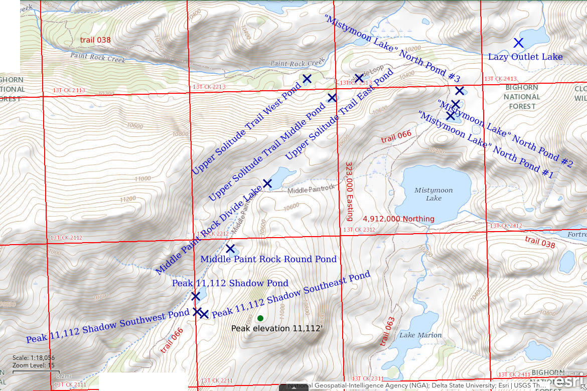
___This map is a screenshot of The National Map (Go to The National Map). The U.S. Geological Survey generally does not copyright or charge for its data or reports (unless printed). A pond location is indicated by an “X”, which corresponds to the coordinates given in the data spreadsheet. Labels in quotations are from 7.5-minute topographic quadrangles.
___Red lines are the U. S. National Grid with a spacing of 1,000 m and intersection labels consisting of the UTM zone (e.g., 11S, 12T), a 2-letter 100-km square designation (e.g., LC, XN), and a 4-digit number. The first 2 digits of the number represent the 1,000-meter Easting and the second 2 digits the 1,000-meter Northing, as seen in the example Easting and Northing. Unlike latitude and longitude, the National Grid is rectilinear on a flat map, the units of abscissa and ordinate have equal lengths, and the units (meters) are measurable on the ground with a tape or by pacing.
___As of April 2025, the National Grid overlay with red lines in UTM coordinates does not load in The National Map.
___As of September 2026, The National Map continues to lose functionality. Symbols and polygons are no longer available online. I have used Inkscape to plot “X”s on the green dots plotted by the Spot Elevation Tool, which also provides coordinates but now only the latitude and longitude. I have used the cursor location tracker in UTM mode and have manually written down the UTM coordinates before moving the cursor to the spreadsheet for data entry. Showing colored, non-opaque polygons of private or otherwise non-public lands is no longer feasible.
___This map is a 2022 screenshot of The National Map but Lazy Outlet Lake and trail numbers were added to the svg file in 2026.
___There is no private or state land on this map.
Peak 11,112 Shadow Pond is 400 m (1,310′) west of a peak with spot elevation 11,112′ (3,385 m). Peak 11,112 is 960 m (3,150′) west of “Lake Marion” and 42 km (26 miles) west of Buffalo. The peak is 230 m (760′) higher than the pond and has a steep west side that would cast a long shadow over Peak 11,112 Shadow Pond when the sun is shining. Peak 11,112 Shadow Pond is close to, but not on, Middle Paint Rock Creek. The pond has no inlet or outlet on the 7.5-minute topographic quadrangle. It is in a depression that does not allow a connection to the creek. On the 7.5-minute topographic quadrangle, the pond has dimensions of 150 m x 60 m (490′ x 200′).
For access, see Middle Paint Rock Divide Lake. Peak 11,112 Shadow Pond is close to trail 066 about 850 m (2,790′) southwest of Middle Paint Rock Divide Lake. In 2007, I followed trail 066 from the “Lily Lake” trailhead. As I recall, the road to the trailhead was in poor condition and I had a hard time finding the trailhead.
Elevation: 3,151 m (10,338′)
September 23, 2007
The water level is well below the high-water mark but that is not a surprise this late in the year.
- 60 m x 150 m based on the 7.5-minute quadrangle; depth not estimated.
- Water clarity not noted but can be assumed to have been clear.
- Sparse fairy shrimp.
- Other animals not noted.
This is a great start after sitting out the snow on the 22nd.
August 31, 2026
I found fairy shrimp here 19 years ago. With the sunny weather, I should be able to get a photograph of them today, if they are still here.
- 50 m x 85 m, which is 30 m shorter and 10 m narrower than the pond on The National Map imagery due to a low water level; greater than 200 cm deep.
- Clear water; 11 C at 1300.
- Greenish-gray fairy shrimp 10-15 mm long; eggs rare or absent.
- Water boatmen (sub-order Heteroptera, family Corixidae), black copepods (Crustacea: class Maxillopoda, subclass Copepoda) 2 mm long, red copepods 1 mm long, cladocerans (Crustacea: class Branchiopoda, orders Anomopoda, Ctenopoda, Onychopoda, Haplopoda) 1 mm long, caddisfly larvae (Trichoptera), small birds.
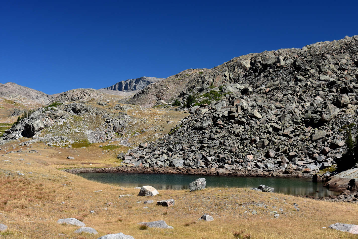
Looking northeast across Peak 11,112 Shadow Pond. The pond is visible from trail 066, which is off the left edge of the photograph.
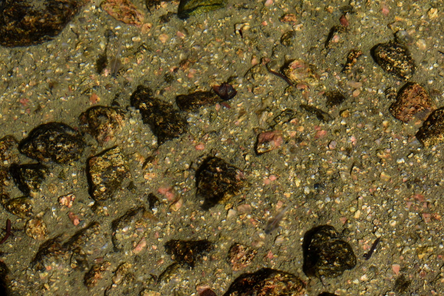
2 greenish-gray, male fairy shrimp in Peak 11,112 Shadow Pond, at upper left and lower right. Both have relatively short antennae II which do not meet or cross above the thorax, which is similar to Branchinecta paludosa (BTANSD). Compare this to Branchinecta coloradensis in Bivouac Lake and Bull Canyon Pond and to B. paludosa in “Coyote Lake”. Although visual features are suggestive, microscopic characteristics are needed to definitively identify fairy shrimp species.
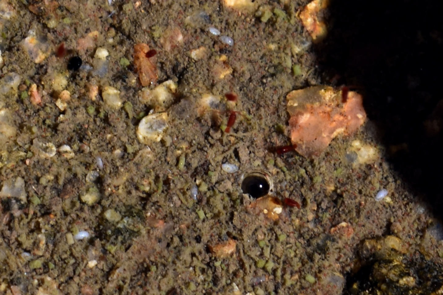
Several red copepods in Peak 11,112 Shadow Pond, at and above center. Most are more or less bullet-shaped but the one above center, at least, has an elongate feature extending from the posterior part of the “bullet” that is the urosome (Figures 2 and 5 of Thorp and Covich, 2001, p. 918 and 922).

The lenticular, brownish-gray animal at center is a cladoceran in Peak 11,112 Shadow Pond. The field of view also includes 3 or 4 red copepods. With better weather and more time, Peak 11,112 Shadow Pond turned out to have more life than I previously saw. Cladocerans and copepods can overwinter in the cold or frozen pond as eggs or copepodids, respectively, so they are probably not recent arrivals.
Peak 11,112 Shadow Southeast Pond (Powder River Ranger District, Bighorn National Forest, Cloud Peak Wilderness)
Peak 11,112 Shadow Southeast Pond is about 100 m (330′) southeast of Peak 11,112 Shadow Pond. It is shown as a perennial pond less than 30 m (100′) across on the 7.5 minute topographic quadrangle.
For access, see Peak 11,112 Shadow Pond.
Elevation: 3,164 m (10,382′)
September 23, 2007
It’s on the map and close so NPPWOPII.
- Less than 30 m across based on the 7.5-minute quadrangle; depth not estimated.
- Water clarity not noted but can be assumed to have been clear.
- No fairy shrimp
- No aquatic animals seen.
Peak 11,112 Shadow Southwest Pond (Powder River Ranger District, Bighorn National Forest, Cloud Peak Wilderness)
Peak 11,112 Shadow Southwest Pond is 80-100 m (260-330′) west of Peak 11,112 Shadow Southeast Pond and 60-80 m (200-260′) south of Peak 11,112 Shadow Pond. It is not shown on the 7.5 minute topographic quadrangle and is not really visible on the USGS imagery for The National Map. Its location on the Peak 11,112 Shadow Pond map and the coordinates in the data spreadsheet (on the Data page) may be off by 50 m (165′) or so.
For access, see Peak 11,112 Shadow Pond.
Elevation: 3,159 m (10,363′)
September 23, 2007
I found this pond walking back toward the trail from Peak 11,112 Shadow Southeast Pond.
- Less than 30 m across; depth not estimated.
- Water clarity not noted but can be assumed to have been clear.
- No fairy shrimp
- No aquatic animals seen.
Middle Paint Rock Round Pond (Powder River Ranger District, Bighorn National Forest, Cloud Peak Wilderness)
Middle Paint Rock Round Pond is 525 m (1,720′) southwest of Middle Paint Rock Divide Lake and less than 50 m (165′) east of the trail. Like Peak 11,112 Shadow Pond, the pond is close to, but not on, Middle Paint Rock Creek. Middle Paint Rock Round Pond has no inlet or outlet on the 7.5-minute topographic quadrangle. It is approximately 60 m (200′) across on the 7.5-minute topographic quadrangle.
For access, see Middle Paint Rock Divide Lake.
Elevation: 3,178 m (10,426′)
September 23, 2007
This one is well off the creek and not connected to it.
- About 60 m across based on the 7.5-minute quadrangle; depth not estimated.
- Water clarity not noted but can be assumed to have been clear.
- No fairy shrimp
- Backswimmers (sub-order Heteroptera, family Notonectidae).
August 31, 2026
Unlike Peak 11,112 Shadow Pond, Middle Paint Rock Round Pond is close to its usual size. There is green algae on the bottom of the pond in places. That could affect animal habitats.
- 60 m x 75 m, based on The National Map imagery; greater than 200 cm deep.
- Clear water; 12 C at 1315.
- No fairy shrimp.
- Water boatmen (sub-order Heteroptera, family Corixidae), black copepods (Crustacea: class Maxillopoda, subclass Copepoda) 1 mm long, dytiscid larvae (order Coleoptera, family Dytiscidae).
I suspect the backswimmers that I identified 19 years ago were really water boatmen. I’m better at distinguishing the 2 now and today’s weather is more conducive to a closer, longer look.
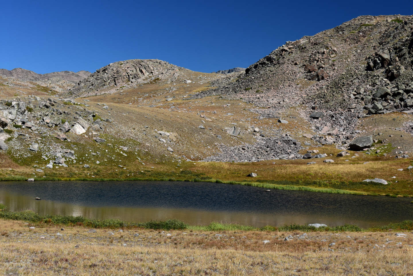
Middle Paint Rock Round Pond is not readily visible from trail 066 but it is in close proximity. Its drainage area didn’t lack for snow this year as the shore has a border of green grass rather than a wide swath of dry rock like the one around Peak 11,112 Shadow Pond.
Middle Paint Rock Divide Lake (Powder River Ranger District, Bighorn National Forest, Cloud Peak Wilderness)
Middle Paint Rock Divide Lake is 42 km (26 miles) west of Buffalo and about 800 m (2,620′) west of “Mistymoon Lake”. It is in a depression north of trail #66 where it crosses the divide between Middle Paint Rock Creek and West Tensleep Creek. On the 7.5-minute topographic quadrangle, the lake is 200 m x 70 m (660′ x 230′). It seems like an odd place for a lake but here it is. It has an outlet that descends to “Mistymoon Lake”. A long, steep section would be a tough climb for trout.
For access, see Mather Peaks South Lake. Like Mather Peaks South Lake, Middle Paint Rock Divide Lake can be reached from a trailhead at “West Tensleep Lake” but take trail 063 to “Lake Helen” and “Mistymoon Lake” rather than trail 065 to “Lost Twin Lakes”. From a trail junction northwest of “Mistymoon Lake”, trail 066 leads southwest and over the divide to Middle Paint Rock canyon. Middle Paint Rock Divide Lake is less than 30 m (100′) from the trail. Middle Paint Rock Divide Lake can also be reached via trail 066 from “Lily Lake” trailhead, which I had a hard time finding in 2007. It is a long drive on a poor road to “Lily Lake” trailhead. A much longer route from “Lower Paint Rock Lake” trailhead is also possible, via trail 059 to Tepee Pole Flats and trail 038 from Tepee Pole Flats past “Poacher Lake” and “Lake Solitude” to the trail junction northwest of “Mistymoon Lake”.
Elevation: 3,219 m (10,560′)
September 23, 2007
Definitely bad timing for this trip with rain or snow most of the day yesterday. Although I stayed warm in my vehicle yesterday, it’s not warming up much today. Fortunately, the ground is warm enough to melt most of the snow. There’s the possibility the lake has been stocked – it’s big enough to tempt someone – but WIDLA.
- 70 m x 200 m based on the 7.5-minute quadrangle; depth not estimated.
- Water clarity not noted but can be assumed to have been clear.
- No fairy shrimp
- Backswimmers (sub-order Heteroptera, family Notonectidae).
August 31, 2026
What a difference the weather makes! Not a cloud in the sky today compared to cloudy, windy, cold, and snow on the ground last time. Before, I wrote minimal observations on the topographic map without taking my gloves off but today I can sit in the grass and take my time writing up my observations in a notebook. Like Middle Paint Rock Round Pond, this pond has algae on the bottom.
- 95 m x 185 m, based on The National Map imagery; greater than 200 cm deep.
- Clear water; 13 C at 1330.
- No fairy shrimp.
- Water boatmen (sub-order Heteroptera, family Corixidae), black copepods (Crustacea: class Maxillopoda, subclass Copepoda) 1 mm long, caddisfly larvae (Trichoptera).
I suspect my previous identification of backswimmers here was mistaken as it was for Middle Paint Rock Round Pond. Today, the largest swimming animals are clearly water boatmen.
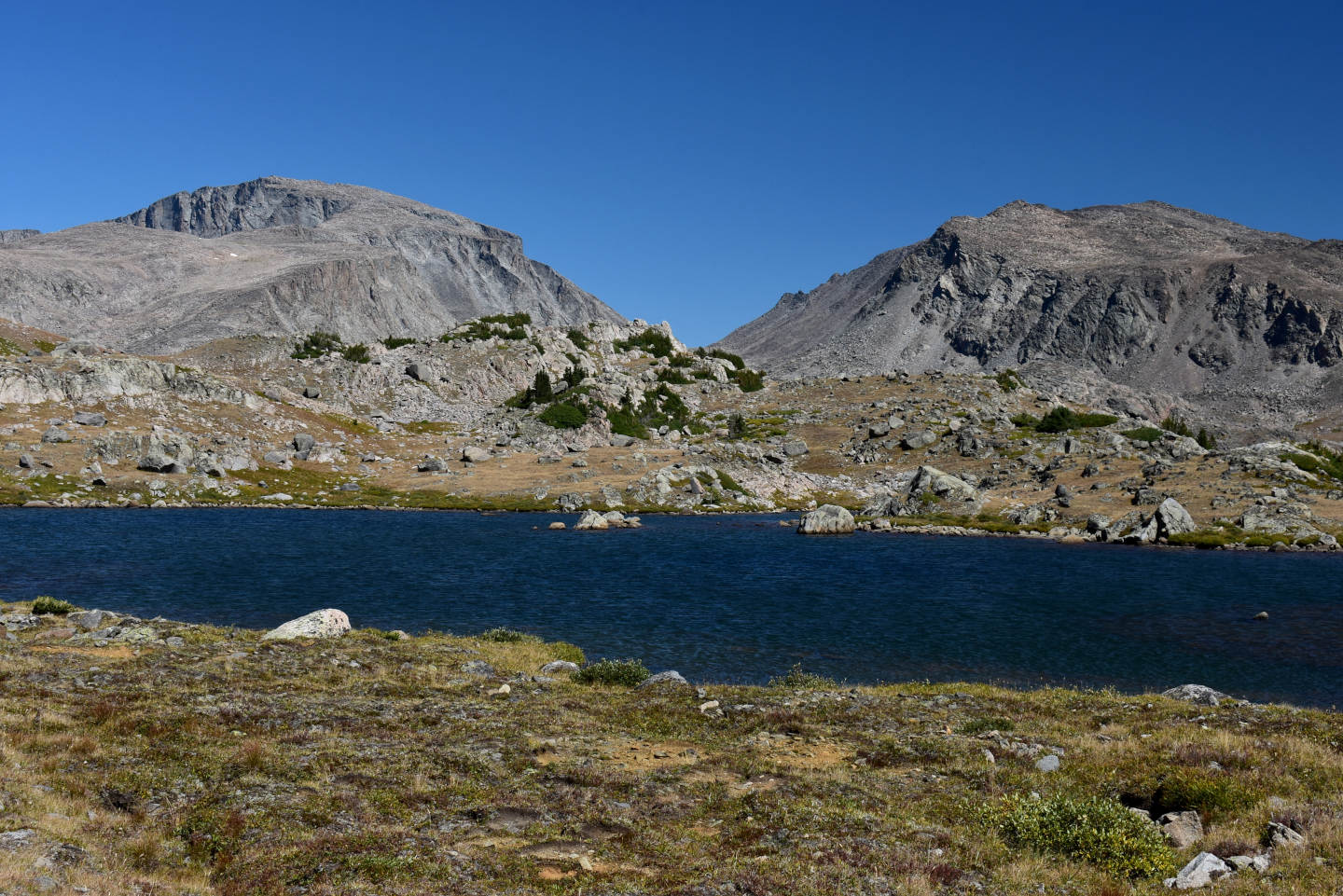
Middle Paint Rock Divide Pond, looking northeast. The ridge in the distance at left is a ramp up to Cloud Peak.
“Mistymoon Lake” North Pond #1 (Powder River Ranger District, Bighorn National Forest, Cloud Peak Wilderness)
“Mistymoon Lake” North Pond #1 is the lowest and southernmost of the 3 “Mistymoon Lake” North ponds. It is 350 m (1,150′) north of “Mistymoon Lake”. “Mistymoon Lake” is 41 km (25 miles) west of Buffalo. “Mistymoon Lake” North Pond #1 is 100 m long and 50 m wide (330′ x 160′) on the 7.5-minute topographic quadrangle. It is in a catchment less than 500 m (1,640′) across that has some boggy areas but not much flowing water.
For access, see Middle Paint Rock Divide Lake. Instead of going west to Middle Paint Rock Divide Lake from the trail junction northwest of “Mistymoon Lake”, continue north on the Solitude Loop, trail 038. The trail passes the 3 “Mistymoon Lake” North ponds as it climbs to the divide between Paint Rock Creek and West Tensleep Creek.
Elevation: 3,179 m (10,431′)
September 23, 2007
Having ponds this close to a trail makes it easy.
- 50 m x 100 m based on the 7.5-minute quadrangle; depth not estimated.
- Water clarity not noted but can be assumed to have been clear.
- No fairy shrimp
- No aquatic animals seen.
August 31, 2026
More than half the pond is a grassy bog now and I don’t remember if that was the case 19 years ago. I didn’t see any aquatic animals back then but I bet I can find some today.
- 50 m x 75 m, based on The National Map imagery; depth not estimated but probably less than 200 cm deep.
- Clear water; 14 C at 1415.
- No fairy shrimp.
- Brown water boatmen (sub-order Heteroptera, family Corixidae) 4-6 mm long, pale yellow water boatmen or backswimmers (sub-order Heteroptera, family Notonectidae) 10 mm long, mayfly larvae (Ephemeroptera) (shed exoskeletons), falcon.

“Mistymoon Lake” North Pond #1, looking northeast. A falcon was perched at the left edge of the water when I approached and waited a surprisingly long time before flying off. Had it found something to eat? The dry grass at left is a bog partially encircled by open water.

The strikingly colorful, pale yellow water boatmen or backswimmers in “Mistymoon Lake” North Pond #1. The back and ventral sides are the same color so I can’t be sure which they are. There seem to be wings on the visible side of the one at right. That would mean it is a water boatmen with the back side up but having 2 such different species of water boatmen in the same pond gives me pause.
“Mistymoon Lake” North Pond #2 (Powder River Ranger District, Bighorn National Forest, Cloud Peak Wilderness)
“Mistymoon Lake” North Pond #2 is the middle pond of the 3 “Mistymoon Lake” North ponds. It is 450 m (1,480′) north of “Mistymoon Lake”. “Mistymoon Lake” is 41 km (25 miles) west of Buffalo. On the 7.5-minute topographic quadrangle, “Mistymoon Lake” North Pond #2 is barely 70 m long and 40 m wide (230′ x 130′). Unlike the other 2 “Mistymoon Lake” North ponds, it is shown with an intermittent rather than a perennial pond symbol on the topographic map.
For access, see “Mistymoon Lake” North Pond #1.
Elevation: 3,182 m (10,440′)
September 23, 2007
The map is right; this pond is almost dry.
- Size and depth not estimated.
- Water clarity not noted but can be assumed to have been clear.
- No fairy shrimp
- Backswimmers (sub-order Heteroptera, family Notonectidae).
August 31, 2026
19 years ago, this pond was almost dry on September 23 and had backswimmers, which may really have been water boatmen. This year, it is dry on August 31.
- Dry.
“Mistymoon Lake” North Pond #3 (Powder River Ranger District, Bighorn National Forest, Cloud Peak Wilderness)
“Mistymoon Lake” North Pond #3 is the highest and northernmost of the 3 “Mistymoon Lake” North ponds. It is also the smallest. “Mistymoon Lake” North Pond #3 is 540 m (1,770′) north of “Mistymoon Lake”. “Mistymoon Lake” is 41 km (25 miles) west of Buffalo. “Mistymoon Lake” North Pond #3 is less than 60 m (200′) long on the 7.5-minute topographic quadrangle. The pond is in a small depression with no inlet or outlet.
For access, see “Mistymoon Lake” North Pond #1.
Elevation: 3,183 m (10,443′)
September 23, 2007
Maybe smaller is better.
- Less than 60 m long based on the 7.5-minute quadrangle; depth not estimated.
- Water clarity not noted but can be assumed to have been clear.
- No fairy shrimp
- No aquatic animals seen.
August 31, 2026
The previous statement “Water clarity not noted but can be assumed to have been clear” was an unreliable assumption. Maybe it was clear, maybe it wasn’t. Today, this is a blackwater pond.
- 25 m x 50 m, based on The National Map imagery; I think I can see to a depth of about 100 cm so the pond is deeper than that.
- Reddish-black water; 15 C at 1430.
- No fairy shrimp.
- Water boatmen (sub-order Heteroptera, family Corixidae); black diving beetles; non-swimming, thin, tubular larvae about 10 mm long that may be of the family Chaoboridae (Insecta: order Diptera).
The presence of chaoborids in this pond could be analogous to the case reported by Lindholm and others (2016, abstract only) for Chaoborus nyblaei in alpine ponds of southern Norway. They found C. nyblaei only in ponds with high concentrations of total organic carbon (e.g., 10.5 mg/L). The darkly colored water provides protection from short-wave ultraviolet radiation, which increases with latitude and elevation. C. nyblaei lacks pigmentation for UV protection. The presence of C. nyblaei in ponds above timberline at 900 m may have also been facilitated by a 200 m upward shift of isotherms from 1970 to 2011 (Lindholm and others, 2012, abstract only). An upward migration of C. nyblaei due to climate-induced water browning and warming is implied by Lindholm and others’ (2016, abstract only) attribution of the disappearance of the fairy shrimp Branchinecta paludosa from ponds in the 900-1,100 m range (Lindholm and others, 2012, abstract only) to post-1970 predation by C. nyblaei. The chaoborids here, if that is what they are, could also have arrived relatively recently due to warmer weather. Since 1981 (the date of the aerial photographs used to revise the Cloud Peak 7.5-minute topographic quadrangle), glaciers have largely disappeared from “Crater Lake” canyon, West Birthday Lake canyon, East Birthday Lake canyon, “Sawtooth Lakes” canyon, and “Lake Silver” canyon.
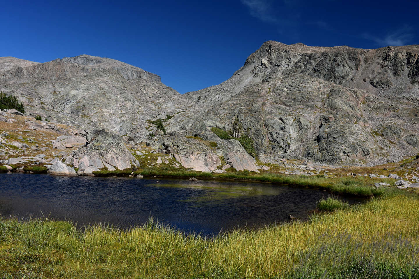
View to north across “Mistymoon Lake” North Pond #3. The reddish-black color is probably due to dissolved organic acids. It is not clear where abundant organic matter came from. This pond doesn’t have more leafy trees or shrubbery than other alpine ponds I’ve visited in the Bighorns. Perhaps the lack of an outlet that allows flushing dissolved and particulate organic matter downstream can account for the high organic content.
Upper Solitude Trail East Pond (Powder River Ranger District, Bighorn National Forest, Cloud Peak Wilderness)
Upper Solitude Trail East Pond is 700 m (2,300′) northwest of “Mistymoon Lake” and about 2,200 m (7,220′) east of “Lake Solitude”. “Mistymoon Lake” is 41 km (25 miles) west of Buffalo. The pond is shown on the 7.5-minute topographic quadrangle as less than 30 m (100′) south of the trail and about 70 m (230′) long.
For access, see “Mistymoon Lake” North Pond #1. Continue on the trail 038 past “Mistymoon Lake” North Pond #3 and hike another 675 m (2,210′) or so over the divide and down into the Paint Rock Creek drainage.
Elevation: 3,118 m (10,231′)
September 23, 2007
Another problem with the timing of this trip is that the days are too short. I’m running out of day light.
- About 70 m long based on the 7.5-minute quadrangle; depth not estimated.
- Water clarity not noted but can be assumed to have been clear.
- No fairy shrimp
- Backswimmers (sub-order Heteroptera, family Notonectidae).
Upper Solitude Trail Middle Pond (Powder River Ranger District, Bighorn National Forest, Cloud Peak Wilderness)
Upper Solitude Trail Middle Pond is about 700 m (2,300′) northwest of “Mistymoon Lake”. “Mistymoon Lake” is 41 km (25 miles) west of Buffalo. The pond has dimensions of 90 m x 30 m (300′ x 100′) on the 7.5-minute topographic quadrangle.
For access, see Upper Solitude Trail East Pond. Hike about 200 m (660′) southwest from Upper Solitude Trail East Pond. The pond is 150 m (490′) south of the Solitude Trail.
Elevation: 3,131 m (10,271′)
September 23, 2007
I passed another, smaller pond on the way here from Upper Solitude Trail East Pond but it is not on the 7.5-minute quadrangle and has only backswimmers.
- 30 m x 90 m based on the 7.5-minute quadrangle; depth not estimated.
- Water clarity not noted but can be assumed to have been clear.
- No fairy shrimp
- Backswimmers, beetles.
Upper Solitude Trail West Pond (Powder River Ranger District, Bighorn National Forest, Cloud Peak Wilderness)
Upper Solitude Trail West Pond is 900 m (2,950′) northwest of “Mistymoon Lake” and about 380 m (1,250′) west of Upper Solitude Trail East Pond. “Mistymoon Lake” is 41 km (25 miles) west of Buffalo. The pond is 40 m (130′), more or less, south of the trail and is 50 m x 35 m (165′ x 115′) on the 7.5-minute topographic quadrangle.
For access, see Upper Solitude Trail East Pond.
Elevation: 3,085 m (10,120′)
September 23, 2007
I saw 2 other very small ponds in the woods on the way here from Upper Solitude Trail Middle Pond but they didn’t appear to have anything swimming in them.
- 35 m x 50 m based on the 7.5-minute quadrangle; depth not estimated.
- Water clarity not noted but can be assumed to have been clear.
- No fairy shrimp
- Backswimmers (sub-order Heteroptera, family Notonectidae).
South Piney Canyon Lowest Pond (Tongue Ranger District, Bighorn National Forest)
South Piney Canyon Lowest Pond is below the lakes in the canyon of South Piney Creek and just outside the Cloud Peak Wilderness. A small pond less than 60 m (200′) long is shown on the 7.5-minute topographic quadrangle but the actual pond is larger and has connected pond lobes to the south and northwest. Imagery on The National Map shows the pond to be about 140 m long and 95 m wide (460′ x 310′), including the lobes. The stream from the lake above the pond flows through the pond but is not shown on the topographic quadrangle. Water in the stream is only rarely visible among the boulders but it is audible. Stream segments connecting the lakes in “South Piney Lakes” canyon are not shown for the same reason. The lake above South Piney Canyon Lowest Pond has been stocked with fish according to WGF’s online map (https://wgfd.wyo.gov/fishing-boating/places-fish-wyoming) but they evidently cannot get through the boulders. Access to the water is difficult due to steep outcrops or to dense forest with abundant downfall and young growth along much of the shore.
The dam of “Cloud Peak Reservoir” is accessible by various routes: trail 038 from the south or northeast, with connecting trail 037 to the northeast, ATV trail 082 to the east, or trail 030 to the southeast; trail 219 from the southeast (also via trail 030); and trail 043 from the east via trail 082 or trails 038 and 030. From the north end of the dam, follow the trampled path through 3 camp sites close to the north shore of the reservoir. If the water level in the reservoir is low enough, walk along the exposed shoreline west of the 3rd camp site as far as the peninsula which juts southward into the reservoir. From there, head northwest through dense forest and boulder piles to the pond.
Elevation: 3,020 m (9,910′)
August 11, 2026
It took so long to get through the forest and over the boulder piles that I never made it to the fishless lakes above the stocked lakes in “South Piney Lakes” canyon. I passed this pond on the way up and stopped here on the way down for a longer look.
- 95 m x 140 m, based on The National Map imagery; depth not estimated.
- Clear water; 17 C at 1600.
- No fairy shrimp.
- Amphipods (Crustacea: class Malacostraca, order Amphipoda) 10-15 mm long, backswimmers (sub-order Heteroptera, family Notonectidae), dytiscid larvae (order Coleoptera, family Dytiscidae), black diving beetles, caddisfly larvae (Trichoptera) 8-20 mm long.
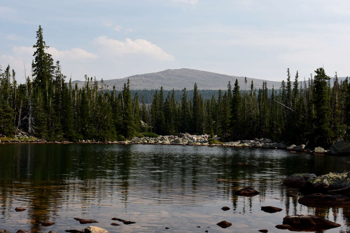
Looking southeast across South Piney Canyon Lowest Pond toward Ant Hill with smoke from distant fires in the air.

The small pond lobe south of South Piney Canyon Lowest Pond and separated from it by a strip of boulders (off right edge of photo), under which the creek flows. The stream from the lake above flows under the boulders at center. The mountains in the distance are at the upper end of “South Piney Lakes” canyon and north of Cloud Peak.

2 amphipods grappling in South Piney Canyon Lowest Pond. Maybe the big one is trying to eat the smaller one.
“Elk Lake” (Powder River Ranger District, Bighorn National Forest, Cloud Peak Wilderness)
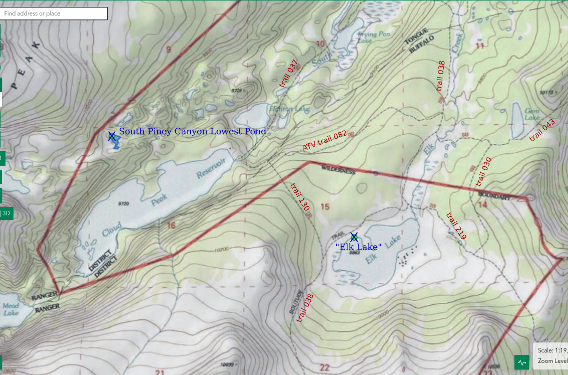
___This map is a screenshot of The National Map (Go to The National Map). The U.S. Geological Survey generally does not copyright or charge for its data or reports (unless printed). A pond location is indicated by an “X”, which corresponds to the coordinates given in the data spreadsheet. Labels in quotations are from 7.5-minute topographic quadrangles.
___As of April 2025, the National Grid overlay with red lines in UTM coordinates does not load in The National Map.
___As of September 2026, The National Map continues to lose functionality. Symbols and polygons are no longer available online. I have used Inkscape to plot “X”s on the green dots plotted by the Spot Elevation Tool, which also provides coordinates but now only the latitude and longitude. I have used the cursor location tracker in UTM mode and have manually written down the UTM coordinates before moving the cursor to the spreadsheet for data entry. Showing colored, non-opaque polygons of private or otherwise non-public lands is no longer feasible.
___There is no private or state land on this map.
“Elk Lake” is at the head of Elk Creek and about 1.6 km southeast of “Cloud Peak Reservoir”. It has no mapped inlet streams but collects snowmelt from the north side of Ant Hill. It is surrounded by an extensive boggy area with grass and willows, which makes it dimensions imprecise. On the 7.5-minute topographic quadrangle it is 900 m by 600 m (2,950′ x 1,970′). The lake bottom has abundant fine sand and silt and only scattered bigger rocks and boulders. This is evidently good for pond lilies and emergent grass.
Several trails provide access to “Elk Lake”. The “Lake Solitude” loop, trail 038, passes along the western side of the lake. Trail 038 also passes within about 2.7 km (1.6 miles) of the end of road 394 west of Soldier Park and then crosses the saddle west of Ant Hill to reach the lake. Road 394 is terrible and best not driven although some people do. A somewhat shorter route is through Triangle Park on trail 219. Trail 219 starts at the end of road 365 at the ford of South Rock Creek. Road 365 is also terrible and connects to terrible road 394. It is also possible to follow terrible roads 396 and 399 from the Hunter corrals and campground to reach trail 007 at another ford of South Rock Creek. Trail 007 joins trail 219 in less than 3.3 km (2 miles).
Elevation: 3,007 m (9,865′)
August 11, 2026
I hadn’t planned to take a look at “Elk Lake” because it seemed to be just a big, grassy bog on The National Map aerial imagery. When I saw the ducks, those most likely dispersal agents for fairy shrimp eggs, I knew I had to look closer in spite of the fading light. Notwithstanding the dry water year and lack of an inlet stream, “Elk Lake” seems full with negligible exposed rock or lake bottom along the shore.
- 600 m x 900 m, based on the 7.5-minute topographic quadrangle; depth is visibly no more than 100 cm near the shore but non-visible parts of the lake could be much deeper.
- Clear water; 19 C at 1900.
- No fairy shrimp.
- Amphipods (Crustacea: class Malacostraca, order Amphipoda), water boatmen (sub-order Heteroptera, family Corixidae), black diving beetles, copepods (Crustacea: class Maxillopoda, subclass Copepoda) less than 1 mm long, diving and dabbling ducks, small birds.
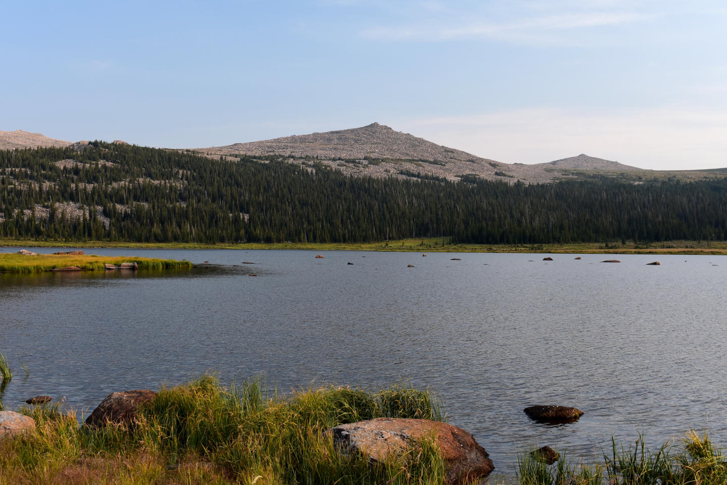
“Elk Lake” and Ant Hill and a sky with smoke from distant wildfires. The exposed rocks far from shore suggest much of the lake is shallow but it is a big lake with the potential for deep holes. The lake has considerable emergent vegetation in patches and there are boggy areas around much of the shore.
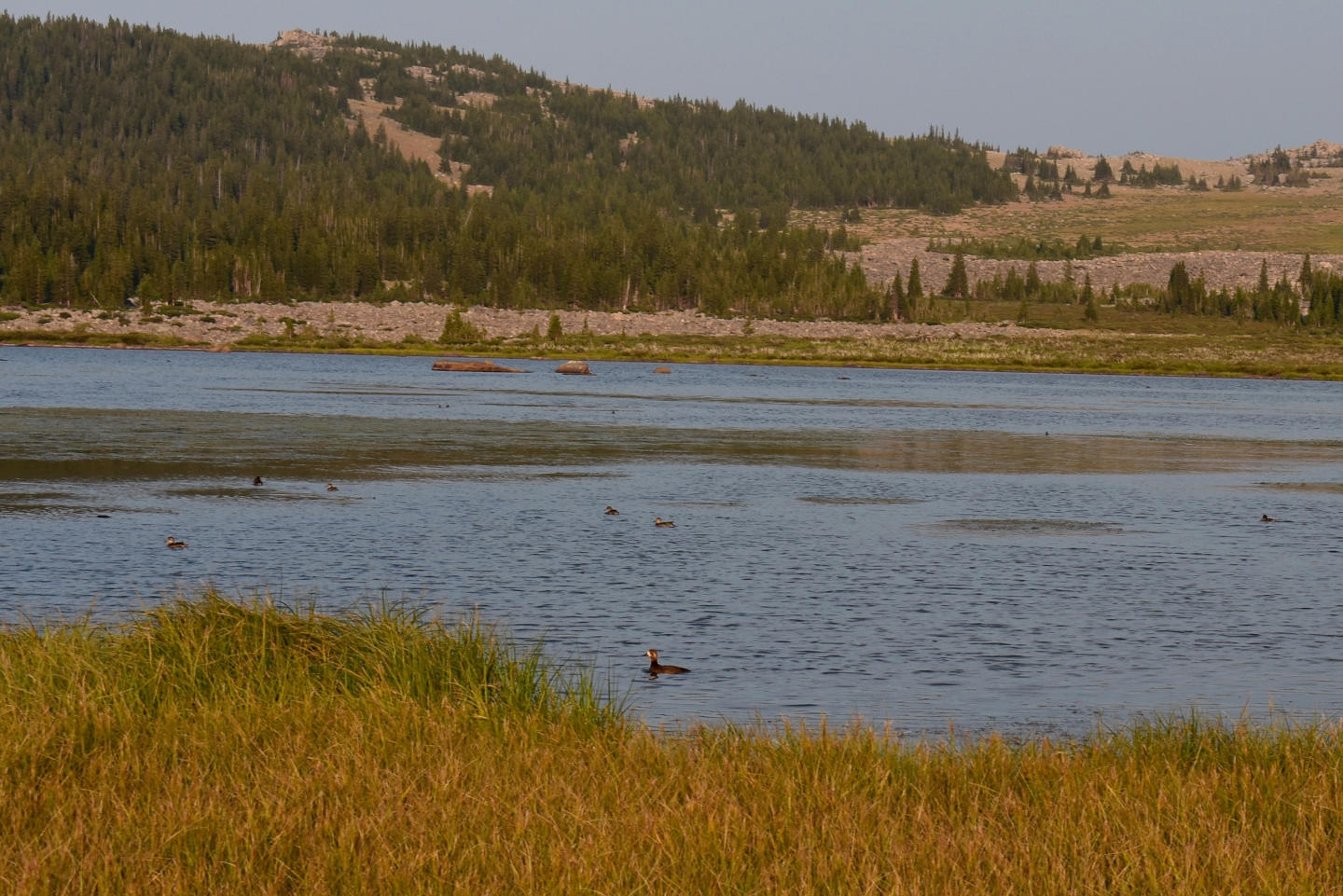
Ducks at “Elk Lake”. There are quite a few. Some in the distance are feeding tail up. Others are diving ducks that disappear from the water surface from time to time. I didn’t see any ducks at “Cloud Peak Reservoir”, which has fish.
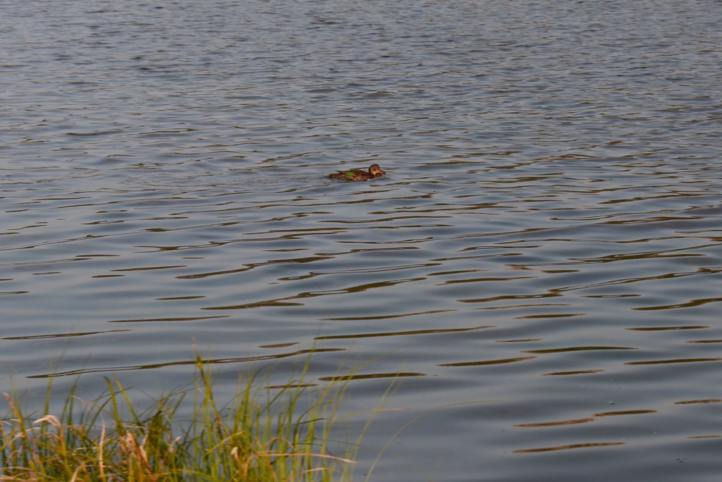
This duck on “Elk Lake” was putting on quite a display. Near constant squawking and flapping of wings seemed to be a kind of broken-wing act. I presume the duck was trying to lead me away from eggs or ducklings near the shore. That means some of these ducks aren’t just temporary visitors; they are living here. They may be attracted by the amphipods as migrating lesser scaup in southern Saskatchewan and the upper Midwest of the U.S. are (Lindeman and Clark, 1999). Carleen and others (2024) found strong negative correlations between amphipod and fish densities in that region. The expanded distribution of fish populations in the prairie potholes region has led to a decline in duck populations (McLean and others, 2016). This implies the fish-free “Elk Lake” is an important refuge for ducks in the Bighorn Mountains.
Lower “Golden Lake” (Powder River Ranger District, Bighorn National Forest, Cloud Peak Wilderness)
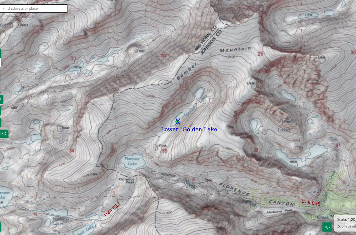
___This map is a screenshot of The National Map (Go to The National Map). The U.S. Geological Survey generally does not copyright or charge for its data or reports (unless printed). A pond location is indicated by an “X”, which corresponds to the coordinates given in the data spreadsheet. Labels in quotations are from 7.5-minute topographic quadrangles.
___As of April 2025, the National Grid overlay with red lines in UTM coordinates does not load in The National Map.
___As of September 2026, The National Map continues to lose functionality. Symbols and polygons are no longer available online. I have used Inkscape to plot “X”s on the green dots plotted by the Spot Elevation Tool, which also provides coordinates but now only the latitude and longitude. I have used the cursor location tracker in UTM mode and have manually written down the UTM coordinates before moving the cursor to the spreadsheet for data entry. Showing colored, non-opaque polygons of private or otherwise non-public lands is no longer feasible.
___There is no private or state land on this map.
“Golden Lakes” are 2 lakes in the hanging valley on the south and southeast sides of Bomber Mountain and northeast of “Florence Lake”. Lower “Golden Lake” is the lower, larger one. On the 7.5-minute topographic map, the lake is about 325 m long and 110 m wide (1,070′ x 360′). The shore is all boulders with a few patches of grass.
Lower “Golden Lake” is about 900 m (2,950′) from trail 038 at the southeast corner of “Florence Lake”. That trail can be accessed from the west via “Mistymoon Lake” or from the east via Florence Canyon and the valley of North Clear Creek. A path up the steepest part of the hill northeast of “Florence Lake” is marked by trampled grass and cairns of small rocks. The climb is not technical; nor is it hands-free. Rare additional cairns on smooth rock or boulders above the steepest part are largely superfluous.
Elevation: 3,421 m (11,220′)
August 13, 2026
I didn’t get to the fishless lakes in “South Piney Lakes” canyon because of the very slow hiking from “Cloud Peak Reservoir” up the canyon. I thought I would have better luck with “Golden Lakes” because they are closer to a trail and the off-trail hiking is all above timberline. So here I am.
- 110 m x 325 m, based on the 7.5-minute topographic quadrangle; depth greater than 300 cm.
- Clear greenish water; 12 C at 1200.
- No fairy shrimp.
- Caddisfly larvae (Trichoptera), wriggly larvae, there are a lot of very small non-biting insects flying around that may be chironomids (Insecta: order Diptera, family Chironomidae), chaoborid larvae(?) (Insecta: order Diptera, family Chaoboridae), small birds.
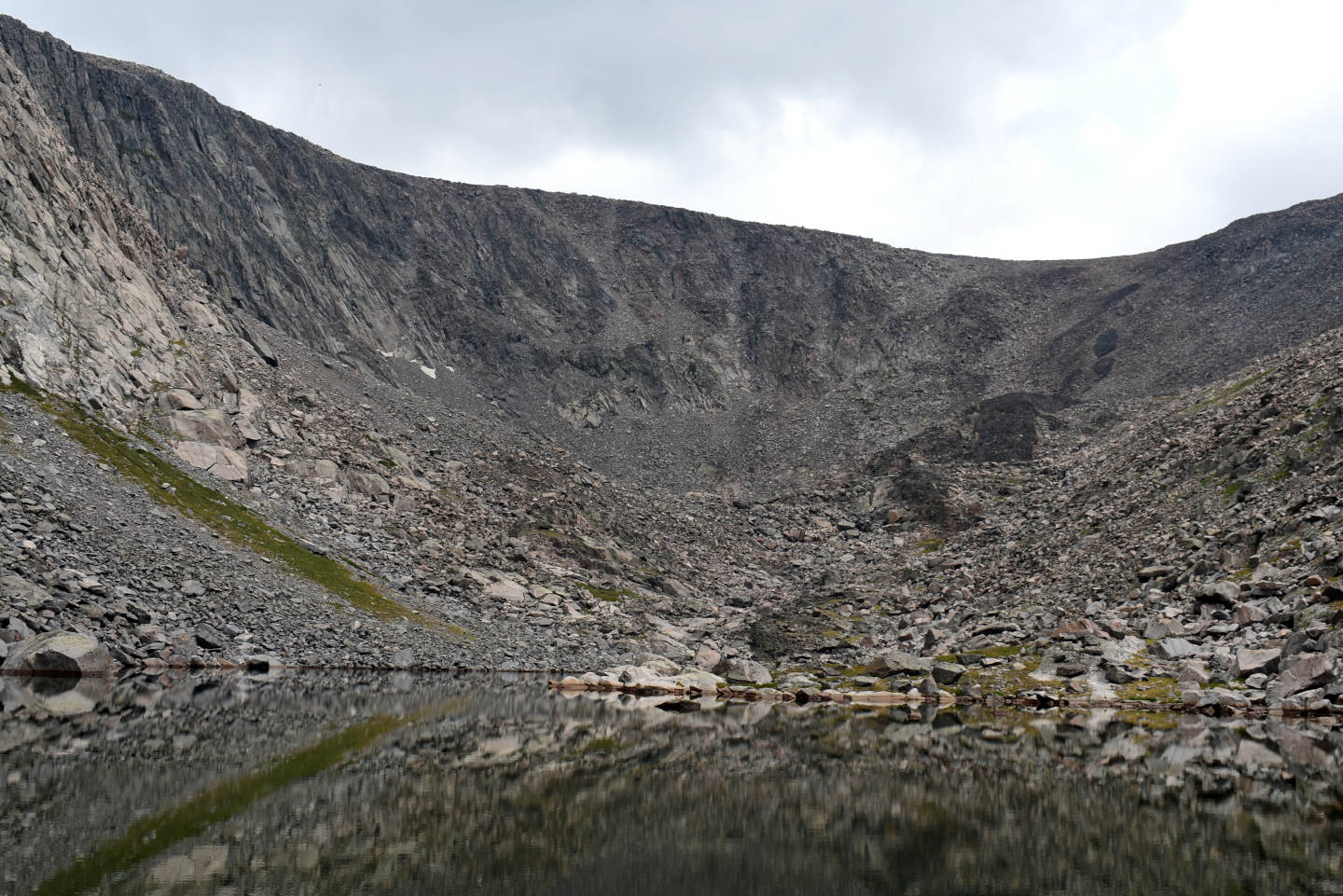
A very still Lower “Golden Lake”. Upper “Golden Lake” is not much higher, just up the low, boulder-strewn slope to the left of the mafic dike. I did get to the shore of Upper “Golden Lake” and snap a photograph but then the rain and hail started. That put an end to my fairy shrimp searching for the day.
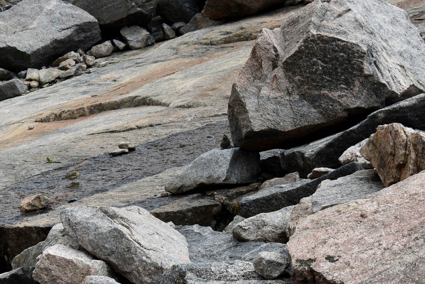
There is a small, dark colored bird to the left of the big boulder at upper right. It may be a black rosy finch. Black rosy finches breed in the Bighorn Mountains and have been seen on Cloud Peak (Canterbury, Johnsgard, and Downing, 2013). In the Sierra Nevada, hatching mayflies are an important food for gray-crowned rosy finches, which consequently are much more common at fishless lakes than lakes with fish (Epanchin and others, 2010). Lower “Golden Lake” lacks fish but I didn’t see mayfly larvae. Maybe this and another species of small bird are feeding on the chironomids(?) here.
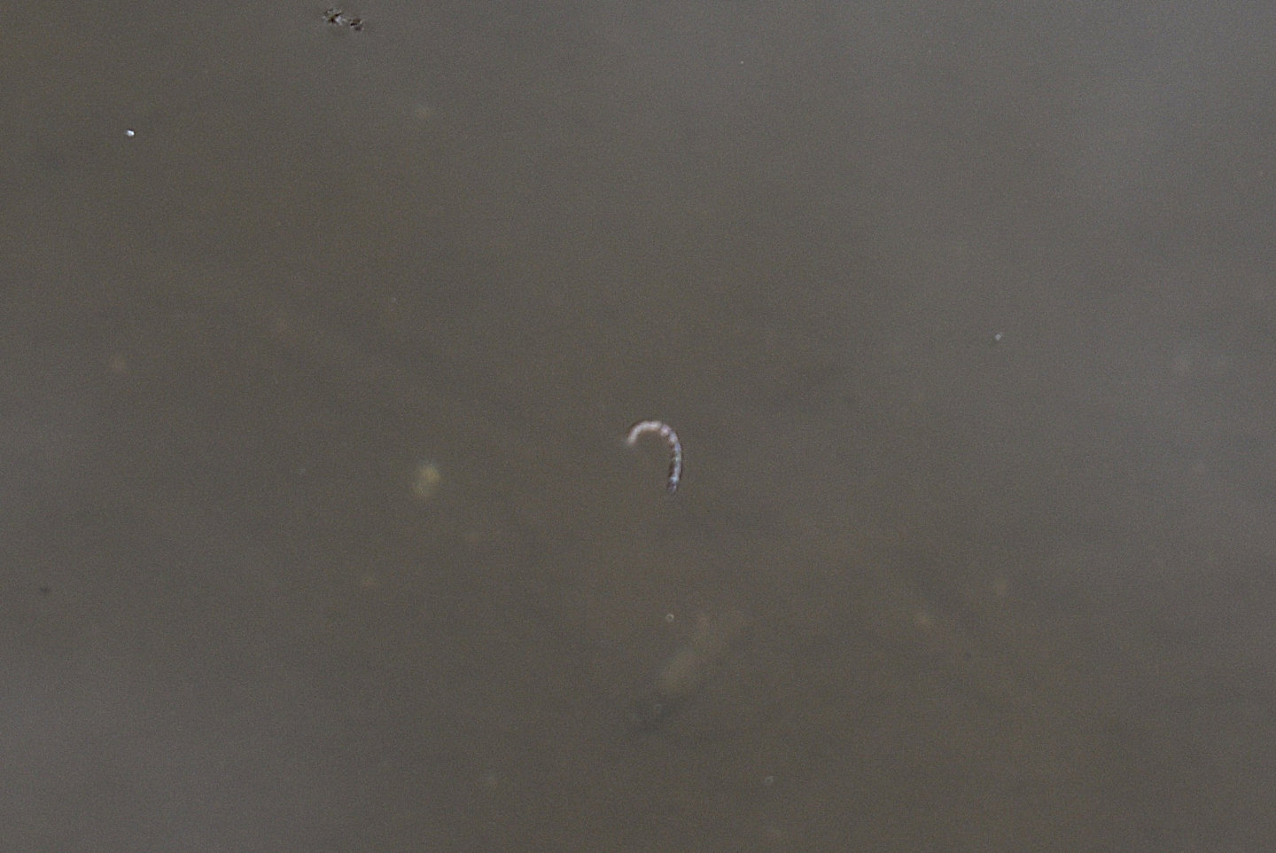
This small, white larva may be a species of the genus Chaoborus. It is similar to that pictured in Fig. 5A of Salmela and others (2021). However, the elevation range of Chaoborus nyblaei is limited by ultraviolet radiation (Lindholm and others, 2012, abstract only, and 2016b, abstract only), which increases with elevation and latitude. This may be true of other species as well but Chaoborus americanus was collected at an elevation of 2,920 m (9,580′) in the Beartooth Mountains of northwestern Wyoming (Williams, 1980). Following Williams (1980), Stoddard (1987) thought that Chaoborus species may have been eliminated from lakes higher than 3,000 m (9,840′)in the Sierra Nevada by copepod predators but that implies that chaoborids do occur above 3,000 m in some places. Some Chaoborus species survive the ultraviolet radiation above the Arctic Circle, about 66.5 degrees north, and may also do well at high elevations. Lamontagne and others (1994) found a Chaoborus species that was probably trivittatus on Baffin Island. Borkent (1979) reported C. cooki in northern Alaska and C. trivittatus in the Northwest Territories.
Road 394 Bad Hill Pond (Powder River Ranger District, Bighorn National Forest)
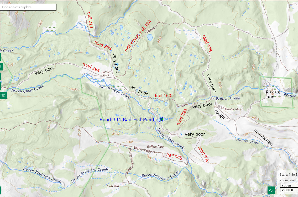
___This map is a screenshot of The National Map (Go to The National Map). The U.S. Geological Survey generally does not copyright or charge for its data or reports (unless printed). A pond location is indicated by an “X”, which corresponds to the coordinates given in the data spreadsheet. Labels in quotations are from 7.5-minute topographic quadrangles.
___As of April 2025, the National Grid overlay with red lines in UTM coordinates does not load in The National Map.
___As of September 2026, The National Map continues to lose functionality. Symbols and polygons are no longer available online. I have used Inkscape to plot “X”s on the green dots plotted by the Spot Elevation Tool, which also provides coordinates but now only the latitude and longitude. I have used the cursor location tracker in UTM mode and have manually written down the UTM coordinates before moving the cursor to the spreadsheet for data entry. Showing colored, non-opaque polygons of private or otherwise non-public lands is no longer feasible.
___There is a block of private near the right edge of the map.
Road 394 Bad Hill Pond is on the northeast side of road 394 between Soldier Park and Hunter Corrals and Campground. The pond is next to where the road curves up a small hill with big rocks, loose rocks, and deep ruts. Road 394 Bad Hill Pond is on a small, meandering stream that has not been named. The east shore is sandy but there are also boggy areas around the pond. The pond has an irregular shape, which is about 125 m long and 60 m wide (410′ x 200′) on The National Map’s aerial imagery. At the time of the visit, a partially vegetated gravel bar separated the main part of the pond from a smaller part to the west.
Although Road 394 Bad Hill Pond is next to a road, it is best visited on foot or horseback. The road is terrible. The pond is probably less than 3 km (1.8 Miles) from Hunter Corrals and Campground along the windy road 394.
Elevation: 2,547 m (8,360′)
August 14, 2026
I stopped at the pond on the way back to my vehicle from a camp on North Clear Creek.
- 60 m x 125 m, based on The National Map’s aerial imagery; depth greater than 100 cm.
- Clear water; 19 C at 1400.
- No fairy shrimp.
- Black ostracods less than 1 mm long, mayfly larvae, caddisfly larvae, snails, ducks.
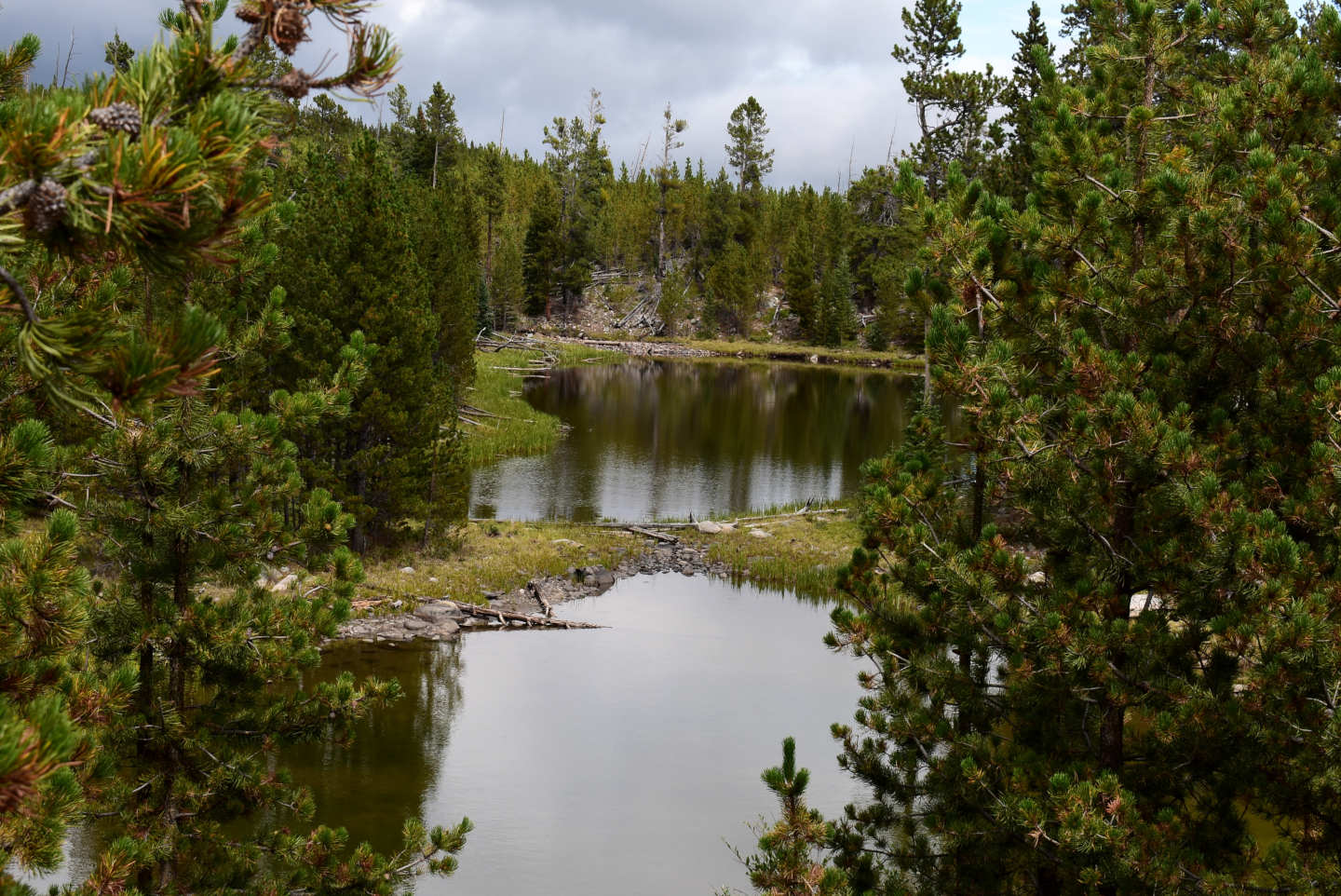
A view to the northeast of Road 394 Bad Hill Pond from the bad hill. The gravel bar at center isolates the western part of the pond from the rest of the pond.
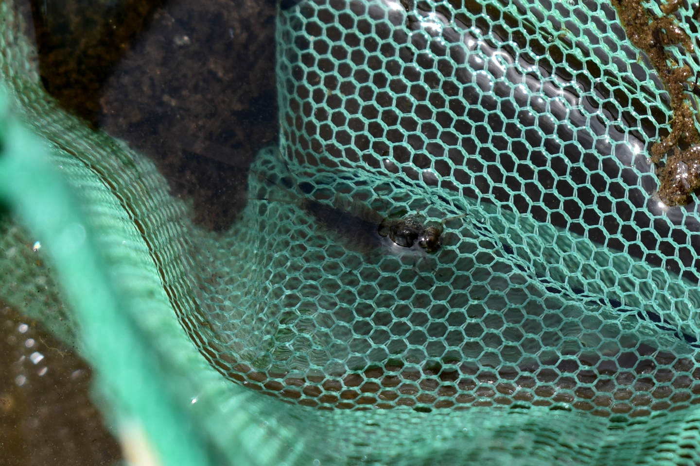
Mayfly larva in the net at Road 394 Bad Hill Pond. The 3 tail-like features and the gills which make the abdomen look fat are characteristic of mayfly larvae.

Several black ostracods at the edge of the water on the sandy shore of Road 394 Bad Hill Pond.
“Rainy Lake” (Powder River Ranger District, Bighorn National Forest, Cloud Peak Wilderness)
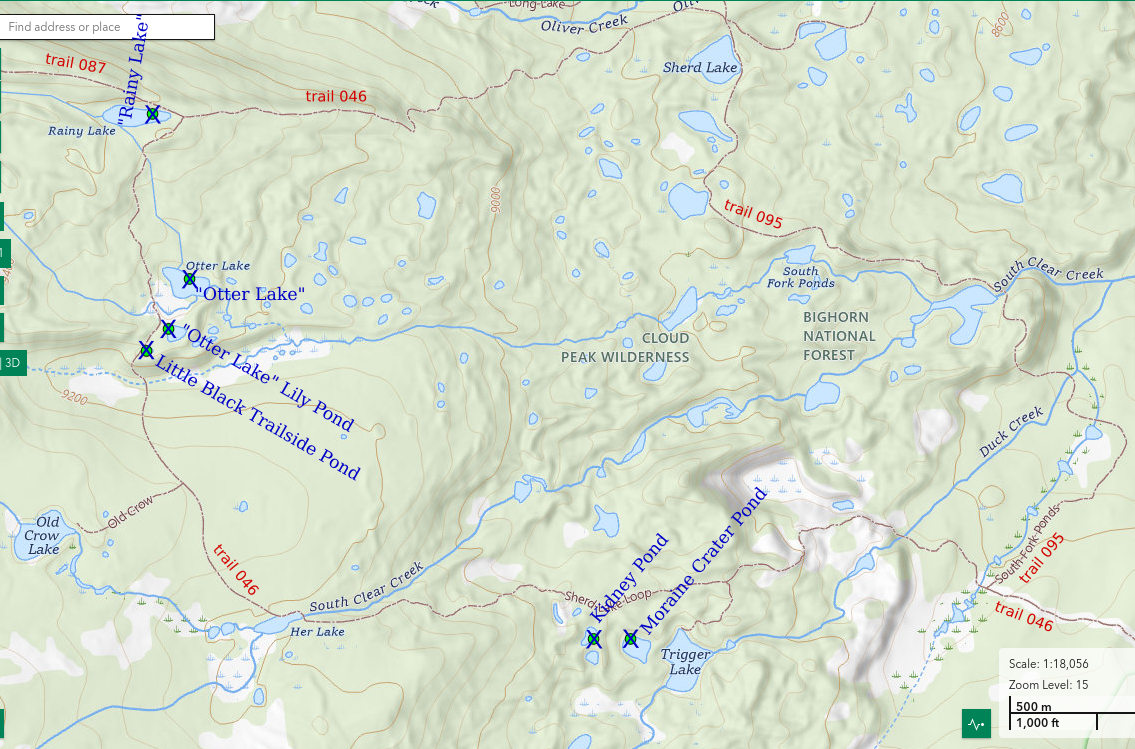
___This map is a screenshot of The National Map (Go to The National Map). The U.S. Geological Survey generally does not copyright or charge for its data or reports (unless printed). A pond location is indicated by an “X”, which corresponds to the coordinates given in the data spreadsheet. Labels in quotations are from 7.5-minute topographic quadrangles.
___As of April 2025, the National Grid overlay with red lines in UTM coordinates does not load in The National Map.
___As of September 2026, The National Map continues to lose functionality. Symbols and polygons are no longer available online. I have used Inkscape to plot “X”s on the green dots plotted by the Spot Elevation Tool, which also provides coordinates but now only the latitude and longitude. I have used the cursor location tracker in UTM mode and have manually written down the UTM coordinates before moving the cursor to the spreadsheet for data entry. Showing colored, non-opaque polygons of private or otherwise non-public lands is no longer feasible.
___There is no private or state land on this map.
“Rainy Lake” is a rocky lake in dense forest on the moraine-blanketed hills between Middle and South Clear creeks. The lake is named on the 7.5-minute topographic quadrangle. The fact that it rained during my visit is a coincidence. On The National Map’s aerial imagery it is 180 m by 40 m (590′ x 130′). The lake has no inlet or outlet on the topographic map although The National Map shows both at the western end of the lake. I did not notice a stream coming or going but it may have dried up due to the weather or it may have been obscured by boulders.
Most of the “South Fork Ponds” have fish, either because they have been stocked or because they are on streams with fish. Named lakes with fish include “Trigger Lake”, “Her Lake”, “Old Crow Lake”, “Romeo Lake”, “Ringbone Lake”, “Long Lake”, and “Sherd Lake”. “Rainy Lake” and “Otter Lake” are exceptions and, importantly, they are close to trails. Visiting ponds away from the trails is surprisingly difficult because of the usually dense forest with downfall; the numerous, steep, moraine ridges; and boulder piles.
Trail 087 passes close to the north shore of “Rainy Lake” and the junction of trail 087 with trail 046 is just east of the lake. Trailheads for trail 046 are at Circle Park, via county road 20 and forest road 384, or in the Sourdough Creek drainage, via county road 23 and forest roads 491, 612, and 382. Road 491 is maintained for highway vehicles, road 612 is rougher but in good shape, and road 382 is a little rougher but still passable to highway vehicles.
Elevation: 2,854 m (9,360′)
August 15, 2026
The light rain that fell while I visited the pond convinced me to turn around but, fortunately, it did not continue long and I was able to visit several other ponds on the way back.
- 30 m x 130 m, by subtracting 10 m width and 50 m length from The National Map’s aerial imagery size; depth somewhere between 100 cm and 200 cm.
- Clear water; 15 C at 1300.
- No fairy shrimp.
- Water boatmen (sub-order Heteroptera, family Corixidae), backswimmers (sub-order Heteroptera, family Notonectidae).
Looking west across “Rainy Lake”. The water level looks like it is considerably below normal. The clouds have lifted a little but there is still sparse dripping off and on. During the “off” times, I can see what is in the water.
“Otter Lake” (Powder River Ranger District, Bighorn National Forest, Cloud Peak Wilderness)
“Otter Lake” is a muddy lake with boulders surrounded by a bog. At the time of the visit, the bog was dry enough to walk across. The lake is about 550 m (1,800′) south of “Rainy Lake” and on the east side of trail 046. It is 150 m long by 80 m wide (490′ x 260′) on The National Map’s aerial imagery.
“Otter Lake” is visible from trail 046. For trail 046 access, see “Rainy Lake”.
Elevation: 2,815 m (9,240′)
August 15, 2026
A bull moose on the far side of the lake adds a little vertebrate interest. Unlike the water level in “Rainy Lake”, the water level here is down only a little and could be normal for this time of year.
- 80 m x 150 m, based on The National Map’s aerial imagery; depth too hard to estimate given the size of the lake and the seemingly flat topography.
- Clear water; 16 C at 1400.
- No fairy shrimp.
- Backswimmers (sub-order Heteroptera, family Notonectidae), ducks, moose.
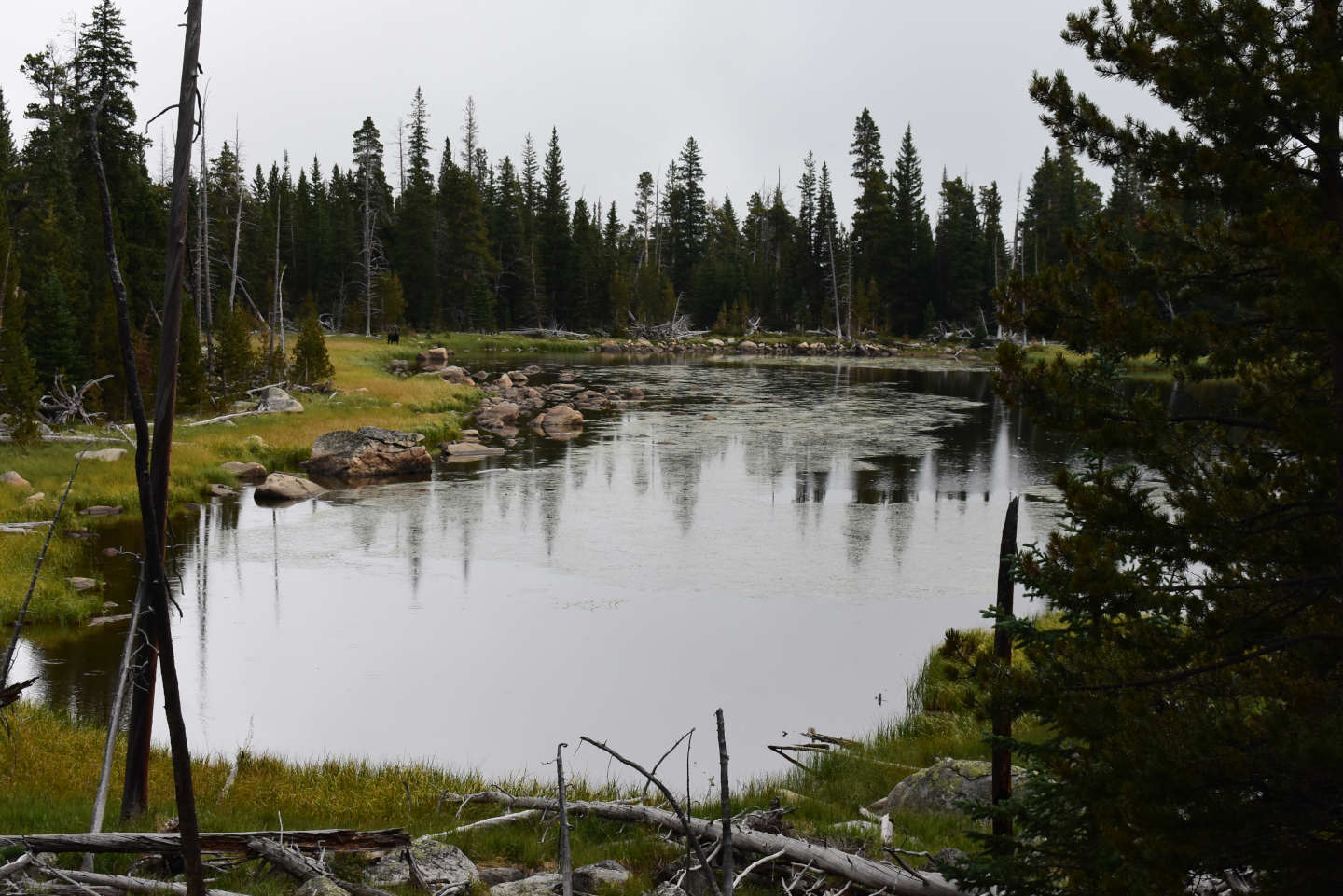
View to the east across “Otter Lake”. The water level looks fine. There are extensive patches of emergent vegetation such as pond lilies and grass. The small black thing in the distance to the left of the lake is the moose.
“Otter Lake” Lily Pond (Powder River Ranger District, Bighorn National Forest, Cloud Peak Wilderness)
“Otter Lake” Lily Pond is about 110 m (360′) south of “Otter Lake” and also east of trail 046. The “Otter Lake” bog is essentially continuous to “Otter Lake” Lily Pond. The pond is also muddy and has only a few boulders. “Otter Lake” Lily Pond appears to have dimensions of about 70 m by 30 m (230′ x 100′) on The National Map’s imagery, which are close to those on the 7.5-minute topographic quadrangle.
“Otter Lake” Lily Pond is not visible from trail 046. See “Rainy Lake” for trail 046 access.
Elevation: 2,816 m (9,240′)
August 15, 2026
This pond is almost covered with pond lilies. That is probably not good for filter-feeding fairy shrimp but WIDLA.
- 30 m x 70 m, based on The National Map’s aerial imagery; depth less than 100 cm.
- Clear water; 15 C at 1415 in 2 cm water (as far as I can reach).
- No fairy shrimp.
- No aquatic animals seen.
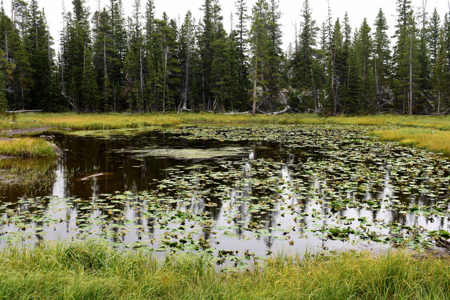
A very lush and green “Otter Lake” Lily Pond. Unfortunately, there aren’t many places where I can get close to the water to look for animals without sinking in the mud.
Little Black Trailside Pond (Powder River Ranger District, Bighorn National Forest, Cloud Peak Wilderness)
Little Black Trailside Pond is about 70 m (230′) southwest of “Otter Lake” Lily Pond and closer to trail 046. The steeply sloped side of a large moraine starts a little south of the pond. Little Black Trailside Pond has a muddy bottom with abundant organic matter. It is surrounded by lush grass. In spite of its small size, it is shown on the 7.5-minute topographic quadrangle.
The grassy area by Little Black Trailside Pond is visible from trail 046 but not the black water. See “Rainy Lake” for trail 046 access.
Elevation: 2,814 m (9,230′)
August 15, 2026
I haven’t seen a pond quite like this before. The water is very black. It looks ominous but Branchinecta lindahli and B. campestris were found in a pond in the Nebraska sandhills with “water the color of black ink” (McCarraher, 1970). I have found and DB has identified both those species in Wyoming. However, the B. campestris samples were later identified as the previously unnamed species B. lateralis by Rogers (2006).
- 10 m x 15 m; depth about 30 cm.
- Black water; 15.5 C at 1430 in 2 cm water.
- No fairy shrimp.
- Lots of insects on the water surface but none seen in the water.
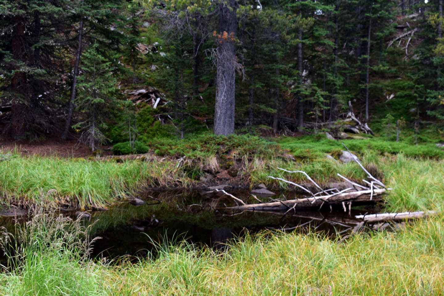
Little Black Trailside Pond. The water doesn’t look as black as it really is because of reflections from the water surface in this photograph.
Kidney Pond (Powder River Ranger District, Bighorn National Forest, Cloud Peak Wilderness)
Kidney Pond is 250 m (820′) west of “Trigger Lake”. It is farther south of trail 046 than shown on the 7.5-minute topographic quadrangle and is not visible from the trail. One thing other than coordinates that might help identify the pond is that it is intermediate in size between a long, thin pond to the west and Moraine Crater Pond to the east. Kidney Pond is shaped like a kidney concave to the west.
Kidney Pond is not visible from trail 046 but is rather close. See “Rainy Lake” for trail 046 access.
Elevation: 2,718 m (8,920′)
August 15, 2026
Another pond with lots of pond lilies. The low water level exposing mud around the shore makes observations difficult.
- 40 m x 70 m; depth less than 50 cm.
- Clear water; 17 C at 1630.
- No fairy shrimp.
- No aquatic animals seen.
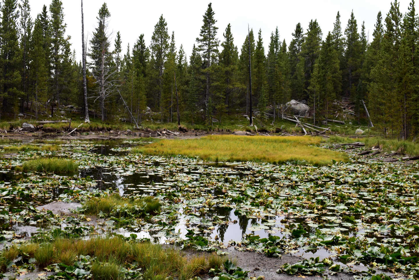
Kidney Pond, looking south. The shorelines at left and right are curved and concave to the west. The exposed mud on the far shoreline indicates the water level is lower than normal. Given the apparently shallow depth, this pond could dry up in some years.
Moraine Crater Pond (Powder River Ranger District, Bighorn National Forest, Cloud Peak Wilderness)
Moraine Crater Pond is only about 50 m (160′) west of “Trigger Lake” but it is hard to find because it is in a crater. The crater is not explosive or volcanic, the steep walls are formed by a bouldery moraine. The lack of outlet makes this pond a good candidate for dark, organic-rich water. Even so, the water is clear. Moraine Crater Pond is about 80 m by 65 m on the 7.5-minute topographic quadrangle.
Moraine Crater Pond is more than 100 m (330′) south of and is not visible from trail 046. See “Rainy Lake” for trail 046 access. It may be closer to trail 099, which leads from trail 046 to the north shore of “Trigger Lake”.
Elevation: 2,703 m (8,870′)
August 15, 2026
This pond is in a very round depression that looks like a crater but it’s all moraine.
- 50 m x 70 m; depth about 40 cm.
- Clear water; 16 C at 1700.
- No fairy shrimp.
- Backswimmers (sub-order Heteroptera, family Notonectidae).
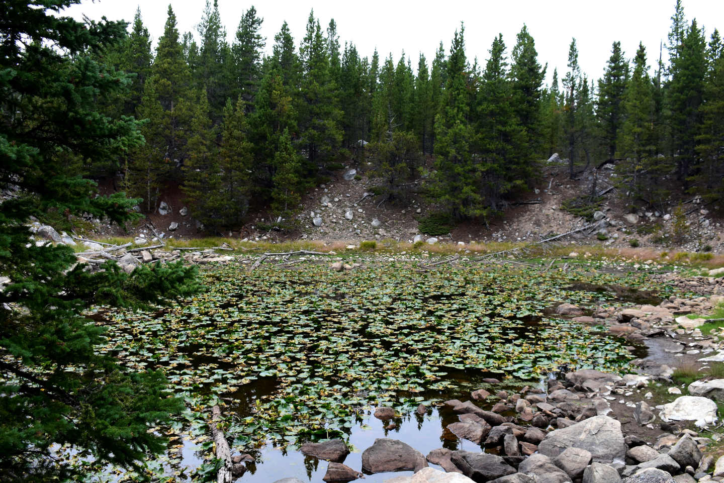
Moraine Crater Pond, with maybe the most pond lilies of all. All the boulders make it easy to get to the water’s edge so I actually saw something swimming in this pond.
“Mabel Lake” (Powder River Ranger District, Bighorn National Forest, Cloud Peak Wilderness)
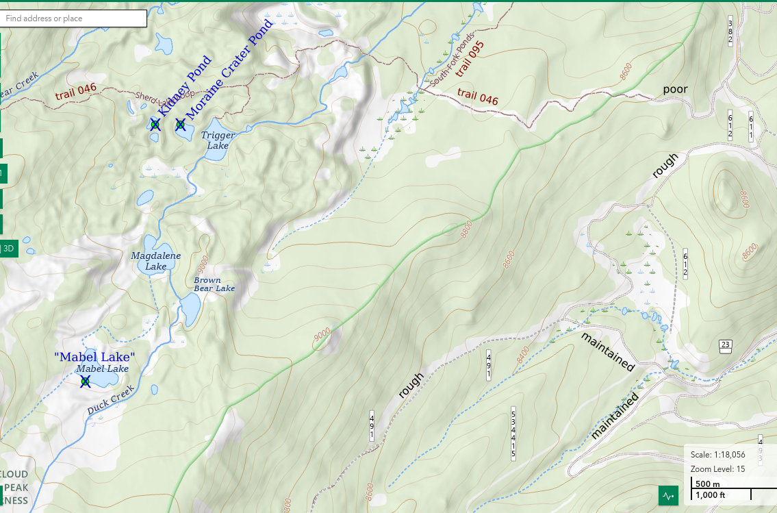
___This map is a screenshot of The National Map (Go to The National Map). The U.S. Geological Survey generally does not copyright or charge for its data or reports (unless printed). A pond location is indicated by an “X”, which corresponds to the coordinates given in the data spreadsheet. Labels in quotations are from 7.5-minute topographic quadrangles.
___As of April 2025, the National Grid overlay with red lines in UTM coordinates does not load in The National Map.
___As of September 2026, The National Map continues to lose functionality. Symbols and polygons are no longer available online. I have used Inkscape to plot “X”s on the green dots plotted by the Spot Elevation Tool, which also provides coordinates but now only the latitude and longitude. I have used the cursor location tracker in UTM mode and have manually written down the UTM coordinates before moving the cursor to the spreadsheet for data entry. Showing colored, non-opaque polygons of private or otherwise non-public lands is no longer feasible.
___There is no private or state land on this map.
“Mabel Lake” is about 1.1 km (0.7 mile) southwest of “Trigger Lake”. Unlike “Trigger Lake”, “Magdalene Lake”, and “Brown Bear Lake”, which are all on Duck Creek and all have fish, “Mabel Lake” is not connected to Duck Creek and does not have fish. On The National Map’s aerial imagery, “Mabel Lake” is 150 m long and 110 m wide (490′ x 360′). The 7.5-minute topographic quadrangle shows that it has an outlet that flows northeasterly into “Magdalene Lake”. The 1:100,000-scale, 30-minute x 60-minute topographic map mistakenly shows Duck Creek flowing through “Mabel Lake” to “Magdalene Lake”. “Mabel Lake” is separated from Duck Creek by a substantial ridge of moraine.
“Mabel Lake” is not close to a trail. It is a little over 1 km (0.6 mile) west of road 491 in the Sourdough Creek watershed and about the same distance from “Trigger Lake” to the northeast. “Trigger Lake” is accessible via trail 099 and trail 046. See “Rainy Lake” for trail 046 access. I noticed trampled paths on both sides of Duck Creek. One or both of those paths may continue to “Trigger Lake”. Hiking through the forest from road 491 is not difficult, though, due to ample spacing between the trees and lack of downfall, at least on the southeast side of the ridge. On the northwest side of the ridge, the forest gets tighter and there are sporadic bouldery moraines.
I stumbled on to a constructed trail near the top of the ridge east of “Mabel Lake”. It went northerly southeast of the ridge top and southwesterly northwest of the ridge top. The trail must intersect road 491 south of where I left that road. I don’t know where the trail goes on the northwest side of the ridge. The 2023 recreation map for the Bighorn National Forest shows trail 089 going southwesterly from the end of road 491 and then looping to the north and ending at the top of the ridge east of “Mabel Lake”. That location is south of where I encountered a trail and the trail I encountered continued over the top of the ridge. If trail 089 is as shown on the recreation map, it does not facilitate access to “Mabel Lake”. If the constructed trail I found is a modified or mismapped trail 089, it could be followed to the top of the ridge provided its intersection with road 491 is marked.
Elevation: 2,758 m (9,050′)
August 16, 2026
“Mabel Lake” is the only target today. With the clear skies, I’ll have plenty of time to peer into the water.
- 110 m x 150 m, based on The National Map’s aerial imagery; depth not estimated due to large size and flat topography.
- Clear water; 17 C at 1530.
- No fairy shrimp.
- Amphipods (Crustacea: class Malacostraca, order Amphipoda) 2-10 mm long, backswimmers (sub-order Heteroptera, family Notonectidae), adult dragonflies (Insecta: Odonata, suborder Anisoptera), ducks, lots of bird droppings on the rocks.
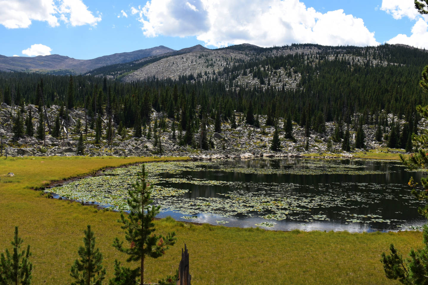
“Mabel Lake”, view to the southwest. The lake is in a wide depression that is ringed by moraine except for a small part of the northwestern side. Like “Elk Lake”, “Mabel Lake” has considerable emergent vegetation. The surrounding grassy bog is hummocky but currently mostly dry.
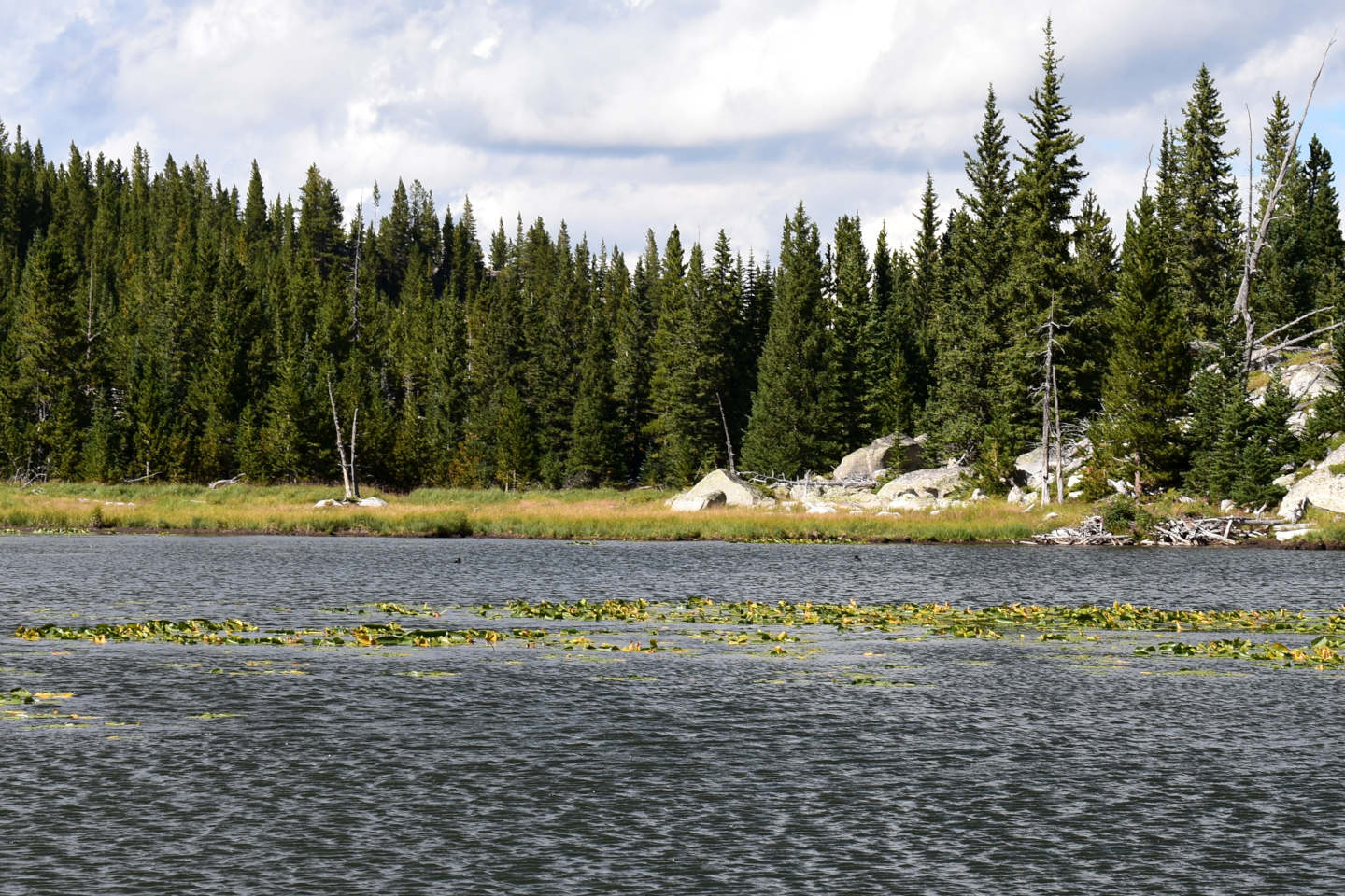
Looking northwest across “Mabel Lake”. 2 dark specks on the water near the far shore are ducks. Like “Elk Lake”, “Mabel Lake” lacks fish and has amphipods and ducks. The bird droppings on the rocks along the shore indicate small birds, like finches and pipits, commonly visit. They were likely attracted by mayflies or other flying insects with aquatic larvae. Although I didn’t see any mayfly larvae, that could be because almost all of them hatched. Ducks and small birds at fishless lakes is a pattern. Several of the fishless lakes I have visited had small birds or ducks or both. Of the many lakes with fish that I passed, I didn’t notice small birds at any and saw ducks at only one.
“Chill Lake” #2 (Powder River Ranger District, Bighorn National Forest, Cloud Peak Wilderness)
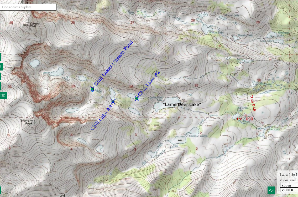
___This map is a screenshot of The National Map (Go to The National Map). The U.S. Geological Survey generally does not copyright or charge for its data or reports (unless printed). A pond location is indicated by an “X”, which corresponds to the coordinates given in the data spreadsheet. Labels in quotations are from 7.5-minute topographic quadrangles.
___As of April 2025, the National Grid overlay with red lines in UTM coordinates does not load in The National Map.
___As of September 2026, The National Map continues to lose functionality. Symbols and polygons are no longer available online. I have used Inkscape to plot “X”s on the green dots plotted by the Spot Elevation Tool, which also provides coordinates but now only the latitude and longitude. I have used the cursor location tracker in UTM mode and have manually written down the UTM coordinates before moving the cursor to the spreadsheet for data entry. Showing colored, non-opaque polygons of private or otherwise non-public lands is no longer feasible.
___There is no private or state land on this map.
“Chill Lake” #2 is about 425 m (1,390′) northwest of “Lame Deer Lake” in “Chill Lakes” canyon, which has 6 lakes. For names of the “Chill Lakes”, WGF numbered the lakes consecutively with number 1 as the lowest lake. I have used the WGF names in this case. “Lame Deer Lake” has fish but they cannot climb through the boulders up to “Chill Lake” #2. On the 7.5-minute topographic quadrangle, “Chill Lake” #2 has dimensions of 325 m by 100 m (1,070′ x 330′). It has about the same size and shape as “Chill Lake” #1, which is to its south. The lake bottom is essentially all boulders although there is some soil filling in spaces between boulders on the ridge south of the lake.
“Chill Lake” #2 is an off-trail hike from “Old Crow Lake”. “Old Crow Lake” can be reached from trail 046, via trail 090. See “Rainy Lake” for trail 046 access. There is a well trampled path that follows the creek from “Old Crow Lake” to “Lame Deer Lake”, entirely avoiding the forest. The path disappears in the boulder pile extending a few hundred meters east of “Lame Deer Lake”. There is another path that follows the southern shore of “Lame Deer Lake” in spite of the steepness and considerable downfall. The climb from “Lame Deer Lake” to “Chill Lake” #2 is easy because the forest opens up and there are a few grassy slopes between the boulder piles. I didn’t see a path above “Lame Deer Lake”. None of the lakes in “Chill Lakes” canyon have fish according to WGF’s online map (https://wgfd.wyo.gov/fishing-boating/places-fish-wyoming).
Elevation: 3,005 m (9,860′)
August 17, 2026
After finding ducks at Upper Indian Pass Lake in the Wind River Mountains, I searched for alpine ducks online to find out more about them. Using various terms, I got no valid and relevant results except “Common Goldeneye, . . . three were seen on Chill Lakes, between 10,000’ and 10,400’ elevation, 9-24-1987” in a Bighorn Mountains birding book (Canterbury, Johnsgard, and Downing, 2013; https://digitalcommons.unl.edu/zeabook/18). Could “Chill Lakes” have the only other alpine duck population in the entire world, and maybe fairy shrimp as a result? I have to know.
- 100 m x 325 m, based on the 7.5-minute topographic quadrangle; depth greater than 300 cm.
- Clear water; 16 C at 1230.
- No fairy shrimp.
- Water boatmen (sub-order Heteroptera, family Corixidae), adult dragonflies (Insecta: Odonata, suborder Anisoptera), caddisfly larvae (Trichoptera).
As the first lake in “Chill Lakes” canyon that I visited, this was a disappointment. I didn’t expect all the lakes to have ducks but this one doesn’t even have the feces of small birds decorating the rocks along the shore.
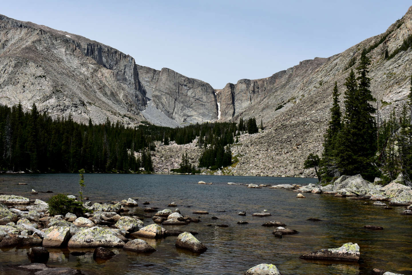
“Chill Lake” #2,looking up the canyon from the outlet. The southern shore (left) is more hikable than the northern in spite of dense forest and downfall.
“Chill Lake” #3 (Powder River Ranger District, Bighorn National Forest, Cloud Peak Wilderness)
“Chill Lake” #3 is 350 m (1,150′) west of “Chill Lake” #2 and only a little higher. Unlike the other lakes in “Chill Lakes” canyon, it is elongated in a north-south direction rather than northwest-southeast. According to the 7.5-minute topographic quadrangle, “Chill Lake” #3 receives inflow from “Chill Lake” #4, the next one up the canyon, but the outflow bypasses both “Chill Lake” #2 and “Chill Lake” #1 to empty directly into “Lame Deer Lake”. “Chill Lake” #3 has an irregular shape and dimensions of 375 m x 125 m (1,230′ x 410′) on the 7.5-minute topographic quadrangle.
For access, see “Chill Lake” #2. Find a way west through the forest and over the boulders from “Chill Lake” #2.
Elevation: 3,041 m (9,980′)
August 17, 2026
Another lake on boulders but there is a grassy area with a little soil on the southern shore.
- 125 m x 375 m, based on the 7.5-minute topographic quadrangle; depth greater than 300 cm.
- Clear water; 15 C at 1315.
- No fairy shrimp.
- Water boatmen (sub-order Heteroptera, family Corixidae), caddisfly larvae (Trichoptera), mayfly larvae (Ephemeroptera)(shed exoskeletons).
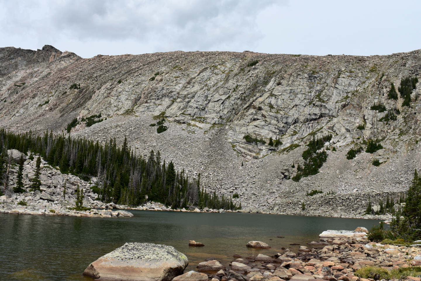
Looking along the length of “Chill Lake” #3 toward the northern wall of “Chill Lakes” canyon. Dry rocks in the foreground indicate the water level is low but not drastically so.
“Chill Lakes” Unseen Pond (Powder River Ranger District, Bighorn National Forest, Cloud Peak Wilderness)
“Chill Lakes” Unseen Pond is a small round pond between “Chill Lake” #3 and “Chill Lake” #4 but was not seen by the topographer who prepared the 7.5-minute quadrangle. It is clearly visible on The National Map’s current aerial imagery. “Chill Lakes” Unseen Pond is about 225 m (740′) west of the north end of “Chill Lake” #3. Its inlet is not obvious. Gurgling noises indicate the pond receives some flow from the hanging valley rising to the southwest from “Chill Lakes” canyon toward Bighorn Peak. It may also receive flow under boulders from the north, where the outlet of “Chill Lakes” #4 is. There is at least some water gurgling out of the pond to the south.
For access, see “Chill Lake” #2.
Elevation: 3,078 m (10,100′)
August 17, 2026
I ran out of time to visit the higher lakes but I came across this pond after turning back.
- 45 m x 85 m, based on The National Map aerial imagery; depth greater than 200 cm.
- Clear water; 15 C at 1400.
- No fairy shrimp.
- Amphipods (Crustacea: class Malacostraca, order Amphipoda), water boatmen (sub-order Heteroptera, family Corixidae), small black beetles, caddisfly larvae (Trichoptera), adult mayflies (Ephemeroptera), small winged insects (chironomids?) floundering on the water surface.
A very wide angle view of “Chill Lakes” Unseen Pond with the side canyon leading up to Bighorn Peak in the background. In spite of this pond’s small size, I saw more aquatic species here than in the larger lakes. Importantly, it has amphipods, which ducks eat, and ducks can drop fairy shrimp eggs in ponds they visit. If “Chill Lake” #4 or “Chill Lake” #5 also has amphipods, that could explain the 1987 sighting of ducks between 10,000′ (3,048 m) and 10,400′ (3,170 m) (see “Chill Lake” #2). Ducks would probably prefer a bigger lake to “Chill Lakes” Unseen Pond.
“Peggy Lake” West Pond (Tongue Ranger District, Bighorn National Forest, Cloud Peak Wilderness)
“Peggy Lake” West Pond is 550 m (1,800′) west of, and drains into, “Peggy Lake”. It has no mapped inlet but probably receives flow from snowbanks on the steep slopes to the southwest. “Peggy Lake” West Pond is 160 m x 80 m (525′ x 260′) on the 7.5-minute topographic quadrangle.
The nearest trail to “Peggy Lake” West Pond is trail 036 at the east end of “Highland Lake”. Trail 036 connects to ATV trail 320 and Solitude Loop Trail 038 at the northeast end of “Kearny Lake Reservoir”. Trail 036 provides access to trail 038 in Highland Park via the short trail 414. Trail 119 connects trail 036 on the north shore of “Highland Lake” to trail 038 north of Highland Park but its intersections are not signed and it has been omitted from the U.S. Forest Service’s 2023 recreation map of the Bighorn National Forest. To get to Highland Park, one could take trail 027 up East Fork Little Goose Creek from poor road 314 or trail 038 from Coffeen Park (and via trail 592 for less than 1 km, 0.6 mile), which is accessible via poor road 293 south from Red Grade Road at East Fork Campground. Historically, trail 036 continued southwest from the east side of “Highland Lake” to “Spear Lake” but the route shown on the 7.5-minute topographic quadrangle is no longer accurate. The most used current trail ends in the meadow at the confluence of Kearny Creek and the stream draining the “Sawtooth Lakes”. To get to “Spear Lake”, one now has to take the western fork at a rock cairn with a small, inclined stick about 1.3 km southwest of the east end of “Highland Lake”. One could follow the first part of the trail southwest from “Highland Lake” and then turn west to go around the north end or the south end of “Peggy Lake” to get to “Peggy Lake” West Pond. Instead, I went around the north and west sides of “Highland Lake” and headed up the hill toward “Peggy Lake” West Pond before reaching “Peggy Lake”.
Elevation: 3,056 m (10,030′)
August 20, 2026
“Peggy Lake” has fish but the steep rise to “Peggy Lake” West Pond will keep the fish out.
- 80 m x 160 m, based on the 7.5-minute quadrangle; depth greater than 300 cm.
- Clear water; 17 C at 1430.
- No fairy shrimp.
- Water boatmen (sub-order Heteroptera, family Corixidae), caddisfly larvae (Trichoptera), small winged insects (chironomids?) floundering on the water surface, pair of ducks.

View to the southwest across “Peggy Lake” West Pond. The dry rocks around the shore suggest a relatively low water level but perhaps not unusual for mid-August. The haze is smoke from distant wildfires.
Peak 10,505 West Pond (Tongue Ranger District, Bighorn National Forest, Cloud Peak Wilderness)
Peak 10,505 West Pond is 1.4 km (0.8 mile) west of “Highland Lake”. It lies within a small cirque west of a peak with elevation 10,505′ (3,200 m). On the 7.5-minute topographic quadrangle, Peak 10,505 West Pond is round with dimensions 135 m x110 m (440′ x 360′). The quadrangle does not show an inlet or an outlet. Inflow and outflow is probably masked by boulders.
For access to the nearest trail at the east end of “Highland Lake”, see “Peggy Lake” West Pond.
Elevation: 3,143 m (10,310′)
August 20, 2026
There is certainly no way for fish to get up here without human assistance.
- 110 m x 135 m, based on the 7.5-minute quadrangle; depth greater than 300 cm.
- Clear water; 16 C at 1515.
- No fairy shrimp.
- Backswimmers (sub-order Heteroptera, family Notonectidae), cladocerans (Crustacea: class Branchiopoda, orders Anomopoda, Ctenopoda, Onychopoda, Haplopoda) 1 mm long, caddisfly larvae (Trichoptera), mayfly larvae (Ephemeroptera) (shed exoskeletons), 3 diving ducks.
The cladoceran I saw in this pond was not easily confused with copepods because it was prone to swimming in circles.
There are ducks but I didn’t see amphipods, a preferred food. There appears to have been a recent mayfly hatch but I didn’t see small birds, common predators. Obviously, I can’t document much of a pond’s ecology from a brief, 1-time visit but I think it is helpful to note what I do see. In the end, my goal is really just presence-absence data for fairy shrimp.

Very wide angle view to the south across Peak 10,505 West Pond. The smoke from distant wildfires has erased any blue from the sky.
“Lake Silver” (Tongue Ranger District, Bighorn National Forest, Cloud Peak Wilderness)
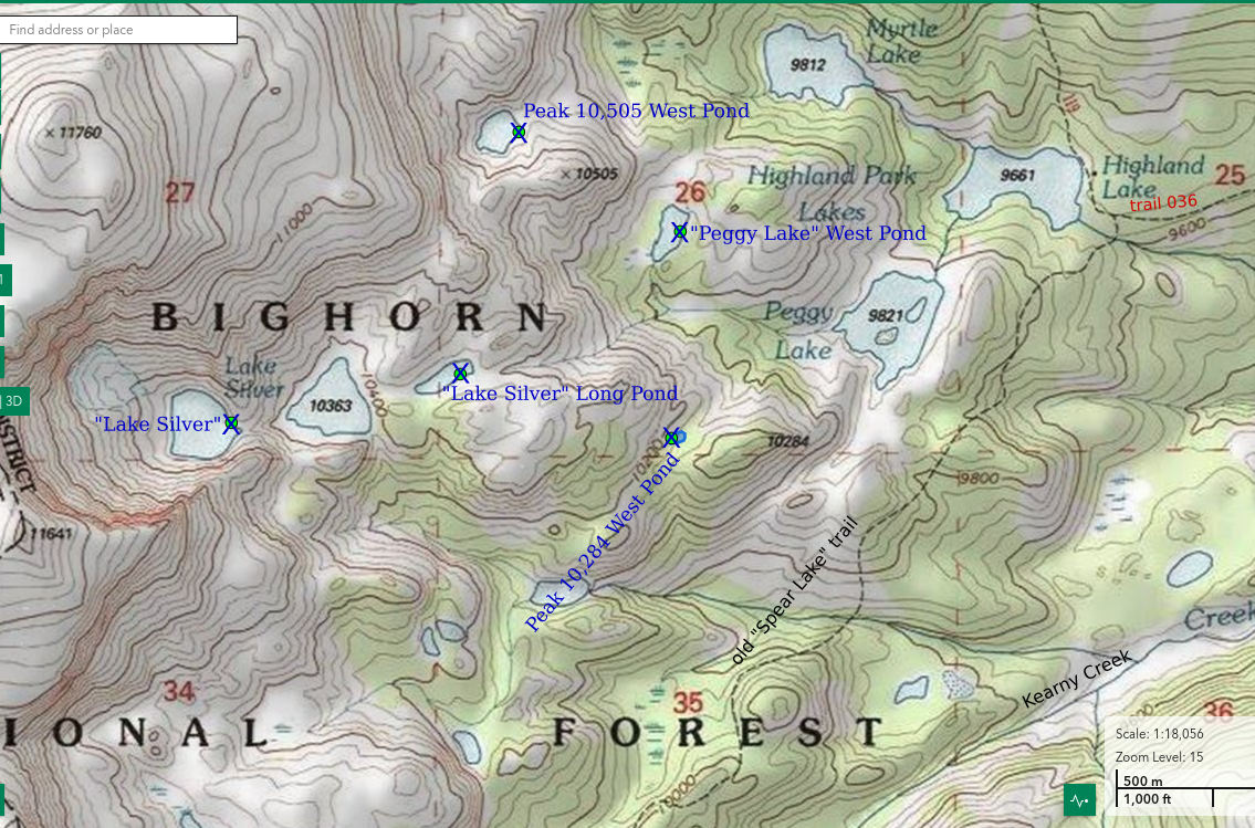
___This map is a screenshot of The National Map (Go to The National Map). The U.S. Geological Survey generally does not copyright or charge for its data or reports (unless printed). A pond location is indicated by an “X”, which corresponds to the coordinates given in the data spreadsheet. Labels in quotations are from 7.5-minute topographic quadrangles.
___As of April 2025, the National Grid overlay with red lines in UTM coordinates does not load in The National Map.
___As of September 2026, The National Map continues to lose functionality. Symbols and polygons are no longer available online. I have used Inkscape to plot “X”s on the green dots plotted by the Spot Elevation Tool, which also provides coordinates but now only the latitude and longitude. I have used the cursor location tracker in UTM mode and have manually written down the UTM coordinates before moving the cursor to the spreadsheet for data entry. Showing colored, non-opaque polygons of private or otherwise non-public lands is no longer feasible.
___There is no private or state land on this map.
“Lake Silver” is in a 330 m (1,080′) deep cirque below the crest of the Bighorn Mountains. It is 2.3 km (1.4 mile) southwest of “Highland Lake”. “Lake Silver” is quite round with dimensions of 225 m x 200 m (740′ x 660′) on the 7.5-minute topographic quadrangle. The quadrangle does not show an outlet because water drains through boulders.
“Lake Silver” is a cross-country hike from the trail southwest of “Highland Lake”. For more about that trail, see “Peggy Lake” West Pond.
Elevation: 3,201 m (10,500′)
August 20, 2026
Steep outcrops around the lake make it hard to get to the water. The wind has picked up and that doesn’t help visibility. Are the fairy shrimp playing hard-to-see?
- 200 m x 225 m, based on the 7.5-minute quadrangle; depth greater than 300 cm.
- Clear water; 13 C at 1630.
- No fairy shrimp.
- Caddisfly larvae (Trichoptera).
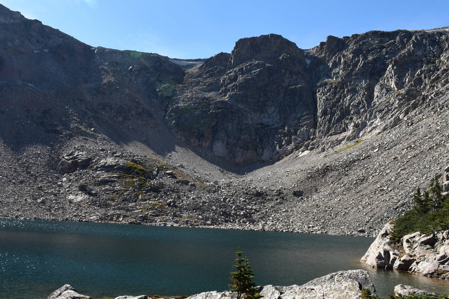
Very wide angle view across “Lake Silver” at the very steep cliff to the northwest, where the snow used to be. In 1981 when aerial photographs for revision of the topographic quadrangle were taken, there was a small glacier or snowbank almost as big as the lake below that very steep cliff.
“Lake Silver” Long Pond (Tongue Ranger District, Bighorn National Forest, Cloud Peak Wilderness)
“Lake Silver” Long Pond is an elongated pond 600 m (1,970′) east of “Lake Silver”. It is downstream of the lake labeled with elevation 10,363′ (3,159 m) on the 7.5-minute topographic quadrangle and is between “Lake Silver” Long Pond and “Lake Silver”. According to WGF’s online map (https://wgfd.wyo.gov/fishing-boating/places-fish-wyoming), lake 10,363′ has been stocked with fish but “Lake Silver” Long Pond has not. The 7.5-minute topographic quadrangle does not show stream connections between these lakes. Flow between the lakes is probably through boulders that cannot be navigated by fish. The 7.5-minute topographic quadrangle gives “Lake Silver” Long Pond a length of 190 m and a width of 55 m (620′ x 180′).
“Lake Silver” Long Pond is a cross-country hike from the trail east and southwest of “Highland Lake”. For access to that trail, see “Peggy Lake” West Pond.
Elevation: 3,172 m (10,410′)
August 20, 2026
It’s windy here, too, but I’ll have a look.
- 55 m x 190 m, based on the 7.5-minute quadrangle; depth greater than 300 cm.
- Clear water; 16 C at 1730.
- No fairy shrimp.
- Water boatmen (sub-order Heteroptera, family Corixidae), backswimmers (sub-order Heteroptera, family Notonectidae), I think I can see caddisfly larvae (Trichoptera) through the waves.
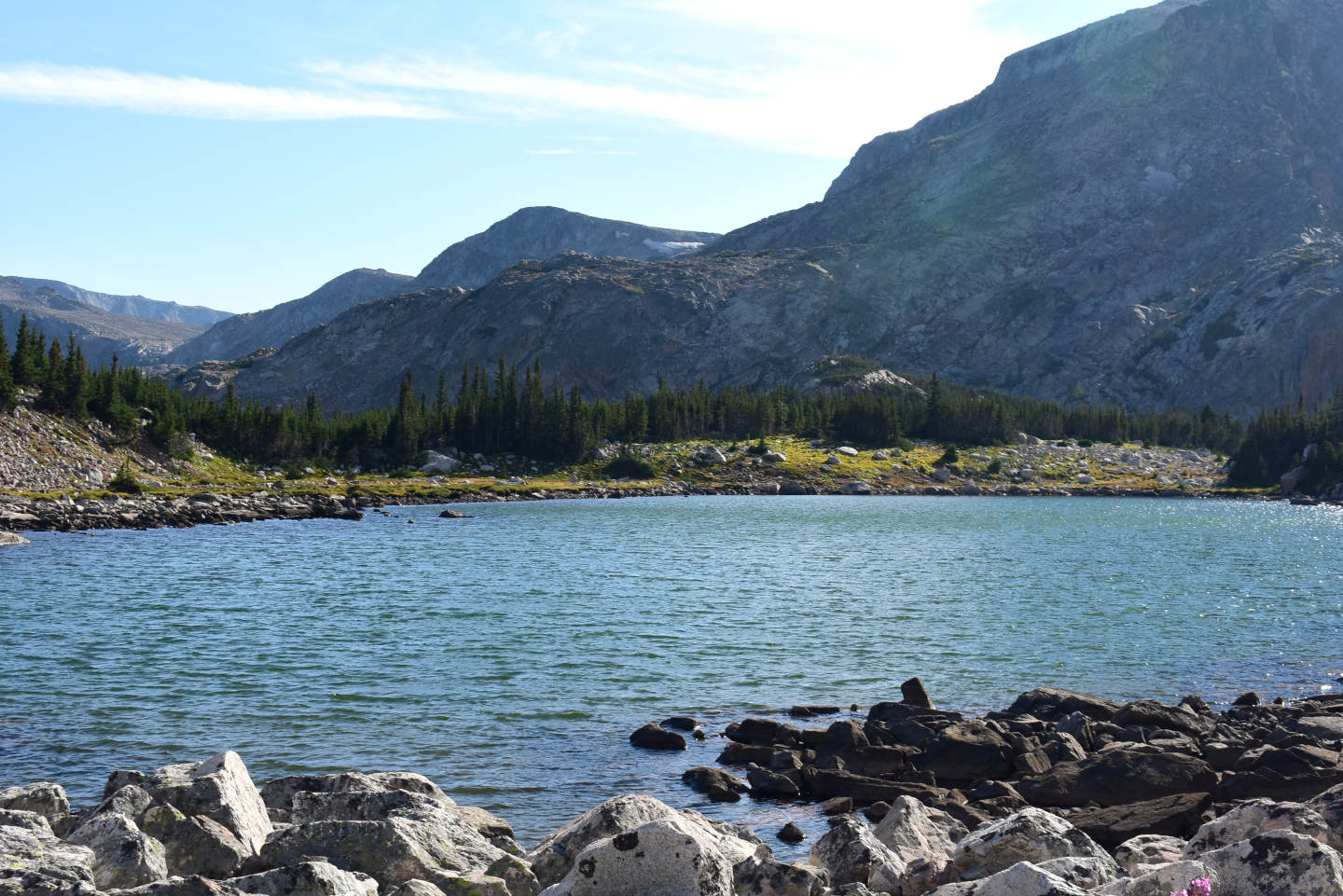
“Lake Silver” Long Pond from the outlet looking southwest, away from the “Lake Silver” cirque. Still smoke in the air this late in the day and even with the wind.
Peak 10,284 West Pond (Tongue Ranger District, Bighorn National Forest, Cloud Peak Wilderness)
Peak 10,284 West Pond is not on the 7.5-minute topographic quadrangle but appeared on my route back to camp. It is in the saddle west of Peak 10,284′ (3,135 m). It is not on any stream but may drain north to “Peggy Lake”. The surroundings are rocky but there is some grass on the northern shore that allows easier access to the water. Peak 10,284 West Pond has dimensions of about 50 m x 30 m (160′ x 100′) on The National Map’s aerial imagery.
The closest trail is southwest of “Highland Lake”. For more on that trail, see “Peggy Lake” West Pond. Walking east from Peak 10,284 West Pond, I should have reached the trail southwest of “Highland Lake” in less than 1 km (0.6 mile). I didn’t find an easy way to get there and I think it took me almost an hour.
Elevation: 3,087 m (10,130′)
August 20, 2026
The pond is already in shadow but maybe I’ll be able to see whatever is in the water.
- 30 m x 50 m, based on The National Map’s aerial imagery; depth greater than 100 cm.
- Clear water; 17 C at 1800.
- No fairy shrimp.
- Water boatmen (sub-order Heteroptera, family Corixidae), black diving beetles, copepods(?), caddisfly larvae (Trichoptera).
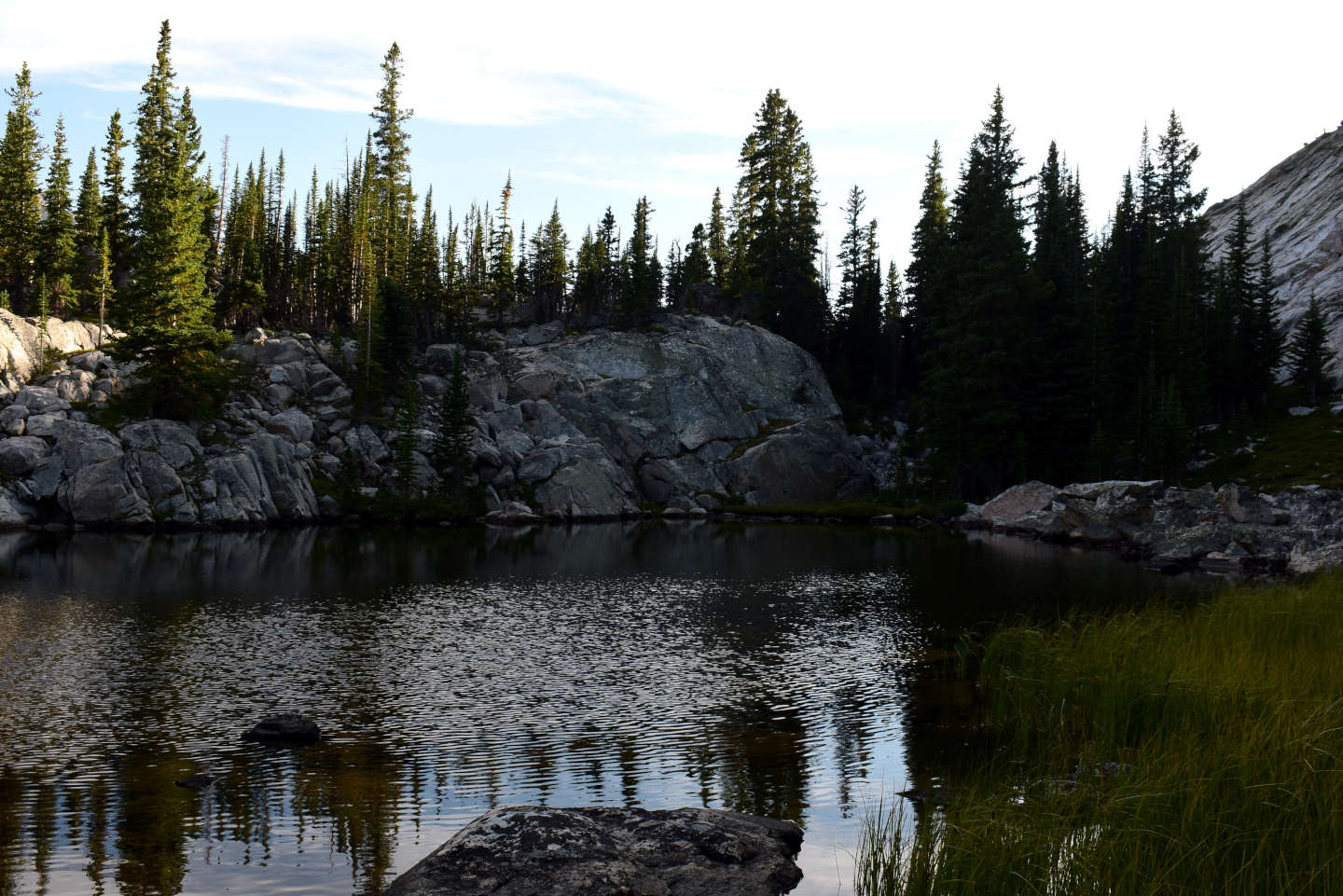
Rocky shores of Peak 10,284 West Pond, looking southwest, and some grass at right.
Sawtooth Peak 10,570 Southwest Lake (Tongue Ranger District, Bighorn National Forest, Cloud Peak Wilderness)
Sawtooth Peak 10,570 Southwest Lake is on the southwest side of the hill capped by a peak with elevation 10,570′ (3,220 m) within “Sawtooth Lakes” canyon. It is the 4th lowest lake in “Sawtooth Lakes” canyon and the lowest one that has not been stocked with fish. 2 of the 3 lower lakes have fish according to WGF’s online map (https://wgfd.wyo.gov/fishing-boating/places-fish-wyoming). The smallest lower lake is not shown on WGF’s map but undoubtedly has fish, too. WGF labeled the “Sawtooth Lakes” from 1 to 6 with 1 being the lowest. Consequently, Sawtooth Peak 10,570 Southwest Lake has been labeled Sawtooth Lake 3 by WGF. I think it is more meaningful to give the lake a name that refers to a nearby geographic feature. On the 7.5-minute topographic quadrangle Sawtooth Peak 10,570 Southwest Lake is 360 m by 250 m (1,180′ x 820′).
To reach the northern end of “Sawtooth Lakes” canyon, follow the trail southwest from the east end of “Highland Lake”. For how to reach “Highland Lake” via trail 036, see “Peggy Lake” West Pond. Take the eastern fork at a rock cairn with a small, inclined stick about 1.3 km (0.8 mile) southwest of the east end of “Highland Lake”. This is the most used route. The western fork goes to “Spear Lake” but not along the route shown on the 7.5-minute topographic quadrangle. I have sketched in where I think the current trails are in brown on the Sawtooth West Cliffs Lake map. The eastern fork ends at Kearny Creek opposite the stream with waterfalls coming out of “Sawtooth Lakes” canyon. There is a trampled path that leads up the hill to “Sawtooth Lakes” canyon and as far as the western shore of Sawtooth Peak 10,570 Southwest Lake. To get on it, cross Kearny Creek and look for a path nearly straight up the hill through the trees within 200 m west of the “Sawtooth Lakes” stream. The path lacks any improvements, makes sharp turns, and is easily lost where it crosses rocks. There are “cairns” of a few small rocks in places, but not consistently so. Not all the “cairns” and trampling are on the same path. Nonetheless, the path(s) provide a direct route into “Sawtooth Lakes” canyon that is difficult in spots but not technical. If you lose the path, take what looks like the easiest way and you may stumble into it again. I lost it on the way up and decided to get above the trees and cross the rocks on the west side of the canyon. The used path is easier to follow on the way down but I lost it and found it again a couple of times. Above Sawtooth Peak 10,570 Southwest Lake, it is all rock – boulders, outcrop, or slickrock – and occasional patches of grass. Although the route is slow-going in places, there were no climbing challenges on the floor of the canyon as far as I went.
Elevation: 3,140 m (10,300′)
August 21, 2026
No need to waste time on the lower lakes with fish. The ducks here are a good sign.
- 250 m x 360 m, based on the 7.5-minute quadrangle; depth greater than 300 cm.
- Clear water; 13 C at 1145.
- No fairy shrimp.
- Mayfly larvae and adults (Ephemeroptera), caddisfly larvae (Trichoptera), 4 diving ducks, small birds.
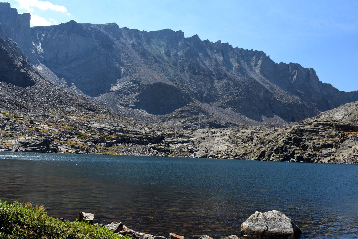
Looking south up “Sawtooth Lakes” canyon with Sawtooth Peak 10,570 Southwest Lake in foreground. The rocks jutting irregularly from the top of the cliffs on the east side of the canyon may be the saw teeth that give the canyon its name.

The shore of Sawtooth Peak 10,570 Southwest Lake with a small bird at center that is probably here because of the mayfly hatch. I did not see birds at the next lower lake, which has fish, which could exterminate a population of mayfly larvae. In the Sierra Nevada, hatching mayflies are an important food for gray-crowned rosy finches, which consequently are much more common at fishless lakes than at lakes with fish (Epanchin and others, 2010).

Diving ducks in Sawtooth Peak 10,570 Southwest Lake. I took this photograph on the hike out and the ducks were still here. This continues the pattern I saw in “Elk Lake” and “Mabel Lake”. Lakes without fish have more large invertebrates for food and consequently are more likely to have ducks and small birds. Those with fish don’t and don’t. “Elk Lake” and “Mabel Lake” both had amphipods. This lake may have amphipods or something other duck food I didn’t see. Ducks are important because they are potential dispersal agents for fairy shrimp eggs.
Sawtooth West Cliffs Lake (Tongue Ranger District, Bighorn National Forest, Cloud Peak Wilderness)
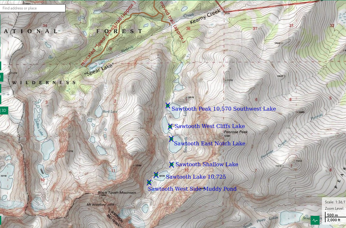
___This map is a screenshot of The National Map (Go to The National Map). The U.S. Geological Survey generally does not copyright or charge for its data or reports (unless printed). A pond location is indicated by an “X”, which corresponds to the coordinates given in the data spreadsheet. Labels in quotations are from 7.5-minute topographic quadrangles.
___As of April 2025, the National Grid overlay with red lines in UTM coordinates does not load in The National Map.
___As of September 2026, The National Map continues to lose functionality. Symbols and polygons are no longer available online. I have used Inkscape to plot “X”s on the green dots plotted by the Spot Elevation Tool, which also provides coordinates but now only the latitude and longitude. I have used the cursor location tracker in UTM mode and have manually written down the UTM coordinates before moving the cursor to the spreadsheet for data entry. Showing colored, non-opaque polygons of private or otherwise non-public lands is no longer feasible.
___There is no private or state land on this map.
Sawtooth West Cliffs Lake is an elongated lake on the western side of the floor of “Sawtooth Lakes” canyon. It is only about 150 m (490′) from Sawtooth Peak 10,570 Southwest Lake. The western wall of “Sawtooth Lakes” canyon rises over 1,000′ (305 m) above the lake and probably 600′ (180 m) of that is near vertical. The cliffs continue south to the west side of Sawtooth East Notch Lake. Sawtooth West Cliffs Lake is 285 m long and 175 m wide (940′ x 570′) on the 7.5-minute topographic quadrangle.
For access, see Sawtooth Peak 10,570 Southwest Lake.
Elevation: 3,164 m (10,380′)
August 21, 2026
The small birds and ducks at Sawtooth 10,570 Southwest Lake were encouraging for fairy shrimp colonization. Will the pattern continue here?
- 175 m x 285 m, based on the 7.5-minute quadrangle; depth greater than 300 cm.
- Slightly murky, brownish-green water; 12 C at 1230.
- No fairy shrimp.
- Rare caddisfly larvae (Trichoptera), small birds, pikas.
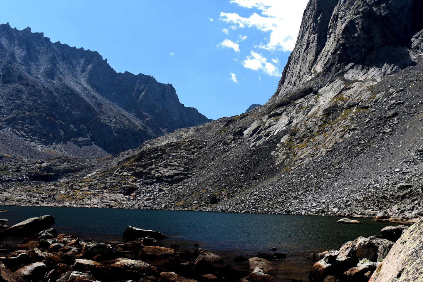
Looking south across Sawtooth West Cliffs Lake. The dramatic cliffs on the west side of “Sawtooth Lakes” canyon are at upper right.
Sawtooth East Notch Lake (Tongue Ranger District, Bighorn National Forest, Cloud Peak Wilderness)
Sawtooth East Notch Lake is below a u-shaped notch, or embayment, in the eastern wall of “Sawtooth Lakes” canyon. Talus below the walls of the notch changes to bouldery moraine on the lower slopes and floor of the notch. The lake is below a step down in the floor of the canyon. Sawtooth East Notch Lake is barely 150 m (490′) from Sawtooth West Cliffs Lake and not even 15 m (50′) higher. At 400 m by 300 m (1,310′ x 980′) on the 7.5-minute topographic quadrangle, Sawtooth East Notch Lake is the roundest in “Sawtooth Lakes” canyon.
For access, see Sawtooth Peak 10,570 Southwest Lake.
Elevation: 3,175 m (10,420′)
August 21, 2026
The third fishless lake – that was quick. The 3 lowest fishless lakes are all close together and not much different in elevation. That gives me more time to look for fairy shrimp. I will need it for a lake this size.
- 300 m x 400 m, based on the 7.5-minute quadrangle; depth greater than 300 cm.
- Slightly murky, greenish water; 13 C at 1300.
- No fairy shrimp.
- Amphipods (Crustacea: class Malacostraca, order Amphipoda), caddisfly larvae (Trichoptera) less than 5 mm long, small winged insects (chironomids?) on water surface, small birds.
Good duck food here but no ducks like in Sawtooth Peak 10,570 Southwest Lake. In the prairie potholes region of southern Saskatchewan and Minnesota, lesser scaup eat amphipods (Lindeman and Clark, 1999). No mayflies here like in Sawtooth Peak 10,570 Southwest Lake but the small birds are here anyway. In the Sierra Nevada, mayflies are food for finches (Epanchin and others, 2010). Or are the small birds here for the chironomids? I suspect that if I could camp here for a week and record the animals observed every day, these 3 lower lakes would have the same aquatic communities. Mayflies and caddisflies have flying adults that could easily colonize these ponds from, say “Elk Lake”, even if they don’t overwinter here. As crustaceans, amphipods need a dispersal agent. Ducks are the obvious possibility. If ducks visit Sawtooth Peak 10,570 Southwest Lake, why wouldn’t they visit Sawtooth West Cliffs Lake and Sawtooth East Notch Lake, at least occasionally?
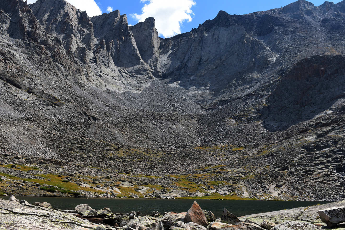
Sawtooth East Notch Lake and the notch in the eastern wall of the canyon. There is a mafic dike at the top of the cliffs at upper right, like the one that makes Black Tooth Mountain black. It might even be the same one. Black Tooth Mountain is only 2.6 km (1.6 miles) to the southwest.
Sawtooth Shallow Lake (Tongue Ranger District, Bighorn National Forest, Cloud Peak Wilderness)
Sawtooth Shallow Lake is shown as an intermittent water body on the 7.5-minute topographic quadrangle. Regardless of how often it dries up, the lake is clearly shallower than others in “Sawtooth Lakes” canyon. This lake and the 2 higher ones I visited all have bluish water, which looks more green in the photographs. This may be the result of suspended clay-sized rock matter, or “glacial flour”. The water in Sawtooth East Notch Lake, which looked “greenish” during the visit, is different. The color of the “greenish” water in “Rainbow Lake” West Ponds #1 and #2, Little East Birthday Lake, West Birthday Lake, and Lazy Outlet Lake is more likely due to algae than to clay. As the name implies, glacial flour is more common in lakes adjacent to active glaciers than farther downstream. “Sawtooth Lakes” canyon may no longer have active glaciers but the upper part of the canyon is where the most recent ones were. The National Map’s aerial imagery indicates the lake is 110 m by 60 m (360′ x 200′).
For access, see Sawtooth Peak 10,570 Southwest Lake.
Elevation: 3,255 m (10,680′)
August 21, 2026
The intermittent symbol on the map piqued my interest because drying up from time to time might improve the chances of fairy shrimp colonization. Although there are a lot of dry rocks near the shore, it looks like there is enough water to last until freeze up this year. Given that this is a dry year, that implies the lake only rarely dries up completely.
- 50 m x 90 m, based on The National Map’s aerial imagery minus 10 m in width and minus 20 m in length; depth greater than 100 cm.
- Clear, bluish water; 16 C at 1345.
- No fairy shrimp.
- Mayfly larvae (Ephemeroptera) less than 8 mm long and mayfly wings on water surface, caddisfly larvae (Trichoptera), small birds.
As at Sawtooth Peak 10,570 Southwest Pond and in the Sierra Nevada (Epanchin and others, 2010), small birds here have likely fed on hatched mayflies. Although I didn’t see any adults, the wings indicate some were here recently. Some may still be flying around.
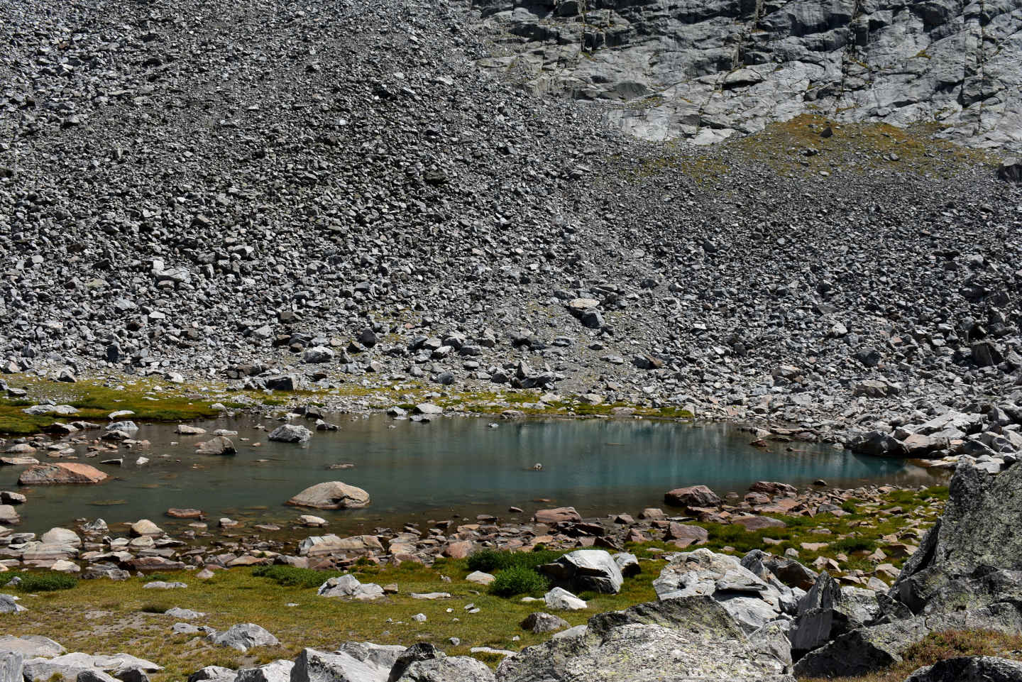
Sawtooth Shallow Lake, looking southeast. It has a distinctly bluish tint although the photograph looks more green than what I recall.
Sawtooth Lake 10,725 (Tongue Ranger District, Bighorn National Forest, Cloud Peak Wilderness)
Sawtooth Lake 10,725 is labeled with an elevation of 10,725′ (3,269 m) on the 7.5-minute topographic quadrangle. As of September 2026, The National Map’s spot elevation tool gives the elevation as 3,275 m (10,745′). Sawtooth Lake 10,725 is about 1.2 km (0.7 mile) south of Sawtooth Peak 10,570 Southwest Lake and about 6 km (3.6 miles) south of “Highland Lake”. The 7.5-minute topographic quadrangle indicates the lake has dimensions of 340 m by 190 m (1,120′ x 620′).
For access, see Sawtooth Peak 10,570 Southwest Lake.
Elevation: 3,269 m (10,725′, according to topographic quadrangle)
August 21, 2026
What a view!
- 190 m x 340 m, based on the 7.5-minute quadrangle; depth greater than 300 cm.
- Clear, bluish water; 10 C at 1415.
- No fairy shrimp.
- Caddisfly larvae (Trichoptera), small winged insects (chironomids?) in clusters on water surface, small birds.
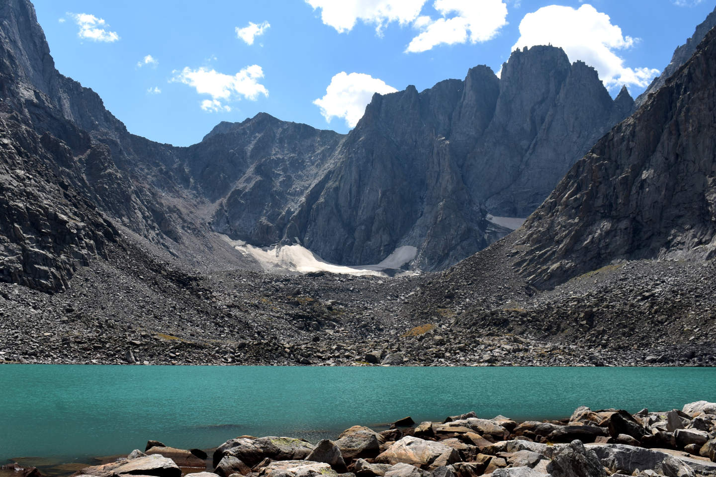
Sawtooth Lake 10,725 and the cliffs at the head of “Sawtooth Lakes” canyon. The water color looked blue in person but looks green in the photograph. According to the 7.5-minute topographic quadrangle, which was revised from 1981 aerial photographs, there was a 180 m long (down-canyon) by 650 m wide (590′ x 2,130′) glacier at the head of “Sawtooth Lakes” canyon. The western part can’t be seen in this view but the eastern part is clearly much smaller now. Unless the rock rubble on the far side of the lake is blocking the view of the lower part of the snowbank, the snowbank looks too thin to have much, if any, ice.
Sawtooth West Side Muddy Pond (Tongue Ranger District, Bighorn National Forest, Cloud Peak Wilderness)
Sawtooth West Side Muddy Pond is about 60 m (200′) southwest of Sawtooth Lake 10,725. There is another larger pond closer to the east side of the canyon about 200 m (660′) south of Sawtooth Lake 10,725. Sawtooth West Side Muddy Pond has bluish water and the pond bottom has proportionally more mud, including glacial flour, than does any lower lake. The pond is about 50 m long by 35 m wide (160′ x 115′) on the 7.5-minute topographic quadrangle.
For access, see Sawtooth Peak 10,570 Southwest Lake.
Elevation: 3,278 m (10,750′)
August 21, 2026
With all the mud and a smaller size, this pond might have a different aquatic community than the bigger lakes at lower elevations.
- 35 m x 50 m, based on the 7.5-minute quadrangle; depth greater than 300 cm.
- Clear, bluish water; 13 C at 1445.
- No fairy shrimp.
- Backswimmers (sub-order Heteroptera, family Notonectidae), small winged insects (chironomids?) in clusters on water surface, small birds.
It’s interesting that a cluster of the winged insects, some still moving, floated into a backswimmer but the backswimmer made no effort to eat them. The small birds are here, too, and they may be eating chironomids(?) before they get stuck on the water surface. Small birds have been reported at higher elevations in the Bighorns. “Gray-crowned rosy-finches were seen on the east face of Black Tooth Mountain at 12,000’ elevation” (3,658 m) in August 1979 and black rosy finches were collected at 11,300′ (3,444 m) near Cloud Peak in 1959 (Canterbury, Johnsgard, and Downing, 2013). Fishless lakes, which produce more bird food than lakes with fish, probably help support such populations.
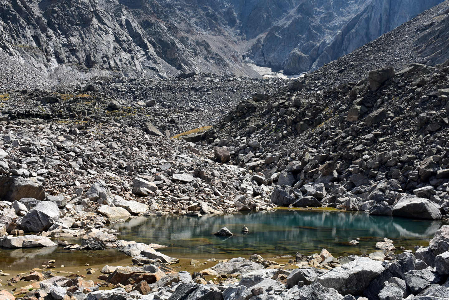
Sawtooth West Side Muddy Pond. There is considerable mud exposed on the near and far shores. As for Sawtooth Lake 10,725 and Sawtooth Shallow Lake, the blue color, which looks more green in the photograph, is likely due to glacial flour.
“Upper Crater Lake” (Medicine Wheel Ranger District, Bighorn National Forest, Cloud Peak Wilderness)
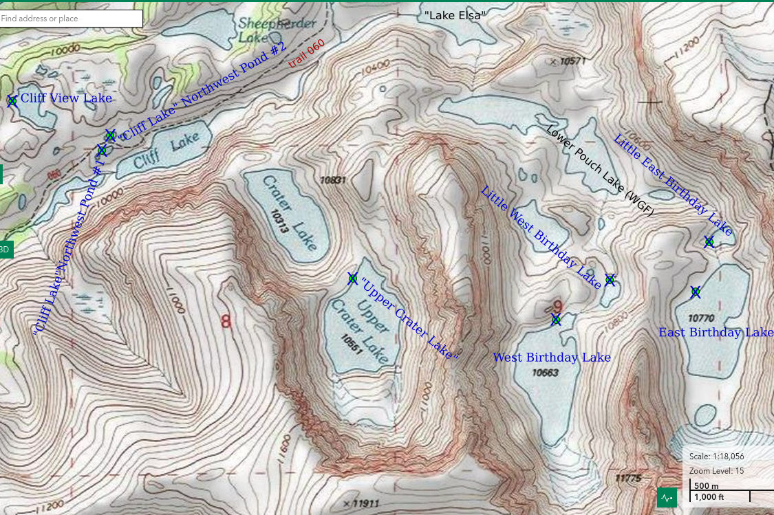
___This map is a screenshot of The National Map (Go to The National Map). The U.S. Geological Survey generally does not copyright or charge for its data or reports (unless printed). A pond location is indicated by an “X”, which corresponds to the coordinates given in the data spreadsheet. Labels in quotations are from 7.5-minute topographic quadrangles.
___As of April 2025, the National Grid overlay with red lines in UTM coordinates does not load in The National Map.
___As of September 2026, The National Map continues to lose functionality. Symbols and polygons are no longer available online. I have used Inkscape to plot “X”s on the green dots plotted by the Spot Elevation Tool, which also provides coordinates but now only the latitude and longitude. I have used the cursor location tracker in UTM mode and have manually written down the UTM coordinates before moving the cursor to the spreadsheet for data entry. Showing colored, non-opaque polygons of private or otherwise non-public lands is no longer feasible.
___There is no private or state land on this map.
“Upper Crater Lake” is named on the 7.5-minute topographic quadrangle. It is labeled as Crater Lake on WGF’s online fishing map (https://wgfd.wyo.gov/fishing-boating/places-fish-wyoming) while “Crater Lake” is labeled Fatwoman Lake. To make matters more confusing, “Upper Crater Lake” (aka Crater Lake) is said to have fish but “Crater Lake” (aka Fatwoman Lake) is said to not have fish. This contradicts the clear pattern in the Bighorn Mountains of the highest lakes in a drainage not being stocked with fish, such as those in “Sawtooth Lakes” canyon (e.g., Sawtooth Lake 10,725). This makes sense because the higher lakes lack trails and take longer to get to and are, consequently, less likely to be visited by anglers. The author of the web site hikingthelight.us caught fish in “Crater Lake” but didn’t get any bites at “Upper Crater Lake” (go to “DAY 3: CRATER LAKES AND LOOMIS PASS”). In addition, WGF labeled “Lake Eunice” as Triangle Lake and “Lake Elsa” as Lake Eunice. To compound the error of misidentifying the lake above “Lake Elsa”, WGF misspelled the name as Lake Elsie. What makes this all rather hilarious is that the base map on which the WGF lake labels appear has the names as shown on the 7.5-minute topographic quadrangle.
I should add here that I assign names to lakes and ponds that aren’t named on 7.5-minute topographic maps as a way to uniquely identify water bodies for this web site (see also Pond names). I don’t expect anyone else to use these made up names. Names that are on the 7.5 minute topographic maps are placed in quotation marks so readers will know that those names are widely used. In some cases, I have used WGF names for lakes not named on 7.5-minute topographic quadrangles (e.g., Little “Poacher Lake”).
“Upper Crater Lake” is south of “Crater Lake” in a north-south oriented hanging valley southeast of “Cliff Lake”. On the 7.5-minute topographic map, no stream is shown within “Crater Lake” canyon or issuing from the canyon. Flows are primarily through boulders. “Crater Lake” canyon is 1.80 km (1.1 miles) long and 1,500′ (457 m) deep. The canyon walls could affect which species colonize the lake by blocking morning and evening sunshine on the warm side of the equinoxes and for longer periods on the cool side of the equinoxes. This would reduce water temperatures, delay melting of lake ice in the spring, and hasten freezing in the fall and that, in turn, could affect when eggs hatch and life spans and, hence, survivability. On the 7.5-minute topographic quadrangle, “Upper Crater Lake” is 525 m by 375 m (1,720′ x 1,230′).
“Upper Crater Lake” is about 1,140 m (3,740′) from trail 060 just northeast of “Cliff Lake”. Trail 060 connects to the Solitude Loop, trail 038, about 2 km (1.2 miles) below “Cliff Lake”, which, in turn, connects to trail 059 farther down the creek at Tepee Pole Flats. Trail 059 provides access from the “Lower Paint Rock Lake” trailhead. Trail 038 turns north at the trail 060 junction and connects to the trailhead at Coffeen Park. Trail 038 turns south at Tepee Pole Flats and connects to the Battle Park trailhead via trail 164. The climb from trail 060 to “Crater Lake” can be managed by following a route close to the outlet stream. Others have done the same but there is no marked or conspicuously trampled path. The east side of “Crater Lake” is probably an easier walk than the west side.
Elevation: 3,216 m (10,551′, according to topographic quadrangle)
August 24, 2026
There are steep slopes of boulders almost all the way around the lake. I won’t have time to get far. Hopefully, the northern shore will provide a representative sample of the species present.
- 375 m x 525 m, based on the 7.5-minute quadrangle; depth greater than 300 cm.
- Clear, greenish water; 11 C at 1745.
- No fairy shrimp.
- Amphipods (Crustacea: class Malacostraca, order Amphipoda) less than 5 mm long, copepods (Crustacea: class Maxillopoda, subclass Copepoda) 1.0-1.5 mm long (non-tapered bodies suggest these are harpacticoids as in Fig. 3, p. 919, rather than cyclopoids or calanoids as in Fig. 5, p. 922, of Thorp and Covich, 2001), rare caddisfly larvae (Trichoptera), mayfly larvae (Ephemeroptera)(shed exoskeletons), small birds, pikas.
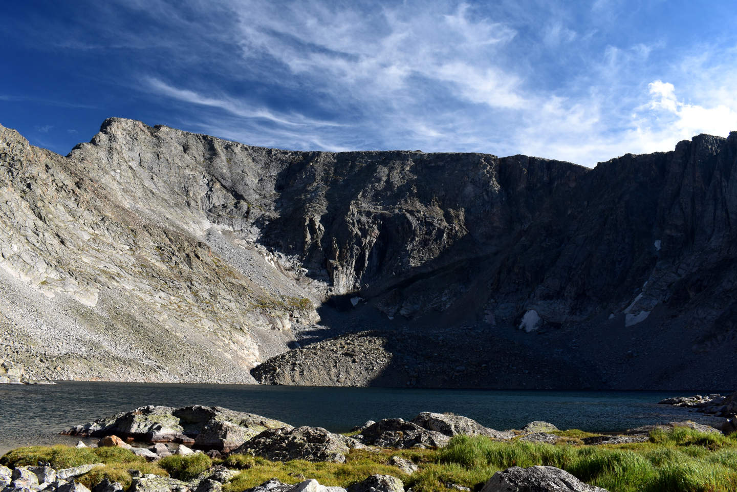
“Upper Crater Lake”. There are the cliffs at the head of “Crater Lake” canyon but there is no glacier, not even a big snowbank. The 7.5-minute topographic quadrangle, which was revised with 1981 aerial photographs, shows a 290 m by 320 m (950′ x 1,050′) glacier.
“Rainbow Lake” West Pond #1 (Medicine Wheel Ranger District, Bighorn National Forest, Cloud Peak Wilderness)
“Rainbow Lake” West Pond #1 is the closest in a series of 3 ponds west of “Rainbow Lake”. It is only about 100 m (330′) west of “Rainbow Lake” and at almost the same elevation. The pond has a narrow, grassy shoreline with easy access to the water. “Rainbow Lake” West Pond #1 is about 110 m by 35 m (360′ x 115′) on the 7.5-minute topographic quadrangle.
Trail 060 is about 650 m (2,130′) to the south and over a hill from “Rainbow Lake” West Pond #1. Trail 060 makes a loop that connects to trail 038 in 2 places. The northern junction is closer to “Rainbow Lake” West Pond #1. For access to trail 060 and trail 038, see “Upper Crater Lake”.
Elevation: 3,190 m (10,466′)
August 25, 2026
The water level is low with bare rocks along the shore. The outlet to “Rainbow Lake” appears to be dry but there may be some water percolating between the rocks. Fish are rising on “Rainbow Lake” and this pond is at such a low elevation that they wouldn’t have to jump at all to get here. WIDLA.
- 35 m x 110 m, based on the 7.5-minute quadrangle; depth greater than 300 cm.
- Clear, greenish water; 14 C at 1015.
- No fairy shrimp.
- Amphipods (Crustacea: class Malacostraca, order Amphipoda) 10-15 mm long, black copepods (Crustacea: class Maxillopoda, subclass Copepoda) 1.5 mm long, water boatmen (sub-order Heteroptera, family Corixidae), unusually abundant caddisfly larvae (Trichoptera).
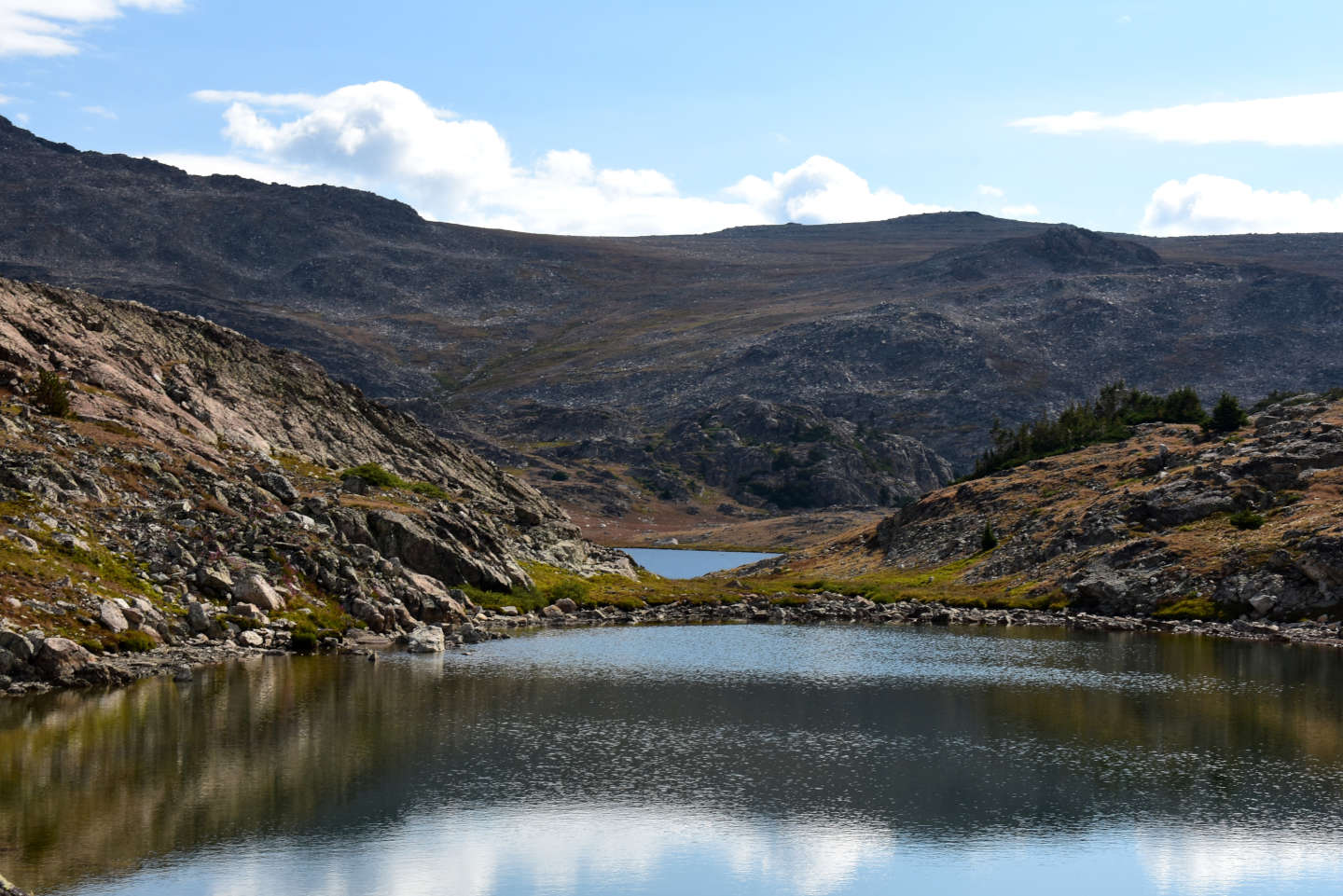
“Rainbow Lake” West Pond #1, looking east with “Rainbow Lake” in the distance.
“Rainbow Lake” West Pond #2 (Medicine Wheel Ranger District, Bighorn National Forest, Cloud Peak Wilderness)
“Rainbow Lake” West Pond #2 is less than 50 m (160′) west of “Rainbow Lake” West Pond #1. The outlet to “Rainbow Lake” West Pond #1 is small and flat and probably very shallow when it has water. It could allow access by small fish capable of swimming between the rocks. The inlet from “Rainbow Lake” West Pond #3, if any, lacks open water. “Rainbow Lake” West Pond #2 is about half the size of “Rainbow Lake” West Pond #1 on the 7.5-minute topographic quadrangle, or 45 m by 25 m (150′ x 80′).
For access, see “Rainbow Lake” West Pond #1.
Elevation: 3,191 m (10,469′)
August 25, 2026
No fish in “Rainbow Lake” West Pond #1 so there shouldn’t be any here either. The outlet to “Rainbow Lake” West Pond #1 is dry. Because the skies look like they could rain, I’m hurrying my observations. With small ponds like this, though, I’m not likely to miss seeing fairy shrimp.
- 25 m x 45 m, based on the 7.5-minute quadrangle; depth greater than 100 cm.
- Clear, greenish water; 14 C at 1030.
- No fairy shrimp.
- Amphipods (Crustacea: class Malacostraca, order Amphipoda) 10-15 mm long, water boatmen (sub-order Heteroptera, family Corixidae), caddisfly larvae (Trichoptera).

The alignment of “Rainbow Lake” West Pond #2, “Rainbow Lake” West Pond #1, and “Rainbow Lake”, from southwest of “Rainbow Lake” West Pond #3 (off left edge of photograph).
“Rainbow Lake” West Pond #3 (Medicine Wheel Ranger District, Bighorn National Forest, Cloud Peak Wilderness)
The south end of “Rainbow Lake” West Pond #3 is about 50 m (160′) west of “Rainbow Lake” West Pond #2. “Rainbow Lake” West Pond #3 is elongated north-south rather than west-east and has bigger rocks than ponds #1 and #2. It is in a very small catchment and doesn’t appear to have an inlet. The pond is about 70 m by 30 m (230′ x 100′) on the 7.5-minute topographic quadrangle.
For access, see “Rainbow Lake” West Pond #1.
Elevation: 3,194 m (10,479′)
August 25, 2026
The water level doesn’t look unusually low for this time of year.
- 30 m x 70 m, based on the 7.5-minute quadrangle; depth greater than 100 cm.
- Clear water; 15 C at 1100.
- No fairy shrimp.
- Water boatmen (sub-order Heteroptera, family Corixidae), caddisfly larvae (Trichoptera).
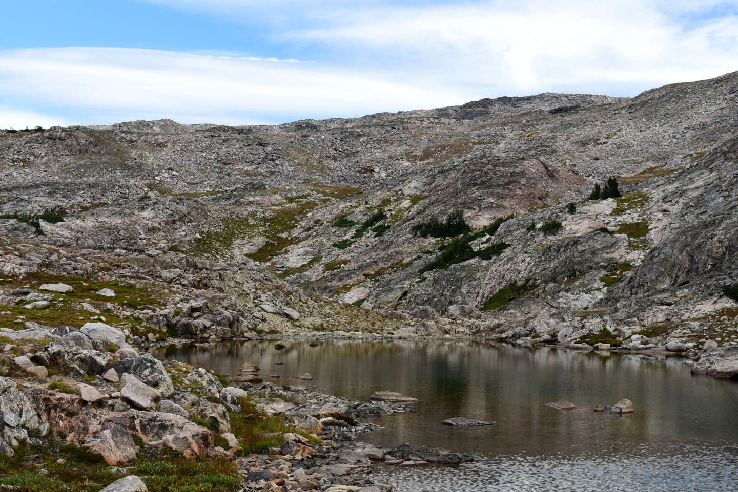
The rocky shores of “Rainbow Lake” West Pond #3, looking north.
Dark Dike Lake (Medicine Wheel Ranger District, Bighorn National Forest, Cloud Peak Wilderness)
Dark Dike Lake is about 650 m (2,130′) due west of “Rainbow Lake” and down the hill from “Rainbow Lake” West Pond #3. The lake has an elongated, irregular shape about 200 m long and 80 m wide (660′ x 260′) on the 7.5-minute topographic quadrangle. There is an inlet at the north end from a small pond north of “Rainbow Lake” West Pond #3 and an outlet to North Paint Rock Creek at the south end.
The southwestern end of Dark Dike Lake is only about 250 m (820′) northeast of, and less than 50 m (160′) higher than trail 060. The northern intersection of trails 060 and 038 is 1,300 m (4,270′) southwest of trail 060’s closest approach to Dark Dike Lake. These distances were measured on the 7.5-minute topographic quadrangle. Trail 060 has a significantly different location on The National Map, which seems consistent with its location on the U.S. Forest Service’s 2023 recreation map of the Bighorn National Forest. On The National Map, the trail junction is 1,715 m (5,630′) southwest of the lake and on the 7.5-minute quadrangle, it is 1,550 m (5,085′) from the lake. For how to get to trail 038, see “Rainbow Lake” West Pond #1.
Elevation: 3,149 m (10,330′)
August 25, 2026
“Rainbow Lake” West Ponds #1, #2, #3 were consistently inhabited by water boatmen and caddisfly larvae. I wonder if the extensive patch of emergent vegetation near the western shore of this lake will change that.
- 80 m x 200 m, based on the 7.5-minute quadrangle; depth greater than 300 cm.
- Clear water; 15 C at 1115.
- No fairy shrimp.
- Water boatmen (sub-order Heteroptera, family Corixidae), caddisfly larvae (Trichoptera).
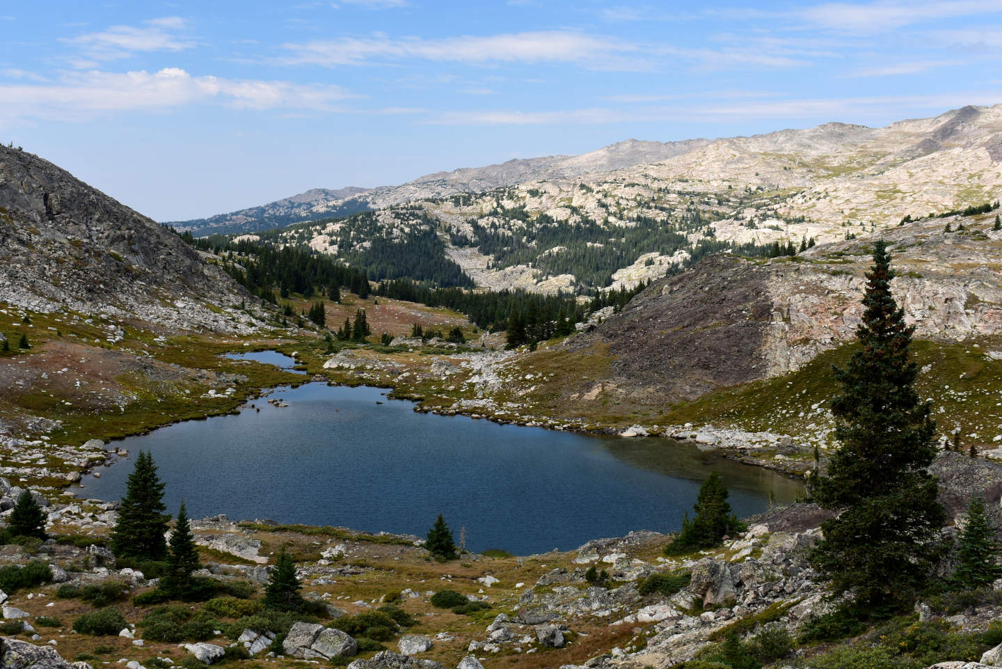
View to the west across the southern half of Dark Dike Lake. A darkly colored mafic dike is on the hill to the right of the lake. There is a patch of emergent grass next to where the dike meets the shoreline. At an elevation of about 3,150 m, this is one of the highest lakes with emergent vegetation that I came across.
“Rainbow Lake” East Pond #3 (Medicine Wheel Ranger District, Bighorn National Forest, Cloud Peak Wilderness)
“Rainbow Lake” East Pond #3 is 360 m (1,180′) southeast of “Rainbow Lake”. “Rainbow Lake” East Pond #1 and “Rainbow Lake” East Pond #2 are closer to “Rainbow Lake” and connected to its outlet but observations were not made there because they have fish. “Rainbow Lake” East Pond #3 is a small pond with no inlet or outlet and dimensions of 90 m by 35 m (300′ x 115′) on the 7.5-minute topographic quadrangle. It is surrounded by a grassy area with little relief.
From trail 060 west of “Lake Eunice” angle across the hill rather than going over it to “Rainbow Lake” West Pond #1, cross the outlet of “Rainbow Lake” and head up the moderate slope to the pond. For more about trail 060, see “Rainbow Lake” West Pond #1.
Elevation: 3,193 m (10,480′)
August 25, 2026
Nice views here of the hanging valleys south of “Lake Elsa”.
- 35 m x 80 m; depth greater than 200 cm.
- Clear water; 15 C at 1245.
- No fairy shrimp.
- Water boatmen (sub-order Heteroptera, family Corixidae), dytiscid larvae (order Coleoptera, family Dytiscidae), black diving beetles, caddisfly larvae (Trichoptera).
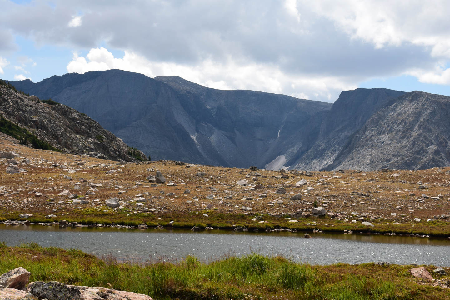
“Rainbow Lake” East Pond #3. The cirque of West “Birthday Lake” canyon is across “Lake Elsa” (out of view down the hill) in the distance. The pale slopes in the cirque are smooth rock, not snow.
“Rainbow Lake” East Pond #4 (Medicine Wheel Ranger District, Bighorn National Forest, Cloud Peak Wilderness)
“Rainbow Lake” East Pond #4 is about 170 m (560′) east of “Rainbow Lake” East Pond #3 and 500 m (1,640′) southeast of “Rainbow Lake”. “Rainbow Lake” East Pond #4 lacks an inlet but some water drains between the rocks down the hill to the north. On the 7.5-minute topographic quadrangle, it is about 30 m by 25 m (100′ x 80′).
For access, see “Rainbow Lake” East Pond #3.
Elevation: 3,214 m (10,540′)
August 25, 2026
Another small pond amid the rocks and grass. There is some algae floating on the water.
- 15 m x 30 m; depth about 100 cm.
- Clear water; 13 C at 1330.
- No fairy shrimp.
- No aquatic animals observed.

“Rainbow Lake” East Pond #4, looking north toward the outlet. There is more blue sky to the north than in the view to the south at “Rainbow Lake” East Pond #3 but it is still hard to tell how this day is going turn out.
Big Crack Lake (Medicine Wheel Ranger District, Bighorn National Forest, Cloud Peak Wilderness)
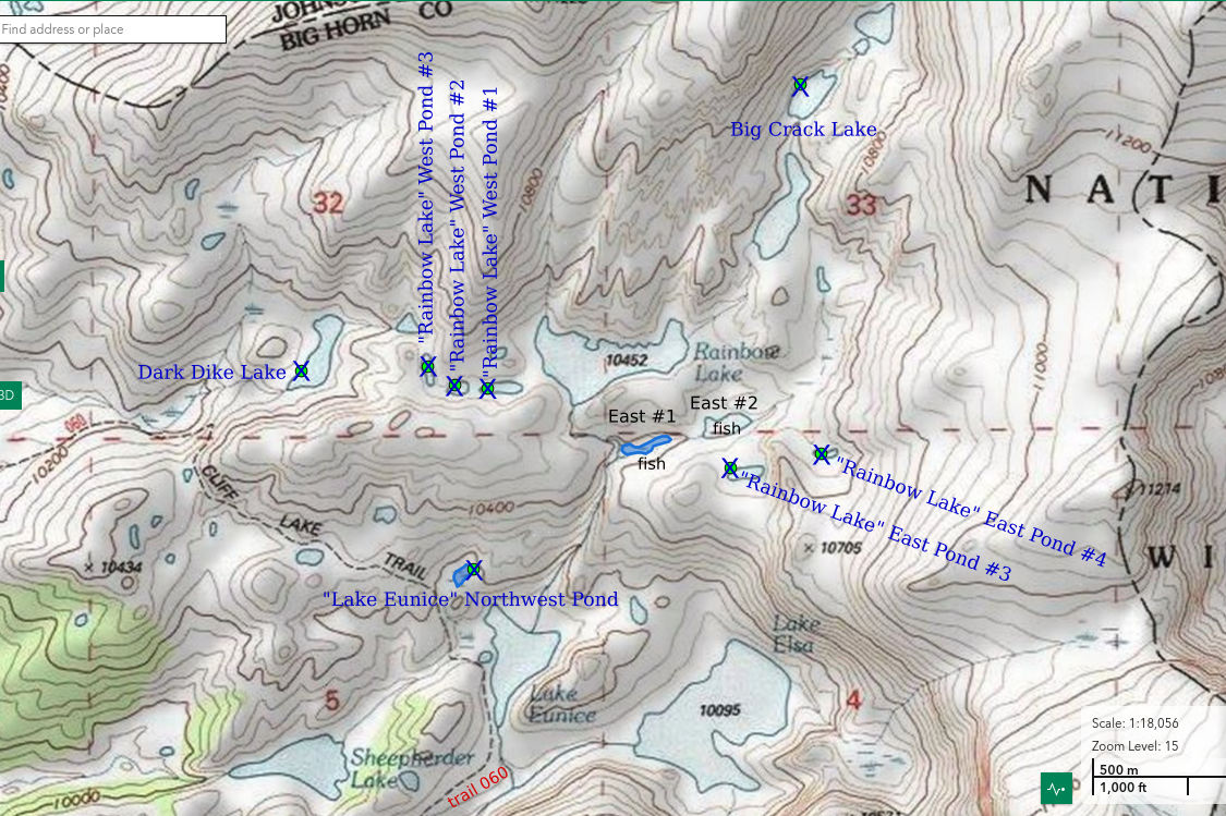
___This map is a screenshot of The National Map (Go to The National Map). The U.S. Geological Survey generally does not copyright or charge for its data or reports (unless printed). A pond location is indicated by an “X”, which corresponds to the coordinates given in the data spreadsheet. Labels in quotations are from 7.5-minute topographic quadrangles.
___As of April 2025, the National Grid overlay with red lines in UTM coordinates does not load in The National Map.
___As of September 2026, The National Map continues to lose functionality. Symbols and polygons are no longer available online. I have used Inkscape to plot “X”s on the green dots plotted by the Spot Elevation Tool, which also provides coordinates but now only the latitude and longitude. I have used the cursor location tracker in UTM mode and have manually written down the UTM coordinates before moving the cursor to the spreadsheet for data entry. Showing colored, non-opaque polygons of private or otherwise non-public lands is no longer feasible.
___There is no private or state land on this map.
Big Crack Lake is on the stream emptying into the east side of “Rainbow Lake”. On a straight line, the lake is 780 m (2,560′) northeast of “Rainbow Lake”. There is a crack a meter or 2 wide along the west side of the lake that trends northeasterly. Vegetation in the crack makes it conspicuous. The lake has an oval shape 160 m long and 75 m wide (520′ x 250′) on the 7.5-minute topographic quadrangle. The lake between Big Crack Lake and “Rainbow Lake”, labeled Upper Rainbow Lake by WGF, has fish on the WGF’s online fishing map (https://wgfd.wyo.gov/fishing-boating/places-fish-wyoming). Big Crack Lake is not shown on that map. If the lake wasn’t surveyed, it was probably never stocked.
The valley of the stream that enters the east side of “Rainbow Lake” can be followed from that lake for less than 1 km (0.6 mile) up to Big Crack Lake. For access to “Rainbow Lake”, see “Rainbow Lake” West Pond #1. A route closer to “Rainbow Lake” East Pond #3 is also possible.
Elevation: 3,237 m (10,620′)
August 25, 2026
A rocky bottom and not much grass around this lake. What will I find?
- 75 m x 160 m, based on the 7.5-minute quadrangle; depth greater than 300 cm.
- Clear water; 15 C at 1415.
- No fairy shrimp.
- Caddisfly larvae (Trichoptera), pikas.
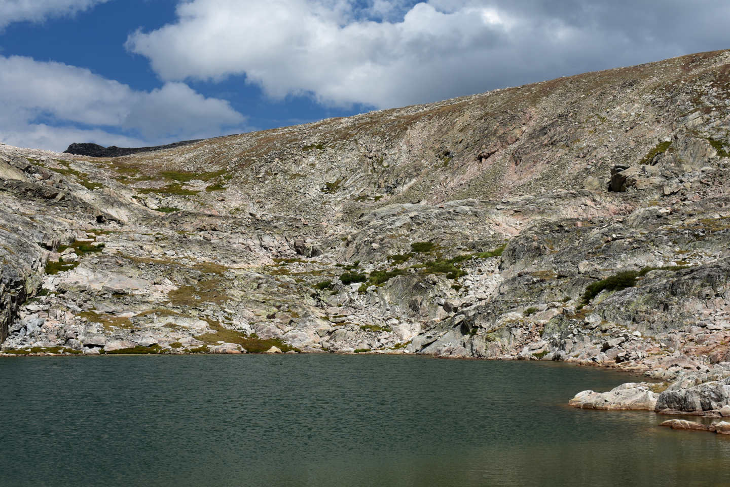
View to the northeast across Big Crack Lake. The big crack is at left.
“Lake Eunice” Northwest Pond (Medicine Wheel Ranger District, Bighorn National Forest, Cloud Peak Wilderness)
“Lake Eunice” Northwest Pond is shown as a marsh or bog on the 7.5-minute topographic map rather than as open water. On The National Map aerial imagery, the water looks like it is about 70 m by 35 m (230′ x 115′) but it looks more like 80 m by 50 m (260′ x 160′) on the ground. Lack of contrast between green grass and dark water on the imagery makes identifying the shoreline difficult. The 7.5-minute topographic quadrangle shows a stream flowing from “Lake Eunice” Northwest Pond down to a marsh on the northwestern side of “Lake Eunice”. There is probably considerable snowmelt and runoff from the rocky slope 122 m (400′) high above “Lake Eunice” Northwest Pond.
“Lake Eunice” Northwest Pond is close to trail 060 where it turns more westerly northwest of “Lake Eunice”. For more on the connections between trail 060 and trail 038 and how to access trail 038, see “Upper Crater Lake”.
Elevation: 3,105 m (10,190′)
August 25, 2026
This pond looks like a dark-water pond from a distance due to the organic-rich, muddy bottom but the water is actually clear.
- 50 m x 80 m; depth greater than 100 cm.
- Clear water; 15 C at 1530.
- No fairy shrimp.
- Water boatmen (sub-order Heteroptera, family Corixidae), copepods (Crustacea: class Maxillopoda, subclass Copepoda) 1 mm long.

Looking down on “Lake Eunice” Northwest Pond and out toward the Bighorn Basin. “Lake Eunice” is off the left side of the photograph.
Cliff View Lake (Medicine Wheel Ranger District, Bighorn National Forest, Cloud Peak Wilderness)
Cliff View Lake is 380 m (1,250′) northwest of “Cliff Lake” and on a ridge rather than in a valley. It has a great view of the cliff that gives “Cliff Lake” its name. I think the cliff is impressive enough to have 2 lakes named after it. The lake has no inlet. It leaks water down hill toward “Cliff Lake”. It is boggy on the east side and the west side has steep rock and some dense forest. That makes access to the water difficult. The pond bottom is muddy and has abundant organic matter. The considerable emergent vegetation is probably a recurring feature. Cliff View Lake has dimensions of 170 m by 120 m (560′ x 390′) on the 7.5-minute quadrangle.
Cliff View Lake is 250 m (820′) from trail 060 near the southwest end of “Cliff Lake”. For more on the connections between trail 060 and trail 038 and how to access trail 038, see “Upper Crater Lake”.
Elevation: 3,047 m (10,000′)
August 25, 2026
There is a lot of emergent pond lilies and grass near the eastern shore. What animals would benefit from that vegetation? Seeing a dozen ducks is promising but they flew off on my approach. Maybe the duck food here isn’t that great.
- 120 m x 170 m, based on the 7.5-minute quadrangle; depth greater than 100 cm.
- Clear water; 18 C at 1700.
- No fairy shrimp.
- Water boatmen (sub-order Heteroptera, family Corixidae), black diving beetles, adult dragonflies, ducks.
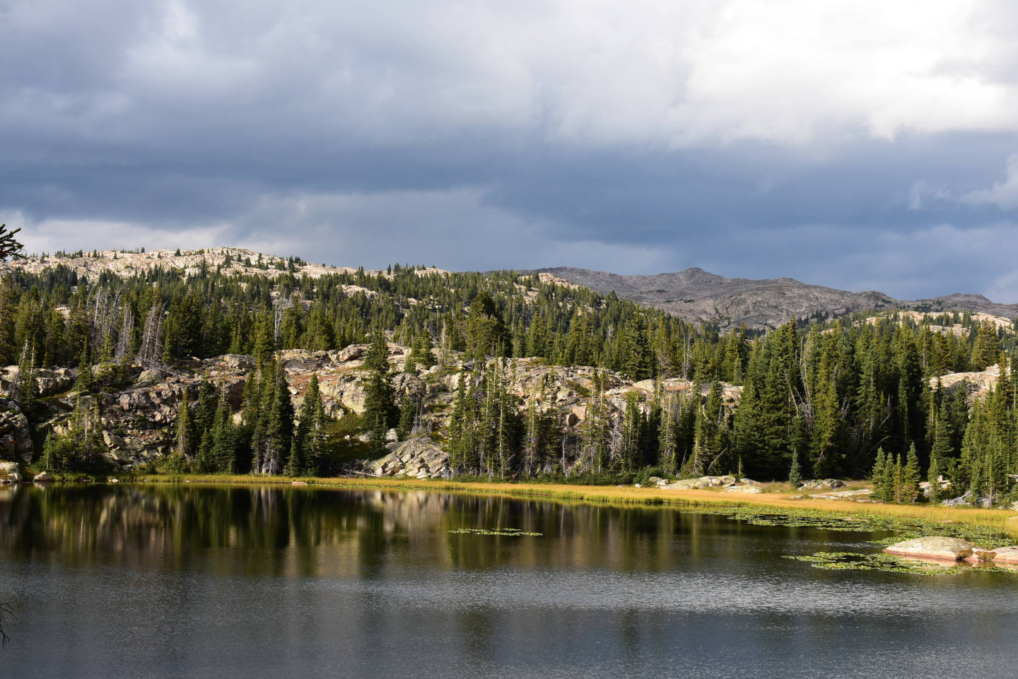
View to the north across Cliff View Lake to show the pond lilies and grass along the eastern shore.
“Cliff Lake” Northwest Pond #1 (Medicine Wheel Ranger District, Bighorn National Forest, Cloud Peak Wilderness)
“Cliff Lake” Northwest Pond #1 is a small, somewhat muddy pond about 70 m (230′) north of the southwest end of “Cliff Lake”. It is 20-30 m (66-98′) north of trail 060 but the 7.5-minute topographic quadrangle shows it to the south. On the 7.5-minute quadrangle, “Cliff Lake” Northwest Pond #1 is in a cluster of 4 ponds but the shapes, sizes, and precise locations of these ponds seem to be off. The map representation is best considered generalized. On the ground, “Cliff Lake” Northwest Pond #1 is the largest. The pond lacks inlet and outlet.
“Cliff Lake” Northwest Pond #1 is next to trail 060 near the southwest end of “Cliff Lake”. It is not easily seen from the trail. For more on the connections between trail 060 and trail 038 and how to access trail 038, see “Upper Crater Lake”.
Elevation: 3,025 m (9,925′)
August 25, 2026
In a change from most other ponds I’ve visited today, the water level is low and the water is darkly colored. Maybe I’ll find something different.
- 40 m x 50 m; depth greater than 100 cm.
- Murky, dark green water; 18 C at 1745.
- No fairy shrimp.
- Water boatmen (sub-order Heteroptera, family Corixidae); caddisfly larvae (Trichoptera); non-swimming, thin, tubular larvae 10 mm long may be chaoborids (Insecta: order Diptera, family Chaoboridae).

Very wide angle view to the southwest across “Cliff Lake” Northwest Pond #1, with part of the cliff that gives “Cliff Lake” its name at left.
“Cliff Lake” Northwest Pond #2 (Medicine Wheel Ranger District, Bighorn National Forest, Cloud Peak Wilderness)
“Cliff Lake” Northwest Pond #2 is a short distance northwest of “Cliff Lake” Northwest Pond #1. On the 7.5-minute quadrangle, it is probably the one north of, and about the same size as, “Cliff Lake” Northwest Pond #1. Unlike what is shown on the 7.5-minute quadrangle, trail 060 does not go between the ponds; it goes south of “Cliff Lake” Northwest Pond #1. As mentioned for “Cliff Lake” Northwest Pond #1, the map representation of a cluster of 4 ponds northwest of “Cliff Lake” is best considered generalized. Unlike “Cliff Lake” Northwest Pond #1, “Cliff Lake” Northwest Pond #2 is rocky with little mud. It has no inlet or outlet.
For access, see “Cliff Lake” Northwest Pond #1.
Elevation: 3,024 m (9,921′)
August 25, 2026
Just because it is almost dried up doesn’t mean I shouldn’t look.
- 10 m x 20 m; depth less than 100 cm.
- Clear water; 17 C at 1815.
- No fairy shrimp.
- Water boatmen (sub-order Heteroptera, family Corixidae), copepods (Crustacea: class Maxillopoda, subclass Copepoda) 1 mm long, caddisfly larvae (Trichoptera) cases stuck to dry rocks.

In this view to the east, “Cliff Lake” Northwest Pond #2 looks dry but there is relatively deep water between the rocks near the far end. I estimated that the area of water now is about 1/3 of the normal pond size. The cliff at right is above “Cliff Lake”.
Little East Birthday Lake (Medicine Wheel Ranger District, Bighorn National Forest, Cloud Peak Wilderness)
Little East Birthday Lake is the small lake at the north end of East Birthday Lake canyon. The straight-line distance from “Lake Elsa” is 1.5 km (0.9 mile). WGF’s online fishing map (https://wgfd.wyo.gov/fishing-boating/places-fish-wyoming) indicates that the 3 large lakes below both West and East Birthday Lake canyons – Lake Elsie (sic), Lower Pouch Lake, and Upper Pouch Lake – all have fish but the 4 in the canyons don’t. WGF labeled the 4 lakes in the 2 canyons Birthday lakes: either West or East and either Lake #1 or Lake #2. There’s no telling where the name Birthday came from. I think it is more meaningful to distinguish the little lakes from the big lakes by size rather than by number. The shore of Little East Birthday Lake is essentially all rock. The inlet is from East Birthday Lake and the outlet is to Lower Pouch Lake. Little East Birthday Lake is approximately 130 m by 80 m (430′ x 260′) on the 7.5-minute quadrangle.
A route along the northern and eastern shores of “Lake Elsa” is probably the easiest way to Little East Birthday Lake. From “Cliff Lake”, continue straight to the northeast from trail 060 where it turns more northerly toward “Lake Eunice” and cross the outlet stream from “Lake Eunice”. For access to “Cliff Lake”, see “Upper Crater Lake”. There is more than one trampled path leading this way. Perhaps the more continuous one stays on the slope more than 50 m (160′) from the lake shore. After turning to the southeast around the north end of “Lake Elsa”, the path stays close to the eastern shore of the lake. It follows the stream up the hill and swings around the western side of the bog before more or less disappearing where it crosses the ridge north of Lower Pouch Lake. There are trampled spots near the eastern shore of Lower Pouch Lake but most of the route is rock. The slope east of Lower Pouch Lake has patches of grass that make the climb easier. The gorge below Little East Birthday Lake is full of giant boulders but I didn’t see an easier route.
Elevation: 3,267 m (10,720′)
August 26, 2026
After the climb, this looks and feels like a different world – of rock and towering cliffs. Maybe it is full of fairy shrimp.
- 80 m x 130 m based on the 7.5-minute quadrangle; depth greater than 300 cm.
- Slightly murky, greenish water; 13 C at 1100.
- No fairy shrimp.
- Amphipods (Crustacea: class Malacostraca, order Amphipoda) 5 and 20 mm long, copepods (Crustacea: class Maxillopoda, subclass Copepoda) 1.5 mm long, caddisfly larvae (Trichoptera).

Little East Birthday Lake and the headwall of East Birthday Lake canyon in the background (wide angle view). The black mafic dike at the top of the cliffs may be the same one that forms the top of Black Tooth Mountain, which is only 2 km (1.2 miles) to the east.
East Birthday Lake (Medicine Wheel Ranger District, Bighorn National Forest, Cloud Peak Wilderness)
East Birthday Lake occupies most of the floor of East Birthday Lake canyon. The lake is labeled East Birthday Lake 2 by WGF. It is bounded on the east and west sides by steep slopes but there is an extensive, flat area to the south at close to the same elevation. At 1.38 km (0.83 mile) long and about 1,430′ (436 m) deep (to the lake surface), East Birthday Lake canyon isn’t as long or as deep as “Crater Lake” canyon. Nonetheless, it is deep enough to affect lake temperatures by blocking the sun, which may in turn affect hatching and life spans. The canyon lacks the stair step down of “Crater Lake” canyon. However, there is a comparable drop of 300′ (91 m) to Lower Pouch Lake (WGF name) below the canyon. On the 7.5-minute topographic quadrangle, East Birthday Lake is 560 m long and 310 m wide (1,840′ x 1,020′). The quadrangle labels the lake with elevation 10,770′ (3,283 m).
For access, see Little East Birthday Lake. East Birthday Lake is barely 100 m (330′) south of, and 80′ (24 m ) higher than Little East Birthday Lake.
Elevation: 3,283 m (10,770′, according to topographic quadrangle)
August 26, 2026
The clearer water suggests there could be filter feeders here that weren’t in Little East Birthday Lake. Fingers crossed.
- 310 m x 560 m based on the 7.5-minute quadrangle; depth greater than 300 cm.
- Clear water; 13 C at 1145.
- No fairy shrimp.
- Amphipods (Crustacea: class Malacostraca, order Amphipoda) 10-15 mm long, copepods (Crustacea: class Maxillopoda, subclass Copepoda) 1.5 mm long, small birds.
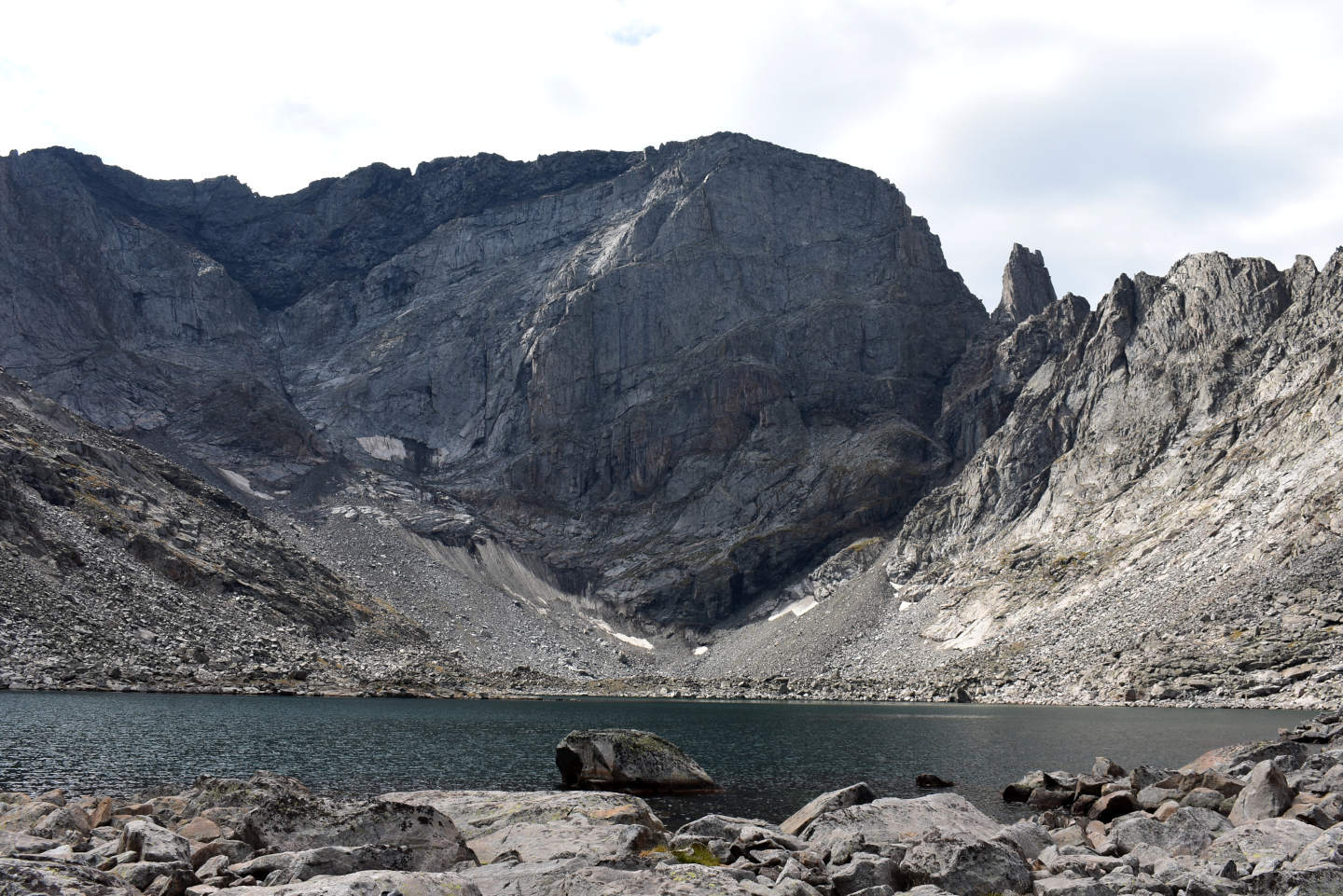
East Birthday Lake (very wide angle view). Big lake, big cliffs, no more glacier. The 7.5-minute topographic quadrangle shows a glacier 600 m wide (west-east) and 190 m long (south-north) (1,970′ x 620′) below the cliffs and extending up the eastern wall of the canyon well above the residual snowbank at left. The quadrangle was revised using 1981 aerial photographs. Without ice water draining into the lake, the water temperature could be warmer than in the recent past and more welcoming to fairy shrimp and other aquatic invertebrates; if only a decade or 2 were long enough to increase the chances of colonization.
Little West Birthday Lake (Medicine Wheel Ranger District, Bighorn National Forest, Cloud Peak Wilderness)
Little West Birthday Lake is 1.4 km (0.8 mile) southeast of “Lake Elsa” at the north end of West Birthday Lake canyon. WGF uses the name West Birthday Lake 1. It is about 150 m (490′) northeast of the much bigger West Birthday Lake and less than 18 m (60′) lower. The shore is essentially all rock. The 7.5-minute topographic quadrangle gives Little West Birthday Lake dimensions of 140 m and 75 m (460′ x 250′)
Because I previously visited East Birthday Lake, I decided to hike over the saddle in the ridge between East and West Birthday Lake canyons. The route was almost entirely boulders and the west side was uncomfortably steep. Conversely, the route from the south end of Lower Pouch Lake (WGF name) is easy with a moderate to gentle slope. To reach Lower Pouch Lake, see Little East Birthday Lake. Alternatively, one could follow the stream from “Lake Elsa” south up to Lake Elsie (sic, WGF name) and the northern shore of Lake Elsie to Lower Pouch Lake. The topographic map suggests it would also be possible to start up the hill toward “Upper Crater Lake” from northeast of “Cliff Lake” and then follow more moderate slopes to the east over the ridge to Lake Elsie.
Elevation: 3,236 m (10,620′)
August 26, 2026
Another world of rock without trees and with little grass. What are the birds eating?
- 75 m x 140 m based on the 7.5-minute quadrangle; depth greater than 300 cm.
- Clear water; 13 C at 1315.
- Fairy shrimp up to 15 mm long; no definite eggs although some females have white or greenish-white ovisacs or oviducts.
- Amphipods (Crustacea: class Malacostraca, order Amphipoda), red copepods (Crustacea: class Maxillopoda, subclass Copepoda) 1.5 mm long, wriggly larvae less than 5 mm long, caddisfly larvae (Trichoptera) less than 5 mm long, small birds.
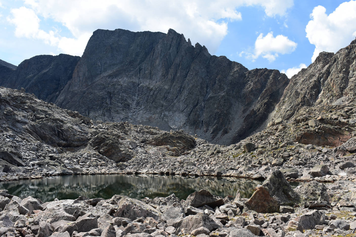
Little West Birthday Lake, very wide angle view looking southwest. West Birthday Lake is just above the rise on the far side of the lake. The cliffs in the background are part of the western wall of West Birthday Lake canyon, not the headwall. Near vertical anyway.
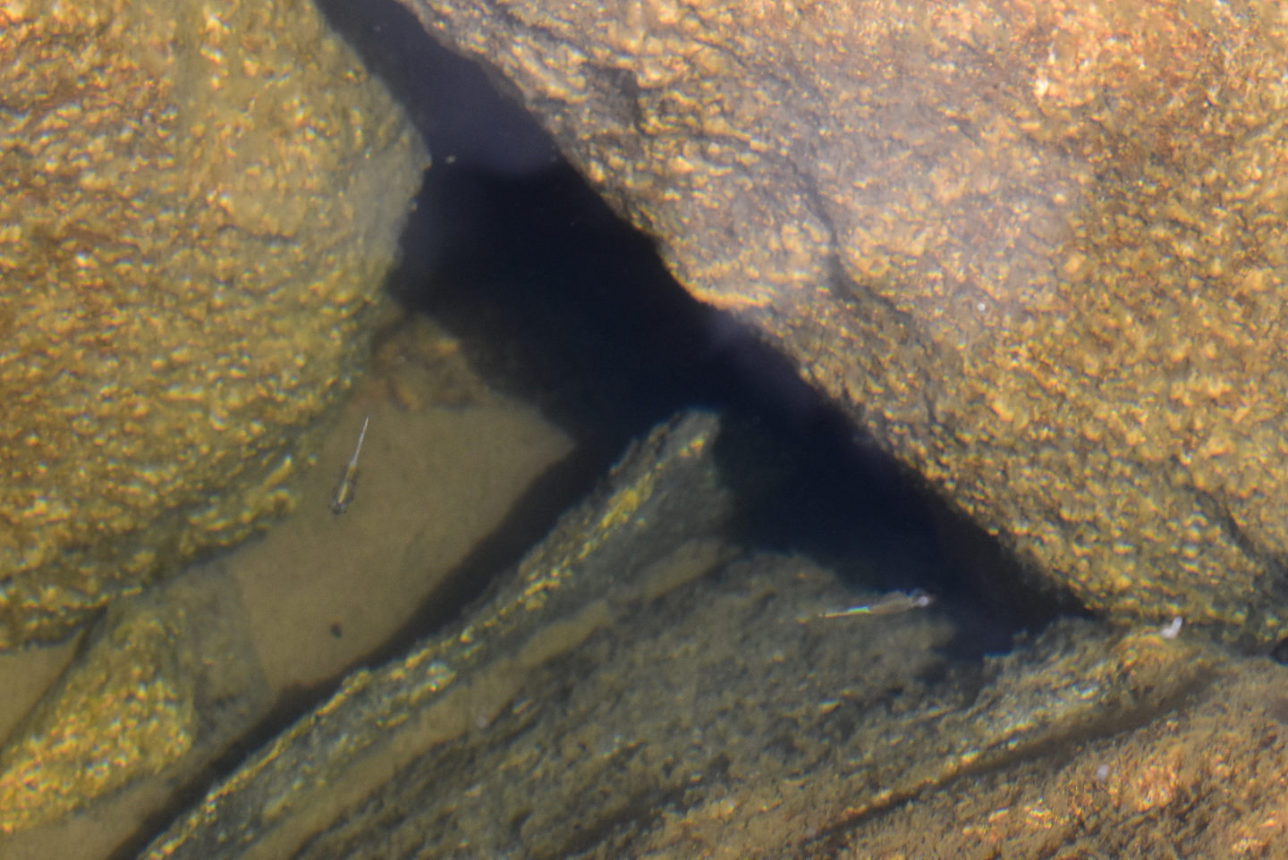
Little West Birthday Lake with fairy shrimp. Even better, this is what I saw when I first got to the water. No long walk along the shoreline hoping for a glimpse. They’re here and they are abundant enough to be found easily. That suggests the 39 other lakes and ponds I have already visited in the Bighorns really didn’t have fairy shrimp, unfortunately.

This is not a good photograph but it is the best I got of a male fairy shrimp in Little West Birthday Lake. This one has short antennae II, like Branchinecta paludosa (BTANSD). Compare this to Branchinecta coloradensis in Bivouac Lake and Bull Canyon Pond and to B. paludosa in “Coyote Lake”.
West Birthday Lake (Medicine Wheel Ranger District, Bighorn National Forest, Cloud Peak Wilderness)
West Birthday Lake is about 1.5 km south of “Lake Elsa” and 1.8 km southeast of “Cliff Lake”. WGF uses the name West Birthday Lake 2. The lake pretty much covers the bottom of West Birthday Lake canyon, with high, steep walls on all sides but the north. West Birthday Lake canyon is 1.44 km (0.86 mile) long to the crest of the hill at the north end. It is the deepest of the 3 canyons south of “Lake Elsa” at 1,540′ (469 m) to the lake surface. The deep canyon keeps the lakes cooler than more exposed lakes at similar elevations and could affect which species are present. West Birthday Lake is labeled with an elevation of 10,663′ (3,250 m) on the 7.5-minute topographic quadrangle. This is 6′ (1.8 m) lower than the elevation given by The National Map’s spot elevation tool. The 7.5-minute topographic quadrangle indicates West Birthday Lake is 600 m long and 330 m across (1,970′ x 1,080′).
For access, see Little West Birthday Lake.
Elevation: 3,250 m (10,663′, according to the topographic quadrangle)
August 26, 2026
A swath of dry rock about 10 m (33′) wide on the north shore indicates the water level is below normal but not by that much.
- 320 m x 580 m; depth greater than 300 cm.
- Slightly murky, greenish water; 12 C at 1400.
- No fairy shrimp.
- Amphipods (Crustacea: class Malacostraca, order Amphipoda), red copepods (Crustacea: class Maxillopoda, subclass Copepoda) 1.0 mm long, small birds, pikas.
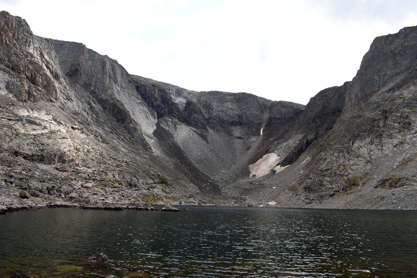
West Birthday Lake (very very wide angle view, 18 mm focal length), another lake with no more glacier. 1981 aerial photographs for revising the 7.5-minute topographic quadrangle show a glacier extending 320 m (1,050′) up the canyon to the south, probably past the snowbank at right. The glacier was a relatively narrow 240 m (790′) wide due to the narrowing of the canyon. The black mafic dike at the head of East Birthday Lake canyon crosses this canyon, too.
Little “Poacher Lake” (Medicine Wheel Ranger District, Bighorn National Forest, Cloud Peak Wilderness)
Little “Poacher Lake” is on the ridge between North Paint Rock Creek and Main Paint Rock Creek about 4.3 km (2.6 miles) northwest of “Lake Solitude”. It is 650 m (2,130′) northeast of “Poacher Lake”. WGF has labeled the lake Little Poacher Lake and “Poacher Lake” is named on the 7.5-minute topographic quadrangle. The shore of Little “Poacher Lake” has both rock and bog with tree downfall. This makes water viewing locations hard to find and hard to get to. The lake is 140 m long and 90 m across (460′ x 300′) according to The National Map’s aerial imagery. Little “Poacher Lake” has no mappable inlet or outlet.
Little “Poacher Lake” is less than 30 m east of the Solitude Trail, trail 038. The lake can be reached from the north by way of the “Lower Paint Rock Lake” trailhead and trail 059 to Tepee Pole Flats. Trail 038 leads from Tepee Pole Flats past the lake. Battle Park trailhead and trail 164 past “Grace Lake” provide access from the south. Trail 164 ends near trail 038’s ford of Main Paint Rock Creek west of “Lake Solitude”. Trail 038 leads up the hill from the ford to Little “Poacher Lake”.
Elevation: 2,950 m (9,680′)
August 29, 2026
Luckily, this lake is easily seen from trail 038. I was expecting the topography to flatten out more before I got to the lake.
- 90 m x 140 m, based on The National Map’s aerial imagery; depth not estimated.
- Clear water; 17 C at 1330.
- No fairy shrimp.
- No aquatic animals observed.
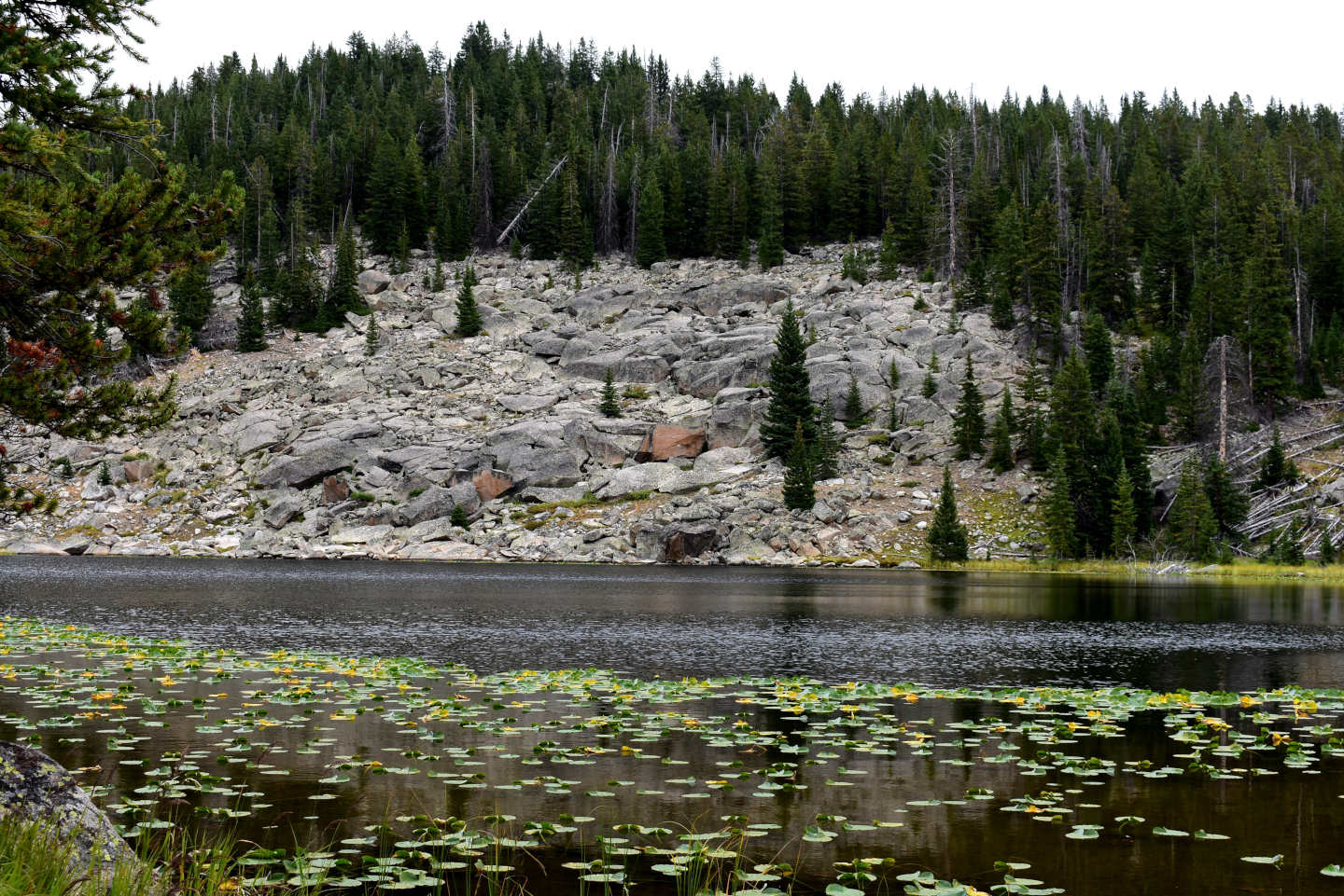
Little “Poacher Lake” with pond lilies and a rocky eastern shore.
“Poacher Lake” (Medicine Wheel Ranger District, Bighorn National Forest, Cloud Peak Wilderness)
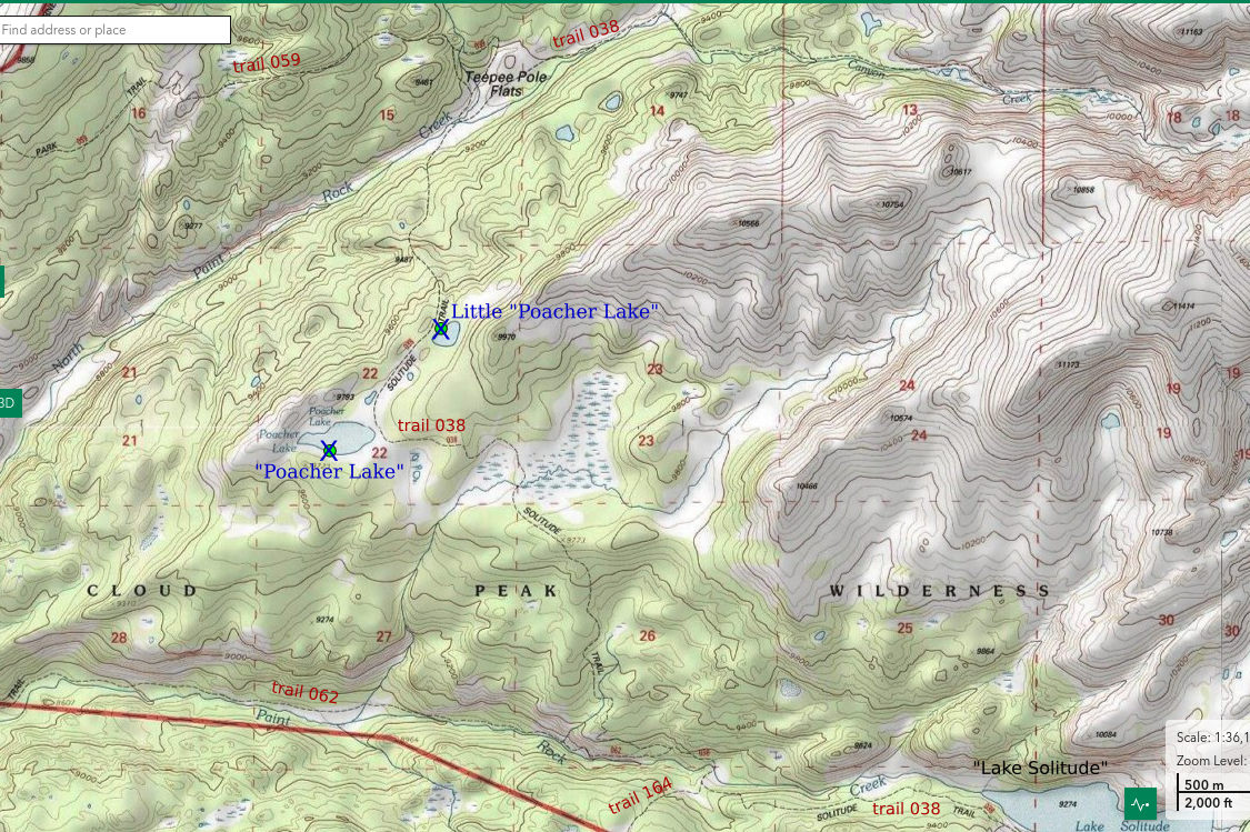
___This map is a screenshot of The National Map (Go to The National Map). The U.S. Geological Survey generally does not copyright or charge for its data or reports (unless printed). A pond location is indicated by an “X”, which corresponds to the coordinates given in the data spreadsheet. Labels in quotations are from 7.5-minute topographic quadrangles.
___As of April 2025, the National Grid overlay with red lines in UTM coordinates does not load in The National Map.
___As of September 2026, The National Map continues to lose functionality. Symbols and polygons are no longer available online. I have used Inkscape to plot “X”s on the green dots plotted by the Spot Elevation Tool, which also provides coordinates but now only the latitude and longitude. I have used the cursor location tracker in UTM mode and have manually written down the UTM coordinates before moving the cursor to the spreadsheet for data entry. Showing colored, non-opaque polygons of private or otherwise non-public lands is no longer feasible.
___There is no private or state land on this map.
“Poacher Lake” is about 4.3 km (2.6 miles) northwest of “Lake Solitude” but is farther south on trail 038 than Little “Poacher Lake”. It is in a broad, wet, grassy area that extends about 500 m (1,640′) to the northeast toward Little “Poacher Lake”. The grassy area also extends over 100 m (330′) to the east of the lake. The northwestern and southern shores are rocky and treed but with interspersed boggy areas. In 2026, part of the area east of the lake was dry enough for easy walking. The 7.5-minute topographic quadrangle does not show an inlet or outlet stream. Although the lake bottom is muddy and has abundant algae, the water is not darkened by dissolved organic compounds. The size of “Poacher Lake” on The National Map’s aerial imagery is 180 m by 160 m (590′ x 520′) but it is 480 m by 220 m (1,570′ x 720′) on the 7.5-minute topographic quadrangle. Much of what is lake on the topographic quadrangle is likely grass now.
For access, see Little “Poacher Lake”. “Poacher Lake” is 650 m (2,130′) to the southwest of that lake and also easily visible from the trail.
Elevation: 2,950 m (9,680′)
August 29, 2026
Looks like the rocks on the southern shore are my best bet for getting close enough to the water to look for animals but there are pond lilies even there.
- 160 m x 180 m, based on The National Map’s aerial imagery; depth not estimated due to large lake area and flat topography.
- Clear water; 15 C at 1400.
- No fairy shrimp.
- Caddisfly larvae (Trichoptera).
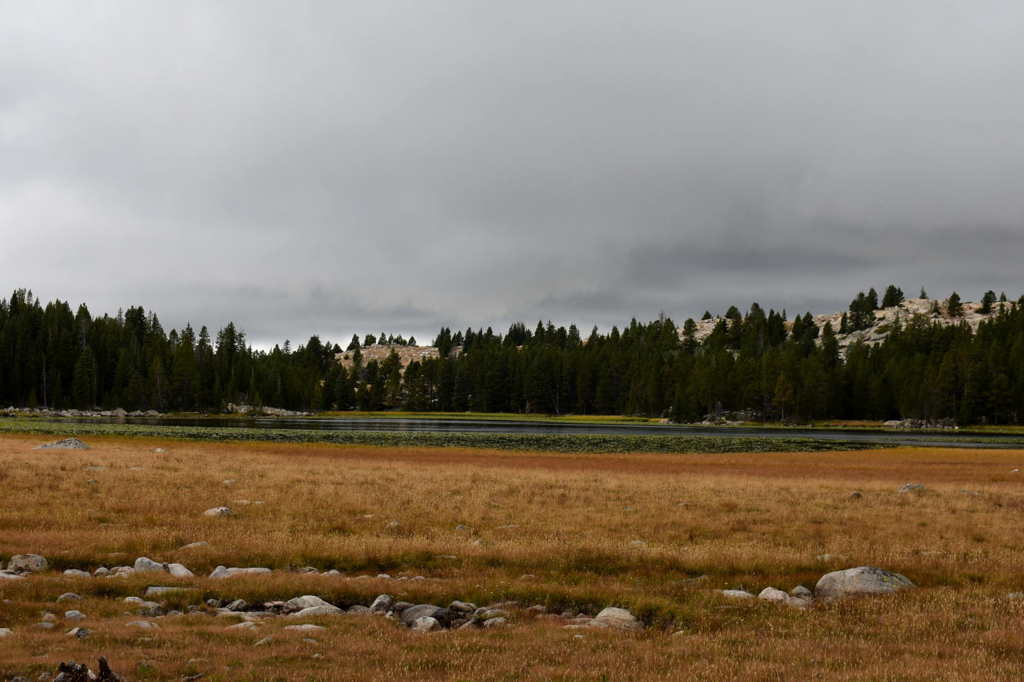
Looking west across “Poacher Lake”. The lake has a broad swath of dense pond lilies and emergent grass around most of its shoreline. This makes it difficult to see animals in the water from the shore.
Cloud Peak Big Climb Lake (Medicine Wheel Ranger District, Bighorn National Forest, Cloud Peak Wilderness)
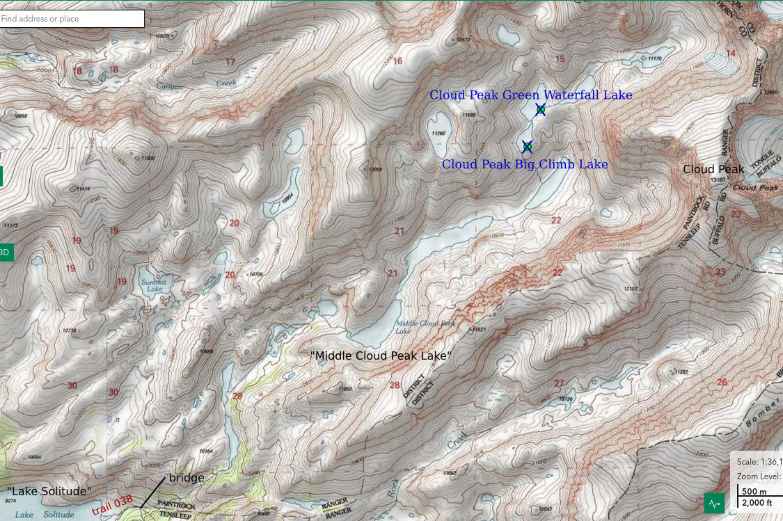
___This map is a screenshot of The National Map (Go to The National Map). The U.S. Geological Survey generally does not copyright or charge for its data or reports (unless printed). A pond location is indicated by an “X”, which corresponds to the coordinates given in the data spreadsheet. Labels in quotations are from 7.5-minute topographic quadrangles.
___As of April 2025, the National Grid overlay with red lines in UTM coordinates does not load in The National Map.
___As of September 2026, The National Map continues to lose functionality. Symbols and polygons are no longer available online. I have used Inkscape to plot “X”s on the green dots plotted by the Spot Elevation Tool, which also provides coordinates but now only the latitude and longitude. I have used the cursor location tracker in UTM mode and have manually written down the UTM coordinates before moving the cursor to the spreadsheet for data entry. Showing colored, non-opaque polygons of private or otherwise non-public lands is no longer feasible.
___There is no private or state land on this map.
Cloud Peak Big Climb Lake is 2.0 km (1.2 miles) west of Cloud Peak and about 5.5 km (3.3 miles) northeast of “Lake Solitude”. It is labeled NE Solitude Lake 8 on WGF’s online fishing map (https://wgfd.wyo.gov/fishing-boating/places-fish-wyoming). WGF has labeled the lakes in this canyon from 1 to 11 with 11 being the highest. The 7.5-minute topographic quadrangle has named 1 lake in this canyon: “Middle Cloud Peak Lake”. That lake is NE Solitude Lake 5 on WGF’s map and is the third lake down from Cloud Peak Big Climb Lake. I consider the proximity to Cloud Peak and at least 1 official lake name with the term Cloud Peak as better reasons to prefer Cloud Peak over Solitude in the lake name. The climb up to Cloud Peak Big Climb Lake from the next lake below is the highest between-lake climb in the canyon, about 300′ (91 m). Cloud Peak Big Climb Lake is deep and rocky but grassy areas are common around the lake. The lake has a tear drop shape with dimensions of 300 m by 150 m (980′ x 490′) on the 7.5-minute topographic quadrangle.
The nearest trail to Cloud Peak Big Climb Lake is trail 038 where it crosses the bridge over the stream 450-500 m (1,480-1,640′) east of “Lake Solitude”. The bridge provides a good view of waterfalls on the stream coming from the canyon with Cloud Peak Big Climb Lake. Trail 038 at the bridge can be reached from “Lower Paint Rock Lake” trailhead to the northwest or Battle Park trailhead to the southwest (see Little “Poacher Lake”). It can also be reached from “Mistymoon Lake” to the east. “Mistymoon Lake” can be reached from the “Lily Lake” trailhead and trail 066 to the southwest and from West Tensleep trailhead and trail 063 to the south. A well trampled path sporadically marked with cairns of small rocks leads up the canyon to “Middle Cloud Peak Lake” from immediately west of the bridge. The climb to the first lake is quite steep. Handholds are necessary in a few spots but nothing to get excited about. The path is relatively easy to follow along the lowest 2 lakes. There are a few trampled spots along the south shore of “Middle Cloud Peak Lake” but don’t expect to find a path above there. The lake above “Middle Cloud Peak Lake” is the highest one with fish.
Elevation: 3,301 m (10,830′)
August 30, 2026
This canyon is spectacular above “Middle Cloud Peak Lake”. Could the aquatic communities be too?
- 150 m x 300 m, based on the 7.5-minute quadrangle; depth greater than 300 cm.
- Clear water; 12 C at 1200.
- No fairy shrimp.
- Copepods (Crustacea: class Maxillopoda, subclass Copepoda), mayfly larvae (Ephemeroptera), caddisfly larvae (Trichoptera), small birds.
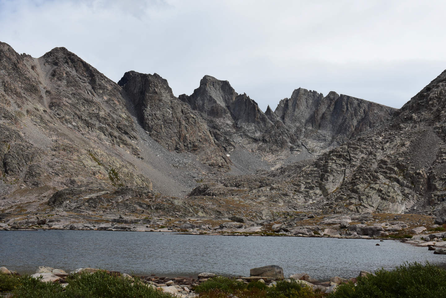
View to the northeast across Cloud Peak Big Climb Lake. Cloud Peak Green Waterfall Lake is well off the left edge of the photograph.
Cloud Peak Green Waterfall Lake (Medicine Wheel Ranger District, Bighorn National Forest, Cloud Peak Wilderness)
Cloud Peak Green Waterfall Lake is the third highest lake in the canyon on the west side of the ridge up to Cloud Peak. A portion of the cliffs on the west side of Cloud Peak Green Waterfall Lake has streaks of water and green vegetation like a waterfall, although there is no stream. Cloud Peak Green Waterfall Lake is 5.8 km (3.5 miles) northeast of the east end of “Lake Solitude” and about 2.75 km (1.65 miles) from the southern shore of “Middle Cloud Peak Lake”. Cloud Peak Green Waterfall Lake is 390 m by 190 m (1,280′ x 620′) on the 7.5-minute topographic quadrangle.
For access, see Cloud Peak Big Climb Lake. Cloud Peak Green Waterfall Lake is very close to Cloud Peak Big Climb Lake. Just continue walking along the shore.
Elevation: 3,303 m (10,837′)
August 30, 2026
The pattern holds: small birds at the fishless lakes but not at the lakes with fish.
- 190 m x 390 m, based on the 7.5-minute quadrangle; depth greater than 300 cm.
- Clear water; 10 C at 1230.
- No fairy shrimp.
- Copepods (Crustacea: class Maxillopoda, subclass Copepoda), small birds.
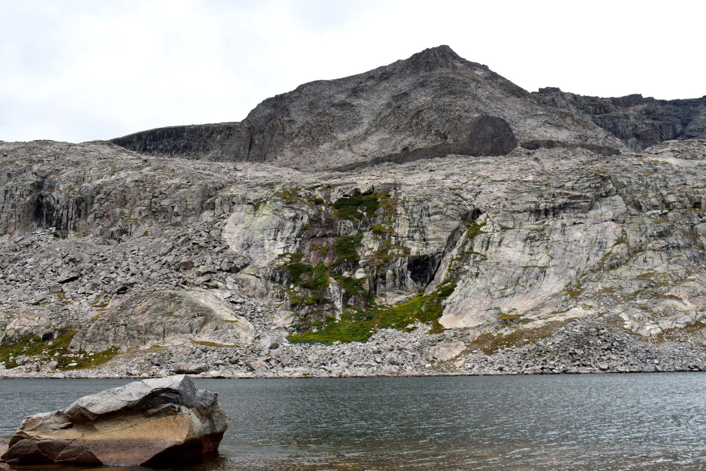
Looking west across Cloud Peak Green Waterfall Lake at the vegetation taking advantage of the water seeping from part of the cliff. There’s a black mafic dike above the waterfall that may be the one through Black Tooth Mountain.
The “drips” started at Cloud Peak Big Climb Lake. These are sporadic drops of rain that don’t even amount to a drizzle. They may continue intermittently for 10 minutes or 2 hours. This August in the Bighorns, they have presaged rain on some days but not on others. The next higher lake is close. I put on down vest, rain jacket, knit cap, and heavy gloves just in case. When I get to within about 50 m (160′) of the lake, the rain starts. The wind picks up. I put on a poncho for extra protection and to cover my day pack. I head down, cautiously, with all wet rocks ahead.
Lazy Outlet Lake (Powder River Ranger District, Bighorn National Forest, Cloud Peak Wilderness)
Lazy Outlet Lake is 950 m (3,120′) north of “Mistymoon Lake”. On the 7.5-minute topographic quadrangle, Lazy Outlet Lake is somewhat rectangular with a length of 200 m and a width of about 110 m (660′ x 360′). It drains to the west into (main) Paint Rock Creek rather than to the south into the “Mistymoon Lake” watershed. The inlet to the lake is obscured by boulders. The outlet is a wide meandering pool partially overgrown by grass that is, itself, almost a lake.
Lazy Outlet Lake is an easy walk to the northeast and down hill from “Mistymoon Lake” North Pond #3. “Mistymoon Lake” North Pond #3 is less than 70 m (230′) east of trail 038 where it crosses the ridge north of “Mistymoon Lake”. Access to that point can be from “West Tensleep Lake” to the south via trail 063, from “Lily Lake” to the southwest via trail 066, or from “Lower Paint Rock Lake” to the northwest via trails 059 and 038. There is additional route description at Middle Paint Rock Divide Lake.
Elevation: 3,149 m (10,330′)
August 31, 2026
The relatively large size and surrounding vegetation with hiding spots for eggs might appeal to ducks and, if so, they could have dropped off some fairy shrimp eggs.
- 110 m x 200 m, based on The National Map imagery; depth greater than 300 cm deep.
- Clear, greenish water; 14 C at 1500.
- No fairy shrimp.
- Amphipods (Crustacea: class Malacostraca, order Amphipoda) 5 mm and 10 mm long, black copepods (Crustacea: class Maxillopoda, subclass Copepoda) 2 mm long, caddisfly larvae (Trichoptera), hawk.
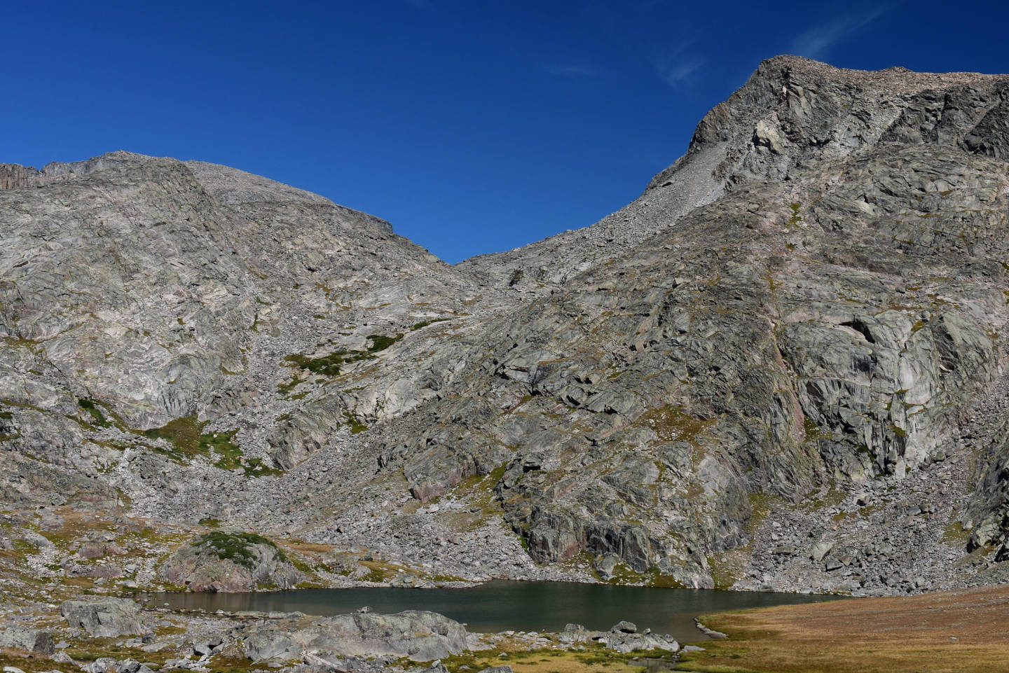
Lazy Outlet Lake and the cliff above it. The lake is in a wide, grassy basin with unusually abundant fine sand and silt. Maybe there was a big lake here before all the ice melted.
What Can We Learn from the Ponds in the Bighorn Mountains?
I visited 60 ponds in the Bighorn Mountains and saw fairy shrimp in 3 (5.0%). This is a real occurrence rate as I tallied the presence or absence of fairy shrimp in essentially all the ponds I visited, unlike in the Wind River Mountains and Snowy Range where I neglected recording some ponds where I didn’t see fairy shrimp. Although real, this percentage may not be representative of fairy shrimp occurrences in the Bighorn Mountains. Nonetheless, the ponds visited range in elevation from 2,547 m to 3,421 m (8,360′-11,220′) and in maximum dimension from 15 m to 900 m (49′-2,950′). 2 of the ponds have black water. One of the ponds is ephemeral (“Mistymoon Lake” North Pond #2) and a few may dry up in some years (e.g., “Cliff Lake” Northwest Pond #2, “Otter Lake” Lily Pond, Peak 11,112 Shadow Southwest Pond).
The ponds where I found fairy shrimp in the Bighorn Mountains have little in common other than clear water, elevations above 3,100 m, and permanence. These features are also common to many ponds without fairy shrimp.
- “Lost Twin Lakes” Ledge Pond: elevation – 3,175 m, max. dimension – 50 m, other animals – backswimmers (possibly water boatmen as I found water boatmen in 2 ponds in 2026 where I had identified backswimmers in 2007), black diving beetles.
- Peak 11,112 Shadow Pond: elevation – 3,151 m; max. dimension – 115 m; other animals – water boatmen, 2 kinds of copepods, cladocerans, caddisfly larvae.
- Little West Birthday Lake: elevation – 3,236 m; max. dimension – 140 m; other animals – amphipods, copepods, wriggly larvae, caddisfly larvae.
I didn’t collect any specimens of fairy shrimp in the Bighorn Mountains. Consequently, the species present has(ve) not been determined. Visually, the male fairy shrimp in all 3 ponds appear to have short antennae II like Branchinecta paludosa. This observation alone cannot be used to identify the species but it may be sufficient to distinguish these fairy shrimp from Branchinecta coloradensis, which is the dominant species in the Wind River Mountains and a common species in the Snowy Range. Horne (1967) identified B. paludosa in the Snowy Range and DB identified specimens from Jons Snowy Range Pond as B. paludosa. I identified what could be B. paludosa visually in “Coon Lake” South Pond #2 in the Wind River Mountains.
Based on my limited sampling, fairy shrimp are not as common in the Bighorn Mountains as they are in the Wind River Mountains or Snowy Range. They are more common than in East-Central Sierra Nevada, where I found none in 22 recorded ponds and almost as many non-recorded ponds.
The fairy shrimp population in Peak 11,112 Shadow Pond appears to be persistent. I found fairy shrimp there on both visits, in 2007 and 2026. Nearby Middle Paint Rock Round Pond and Middle Paint Rock Divide Lake did not gain fairy shrimp between 2007 and 2026.
The Bighorn Mountains may offer a good case study of the affects of fish-stocking on alpine bird populations. This is marginally relevant to fairy shrimp because birds are potential dispersal agents. More importantly, the predominance of birds at fishless lakes rather than at lakes with fish suggests the 20th century fish-stocking frenzy reduced bird populations in the Bighorn Mountains and possibly other mountain ranges throughout the world. In 2026, I saw ducks at 7 of 46 (15%) lakes and ponds without fish. I saw ducks at only 1 lake with fish – “Old Crow Lake”. Although I didn’t pay as much attention to lakes with fish, ducks were noticeably absent at: “Cloud Peak Reservoir”, the 2 lower “South Piney Lakes”, “Lame Deer Lake”, “Highland Lake”, “Peggy Lake”, lake 10,363 (below “Lake Silver”), “Spear Lake”, the lake below Sawtooth Peak 10,570 Southwest Lake, “Cliff Lake”, “Crater Lake”, Lower Pouch Lake (WGF name), “Lake Elsa”, “Lake Eunice”, “Rainbow Lake”, the lake northeast of “Rainbow Lake”, “Lake Solitude”, “Middle Cloud Peak Lake”, and the 2 lowest lakes in the canyon with “Middle Cloud Peak Lake”. That implies an occurrence rate of ducks at lakes with fish of 1 in 21 (4.8%) or, more confidently, less than 2 in 21 (about 10%). In the section on Fish-stocking Zooicide in the Sierra Nevada on the East-Central Sierra Nevada page, I listed 4 examples from the literature of how fish have negatively affected duck populations. I discussed the duck connection more fully in the description of Lower Indian Pass Lake (Wind River Mountains), which has ducks, fairy shrimp, mayflies, and other relatively large aquatic invertebrates.
I also saw more small birds at fishless lakes than at lakes with fish, 14 of 46 ponds in 2026, or 30%. Small birds are not as noticeable as ducks so I can’t say they were absent from lakes with fish where I didn’t see them. Notably, I commonly saw them fly out from under boulders when I walked along a shore looking for fairy shrimp. I only rarely walked along the shore of a lake with fish. That said, I never saw small birds or feces splattered rocks at lakes with fish. Mayflies are an important food for gray-crowned rosy finches in the Sierra Nevada (Epanchin and others, 2010) but, like other relatively large invertebrates, can be eliminated from lakes by fish (for examples, see Fish-stocking Zooicide in the Sierra Nevada). I did see mayfly larvae or adults at 3 of the lakes where I saw small birds. At 4 lakes, the small birds I saw may have been feeding on small flying insects that may have been chironomids.
Observations of more lakes and ponds with ducks in the Bighorn Mountains and more lakes and ponds with fairy shrimp in the Wind River Mountains borders on the paradoxical. Ducks are known dispersal agents for fairy shrimp eggs (Fairy Shrimp Dispersal). More ducks should mean more fairy shrimp. That hasn’t happened in the Bighorn Mountains. Maybe there is something about the deglaciation history or changing migration routes that could explain this.
The most common animal in the native aquatic communities I visited was caddisfly larvae, in 45% of the water bodies. About 30% had water boatmen or copepods, 20% amphipods, and 15% beetles or backswimmers (based on 2026 data only as I may have misidentified backswimmers in 2007). About 10% of the water bodies had small winged insects that might have been chironomids. I usually noticed them because they were floundering or dead on the water surface. 2026 is the first year in which I recorded such observations. Mayfly larvae or adults were at less than 10% of the water bodies. Ostracods, dragonflies, chaoborids(?), and cladocerans were rare. 2026 is also the first year in which I have tentatively identified chaoborids.
The good news is fishless, alpine lakes in the Bighorn Mountains are commonly surrounded by spectacular scenery. The bad news is they probably don’t have fairy shrimp. If you are an experienced off-trail hiker, go anyway. Maybe you will be greeted by ducks or finches instead.