The base map is provided by OpenTopoMap’s volunteer servers.
Previous Reports of Fairy Shrimp
Glaciation of the Snowy Range
Fish-stocking Zooicide in the Snowy Range
Libby Flats Overlook Pond
Jons Snowy Range Pond
“Arrowhead Lake” Southwest Pond
String of 3 East Pond
String of 3 Middle Pond
String of 3 West Pond
Sugarloaf West Pond #1
Sugarloaf West Pond #2
Sugarloaf West Pond #3
Sugarloaf West Pond #4
Sugarloaf West Pond #5
Sugarloaf West Pond #6
Sugarloaf West Pond #7
Sugarloaf West Pond #8
“Klondike Lake” West Pond
“Crescent Lake” West Pond
“Upper Long Lake”
“Hatchet Lake” Southwest Pond #1
“Hatchet Lake” Southwest Pond #2
Lost in the Trees Pond
“North Gap Lake” East Pond
“Reservoir Lake” West Pond
“Sheep Lake” South Pond
“Glacier Lakes” North Pond
“Brooklyn Lake” West Meadow Pond
Edge of Trees Pond
“Telephone Lakes” East Pond
“Lost Lake” East Pond
“Lost Lake” West Pond
Browns Peak Southeast Pond
Browns Peak South Pond
Browns Peak Southwest Pond
“Shelf Lakes” Northwest Ponds
“Shelf Lakes” North Ponds
“Shelf Lakes” Northeast Pond
“Corral Lake”
What Can We Learn from the Ponds in the Snowy Range?
The Snowy Range proper is a glaciated ridge above 3,300 m (10,830′) at the top of the Medicine Bow Mountains. It usually has snow banks throughout the summer. The 2 major peaks are Medicine Bow Peak and Browns Peak. Medicine Bow Peak is 41 km (25 miles) east of Saratoga and 57 km (35 miles) west of Laramie. The ridge is surrounded by an area of low relief that has abundant ponds and is generally above 3,100 m (10,170′). To include most of these ponds, the Snowy Range is defined for this web site as Township 16 North, Range 79 West; Township 16 North, Range 80 West; the southern half of Township 17 North, Range 79 West; and the southern half of Township 17 North, Range 80 west. This area is 19 km (12 miles) from west to east and 15 km (9 miles) from south to north. For those without a map that shows the section lines of the Public Land Survey System, this is a rectangular area from about Green Rock Picnic Ground in the east to the confluence of South Brush and Little Brush creeks in the west and from a little south of Silver Lake in the south to the middle of Turpin Reservoir in the north. It doesn’t include the Snowy Range ski area or “Sand Lake”.
The elevation of Medicine Bow Peak is 3,662 m (12,013′). Elevations in the Snowy Range drop to 3,000 m (9,840′) in some places around the edges of the area or even down to 2,750 m (9,020′) along South Brush Creek.
Mean Annual Precipitation according to the Wyoming Climate Atlas by the Water Resources Data System and State Climate Office at http://www.wrds.uwyo.edu/sco/climateatlas/precipitation.html, Parameter-Elevation Regressions on Independent Slopes Model, PRISM, with 1971-2000 data at very widely spaced weather stations (I have eyeballed the values from a very small scale map with 11 precipitation bins marked with indistinct colors and further obscured by a shaded relief base map):
41″-50″ (104-127 cm) with maybe 51″-60″ (130-152 cm) on crest
The Medicine Bow Mountains are heavily forested with lodgepole pine but this gives way to fir and spruce near the Snowy Range. The ridge of the Snowy Range itself is alpine tundra. Wet meadows are common and summer wildflower displays can be spectacular.
The Snowy Range is public land of the Medicine Bow-Routt National Forest. There are some patented mining claims south of “Arastre Lake” and there is some private land around “Turpin Reservoir”. There are summer homes and lodges in the “Brooklyn Lake” area but these are apparently leased facilities without private land ownership. Wyoming 130 crosses the Medicine Bow Mountains at Snowy Range Pass 2.5 km (1.6 miles) south of Medicine Bow Peak and thus enables extensive recreational use of the Snowy Range. There is camping, picnicking, and hiking in the summer and snowmobiling and cross-country skiing in the winter.
Previous Reports of Fairy Shrimp
Fairy shrimp have been previously documented in the Snowy Range. Horne (1967; see the References page) collected Branchinecta coloradensis, Branchinecta paludosa, and Chirocephalus bundyi from 4 “alpine ponds” in the “Medicine Bow Mountains” at elevations of 3,000-3,500 m (9,840-11,480′). Although the pond locations were not given, the elevations suggest they are in the Snowy Range, as defined for this web site.
Linder (1941) identified specimens collected in the Medicine Bow Mountains at 9,700 feet (2,957 m) and held at the U.S. National Museum as Branchinecta paludosa. This elevation is lower than all the Snowy Range ponds I visited but close enough to be within the Snowy Range area if the elevation had not been precisely or accurately determined.
Glaciation of the Snowy Range
The glaciated terrain in the Snowy Range doesn’t look like that in the Bighorn or Wind River Mountains. There are no deep, u-shaped valleys or sharp ridges and no well developed cirques. “Glacier Lakes” and “Lost Lake” have curved cliffs above them but no deep canyons below them as most cirques do. Glacial debris is widely scattered but moraine ridges are generally not evident. What there is is a northeast-southwest trending cliff about 9 km long and up to 300 m (980′) high on the southeast side of the Snowy Range. The northwest side has moderate convex slopes. Faults do not account for the cliff so it is most plausibly interpreted as the result of glacial erosion.
The Snowy Range is encircled by a region of low relief with widely scattered glacial erratics, such as the one at center in this view of The Gap and the mostly buried boulders at “Sheep Lake” South Pond. Other evidence for glaciation includes the deep South French Creek valley even though it is only moderately u-shaped. Both South French Creek valley and Libby Creek valley have moraines (Leonard and others, 2023). In spite of its atypical appearance, the Snowy Range has an abundance of ponds like other glaciated terrains. There are ponds of all sizes up to the 240 m by 640 m (790′ x 2,100′) of “South Gap Lake”.
Fairy shrimp could not have colonized ponds in the Snowy Range before the glaciers melted. Consequently, exposure ages of the glacial features associated with the most recent major glacial advance constrain the timing of colonization. For more on glacial features and exposure ages, see “Glaciation of the Wind River Mountains” on the Wind River Mountains page.
In the case of the Snowy Range, it is helpful to review available carbon-14 dates of organic matter deposited in Snowy Range lakes before considering the beryllium-10 exposure ages. Organic matter does not collect in lake sediment if the surrounding terrain is covered by ice or perennial snow. Something has to be living to create the organic matter and then die and get washed into the lake while decomposing into various organic compounds. Thus, organic matter provides a youngest possible age for the disappearance of a glacier from an area. The glacier could have disappeared earlier but it may have taken a while for microorganisms, plants, and animals to become abundant enough to enrich lake sediment in organic matter. Calibrated carbon-14 ages for the Snowy Range include 30,050-31,280 years (range for 95% confidence) for basal sediment in “Little Brooklyn Lake”, 17,680-18,520 years for mid-depth sediment from “Little Brooklyn Lake”, 14,890-15,140 years for near basal sediment from “East Glacier Lake”, and 16,460 years for basal sediment from “West Glacier Lake” (reported by Leonard and others, 2023, citing Brunelle and others, 2013, Mensing and others, 2011, and Minckley, 2014). Because none of the dates match within analytical error, they are difficult to interpret and don’t inspire confidence. The “Little Brooklyn Lake” mid-depth age could be a mixture of younger and older organic matter. The basal sediment age of 30,700 years could post-date an older glaciation and the basal or near-basal ages of the “Glacier Lakes” could post-date a younger glaciation since 16,500 years ago. “Glacier Lakes” are close to “Little Brooklyn Lake” but at a higher elevation.
Leonard and others (2023) determined beryllium-10 ages of 143,700, 23,700, 22,200, 19,600, 17,400, and 16,100 years for boulders on the Libby Creek moraine at the mouth of the canyon of Libby Creek and North Fork Little Laramie River. The oldest age is contaminated by the presence of considerable beryllium-10 accumulated during exposure before the most recent ice field formed on the Snowy Range. Only 2 ages overlap within analytical error: 23,700 and 22,200 years. Their mean is 22,950 years, or 23,000 years rounded. I suspect the 3 youngest ages are too young because of burial or erosion after the ice melted off. Leonard and others (2023) reported the mean of the 4 intermediate ages, 20,700 years (standard deviation 2,800 years) as the best estimate of the beginning of the retreat of the glacier in Libby Creek canyon but noted that the range of the 4 ages exceeds analytical error. Either choice indicates that all the Snowy Range lakes and ponds were covered by ice 23,000 years ago. This age is compatible with the younger carbon-14 dates but not with the older one.
Most of the ice had disappeared from the Snowy Range by 10,000 years ago. Boulders on 2 adjacent moraines below the cliffs west of “Lookout Lake” yielded beryllium-10 ages of 10,500 years (standard deviation 300 years, n=4) and 11,500 years (standard deviation 500 years, n=500) (reported by Leonard and others, 2023, citing Marcotte and others, 2019). Boulders on a moraine on the east side of “Lookout Lake” gave an older date of 14,500 years (standard deviation 300 years, n=5) (reported by Leonard and others, 2023, citing Marcotte and others, 2019). It makes sense that the glacier retreated from “Lookout Lake” before it melted off the less exposed base of the cliff to the west of the lake.
Beryllium-10 exposure ages for a bedrock sample and a boulder sample at the same site a little over a third of the way up the Libby Creek valley provide a useful constraint for the timing of glacier retreat. The ages of 17,700 years and 18,400 years overlap within analytical uncertainty (Leonard and others, 2023). The mean is 18,100 years. At elevations of about 3,045 m and 3,047 m (9,990′), the sample site is just below the broad upland where most of the ponds are located. Most ponds were probably still covered by ice or perennial snow 18,100 years ago. This date is older than the sediment carbon-14 ages in “Glacier Lakes”, which are above 3,250 m (10,660′).
Ice-off for most ponds has been dated by the beryllium-10 exposure ages of 8 bedrock samples collected at elevations of 3,311-3,328 m (10,860-10,920′) and at various locations up to 2.4 km (1.4 miles) southeast of the crest of the Snowy Range (Leonard and others, 2023). The age range is a tight 13,700-14,700 years (standard deviations of analytical uncertainty for individual samples 300-700 years) and the mean is 14,300 years. This date is not consistent with the sediment carbon-14 ages in “Glacier Lakes” but is probably more reliable. Based on the sample locations, it is safe to say that all the ponds I visited in the Snowy Range, except “Lost Lake” West Pond (Jons Snowy Range Pond map), Klondike Lake West Pond (Sugarloaf West ponds map), and Sugarloaf West Ponds were free of glacial ice by 14,300 years ago. This includes ponds north of the Snowy Range where exposure ages are lacking. Current snow depths are less and sun exposure is greater on the north side of the range. As there are no ponds on top of the Snowy Range, essentially all of the ponds in the Snowy Range would have been free of ice by 10,500 years ago, the youngest exposure age west of “Lookout Lake”.
Some glaciers in the Wind River Mountains advanced during the Little Ice Age (1300-1850) and haven’t melted completely away yet. The advance of Mammoth Glacier, the largest west of the Continental Divide, was less than about 1 km (0.6 mile) from the 2021 ice margin (Jones and others, 2023). Because the Snowy Range lacks current glaciers and the ice-shed on the southeast side of Medicine Bow Peak is quite limited, it is unlikely that Little Ice Age glaciation, if any, affected any ponds.
Glaciation has blessed the Snowy Range with abundant habitat for fairy shrimp. Since 14,300 years ago, fairy shrimp have colonized at least 13 ponds. They probably colonized many more than that but have been eliminated from most ponds by fish.
Fish-stocking Zooicide in the Snowy Range
Most of the lakes and ponds in the Snowy Range have been stocked with fish. The U.S. Forest Service (USFS) and Wyoming Game and Fish Department (WGF) have produced the 2019 “Fishing in the Medicine Bow – Routt National Forest, Snowy Range Area” guide, which is available online. The guide tabulates about 85 lakes with acreages, depths, and which species of fish are present. Most of the lake names also appear on the Medicine Bow Peak and “Sand Lake” 7.5-minute topographic quadrangles. Exotic brook trout are by far the most common. Lakes as small as 1 acre (0.4 hectare) have fish (e.g., “Bellamy Lake”). Lakes as shallow as 2 feet (61 cm) have fish (e.g., “Corral Lake”). Most of the fish populations are self-sustaining but some are stocked “periodically”. 22 lakes are listed as lacking fish but without annual surveys, this would not account for impulsive fish-stocking by the public.
Studies of aquatic communities in fishless and fish-hosting lakes indicate fish radically alter such communities by extirpating populations of invertebrates larger than about 2 mm. Summaries are provided in the Fish-stocking Zooicide section on the east-central Sierra Nevada page. Some experimental studies of fish introduction or removal are summarized and more details on WGF’s fish-stocking efforts are provided in the Fish-stocking Zooicide section on the Wind River Mountains page.
The extent of the fish-stocking zooicide in the Snowy Range cannot be determined. There are no pre-stocking invertebrate surveys and there may be no post-stocking surveys either. According to the fishing guide, 63 lakes have fish. That suggests at least 63 populations of large-bodied invertebrates have been eliminated. Given the non-trivial presence of fairy shrimp in the Snowy Range, at least a few fairy shrimp populations have been killed off by fish. Those that survived in non-stocked ponds are now more isolated than before and that may have genetic or sustainability consequences. Reduced ecosystem services by fairy shrimp and other affected invertebrates may cause problems for other species. Lower Indian Pass Lake in the Wind River Mountains has resident ducks that must be eating the abundant fairy shrimp and other aquatic invertebrates in the lake. The lake and its surroundings have negligible aquatic or terrestrial vegetation. I have passed fish-hosting lakes in the Wind River Mountains at least several dozen times and have seen only 1 duck at 1 lake and that duck was a transient. I don’t remember ever seeing ducks in the Snowy Range. The ponds in the Snowy Range that still have fairy shrimp may be too small to appeal to ducks. Maybe the Snowy Range never had ducks or maybe stocked fish drove them away by eating all their food, as they have in the prairie potholes region of Minnesota (Carleen and others, 2024).
Snowy Range – top
Libby Flats Overlook Pond (Laramie Ranger District, Medicine Bow-Routt National Forest)
___This map is a screenshot of The National Map (Go to The National Map). The U.S. Geological Survey generally does not copyright or charge for its data or reports (unless printed). A pond location is indicated by an “X”, which corresponds to the coordinates given in the data spreadsheet. Labels in quotations are from 7.5-minute topographic quadrangles.
___Red lines are the U. S. National Grid with a spacing of 1,000 m and intersection labels consisting of the UTM zone (e.g., 11S, 12T), a 2-letter 100-km square designation (e.g., LC, XN), and a 4-digit number. The first 2 digits of the number represent the 1,000-meter Easting and the second 2 digits the 1,000-meter Northing, as seen in the example Easting and Northing. Unlike latitude and longitude, the National Grid is rectilinear on a flat map, the units of abscissa and ordinate have equal lengths, and the units (meters) are measurable on the ground with a tape or by pacing.
___There is no private or state land on this map. All the lands are public.
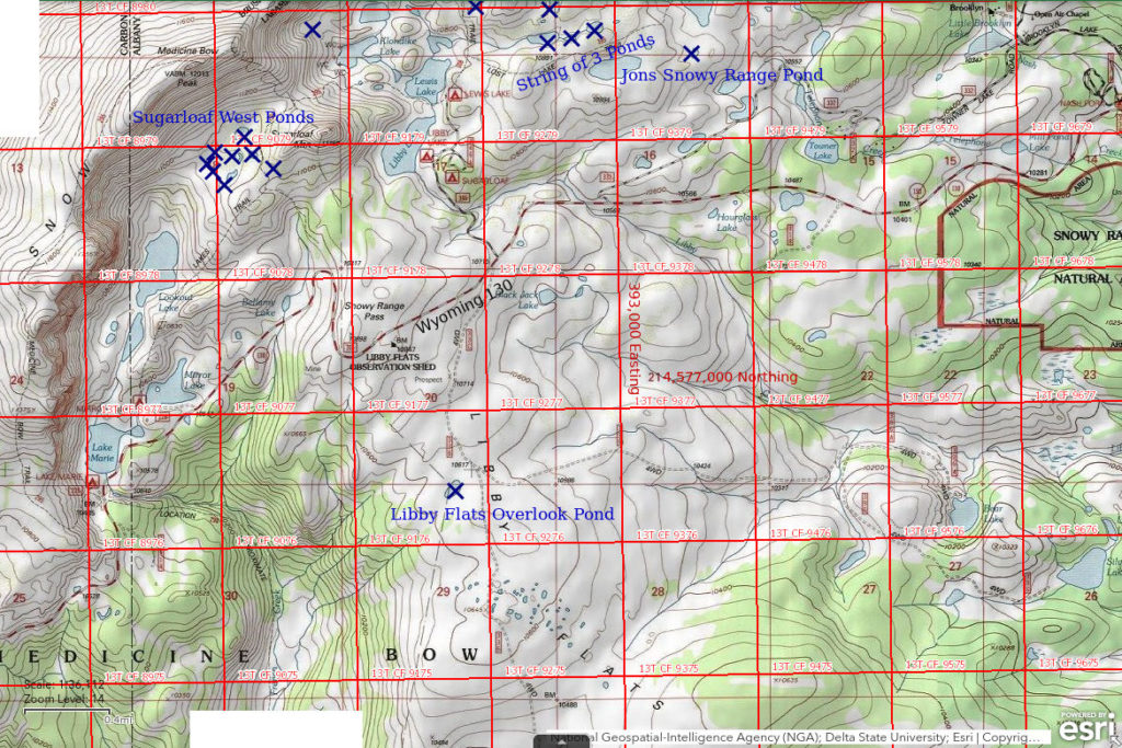
Libby Flats Overlook Pond is 3.7 km (2.3 miles) south of Medicine Bow Peak. The pond can be seen from the Libby Flats Overlook on Wyoming 130, which is just east of Snowy Range Pass. On the 7.5-minute topographic quadrangle, the pond is 170 m x 90 m (560′ x 300′). Libby Flats Overlook Pond is not shown on the map in the Snowy Range fishing guide by the USFS and WGF.
To get to the pond, turn off Wyoming 130 immediately east of Snowy Range Pass at the Libby Flats Overlook. It is a gentle hike of about 1,000 m (3,280′) to the pond but the elevation above 3,200 m (10,500′) may be a concern for some.
Elevation: 3,239 m (10,625′)
July 5, 1989
Just driving through but I had time to walk down to the pond.
- 90 m x 170 m based on the 7.5-minute quadrangle; possibly up to 100 cm deep.
- Clear with brown tint; 22 C at 1515.
- Sparse, pale greenish-gray fairy shrimp about 20 mm long; some females have eggs.
- Small black beetles, relatively large cladocerans, red spheres that may be water mites, snails.
The fairy shrimp look more similar to the Branchinecta coloradensis collected from Bivouac Lake (Wind River Mountains) rather than to the Branchinecta paludosa collected from “Coyote Lake” (Antelope Hills), both of which were collected by Horne (1967) from other ponds in the area.
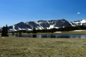
Libby Flats Overlook Pond, looking northwest. Cliffs of the Snowy Range above “Lake Marie” and “Lookout Lake” are in the distance. Medicine Bow Peak is off the right edge of the photograph. The boundary between the Laramie and the Brush Creek – Hayden Ranger Districts generally follows the hydrologic divide between the Laramie River and the upper North Platte River north of Saratoga and has been drawn to pass through Libby Flats Overlook Pond.
September 5, 2007
The pond is partially dried up. There are ATV tracks around and into the pond.
- No fairy shrimp.
Jons Snowy Range Pond (Laramie Ranger District, Medicine Bow-Routt National Forest)
___This map is a screenshot of The National Map (Go to The National Map). The U.S. Geological Survey generally does not copyright or charge for its data or reports (unless printed). A pond location is indicated by an “X”, which corresponds to the coordinates given in the data spreadsheet. Labels in quotations are from 7.5-minute topographic quadrangles.
___Red lines are the U. S. National Grid with a spacing of 1,000 m and intersection labels consisting of the UTM zone (e.g., 11S, 12T), a 2-letter 100-km square designation (e.g., LC, XN), and a 4-digit number. The first 2 digits of the number represent the 1,000-meter Easting and the second 2 digits the 1,000-meter Northing, as seen in the example Easting and Northing. Unlike latitude and longitude, the National Grid is rectilinear on a flat map, the units of abscissa and ordinate have equal lengths, and the units (meters) are measurable on the ground with a tape or by pacing.
___There is no private or state land on this map. All the lands are public.
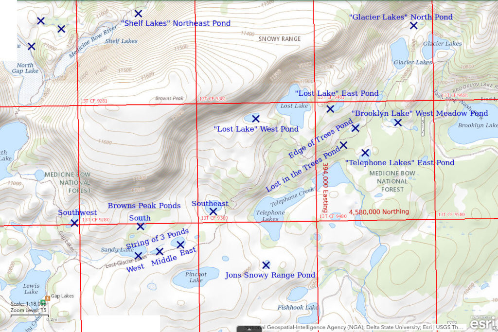
Jons Snowy Range Pond is 3.8 km (2.4 miles) east of Medicine Bow Peak about half way between “Brooklyn Lake” and “Lewis Lake”. On the 7.5-minute topographic quadrangle, it is 430 m (1,410′) due south of the inlet of the western and larger of the “Telephone Lakes”. Its size is 75 m x 50 m (245′ x 165′). I thank Jon Benedict for leading me to it.
One can reach Jons Snowy Range Pond by various routes. It is a short, gentle hike from the “Lost Lake” Trail (also known as “Telephone Lakes” trail and “Glacier Lakes” trail) at the crossing of the inlet of the western of the “Telephone Lakes”. This trail connects the “Brooklyn Lake” trailhead to the “Lewis Lake” trailhead, both of which can be reached over maintained roads less than 2 miles long from Wyoming 130. The inlet is 1.9 km (1.2 miles) from “Lewis Lake” trailhead and 2.4 km (1.5 miles) from “Brooklyn Lake” trailhead. The pond can also be reached by hiking less than 1,300 m (4,270′) north from the “Towner Lake” road, which turns north off Wyoming 130 1 1/2 miles east of Snowy Range Pass. It is also possible to hike cross-country with little elevation change for about 2 km east from the Sugarloaf Campground, which is less than 1/2 mile south of the “Lewis Lake” trailhead. The pond is less than 1.5 km (1 mile) from a stretch of Wyoming 130 south of “Towner Lake” road but the highway is too narrow for parking on the shoulder and there are few turnouts.
Elevation: 3,277 m (10,750′)
September 3, 1989
Snowy Range Pass is less than 40 highway miles west of Laramie so this may be worth a side trip if you are passing through Laramie.
- Nearly circular with a diameter of about 30 m; depth less than 100 cm.
- Clear water with slight brown tint; 17 C at 1500.
- Brownish-green fairy shrimp, males 25-27 mm but females about 22 mm; females have light brown eggs in slender ovisacs almost as long as their abdomens.
- Other animals not noted.
Specimens were identified as Branchinecta paludosa by DB.
August 28, 2005
It’s been a long time so I am not sure I found Jons Snowy Range Pond again. On the map, there is another small pond about 350 m to the west but that seems much less likely.
- No fairy shrimp.
“Arrowhead Lake” Southwest Pond (Brush Creek – Hayden Ranger District, Medicine Bow-Routt National Forest)
___This map is a screenshot of The National Map (Go to The National Map). The U.S. Geological Survey generally does not copyright or charge for its data or reports (unless printed). A pond location is indicated by an “X”, which corresponds to the coordinates given in the data spreadsheet. Labels in quotations are from 7.5-minute topographic quadrangles.
___Red lines are the U. S. National Grid with a spacing of 1,000 m and intersection labels consisting of the UTM zone (e.g., 11S, 12T), a 2-letter 100-km square designation (e.g., LC, XN), and a 4-digit number. The first 2 digits of the number represent the 1,000-meter Easting and the second 2 digits the 1,000-meter Northing, as seen in the example Easting and Northing. Unlike latitude and longitude, the National Grid is rectilinear on a flat map, the units of abscissa and ordinate have equal lengths, and the units (meters) are measurable on the ground with a tape or by pacing.
___There is no private or state land on this map. All the lands are public.
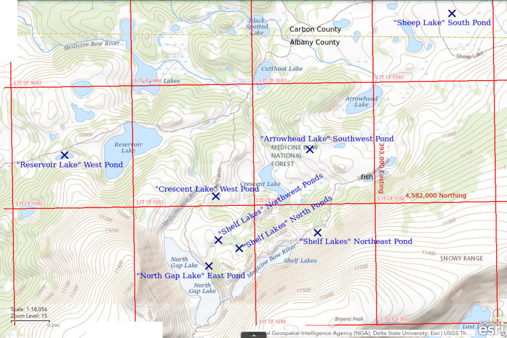
“Arrowhead Lake” Southwest Pond is 3.9 km (2.4 miles) northeast of Medicine Bow Peak. It is 430 m (1,410′) southwest of “Arrowhead Lake”. It is not shown on the 7.5-minute topographic quadrangle but is apparent, although mostly dry, on USGS imagery for The National Map. “Arrowhead Lake” Southwest Pond is probably less than 100 m (330′) across when fully inundated. The 7.5-minute quadrangle shows another pond 200-250 m (660-820′) to the east of “Arrowhead Lake” Southwest Pond. I likely looked in that pond, too, but did not see fairy shrimp.
The shortest route to “Arrowhead Lake” Southwest Pond is to take the “Gap Lakes” Trail north from the “Lewis Lake” trailhead. Follow the trail past “North Gap Lake” and “Crescent Lake”. At or before the junction with the “Quealy Lake” trail to “Reservoir Lake”, turn off the trail and head east or southeast to the pond.
Elevation: 3,311 m (10,862′)
August 28, 2005
The low-relief area north of Browns Peak is mostly grass and meadow and easy hiking. Ponds are common so I cut off the trail for a look around.
- Fairy shrimp.
September 1, 2010
Near the end of a long day of looking at ponds.
- Fairy shrimp.
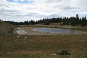
Looking west across an almost dry “Arrowhead Lake” Southwest Pond. I saw fairy shrimp in the puddle at left but not in the larger puddle at right.
String of 3 East Pond (Laramie Ranger District, Medicine Bow-Routt National Forest)
String of 3 East Pond is the uppermost of 3 ponds on a small stream that drains westward into “Lewis Lake”. The pond is 3 km (1.9 miles) east of Medicine Bow Peak. It has dimensions of 120 m x 85 m (390′ x 280′) on the 7.5-minute topographic quadrangle.
String of 3 East Pond is about 100 m (330′) north of the “Lost Lake” Trail between the “Lewis Lake” and “Brooklyn Lake” trailheads and much closer to the former.
Elevation: 3,317 m (10,882′)
July 31, 2007
The stream has a low gradient so fish may be able to get up here from “Lewis Lake” but WIDLA.
- Fairy shrimp.
These fairy shrimp have short, pointed distal segments of male antennae II like the Branchinecta paludosa (BTANSD) in Jons Snowy Range Pond, which is about 700 m (2,300′) away.
August 25, 2010
I’m trying to hit as many ponds as possible today so it makes sense to come back to a past producer to see if the timing and other conditions are favorable.
- Fairy shrimp.
September 1, 2010
I came back for photographs. The pond is almost dry so I hope I made it in time.
- Fairy shrimp.
- Copepods in photograph.
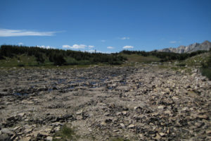
An almost dry String of 3 East Pond, looking west. There is still water among the rocks in the very center of the pond. Occasional desiccation like this is good for fairy shrimp because it would prevent a sustainable fish population. Nonetheless, fish might still try to swim up the stream from “Lewis Lake” early in the summer. Being the farthest of the String of 3 Ponds from “Lewis Lake”, String of 3 East Pond might be the least susceptible to this threat.
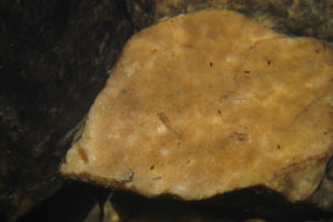
A fairy shrimp (center) in String of 3 East Pond. The shadow of a fairy shrimp at the left edge of the rock is facing in the wrong direction to be the shadow of the fairy shrimp at center. The much smaller dark brown animals swimming above the pale rock are copepods.
String of 3 Middle Pond (Laramie Ranger District, Medicine Bow-Routt National Forest)
String of 3 Middle Pond is the middle and smallest pond of the 3 adjacent ponds on the small stream east of “Lewis Lake”. On the 7.5-minute topographic quadrangle, it is barely 100 m (330′) long.
For access, see String of 3 East Pond.
Elevation: 3,317 m (10,884′)
July 31, 2007
This is obviously connected to String of 3 East Pond and String of 3 West Pond but it’s worth looking to see how the aquatic fauna may differ.
- No fairy shrimp.
- Backswimmers (sub-order Heteroptera, family Notonectidae), beetles.
String of 3 West Pond (Laramie Ranger District, Medicine Bow-Routt National Forest)
String of 3 West Pond is the largest of the 3 adjacent ponds on the small stream east of “Lewis Lake”. The pond is 220 m x 100 m (720′ x 330′) on the 7.5-minute topographic quadrangle.
For access, see String of 3 East Pond.
Elevation: 3,317 m (10,882′)
July 31, 2007
I didn’t see the same animals in String of 3 Middle Pond that I saw in String of 3 East Pond so what will this one have?
- No fairy shrimp.
- Amphipods.
There is probably a sampling bias going on with the String of 3 Ponds. Due to the stream connection, all 3 would be likely to have the same aquatic species though abundances could vary. Stream flow between the ponds is weak. Walking along the shore, I probably didn’t see all the larger invertebrates present in each pond. This is likely true for many ponds I have visited.
Sugarloaf West Pond #1 (Brush Creek – Hayden Ranger District, Medicine Bow-Routt National Forest)
___This map is a screenshot of The National Map (Go to The National Map). The U.S. Geological Survey generally does not copyright or charge for its data or reports (unless printed). A pond location is indicated by an “X”, which corresponds to the coordinates given in the data spreadsheet. Labels in quotations are from 7.5-minute topographic quadrangles.
___Red lines are the U. S. National Grid with a spacing of 1,000 m and intersection labels consisting of the UTM zone (e.g., 11S, 12T), a 2-letter 100-km square designation (e.g., LC, XN), and a 4-digit number. The first 2 digits of the number represent the 1,000-meter Easting and the second 2 digits the 1,000-meter Northing, as seen in the example Easting and Northing. Unlike latitude and longitude, the National Grid is rectilinear on a flat map, the units of abscissa and ordinate have equal lengths, and the units (meters) are measurable on the ground with a tape or by pacing.
___There is no private or state land on this map. All the lands are public.
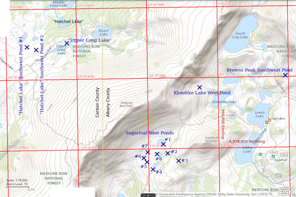
Sugarloaf West Pond #1 is the largest and northernmost of a group of ponds in a small basin on the west side of Sugarloaf Mountain. Medicine Bow Peak, only 575 m (1,890′) to the northwest, looms dramatically above the pond. The 7.5-minute topographic quadrangle shows 6 ponds in this area. I looked at 5 of those and at 3 ponds that are not on the map. Some of the ponds have considerable vegetation and there are bogs around some ponds so different observers could identify different numbers of ponds depending on how much open water a pond must have to be a pond. Sugarloaf West Pond #1 is 120 m x 70 m (390′ x 230′) on the 7.5-minute quadrangle.
Trails from the “Lewis Lake” trailhead and the “Mirror Lake” trailhead meet in the saddle between Sugarloaf Mountain and Medicine Bow Peak. The “Lewis Lake” trailhead is much closer but the “Lookout Lake” trail from the “Mirror Lake” trailhead allows more time to admire the cliffs and cornices. Sugarloaf West Pond #1 is 400 m (1,310′) southwest of the saddle.
Elevation: 3,348 m (10,984′)
July 31, 2007
Lots of ponds in a small area so my hopes are up.
- No fairy shrimp.
- Backswimmers (sub-order Heteroptera, family Notonectidae), beetles.
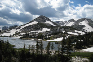
Looking west across “Libby Lake” at Sugarloaf Mountain in a different year that may have been snowier. Sugarloaf West Ponds are on the other side. Medicine Bow Peak is at right.
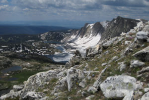
View southwest along the cliffs of the Snowy Range from the trail up to Medicine Bow Peak in a different year. Sugarloaf West Ponds #1, #8, and #4 are at the left edge of the photograph. Pond #4 is about 1/3 of the way up from the bottom of the photograph and is the most visible. Pond #1 is just above the rock in the foreground, near the bottom. Pond #8 is between those 2 ponds. The long lake with ice in the distance is “Lookout Lake” and just above it is “Lake Marie”.
Sugarloaf West Pond #2 (Brush Creek – Hayden Ranger District, Medicine Bow-Routt National Forest)
Sugarloaf West Pond #2 is a little over 100 m (330′) southeast of Sugarloaf West Pond #1. On the 7.5-minute topographic quadrangle, it is only about 70 m (230′) long.
For access, see Sugarloaf West Pond #1. Sugarloaf West Pond #2 is just below the trail from “Lookout Lake”.
Elevation: 3,349 m (10,987′)
July 31, 2007
No luck in Pond #1, what about this smaller one?
- No fairy shrimp.
- Backswimmers (sub-order Heteroptera, family Notonectidae), beetles.
Sugarloaf West Pond #3 (Brush Creek – Hayden Ranger District, Medicine Bow-Routt National Forest)
Sugarloaf West Pond #3 is about 300 m (980′) southeast of Sugarloaf West Pond #1. Although I didn’t estimate the size, I’m sure it was less than 100 m (330′) across, probably considerably less.
It is not on the 7.5-minute topographic quadrangle so the location shown on the map and the coordinates in the data spreadsheet (on the Data page) could be off by 50 m (165′) or so.
For access, see Sugarloaf West Pond #1. Sugarloaf West Pond #3 is east of the “Lookout Lake” trail where it crosses the ridge on the southwest slope of Sugarloaf Mountain.
Elevation: 3,364 m 11,036′)
July 31, 2007
The flat-topped ridge on the southwest slope of Sugarloaf Mountain looks like it might have snowmelt ponds and it also offers a nice view.
- No fairy shrimp.
- Beetles.
Sugarloaf West Pond #4 (Brush Creek – Hayden Ranger District, Medicine Bow-Routt National Forest)
Sugarloaf West Pond #4 is 300 m (980′) south of Sugarloaf West Pond #1. On the 7.5-minute topographic quadrangle, it is 120 m x 50 m (390′ x 165′).
For access, see Sugarloaf West Pond #1. Sugarloaf West Pond #4 is below and only about 50 m (165′) from the “Lookout Lake” trail.
Elevation: 3,341 m (10,962′)
July 31, 2007
After the nice views, time to look at more ponds.
- No fairy shrimp.
- Amphipods, backswimmers (sub-order Heteroptera, family Notonectidae).
Sugarloaf West Pond #5 (Brush Creek – Hayden Ranger District, Medicine Bow-Routt National Forest)
Sugarloaf West Pond #5 is about 325 m (1,070′) southwest of Sugarloaf West Pond #1. Although I didn’t estimate the size, it was probably less than 100 m (330′).
Sugarloaf West Pond #5 is not on the 7.5-minute topographic quadrangle so the location shown on the map and the coordinates in the data spreadsheet (on the Data page) could be off by 50 m (165′) or so. The possible error is constrained by the pond’s location between Pond #4 and Pond #6.
For access, see Sugarloaf West Pond #1.
Elevation: 3,335 m (10,941′)
July 31, 2007
Not much of a pond but I’m here so I’ll have a look.
- No fairy shrimp.
- Backswimmers (sub-order Heteroptera, family Notonectidae).
Sugarloaf West Pond #6 (Brush Creek – Hayden Ranger District, Medicine Bow-Routt National Forest)
Sugarloaf West Pond #6 is about 250 m (820′) southwest of Sugarloaf West Pond #1. It is less than 50 m (165′) across on the 7.5-minute topographic quadrangle.
For access, see Sugarloaf West Pond #1. Sugarloaf West Pond #6 is the farthest of the Sugarloaf West Ponds from the “Lookout Lake” trail but it is still less than 400 m (1,310′) away.
Elevation: 3,335 m (10,942′)
July 31, 2007
After picking my way through the boggy area around Pond #5, I’m back on the rock at this pond.
- No fairy shrimp.
Sugarloaf West Pond #7 (Brush Creek – Hayden Ranger District, Medicine Bow-Routt National Forest)
Sugarloaf West Pond #7 is about 200 m (660′) southwest of Sugarloaf West Pond #1. Although I didn’t estimate its size, it was no bigger than Pond #6, which has map dimensions of less than 50 m (165′).
Because Sugarloaf West Pond #7 is not shown on the 7.5-minute topographic quadrangle, its location on the map and its coordinates in the data spreadsheet (on the Data page) could be off by 50 m (165′) or so. Its location is constrained by its position between Sugarloaf West Pond #1 and Sugarloaf West Pond #6.
For access, see Sugarloaf West Pond #1.
Elevation: 3,340 m (10,957′)
July 31, 2007
Another little pond on the way back to Pond #1 from Pond #6.
- No fairy shrimp.
- Backswimmers (sub-order Heteroptera, family Notonectidae), beetles.
Sugarloaf West Pond #8 (Brush Creek – Hayden Ranger District, Medicine Bow-Routt National Forest)
Sugarloaf West Pond #8 is in the middle of the cluster of Sugarloaf West Ponds and about 130 m (430′) south of Sugarloaf West Pond #1. The 7.5-minute topographic quadrangle has a very small round pond and a long pond at this location. This area is dark due to thick vegetation on the USGS imagery of The National Map and it is difficult to discern 2 distinct ponds. Based on photograph Sugarloaf West Pond #1 2010-07-12, #001, I think Pond #8 is a round pond less than 80 m (260′) across.
For access, see Sugarloaf West Pond #1.
Elevation: 3,341 m (10,960′)
July 31, 2007
Looking down from near Pond #7, this pond is surrounded by bog. However, I think I can see a close-to-dry route so what the heck.
- No fairy shrimp.
- Backswimmers (sub-order Heteroptera, family Notonectidae).
“Klondike Lake” West Pond (Laramie Ranger District, Medicine Bow-Routt National Forest)
“Klondike Lake” West Pond is at the base of the cliff east of Medicine Bow Peak and above “Klondike Lake” (this is the spelling on the Medicine Bow Peak 7.5-minute topographic quadrangle whereas the Medicine Bow-Routt National Forest uses the spelling “Klondyke” on its recreation map and in the fishing guide). The pond is about 250 m (820′) west and a little north of “Klondike Lake”. The pond is not shown on the 7.5-minute quadrangle but the USGS imagery of The National Map has a pond-like feature at this location. However, there is another pond-like feature on the imagery a few hundred meters to the east and above “Klondike Lake” that could conceivably be the pond I visited.
“Klondike Lake” West Pond is within 500 m (1,640′) of the trail from the “Lewis Lake” trailhead to Medicine Bow Peak but the off-trail hike could be longer depending on where one chooses to cut north off the trail. A variety of other routes are possible, including a traverse from the south end of “South Gap Lake” that would have little change in elevation.
Elevation: 3,316 m (10,878′)
July 31, 2007
There are no trees and no brush on the Snowy Range proper so it is easy to explore off trail, depending on your ability to pick your way through boulder fields and negotiate steep rocky slopes. Use of the Snowy Range hasn’t reached the point where off-trail hiking has to be prohibited to protect the natural environment.
- No fairy shrimp.
“Crescent Lake” West Pond (Brush Creek – Hayden Ranger District, Medicine Bow-Routt National Forest
“Arrowhead Lake” Southwest Pond map
“Crescent Lake” West Pond is 3.1 km (1.9 miles) northeast of Medicine Bow Peak and 1,150 m (3,770′) north of The Gap between Medicine Bow Peak and Browns Peak. “Crescent Lake” West Pond is shown as an oval pond 50 m (165′) long adjacent to the “North Gap Lake” Trail 360 m (1,180′) west of “Crescent Lake” on the 7.5-minute topographic quadrangle.
The shortest route to “Crescent Lake” West Pond is to take the “North Gap Lake” Trail north from the “Lewis Lake” trailhead. The pond is next to the trail about 475 m (1,560′) northeast of where the trail bends to the northeast at the north end of “North Gap Lake”.
Elevation: 3,314 m (10,874′)
July 31, 2007
Didn’t have to go looking for this pond. It’s visible from the trail.
- No fairy shrimp.
- Beetles.
“Upper Long Lake” (Brush Creek – Hayden Ranger District, Medicine Bow-Routt National Forest)
“Upper Long Lake” is on the gentler north side of the Snowy Range 1.3 km (0.8 miles) northwest of Medicine Bow Peak. It has dimensions of 350 m x 70 m (1,150′ x 230′) on the 7.5-minute topographic quadrangle.
On the map, “Upper Long Lake” has an outlet to “Hatchet Lake” but I don’t think I noticed it at the time. It has no inlet. According to the fishing guide by USFS and WGF, “Hatchet Lake” has fish but “Upper Long Lake” does not. I didn’t have that information at the time of my visit, which was before publication of the guide in 2019. The elevation is not much higher than “Hatchet Lake” so it’s possible that fish could swim up to “Upper Long Lake”.
“Upper Long Lake” is along the “Heart Lake” Trail. The trailhead for the “Heart Lake” Trail is at “Dipper Lake”. To reach the trailhead, turn north off Wyoming 130 about 6 miles west of Snowy Range Pass. This is just west of the big bend in the highway about a mile north of “Silver Lake” Campground. At the intersection just under a mile from the highway, continue north on the poor National Forest road #103. This road passes “South Twin Lake” and “North Twin Lake” before reaching “Dipper Lake” after 2.5-3 miles. The “Heart Lake” Trail can also be reached from the “Lewis Lake” trailhead after hiking over Medicine Bow Peak.
Elevation: 3,300 m (10,826′)
August 7, 2007
This lake may be big enough for fish but WIDLA.
- No fairy shrimp.
“Hatchet Lake” Southwest Pond #1 (Brush Creek – Hayden Ranger District, Medicine Bow-Routt National Forest)
“Hatchet Lake” Southwest Pond #1 is 300 m (980′) west of “Upper Long Lake” and 560 m (1,840′) southwest of “Hatchet Lake”. On the 7.5-minute topographic quadrangle, it is about 120 m long but barely 25 m wide (390′ x 80′). It is not one of the 2 wide ponds that are also southwest of “Hatchet Lake” on the 7.5-minute quadrangle.
For access, see “Upper Long Lake”. “Hatchet Lake” Southwest Pond #1 is not visible from the “Heart Lake” trail. Hiking due north from the intersection of the “Heart Lake” trail and the trail over Medicine Bow Peak should get you close enough.
Elevation: 3,278 m (10,755′)
August 7, 2007
This is one of several ponds close to the “Heart Lake” Trail near “Upper Long Lake” that aren’t connected to streams.
- Fairy shrimp.
“Hatchet Lake” Southwest Pond #2 (Brush Creek – Hayden Ranger District, Medicine Bow-Routt National Forest)
“Hatchet Lake” Southwest Pond #2 is 160 m (520′) west of “Upper Long Lake” about half way between that lake and “Hatchet Lake” Southwest Pond #1. It is not one of the 2 large ponds southwest of “Hatchet Lake” on the 7.5-minute quadrangle. The pond was considerably smaller than “Hatchet Lake” Southwest Pond #1 but I didn’t write down a size estimate.
“Hatchet Lake” Southwest Pond #2 is not shown on the 7.5-minute topographic quadrangle so its location on the Sugarloaf West Pond #1 map and its coordinates in the data spreadsheet (on the Data page) could be off by 100 m (330′).
For access, see “Upper Long Lake”. As for “Hatchet Lake” Southwest Pond #1, hiking due north from the intersection of the “Heart Lake” trail and the trail over Medicine Bow Peak should get you close enough.
Elevation: 3,287 m (10,786′)
August 7, 2007
Another small pond in the area west of “Upper Long Lake”.
- No fairy shrimp.
Lost in the Trees Pond (Laramie Ranger District, Medicine Bow-Routt National Forest)
Lost in the Trees Pond is 4.5 km (2.8 miles) east of Medicine Bow Peak and about 175 m (570′) northeast of the north tip of the eastern of the “Telephone Lakes”. It is in the forest south of the trail from the “Brooklyn Lake” trailhead to “Lost Lake”.
The location of Lost in the Trees Pond is uncertain as it is not shown on the 7.5-minute topographic quadrangle. Its position on Jons Snowy Range Pond map and the coordinates in the data spreadsheet (Data page) could be off by 100 m (330′).
Lost in the Trees Pond is only 1 mile (1.6 km) due west of the “Brooklyn Lake” trailhead. Follow the “Lost Lake” trail past “Glacier Lakes” but turn south off the trail toward the eastern of the “Telephone Lakes” before the trail turns north toward “Lost Lake”.
Elevation: 3,284 m (10,773′)
August 25, 2010
I don’t remember why I turned off the trail into the woods. I may have intended to look at “Telephone Lakes” East Pond, which is on the map, but when I found this one, I didn’t go farther southeast.
- Fairy shrimp.
- Copepods in photo.
These fairy shrimp looked more like Branchinecta paludosa with short distal segments of male antennae II like those in Jons Snowy Range Pond than like Branchinecta coloradensis with long distal segments of male antennae II (BTANSD).
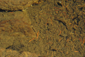
Fairy shrimp and copepods in Lost in the Trees Pond. There are 2 female fairy shrimp that are made more visible by the whitish eggs in their long, thin ovisacs: one at lower right and one a little to the right of center. The much smaller, dark brown copepods with non-branched antennae extending laterally from their heads are harder to see. One is over the edge of the rock to the left of the fairy shrimp at center and another is near the top of the photograph about 1/4 of the way from the left edge and also over a rock. You have to zoom in on the image to see them.
September 1, 2010
I wanted to take more photographs but it looks like I’m too late.
- Dry.
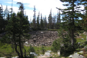
Lost in the Trees Pond is dry a week after my last visit. It looks like the pond would never be 100 cm (39″) or more deep.
“North Gap Lake” East Pond (Brush Creek – Hayden Ranger District, Medicine Bow-Routt National Forest)
“Arrowhead Lake” Southwest Pond map
“North Gap Lake” East Pond is 2.5 km (1.6 miles) northeast of Medicine Bow Peak on the eastern shore of “North Gap Lake” about halfway between the southeastern and northwestern ends of the lake. The pond could be quite long while the snowbank in the draw is melting (see photograph “Shelf Lakes” Northwest Ponds 1996-06, #0603) but it is probably less than 50 m (165′) across for most of the summer.
“North Gap Lake” East Pond is not on the 7.5-minute topographic quadrangle but a dry pond is visible on the USGS imagery for The National Map. The location adjacent to the “North Gap Lake” Trail limits location errors to less than 30 m (100′).
“North Gap Lake” East Pond is on the “North Gap Lake” Trail about halfway up the east side of “North Gap Lake”.
Elevation: 3,330 m (10,925′)
August 25, 2010
Just another puddle along a trail.
- Fairy shrimp.
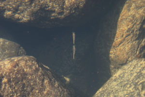
2 fairy shrimp swimming between the boulders in “North Gap Lake” East Pond. My guess now, 12 years later, is that these fairy shrimp are males. They lack ovisacs and the behavior of following close behind another fairy shrimp to assess the chances of copulation is a common male behavior, from what I have seen. The fairy shrimp are large enough to be mature but lack conspicuous antennae II like Branchinecta coloradensis. I suspect they are Branchinecta paludosa.
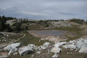
A rapidly drying “North Gap Lake” East Pond a week later. I went back to take photographs of this pond as I did for other ponds but I didn’t write down whether the fairy shrimp were still there. Consequently, I haven’t added an entry for September 1.
“Reservoir Lake” West Pond (Brush Creek – Hayden Ranger District, Medicine Bow-Routt National Forest)
“Arrowhead Lake” Southwest Pond map
“Reservoir Lake” West Pond is 2.8 km (1.7 miles) north of Medicine Bow Peak and 300 m (980′) west of “Reservoir Lake”. On the 7.5-minute topographic quadrangle, the pond is 170 m long and 50 m wide (560′ x 165′).
“Reservoir Lake” West Pond is on the south side of the “Quealy Lake” Trail. One route is to follow the “North Gap” Lake Trail from the “Lewis Lake” trailhead north to the trail junction a little south of “Cutthroat Lake”. Turn west there and follow the “Quealy Lake” Trail past “Reservoir Lake” to “Reservoir Lake” West Pond. That distance is about 5.5 km (3.5 miles). A shorter route, but one that requires driving on a poor road, is from the trailhead by “Quealy Lake” at the west end of the “Quealy Lake” trail. That trailhead can be reached by continuing past the “Heart Lake” trailhead at “Dipper Lake” for another mile or so (see “Upper Long Lake”). “Reservoir Lake” West Pond is less than 3 km (1.9 miles) from the “Quealy Lake” trailhead.
Elevation: 3,274 m (10,742′)
August 25, 2010
Maps, which didn’t have at the time, show several isolated ponds north of the trail near here but this is the only pond I recorded looking at.
- Fairy shrimp.
My notes indicate that these fairy shrimp have the long, blade-like distal segments of the male antennae II like Branchinecta coloradensis rather than the short, pointed ones like Branchinecta paludosa (BTANSD). But maybe they are a different species altogether.
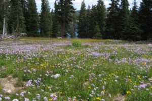
“Reservoir Lake” through the trees beyond a field of flowers. This is close to “Reservoir Lake” West Pond.
“Sheep Lake” South Pond (Brush Creek – Hayden Ranger District, Medicine Bow-Routt National Forest)
___This map is a screenshot of The National Map (Go to The National Map). The U.S. Geological Survey generally does not copyright or charge for its data or reports (unless printed). A pond location is indicated by an “X”, which corresponds to the coordinates given in the data spreadsheet. Labels in quotations are from 7.5-minute topographic quadrangles.
___Red lines are the U. S. National Grid with a spacing of 1,000 m and intersection labels consisting of the UTM zone (e.g., 11S, 12T), a 2-letter 100-km square designation (e.g., LC, XN), and a 4-digit number. The first 2 digits of the number represent the 1,000-meter Easting and the second 2 digits the 1,000-meter Northing, as seen in the example Easting and Northing. Unlike latitude and longitude, the National Grid is rectilinear on a flat map, the units of abscissa and ordinate have equal lengths, and the units (meters) are measurable on the ground with a tape or by pacing.
___There is no private or state land on this map. All the lands are public.
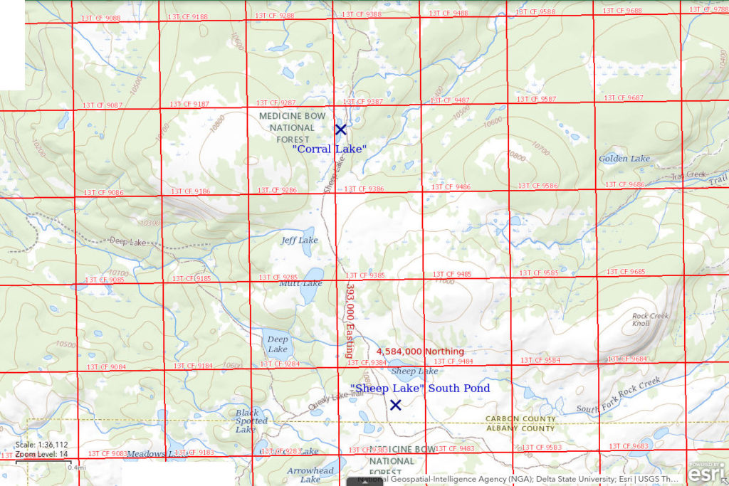
“Sheep Lake” South Pond is 5.5 km (3.4 miles) northeast of Medicine Bow Peak. It is about 350 m (1,150′) south of “Sheep Lake”. It is in an extensive area of gentle terrain north of Browns Peak. I didn’t record a size but, depending on time of year, the pond is likely more than 50 m (165′) across but less than 100 m (330′) across.
The pond is not shown on the 7.5-minute topographic quadrangle but it is clearly visible, and mostly dry, on USGS imagery of The National Map.
“Sheep Lake” South Pond can be accessed from the “Sand Lake” trailhead to the north, which is itself accessible via National Forest Roads from Arlington or Elk Mountain. It can also be reached from the “Lewis Lake” trailhead by following the “North Gap Lake” Trail or from the “Brooklyn Lake” trailhead using the “Sheep Lake” Trail around the east end of Browns Peak. The “North Gap Lake” Trail route is a little longer. The circuit from “Brooklyn Lake” to the “North Gap Lake” Trail at “Lewis Lake” to “Sheep Lake” and back to “Brooklyn Lake” on the “Sheep Lake” Trail is a good, not-too-strenuous day hike, weather permitting. I don’t have a good estimate of the distance but most hikers accustomed to the elevation would complete the circuit in less than 8 hours, unless they spent several hours looking for fairy shrimp. Fast walkers could complete it in 5 hours.
Elevation: 3,293 m (10,803′)
August 25, 2010
Mountain gentian is blooming in the grass south of “Sheep Lake”. Look for flowers, find ponds; look for ponds, find flowers.
- Fairy shrimp.
The fairy shrimp in this pond are very small compared to the others I have seen today. The elevation and shallow depth of the pond do not suggest it is any colder than the other ponds, which might delay hatching, so maybe this is a different species.
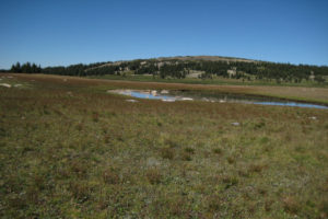
View to northeast across “Sheep Lake” South Pond. “Sheep Lake” is at the base of the hill in the distance but the water is not quite visible from this angle.
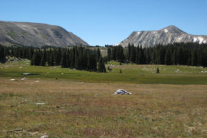
Looking southwest at The Gap between Browns Peak (left) and Medicine Bow Peak (right). The Gap is also the divide between “North Gap Lake” and the Medicine Bow River on this side and “South Gap Lake” and the Little Laramie River on the far side. The rolling hills with meadows and ponds, like the one at left, have lots of potential fairy shrimp habitat.
I took photograph The Gap 2010-08-25, #082 (above), about 2 1/2 hours before photograph “Sheep Lake” South Pond 2010-08-25, #086, even though I was probably less than 1.5 km (1 mile) away. Most of that time was spent looking at ponds. Unfortunately, I didn’t note the ponds that didn’t have fairy shrimp on this hike, I only noted those that did. Consequently, the percentage of ponds with fairy shrimp calculated from my data would be greater than the actual percentage of ponds with fairy shrimp in the Snowy Range (and likely elsewhere in Wyoming). When I came back on September 1 to better document the fairy shrimp occurrences with photographs, I did note the ponds where I did not find fairy shrimp. Whereas 5 of 5 ponds noted on August 25, 2010 had fairy shrimp, 4 of 13 ponds noted on September 1 , 2010 had fairy shrimp, or 6 of 15 ponds counting 2 that I went back to after finding fairy shrimp on August 25. Consequently, my observations in the Snowy Range can’t really be used to infer the proportion of ponds in the Snowy Range that have fairy shrimp.
“Glacier Lakes” North Pond (Laramie Ranger District, Medicine Bow-Routt National Forest)
“Glacier Lakes” North Pond is about 5.4 km (3.3 miles) northeast of Medicine Bow Peak. It is north of both “Glacier Lakes” and close to the cliff of Browns Peak.
“Glacier Lakes” North Pond is not on the 7.5-minute topographic quadrangle. The USGS imagery of The National Map is only suggestive of a pond in this area. Consequently, the location on Jons Snowy Range Pond map and the coordinates in the data spreadsheet (Data page) could be off by 50 m (165′) or so.
The “Glacier Lakes” are only about 0.8 km (0.5 miles) west of the “Brooklyn Lake” trailhead. Head north from the trail where it passes between the lakes. “Glacier Lakes” North Pond is toward the base of the cliffs of Browns Peak.
Elevation: 3,286 m (10,781′)
September 1, 2010
At this point, I had seen fairy shrimp in several ponds in the Snowy Range in 1989, 2007, and earlier in 2010 but was losing track of where they were. The purpose of this hike was to photograph and plot on a map fairy shrimp occurrences I had seen previously but I did look at a few additional ponds like this one.
- No fairy shrimp.
“Brooklyn Lake” West Meadow Pond (Laramie Ranger District, Medicine Bow-Routt National Forest)
“Brooklyn Lake” West Meadow Pond is 5 km (3 miles) northeast of Medicine Bow Peak. The pond is 50 m (165′) long on the 7.5-minute quadrangle. It is in a large meadow on the slope 500 m (1,640′) west of “Brooklyn Lake”. The 7.5-minute topographic quadrangle does not show an outlet from this pond to “Brooklyn Lake” but the water likely does drain to the lake through the rocks. The quadrangle shows “Brooklyn Lake” West Meadow Pond on the outlet of the western of the “Glacier Lakes”, which has fish, but I didn’t realize that at the time.
“Brooklyn Lake” West Meadow Pond is 175 m (570′) southeast of the “Lost Lake” Trail about half way between “Glacier Lakes” and “Telephone Lakes”. Turn off the trail near where it crosses the creek about 1.3 km (0.8 miles) west of the “Brooklyn Lake” trailhead.
Elevation: 3,266 m (10,715′)
September 1, 2010
The boggy meadow makes it a bit difficult to get to the pond.
- No fairy shrimp.
Edge of Trees Pond (Laramie Ranger District, Medicine Bow-Routt National Forest)
Edge of Trees Pond is 4.7 km northeast of Medicine Bow Peak and about 325 m (1,070′) northeast of the eastern of the “Telephone Lakes”. It is shown on the 7.5-minute topographic quadrangle as a narrow pond about 100 m (330′) long. It has no inlet and no outlet on the map.
Edge of Trees Pond is on the “Lost Lake” Trail about 1.6 km (1 mile) west of the “Brooklyn Lake” trailhead. It is on the north side of the trail at the edge of the trees about 250 m (820′) past the creek from the western of the “Glacier Lakes”.
Elevation: 3,290 m (10,793′)
September 1, 2010
Since I have a map this time, I might as well record another pond.
- No fairy shrimp.
“Telephone Lakes” East Pond (Laramie Ranger District, Medicine Bow-Routt National Forest)
“Telephone Lakes” East Pond is 4.7 km northeast of Medicine Bow Peak and 250 m (820′) south of Edge of Trees Pond. It is 200 m (660′) east of the eastern of the “Telephone Lakes” and also 200 m (660′) southeast of Lost in the Trees Pond. On the 7.5-minute topographic quadrangle, the pond is 120 m long and up to 70 m wide (390′ x 230′). No stream connects “Telephone Lakes” East Pond to “Telephone Lakes”. Instead, Telephone Creek flows south from the southeast corner of the eastern of the “Telephone Lakes” to “Towner Lake” rather than east to the closer “Brooklyn Lake”.
“Telephone Lakes” East Pond is a ways off the “Lost Lake” Trail a little over a mile west of the “Brooklyn Lake” trailhead. The most reliable approach may be to turn south off the trail to the eastern of the “Telephone Lakes”, which should be visible through the trees, and then to head east from the north end of that lake.
Elevation: 3,280 m (10,761′)
September 1, 2010
The nearby Lost in the Trees pond has fairy shrimp (or did a week ago before it dried up) but Edge of Trees Pond doesn’t. It’s time to look at another one.
- Fairy shrimp.
- Copepods in photograph.
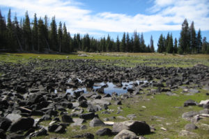
A very wide angle view of a nearly dry “Telephone Lakes” east pond. The grass around the edges suggests this pond hasn’t been full in years. Nonetheless, the fairy shrimp keep hatching.
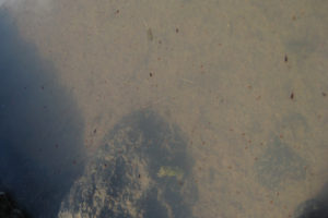
Fairy shrimp in the murky water of “Telephone Lakes” East Pond. White eggs in thin ovisacs and pale food in thin abdomens make the fairy shrimp a little easier to spot. There is one with a greenish body near the top, above center, and 2 near the top end of the boulder at center. There are also much smaller dark brown copepods of apparently 2 sizes which stand out against the pale pond bottom.
“Lost Lake” East Pond (Laramie Ranger District, Medicine Bow-Routt National Forest)
“Lost Lake” East Pond is 4.6 km (2.9 miles) northeast of Medicine Bow Peak and 200 m (660′) east of “Lost Lake”. It has an elongate shape with dimensions of 130 m x 60 m (430′ x 200′) on the 7.5-minute topographic quadrangle. It is not connected to “Lost Lake”, which has fish, and has no inlet or outlet on the 7.5-minute quadrangle.
The “Lost Lake” Trail, with trailheads at “Brooklyn Lake” and “Lewis Lake”, goes to the south end of “Lost Lake”. “Lost Lake” East Pond is a short hike to the northeast from there.
Elevation: 3,342 m (10,966′)
September 1, 2010
No question this pond is safe from fish unless somebody stocks it. The depth appears to be between 100 and 200 cm and that might tempt somebody to drop in a few fish.
- Fairy shrimp.
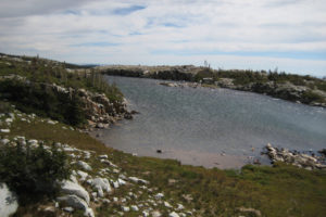
“Lost Lake” East Pond, looking east. I saw only one fairy shrimp in this pond but the wind is strong enough now to seriously impair visibility. Notice the rippled water surface.
“Lost Lake” West Pond (Laramie Ranger District, Medicine Bow-Routt National Forest)
“Lost Lake” West Pond is 3.8 km (2.4 miles) northeast of Medicine Bow Peak. It is maybe 20 m (65′) above and about 200 m (660′) west of “Lost Lake”. On the 7.5-minute topographic quadrangle, the pond is 120 m x 70 m (390′ x 230′). “Lost Lake” West Pond likely drains through the rocks to “Lost Lake” but there is no stream which fish could climb to reach it. The map in the 2019 “Fishing in the Medicine Bow – Routt National Forest, Snowy Range Area” guide by USFS and WGF shows a “Scott Lake” where “Lost Lake” West Pond is. The guide indicates “Scott Lake” does not have fish and has a maximum depth of 21 feet (6.4 m).
The “Lost Lake” Trail, with trailheads at “Brooklyn Lake” and “Lewis Lake”, goes to the south end of “Lost Lake”. “Lost Lake” West Pond is a short hike up the hill to the northwest from there.
Elevation: 3,361 m (11,028′)
September 1, 2010
Great views from up here as this is the second highest pond I’ve looked at.
- No fairy shrimp.
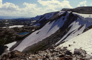
Looking southwest along the cliffs of Browns Peak and, in the distance, Medicine Bow Peak. “Lost Lake” West Pond is to the left of center and “Lost Lake” is at the lower left edge. This photograph was taken in June of an earlier year.
Browns Peak Southeast Pond (Laramie Ranger District, Medicine Bow-Routt National Forest)
There are 3 ponds south of the west end of Browns Peak and I have distinguished them with the names Southeast, South, and Southwest. Browns Peak Southeast Pond is 3.3 km (2 miles) east of Medicine Bow Peak. The outlet of the pond drains into “Telephone Lakes”, which have fish, but the stream is steep and unlikely to allow access by fish. Browns Peak Southeast Pond measures 150 m x 100 m (490′ x 330′) on the 7.5-minute topographic quadrangle.
Browns Peak Southeast Pond can be reached by following the outlet stream 250 m (820′) up the hill from the “Lost Lake” Trail at the west end of “Telephone Lakes”. Coming from the “Lewis Lake” trailhead, it would be easier to cut north off the trail before descending to the western of the “Telephone Lakes”.
The “Lost Lake” trail is misplaced on The National Map on the map of Jons Snowy Range Pond. The trail actually touches the west end of the western “Telephone Lake”. From there it climbs northeast to “Lost Lake” and climbs west to String of 3 Ponds, as shown on the 7.5-minute topographic quadrangle.
Elevation: 3,290 m (10,793′)
September 1, 2010
The 3 relatively large ponds high on the slope of Browns Peak seem like a good opportunity for fairy shrimp, and for a more interesting off-trail route from “Telephone Lakes” to The Gap.
- No fairy shrimp.
Browns Peak South Pond (Laramie Ranger District, Medicine Bow-Routt National Forest)
There are 3 ponds south of the west end of Browns Peak and I have distinguished them with the names Southeast, South, and Southwest. Browns Peak South Pond is 2.7 km (1.7 miles) east of Medicine Bow Peak. It has no inlet or outlet. It has dimensions of about 110 m x 70 m (360′ x 230′) on the 7.5-minute topographic quadrangle.
Browns Peak South Pond is about 350 m (1,150′) north of, and up hill from, the “Lost Lake” Trail about 1.0 km (0.6 miles) east of the “Lewis Lake” trailhead.
Elevation: 3,328 m (10,920′)
September 1, 2010
This one is on the way from Browns Peak Southeast Pond to Browns Peak Southwest Pond. The data for these ponds will complement those for the String of 3 Ponds down the hill from here.
- No fairy shrimp.
Browns Peak Southwest Pond (Laramie Ranger District, Medicine Bow-Routt National Forest)
There are 3 ponds south of the west end of Browns Peak and I have distinguished them with the names Southeast, South, and Southwest. Browns Peak Southwest Pond is 2.2 km (1.4 miles) east of Medicine Bow Peak. It lacks an inlet and an outlet. On the 7.5-minute topographic quadrangle, it is 200 m long and up to 60 m wide (660′ x 200′).
The southwest tip of Browns Peak Southwest Pond is less than 75 m (250′) east of the “North Gap Lake” Trail about 700 m (2,300′) north of the “Lewis Lake” trailhead.
Elevation: 3,335 m (10,941′)
September 1, 2010
This pond is a little worrisome. It looks big enough and deep enough to support fish and is so close to the trail, someone could be tempted to stock it.
- Fairy shrimp.
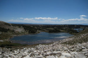
Browns Peak Southwest Pond, looking south. The water is sparkling with wind-driven ripples. As at “Lost Lake” East Pond, the wind makes spotting fairy shrimp harder but at least I saw a few. The lake in the distance at right is “Lewis Lake”.
“Shelf Lakes” Northwest Ponds (Brush Creek – Hayden Ranger District, Medicine Bow-Routt National Forest)
“Arrowhead Lake” Southwest Pond map
“Shelf Lakes” Northwest Ponds are a cluster of ponds in a boggy area about 3.9 km (2.4 miles) northeast of Medicine Bow Peak. The ponds are 350-400 m (1,150-1,310′) northwest of “Shelf Lakes”. I didn’t record pond sizes but they are likely no more than 50 m (165′) across. I marked 2 on the map I was carrying but there may be more.
“Shelf Lakes” Northwest Ponds are not shown on the 7.5-minute topographic quadrangle. However, the boggy area around them is evident on USGS imagery of The National Map and closely constrains the pond locations.
Follow the “North Gap Lake” Trail from the “Lewis Lake” trailhead to about half way up the east shore of “North Gap Lake” and then head north for about 250 m (820′). Coincidentally, following the draw north from “North Gap Lake” East Pond would also be a good route.
Elevation: 3,335 m (10,941′)
September 1, 2010
Might as well cut across country to see how many ponds I stumble across.
- No fairy shrimp.
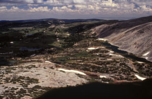
View to northeast across “North Gap Lake” (bottom), with “Shelf Lakes” (upper and lower) at base of Browns Peak at right. The 2 water bodies in the green area a little below and to the left of center are the “Shelf Lakes” Northwest Ponds. For scale, the “Shelf Lakes” are about 70 m (230′) wide. The many small ponds in the green area just below center are the “Shelf Lakes” North Ponds. “North Gap Lake” East Pond is adjacent to “North Gap Lake” at the right end of the long snow bank below center. “Shelf Lakes” Northeast Pond is in shadow at the left end of the snow bank above the end of the “Shelf Lakes”. “Crescent Lake” is in the shadow to left of center. Above it, in the sun, is “Arrowhead Lake”. The sunny grass in the sun above “Arrowhead Lake” is next to “Sheep Lake”, which is in shadow. This photograph was taken several years before I got serious about looking for fairy shrimp in the Snowy Range. What a coincidence that it shows so many of the ponds.
“Shelf Lakes” North Ponds (Brush Creek – Hayden Ranger District, Medicine Bow-Routt National Forest)
“Arrowhead Lake” Southwest Pond map
“Shelf Lakes” North Ponds are a cluster of ponds in a boggy area about 3.9 km (2.4 miles) northeast of Medicine Bow Peak and 150-200 m (490-660′) southeast of “Shelf Lakes” Northwest Ponds. “Shelf Lakes” North Ponds are about 250 m (820′) north of the lower of the “Shelf Lakes”. As shown in photograph “Shelf Lakes” Northwest Ponds 1996-06, #0603 (refer to caption above for description of locations), there are several ponds and all are less than 30 m (100′) across.
“Shelf Lakes” North Ponds are not shown on the 7.5-minute topographic quadrangle and their locations within the boggy area on USGS imagery of The National Map are uncertain. The location shown on the “Arrowhead Lake” Southwest Pond map and the coordinates in the data spreadsheet (Data page) may not be exactly on one of the ponds but they are close.
Follow the “North Gap Lake” Trail from the “Lewis Lake” trailhead to “North Gap Lake”. From there, you could continue up the shore of the lake to “North Gap Lake” East Pond and then turn off to the east. Or, you could follow the trail along the shore of “Shelf Lakes” for about 350 m (1,150′) to the northeast from “North Gap Lake” and then turn north.
Elevation: 3,334 m (10,938′)
September 1, 2010
Picking a way through the bogs around “Shelf Lakes” Northwest Ponds and “Shelf Lakes” North Ponds is tricky and thick willows make the going difficult in spots but where there are bogs, there may be ponds.
- Fairy shrimp. I’m pretty sure the fairy shrimp were in at least 2 ponds but I don’t remember how many ponds I looked at.
- Copepods in photograph.
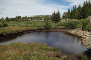
One of the “Shelf Lakes” North Ponds. It has clear, brown water and fairy shrimp.
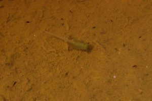
Fairy shrimp and copepods in one of the “Shelf Lakes” North Ponds. The blade-like distal segments of the male’s antennae II, which are long enough to meet above the body 3/4 of the way down the thorax, are like those of Branchinecta coloradensis (BTANSD). Compare this photograph to Bivouac Lake 1986-09-03, #0806c2. There are also numerous dark copepods. Contrast has been enhanced for clarity.
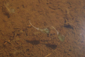
2 male fairy shrimp cavorting in one of the “Shelf Lakes” North Ponds. The bladed nature of the distal segments of the antennae II of the male at left is clearly evident.
“Shelf Lakes” Northeast Pond (Brush Creek – Hayden Ranger District, Medicine Bow-Routt National Forest)
“Arrowhead Lake” Southwest Pond map
“Shelf Lakes” Northeast Pond is about 3.4 km (2.1 miles) northeast of Medicine Bow Peak and about 230 m (750′) northeast of the northeast end of the “Shelf Lakes”. The pond is probably less than 50 m (165′) across. There is no stream connecting “Shelf Lakes” Northeast Pond to the fish in “Shelf Lakes”, or to any other body of water.
“Shelf Lakes” Northeast Pond is not on the 7.5-minute topographic quadrangle but the pond and the snow bank next to it are on USGS imagery of The National Map.
Follow the “North Gap Lake” Trail from the “Lewis Lake” trailhead to “North Gap Lake” and then follow the “Shelf Lakes” Trail past the northeast end of the “Shelf Lakes” to the pond. The identifying snow bank (see photograph “Shelf Lakes” Northwest Ponds 1996-06, #0603 and refer to caption above for description of locations) persists through most of the summer.
Elevation: 3,335 m (10,941′)
September 1, 2010
Being at the base of the north slope of Browns Peak and in contact with a persistent snowbank probably keeps the water here relatively cool, if not frigid.
- No fairy shrimp.
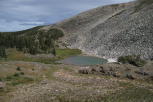
Looking east at “Shelf Lakes” Northeast Pond. A small remnant of the snow bank is still here on September 1. The “Shelf Lakes” Trail can be seen to the left of the pond.
“Corral Lake” (Brush Creek – Hayden Ranger District, Medicine Bow-Routt National Forest)
“Corral Lake” is 7.8 km (4.8 miles) northeast of Medicine Bow Peak. It is in somewhat more forested terrain than the area immediately north of Browns Peak. “Corral Lake” is named on the 7.5-minute topographic quadrangle, where it is a little over 250 m long and no more than 70 m wide (820′ x 230′). The Snowy Range fishing guide by USFS and WGF indicates “Corral Lake” is only 2 feet (120 cm) deep but nonetheless has brook trout. I didn’t know that when I visited the lake.
“Corral Lake” can be reached from the “Lewis Lake” trailhead by following the “North Gap Lake” Trail to the trail junction southwest of “Sheep Lake” and then following the “Sheep Lake” Trail north for about 3.4 km (2.1 miles). “Corral Lake” can also be reached from the trailhead at “Sand Lake” about the same distance to the north.
Elevation: 3,232 m (10,604′)
September 1, 2010
I headed north from “Sheep Lake” on the “Sheep Lake” Trail hoping to find more ponds. I passed “Jeff Lake” and “Mutt Lake”, which definitely looked big enough for fish, but this one looked like it might be too small.
- No fairy shrimp.
What Can We Learn from the Ponds in the Snowy Range?
Cosmogenic beryllium-10 exposure ages indicate that most ponds in the Snowy Range emerged from below glacial ice by about 14,300 years ago. The highest ponds, such as Klondike Lake West Pond and Sugarloaf West Ponds, may not have been exposed until about 10,500 years ago. The processes responsible for fairy shrimp colonization have thus had a considerable period of time over which to operate. However, the colonization rate cannot now be determined because most lakes and ponds have been stocked with fish, which would have killed off any population of fairy shrimp to which they were introduced.
Ponds in the Snowy Range are located on the glaciated, low relief terrain surrounding the main ridges of Medicine Bow Peak and Browns Peak rather than on the ridges themselves. The ponds visited have a narrow elevation range of 3,230-3,370 m (10,600-11,060′). They range in size from 170 m x 90 m (560′ x 300′) for Libby Flats Overlook Pond to less than about 30 m (100′) across for the “Shelf Lakes” North Ponds. Ponds were visited from early July to early September.
Of the 35 ponds visited in the Snowy Range, 13 (37%) had fairy shrimp. The actual percentage of fairy shrimp-hosting ponds is probably less. I saw but did not record additional ponds without fairy shrimp.
The 1 sample of fairy shrimp I collected was identified as Branchinecta paludosa by Denton Belk. B. paludosa, Branchinecta coloradensis, and Chirocephalus bundyi (now Eubranchipus bundyi, Rogers, 2013) were previously identified in the Snowy Range. In the 6 other ponds where I had a reasonably good look at the antennae II of males without a microscope, I guessed that those in 3 ponds were B. paludosa (String of 3 East Pond, Lost in the Trees Pond, “North Gap Lake” East Pond) and that those in 3 ponds were B. coloradensis (Libby Flats Overlook Pond, “Reservoir Lake” West Pond, “Shelf Lakes” North Pond). This assumes that all the fairy shrimp I saw in the Snowy Range were either B. paludosa or B. coloradensis. E. bundyi has antennal appendages, which give it a different appearance than B. coloradensis and B. paludosa. In contrast, B. coloradensis is much more common in the Wind River Mountains. I visually determined that B. paludosa was present in only 1 of 13 ponds with fairy shrimp there.
Although I was lax in looking for other aquatic animals, I most commonly noted unspecified beetles. I saw backswimmers and copepods slightly less frequently.
The clear water of the Snowy Range ponds makes photographing fairy shrimp easy; the frequent wind makes it difficult.
I never used waders in Snowy Range ponds because I didn’t want to carry them while hiking. They would certainly be helpful for a thorough search as the water is cold and pond bottoms are generally rocky. Going barefoot is not a realistic option. I never saw abundant fairy shrimp. If fairy shrimp in the Snowy Range have a strong preference for water more than 2 m (6.5′) from shore, then I probably missed a few populations.
Anostracan species identified by Denton Belk are:
Branchinecta paludosa – Jons Snowy Range Pond.