Killpecker Dunes Ponds
What Can We Learn from the Ponds in the Killpecker Dunes?
The Killpecker Dunes are at the southeastern margin of the Green River Basin 41 km (25 miles) north of the US 191 exit off I-80 at Rock Springs. On the 1:100,000-scale BLM map, they are almost 25 km (15.5 miles) across from southeast to northwest. At the eastern end southwest of Steamboat Rim’s Johnson Gap, they are 2-3 km (1.2-1.9 miles) wide. The more central part of the dunes south of Indian Gap is about 6.5 km (4 miles) wide. The western lobe of the field between Buffalo Hump and Essex Mountain is 10 km (6 miles) north-south and 4-6 km (2.5-3.7 miles) east-west. These areas include vegetated dunes that are essentially immobile from year to year as well as mobile dunes.
Sand dunes may seem like an odd place to look for ponds but inter-dune ponds are common in Killpecker Dunes due to abundant winter snow. Because wind directions typically shift before, during, and after snowstorms, snowdrifts are routinely buried by sand and melt rather gradually during the spring. Snowmelt percolates through the sand and collects in ponds in the inter-dune areas.
Elevations in the Killpecker Dunes are generally between 2,050 m and 2,200 m (6,730-7,220′). The sand has been blown a little higher up the hills in some places.
Mean Annual Precipitation according to the Wyoming Climate Atlas by the Water Resources Data System and State Climate Office at http://www.wrds.uwyo.edu/sco/climateatlas/precipitation.html, Parameter-Elevation Regressions on Independent Slopes Model, PRISM, with 1971-2000 data at very widely spaced weather stations (I have eyeballed the values from a very small scale map with 11 precipitation bins marked with indistinct colors and further obscured by a shaded relief base map):
11″-15″ (28-38 cm)
Sagebrush is the dominant vegetation in the region but grasses are more common on the shifting sands.
Killpecker Dunes are just north of the public-private land checkerboard along the transcontinental railroad. Almost all the land is public but there are a few parcels of private land and a couple of state sections within the dune field.
The BLM refers to the eastern 2/3 of the sand dune field as an “open-play-area”. “Open play” in this context means off-road vehicle use. There is a wilderness study area in the western 1/3 of the dunes but I haven’t found any useful maps of either. Most of the ponds visible on USGS imagery appear to be in the “open-play-area”.
Killpecker Dunes Ponds (Rock Springs BLM Office)
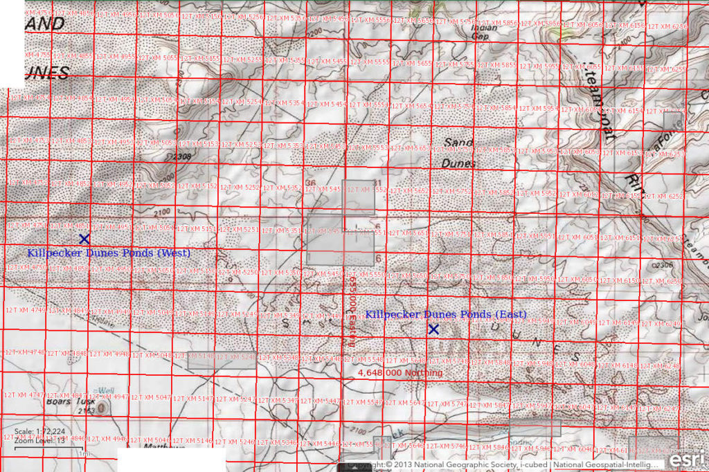
___This map is a screenshot of The National Map (Go to The National Map). The U.S. Geological Survey generally does not copyright or charge for its data or reports (unless printed). A pond location is indicated by an “X”, which corresponds to the coordinates given in the data spreadsheet. Labels in quotations are from 7.5-minute topographic quadrangles.
___Red lines are the U. S. National Grid with a spacing of 1,000 m and intersection labels consisting of the UTM zone (e.g., 11S, 12T), a 2-letter 100-km square designation (e.g., LC, XN), and a 4-digit number. The first 2 digits of the number represent the 1,000-meter Easting and the second 2 digits the 1,000-meter Northing, as seen in the example Easting and Northing. Unlike latitude and longitude, the National Grid is rectilinear on a flat map, the units of abscissa and ordinate have equal lengths, and the units (meters) are measurable on the ground with a tape or by pacing.
___Gray shading represents private land as traced from the PAD-US 2.0 – Federal Fee Managers layer of The National Map. Other lands are public or owned by the state of Wyoming.

Killpecker Dunes Ponds are scattered through parts of the Killpecker Dunes field generally 41 km (25 miles) north of Rock Springs. The dunes are north of Boar’s Tusk and west and southwest of Steamboat Mountain. I didn’t determine any pond locations because no distinctive topographic features or other landmarks are shown on the 1:100,000-scale BLM maps of the dunes and my visits were before GPS. The map above shows western and eastern locations of ponds based on USGS imagery of The National Map in order to demonstrate that the ponds are widely distributed. As shown on 7.5-minute topographic quadrangles, the ponds range in size from 20 m to more than 700 m (66′-2,300′) across. Comparing USGS imagery to pond locations on 7.5-minute quadrangles shows that pond shapes change over the years. Some have disappeared and some have appeared since aerial photographs for the maps were taken in 1979.
The best route to Killpecker Dunes is to turn east off US 191 about 9.5 miles north of Rock Springs. After 2 miles, turn north and drive toward the Boar’s Tusk. At the Y-junction south of Fifteenmile Knoll and reservoir (6 km, 3.7 miles south, of the Boar’s Tusk), turn northeast and follow the maintained road to the southeastern part of the dune field. There are pipeline roads and gas field roads that lead to various parts of the dunes from there but they may not be passable and may change from time to time. There are more difficult routes from the north, such as from the road up Jack Morrow Creek or along the abandoned railroad grade from the Atlantic City iron mine. I have driven from the Jack Morrow Creek road as far as Indian Gap. That was close enough and the road farther south was quite sandy. I tried the railroad grade route and don’t recommend it. There is a road shown with a fatter line on the 1:100,000-scale BLM map from US 191 to Chicken Springs, southwest of the dunes, but I haven’t used it.
Elevation (East): 2,141 m (7,025′)
Elevation (West): 2,062 m (6,765′)
June 18-19, 1987
The points below summarize my observations of all the ponds I visited. There are 2 oil rigs drilling in the sand dunes today.
- Sizes and depths not estimated for various ponds.
- Water clear with or without brown tint.
- No fairy shrimp.
- Caddisfly larvae (Trichoptera) are most common, backswimmers (sub-order Heteroptera, family Notonectidae), blue dragonflies and their larvae, snails, sparse small zooplankton, salamanders, saw 1 possible tadpole, common killdeer, phalaropes, blackbirds, ducks, willets, rare avocets, muskrats.

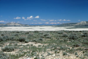
Looking north across Killpecker Dunes through Indian Gap to the Wind River Mountains. Essex Mountain is at left and Steamboat Mountain Rim at right.

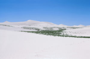
Looking for ponds in Killpecker Dunes. The dunes are greening up from melting snow that got trapped under the sand as the wind changed direction after snowstorms.

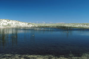
A typical pond in the Killpecker Dunes. The Wind River Mountains can be seen on the horizon.
June 25, 1987
I succeeded in reaching the northwestern part of the dune field by following the old Atlantic City Mine railroad grade but it was difficult. Found some ponds even before I got to the sand. The gnats are terrible but the evening primroses are blooming, in the morning as usual.
- Sizes and depths not estimated for various ponds.
- Water clarity not noted.
- No fairy shrimp.
- Other animals not noted.
What Can We Learn from the Ponds in the Killpecker Dunes?
There are ponds among the sand dunes of the Killpecker dune field but I didn’t find any with fairy shrimp.
Invertebrates such as caddisfly larvae, backswimmers, small unidentified zooplankton, and snails inhabit some ponds so water chemistry is an unlikely cause for the apparent absence of fairy shrimp.
Dispersal agents such as avocets, ducks, phalaropes, and willets are present at some ponds.
Salamanders and probably frogs visit the ponds in Killpecker Dunes but they have not eliminated fairy shrimp populations in the Antelope Hills.
Aerial imagery shows that pond shapes change over a period of a few decades. Some ponds disappear under the moving sand. Are these changes too fast for the establishment of fairy shrimp populations?