The base map is provided by OpenTopoMap’s volunteer servers.
Big Bend Lost Creek Pond #1
Big Bend Lost Creek Pond #2
Big Bend Lost Creek Pond #3
“Hay Reservoir”
“Lost Creek Lake”
“Lost Creek Lake” Northeast Pond
“Mud Lake”
Mud Springs Pond #1
Mud Springs Pond #2
Mud Springs Pond #3
Niland Spring Pond
“Stratton Lakes”
Lamont South Pond
Pipeline By The Road Pond
Siberia Ridge Southeast Pond
Horseshoe Bend Roadside Pond
Horseshoe Bend Well Pond
Lamont Northeast Pond
Fence Bend Pond
Screeching Avocets Pond
Yellow Pond
Long Pond
Osborne Spring Ponds
“Brannan Reservoir”
Sweetwater Mill Road Pond
Separation Rim Dry Lake
Separation Rim Strike Valley Ponds
Big Salty Pond
“Separation Point Lake”
Section Marker Depression Pond
Separation Rim “Soda Lake”
Separation Rim “Soda Lake” Road Pond
Separation Flat Long Dry Lake
“Chain Lakes” Roadside Pond
“Chain Lakes” Forked Pond
“Chain Lakes” Biggest Pond
“Chain Lakes” Crusty Pond
What Can We Learn from the Ponds in the Great Divide Basin?
The Great Divide Basin occupies much of south-central Wyoming. It is defined as an area with internal drainage where no surface water flows to either the Gulf of Mexico, via the North Platte and Mississippi rivers, or to the Gulf of California, via the Green and Colorado rivers. South of the Wind River Mountains at Oregon Buttes, the continental divide splits into western and eastern branches. The western branch follows hills and ridges separating the Great Divide Basin from the Green River Basin and the Washakie Basin. 1:100,000-scale BLM maps generally do not show the eastern branch. The eastern branch follows the irregular edge of the North Platte hydrographic basin, heading east from Oregon Buttes through Continental Peak and Cyclone Rim, jumping north to Crooks Mountain then back to the south of Green Mountain, hitting the southern edge of the Ferris Mountains before turning sharply south to miss the Seminoe Mountains altogether, following the Haystack Mountains, and then making a big loop to the north of Rawlins before turning southwest to meet the western branch at Atlantic Rim. From Steamboat Mountain to the Haystack Mountains, the Great Divide Basin is 177 km (110 miles) across. From Cyclone Rim in the north to Delaney Rim in the south, it is 89 km (55 miles) wide.
Some elevations around the periphery of the Great Divide Basin are: Oregon Buttes 2,624 m (8,610′), Steamboat Mountain 2,647 m (8,680′), Tenmile Rim 2,230 m (7,320′), Delaney Rim 2,280 m (7,480′), Separation Peak on Atlantic Rim 2,586 m (8,480′), Haystack Mountains 2,385 m (7,820′), Whiskey Ridge 2,700 m (8,860′), Crooks Mountain 2,533 m (8,310′), Cyclone Rim 2,240 m (7,350′), and Continental Peak 2,570 m (8,430′). The Red Desert Basin gets down to about 2,000 m (6,560′), the Lost Creek Basin to 1,985 m (6,510′), Battle Spring Flats to 1,975 m (6,480′), and Separation Flats to 1,980 m (6,500′). There may be some areas in the Great Divide Basin which are slightly lower.
Mean Annual Precipitation according to the Wyoming Climate Atlas by the Water Resources Data System and State Climate Office at http://www.wrds.uwyo.edu/sco/climateatlas/precipitation.html, Parameter-Elevation Regressions on Independent Slopes Model, PRISM, with 1971-2000 data at very widely spaced weather stations (I have eyeballed the values from a very small scale map with 11 precipitation bins marked with indistinct colors and further obscured by a shaded relief base map):
6″-10″ (15-25 cm)
Vegetation in the Great Divide Basin is a mix of desert scrub and sagebrush. There are a few pines on the higher hills, such as Oregon Buttes and Steamboat Mountain.
The transcontinental railroad goes through the southern part of the Great Divide Basin and with it the railroad checkerboard of alternating private and public and occasional state lands. Most of the rest of the Great Divide Basin is public land with the usual 2 state sections per township. Private land is rare and widely scattered. Not many tried homesteading in the Great Divide Basin but a few managed. There are ranches, apparently unoccupied, adjacent to Brannan and Joe Hay reservoirs. There are large blocks of private land around the Sweetwater uranium mill and the towns of Bairoil and Lamont.
There are no paved roads through the Great Divide Basin and the official state highway map shows no roads at all within the basin. Which route to follow into the basin depends on whether access will be from I-80 to the south (between Rock Springs and Rawlins), US 287 to the east (north of Rawlins), US 287 to the north (southeast of Lander), or from Wyoming 28 or US 191 to the west (north of Rock Springs). There are a few maintained roads through the basin but they are far apart. Conditions of these roads may change from year to year depending on where the most recent oil drilling or uranium mining activity has been and new roads may be constructed. Consequently, descriptions of access below may be outdated. Following unimproved roads or roads that have not been maintained in several years may be needed to reach some ponds. Conditions of such roads may change due to weather events, long disuse, or rutting due to excessive use. Conditions for all roads vary seasonally. Both maintained and non-maintained roads are likely to become challenging or impassable when wet.
Be aware that some of the roads shown on maps of the Great Divide Basin are seismic lines that were never intended to be used as roads. They may nonetheless have seen more or less vehicle use. Although seismic lines may be passable on flat terrain, the lack of construction means that crossing creek beds and deep draws is likely to be difficult or impossible. Be skeptical of straight roads that cross topographic features on a map with no change in direction.
Big Bend Lost Creek Pond #1 (Lander BLM Office)
___This map is a screenshot of The National Map (Go to The National Map). The U.S. Geological Survey generally does not copyright or charge for its data or reports (unless printed). A pond location is indicated by an “X”, which corresponds to the coordinates given in the data spreadsheet. Labels in quotations are from 7.5-minute topographic quadrangles.
___Red lines are the U. S. National Grid with a spacing of 1,000 m and intersection labels consisting of the UTM zone (e.g., 11S, 12T), a 2-letter 100-km square designation (e.g., LC, XN), and a 4-digit number. The first 2 digits of the number represent the 1,000-meter Easting and the second 2 digits the 1,000-meter Northing, as seen in the example Easting and Northing. Unlike latitude and longitude, the National Grid is rectilinear on a flat map, the units of abscissa and ordinate have equal lengths, and the units (meters) are measurable on the ground with a tape or by pacing.
___Gray shading represents private land as traced from the PAD-US 2.0 – Federal Fee Managers layer of The National Map. Other lands are public or owned by the State of Wyoming.
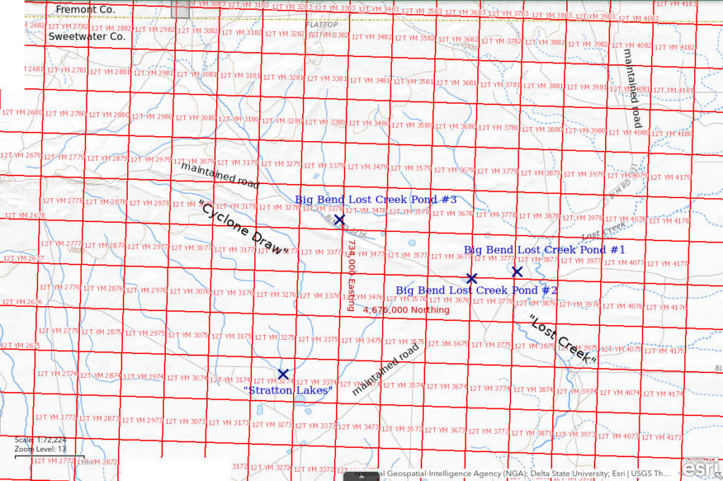
Big Bend Lost Creek Pond #1 is 60 km (37 miles) southeast of Atlantic City and 61 km (38 miles) north of Wamsutter. It is the easternmost of 4 intermittent water bodies shown on the 1:100,000-scale BLM map. The pond is about 700 m (2,300′) north of the Big Bend of Lost Creek. “Big Bend” is a label on the 1:100,000-scale BLM map. On the 7.5-minute topographic quadrangle, the pond is egg-shaped with dimensions of 290 m x 210 m (950′ x 690′).
To reach the pond from the north, turn south onto the Bison Basin road from US 287 on the east side of the Sweetwater River at Sweetwater Station and follow it to the Bison Basin oil field (“Buffalo Basin” on 1:100,000-scale BLM map). Turn east onto a maintained road about 1 mile short of the oil field. That road winds around to Lost Creek and then follows the creek for a few miles to the Big Bend. There are intersections southwest of the Big Bend with 1 road to Cyclone Rim, 1 to Battle Spring Flat, and another to Bastard Butte.
Elevation: 2,072 m (6,797′)
June 8, 1987
The pond has a clay bottom and banks and there is heavy mineral efflorescence in the rushy bogs around the pond. There is a muskrat in the water and a dead one on the shore near an avocet nest.
- 210 m x 290 m based on the 7.5-minute quadrangle; depth not estimated but more than 10 cm.
- Water clear to murky.
- Pale gray, almost invisible fairy shrimp of 2 sizes, 16-19 mm and less than 10 mm; most larger females have eggs; most fairy shrimp are the near bottom of the pond away from shore; a few fairy shrimp are bobbing almost vertically without going anywhere.
- A few small dytiscid larvae (order Coleoptera, family Dytiscidae), copepods up to 3 mm, wriggly larvae, other larvae, lots of flies (alkali flies?), avocets, phalaropes, ducks, muskrats, sheep have trampled the shoreline.
Specimens were identified as Branchinecta campestris by DB (archive #DB 810, which includes specimens from other ponds). Rogers (2006) identified these fairy shrimp as the new species Branchinecta lateralis after DB died.
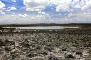
Big Bend Lost Creek Pond #1, on white clayey soil and surrounded by a wide brush-free zone that hints at wetter times.
June 5, 1988
After seeing so many dry ponds on the drive up from I-80, it was a great relief to see water in this one. It doesn’t look much different from last year at this time.
- 210 m x 290 m based on the 7.5-minute quadrangle; depth not estimated.
- Water opaque grayish-white (windy day).
- Pale gray fairy shrimp but most have what looks like a dark green spine that is likely food in the intestine; most are 13-16 mm but one is 11 mm; some females have eggs.
- Other animals not noted.
Specimens were identified as Branchinecta campestris by DB (archive #DB 866). Rogers (2006) identified these fairy shrimp as the new species Branchinecta lateralis after DB died.
May 28, 1989
Water level looks quite shallow. I can actually see the bottom because a thick algal scum on the bottom keeps the wind from churning up the clay.
- Size and depth not estimated.
- Murky water.
- No fairy shrimp.
- Avocets.
Big Bend Lost Creek Pond #2 (Lander BLM Office)
Big Bend Lost Creek Pond #1 map
Big Bend Lost Creek Pond #2 is a little over 800 m (2,620′) southwest of Big Bend of Lost Creek Pond #1. It is the second from the east of the 4 intermittent water bodies shown on the 1:100,000-scale BLM map. On the 7.5-minute topographic quadrangle, the pond is oval with dimensions of 360 m x 170 m (1,180′ x 560′).
For access, see Big Bend Lost Creek Pond #1. Big Bend Lost Creek Pond #2 is farther from the road along Lost Creek than Big Bend Lost Creek Pond #1 but it is closer to the road to Cyclone Rim, which intersects the Lost Creek road southwest of the Big Bend.
Elevation: 2,073 m (6,802′)
June 8, 1987
Not only is the pond dry, it doesn’t look like it ever has much water.
- Dry.
Big Bend Lost Creek Pond #3 (Lander BLM Office)
Big Bend Lost Creek Pond #1 map
Big Bend Lost Creek Pond #3 is about 2,000 m (6,560′) northwest of Big Bend Lost Creek Pond #2 and 3,900 m (12,800′) from Big Bend Lost Creek Pond #1. It is the westernmost of the 4 intermittent water bodies shown on the 1:100,000-scale BLM map. The pond has oval dimensions of 170 m x 120 m (560′ x 390′) on the 7.5-minute topographic quadrangle.
For access, see Big Bend Lost Creek Pond #1.
Elevation: 2,098 m (6,884′)
June 8, 1987
The pond shown on the 1:100,000-scale BLM map between Pond #2 and Pond #3 is dry. Pond #3 is now a grassy mud-cracked meadow with ground squirrel burrows. That suggests it hasn’t had water in quite a while.
- Dry.
“Hay Reservoir” (Rock Springs BLM Office and State of Wyoming)
“Hay Reservoir” is 9 km west of “Lost Creek Lake”. It should not be confused with “John Hay Reservoir”, which is 23 km (14 miles) to the northwest. “Hay Reservoir” is about 3 km (2 miles) north of the east end of the Red Desert sand dune field, as shown on the 1:100,000-scale BLM map, and 3 km (2 miles) east of Luman Butte. “Hay Reservoir” is marked by an intermittent lake symbol 4 km long and up to 2 km wide (2.5 miles x 1.2 miles) on the 1:100,000-scale BLM map. The reservoir is on Red Creek but Red Creek continues a little farther south before disappearing into sand dunes.
Most of the southern part of “Hay Reservoir” is on land owned by the State of Wyoming. There is some private land and the remains of the Luman Ranch south of the southwestern tip of the reservoir.
For access, see “Lost Creek Lake”. The USGS imagery on The National Map shows major oil and gas development near the south end of the reservoir since I was there so the roads have changed.
Elevation: 2,024 m (6,640′)
June 4, 1988
This is a short walk from the road on the way around to the north of “Lost Creek Lake”.
- Dry.
“Lost Creek Lake” (Rawlins BLM Office and State of Wyoming)
___This map is a screenshot of The National Map (Go to The National Map). The U.S. Geological Survey generally does not copyright or charge for its data or reports (unless printed). A pond location is indicated by an “X”, which corresponds to the coordinates given in the data spreadsheet. Labels in quotations are from 7.5-minute topographic quadrangles.
___Red lines are the U. S. National Grid with a spacing of 1,000 m and intersection labels consisting of the UTM zone (e.g., 11S, 12T), a 2-letter 100-km square designation (e.g., LC, XN), and a 4-digit number. The first 2 digits of the number represent the 1,000-meter Easting and the second 2 digits the 1,000-meter Northing, as seen in the example Easting and Northing. Unlike latitude and longitude, the National Grid is rectilinear on a flat map, the units of abscissa and ordinate have equal lengths, and the units (meters) are measurable on the ground with a tape or by pacing.
___Gray shading represents private land as traced from the PAD-US 2.0 – Federal Fee Managers layer of The National Map. Other lands are public or owned by the State of Wyoming.
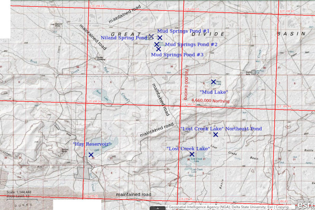
“Lost Creek Lake” is in the center of the Great Divide Basin about 95 km (59 miles) northeast of Rock Springs and 41 km (25 miles) northwest of Wamsutter. Lost Creek terminates at “Lost Creek Lake” after winding its way south from Green Mountain. The intermittent lake symbol for “Lost Creek Lake” on the 1:100,000-scale BLM map has an irregular shape up to 3 km (1.9 miles) long and 2 km (1.2 miles) wide.
The western 1/3 of “Lost Creek Lake” is on land owned by the State of Wyoming.
Being in the middle of the Great Divide Basin, “Lost Creek Lake” can be reached from various directions by several routes with various degrees of complexity and passability. The most direct routes are from I-80 to the south or US 287 to the east. There are signs at some of the intersections of the best maintained and most heavily used roads through the Great Divide Basin but they may or may not help, depending on your knowledge of the region. One of the simpler routes is to turn north off I-80 at the Red Desert exit. Drive north on the Red Desert road for 20 miles (I either saw this distance on a sign or clocked it with my odometer) to the intersection with the Luman Road, also known as Sweetwater County road 22. Turn to the northwest and follow the road (now Sweetwater County road 20) for 9.5 miles to an intersection with 2 unimproved roads: one that goes to the east and one that goes to the north-northeast. The north-northeast road approaches the southwest tip of “Lost Creek Lake” after 2.5 miles. This road reaches to within 700 m (2,300′) of the intermittent lake symbol on the 1:100,000-scale BLM map but, of course, this may not be where the water is when you get there. Because I continued past “Hay Reservoir” (see next paragraph) before visiting “Lost Creek Lake”, I suspect the north-northeast road became impassable a short distance from the maintained road.
Instead of turning off on the unimproved road, a more reliable route would be to drive approximately 20 miles from the Luman road intersection to an intersection 1 km (0.6 miles) south of Hay Reservoir. Turn east there and proceed approximately 10.5 miles to where the maintained road makes a right-angle turn from northeasterly to northwesterly. Turn southeast onto an unimproved road that goes 0.8 miles toward “Lost Creek Lake”. The end of the road on the map is about 2.5 km (1.6 miles) from the intermittent lake symbol for “Lost Creek Lake” but at least it is on a bluff so that you can look down into Lost Creek Basin and see if there is any water before setting off on foot.
Elevation: 1,987 m (6,520′)
June 5, 1988
The lake looks big but the water is very shallow and surrounded by mudflats that make walking very difficult.
- Size not estimated but greater than 500 m; depth mostly less than 3 cm as far as I could get.
- Opaque grayish-white water.
- No fairy shrimp.
- Tadpole shrimp (Notostraca) carapaces, ostracod shells.
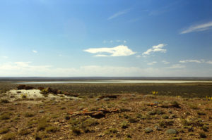
“Lost Creek Lake” from the north. The water is extensive but extremely shallow.
May 7, 1992
I was hoping for more water than last time, not less.
- Dry.
June 12, 1993
“Coyote Lake” and “Lewiston Lakes” in the Antelope Hills had water and fairy shrimp yesterday but it looks like the Great Divide Basin didn’t get as much precipitation.
- Dry.
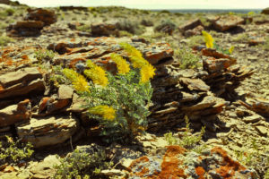
Golden prince’s plumes blowing in the wind on the bluff north of “Lost Creek Lake”. The photo is from 1988 but the wind was blowing just as strongly in 1993.
June 25, 1995
The lake finally has a lot of water. Good thing I have my waders.
- 2.5 km long more or less; depth mostly less than 15 cm but probably deeper in places.
- Opaque grayish-white water; 16 C at 1045.
- Abundant fairy shrimp of various sizes, a smaller species up to 20 mm long and a rare larger species at least 50 mm long; eggs not noted.
- Common clam shrimp (Conchostraca), some tadpole shrimp (Notostraca), cladocerans, ostracods.
The smaller fairy shrimp specimens were identified as Branchinecta readingi and 2 very large females as Branchinecta gigas by DB but my inability to catch a male B. gigas specimen leaves some uncertainty. DB also identified the clam shrimp as Caenestheriella belfragei (now Cyzicus belfragei of the sub-order Spinicaudata according to online Integrated Taxonomic Information System) and the tadpole shrimp as Lepidurus lemmoni.
Ever since DB identified Branchinecta readingi in Cuesta Pond in the Antelope Hills in 1987, I had hoped to find the giant fairy shrimp, Branchinecta gigas. B. readingi wasn’t previously known to occur in Wyoming so its discovery changed the possibilities. Brown and Carpelan (1971) (see the References page) had found B. gigas with B. mackini, a species similar to B. readingi, in Rabbit Dry Lake in the Mojave Desert. B. gigas is a rare predatory species of fairy shrimp that is commonly associated with, and eats, B. mackini. Brown and Carpelan (1971) noted that the ratio of B. gigas to B. mackini in one occurrence was 1:40,000 and that individuals have been observed to eat 35 B. mackini in one day (Brown and Carpelan, 1971). That suggests B. gigas needs a large pond with 100,000s or millions of B. mackini, or B. readingi. That makes a large lake like “Lost Creek Lake” more prospective than a small pond like Cuesta Pond.
B. readingi commonly occurs in opaque water like what I saw on my first visit to “Lost Creek Lake”. The case was strengthened by also finding B. readingi in “Brannan Reservoir” in 1993, another big ephemeral lake in the Great Divide Basin 30 km to the northwest of “Lost Creek Lake”. That makes it more likely “Lost Creek Lake” also has B. readingi. At the time, B. gigas had not been reported in Wyoming (Belk, 1975, and personal communication). If B. gigas is associated with B. mackini and the similar B. readingi occurs in the Great Divide Basin, why couldn’t B. gigas also occur in the Great Divide Basin? The question kept me coming back to “Lost Creek Lake”, one of the biggest dry lakes in the basin. It certainly wasn’t for the miles and miles of dusty roads. Now I can say it was worth it. They’re here.
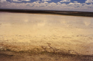
“Lost Creek Lake”, looking south from the bluff north of the lake. The water to the south of the lake might be the southern spur of “Lost Creek Lake” rather than a separate pond.
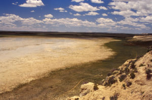
“Lost Creek Lake”, looking southwest. This is big.
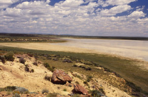
“Lost Creek Lake”, looking northeast. It just keeps going. The gray bump on the horizon is the Ferris Mountains.
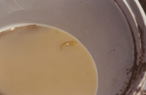
A big fairy shrimp from “Lost Creek Lake” swimming in a 5-gallon bucket. This female Branchinecta gigas is over 5 cm long. With much effort, I was only able to net 3 fairy shrimp of this size. 1 died and disintegrated before I was able to preserve it but DB was able to identify the species from the other 2.
June 14, 2005
No fairy shrimp this year but I know the eggs are there, waiting for the right conditions.
- Dry.
“Lost Creek Lake” Northeast Pond (Rawlins BLM Office)
“Lost Creek Lake” Northeast Pond is in the northern part of Lost Creek Basin 1,500 m (4,920′) northeast of “Lost Creek Lake”. On the 1:100,000-scale BLM map, it has a triangular shape with base and altitude both about 400 m (1,310′).
For access, see “Lost Creek Lake”. “Lost Creek Lake” Northeast Pond is more easily reached from the road north of “Lost Creek Lake”, which is about 2,500 m (8,200′) away.
Elevation: 1,992 m (6,536′)
June 5, 1988
I checked this one on the way to “Lost Creek Lake”.
- Dry.
“Mud Lake” (Rawlins BLM Office)
“Mud Lake” is in its own depression about 6.5 km (4 miles) north of “Lost Creek Lake”. On the 1:100,000-scale BLM map, it has dimensions of 900 m x 600 m (2,950′ x 1,970′).
For access, see “Lost Creek Lake”. “Mud Lake” is at least 4.5 km (2.8 miles) from the maintained road north of the road’s northwestward bend. However, the 1:100,000-scale map shows a road that turns northeast off the maintained road 3 miles northwest of the northwestward bend and passes 2,000 m (6,560′) north of the lake.
Elevation: 2,020 m (6,628′)
June 5, 1988
As seen from the ridge to the south, “Mud Lake” is a “shining white salt pan” according to my notes.
- Dry.
Mud Springs Pond #1 (Rawlins BLM Office)
Mud Springs Pond #1 is 13 km (8 miles) north of “Lost Creek Lake”. It is the northernmost of 3 intermittent ponds on the 1:100,000-scale BLM map east and southeast of Niland Spring. It has dimensions of 400 m x 300 m (1,310′ x 980′). The 7.5-minute topographic quadrangles have the label “Mud Springs” adjacent to the ponds but no spring symbols. This may indicate a dispersed ground water seep or individual springs under each of the ponds.
For access, see “Lost Creek Lake”. Mud Springs Pond #1 is at least 3 km (2 miles) from maintained roads to the north and south. Unimproved roads lead closer to the pond. I decided to try my luck via Niland Spring. To reach Niland Spring, follow the maintained road to the northwest from the right-angle turn north of “Lost Creek Lake”. Drive about 11 miles, past Rocky Crossing to Bastard Butte. At Bastard Butte, turn sharply east onto another maintained road. Follow this road for 3 miles to the junction with the unimproved road to Niland Spring and a bend to the north. It is 2.5 miles to Niland Spring along the unimproved road.
Elevation: 2,031 m (6,664′)
June 5, 1988
The shoreline is very muddy and covered with white mineral efflorescence. The water has such high TDS that minerals precipitate on my net as the water dries.
- About 150 m x 200 m; depth no more than 10 cm (i.e., less than knee-high to an avocet in the middle of the pond).
- Cloudy gray.
- Extremely abundant, 5-7 mm, reddish-brown fairy shrimp like a red tide; about half of females have eggs.
- Avocets.
Specimens were identified as the genus Artemia by DB but species names were being revised at the time.
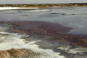
Mud Springs Pond #1 with white mineral efflorescence on shore and dark masses of red fairy shrimp in the water. The wind has pushed the fairy shrimp into heaps at the edge of the water. There is an avocet above and to the right of center.
Mud Springs Pond #2 (Rawlins BLM Office)
Mud Springs Pond #2 is about 700 m (2,300) south of Mud Springs Pond #1. The pond is the middle one of the 3 intermittent ponds on the 1:100,000-scale BLM map east and southeast of Niland Spring. Mud Springs Pond #2 dimensions of 500 m x 200 m (1,640′ x 660′).
For access, see Mud Springs Pond #1.
Elevation: 2,031 m (6,664′)
June 5, 1988
1 out of 2 dry.
- Dry.
Mud Springs Pond #3 (Rawlins BLM Office)
Mud Springs Pond #3 is about 1,000 m (3,280′) south of Mud Springs Pond #1. The pond is the southernmost of the 3 intermittent ponds on the 1:100,000-scale BLM map east and southeast of Niland Spring. It has dimensions of 300 m x 100 m (980′ x 330′).
For access, see Mud Springs Pond #1.
Elevation: 2,031 m (6,662′)
June 5, 1988
2 out of 3 dry.
- Dry.
Niland Spring Pond (private?)
Niland Spring Pond is a small pond east of Niland Spring and 500 m (1,640′) west of Mud Springs Pond #1. It is not shown on the 1:100,000-scale BLM map but is on the 7.5-minute topographic quadrangle, where it has dimensions of 220 m x 70 m (720′ x 230′) and is shown as a perennial lake. Niland Spring Pond is likely on the 16 hectares (40 acres) parcel of private at Niland Spring.
For access, see Mud Springs Pond #1.
Elevation: 2,034 m (6,672′)
June 5, 1988
Well, at least there is one other pond with water in the Mud Springs-Niland Spring area.
- Size and depth not estimated.
- Water clarity not noted.
- No fairy shrimp.
- Other animals not noted.
“Stratton Lakes” (Rawlins BLM Office)
Big Bend Lost Creek Pond #1 map
“Stratton Lakes” are 56 km (35 miles) southeast of Atlantic City and 19 km (12 miles) north of “Lost Creek Lake”. They are 5.5 km (3.4 miles) southwest of Big Bend Lost Creek Pond #1. On the 1:100,000-scale BLM map, they are shown as 2 lakes more than 800 m (2,620′) from the maintained road. The intermittent lake symbol for the larger lake has dimensions of 1,000 m x 300 m (3,280′ x 980′). On the 7.5-minute topographic quadrangle, there are instead 4 ponds at least 150 m across (490′) and 3 much smaller ponds, not counting 3 ponds along the maintained road. The larger lakes are 600-1,600 m (1,970-5,250′) from the maintained road.
For access, see Mud Springs Pond #1. “Stratton Lakes” are about 7.8 miles northeast of the turn-off to Niland Spring. Alternatively, from Big Bend Lost Creek Pond #1 (Big Bend Lost Creek Pond #1), turn west at the intersection of maintained roads 800 m (2,620′) southwest of the Big Bend and follow the road for about 2.7 miles.
Elevation: 2,062 m (6,764′)
June 5, 1988
None of the ponds have water.
- Dry.
Lamont South Pond (Rawlins BLM Office)
___This map is a screenshot of The National Map (Go to The National Map). The U.S. Geological Survey generally does not copyright or charge for its data or reports (unless printed). A pond location is indicated by an “X”, which corresponds to the coordinates given in the data spreadsheet. Labels in quotations are from 7.5-minute topographic quadrangles.
___Red lines are the U. S. National Grid with a spacing of 1,000 m and intersection labels consisting of the UTM zone (e.g., 11S, 12T), a 2-letter 100-km square designation (e.g., LC, XN), and a 4-digit number. The first 2 digits of the number represent the 1,000-meter Easting and the second 2 digits the 1,000-meter Northing, as seen in the example Easting and Northing. Unlike latitude and longitude, the National Grid is rectilinear on a flat map, the units of abscissa and ordinate have equal lengths, and the units (meters) are measurable on the ground with a tape or by pacing.
___Gray shading represents private land as traced from the PAD-US 2.0 – Federal Fee Managers layer of The National Map. Other lands are public or owned by the State of Wyoming.
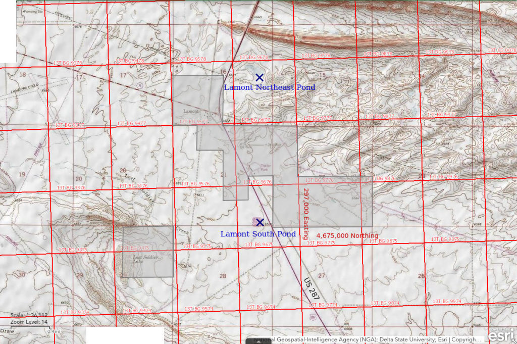
Lamont South Pond is in an excavation on the west side of US 287 1.1 miles south of Lamont. An approximately square dike surrounds the pond. Lamont South Pond is about 200 m (660′) across on the 7.5-minute topographic quadrangle. The excavation doesn’t really look like a gravel pit. It seems to be too far from the barely populated town of Lamont to be a wastewater pond and it doesn’t smell bad.
Lamont South Pond can be seen from US 287. It is only about 100 m (330′) from the highway.
Elevation: 2,010 m (6,595′)
May 31, 1989
This is one of the few ponds that can be seen from the highway that has water today. The area within the dike is not all water; there is a lot of grass and rushes.
- Size and depth not estimated.
- Clear water.
- No fairy shrimp.
- Cladocerans, avocets, phalaropes, gulls.
Lamont South Pond is marked by a purple stipple pattern on the 1981 revision of the Lamont 7.5-minute quadrangle, based on 1980 aerial photographs. The fact that Lamont South Pond is visible on 1980 aerial photographs but not on the 1960 photographs used to draft the original Lamont quadrangle suggests it had been in existence for 9 to 29 years prior to my visit. That has evidently been long enough for cladocerans to colonize the pond but not for fairy shrimp.
June 3, 1993
There is plenty of water today.
- Size and depth not estimated.
- Water clear.
- No fairy shrimp.
- Lots of copepods.
Pipeline By The Road Pond (private)
Siberia Ridge Southeast Pond map
Pipeline By The Road Pond is 18 km (11 miles) north of Wamsutter. It is about 1,200 m (3,940′) west of the Wamsutter – Crooks Gap road on the south side of another road. There is a pipeline close to, and south of, the road at this location. Pipeline By The Road Pond looks like a stock watering pond. The intersection of the road by the pond with the Wamsutter – Crooks Gap road has a spot elevation of 2,068 m (6,780′) on the 1:100,000-scale BLM map. The 7.5-minute topographic quadrangle does not have a spot elevation at this point.
The USGS imagery for The National Map is inconclusive so the location of the pond on the Siberia Ridge Southeast Pond map and in the data spreadsheet (on the Data page) may be off by 200 m (660′).
Pipeline By The Road Pond is on private land within the railroad checkerboard. Given its proximity to the road, I don’t think anyone would mind my walking over and having a look.
To reach the pond, follow the Wamsutter – Crooks Gap road from the Wamsutter exit off I-80 north for 11.7 miles to the road intersection. Turn west and drive about 1 mile to the pond. The USGS imagery on The National Map shows major oil and gas development nearby since I was there so the roads have changed.
Elevation: 2,067 m (6,782′)
May 7, 1992
A different road through the Great Divide Basin, different ponds to look at. I was driving toward a 400 m (1,310′) broad stipple pattern shown on the 1:100,000-scale BLM map 1.8 km west of the Wamsutter – Crooks Gap road and saw this on the way. I made no notes of what I found at the stipple pattern so either it was dry or I didn’t bother after looking at this pond.
- Size and depth not estimated.
- Opaque brown water.
- No fairy shrimp.
- Salamanders, backswimmers, amphipods(?), cladocerans, copepods, avocets.
Siberia Ridge Southeast Pond (private)
___This map is a screenshot of The National Map (Go to The National Map). The U.S. Geological Survey generally does not copyright or charge for its data or reports (unless printed). A pond location is indicated by an “X”, which corresponds to the coordinates given in the data spreadsheet. Labels in quotations are from 7.5-minute topographic quadrangles.
___Red lines are the U. S. National Grid with a spacing of 1,000 m and intersection labels consisting of the UTM zone (e.g., 11S, 12T), a 2-letter 100-km square designation (e.g., LC, XN), and a 4-digit number. The first 2 digits of the number represent the 1,000-meter Easting and the second 2 digits the 1,000-meter Northing, as seen in the example Easting and Northing. Unlike latitude and longitude, the National Grid is rectilinear on a flat map, the units of abscissa and ordinate have equal lengths, and the units (meters) are measurable on the ground with a tape or by pacing.
___Gray shading represents private land as traced from the PAD-US 2.0 – Federal Fee Managers layer of The National Map. Other lands are public.
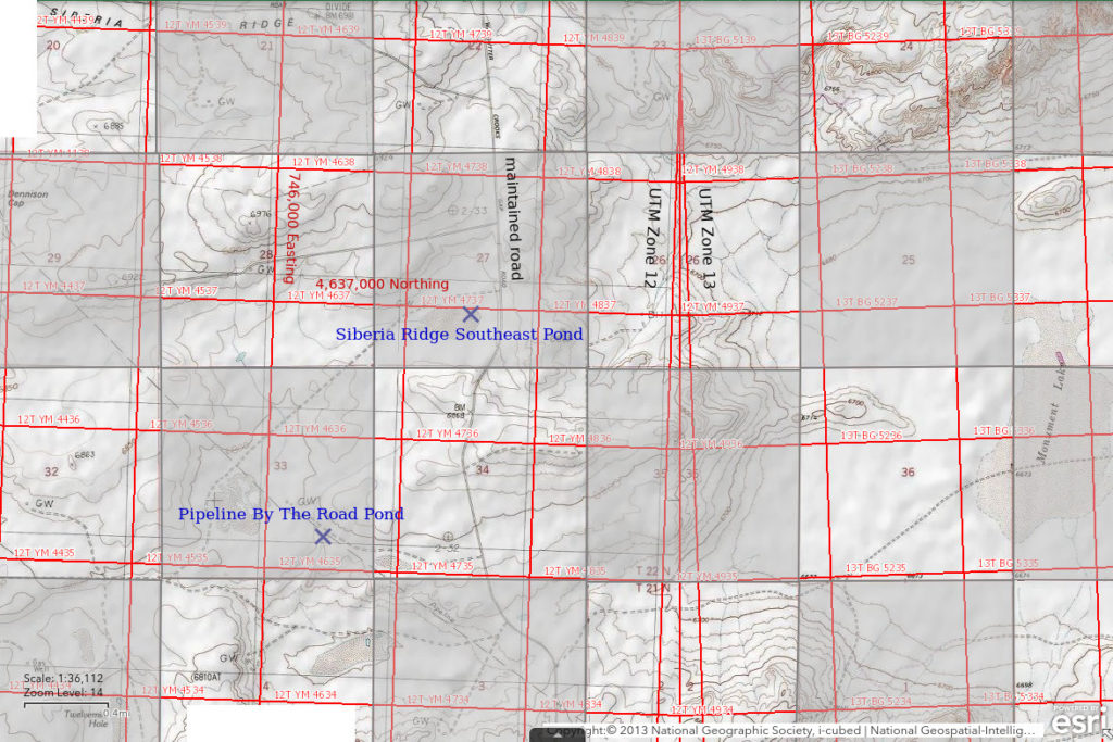
Siberia Ridge Southeast Pond is 19 km (12 miles) north of Wamsutter. It is also 8 km (5 miles) northeast of Pipeline By The Road Pond. The 7.5-minute topographic quadrangle shows a 450 m x 250 m (1,480′ x 820′) stipple pattern for the pond. A perennial pond less than 100 m (330′) long is shown in the eastern part of the stipple pattern where a stock pond has been constructed. The pond is 2,650 m (8,690′) southeast of the “Siberia Ridge” label on the 7.5-minute topographic quadrangle. I suspect “Siberia Ridge” got its name because it is not a place you want to be during a blizzard, even more so than I-80 between Rock Springs and Rawlins.
Siberia Ridge Southeast Pond is on private land within the railroad checkerboard but that is not evident from any indications on the ground.
For access, see Pipeline by the Road Pond. Instead of turning at the intersection for the road to Pipeline by the Road Pond, continue north for another 1 mile. The mud flat with the pond is about 250 m (820′) west of the road.
Elevation: 2,077 m (6,813′)
May 7, 1992
I can see the water so NPPWOPII.
- Size and depth not estimated.
- Water clarity not noted.
- No fairy shrimp.
- Other animals not noted.
Horseshoe Bend Roadside Pond (Rawlins BLM Office)
Horseshoe Bend Roadside Pond is in the Lost Creek Basin between the arms of Horseshoe Bend. It is approximately 2 km (1.2 miles) southeast of Horseshoe Bend Well Pond on the northeast side of Luman road.
Horseshoe Bend Roadside Pond appears to be just outside a section of private land at the north edge of the railroad checkerboard.
To reach Horseshoe Bend Roadside pond, follow the Wamsutter – Crooks Gap road from the Wamsutter exit off I-80 north for 14 miles to the intersection with the Luman road (also known as Sweetwater County 22) on Siberia Ridge. Turn west on the Luman road. The pond is 11.3 miles from the Wamsutter – Crooks Gap road. The USGS imagery on The National Map shows major oil and gas development on Siberia Ridge and vicinity since I was there so the roads have changed.
Elevation: 1,993 m (6,539′)
May 7, 1992
Hard to ignore a pond right next to the road. There is considerable floating algae.
- Size and depth not estimated.
- Opaque pale brown water.
- No fairy shrimp.
- Beetles, avocets.
Horseshoe Bend Well Pond (Rawlins BLM Office)
___This map is a screenshot of The National Map (Go to The National Map). The U.S. Geological Survey generally does not copyright or charge for its data or reports (unless printed). A pond location is indicated by an “X”, which corresponds to the coordinates given in the data spreadsheet. Labels in quotations are from 7.5-minute topographic quadrangles.
___Red lines are the U. S. National Grid with a spacing of 1,000 m and intersection labels consisting of the UTM zone (e.g., 11S, 12T), a 2-letter 100-km square designation (e.g., LC, XN), and a 4-digit number. The first 2 digits of the number represent the 1,000-meter Easting and the second 2 digits the 1,000-meter Northing, as seen in the example Easting and Northing. Unlike latitude and longitude, the National Grid is rectilinear on a flat map, the units of abscissa and ordinate have equal lengths, and the units (meters) are measurable on the ground with a tape or by pacing.
___Gray shading represents private land as traced from the PAD-US 2.0 – Federal Fee Managers layer of The National Map. Other lands are public or owned by the State of Wyoming.
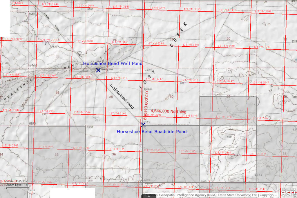
Horseshoe Bend Well Pond is 33 km (20 miles) north of the Red Desert exit of I-80, which is 8 miles west of Wamsutter, and 7 km (4 miles) south of “Lost Creek Lake”. The pond is by the “flowing well” on the north end of the northwestern arm of Horseshoe Bend ridge as shown on the 1:100,000-scale BLM map and the 7.5-minute topographic quadrangle. On the USGS imagery of The National Map, there is extensive vegetation below the pond that is presumably due to overflow from the well.
For access, see Horseshoe Bend Roadside Pond. Horseshoe Bend Well Pond is about 1.3 miles northwest of Horseshoe Bend Roadside Pond. The pond is 170 m (560′) northeast of the Luman road.
Elevation: 1,999 m (6,557′)
May 7, 1992
This is probably a perennial pond due to the well but WIDLA.
- Size and depth not estimated.
- Water clarity not noted.
- No fairy shrimp.
- Other animals not noted.
Lamont Northeast Pond (State of Wyoming)
Lamont Northeast Pond is on a large mud flat 1 km (0.6 miles) northeast of Lamont on the east side of US 287. On the 7.5-minute topographic quadrangle, it is shown as an intermittent lake 350 m long and 100 m wide (1,150′ x 330′).
Lamont Northeast Pond is on land owned by the State of Wyoming.
US 287 passes within about 200 m (660′) of Lamont Northeast Pond about 1/2 mile north of Lamont, just north of where a pipeline crosses the highway. It may be better to park on the road along the pipeline than along the highway.
Elevation: 2,018 m (6,621′)
June 3, 1993
Snow put an end to plans for fairy shrimping in the Antelope Hills today. The weather is a little better here but the wind is chilling.
- Size and depth not estimated.
- Opaque grayish-white water.
- No fairy shrimp.
- Other animals not noted.
Fence Bend Pond (Rawlins BLM Office)
___This map is a screenshot of The National Map (Go to The National Map). The U.S. Geological Survey generally does not copyright or charge for its data or reports (unless printed). A pond location is indicated by an “X”, which corresponds to the coordinates given in the data spreadsheet. Labels in quotations are from 7.5-minute topographic quadrangles.
___Red lines are the U. S. National Grid with a spacing of 1,000 m and intersection labels consisting of the UTM zone (e.g., 11S, 12T), a 2-letter 100-km square designation (e.g., LC, XN), and a 4-digit number. The first 2 digits of the number represent the 1,000-meter Easting and the second 2 digits the 1,000-meter Northing, as seen in the example Easting and Northing. Unlike latitude and longitude, the National Grid is rectilinear on a flat map, the units of abscissa and ordinate have equal lengths, and the units (meters) are measurable on the ground with a tape or by pacing.
___Gray shading represents private land as traced from the PAD-US 2.0 – Federal Fee Managers layer of The National Map. Other lands are public or owned by the State of Wyoming.
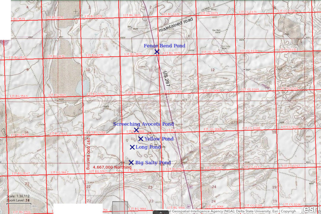
Fence Bend Pond is on the east side of US 287 5 miles south of Lamont and about 1/2 mile south of the turn-off to Ferris. It is too small to show up on a map. A barbed wire fence makes a right-angle turn in the middle of the pond. The generally north-south fence is probably the one along the highway. If so, following the highway fence could be an easy way to find the pond.
Fence Bend Pond is also too small to show up on the USGS imagery of The National Map. If Fence Bend Pond is under the highway fence, the location coordinates in the data spreadsheet (on the Data page) could be off by 100 m (330′). If not, the error would be greater.
Fence Bend Pond is close to US 287 and is probably visible from the highway. Otherwise, I wouldn’t have stopped.
Elevation: 1,992 m (6,535′)
June 3, 1993
Lamont Northeast Pond and Lamont South Pond were misses. How about this one?
- 15 m x 25 m; depth not estimated.
- Opaque grayish-white water but with lots of green algal scum; 18 C at 1315 (considerably warmer than air temperature).
- Abundant pale gray mostly small but some large fairy shrimp, 7-20 mm long; females have white eggs.
- Other animals not noted.
Specimens were identified as Branchinecta lindahli by DB (archive #DB 1233).
Fence Pond Bend, below 2 right-angle bends in a barbed wire fence. This view is probably to the south with the eastern part of the Rawlins uplift in the distance but I didn’t make a note of the direction at the time.
Screeching Avocets Pond (Rawlins BLM Office)
Screeching Avocets Pond is one of a complex of ponds among partially vegetated sand dunes in a depression on the west side of US 287 9.5 km (6 miles) south of Lamont. It is the farthest northwest of the group and is shaped like a pair of spectacles with 2 nearly circular lobes. It is popular with avocets. I was repeatedly screeched at and dive-bombed on both visits in June 1993.
Screeching Avocets Pond is about 1 km (0.6 miles) west of US 287 1.7 miles south of the turn-off to Ferris. It is on the west side of what appears to be the old highway.
Elevation: 1,982 m (6,504′)
June 3, 1993
There is mineral efflorescence along the shore of the pond and rushes growing in the water. The wind is still cold.
- Larger lobe is about 40 m in diameter; depth not estimated.
- Clear yellow-gray water; 18 C at 1440 (warmer than air temperature).
- 2 kinds of pale gray fairy shrimp: 10-14 mm population with long distal segments of male antennae II and ovisacs more than 2/3 the length of the abdomen and 5-8 mm population with triangular distal segments of male antennae II and short, fat ovisacs; the larger females have eggs and most of the smaller females have males clinging to them.
- Avocets.
The smaller fairy shrimp were identified as the genus Artemia by DB but species names were being revised at the time; the larger fairy shrimp were identified as Branchinecta campestris (archive #DB 1239). Rogers (2006) identified these fairy shrimp as the new species Branchinecta lateralis after DB died.
A large pond over the sand dune to the southwest also had fairy shrimp like the larger ones in Screeching Avocets Pond but is not described separately.
Screeching Avocets Pond, looking north across the larger, northwestern lobe of the pond with falling snow or rain obscuring Green Mountain in the distance.
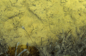
Many individuals of the larger variety of fairy shrimp swimming in Screeching Avocets Pond. The fairy shrimp are rather indistinct pale gray blobs but pairs of black eyes and a bulge of dark eggs near the end of the ovisac on females make some more visible. There do not appear to be any of the smaller fairy shrimp in this photograph. This raises the possibility that fairy shrimp segregate themselves by species in the same pond and that means they must be able to recognize different species by visual, chemical, or other means. Segregation by water chemistry or temperature seems less likely in a pond this size.
June 13, 1993
It looks like the pond has about the same amount of water as on June 3.
- Larger lobe is still about 40 m in diameter; depth not estimated.
- Water clarity not noted.
- Same 2 kinds of fairy shrimp as before with similar abundances; eggs not noted.
- Avocets.
Yellow Pond (Rawlins BLM Office)
Yellow Pond is in the complex of ponds on the west side of US 287 9.5 km (6 miles) south of Lamont and about 250 m (820′) southeast of Screeching Avocets Pond. There is another, smaller pond about 100 m (330′) east of Yellow Pond. Both are on the north side of a partially vegetated sand dune. The water in Yellow Pond has a distinctly yellower color than the water in the other nearby ponds.
Like Screeching Avocets Pond, Yellow Pond is about 1 km (0.6 miles) west of US 287 1.7 miles south of the turn-off to Ferris. It is on the west side of what appears to be the old highway.
Elevation: 1,982 m (6,504′)
June 3, 1993
With fairy shrimp in Screeching Avocets Pond, it is worth checking some of the others to see how common they are.
- Approximately 35 m in diameter; depth not estimated.
- Clear yellow water; 17 C at 1540 (warmer than air temperature).
- Pale gray fairy shrimp 9-11 mm long; some females have eggs.
- Other animals not noted.
Specimens were identified as Branchinecta campestris by DB (archive #DB 1240). Rogers (2006) identified these fairy shrimp as the new species Branchinecta lateralis after DB died.
The smaller pond to the east had similar fairy shrimp.
Long Pond (Rawlins BLM Office)
Long Pond is in the same cluster of ponds as Screeching Avocets Pond and Yellow Pond. My notes said it is 100 m (330′) south of Yellow Pond but this location is not consistent with USGS imagery of The National Map. Although Long Pond is not a visible feature on the imagery, my notes mentioned 2 large ponds just south of Long Pond. The imagery shows 2 large connected ponds 350 m (1,150′) southwest of Yellow Pond. Although “long”, the 2 large ponds on the imagery are too big to be Long Pond. The most likely location of Long Pond is on a patch of bare clay (as seen on the imagery) 50 m north of the 2 large ponds, 300 m (980′) southwest of Yellow Pond, and about 450 m (1,480′) south of Screeching Avocets pond. The imagery also shows 2 small ponds east of the 2 large ponds which my notes did not mention.
Given the conflicting information, the pond location on the Fence Bend Pond map and in the data spreadsheet (on the Data page) could be off by 200 m (660′). Whatever the case, there are many ponds in the area and I saw fairy shrimp in every one I looked at.
Like Screeching Avocets Pond and Yellow Pond, Long Pond is about 1 km (0.6 miles) west of US 287 1.7 miles south of the turn-off to Ferris. It is on the west side of what appears to be the old highway.
Elevation: 1,981 m (6,500′)
June 3, 1993
The water in this pond is also yellow and there are rushes growing in the water. This pond may be connected to the west side of the large ponds to the south, depending on water level. Difficult to take notes as my fingers are nearly frozen.
- Size about 10 m x 25 m; depth not estimated.
- Clear yellow water.
- 2 distinct populations of pale gray fairy shrimp, one smaller than the other but sizes not noted; eggs not noted.
- Other animals not noted.
The smaller fairy shrimp were identified as the genus Artemia by DB but species names were being revised at the time; the larger fairy shrimp were identified as Branchinecta campestris (archive #DB 1237). Rogers (2006) identified these fairy shrimp as the new species Branchinecta lateralis after DB died.
The 2 large ponds 50 m (165′) south of Long Pond had fairy shrimp similar to the larger population in Long Pond.
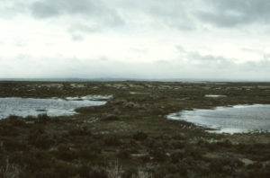
Long Pond, looking northeast under stormy skies. Only part of Long Pond is visible in the middle distance at center. The ponds in the foreground are the 2 large ponds south of Long Pond. All 3 ponds have fairy shrimp.
Osborne Spring Ponds (private)
___This map is a screenshot of The National Map (Go to The National Map). The U.S. Geological Survey generally does not copyright or charge for its data or reports (unless printed). A pond location is indicated by an “X”, which corresponds to the coordinates given in the data spreadsheet. Labels in quotations are from 7.5-minute topographic quadrangles.
___Red lines are the U. S. National Grid with a spacing of 1,000 m and intersection labels consisting of the UTM zone (e.g., 11S, 12T), a 2-letter 100-km square designation (e.g., LC, XN), and a 4-digit number. The first 2 digits of the number represent the 1,000-meter Easting and the second 2 digits the 1,000-meter Northing, as seen in the example Easting and Northing. Unlike latitude and longitude, the National Grid is rectilinear on a flat map, the units of abscissa and ordinate have equal lengths, and the units (meters) are measurable on the ground with a tape or by pacing.
___Gray shading represents private land as traced from the PAD-US 2.0 – Federal Fee Managers layer of The National Map. Other lands are public or owned by the State of Wyoming.
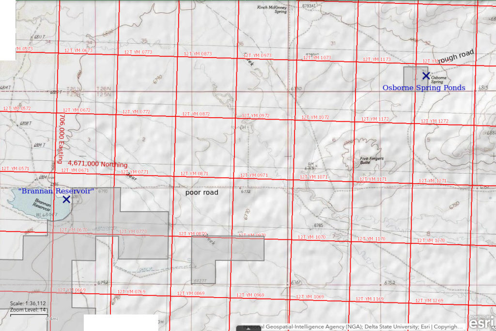
Osborne Spring Ponds are adjacent to Osborne Spring 43 km (27 miles) southeast of Atlantic City and about 1,800 m (5,910′) northeast of Five Fingers Butte. There are a few ponds. All are probably less than 50 m long but I didn’t note the sizes.
Osborne Spring Ponds are on a 16 hectares (40 acres) parcel of private land.
Osborne Spring Ponds are west of the maintained road from “Scotty Lake” to “Lost Creek Lake”. To reach “Scotty Lake” from Wyoming 28 at Atlantic City, see “Scotty Lake” on the Antelope Hills page. From “Scotty Lake”, continue south over Cyclone Rim for not quite 4 miles. Turn west at the road junction there and drive west on the unimproved for 1.6 miles. To reach “Lost Creek Lake” from I-80 at Red Desert, see “Lost Creek Lake”. From the right-angle bend north of “Lost Creek Lake” continue northwest past Rocky Crossing and Bastard Butte for about 15 miles to the Osborne Spring turn-off. Turn west and drive about 1.6 miles to Osborne Spring.
Elevation: 2,072 m (6,799′)
June 12, 1993
This is on the way to “Brannan Reservoir”.
- Size and depth not estimated.
- Some ponds have clear water, some have cloudy water.
- No fairy shrimp.
- Dragonfly larvae, wriggly larvae.
“Brannan Reservoir” (Rock Springs BLM Office)
“Brannan Reservoir” is far from anywhere and hard to get to: approximately 41 km (25 miles) southeast of Atlantic City and 70 km (43 miles) northwest of Wamsutter. Be prepared. On the 1:100,000-scale BLM map, the reservoir is 1,000 m long and 500 m wide (3,280′ x 1,640′). It is shown as a perennial lake.
There are large blocks of state and private land surrounding the reservoir but the reservoir itself seems to be on public land. It doesn’t appear that anyone has lived there in more than 50 years.
For access, see Osborne Spring Ponds. The 1:100,000-scale BLM map (1989) shows a road from Osborne Spring Ponds around the north and west sides of Five Fingers Butte but the 7.5-minute topographic quadrangle (revised based on 1984 aerial photographs) instead shows a road to the east of Five Fingers Butte and I don’t remember which one I found. In either case, there is an intersection with the west-east road to “Brannan Reservoir” less than 1 km (0.6 miles) from Five Fingers Butte. This road intersects the maintained road between Bastard Butte and “Scotty Lake” about 3.5 miles to the east. The “Brannan Reservoir” road crosses Red Creek about 1 km (0.6 miles) southwest of Five Fingers Butte. After the crossing, it continues straight west for 2.5 miles to the reservoir. There is a deep, muddy crossing that may be difficult or impassable on this route but I don’t remember if it is at Red Creek or farther west at Bear Creek. The Five Fingers Butte and John Hay Reservoir 7.5-minute quadrangles show a better road to “Brannan Reservoir” from the south.
Elevation: 2,075 m (6,808′)
June 12, 1993
There is water but it is way below the top of the dam. Still, it looks a lot better than “Hay Reservoir” in 1988.
- Size assumed to be to 80% of that shown on BLM map, at 400 m x 800 m; depth at least 20 cm.
- Opaque pale brown water.
- Abundant pale gray fairy shrimp 15-20 mm long, some with blue tint; eggs not noted.
- Abundant cladocerans, some copepods.
Specimens were identified as Branchinecta readingi by DB (archive #DB 1236).
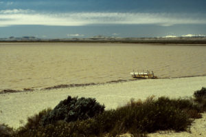
View to the northwest from the dam at the southeast end of Brannan Reservoir. On the horizon from left to right are Oregon Buttes, Continental Peak, and the Wind River Mountains. Strong winds are making the water very choppy. I had to wade well out into the water to be able to use a net effectively.
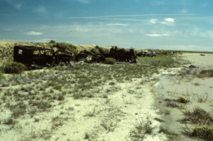
Old cars and wagon boxes along the dam at “Brannan Reservoir”. These would probably reduce the destructiveness of the wave action when the water level is higher. More relevant for fairy shrimp, the vintages of these relics suggest the reservoir has been here a long time, likely 100 years or so. That length of time has been sufficient for fairy shrimp colonization.
June 25, 1995
Lots more water than in 1993, it is up to the car wrecks and wagons along the dam (see photograph “Brannan Reservoir” 1993-06-12, #0511). It is also deeper than I dare go in my waders.
- Size assumed to be to 100% of that shown on BLM map, at 500 m x 1,000 m; depth greater than 60 cm.
- Opaque pale brown water; 18 C at 1515 but the deep water feels significantly cooler.
- Common fairy shrimp about 15 mm long; eggs not noted.
- Tadpole shrimp (Notostraca).
After finding the predatory fairy shrimp Branchinecta gigas in “Lost Creek Lake”, I was hoping to find B. gigas here, too, since both ponds have the prey species Branchinecta readingi. Could they have been in the deeper water I couldn’t reach?
Sweetwater Mill Road Pond (private)
___This map is a screenshot of The National Map (Go to The National Map). The U.S. Geological Survey generally does not copyright or charge for its data or reports (unless printed). A pond location is indicated by an “X”, which corresponds to the coordinates given in the data spreadsheet. Labels in quotations are from 7.5-minute topographic quadrangles.
___Red lines are the U. S. National Grid with a spacing of 1,000 m and intersection labels consisting of the UTM zone (e.g., 11S, 12T), a 2-letter 100-km square designation (e.g., LC, XN), and a 4-digit number. The first 2 digits of the number represent the 1,000-meter Easting and the second 2 digits the 1,000-meter Northing, as seen in the example Easting and Northing. Unlike latitude and longitude, the National Grid is rectilinear on a flat map, the units of abscissa and ordinate have equal lengths, and the units (meters) are measurable on the ground with a tape or by pacing.
___Gray shading represents private land as traced from the PAD-US 2.0 – Federal Fee Managers layer of The National Map. Other lands are public.
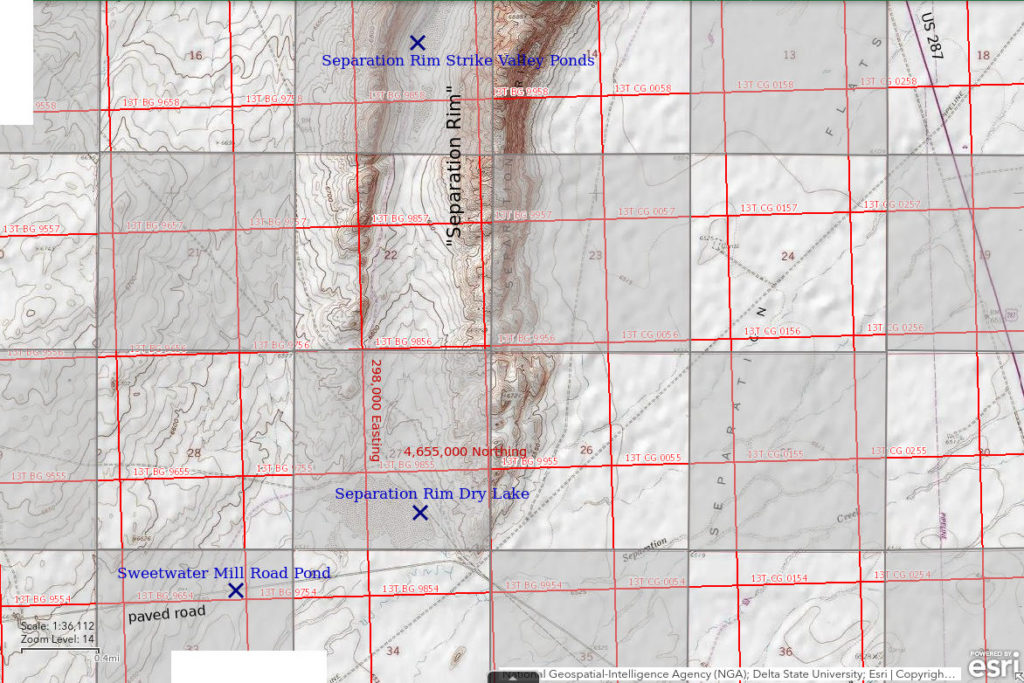
Sweetwater Mill Road Pond is 30 km (19 miles) northwest of Rawlins in the ditch on the south side of the paved road to the Sweetwater Uranium Mill. The road is also known as Sweetwater County Road 63 for the portion in Sweetwater County. The pond is just east of where the road descends to Separation Flats and that location may improve the chances of the pond collecting water.
The pond cannot be seen on the USGS imagery of The National Map so its location on the Sweetwater Mill Road Pond map and the coordinates in the data spreadsheet (on the Data page) may be off by 100 m (330′) or more.
Sweetwater Mill Road Pond is on private land of the railroad checkerboard but the pond is within the road’s right-of-way.
The turn-off to the Sweetwater Uranium Mill Road is at the base of the hill on the south side of Separation Flats 13 miles north of the junction of US 287 (3rd Street) and US 287 Bypass at the north edge of Rawlins. The pond is approximately 6 miles west of US 287.
Elevation: 1,991 m (6,533′)
June 12, 1993
Given the late hour, I was tempted to drive on by but . . . there’s water. There must have been a relatively recent storm in this area to account for this much water. The high-water mark is about 50 cm above the current water level.
- Less than 2 m wide and about 200 m long; depth at least 15 cm.
- Opaque pale brown water; 12 C at 1915.
- Pale gray fairy shrimp; some with pale eggs.
- Caught 1 clam shrimp (Conchostraca).
Fairy shrimp were identified as Branchinecta coloradensis (archive #DB 1234) and the clam shrimp as Caenestheriella belfragei (now Cyzicus belfragei of the sub-order Spinicaudata according to online Integrated Taxonomic Information System) by DB.
The Sweetwater Uranium Mill was, and may still be, licensed by the Nuclear Regulatory Commission (NRC) even though it seems to have never achieved commercial production. A page for the Kennecott-Sweetwater Uranium Recovery Facility by the NRC indicates the facility was first licensed in 1979 and was constructed in 1980. Paving of the road may have occurred at about that time. Although there may have been a non-paved road at the same location previously, drainage was likely significantly impacted by the greater widths of the paved road and shoulders. Earlier roadside ponds at this location, if any, were probably destroyed. It would seem reasonable to then conclude that fairy shrimp colonization was able to occur within about 13 years if the road was paved at the time the mill was constructed. Proof of the construction date of the highway to the Sweetwater Uranium Mill could be found in environmental impact statements or environmental assessments but I could find only a reference to a 1977 draft environmental impact statement, not the document itself or related documents.
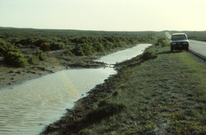
Sweetwater Mill Road Pond, looking west. The dirt in the pond at center was deposited by water flowing into the pond from the flats to the south so this location may capture more natural drainage than road drainage. The width of the road suggests no ponds along any previous non-paved road would have survived road construction. Consequently, construction of the paved road most likely started the clock for fairy shrimp colonization.
Separation Rim Dry Lake (private)
Separation Rim Dry Lake is about 30 km (19 miles) northwest of Rawlins on the north side of the paved road to the Sweetwater Uranium Mill and about 1.5 km (1 mile) east of Sweetwater Mill Road Pond. It is at the south end of the 2 ridges of Separation Rim. The dry lake is shown as a stippled area 900 m long and 500 m wide (2,950′ x 1,640′) on the 1:100,000-scale BLM map.
Separation Rim Dry Lake is on a section of private land within the railroad checkerboard. Although not within the right-of-way to the Sweetwater Uranium Mill road, it is close to a dirt road that may have a public right-of-way.
Take the turn-off to the Sweetwater Uranium Mill Road 13 miles north of the junction of US 287 (3rd Street) and US 287 Bypass at the north edge of Rawlins. Separation Rim Dry Lake is northwest of where the road bends to the west approximately 5 miles west of US 287.
Elevation: 1,991 m (6,533′)
June 12, 1993
Big playa but no water whereas Sweetwater Mill Road Pond was in a small ditch and had lots of water. Maybe the recent rain event was only south of the road to the mill.
- Dry.
Separation Rim Strike Valley Ponds (private)
Separation Rim Strike Valley Ponds are in the valley between the 2 ridges of Separation Rim near Separation Point, which is 33 km (20 miles) northwest of Rawlins. There are 3 large ponds shown by stipple patterns on the 1:100,000-scale BLM map. Lengths are 700 m, 650 m, and 375 m, (2,300′, 2,130′, 1,230′) and widths are no more than about 200 m (660′).
Separation Rim Strike Valley Ponds are on private land within the checkerboard of public and private land straddling the transcontinental railroad.
For access, see Separation Rim Dry Lake. At Separation Rim Dry Lake, turn off the paved road and follow an unimproved road to the northwest close to the east side of the western ridge. The 1:100,000-scale BLM map shows the road extending the full length of the strike valley but I don’t remember its condition. I hiked along the ridge top for the view.
Elevation: 2,015 m (6,610′)
June 13, 1993
It doesn’t really look like these ponds ever get much water.
- Dry.
Big Salty Pond (Rawlins BLM Office)
Big Salty Pond is 10 km (6 miles) south of Lamont in the same depression on the west side of US 287 as Screeching Avocets Pond, Yellow Pond, and Long Pond. Unlike those ponds, it is on a part of the mud flat without sand dunes. Big Salty Pond is bigger than all the other ponds in the Screeching Avocets cluster and is surrounded by areas of white mineral crusts, which are probably not sodium chloride salt. It is shown on the 7.5-minute topographic quadrangle as a triangular stippled area with a base of 260 m (850′) and an altitude of 150 m (490′).
The closest approach of US 287 to Big Salty Pond is 2.1 miles south of the turn-off to Ferris. The pond is 700 m (2,300′) west of what appears to be the old highway.
Elevation: 1,979 m (6,493′)
June 13, 1993
Quick looks indicated the other ponds in the area still have fairy shrimp so I decided to take the time to have a look at this one. There is extensive white, mineral efflorescence around the shore line up to 1 m (3′) vertically (EIGWUU) above the current water level.
- 150 m x 260 m based on the 7.5-minute quadrangle; depth not estimated.
- Cloudy grayish-white water; 16 C at 1200.
- Very abundant pale gray fairy shrimp 5-12 mm long; eggs present; these look like Artemia as the females have short, fat ovisacs.
- Other animals not noted.
The fairy shrimp were identified as the genus Artemia by DB but species names were being revised at the time (archive #DB 1235).
“Separation Point Lake” (State of Wyoming)
Separation Rim “Soda Lake” map
“Separation Point Lake” is adjacent to US 287 16 km (10 miles) south of Lamont. It is labeled and shown as an intermittent lake on the 7.5-minute topographic quadrangle. Its dimensions are 210 m x 100 m (690′ x 330′).
“Separation Point Lake” is on about 32 hectares (80 acres) owned by the State of Wyoming within a section having both public and private land.
What appears to be the old highway branches to the northwest off US 287 at a slight bend in US 287 about 10 miles south of Lamont or about 21 miles north of Rawlins. This junction is less than 400 m from “Separation Point Lake”. The old highway passes within 50 m (165′) of the lake and offers better parking than the shoulder of US 287.
Elevation: 1,980 m (6,497′)
June 13, 1993
Not much of a “lake”.
- Dry.
Section Marker Depression Pond (State of Wyoming)
Separation Rim “Soda Lake” map
Section Marker Depression Pond is 13.5 km (8.5 miles) south of Lamont and 3 km (2 miles) northwest of “Separation Point Lake”. On the 7.5-minute topographic quadrangle, the corner for sections 25, 26, 35, and 36 (T25N, R89W) is at the east end of a depression which is 330 m (1,080′) across and abuts what appears to be the old highway. My guess while writing this up is that the section marker is a pipe with an inscribed metal cap. Such pipes usually extend 15-46 cm (0.5-1.5′) above the ground. The 7.5-minute quadrangle shows the pond as an intermittent pond less than 80 m (260′) across within this depression.
For access, see “Separation Point Lake”. I vaguely remember being able to drive what appears to be the old highway from “Separation Point Lake” as far as this pond but not much farther.
Elevation: 1,982 m (6,503′)
June 13, 1993
No water here either.
- Dry.
Separation Rim “Soda Lake” (private)
___This map is a screenshot of The National Map (Go to The National Map). The U.S. Geological Survey generally does not copyright or charge for its data or reports (unless printed). A pond location is indicated by an “X”, which corresponds to the coordinates given in the data spreadsheet. Labels in quotations are from 7.5-minute topographic quadrangles.
___Red lines are the U. S. National Grid with a spacing of 1,000 m and intersection labels consisting of the UTM zone (e.g., 11S, 12T), a 2-letter 100-km square designation (e.g., LC, XN), and a 4-digit number. The first 2 digits of the number represent the 1,000-meter Easting and the second 2 digits the 1,000-meter Northing, as seen in the example Easting and Northing. Unlike latitude and longitude, the National Grid is rectilinear on a flat map, the units of abscissa and ordinate have equal lengths, and the units (meters) are measurable on the ground with a tape or by pacing.
___Gray shading represents private land as traced from the PAD-US 2.0 – Federal Fee Managers layer of The National Map. Other lands are public or owned by the State of Wyoming.
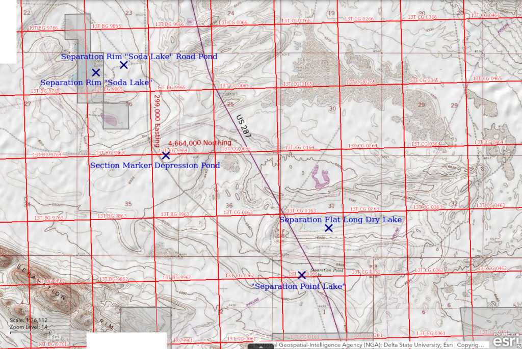
Separation Rim “Soda Lake” is 12 km (7.5 miles) south of Lamont and 6.5 km (4 miles) north of Separation Point on Separation Rim. It is labeled “Soda Lake” and shown as a perennial lake on the 1:100,000-scale BLM map. The perennial water body is 650 m long and up to 210 m wide (2,130′ x 690′) on the 7.5-minute topographic quadrangle but a stippled area continues another 400 m (1,310′) to the north.
Separation Rim “Soda Lake” is on private land north of the railroad checkerboard. The boundaries of the private land are configured to enclose the lake and suggest the private land may be patented mining claims related to salt or “soda” mining.
Separation Rim “Soda Lake” is 1,800 m (5,910′) west of a point on US 287 which is 7.8 miles south of Lamont and 23.3 miles north of Rawlins. It may be possible to get closer by driving on what appears to be the old highway west of US 287 (see “Separation Point Lake”).
Elevation: 1,977 m (6,488′)
June 13, 1993
There are thick mineral encrustations along the shore and the water level is well below the high-water mark. The water is white and quite choppy due to the wind.
- 210 m x 650 m based on the 7.5-minute quadrangle; depth not estimated.
- Clear milky-white water.
- Numerous small fairy shrimp that look like Artemia, as seen in Big Salty Pond and identified by DB.
- Several avocets.
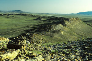
View north across the western ridge of Separation Rim with Separation Rim “Soda Lake” in the distance on the flats beyond the ridge. On the horizon from left to right are Green Mountain, Muddy Gap, and the Ferris Mountains. One of the pointy Granite Mountains can be seen through Muddy Gap.
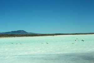
Avocets standing in and landing in the milky white water of Separation Rim “Soda Lake”. The legs of the avocets at left are submerged while those of the avocets at right are mostly above the water. This suggests the maximum water depth is at least as deep as an avocet’s leg is long, which I am pretty sure is greater than 20 cm but probably less than 50 cm. Green Mountain is in the distance.
Separation Rim “Soda Lake” Road Pond (Rawlins BLM Office)
Separation Rim “Soda Lake” map
Separation Rim “Soda Lake” Road Pond is along a road about 500 m (1,640′) east of the shore of Separation Rim “Soda Lake”. Water collects in borrow pits or ditches on both sides of the road at this location. The road extends from the southeastern corner of Separation Rim “Soda Lake” to what appears to be the old highway and is shown on the 1:100,000-scale BLM map.
The ponds are not evident on the USGS imagery of The National Map so the location on the map and the coordinates in the data spreadsheet (on the Data page) may be off by 100 m (330′).
For access, see Separation Rim “Soda Lake”.
Elevation: 1,980 m (6,497′)
June 13, 1993
There’s water and it’s not on private land. NPPWOPII.
- Less than 2 m wide, about 30 m long; depth probably less than 50 cm.
- Opaque pale brown water; 17 C at 1330.
- Small fairy shrimp unlike those in Separation Rim “Soda Lake”; females appear to lack mature eggs.
- Other animals not noted.
Specimens were identified as Branchinecta readingi by DB (archive #DB 1238).
Separation Flat Long Dry Lake (Rawlins BLM Office)
Separation Rim “Soda Lake” map
Separation Flat Long Dry Lake is 4.4 km (2.7 miles) southeast of Separation Rim “Soda Lake” and 750 m (2,460′) north of “Separation Point Lake”. It is east of US 287. Separation Flat Long Dry Lake is in a long, wide depression with an east-west orientation. On the 7.5-minute topographic quadrangle, it is an intermittent lake 1.6 km (1 mile) long and up to 250 m (820′) wide. The intermittent lake symbol is also shown on the 1:100,000-scale BLM map.
Separation Flat Long Dry Lake is about 9 miles south of Lamont and 22 miles north of Rawlins. Its west end is only 175 m (580′) east of the highway. Any water would be visible from the highway.
Elevation: 1,976 m (6,482′)
June 13, 1993
Its size is impressive but it didn’t get water even in this relatively wet year.
- Dry.
“Chain Lakes” Roadside Pond (private)
___This map is a screenshot of The National Map (Go to The National Map). The U.S. Geological Survey generally does not copyright or charge for its data or reports (unless printed). A pond location is indicated by an “X”, which corresponds to the coordinates given in the data spreadsheet. Labels in quotations are from 7.5-minute topographic quadrangles.
___Red lines are the U. S. National Grid with a spacing of 1,000 m and intersection labels consisting of the UTM zone (e.g., 11S, 12T), a 2-letter 100-km square designation (e.g., LC, XN), and a 4-digit number. The first 2 digits of the number represent the 1,000-meter Easting and the second 2 digits the 1,000-meter Northing, as seen in the example Easting and Northing. Unlike latitude and longitude, the National Grid is rectilinear on a flat map, the units of abscissa and ordinate have equal lengths, and the units (meters) are measurable on the ground with a tape or by pacing.
___All lands are within the “Chain Lakes” Big Game Winter Range checkerboard of public and state lands.
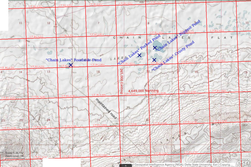
“Chain Lakes” Roadside Pond is on “Chain Lakes” Flat along the Riner Road 34 km (21 miles) northeast of Wamsutter. There are numerous ponds on “Chain Lakes” Flat. “Chain Lakes” Roadside Pond is the one closest to the road and on the west side of the road. It is shown on the 7.5-minute topographic quadrangle as a perennial lake with dimensions of 320 m x 100 m (1,050′ x 330′).
“Chain Lakes” Flat is within the railroad land checkerboard of alternating sections of public and private land. “Chain Lakes” Roadside Pond happens to be on private land according to my paper 1991 1:100,000-scale BLM map (Rawlins 30-minute x 60-minute quadrangle). However, the 2020 “State of Wyoming, Land Status” map prepared by the Wyoming State Office of the BLM (a pdf of the 1:500,000-scale map is available online) shows the “Chain Lakes” Big Game Winter Range now as a checkerboard of public and “State Wildlife Agency” lands up to 14 miles long and 8 miles wide. What were previously private lands are apparently now owned by the State of Wyoming.
The Riner exit of I-80 is 15 miles west of Rawlins and about 9 miles east of Creston Junction. The Riner Road heads north from the exit and then to the northwest. “Chain Lakes” Roadside Pond is about 26 miles from I-80. The descent from “Chain Lakes” Rim, about 2 1/2 miles southeast of the pond, to “Chain Lakes” Flat is a distinctive landmark. Somewhere along the road from the rim to the pond (I don’t remember where), there is a sign by the Wyoming Game and Fish Department which identifies the area as the “Chain Lakes” Big Game Winter Range. A mile north of “Chain Lakes” Roadside Pond, Riner Road intersects another maintained road that goes to Bairoil. A sign at that intersection indicates that US 287 is 27 miles away on the Bairoil road.
Elevation: 1,990 m (6,528′)
June 14, 2005
Looks good, there are avocets.
- 100 m x 320 m based on the 7.5-minute quadrangle; depth not estimated.
- Water clarity not noted.
- No fairy shrimp.
- Avocets, phalaropes, killdeer.
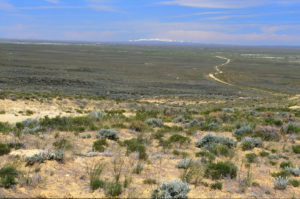
“Chain Lakes” Roadside Pond on “Chain Lakes” Flat from “Chain Lakes” Rim. “Chain Lakes” Roadside Pond is close to where the road disappears, i.e., left of the road across from the white mud flats. The Wind River Mountains are on horizon to the northwest.
“Chain Lakes” Forked Pond (private)
“Chain Lakes” Roadside Pond map
“Chain Lakes” Forked Pond is 2,150 m (7,050′) due east of “Chain Lakes” Roadside Pond and 350 m (1,150′) southwest of “Chain Lakes” Biggest Pond. It is approximately 310 m x 120 m (1,020′ x 390′) on the 7.5-minute topographic quadrangle and is denoted as an intermittent pond. There are 2 arms on the southwest side of the pond that give it a forked, or wisdom tooth-like, appearance.
Although separated from “Chain Lakes” Roadside Pond by a section of public land, “Chain Lakes” Forked Pond is also on state land within the “Chain Lakes” Big Game Winter Range checkerboard.
For access, see “Chain Lakes” Roadside Pond. Although there are many ponds on “Chain Lakes” Flat, “Chain Lakes” Forked Pond is the first large pond I met while walking east of “Chain Lakes” Roadside Pond.
Elevation: 1,991 m (6,531′)
June 14, 2005
Can’t check out all the ponds but the larger ones with water deserve a look.
- 120 m x 310 m based on the 7.5-minute quadrangle; depth not estimated.
- Water clarity not noted.
- Sparse, colorless fairy shrimp; females have long ovisacs but no eggs.
- Other animals not noted.
“Chain Lakes” Biggest Pond (Rawlins BLM Office, private)
“Chain Lakes” Roadside Pond map
“Chain Lakes” Biggest Pond is 2,820 m (9,250′) northeast of “Chain Lakes” Roadside Pond. On the 7.5-minute topographic quadrangle, “Chain Lakes” Biggest Pond is a perennial lake with a spot elevation of 6,528 feet (1,990 m). At 480 m x 310 m (1,570′ x 1,020′), this is the biggest pond on the part of “Chain Lakes” Flat shown on the Hansen Lake NE 7.5-minute quadrangle. There may be larger ponds on other quadrangles.
The northern 2/3 of “Chain Lakes” Biggest Pond is on public land and the rest is on state land of the “Chain Lakes” Big Game Winter Range checkerboard.
For access, see “Chain Lakes” Roadside Pond. “Chain Lakes” Biggest Pond is the second pond northeast of “Chain Lakes” Forked Pond and is obviously larger than nearby ponds.
Elevation: 1,991 m (6,531′)
June 14, 2005
This pond has a sandier bottom and is easier to approach than most of the other ponds.
- 310 m x 480 m based on the 7.5-minute quadrangle; depth not estimated.
- Water clarity not noted.
- No fairy shrimp.
- Other animals not noted.
“Chain Lakes” Crusty Pond (private)
“Chain Lakes” Roadside Pond map
“Chain Lakes” Crusty Pond is 2,750 m (9,020′) east of “Chain Lakes” Roadside Pond and 100 m (330′) south of “Chain Lakes” Biggest Pond. It is a 290 m x 290 m (950′ x 950′), odd-shaped, perennial lake on the 7.5-minute topographic quadrangle. “Chain Lakes” Crusty Pond has more extensive white mineral encrustations around its shore than other ponds in the vicinity.
“Chain Lakes” Crusty Pond is on the same section of state land as “Chain Lakes” Forked Pond and the southern part of “Chain Lakes” Biggest Pond.
For access, see “Chain Lakes” Roadside Pond. The 7.5-minute quadrangle does not show any ponds to the south of “Chain Lakes” Crusty Pond and this may help to identify it.
Elevation: 1,991 m (6,531′)
June 14, 2005
The heavier mineral efflorescence here indicates there may be significant variability in water chemistry on “Chain Lakes” Flat.
- 290 m x 290 m based on the 7.5-minute quadrangle; depth not estimated.
- Water is clear.
- No fairy shrimp.
- Other animals not noted.
What Can We Learn from the Ponds in the Great Divide Basin?
The gentle topography and clayey soil of most of the Great Divide Basin are well suited for ponds. Maximum sizes range from greater than 1,000 m (3,280′) to about 25 m (80′). Unlike the Antelope Hills to the north though, a smaller percentage are shown as perennial on the 1:100,000-scale BLM maps. Of the 37 ponds visited, 13 were dry on the only visits, 13 (54% of the wet ponds) had fairy shrimp, and 11 had water but no fairy shrimp.
The Great Divide Basin has all 3 large branchiopods. Clam shrimp (Conchostraca, or the orders Spinicaudata, Laevicaudata, and Cyclestherida) and tadpole shrimp (Notostraca) were each found in 2 ponds. “Lost Creek Lake” has both, in addition to fairy shrimp. The other 2 ponds with clam shrimp or tadpole shrimp also had fairy shrimp.
Avocets were seen at 8 ponds and 3 of those ponds had fairy shrimp. Phalaropes were seen at 3 ponds that also had avocets and 1 of those had fairy shrimp.
Repeat visits definitely improve the chances of finding fairy shrimp in a particular pond. Of 5 visits to “Lost Creek Lake”, it was dry 3 times, had water 2 times, and had fairy shrimp once.
Anostracan species identified by Denton Belk are:
Branchinecta readingi – “Lost Creek Lake”, “Brannan Reservoir”, Separation Rim “Soda Lake” Road Pond;
Branchinecta gigas – “Lost Creek Lake”;
Branchinecta coloradensis – Sweetwater Mill Road Pond;
Branchinecta campestris (DB), named as new species Branchinecta lateralis by Rogers (2006) – Big Bend Lost Creek Pond #1, Screeching Avocets Pond, Yellow Pond, Long Pond;
Artemia (species not identified) – Mud Springs Pond #1, Screeching Avocets Pond, Long Pond, Big Salty Pond.
Conchostracan (order Spinicaudata) species identified by Denton Belk are:
Cyzicus belfragei – “Lost Creek Lake”, Sweetwater Mill Road Pond.
Notostracan species identified by Denton Belk are:
Lepidurus lemmoni – “Lost Creek Lake”.