The base map is provided by OpenTopoMap’s volunteer servers.
Wild Horse Rock Pool
Hill 7122 Rock Pool
West Tin Cup Summit Rock Pool
Half Moon Rock Pool
Dead Ant Rock Pool
Antelope Pocket Overlook Rock Pool
North “Bucklin Reservoir”
“Beulah Belle Lake”
“Jackson Lake”
Rawlins Draw “Soda Lake”
“Steamboat Lake” 2nd East Pond
“Steamboat Lake” Oxbow Pond
“Steamboat Lake” 1st East Pond
“Steamboat Lake”
Big Skunk Granite Rock Pool
Little Skunk Granite Rock Pool
Dry Creek Crossing Pond
“Piaya Lake”
Little “Piaya Lake”
Beaver Divide “Dry Lakes”
Eastern “Soda Lake”
“Soda Lakes” Far Eastern Pond
Middle “Soda Lake”
Western “Soda Lake”
Bent Knee Rock Pool
Deep Hollow Rock Pool
Lankin Dome Summit Rock Pools
Beaver Rim Snow Fence Pond
Beaver Rim Quack Pond
“Carmody Lake” Northwest Pond
“Carmody Lake” West Pond
What Can We Learn from the Ponds in the Granite Mountains?
“Granite Mountains” is not a good name for the Sweetwater River drainage basin between the boundary with the Antelope Hills (as defined on this web site) at the mouth of Sweetwater Canyon in the west and Pathfinder Dam at the upper end of Fremont Canyon in the east. The official state highway map has no name for the area. “Sweetwater Plateau” would be a good name but it’s not on any maps. The Rattlesnake Hills 30-minute x 60-minute topographic quadrangle has the major place names “Beaver Divide” and “Rattlesnake Hills” for features at the northern boundary of the area and the Bairoil 30-minute x 60-minute topographic quadrangle has the major place names “Green Mountain” and “Ferris Mountain” for features at the southern boundary of the area. In between is a broad plain of low relief with scattered hills but the only major place name is “Granite Mountains”. That term is appropriate for the steep hills of granite north of the Sweetwater River between Jeffrey City and Devil’s Gate but not for most of the area. In the absence of other viable choices, “Granite Mountains” it is.
The Granite Mountains extend for 115 km (71 miles) in an east-west direction from the mouth of Sweetwater Canyon to Pathfinder Dam. The north – south width of the Granite Mountains ranges from about 30 km (19 miles) to about 50 km (31 miles), such as from the Sage Hen Creek – Deer Creek divide to Muddy Gap. As a measure of the low relief, the Sweetwater River gains only 228 m (750′) from “Pathfinder Reservoir” to Sweetwater Canyon. That is less than a 1/2% slope.
The lowest elevation in the Granite Mountains is “Pathfinder Reservoir”, at 1,782 m (5,846′). McIntosh Peak is the highest at 2,456 m (8,058′). Elevations on the plains north of the Sweetwater River are mostly 1,900-2,050 m (6,230-6,730′), such as on Agate Flats. South of the river, they range mostly between 1,850 m and 2,100 m (6,070-6,890′). Only a few of the granite knobs are higher than 2,300 m (7,550′) and the other hills are mostly lower than 2,200 m (7,220′).
Mean Annual Precipitation according to the Wyoming Climate Atlas by the Water Resources Data System and State Climate Office at http://www.wrds.uwyo.edu/sco/climateatlas/precipitation.html, Parameter-Elevation Regressions on Independent Slopes Model, PRISM, with 1971-2000 data at very widely spaced weather stations (I have eyeballed the values from a very small scale map with 11 precipitation bins marked with indistinct colors and further obscured by a shaded relief base map):
11″-15″ (28-38 cm)
Sagebrush dominates the Granite Mountains but there are pines on the wetter areas of the hills and occasional grassy meadows.
The area along the Sweetwater River is all ranches. Strips of private land occur along most creeks, such as Dry Creek, Sage Hen Creek, Long Creek, and Crooks Creek. There are also a few smaller parcels of private land scattered about, with or without water. It is difficult to get to many areas of the Granite Mountains without crossing private land but locked gates are (or were) rare. Ranches where one could ask permission are easy to find because that is where the best maintained roads go but the ranchers may not be there.
Wild Horse Rock Pool (Lander BLM Office)
___This map is a screenshot of The National Map (Go to The National Map). The U.S. Geological Survey generally does not copyright or charge for its data or reports (unless printed). A pond location is indicated by an “X”, which corresponds to the coordinates given in the data spreadsheet. Labels in quotations are from 7.5-minute topographic quadrangles.
___As of April 2025, the National Grid overlay with red lines in UTM coordinates does not load in The National Map.
___Gray shading represents private land as traced from the PAD-US 4.0 – Federal Fee Managers layer of The National Map. Other lands are public or owned by the State of Wyoming.
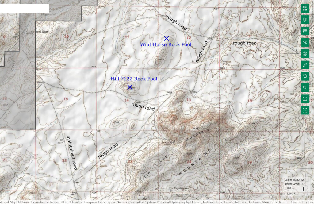
Wild Horse Rock Pool is 20.5 km (13 miles) north of Jeffrey City and 8 km (5 miles) south of Beaver Rim. It is on a bit of rock exposed in the sagebrush near the northeastern end of a small, northeasterly trending ridge north of Tin Cup Mountain. There is at least one horse herd that hangs out in the vicinity of Tin Cup Mountain. Droppings indicate they visit the rock pool.
Small rock pools cannot be seen on the USGS imagery for The National Map so the location on the map above and in the data spreadsheet (on the Data page) could be off by 200 m (660′) due to poor topographic constraints.
Wild Horse Rock Pool is 4 km (2.5 miles) east of the Long Creek Ranch (uninhabited in the 1980s) on the East Fork of Long Creek. To get on the Long Creek Ranch road, turn northwest off US 287 4 miles west of Jeffrey City. After 4 1/2 miles turn northeast and cross the Sweetwater River to the Graham Ranch. As the road goes through their front yard, it would be appropriate to stop and ask for permission although there may be a public right-of-way. The road to Long Creek Ranch leads north from the Graham Ranch and reaches Long Creek Ranch not quite 9 miles north of the Sweetwater River crossing. A vehicle track that goes around the west side of Tin Cup Mountain turns northeast off the Long Creek Ranch road about 1/2 mile after crossing the ridge southwest of Tin Cup Mountain. After the road loops around the north ridge of Tin Cup Mountain and heads to the southeast, turn north at the road junction with a spot elevation of 7,036 feet (2,145 m) on the 7.5-minute topographic quadrangle. Drive another 1 mile to a road junction with a spot elevation of 7,010 feet (2,135 m) and turn to the west. After driving another 0.6 miles, you would be within a few hundred meters of Wild Horse Rock Pool. A more direct but less used track turns east off the Long Creek Ranch road about 1/2 mile south of the East Fork Long Creek crossing. Follow the road to the northeast for about 2 miles.
There is an alternate, roundabout route that doesn’t require driving across private land except at Long Creek Ranch. Turn north off US 287 onto Wyoming 135 at Sweetwater Station. After about 7 miles, turn to the northeast and follow the road up Cedar Rim Draw for approximately 7 miles to an intersection of 6 tracks. Take the track that goes east past the north side of Long Creek Mountain. After about another 7 miles, this track turns south around the east end of Long Creek Mountain and crosses East Fork Long Creek at Long Creek Ranch within 1 1/2 miles. There are many roads in this area with varying degrees of passability that may change from year to year. There could be multiple routes to, or close to, any one location. With plenty of fuel, flexibility, and a willingness to backtrack when necessary, you might just get to where you want to go.
Elevation: 2,145 m (7,039′)
August 16, 1987
I was not looking for fairy shrimp but I had read that they can occur in small rock pools. This rock pool was in no way impressive but I had already adopted the principle of NPPWOPII. The water level is about 2 cm below the high-water mark so the pool has been here a while.
- Size not estimated; depth 12 cm.
- Water generally clear.
- Pale gray fairy shrimp less than 10 mm long; most females have less than 10 eggs in ovisac about half the length of the abdomen.
- Other animals not noted.
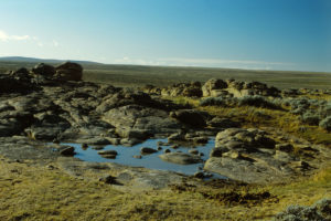
Wild Horse Rock Pool north of Tin Cup Mountain. There’s just a little bit of water but that’s enough for fairy shrimp. There are horse droppings at lower right.
There was rain in Lander on August 11. August 14 was also stormy and there may, or may not, have been rain then. If these fairy shrimp hatched on August 11, they grew at a rate of 1.5-2 mm/day. For comparison, Branchinecta mackini were found to grow at rates of 1 mm/day in Alberta (Daborn 1977, see the References page) and at rates of 0.6-2 mm/day on a playa in the Mojave Desert at various times over 2 years (Brown and Carpelan, 1971).
August 17, 1987
The fairy shrimp I saw the previous day looked different from those I had previously seen in Bivouac Lake (Wind River Mountains) as I couldn’t make out the distal segments of antennae II on the males. But it was getting dark. So I came back for a better look and brought a thermometer. Unfortunately, it’s already late.
-
- Less than 10 m across; depth 10 cm.
- Water cloudy, probably because of horses stomping in it; 17 C at 1835.
- Fairy shrimp less than 10 mm long with males larger than females; most females have white, green, or yellowish eggs in ovisacs less than 1/2 the length of abdomen; some females have green color while all males are pale gray; many are scraping the rocks and pond bottom with their legs for food.
- Other animals not noted.
August 18, 1987
Try again. It’s not only horses. Now there are sage grouse turds too.
- Triangular pool has 5.5 m long base and 3.5 m altitude; depth 6 cm.
- Water is clear; 9.5 C at 0930.
- Fairy shrimp less abundant than before; most females have 2 rows of pale green eggs, presumably in oviducts; I think I saw 3 matings.
- Small black ostracod(?).
August 19, 1987
The pond is going fast so I came back for a sample. I’m pretty sure the fairy shrimp are a different species than those in the Wind River Mountains and the Antelope Hills.
- Size not estimated; depth 5 cm in hoof print but mostly 2 cm.
- Murky water with brown tint; 22 C at 1510.
- Abundant, very active, fairy shrimp 7-9 mm long; females have stubby ovisac full of 20-25 yellow-brown eggs or have 2 rows of pale green eggs; ovisac is less than 1/2 the length of the abdomen; distal segments of male antennae are strongly curved and barely meet above the legs.
- Small black ostracod(?) still here, a big backswimmer (sub-order Heteroptera, family Notonectidae).
Specimens were identified as Branchinecta packardi by DB.
Temperatures yesterday and today indicate a minimum daily water temperature range of 12.5 C, or about 23 degrees Fahrenheit. Brown and Carpelan (1971) found that fairy shrimp in ponds on a playa in the Mojave Desert experienced daily temperature changes of up to 19 C.
The decrease in water depth from 12 cm on August 16 to 2 cm on August 19 cannot be explained by evaporation alone. Pan evaporation data collected at Pathfinder Dam, which is about 90 km (56 miles) to the east, indicate a daily evaporation rate of 0.8 mm (0.031″) for the month of August (see “Pond Duration” on the About page). At that rate, 3.2 cm (1.26″) would evaporate over 4 days, not 14 cm (5.5″). Even if recent days have been hotter and windier than normal, it’s unlikely that evaporation accounts for most of the decrease in water depth. It seems more likely that horses sucked up most of the water although rabbits, badgers, ground squirrels, sage grouse, and other wildlife could also have used Wild Horse Rock Pool as a source of water.
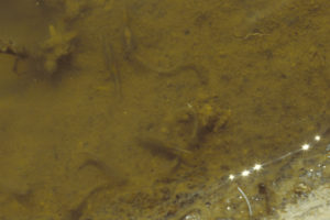
A few pale gray fairy shrimp in Wild Horse Rock Pool. Some are swimming normally with back side down and some are scraping the pond bottom with back side up. In this photograph, if you can see the eyes, the fairy shrimp is back side down. The fairy shrimp at the top of the photograph has eggs.
August 17, 2025
After finishing a backpacking trip to the Wind River Mountains to search for more fairy shrimp, I came to the Granite Mountains to collect GPS coordinates for the rock pools which I could previously locate only approximately on a map. I found the actual location of this rock pool is 85 m south-southwest of the previously estimated location. The coordinates in the spreadsheet on the Data page and the maps have been updated. More accurate coordinates may be helpful to anyone interested in comparing the ecology of Branchinecta packardi found in this pool with that of Branchinecta constricta found in Antelope Pocket Overlook Rock Pool, 1,900 m to the southeast.
- Dry, with hoof prints in dried mud.
- By pacing, I estimated the height and base of the triangular pool as 3.8 m by 5.3 m, compared to my August 18, 1987 estimates of 3.5 m by 5.5 m.
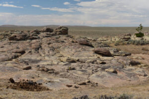
Wild Horse Rock Pool, looking northwest as in the August 16, 1987 photograph. A yellow 15-cm scale is propped against the rock at center. The rocks haven’t moved but now the pile of horse droppings is at left rather than at right, as in the previous photograph, and there is now a pine tree on the outcrop beyond the pool. After visiting this pool, I saw a larger group of horses than I had ever seen before near Tin Cup Mountain on the low ridge between Wild Horse Rock Pool and Hill 7122 Rock Pool.
Hill 7122 Rock Pool (Lander BLM Office)
Hill 7122 Rock Pool is 2 adjacent puddles in rock clefts just north of the top of the hill shown with a spot elevation of 7,122 feet (2,170 m) on the 7.5-minute topographic quadrangle. Hill 7,122 is out in the sagebrush 1,900 m (6,230′) northwest of the top of Tin Cup Mountain. It is about 1,600 m (5,250′) southwest of Wild Horse Rock Pool.
Small rock pools cannot be seen on the USGS imagery for The National Map so the location on the map above and in the data spreadsheet (on the Data page) could be off by 100 m (330′) due to poor topographic constraints.
For access, see Wild Horse Rock Pool. Follow the track around the west side of Tin Cup Mountain. After about 1.8 miles, look for a track to the west. If you see it, take it and stop at the closest approach to Hill 7122. If not, park and hike toward the low hill to the northwest.
Elevation: 2,166 m (7,106′)
August 16, 1987
Wild Horse Rock Pool was not a fluke, here’s another one.
- Each pool less than 3 m long; depth about 15 cm in deeper pool, 7 cm in shallower pool.
- Water is clear.
- Pale gray fairy shrimp less than 8 mm long; females lack conspicuous eggs; most fairy shrimp are scraping rock surfaces or the pond bottom with their legs.
- No other animals noted.
August 17, 2025
After finishing a backpacking trip to the Wind River Mountains to search for more fairy shrimp, I came to the Granite Mountains to collect GPS coordinates for the rock pools which I could previously locate only approximately on a map. I found the actual location of this rock pool is 24 m to the south of the previously estimated location. The coordinates in the spreadsheet on the Data page and the maps have been updated. The species in Hill 7122 Rock Pool was not previously identified but could be Branchinecta packardi like that in Wild Horse Rock Pool 1,600 m to the north, or Branchinecta constricta like that in Antelope Pocket Overlook Rock Pool 1,700 m to the east, or a different species.
- Although the western pool has 3 cm of water, the pool is effectively dry. After a long dry spell, thunderstorms dropped only 0.05″, or 1.3 mm, at Lander (even less at Riverton) yesterday and the day before. Even if some eggs hatched in such a small amount of water, the fairy shrimp couldn’t have grown to a visible size in a day or 2.
- By pacing, the western pool has dimensions of about 0.5 m by 2 m and the eastern pool 1.0 m by 2.3 m and both are at least 15 cm deep. They are separated by about 3 m.
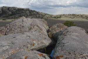
Hill 7122 Rock Pool, looking east with Tin Cup Mountain in background. A yellow 15-cm scale is on the left side of this western pool. Such a crack with 2 pools where water could collect made identification of 7122 Rock Pool easy. That it is at the top of the hill also helped.
West Tin Cup Summit Rock Pool (Lander BLM Office)
___This map is a screenshot of The National Map (Go to The National Map). The U.S. Geological Survey generally does not copyright or charge for its data or reports (unless printed). A pond location is indicated by an “X”, which corresponds to the coordinates given in the data spreadsheet. Labels in quotations are from 7.5-minute topographic quadrangles.
___As of April 2025, the National Grid overlay with red lines in UTM coordinates does not load in The National Map.
___There is no private land or state land on this map.
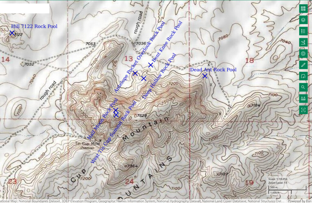
West Tin Cup Summit Rock Pool is on the south side of the western summit of Tin Cup Mountain 18.5 km (11.5 miles) north of Jeffrey City and 5 km (3 miles) east of the small reservoir on East Fork Long Creek, which has beaver and fish.
Although the rock pool cannot be seen on the USGS imagery for The National Map, the location is unlikely to be off by more than 50 m (160′) due to the topographic constraints.
For access, see Wild Horse Rock Pool. Follow the road from the Long Creek Ranch road around the west side of Tin Cup Mountain. After about 1.7 miles, look for a road that turns off to the south. If it’s passable, follow it. That road ends below a derelict mine shaft that was never productive. In the 1980s, there was an unoccupied trailer at the site. West Tin Cup Summit Rock Pool is a steep hike from there. The hike from Tin Cup Spring is longer but more varied. Tin Cup Spring can be reached by turning east off the Long Creek Ranch road just south of crossing the ridge southwest of Tin Cup Mountain. The meadow around Tin Cup Spring can be boggy in the spring.
Elevation: 2,287 m (7,503′)
August 18, 1987
I eventually got around to hiking up to the top of Tin Cup Mountain and, what do you know?, another rock pool.
- 2.5 m long; depth 7.5 cm.
- Water is clear; 18 C at 1640.
- At least 2 pale orange-brown fairy shrimp about 10 mm long; neither has conspicuous ovisac or antennae II; saw 4 more fairy shrimp in a nearby pool that was about the same size but shallower.
- No other animals noted.
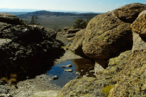
West Tin Cup Summit Rock Pool, looking west with the Wind River Mountains on the horizon. Long Creek Mountain is in the middle distance.
June 10, 1989
The ponds and “soda lakes” along the Sweetwater River were a mixed bag this year so how are the rock pools doing?
- Size not estimated but less than 5 m based on photograph; depth not estimated but more than the 7.5 cm on August 18, 1987.
- Water is clear.
- Several orange-brown fairy shrimp about 10 mm long; didn’t see eggs.
- No other animals noted.
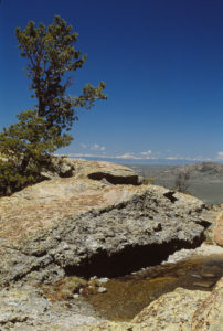
West Tin Cup Summit Rock Pool, again looking west with the Wind River Mountains on the horizon. Comparison to photograph West Tin Cup Summit Rock Pool 1987-08-18, #3517, indicates that the pond is bigger and the water is deeper now.
August 17, 2025
After finishing a backpacking trip to the Wind River Mountains to search for more fairy shrimp, I came to the Granite Mountains to collect GPS coordinates for the rock pools which I could previously locate only approximately on a map. I found the actual location of this rock pool is 33 m east of the previously estimated location. The coordinates in the spreadsheet on the Data page and the maps have been updated. The species in West Tin Cup Summit Rock Pool was not previously identified but could be Branchinecta packardi like that in Wild Horse Rock Pool 2,400 m to the northwest, or Branchinect constricta like that in Antelope Pocket Overlook Rock Pool 600 m to the northeast, or even Branchinecta paludosa like that in the Lankin Dome Summit Rock Pools.
- Dry.
- By pacing, the rock pool has dimensions of about 2 m by 4 m. The depth below the high-water mark is less than about 15 cm. These results are consistent with previous observations.
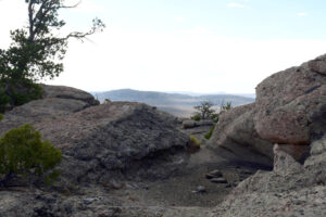
West Tin Cup Summit Rock Pool, looking west as in the August 18, 1987 photograph. Because there are several rock pools on top of Tin Cup Mountain, finding this one was difficult in spite of its location close to my previous estimate. However, the rocks on the bottom of the pool are the same as those in the August 18, 1987 photograph and the pine tree at left is also in the June 10, 1989 photograph.
Half Moon Rock Pool (Lander BLM Office)
West Tin Cup Summit Rock Pool map
Half Moon Rock Pool is close to the top of Tin Cup Mountain but west of the summit and West Tin Cup Summit Rock Pool. It is shaped like the moon in its first quarter to half phase.
Small rock pools cannot be seen on the USGS imagery for The National Map so the location on the map above and in the data spreadsheet (on the Data page) could be off by 100 m (330′) in spite of good topographic constraints due my poor description of the location.
For access, see West Tin Cup Summit Rock Pool.
Elevation: 2,273 m (7,459′)
August 18, 1987
No predicting where these pools occur.
- Less than 2 m long; depth less than 50 cm according to notes but possibly much less.
- Water is clear with brown tint.
- No fairy shrimp.
- No other animals noted.
August 17, 2025
After finishing a backpacking trip to the Wind River Mountains to search for more fairy shrimp, I came to the Granite Mountains to collect GPS coordinates for the rock pools which I could previously locate only approximately on a map. I found the actual location of this rock pool is 115 m east-northeast of the previously estimated location. The coordinates in the spreadsheet on the Data page and the maps have been updated. I did not previously find fairy shrimp in Half Moon Rock Pool but it is such a large pool that it has good potential.
- Dry.
- By pacing, the rock pool has dimensions of about 2.3 m by 3 m. Although the high-water mark appears to be only about 10 cm above the bottom, the hole is more than 30 cm deep.
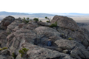
Half Moon Rock Pool, with Long Creek Mountain in the background. The rock pool is convex to the left, like a half moon. The great depth of the pool is illustrated by the daypack, which is 51 cm high.
Dead Ant Rock Pool (Lander BLM Office)
West Tin Cup Summit Rock Pool map
Dead Ant Rock Pool is 18.5 km (11.5 miles) north of Jeffrey City and about 1.7 km (1 mile) northeast of West Tin Cup Summit Rock Pool. It is by a granite knob on the ridge off the northeast end of Tin Cup Mountain. The water surface was covered with dead ants with wings when I first saw the pool.
Small rock pools cannot be seen on the USGS imagery for The National Map so the location on the map above and in the data spreadsheet (on the Data page) could be off by 100 m (330′) due to my poor location description.
For access, see Wild Horse Rock Pool. After looping around the north ridge of Tin Cup Mountain, continue driving to the southeast rather than turning to the north. Stop after about 0.7 mile, near where the road makes a sharp turn to the south.
Elevation: 2,181 m (7,157′)
August 19, 1987
This one seems more like a classic rock pool – just a round hollow partially filled with water in a massive hunk of rock.
- Nearly circular with diameter of 1.5 m; depth 9.5 cm.
- Water is clear with brown tint; 15.5 C at 1040.
- Pale orange-brown fairy shrimp of various sizes, all less than 10 mm long; no conspicuous ovisacs or antennae II; most are aggressively scraping the pond bottom with their legs.
- No other animals noted.
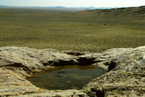
Dead Ant Rock Pool, looking southeast with Tin Cup Mountain off the right edge of the photograph and pointy granite hills north of the Sweetwater River on the horizon.
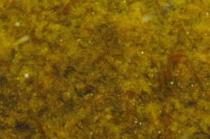
Numerous fairy shrimp in Dead Ant Rock Pool. They have a pale orange color. Dark food in the intestine looks like a backbone. Most of the individuals are scraping the pond bottom back side up. This makes it hard to tell if any have eggs. In the lower left corner of the photograph, there are 2 smaller fairy shrimp without dark intestines on opposite sides of a larger fairy shrimp with a prominent dark intestine. This suggests the presence of at least 2 generations that hatched at least a couple of days apart.
June 15, 1989
No dead ants this time. Looks like the pool could hold another 15 cm of water for a total depth of 23 cm.
- Size not estimated but certainly no more than 1.5 m given a shallower depth than in 1987; depth 8 cm.
- Water is clear with orange-brown tint.
- Abundant pale orange-brown fairy shrimp about 10 mm or less long; no eggs seen; most are scraping the pond bottom.
- No other animals noted.
June 22, 1989
The pool is about gone.
- Size not estimated but certainly less than 1 m considering the very shallow depth of 1.5 cm.
- Water is clear with orange-brown tint.
- Fairy shrimp still abundant; a few have eggs.
- No other animals noted.
The observed decrease in water level in Dead Ant Rock Pool over 8 days is consistent with what would be expected from pan evaporation data. The daily evaporation rate for the month of June at the class A evaporation pan at Pathfinder Dam is 0.7 mm/day (0.028″)(see “Pond Duration” on the About page). The dam is about 85 km (53 miles) east of Dead Ant Rock Pool at a somewhat lower elevation. At 0.7 mm/day, only about 5.6 cm (2.2″) would evaporate rather than the observed 6.5 cm (2.6″). Unlike the case for Wild Horse Rock Pool however, the difference is within the realm of what could be explained by water level measurement errors and wind effects or microclimatic factors. Significantly, Dead Ant Rock Pool is less likely to be used by horses because of the irregular, rocky terrain, although wildlife could have contributed to the decrease in water level. The not too distant agreement between the pan evaporation data and the observed decrease in water level in Dead Ant Rock Pool at least indicates that evaporation estimates based on pan evaporation data are not wildly inaccurate when applied to rock pools in the Granite Mountains.
May 8, 1992
I decided to collect some specimens here to help with identification of a possible new species, which is present in Antelope Pocket Overlook Rock Pool.
- Size not estimated but certainly less than 1.5 m given shallow depth; depth 4.5 cm.
- Clear to murky brown water; 14.5 C at 1940.
- Very abundant, pale orange fairy shrimp, “small” (according to notes); eggs not noted.
- Other animals not noted.
In an August 2, 1992 letter, DB suggested that these specimens, like those in Antelope Pocket Overlook Rock Pool, are a previously unrecognized species similar to Branchinecta lindahli. Rogers (2006) identified these fairy shrimp as the new species Branchinecta constricta after DB died.
August 17, 2025
After finishing a backpacking trip to the Wind River Mountains to search for more fairy shrimp, I came to the Granite Mountains to collect GPS coordinates for the rock pools which I could previously locate only approximately on a map. I found the actual location of this rock pool is 34 m northeast of the previously estimated location. The coordinates in the spreadsheet on the Data page and the maps have been updated. More accurate coordinates may be helpful to anyone interested in Branchinecta constricta, which was newly identified by Rogers (2006) from Denton Belk’s specimens at the National Museum, including those collected from Dead Ant Rock Pool on May 8, 1992.
- Although the pool has about 2 cm of water, it is effectively dry. After a long dry spell, thunderstorms dropped only 0.05″, or 1.3 mm, at Lander (even less at Riverton) yesterday and the day before. Even if some eggs hatched in such a small amount of water, the fairy shrimp couldn’t have grown to a visible size in a day or 2.
- Water-stained rock has dimensions of about 1.0 m by 1.0 m and a height of more than 15 cm. I previously estimated the dimensions as 1.5 m by 1.5 m but am confident that this is the same rock pool.
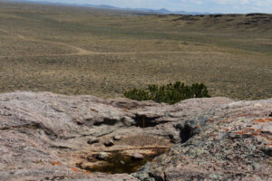
Dead Ant Rock Pool, looking southeast as in the August 19, 1987 photograph. A yellow 15-cm scale is in the shadow on the far side of the pool. The rocks on the bottom of the pool seem to have been rearranged since August 1987 but otherwise the resemblance in the photographs is very close.
Antelope Pocket Overlook Rock Pool (Lander BLM Office)
West Tin Cup Summit Rock Pool map
Antelope Pocket Overlook Rock Pool is less than 1 km (0.6 miles) northeast of West Tin Cup Summit Rock Pool. It is on the north side of Tin Cup Mountain just southeast of the knob on the ridge on the east side of Antelope Pocket. I saw a small herd of antelope watering in the embayment on the north side of Tin Cup Mountain one morning so I refer to the embayment as Antelope Pocket.
Small rock pools cannot be seen on the USGS imagery for The National Map so the location on the map above and in the data spreadsheet (on the Data page) could be off by 100 m (330′) due to my poor location description.
What’s a pocket? Many hills in the Granite Mountains have steep sides and deep embayments that give the impression of an amphitheater. The embayments have been called pockets by residents and visitors to the area, going all the way back to the emigrants on the Oregon-California Emigrant Trail. Some pockets have official names, such as Nolen Pocket north of Lankin Dome.
For access, see Wild Horse Rock Pool. The easiest route is to follow the road from the Long Creek Ranch road to the northeast around the west side of Tin Cup Mountain. After the road loops around the northern ridge of Tin Cup Mountain, stop rather than continuing to the T-junction on the route to Wild Horse Rock Pool. You are in Antelope Pocket. You may find a 2-track that goes southwestward into the middle of Antelope Pocket. That would take you a little closer to Antelope Pocket Overlook Rock Pool.
Elevation: 2,175 m (7,135′)
August 19, 1987
Climbing rock knobs for a view turns out to be a good way to look for rock pools.
- Size 0.5 m x 1.5 m; depth 10.5 cm.
- Water is clear with brown tint; 20 C at 1730.
- Abundant pale orange-brown fairy shrimp 8-10 mm long; some females have up to about 20 brown or pale orange-brown eggs filling a stubby ovisac less than 1/2 as long as the abdomen; many fairy shrimp are scraping the pond bottom with their legs.
- No other animals noted.
Specimens were identified as Branchinecta lindahli by DB (archive #DB-819). In a later August 13, 1991 letter, DB hypothesized that this is not B. lindahli but a previously unrecognized species.
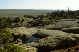
Antelope Pocket Overlook Rock Pool, on the ridge east of Antelope Pocket on the north side of Tin Cup Mountain. It doesn’t look like much but it is a bustling home for fairy shrimp.
June 10, 1989
Looks like the pool has plenty of water.
- Size not estimated but probably at least 1.5 m, the inferred size on June 15; depth not estimated.
- Water is clear.
- Several gray fairy shrimp about 14 mm long and fewer pale orange-brown fairy shrimp about 8 mm long; larger females have numerous white eggs.
- No other animals noted.
Under a microscope, the larger individuals look the same as the Branchinecta lindahli collected here in 1987 but the smaller ones look a little different. Could the smaller ones be Branchinecta packardi, like those collected from Wild Horse Rock Pool in 1987, or are they a more recent hatch of B. lindahli? Castle Gardens Storm Pond (Eastern Wind River Basin) had both B. lindahli and B. packardi.
June 15, 1989
The water is barely cool to the touch and all of the fairy shrimp are swimming in the shade. It looks like the pool could hold about 6 cm more water before overflowing.
- Size not estimated but probably about 1.5 m considering same depth as 1987; depth about 10 cm.
- Water is clear.
- Still 2 size classes of fairy shrimp and they aren’t much bigger – about 14 mm and 10 mm; larger and smaller females have eggs.
- No other animals noted.
All the specimens were identified as Branchinecta lindahli by DB (archive #DB-851) so my B. packardi speculation was wrong. In a later August 13, 1991 letter, DB hypothesized that this is not B. lindahli but a previously unrecognized species.
May 8, 1992
There is not much water but there’s lots of algae in the water and on the pond bottom.
- Size not estimated but certainly less than 1.5 m considering the depth of 4.5 cm, which is shallower than in 1989.
- Water is murky green; 14.5 C at 1900.
- Numerous small pale orange to large pale gray fairy shrimp, 8-15 mm long; eggs not noted.
- Other animals not noted.
Following on his hypothesis in the August 13, 1991 letter, DB suggested in an August 2, 1992 letter that these specimens are a previously unrecognized species similar to B. lindahli. Rogers (2006) identified these fairy shrimp as the new species Branchinecta constricta after DB died.
August 17, 2025
After finishing a backpacking trip to the Wind River Mountains to search for more fairy shrimp, I came to the Granite Mountains to collect GPS coordinates for the rock pools which I could previously locate only approximately on a map. I found the actual location of this rock pool is 24 m to the northwest of the previously estimated location. The coordinates in the spreadsheet on the Data page and the maps have been updated. More accurate coordinates may be helpful to anyone interested in Branchinecta constricta, which was newly identified by Rogers (2006) from Denton Belk’s specimens at the National Museum. Antelope Pocket Overlook Rock Pool is the type locality for the species.
- Although damp, the pool is effectively dry. After a long dry spell, thunderstorms dropped only 0.05″, or 1.3 mm, at Lander (even less at Riverton) yesterday and the day before.
- Water-stained rock in the pool has dimensions of about 0.6 m by 1.0 m and a height of something like 15 cm.
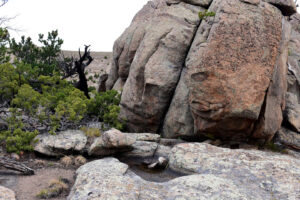
Antelope Pocket Overlook Rock Pool was easy to find because of the granite knob behind it, which provides the overlook for Antelope Pocket. However, that makes this view in the opposite direction as the previous photograph. A yellow 15-cm scale is on the right side of the pool.
North “Bucklin Reservoir” (Lander BLM Office)
The “Bucklin Reservoirs” are along Wyoming 220 7 km (4.3 miles) northeast of Muddy Gap and about 104 km (64 miles) southwest of Casper. One of the reservoirs is southeast of the highway and North “Bucklin Reservoir” is northwest of the highway. On the 1:100,000-scale BLM map, the reservoir is perennial and 600 m by 300 m (1,970′ x 980′).
North “Bucklin Reservoir” is less than 100 m from Wyoming 220 about 4 miles northeast of the junction of Wyoming 220 with US 287 at Muddy Gap.
Elevation: 1,880 m (6,167′)
May 30, 1989
It’s so close to the highway, why not stop?
- Size and depth not estimated.
- Water clarity not noted.
- No fairy shrimp.
- No other animals noted.
“Beulah Belle Lake” (private)
___This map is a screenshot of The National Map (Go to The National Map). The U.S. Geological Survey generally does not copyright or charge for its data or reports (unless printed). A pond location is indicated by an “X”, which corresponds to the coordinates given in the data spreadsheet. Labels in quotations are from 7.5-minute topographic quadrangles.
___Red lines are the U. S. National Grid with a spacing of 1,000 m and intersection labels consisting of the UTM zone (e.g., 11S, 12T), a 2-letter 100-km square designation (e.g., LC, XN), and a 4-digit number. The first 2 digits of the number represent the 1,000-meter Easting and the second 2 digits the 1,000-meter Northing, as seen in the example Easting and Northing. Unlike latitude and longitude, the National Grid is rectilinear on a flat map, the units of abscissa and ordinate have equal lengths, and the units (meters) are measurable on the ground with a tape or by pacing.
___Gray shading represents private land as traced from the PAD-US 2.0 – Federal Fee Managers layer of The National Map. Other lands are public or owned by the State of Wyoming. “Steamboat Lake” is on the Pathfinder National Wildlife Refuge.
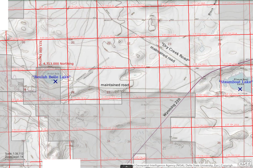
“Beulah Belle Lake” is 4.5 km (2.5 miles) west of the junction of Wyoming 220 and Dry Creek Road and 75 km (47 miles) southwest of Casper. It is an odd feature. It is almost perfectly circular and has no inlet or outlet and yet is perennial. It is only 500 m (1,640′) from Dry Creek. Does it receive ground water recharge from the creek? On the 1:100,000-scale BLM map, the pond is 600 m (1,970′) across.
“Beulah Belle Lake” is on private land and there is a ranch at the end of the road.
For access, turn off Wyoming 220 at Dry Creek Road. This intersection is about 4.3 miles east of the turn-off to Independence Rock. Instead of driving northwest on the Dry Creek Road, take the road that goes due west and drive 3 1/2 miles to the ranch to ask permission and 1/2 mile back to the lake.
Elevation: 1,837 m (6,027′)
May 30, 1989
There was actually somebody at the ranch and I got permission so I hope there are fairy shrimp.
- 500 m x 600 m based on the 1:100,000-scale BLM map; depth not estimated.
- Clear water.
- No fairy shrimp
- Amphipods, tiny beetles, cladocerans.
“Jackson Lake” (Lander BLM office)
“Jackson Lake” is a perennial lake 14 km (9 miles) northeast of Muddy Gap and 18 km (11 miles) west of Independence Rock. It is fed by Whiskey Creek. On the 1:100,000-scale BLM map, the pond has a triangular shape with a base of 500 m and altitude of 800 m. It is only 1,700 m (5,580′) from the Sweetwater River channel to the north.
“Jackson Lake” is on public land just south of the ranches along the Sweetwater River. Nonetheless, ranchers driving along the road may be curious about your activities.
For access, turn off Wyoming 220 8.2 miles northeast of the junction with US 287 north of Muddy Gap and about 10.5 miles southwest of the turn-off to Independence Rock. Follow a maintained ranch access road to the northwest for about 2.7 miles. The road bends to a westerly direction north of the lake.
Elevation: 1,842 m (6,043′)
June 7, 1989
The pond has lots of water but the current level looks like it is about 1 m (3.3′) below the high-water line. The pond has a sandy bottom. There are rushes in places along the shore.
- 500 m x 800 m based on the 1:100,000-scale BLM map; depth not estimated.
- Clear water.
- No fairy shrimp
- Backswimmers (sub-order Heteroptera, family Notonectidae), big beetles, small amphipods, lots of cladocerans.
Rawlins Draw “Soda Lake” (private)
___This map is a screenshot of The National Map (Go to The National Map). The U.S. Geological Survey generally does not copyright or charge for its data or reports (unless printed). A pond location is indicated by an “X”, which corresponds to the coordinates given in the data spreadsheet. Labels in quotations are from 7.5-minute topographic quadrangles.
___Red lines are the U. S. National Grid with a spacing of 1,000 m and intersection labels consisting of the UTM zone (e.g., 11S, 12T), a 2-letter 100-km square designation (e.g., LC, XN), and a 4-digit number. The first 2 digits of the number represent the 1,000-meter Easting and the second 2 digits the 1,000-meter Northing, as seen in the example Easting and Northing. Unlike latitude and longitude, the National Grid is rectilinear on a flat map, the units of abscissa and ordinate have equal lengths, and the units (meters) are measurable on the ground with a tape or by pacing.
___Gray shading represents private land as traced from the PAD-US 2.0 – Federal Fee Managers layer of The National Map. Other lands are public or owned by the State of Wyoming.
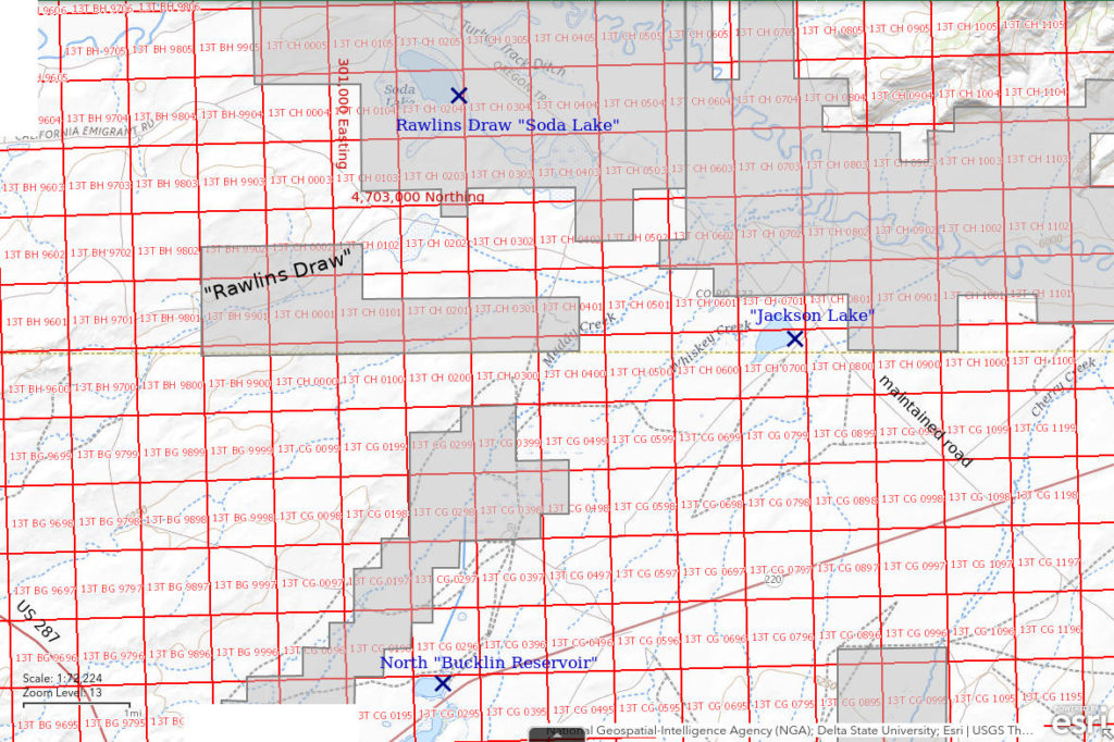
Rawlins Draw “Soda Lake” is a large intermittent lake 600 m (1,970′) south of the Sweetwater River channel 14 km (9 miles) north of Muddy Gap. Its dimensions are approximately 1,700 m x 1,100 m (5,580′ x 3,610′) on the 1:100,000-scale BLM map. There is a slightly smaller, ephemeral lake about 1 km to the southeast of it. To avoid confusion with other soda lakes in the region, the name Rawlins Draw is prefixed to this one as it is near the lower terminus of Rawlins Draw, which does not, however, reach the lake according to the 1:100,000-scale BLM map.
For access, see “Jackson Lake”. Continue to the west from “Jackson Lake” for 2 miles to an intersection. The road north from the intersection goes 2.8 miles to the ranch where you can ask for permission. Rawlins Draw “Soda Lake” is 300 m from this road just before you get to the ranch.
Elevation: 1,846 m (6,057′)
June 7, 1989
The large ephemeral lake 1.5 km southeast of Rawlins Draw “Soda Lake” was dry. There was no one at the ranch past Rawlins Draw “Soda Lake” when I stopped there. I was hopeful that the ranchers wouldn’t be too concerned if they came back and saw me walking around the lake. Maybe they would even be interested in learning about fairy shrimp. [Note to reader: Don’t assume my optimism was justified.]
- 1,100 m x 1,700 m based on the 1:100,000-scale BLM map; depth less than 10 cm.
- Cloudy whitish-gray water.
- Abundant, reddish fairy shrimp with sizes of 3-4 mm or 5-7 mm; many are paired; some females have eggs.
- Avocets, gulls.
Specimens were identified as the genus Artemia by DB but species names were being revised at the time.
View to the north across Rawlins Draw “Soda Lake” (in the middle distance). This illustrates the very low relief of the Sweetwater River flood plain. Hills of granite that give the Granite Mountains its name are in the background.
“Steamboat Lake” 2nd East Pond (Pathfinder National Wildlife Refuge)
“Steamboat Lake” 2nd East Pond is 40 km (25 miles) northeast of Muddy Gap in Pathfinder National Wildlife Refuge west of Pathfinder Reservoir. It is 8 km (4.8 miles) northeast of Independence Rock and 3 km (1.9 miles) southeast of the intersection of Dry Creek Road with Wyoming 220. It is the 2nd large pond east of “Steamboat Lake”. “Steamboat Lake” is named for Steamboat Rock, 4 km (2.5 miles) to the northeast. Steamboat Rock was a landmark for the emigrants on the California-Oregon Emigrant Trail, which passes within about 400 m (1,310′) of “Steamboat Lake” 2nd East Pond. The dimensions of the pond are approximately 500 m x 300 m (1,640′ x 980′) on the 1:100,000-scale BLM map.
There are a couple of alternatives for access. One is to park on the Dry Creek Road where it meets Wyoming 220 and walk 3,000 m (9,840′) past “Steamboat Lake” to the pond. Another is to turn southeast off Wyoming 220 1.7 miles southwest of the Dry Creek Road intersection and 2.5 miles northeast of Independence Rock. At 2 miles, this road crosses the Oregon-California Emigrant Trail and Pony Express route. Walking the the Trail to the northeast across state and public land for about 3,300 m (10,830′) would bring you to the vicinity of “Steamboat Lake” 2nd East Pond.
Elevation: 1,787 m (5,863′)
June 7, 1989
It was a nice walk up the Emigrant Trail and here’s a pond that looks promising. There are avocets.
- 300 m x 500 m based on the 1:100,000-scale BLM map; depth not estimated.
- Cloudy pale gray water; 22 C at 1925.
- Water is boiling with reddish fairy shrimp with sizes of 6-7 mm or about 10 mm; many are paired, saw 1 female with 2 males hanging on; ovisacs are stuffed with whitish eggs.
- Avocets, phalaropes.
Specimens were identified as the genus Artemia by DB but species names were being revised at the time.
Looking northwest across “Steamboat Lake” 2nd East Pond. Southeastern tip of “Steamboat Lake” 1st East Pond” is at extreme left. The fence in the foreground is probably the boundary of the Pathfinder National Wildlife Refuge. It is a cattle fence, not a people fence.
“Steamboat Lake” 2nd East Pond with several avocets at the water’s edge.
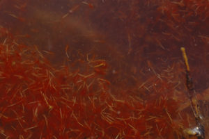
A churning mass of fairy shrimp in “Steamboat Lake” 2nd East Pond. The gray or yellowish BB-size features on some fairy shrimp are ovisacs stuffed with eggs. The red color is due to abundant hemoglobin, possibly as a result of infection by cestode parasites (e.g. Sanchez and others, 2016; see References page).
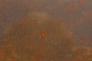
A single male fairy shrimp swimming above the masses in “Steamboat Lake” 2nd East Pond.
“Steamboat Lake” Oxbow Pond (Pathfinder National Wildlife Refuge)
“Steamboat Lake” Oxbow Pond is west of “Steamboat Lake” 2nd East Pond. It has a curved shape suggestive of an oxbow bend in a river. Its most likely location is the 90 m (300′) long intermittent pond shown on the 7.5-minute topographic quadrangle about 200 m (660′) west of “Steamboat Lake” 2nd East Pond and south of “Steamboat Lake” 1st East Pond. It is possible it is a pond to the northwest on the 7.5-minute quadrangle or that it is not shown on the quadrangle.
There is disagreement between the 7.5-minute quadrangle and the 1:100,000-scale BLM map on the boundary of the Pathfinder National Wildlife in this area. The 7.5-minute quadrangle places the southern boundary about 1/4 mile (400 m) north of the southern boundary of section 30 (Township 30 North, Range 85 West). If that is correct, “Steamboat Lake” Oxbow Pond is outside the refuge as is the western half of “Steamboat Lake” 2nd East Pond. The more recent 1:100,000-scale BLM map places the boundary at the southern boundary of section 30 and “Steamboat Lake” Oxbow Pond and all of “Steamboat Lake” 2nd East Pond within the refuge. The position of the fence in photograph “Steamboat Lake” 2nd East Pond 1989-06-07, #0216, suggests the 1:100,000-scale BLM map is right.
For access, see “Steamboat Lake” 2nd East Pond. Look for a small, curved pond west of “Steamboat Lake” 2nd East Pond.
Elevation: 1,787 m (5,863′)
June 7, 1989
A small, foul-smelling pond but why not?
- 20 m x 60 m; depth not estimated.
- Murky orange-brown water; 22 C at 1920.
- Pale gray fairy shrimp 13-15 mm; females may be smaller and darker than males; most females have eggs.
- Lots of cladocerans, wriggly larvae, avocets, phalaropes.
Specimens were identified as Branchinecta campestris by DB. Rogers (2006) identified these fairy shrimp as the new species Branchinecta lateralis after DB died.
“Steamboat Lake” 1st East Pond (Pathfinder National Wildlife Refuge)
“Steamboat Lake” 1st East Pond is in Pathfinder National Wildlife Refuge northwest of “Steamboat Lake” 2nd East Pond and immediately southeast of “Steamboat Lake”. On the 7.5-minute topographic quadrangle, it has an irregular shape and is connected to “Steamboat Lake”. The pond was not connected to “Steamboat Lake” at the time of the only visit. “Steamboat Lake” 1st East Pond is up to 750 m x 250 m (2,460′ x 820′) on the 7.5-minute quadrangle but the observed pond was smaller and split into 2 parts.
For access, see “Steamboat Lake” 2nd East Pond. “Steamboat Lake” 1st East Pond is the big pond northwest of “Steamboat Lake” 2nd East Pond. Alternatively, it is the first big pond southeast of “Steamboat Lake”.
Elevation: 1,787 m (5,863′)
June 7, 1989
Good luck so far and 2 different species so what will I find here?
- Size and depth not estimated.
- Water clarity not noted.
- No fairy shrimp.
- Other animals not noted.
The presence of fairy shrimp in “Steamboat Lake”, “Steamboat Lake” 2nd East Pond, and “Steamboat Lake” Oxbow Pond, suggests that they are also present in “Steamboat Lake” 1st East Pond although I didn’t see them.
“Steamboat Lake” (Pathfinder National Wildlife Refuge)
___This map is a screenshot of The National Map (Go to The National Map). The U.S. Geological Survey generally does not copyright or charge for its data or reports (unless printed). A pond location is indicated by an “X”, which corresponds to the coordinates given in the data spreadsheet. Labels in quotations are from 7.5-minute topographic quadrangles.
___Red lines are the U. S. National Grid with a spacing of 1,000 m and intersection labels consisting of the UTM zone (e.g., 11S, 12T), a 2-letter 100-km square designation (e.g., LC, XN), and a 4-digit number. The first 2 digits of the number represent the 1,000-meter Easting and the second 2 digits the 1,000-meter Northing, as seen in the example Easting and Northing. Unlike latitude and longitude, the National Grid is rectilinear on a flat map, the units of abscissa and ordinate have equal lengths, and the units (meters) are measurable on the ground with a tape or by pacing.
___Gray shading represents private land as traced from the PAD-US 2.0 – Federal Fee Managers layer of The National Map. Other lands are public or owned by the State of Wyoming. The dash-dot line indicates the boundary of the Pathfinder National Wildlife Refuge.
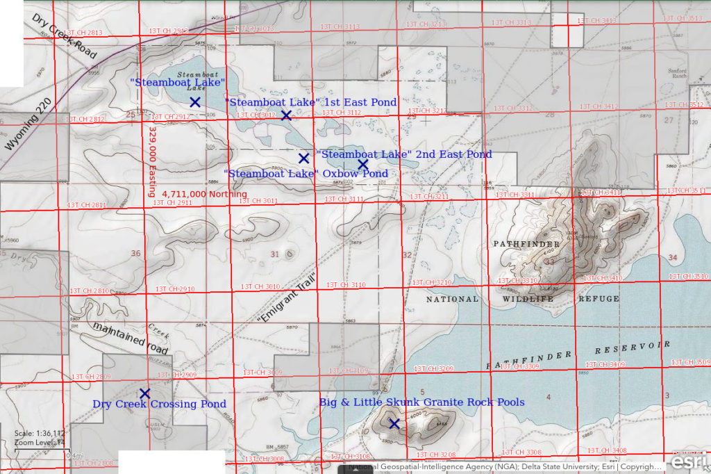
“Steamboat Lake” is at the extreme northwestern end of Pathfinder National Wildlife Refuge 70 km (43 miles) southwest of Casper. It is 700 m (2,300′) east of the intersection of Dry Creek Road and Wyoming 220 and 7 km (4 miles) northeast of Independence Rock. On the 1:100,000-scale BLM map, it has dimensions of 1,100 m by 500 m (3,610′ x 1,640′).
The shortest route to “Steamboat Lake” would be to park off Wyoming 220 at the intersection with Dry Creek Road and walk from there. One could also reach the lake by hiking up the California-Oregon Emigrant Trail as for “Steamboat Lake” 2nd East Pond.
Elevation: 1,787 m (5,863′)
June 7, 1989
The sun is sinking and the murderous gnats and mosquitoes haven’t let up but there is one more pond to check.
- 500 m x 1,100 m based on the 1:100,000-scale BLM map; depth not estimated.
- Murky brown water; 19 C at 1950.
- Caught lots of fairy shrimp in the net although it’s too dark to see them in the water; lengths are 8-12 mm but one is 5 mm; no eggs.
- Other animals not noted.
Specimens were identified as Branchinecta campestris by DB. Rogers (2006) identified these fairy shrimp as the new species Branchinecta lateralis after DB died.
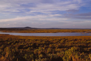
Looking north across the east end of “Steamboat Lake” as the sun sinks slowly in the west. I think the bump in the distance is Black Rock Mountain.
Big Skunk Granite Rock Pool (Pathfinder National Wildlife Refuge)
Big Skunk Granite Rock Pool is 38 km (24 miles) northeast of Muddy Gap on the hill of granite south of the west end of Pathfinder Reservoir. It is 7 km (4 miles) east of Independence Rock. The hill of granite with the rock pool has a spot elevation of 6,169 feet (1,880 m) on the 7.5-minute topographic quadrangle and is within Pathfinder National Wildlife Refuge. Big Skunk Granite Rock Pool and Little Skunk Granite Rock Pool are between the 2 western summits of the hill. I saw a skunk while hiking up the hill.
Although the rock pool cannot be seen on the USGS imagery for The National Map, the location is unlikely to be off by more than 50 m due to the topographic constraints.
To reach the rock pool, turn southeast off Wyoming 220 onto a maintained road 1.7 miles southwest of the Dry Creek Road intersection and 2.5 miles northeast of Independence Rock. At 2 miles, this road crosses the Oregon-California Emigrant Trail. After another mile or so, the road crosses the Sweetwater River. About 1/2 mile east of the Sweetwater River crossing, the road turns to the southeast. The granite hill is 1,200 m (3,940′) northeast of this turn.
Elevation: 1,845 m (6,052′)
June 8, 1989
Rock pools are so unpredictable that I don’t go looking for them. In this case, I thought I would get a good view of the California-Oregon Emigrant Trail and Independence Rock from the top. It would normally be a good view of Pathfinder Reservoir too but this year the western end of the reservoir is dry, already in June.
- 3 m x 5 m; depth less than 20 cm.
- Clear water with slight brown tint; 21 C at 1120.
- Pale gray male and reddish female fairy shrimp 6-8 mm long; some females have pale brown eggs, some have white eggs.
- Small, round, brown beetles; dytiscid larvae (order Coleoptera, family Dytiscidae).
Specimens were identified as Branchinecta lindahli by DB (archive #DB-946).
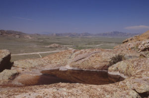
View to the southwest across Big Skunk Granite Rock Pool. The low whaleback of granite above the darker trees and below the distant hills above and slightly to the right of center is Independence Rock, which is an important landmark on the Oregon-California Emigrant Trail. The bridge at center is over the Sweetwater River.
3 fairy shrimp swimming in Big Skunk Granite Rock Pool.
Little Skunk Granite Rock Pool (Pathfinder National Wildlife Refuge)
Little Skunk Granite Rock Pool is only 3 m (10′) south of Big Skunk Granite Rock Pool. Little Skunk Granite Rock Pool is smaller but deeper than Big Skunk Granite Rock Pool. It would last longer and might have a different species so I decided to describe it separately. Both are between the 2 western summits of the hill with spot elevation 6,169 feet (1,880 m) on the 7.5-minute quadrangle and within Pathfinder National Wildlife Refuge.
Although the rock pool cannot be seen on the USGS imagery for The National Map, the location is unlikely to be off by more than 50 m (165′) due to the good topographic constraints.
For access, see Big Skunk Granite Rock Pool.
Elevation: 1,845 m (6,052′)
June 8, 1989
Rock pools are the perfect habitat for humans to find fairy shrimp in. The water is clear, there is no mud to wade through, there is nowhere for fairy shrimp to hide, and the entire pool can be searched in a few glances. And it is startling that what seems like a low probability event, evidently isn’t. How do they do it?
- 0.5 m x 1 m; depth up to 25 cm.
- Clear water with slight brown tint.
- Pale gray fairy shrimp 10 mm long; some females have pale brown eggs, some have white eggs; there is a dead male.
- 2 small beetles.
Specimens were identified as Branchinecta lindahli by DB (archive #DB-947).
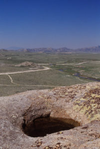
Looking southwest across Little Skunk Granite Rock Pool in essentially the same view as for photograph Big Skunk Granite Rock Pool 1989-06-08, #0222.
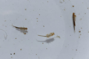
Male (center) and 2 female fairy shrimp with eggs from Little Skunk Granite Rock Pool swimming in white container. The 1/125-second shutter speed caught the legs of the male in action.
Dry Creek Crossing Pond (private)
Dry Creek Crossing Pond is 3.5 km (2.2 miles) south of “Steamboat Lake” and 4.6 km (3 miles) northeast of Independence Rock. It is in a small depression 500 m (1,640′) southwest of where the California-Oregon Emigrant Trail crosses the ephemeral channel of Dry Creek. On the 7.5-minute topographic quadrangle, it is marked by a 190 m x 290 m (620′ x 950′) stipple pattern.
Dry Creek Crossing Pond is on private land in an area with a complex mixture of private, state, and public land. I have read of many people hiking or riding the Emigrant Trail so I assumed that local landowners would not be upset if they saw me near the trail, which the pond is. Landowners whom I had previously asked for permission to hike the trail east of South Pass did not seem concerned about hikers but the landowners here could have different views.
For access, turn southeast off Wyoming 220 onto a maintained road 1.7 miles southwest of the Dry Creek Road intersection and 2.5 miles northeast of Independence Rock. At 2 miles, the road crosses the Oregon-California Emigrant Trail. The pond is about 300 m (980′) southwest of this intersection.
Elevation: 1,784 m (5,854′)
June 8, 1989
The pond is almost dried up. The water is very shallow and newly precipitated minerals are gleaming in the sun on mounds in the pond and along the shoreline. This may be one of the “saleratus lakes” mentioned in emigrant diaries, where the emigrants scraped up sodium bicarbonate for leavening bread.
- Size and depth not estimated.
- Clear orange-brown water.
- No fairy shrimp.
- No animals in the water but numerous flies (alkali flies?) on the surface, phalaropes.
“Piaya Lake” (private)
___This map is a screenshot of The National Map (Go to The National Map). The U.S. Geological Survey generally does not copyright or charge for its data or reports (unless printed). A pond location is indicated by an “X”, which corresponds to the coordinates given in the data spreadsheet. Labels in quotations are from 7.5-minute topographic quadrangles.
___Red lines are the U. S. National Grid with a spacing of 1,000 m and intersection labels consisting of the UTM zone (e.g., 11S, 12T), a 2-letter 100-km square designation (e.g., LC, XN), and a 4-digit number. The first 2 digits of the number represent the 1,000-meter Easting and the second 2 digits the 1,000-meter Northing, as seen in the example Easting and Northing. Unlike latitude and longitude, the National Grid is rectilinear on a flat map, the units of abscissa and ordinate have equal lengths, and the units (meters) are measurable on the ground with a tape or by pacing.
___Gray shading represents private land as traced from the PAD-US 2.0 – Federal Fee Managers layer of The National Map. Other lands are public or owned by the State of Wyoming.
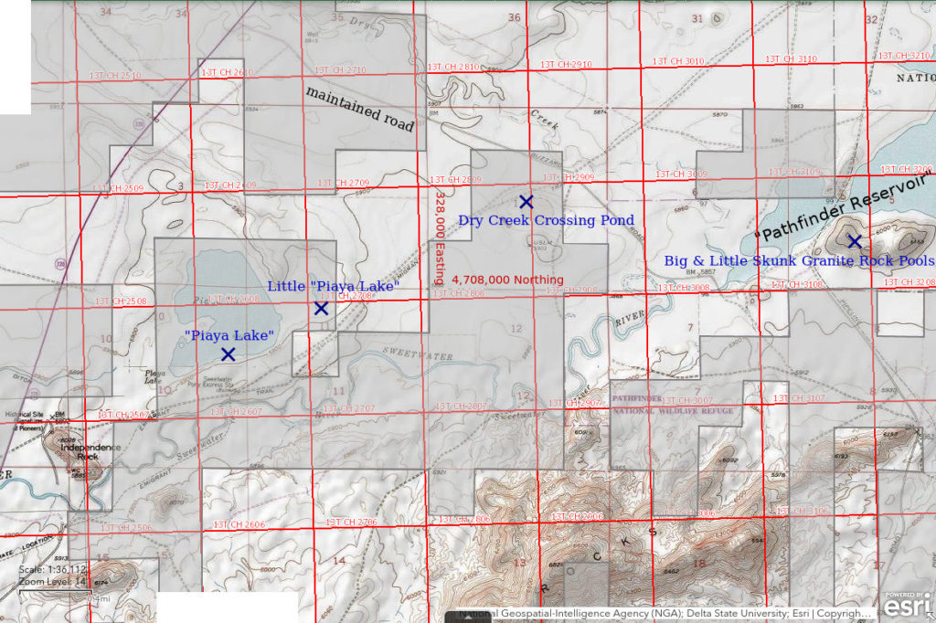
“Piaya Lake” is 33 km northeast of Muddy Gap. It is between Wyoming 220 and the Oregon-California Emigrant Trail 1,200 m (3,940′) northeast of Independence Rock. It has a size of about 1,000 m x 800 m (3,280′ x 2,620′) on the 1:100,000-scale BLM map and is shown with a perennial lake symbol. “Piaya” looks like a misspelling of “playa” but that is the name on the map. It may reflect actual local usage.
“Piaya Lake” is enclosed by private land. However, the southern shore is within 300 m (980′) of the California-Oregon Emigrant Trail.
“Piaya Lake” can be reached by a short hike on the California-Oregon Emigrant Trail from the north end of Independence Rock. Independence Rock is off Wyoming 220 19 miles east of the intersection with US 287 north of Muddy Gap.
Elevation: 1,792 m (5,878′)
June 8, 1989
I assumed local landowners would not be too concerned if they saw me on foot near the lake because of the common foot and hoof traffic along the Emigrant Trail. [Note to reader: Don’t assume my optimism was justified.] Some mineral encrustations along the shoreline indicate this is a high-TDS pond. Rushes are growing along most of the shore.
- 800 m x 1,000 m based on the 1:100,000-scale BLM map; depth not estimated.
- Clear water but murky with abundant green algae; 21 C at 1445.
- Water is red with fairy shrimp; possibly 2 size classes of 6-8 mm and 4-5 mm; no eggs.
- Avocets, phalaropes.
Specimens were identified as the genus Artemia by DB but species names were being revised at the time.
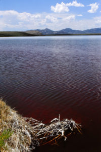
The dark red color of the water in “Piaya Lake” is due to abundant fairy shrimp. The bare rock in the sun beyond the shadowed slope at left is the north end of Independence Rock, a landmark on the Oregon-California Emigrant Trail.
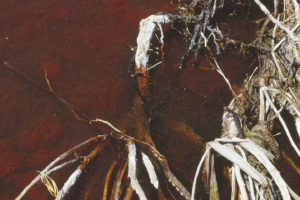
A closer look at the water in “Piaya Lake” teeming with red fairy shrimp. The abundant red hemoglobin in the fairy shrimp may be due to parasites (e.g., Sanchez and others, 2016; see References page). What is the significance of a hatch this prolific? Some insect species use the you-can’t-eat-us-all hatching strategy as a defense against predators but the only predators here seem to be maybe dozens of avocets and phalaropes. Is there enough food to support this many fairy shrimp for several more days or weeks or is a population collapse part of the plan?
Little “Piaya Lake” (private)
Little “Piaya Lake” is 300 m (980′) east of “Piaya Lake” and about 2,700 m (3,940′) northeast of Independence Rock. It is much smaller than “Piaya Lake” and has dimensions of 450 m and 150 m (1,480′ x 490′) on the 1:100,000-scale BLM map. It is shown with a perennial lake symbol.
Little “Piaya Lake” is in the same block of private land that surrounds “Piaya Lake” and is about the same distance from the Emigrant Trail.
For access, see Piaya Lake. Little “Piaya Lake” can also be reached from the northeast by continuing along the California-Oregon Emigrant Trail for about 2.5 km (1.5 miles) from the Dry Creek crossing (see Dry Creek Crossing Pond.
Elevation: 1,796 m (5,893′)
June 8, 1989
As I hadn’t asked for permission to hike across the private land, it’s possible ranchers could approach me and ask me what I was doing. If that happened, maybe I could entertain them with stories of the fairy shrimp I had just seen in “Piaya Lake”. [Note to reader: Don’t assume my optimism was justified.] Little “Piaya Lake” looks quite different from “Piaya Lake” in spite of its close proximity. The water is almost white. There are lots of rushes around the edges but negligible mineral efflorescence.
- 150 m x 450 m based on the 1:100,000-scale BLM map; depth not estimated.
- Cloudy grayish-white water.
- Abundant fairy shrimp 4-8 mm; range of sizes suggests multiple or continuous hatching; larger females have eggs.
- No other animals noted.
Specimens were identified as the genus Artemia by DB but species names were being revised at the time.
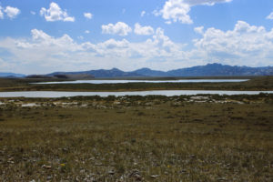
Looking southwest across Little “Piaya Lake” (below) and “Piaya Lake” (above). The whaleback-like bare granite of Independence Rock is to the left of center.
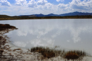
The southern shore of Little “Piaya Lake”, looking southwest. Fairy shrimp are abundant here, too, but are difficult to see because of the opaque water. I haven’t read of Artemia in opaque water; is this occurrence significant? Independence Rock is in the photograph but is poorly visible.
Beaver Divide “Dry Lakes” (Lander BLM Office)
___This map is a screenshot of The National Map (Go to The National Map). The U.S. Geological Survey generally does not copyright or charge for its data or reports (unless printed). A pond location is indicated by an “X”, which corresponds to the coordinates given in the data spreadsheet. Labels in quotations are from 7.5-minute topographic quadrangles.
___Red lines are the U. S. National Grid with a spacing of 1,000 m and intersection labels consisting of the UTM zone (e.g., 11S, 12T), a 2-letter 100-km square designation (e.g., LC, XN), and a 4-digit number. The first 2 digits of the number represent the 1,000-meter Easting and the second 2 digits the 1,000-meter Northing, as seen in the example Easting and Northing. Unlike latitude and longitude, the National Grid is rectilinear on a flat map, the units of abscissa and ordinate have equal lengths, and the units (meters) are measurable on the ground with a tape or by pacing.
___Gray shading represents private land as traced from the PAD-US 2.0 – Federal Fee Managers layer of The National Map. Other lands are public or owned by the State of Wyoming.
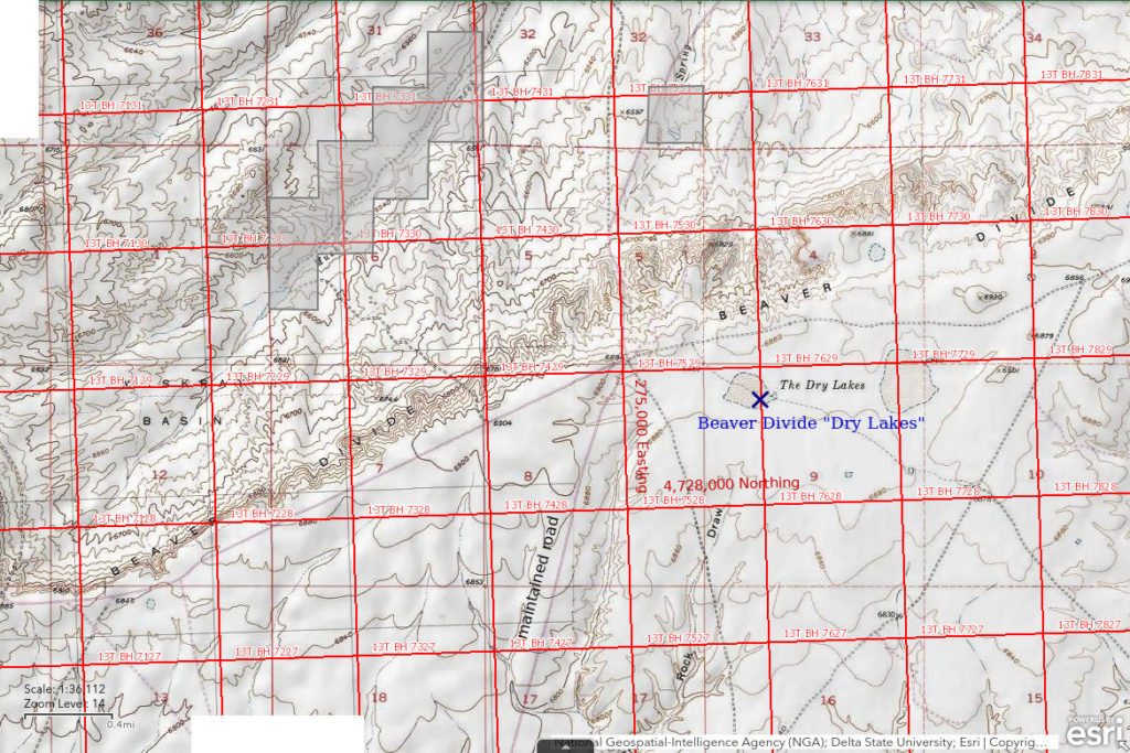
Beaver Divide “Dry Lakes” are 21.5 km (13 miles) north of Jeffrey City on the Beaver Divide overlooking the Wind River Basin. Beaver Divide, or Beaver Rim, is an escarpment at the southern edge of the Wind River Basin which separates flows into the Wind River from flows into the Sweetwater River. On the 1:100,000-scale BLM map, the name “Beaver Divide” is continued about 55 km (34 miles) to the east of the actual Beaver Creek drainage, presumably to conform to local usage. 2 stippled areas are labeled “The Dry Lakes” on the 1:100,000-scale BLM map. They are 300 m (980′) and 450 m (1,480′) across and separated by about 800 m (2,620′).
Beaver Divide “Dry Lakes” are easy to reach from US 287 at Jeffrey City. Take the main road north out of Jeffrey City and drive 14 miles to the edge of Beaver Divide. There, the main road intersects an unimproved that follows the crest of the divide. The western pond is 800 m (2,620′) east of the intersection. The road north from Jeffrey City was previously used to provide access to the uranium mines of the Gas Hills District and was well maintained into the 1990s.
Elevation: 2,098 m (6,882′)
June 8, 1989
Nice breeze along Beaver Divide.
- Dry.
Eastern “Soda Lake” (Lander BLM Office and State of Wyoming)
___This map is a screenshot of The National Map (Go to The National Map). The U.S. Geological Survey generally does not copyright or charge for its data or reports (unless printed). A pond location is indicated by an “X”, which corresponds to the coordinates given in the data spreadsheet. Labels in quotations are from 7.5-minute topographic quadrangles.
___Red lines are the U. S. National Grid with a spacing of 1,000 m and intersection labels consisting of the UTM zone (e.g., 11S, 12T), a 2-letter 100-km square designation (e.g., LC, XN), and a 4-digit number. The first 2 digits of the number represent the 1,000-meter Easting and the second 2 digits the 1,000-meter Northing, as seen in the example Easting and Northing. Unlike latitude and longitude, the National Grid is rectilinear on a flat map, the units of abscissa and ordinate have equal lengths, and the units (meters) are measurable on the ground with a tape or by pacing.
___Gray shading represents private land as traced from the PAD-US 2.0 – Federal Fee Managers layer of The National Map. Other lands are public or owned by the State of Wyoming.
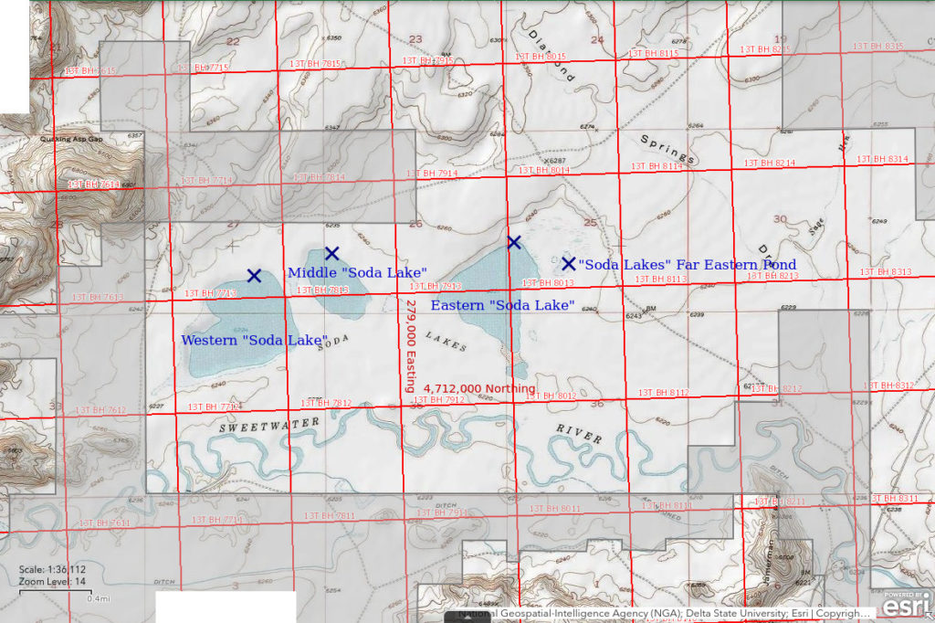
Eastern “Soda Lake” is 12.5 km (8 miles) northeast of Jeffrey City. There are 3 large lakes on the north side of the Sweetwater River here which are labeled “Soda Lakes” on the 1:100,000-scale BLM map and are represented by perennial lake symbols. Eastern “Soda Lake” is the eastern one. Its size is approximately 900 m by 500 m (2,950′ x 1,640′).
The southern end of Eastern “Soda Lake” is on land owned by the State of Wyoming.
Eastern “Soda Lake” can be reached either from the road north of Jeffrey City or from the Agate Flats road but the 2 most direct routes cross private land and may not be open to the public. One of these is to turn east off the Gas Hills road less than 1/2 mile north of the Sweetwater River crossing and then drive around the north side of the granite hills and through Quaking Asp Gap to Middle “Soda Lake”. The other is to turn northwest off the Agate Flats road less than 1/2 mile north of the Sweetwater River crossing, cross Sage Hen Creek and continue through the sagebrush to Eastern “Soda Lake”. The Agate Flats road turns north off US 287 7 miles east of Jeffrey City. A more roundabout route that doesn’t cross private land is to turn east off the Gas Hills road 6.5 miles north of Jeffrey City. After about 3.3 miles, turn southeast on to another road and follow it for another 3.5 miles to Eastern “Soda Lake”.
Elevation: 1,899 m (6,229′)
June 9, 1989
The water level doesn’t look at all low, possibly because of the springs at the northeastern corner of the lake. No mineral efflorescence along the shore.
- 500 m x 900 m based on the 1:100,000-scale BLM map; depth not estimated.
- Murky gray-brown water.
- No fairy shrimp.
- Amphipods, cladocerans, red spheres that may be water mites, geese, grebes, avocets, willets.
“Soda Lakes” Far Eastern Pond (Lander BLM Office)
“Soda Lakes” Far Eastern Pond is 500 m (1,640′) east of Eastern “Soda Lake”. On the 7.5-minute topographic quadrangle, it is 220 m long and up to 100 m wide (720′ x 330′) and abuts a marsh symbol at its northern end.
For access, see Eastern “Soda Lake”.
Elevation: 1,901 m (6,238′)
June 9, 1989
Like Eastern “Soda Lake”, the water level doesn’t look low and the pond may be partially spring-fed. The banks are mostly clay.
- 100 m x 220 m based on the 7.5-minute quadrangle although my estimates were 150 m x 250 m; depth not estimated.
- Cloudy orange-brown water; 18 C at 0945.
- Gray fairy shrimp with 6 male specimens 15-17 mm and 9 female specimens 10-12 mm; many females have eggs.
- Backswimmers (sub-order Heteroptera, family Notonectidae), hordes of cladocerans, millions of flies (alkali flies?), wriggly larvae, red spheres that may be water mites, ducks, phalaropes.
Specimens were identified as Branchinecta campestris by DB. Rogers (2006) identified these fairy shrimp as the new species Branchinecta lateralis after DB died.
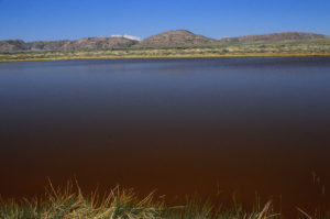
View to west across “Soda Lakes” Far Eastern Pond. The water is dark but not because of lots of fairy shrimp like in photograph “Piaya Lake” 1989-06-08, #0321. Maybe the color is due to organic acids.
Middle “Soda Lake” (Lander BLM Office)
Middle “Soda Lake” is the middle one of the 3 large “Soda Lakes” on the north side of the Sweetwater River northeast of Jeffrey City. It is about 600 m (1,970′) west of Eastern “Soda Lake”. On the 7.5-minute topographic quadrangle, its size is 750 m by 400 m (2,460′ x 1,310′).
The southern edge of Middle “Soda Lake” is on land owned by the State of Wyoming.
For access, see Eastern “Soda Lake”.
Elevation: 1,900 m (6,234′)
June 9, 1989
This one is on clay with no signs of mineral efflorescence. The water is so shallow that I can’t reach water more than a couple of centimeters deep.
- 400 m x 750 m based on the 7.5-minute quadrangle; depth not estimated.
- Water clarity not noted.
- No fairy shrimp.
- Other animals not noted.
Western “Soda Lake” (Lander BLM Office and State of Wyoming)
Western “Soda Lake” is the western one of the 3 large “Soda Lakes” on the north side of the Sweetwater River northeast of Jeffrey City. It is about 250 m (1,970′) west of Middle “Soda Lake”. The dimensions of Western “Soda Lake” on the 7.5-minute topographic quadrangle are 1,000 m by 750 m (3,280′ x 2,460′).
The southern two-thirds of Western “Soda Lake” is on land owned by the State of Wyoming.
For access, see Eastern “Soda Lake”.
Elevation: 1,900 m (6,234′)
June 9, 1989
There is some sand along the shore and only minor mineral efflorescence.
- 750 m x 1,000 m based on the 7.5-minute quadrangle; depth not estimated.
- Water clarity not noted.
- No fairy shrimp.
- Other animals not noted.
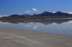
Western “Soda Lake”, looking east with the bare granite of Lankin Dome under the cloud at center.
Bent Knee Rock Pool (Lander BLM Office)
West Tin Cup Summit Rock Pool map
Bent Knee Rock Pool is on the north side of Tin Cup Mountain east of Antelope Pocket Overlook Rock Pool. I had to get down on my knees to see what was in this one.
Small rock pools cannot be seen on the USGS imagery for The National Map so the location on the map above and in the data spreadsheet (on the Data page) could be off by 100 m (330′) due to my poor description of the location.
For access, see Antelope Pocket Overlook Rock Pool. Bent Knee Rock Pool is on the east side of Antelope Pocket.
Elevation: 2,168 m (7,113′)
June 10, 1989
While checking on Antelope Pocket Overlook Rock Pool, I found this one.
- Size 0.8 m x 2 m; depth about 10 cm.
- Water is clear.
- Several pale orange-brown fairy shrimp less than 10 mm long; eggs not noticeable.
- No other animals noted.
May 8, 1992
This is early in the season so the winter must have been dry.
- Dry.
August 17, 2025
After finishing a backpacking trip to the Wind River Mountains to search for more fairy shrimp, I came to the Granite Mountains to collect GPS coordinates for the rock pools which I could previously locate only approximately on a map. I found the actual location of this rock pool is 132 m to the northeast of the previously estimated location. The coordinates in the spreadsheet on the Data page and the maps have been updated. More accurate coordinates may be helpful to anyone interested in Branchinecta constricta, which was newly identified by Rogers (2006) from Denton Belk’s specimens at the National Museum. The species in Bent Knee Rock Pool was not previously identified but the pool is only 233 m from the B. constricta population in Antelope Pocket Overlook Rock Pool.
- Although damp, the pool is effectively dry. After a long dry spell, thunderstorms dropped only 0.05″, or 1.3 mm, at Lander (even less at Riverton) yesterday and the day before.
- The pool has dimensions of about 1.5 m by 1.5 m and a height of about 10 cm or so. This conflicts with my June 10, 1989 observation of water 0.8 m across and 2 m long but the water-stained rock on the near side of the pool could explain the discrepancy.
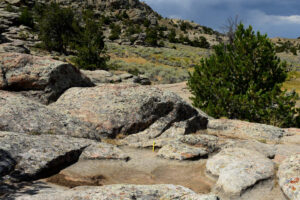
Bent Knee Rock Pool, east of Antelope Pocket. A yellow 15-cm scale is on the right side of the pool. There are a few other pools in the vicinity and I had a hard time deciding this one is Bent Knee Rock Pool. The position of the pool in a local depression supports the idea that I had to get down on my knees to look for fairy shrimp but the large location error and differing size estimates open up the possibility that I have misidentified the rock pool.
Deep Hollow Rock Pool (Lander BLM Office)
West Tin Cup Summit Rock Pool map
Deep Hollow Rock Pool is on the north side of Tin Cup Mountain east of Antelope Pocket Overlook Rock Pool and a short distance uphill from Bent Knee Rock Pool. It is deeper than the other rock pools near Tin Cup Mountain. There is a small, shallow rock pool a little down hill from Deep Hollow Rock Pool.
Small rock pools cannot be seen on the USGS imagery for The National Map so the location on the map above and in the data spreadsheet (on the Data page) could be off by 100 m (330′) due to my poor description of the location.
For access, see Antelope Pocket Overlook Rock Pool. Deep Hollow Rock Pool is on the east side of Antelope Pocket.
Elevation: 2,188 m (7,179′)
June 10, 1989
Yet another rock pool near Antelope Pocket Overlook Rock Pool. This one is so deep I can barely see the bottom.
- Size 1 m x 1.5 m; depth greater than 30 cm.
- Water is murky greenish-gray.
- Abundant pale orange-brown fairy shrimp about 10 mm long; eggs not noticeable; the adjacent shallow pool also has a few fairy shrimp.
- No other animals noted.
May 8, 1992
Only the deeper rock pools have water this year.
- Size and depth not estimated.
- Murky green water.
- Abundant fairy shrimp but didn’t estimate lengths; eggs not noted.
- No other animals noted.
August 17, 2025
After finishing a backpacking trip to the Wind River Mountains to search for more fairy shrimp, I came to the Granite Mountains to collect GPS coordinates for the rock pools which I could previously locate only approximately on a map. I found the actual location of this rock pool is 61 m to the west of the previously estimated location. The coordinates in the spreadsheet on the Data page and the maps have been updated. As on June 10, 1989, I also observed a shallower rock pool nearby. More accurate coordinates may be helpful to anyone interested in Branchinecta constricta, which was newly identified by Rogers (2006) from Denton Belk’s specimens at the National Museum. The species in Deep Hollow Rock Pool was not previously identified but the pool is only 126 m from the B. constricta population in Antelope Pocket Overlook Rock Pool.
- Although damp, the pool is effectively dry. After a long dry spell, thunderstorms dropped only 0.05″, or 1.3 mm, at Lander (even less at Riverton) yesterday and the day before.
- Water-stained rock has dimensions of about 0.7 m by 2.3 m and a height of more than 15 cm.
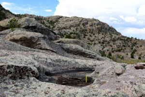
Deep Hollow Rock Pool with Tin Cup Mountain in the background. A yellow 15-cm scale is on the right side of the pool. The current high-water mark is not 30 cm above the bottom, as estimated on June 10, 1989, but the pool does seem to be that deep.
Lankin Dome Summit Rock Pools (Lander BLM Office)
___This map is a screenshot of The National Map (Go to The National Map). The U.S. Geological Survey generally does not copyright or charge for its data or reports (unless printed). A pond location is indicated by an “X”, which corresponds to the coordinates given in the data spreadsheet. Labels in quotations are from 7.5-minute topographic quadrangles.
___Red lines are the U. S. National Grid with a spacing of 1,000 m and intersection labels consisting of the UTM zone (e.g., 11S, 12T), a 2-letter 100-km square designation (e.g., LC, XN), and a 4-digit number. The first 2 digits of the number represent the 1,000-meter Easting and the second 2 digits the 1,000-meter Northing, as seen in the example Easting and Northing. Unlike latitude and longitude, the National Grid is rectilinear on a flat map, the units of abscissa and ordinate have equal lengths, and the units (meters) are measurable on the ground with a tape or by pacing.
___Gray shading represents private land as traced from the PAD-US 2.0 – Federal Fee Managers layer of The National Map. Other lands are public or owned by the State of Wyoming.
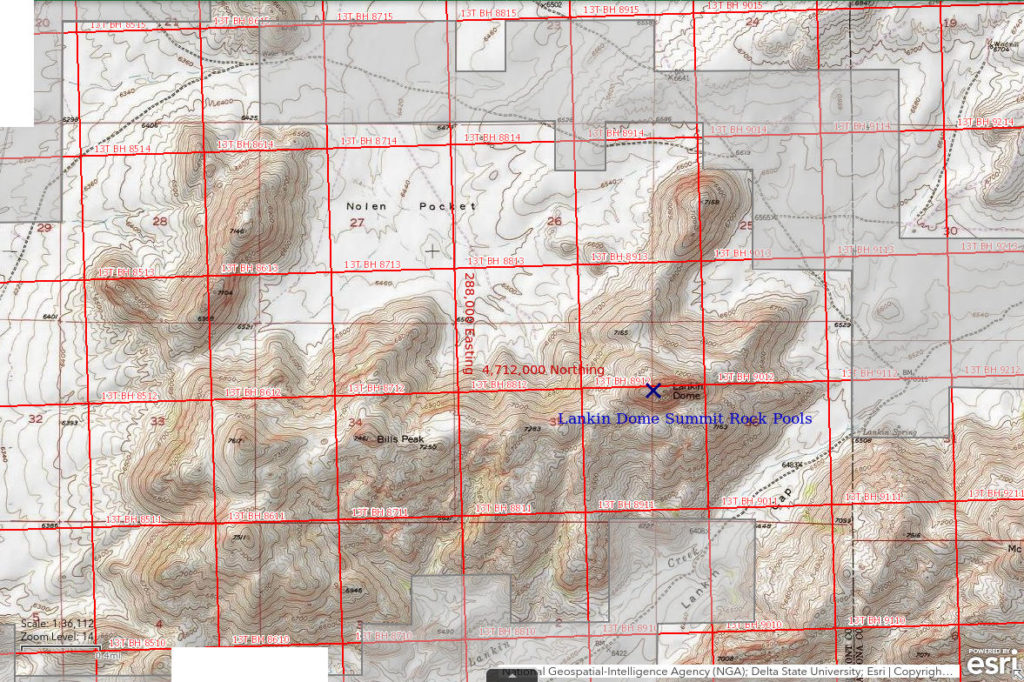
Lankin Dome is a prominence of bare granite 22 km (13.5 miles) northeast of Jeffrey City. I had heard that the National Outdoor Leadership School (based in Lander) held courses on Lankin Dome and that students had seen rock pools and animals in the rock pools. As it turns out, there are many rock pools on top of, and lower down on, Lankin Dome. Rock pools are on the ridge extending northeast from the west end of Lankin Dome and on the smaller ridge extending from the east end of Lankin Dome. There are pools scattered over much of the summit of Lankin Dome, maybe more on the west than on the east.
Individual rock pools cannot be seen on USGS imagery and I never made a sketch map so my distinctions between the pools are futile. Nonetheless, the location on the map above and in the data spreadsheet is unlikely to be off by more than 50 m (165′) due to the small size of the summit.
Lankin Dome is probably most easily accessed from the Agate Flats road, which turns north off Wyoming 220 7 miles east of Jeffrey City. Lankin Dome is part of the hills east of the Agate Flats road and north of the Sweetwater River. 3.5 miles north of the Sweetwater crossing, the Agate Flats road turns to the east toward a hill detached from the main mass farther south. There is a road that goes south of the detached hill through the gap to Nolen Pocket and another that goes north of the detached hill after following the south bank of Sage Hen Creek. Both roads cross bits of private land. I don’t remember which road is better or what the status of any gates was. The 2 roads ultimately intersect at the north end of the ridge on the east side of Nolen Pocket that extends northeast from Lankin Dome. That ridge provides a good route to start the hike up Lankin Dome.
I suspect the National Outdoor Leadership School course taught various climbing skills at Lankin Dome but, with sufficient fortitude, it is possible to walk up to the summit of Lankin Dome from the west. Although it is steep, bare rock, the rock surface is rough and provides good footing. For extra security, one could drop down on all fours and also use one’s hands to scramble up. The wind is commonly strong enough to pose a danger. However, winds are usually from the west and this has a beneficial effect for those ascending the west side as it pushes one toward the rock rather than blowing one off the rock. This is particularly helpful when going down hill as a strong, sustained, westerly wind provides support and makes it feel like you can’t fall forward and tumble down the hill even as you lean down hill. When the wind is gusty rather than steady, things could get tricky.
Elevation: 2,326 m (7,631′)
July 2, 1989
The climb is not as hard as it looks but I found it scary.
- Numerous pools, sizes not estimated; depths mostly less than 30 cm.
- Clear water, some with reddish tint.
- Faintly orange, pale green, and pale gray fairy shrimp in a large proportion of the rock pools, mostly 8-12 mm but some less than 5 mm; some females have eggs.
- Ostracods with white bands near mid-sections of yellowish shells; tiny yellow dots might be younger ostracods.
Both fairy shrimp and ostracods were scraping the rock for food. Driving by on US 287 and seeing Lankin Dome, you would never guess what is up here.
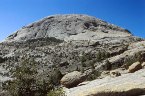
The north side of Lankin Dome, from the ridge to the north. Such is fairy shrimp habitat. They are swimming in the rock pools on top and also on the ridge off the right edge of the photograph. For another view of Lankin Dome, see photograph Western “Soda Lake” 1989-06-09, #0335.
June 4, 1990
There are more than a dozen rock pools near the summit of Lankin Dome. They are generally 0.5-3.5 m across and range in depth from 5 cm to more than 20 cm. The water is clear in most but slightly murky in some. Less than half the rock pools have fairy shrimp. The distribution is sporadic with no obvious correlation with the size or depth of the rock pool. Sizes and colors of fairy shrimp vary from pool to pool.
I describe 3 pools separately below (and in the data spreadsheet; on the Data page) to give some idea of the variability. Other than Rock Pool #1, which I photographed, I would not be able to identify these rock pools again.
Lankin Dome Summit Rock Pool #1 – west of highest point
- Approximately circular and 1.5 m across; depth up to 20 cm.
- Water slightly murky due to green algae; 20 C at 1515.
- Bluish fairy shrimp with females smaller than males, 18-20 mm; some females have eggs; ovisac about half as long as abdomen; pool also has several bodies of dead fairy shrimp.
- Other animals not noted.
Specimens were identified as Branchinecta lindahli by DB (archive #DB-974). In a later August 13, 1991 letter, DB hypothesized that this is not B. lindahli but a previously unrecognized species. Rogers (2006) identified these fairy shrimp as the new species Branchinecta constricta after DB died.
Lankin Dome Summit Rock Pool #2 – toward highest point from Pool #1
- Approximately circular and 2 m across; depth at least 20 cm.
- Water not quite clear but not as murky as in Pool #1; 17 C at 1615.
- Generally pale orange fairy shrimp 10-12 mm with females hard to find; some females have eggs; ovisac about half as long as abdomen.
- Other animals not noted.
Specimens were identified as Branchinecta lindahli by DB (archive #DB-975). In a later August 13, 1991 letter, DB hypothesized that this is not B. lindahli but a previously unrecognized species. Rogers (2006) identified these fairy shrimp as the new species Branchinecta constricta after DB died.
Lankin Dome Summit Rock Pool #3 – near western lip of summit west of and below Pool #2 but south of and above Pool #1
- Trapezoidal shape with 3.5 m base; depth maybe as deep as 40 cm.
- Water clear with brown tint; 13 C at 1650 in shade.
- Generally pale orange fairy shrimp 15-17 mm, mostly males; one female specimen lacked eggs.
- Other animals not noted.
Specimens were identified as Branchinecta paludosa by DB.
The depths of these rock pools suggest that some do not dry up in most years. Pan evaporation data collected at Pathfinder Dam, which is about 60 km (37 miles) to the east, indicate about 13 cm (5″) of water would evaporate over the months of April through September (see “Pond Duration” on the About page) under normal conditions. The average daily evaporation rate over those 183 days is about 0.7 mm (0.028″). Pathfinder Dam is at a lower elevation and would be less windy than the summit of Lankin Dome. Consequently, the pan at Pathfinder Dam would likely experience somewhat warmer temperatures and more evaporation than the pools on the summit of Lankin Dome. Additional water from summer thunderstorms would further reduce the chances of the rock pools drying up.
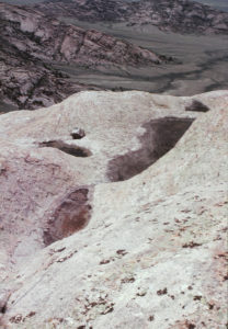
Lankin Dome Summit Rock Pool #1, looking down and to northwest. A tan day pack is by Pool #1, which is to left of center. I don’t remember whether the other rock pools in the photo had fairy shrimp but I suspect I selected Pool #1 for sampling because it had the most fairy shrimp.
Beaver Rim Snow Fence Pond (Lander BLM Office)
___This map is a screenshot of The National Map (Go to The National Map). The U.S. Geological Survey generally does not copyright or charge for its data or reports (unless printed). A pond location is indicated by an “X”, which corresponds to the coordinates given in the data spreadsheet. Labels in quotations are from 7.5-minute topographic quadrangles.
___Red lines are the U. S. National Grid with a spacing of 1,000 m and intersection labels consisting of the UTM zone (e.g., 11S, 12T), a 2-letter 100-km square designation (e.g., LC, XN), and a 4-digit number. The first 2 digits of the number represent the 1,000-meter Easting and the second 2 digits the 1,000-meter Northing, as seen in the example Easting and Northing. Unlike latitude and longitude, the National Grid is rectilinear on a flat map, the units of abscissa and ordinate have equal lengths, and the units (meters) are measurable on the ground with a tape or by pacing.
___Gray shading represents private land as traced from the PAD-US 2.0 – Federal Fee Managers layer of The National Map. Other lands are public or owned by the State of Wyoming.
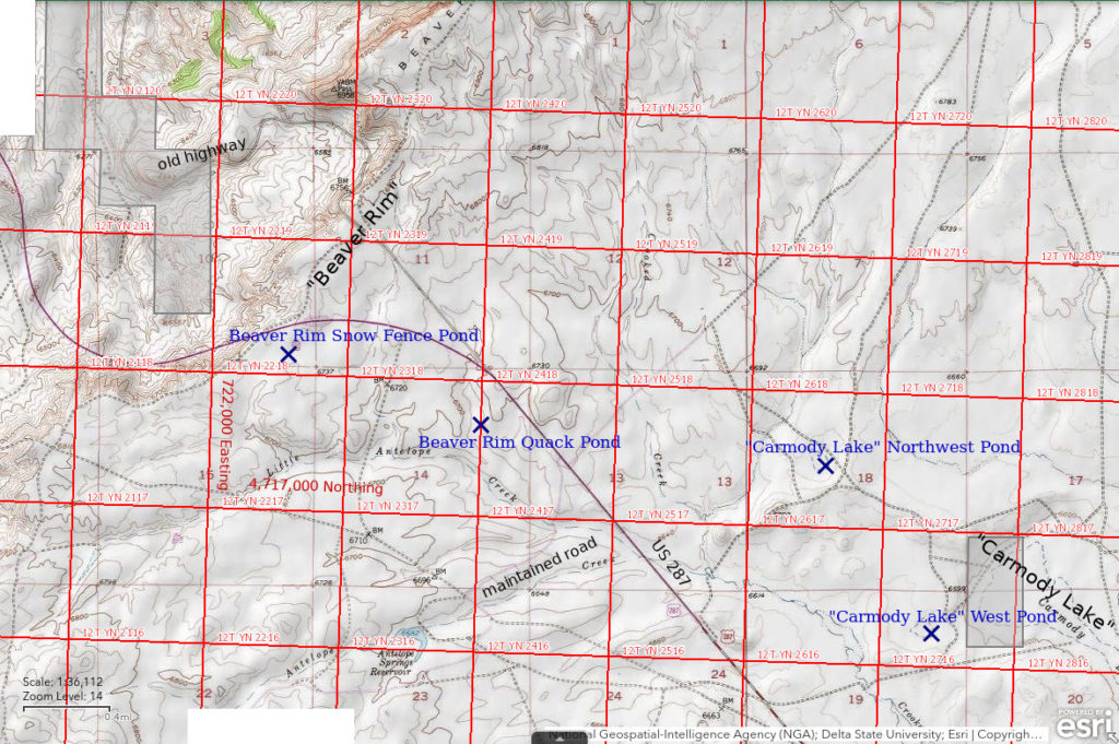
Beaver Rim Snow Fence Pond is 45 km (28 miles) southeast of Lander and 9 km (5.5 miles) northwest of Sweetwater Station. It is about 150 m (490′) south of US 287 at the crest of the Beaver Rim, or Beaver Divide. Beaver Rim is a series of white cliffs that separate the Wind River Basin from the Sweetwater River drainage. The pond is shown on The National Map and on the 1978 version of the 7.5-minute topographic quadrangle as an oval stipple pattern about 70 m (230′) across. On USGS imagery, it looks like it is about 80 m (260′) across but the water is hard to distinguish from the vegetation. The pond is adjacent to a snow fence and is consequently buried by a deep snow drift during winter months.
The pond is visible from US 287 and there is a nearby turnout on US 287 at the top of the descent down the Beaver Rim.
Elevation: 2,054 m (6,740′)
May 7, 1992
I had driven by this pond many times on trips to and from Lander and it seemed to have water for most of the spring and early summer so I finally took the time to stop and look.
- Maximum length not estimated but assumed to be 55 m (2/3 of the 80 m on the USGS imagery due to the dry weather this year); depth not estimated.
- Clear water.
- No fairy shrimp.
- Ostracods; pond has had ducks at other times.
The fact that the 1978 revision of the 7.5-minute topographic quadrangle shows Beaver Rim Snow Fence Pond as a new feature (in purple on the map) offers an opportunity to date the origin of the pond and provide some insight into the fairy shrimp colonization rate. The pond was evidently not present on the 1957 edition of the map, which was based on aerial photographs taken in 1945. The 1978 revision was based on photographs taken in 1975 according to the map legend. The 1978 revision also shows a major realignment of US 287 in purple. Thus, Beaver Rim Snow Fence Pond and the current US 287 alignment had existed for at least 17 years prior to my visit. The topography of the pond hasn’t changed but the snow fence may have led to the creation of the pond or at least to its persistence for many weeks or months and its visibility on aerial photographs. Unless I missed the fairy shrimp, it appears that colonization by fairy shrimp has not occurred in Beaver Rim Snow Fence Pond within at least 17 years. Colonization might have occurred if it had been followed by extirpation. I can’t guess how likely that is.
Rainbow above the white cliffs of Beaver Rim north of Beaver Rim Snow Fence Pond. This is a good sign for fairy shrimp as well as for leprechauns as summer storms make the ponds last longer. This photograph was taken a few years before I actually stopped at Beaver Rim Snow Fence Pond.
June 10, 1993
Fingers crossed.
- Maximum length not estimated but assumed to be 80 m based on USGS imagery; depth not estimated.
- Clear water.
- No fairy shrimp.
- Other animals not noted.
Beaver Rim Quack Pond (Lander BLM Office)
Beaver Rim Snow Fence Pond map
Beaver Rim Quack Pond is 1,450 m (4,760′) southeast of Beaver Rim Snow Fence Pond and 650 m (2,130′) northwest of the turn-off from US 287 to Atlantic City. There is another maintained road that heads northeast from that intersection. The pond is 300 m (980′) southwest of US 287. Beaver Rim Quack Pond is a stock pond in a very small drainage. It has a triangular shape due to the dam. On USGS imagery of The National Map, the triangle has an altitude of about 60 m (200′). The pond had several ducks when I arrived.
For access, see Beaver Rim Snow Fence Pond. The pond is closer to the turn-off to Atlantic City than to the turnout by Beaver Rim Snow Fence Pond.
Elevation: 2,037 m (6,681′)
May 7, 1992
This pond doesn’t look as appealing for fairy shrimp as Beaver Rim Snow Fence Pond but what do I know?
- Maximum length not estimated but assumed to be 40 m (2/3 of the 60 m on the USGS imagery due to the dry weather this year); depth not estimated.
- Clear brown water; 17 C at 1240.
- Rare pale gray fairy shrimp, mostly about 10 mm long but a few maybe 15 mm; eggs not noted.
- Dytiscid larvae, backswimmers, dragonflies, cladocerans, wriggly larvae, ducks, avocets, phalaropes.
DB found the specimens to be immature but identified the genus as Streptocephalus.
The presence of fairy shrimp here suggests that the lack of fairy shrimp in Beaver Rim Snow Fence Pond is not due to it being too early in the season. The climate, general setting, and availability of dispersal agents such as birds did not prevent establishment of a fairy shrimp population here. Not only does Beaver Rim Quack Pond have fairy shrimp, it has several other aquatic invertebrate species that I did not see in Beaver Rim Snow Fence Pond. Is there some feature of Beaver Rim Snow Fence Pond that inhibits colonization by a wide range of species? Or, is it just a question of time? Beaver Rim Quack Pond does not appear on either the older or newer versions of the 7.5-minute quadrangle but, as a stock pond, it has probably been here decades longer than Beaver Rim Snow Fence Pond.
June 10, 1993
I had collected streptocephalids from only one other pond so I was hoping to find mature fairy shrimp that could be identified this time. DB had told me that the Streptocephalus seali I had found in Fremont Lake Moraine Pond (Wind River Mountains) in 1987 were the first reported in Wyoming.
- Maximum length not estimated but assumed to be 60 m based on USGS imagery; depth not estimated.
- Murky greenish-brown water; 21 C at 1630.
- A few large, pale blue-green fairy shrimp about 20 mm long but so elusive that I had to wade out into the water to catch them; eggs not noted as I didn’t see any fairy shrimp with ovisacs.
- Beetles, dytiscid larvae, dragonfly larvae, salamander larvae up to 15 cm.
Specimens were identified as Streptocephalus seali by DB (archive #DB 1246).
“Carmody Lake” Northwest Pond (Lander BLM Office)
Beaver Rim Snow Fence Pond map
“Carmody Lake” Northwest Pond is 5.5 km (3.5 miles) northwest of the junction of US 287 and Wyoming 135 at Sweetwater Station and 4 km (2.5 miles) east of Beaver Rim Snow Fence Pond. It is 1,500 m (4,920′) northeast of US 287. On the 7.5-minute topographic quadrangle, “Carmody Lake” Northwest Pond is shown as a 200 m x 100 m (660′ x 330′) intermittent pond. It is not shown on the 1:100,000-scale BLM map.
The 1:100,000-scale BLM map shows an unimproved road from US 287 directly to “Carmody Lake” Northwest Pond but I haven’t tried it. Another option is to turn northeast at the road junction on US 287 about 1 mile southeast of Beaver Rim instead of southwest toward Atlantic City. This road passes within about 1,300 m (4,270′) of the pond. An unimproved road turns southeast off this road and passes close to the pond on the way to “Carmody Lake”. On the map, there are also unimproved roads to “Carmody Lake” from Wyoming 135 to the east and one continues around the north side of the lake to near the pond.
Elevation: 2,030 m (6,661′)
June 10, 1993
With fairy shrimp in Beaver Rim Quack Pond, it is worth checking other ponds in the vicinity. The very shallow water in this pond doesn’t look promising though.
- Size and depth not estimated.
- Water clarity not noted.
- No fairy shrimp.
- Other animals not noted.
“Carmody Lake” West Pond (Lander BLM Office)
Beaver Rim Snow Fence Pond map
“Carmody Lake” West Pond is only about 400 m (1,310′) west of the large, intermittent “Carmody Lake”. It is 4 km (2.5 miles) northwest of the junction of US 287 and Wyoming 135 at Sweetwater Station and 5 km (3 miles) southeast of Beaver Rim Snow Fence Pond. “Carmody Lake” West Pond is shown as a 160 m x 130 m (520′ x 430′) intermittent lake on the 7.5-minute topographic quadrangle. It is also shown on the 1:100,000-scale BLM map.
For access, see “Carmody Lake” Northwest Pond. The road past “Carmody Lake” Northwest Pond continues to “Carmody Lake” West Pond, as does the road around the north side of “Carmody Lake”.
Elevation: 2,017 m (6,617′)
June 10, 1993
More water than “Carmody Lake” Northwest Pond, it looks good.
- Size and depth not estimated.
- Water clear.
- No fairy shrimp.
- Other animals not noted.
What Can We Learn from the Ponds in the Granite Mountains?
Potential fairy shrimp habitats in the Granite Mountains are quite diverse. They range from large, high-TDS playa lakes (“soda lakes”) to low-TDS rock pools less than 2 m across. Of the 33 ponds visited, I saw fairy shrimp in 18 (56%) and 1 was dry during 1 visit. Rock pools were the most commonly occupied habitat – 91% of 11 pools.
Fairy shrimp were generally the only macroinvertebrate species that I noticed in 11 rock pools (counting the numerous Lankin Dome Summit Rock Pools as 1). I saw possible ostracods in 2 rock pools and beetles or dytiscid larvae in 2 other rock pools.
Thunderstorms may extend the fairy shrimping season in rock pools of the sagebrush steppe by triggering new hatches, as they did in August 1987.
Avocets and phalaropes were each seen at 6 ponds (4 ponds had both), of which 5 had fairy shrimp. These birds are consequently good candidates for dispersal agent.
Anostracan species identified by Denton Belk are:
Branchinecta lindahli – Big Skunk Granite Rock Pool, Little Skunk Granite Rock Pool;
An unnamed species similar to Branchinecta lindahli (DB); named as new species Branchinecta constricta by Rogers (2006) – Dead Ant Rock Pool, Antelope Pocket Overlook Rock Pool, Lankin Dome Summit Rock Pools (2 of 3 sampled pools);
Branchinecta packardi – Wild Horse Rock Pool;
Branchinecta paludosa – Lankin Dome Summit Rock Pools (1 of 3 sampled pools);
Streptocephalus seali – Beaver Rim Quack Pond;
Branchinecta campestris (DB), named as new species Branchinecta lateralis by Rogers (2006) – “Steamboat Lake” Oxbow Pond, “Steamboat Lake”, “Soda Lakes” Far Eastern Pond;
Artemia (species not identified) – Rawlins Draw “Soda Lake”,”Steamboat Lake” 2nd East Pond, “Piaya Lake”, Little “Piaya Lake”.