Castle Gardens Storm Pond
What Can We Learn from the Ponds in the Eastern Wind River Basin?
I recorded observations for only 1 pond in this area but the eastern Wind River Basin lends itself to easy description so I might as well try. The Wind River makes a sharp bend to the north at Riverton and the area to the east is drier than that to the west and is also mostly outside of the Wind River Indian Reservation and accessible to the public. The eastern boundary of the Wind River Indian Reservation is 18 km (11 miles) east of Riverton in the south but remains west of Shoshoni in the north. South of Riverton, Beaver Creek could serve as the southwestern boundary of the eastern Wind River Basin. The eastern Wind River Basin is bounded to the north by the Owl Creek Mountains and to the south by Beaver Divide, or Beaver Rim, which separates the upper Sweetwater River basin from that of the Wind River. The eastern boundary is not marked by a single topographic feature but follows the hydrographic divide on Cyclone Ridge, Maverick Butte, the Coalbank Hills, and unnamed ridges between Hiland and Waltman. From the Wind River north of Riverton to the triangular butte south of US 20 between Hiland and Waltman is 86 km (53 miles). From Lysite, at the south edge of the Owl Creek Mountains to Beaver Divide at the head of Muskrat Creek is 68 km (42 miles).
There do not seem to be many natural ponds in the eastern Wind River Basin but there are stock reservoirs and ponds.
There are also ponds in some of the open-pit uranium mines in the Gas Hills uranium district that have been abandoned and variously reclaimed. I looked in a couple and saw backswimmers and possibly amphipods but no fairy shrimp. The clear water in some had a noticeably blue color. Most mines closed by 1970 so that would provide a rough estimate of the pace of colonization. Unfortunately, I did not note the locations of my observations and did not seek out additional ponds.
Boysen Reservoir, on the Wind River, is the basin low point and is at the northwestern edge of the eastern Wind River Basin. It has an elevation of 1,440 m (4,720′) on the 1:100,000-scale BLM map. Beaver Rim on the southern edge of the basin is generally about 2,100 m (6,890′) high and Maverick Butte at the southeastern corner is 2,123 m (6,970′). The triangular butte between Hiland and Waltman is 1,955 m (6,410′) and the crossroads at Hiland is 1,830 m (6,000′). The base of the Owl Creek Mountains to the north of the basin ranges from about 1,600 m (5,250′) north of Badwater Creek in the west to about 1,900 m (6,230′) north of Arminto in the east.
Mean Annual Precipitation according to the Wyoming Climate Atlas by the Water Resources Data System and State Climate Office at http://www.wrds.uwyo.edu/sco/climateatlas/precipitation.html, Parameter-Elevation Regressions on Independent Slopes Model, PRISM, with 1971-2000 data at very widely spaced weather stations (I have eyeballed the values from a very small scale map with 11 precipitation bins marked with indistinct colors and further obscured by a shaded relief base map):
6″-10″ (15-25 cm)
I’m not familiar enough with the vegetation of the eastern Wind River Basin to comment on it.
The small portion of the eastern Wind River Basin east of Moneta is mostly private land. Elsewhere, large blocks of private land occur along many of the creeks and smaller blocks are scattered in other areas with less obvious homesteading potential. Nonetheless, most of the basin is public land. US 20/26 from Shoshoni to Casper crosses the northern part of the eastern Wind River Basin. US 26 also connects Shoshoni to Riverton. South of Riverton, Wyoming 135 provides access to the Sand Draw Oil Field area and ultimately connects to US 287 on the Sweetwater River. Wyoming 136 leads to the Gas Hills uranium district from Riverton. There are several maintained roads in the eastern Wind River Basin that support or have supported ranching, oil and gas, and uranium mining operations.
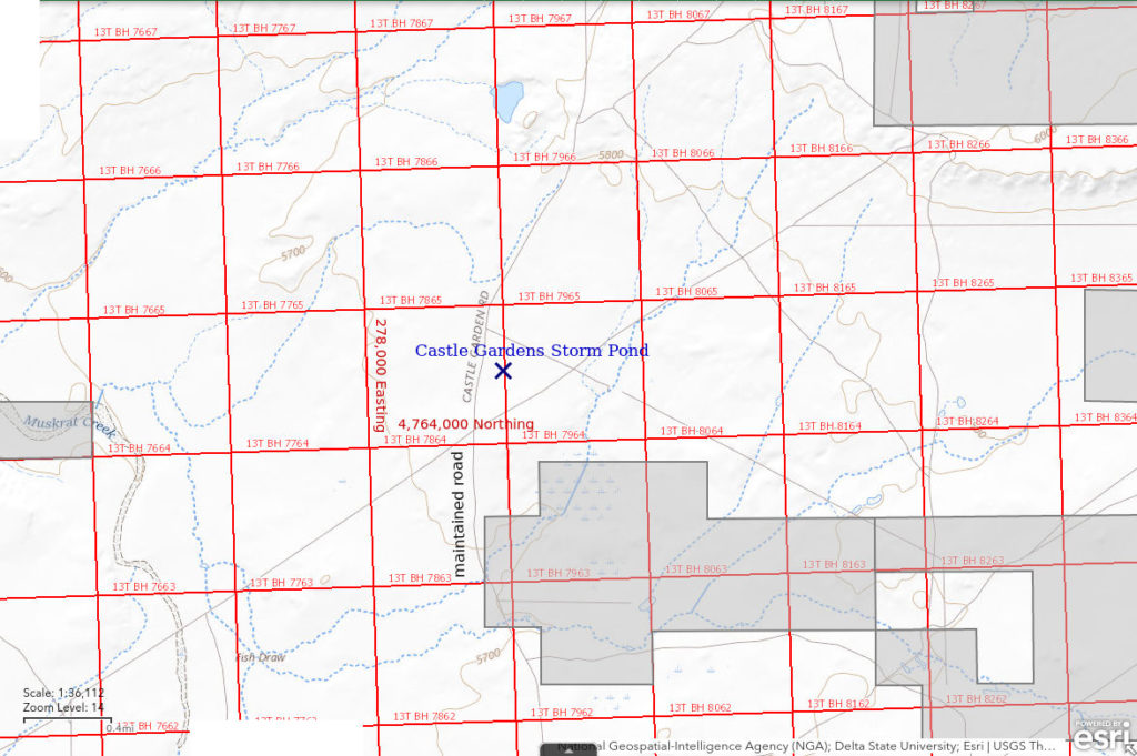
Castle Gardens Storm Pond (Lander BLM Office)
___This map is a screenshot of The National Map (Go to The National Map). The U.S. Geological Survey generally does not copyright or charge for its data or reports (unless printed). A pond location is indicated by an “X”, which corresponds to the coordinates given in the data spreadsheet. Labels in quotations are from 7.5-minute topographic quadrangles.
___Red lines are the U. S. National Grid with a spacing of 1,000 m and intersection labels consisting of the UTM zone (e.g., 11S, 12T), a 2-letter 100-km square designation (e.g., LC, XN), and a 4-digit number. The first 2 digits of the number represent the 1,000-meter Easting and the second 2 digits the 1,000-meter Northing, as seen in the example Easting and Northing. Unlike latitude and longitude, the National Grid is rectilinear on a flat map, the units of abscissa and ordinate have equal lengths, and the units (meters) are measurable on the ground with a tape or by pacing.
___Gray shading represents private land as traced from the PAD-US 2.0 – Federal Fee Managers layer of The National Map. Other lands are public or owned by the State of Wyoming.

Castle Gardens Storm Pond is 115 km (71 miles) west of Casper and 55 km (34 miles) east of Riverton. This is a stock pond in a local depression east of the Castle Gardens road (“Love Ranch Road” on the Seventy-One Reservoir 7.5-minute topographic quadrangle) 3 miles south of Moneta Divide. It is more or less 8 km (5 miles) northwest of the Castle Gardens ridge. When I drove by the pond, it was evening and the weather had become stormy.
The 7.5-minute quadrangle shows a perennial reservoir in the Chalk Hills Draw drainage 1,900 m (6,230′) due north of Castle Gardens Storm Pond but I apparently didn’t see it from the road.
To reach Castle Gardens Storm Pond, turn south off US 20/26 at Moneta and continue south for about 11 miles. Castle Gardens Storm Pond is visible from the maintained road and is about 200 m (660′) east of the road.
Elevation: 1,744 m (5,722′)
June 2, 1993
I can see the pond from the road and I might have time to take a look before the clouds let loose. There is some green algal scum on the water.
- 100 m across; depth not estimated.
- Opaque grayish-white water; 16 C at 1740.
- Pale gray fairy shrimp 6-12 mm long; some of larger females have eggs.
- Abundant cladocerans.
Specimens were identified as Branchinecta lindahli (few) and Branchinecta packardi (most) by DB (archive #DB 1242).

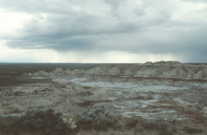
Wind River Basin near Castle Gardens Storm Pond, looking west. These thunderstorms were followed by snow the next day in the Granite Mountains.

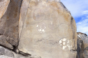
A few of the petroglyphs in Castle Gardens, Eastern Wind River Basin, in the same general area as Castle Gardens Storm Pond. The photograph was taken on a previous visit.
What Can We Learn from the Ponds in the Eastern Wind River Basin?
I recorded looking in 1 pond and finding fairy shrimp. That is encouraging but obviously suffers from a sampling problem.
The 2 species found in that 1 pond have also been found in the Granite Mountains to the south.
Anostracan species identified by Denton Belk are:
Branchinecta lindahli – Castle Gardens Storm Pond;
Branchinecta packardi – Castle Gardens Storm Pond.