The base map is provided by OpenTopoMap’s volunteer servers.
Cody Airport “Alkali Lake”
431 Steele Roadside Pond
Henry Draw Reservoir
Nowater Creek Reservoir
Nowater 4623 Pond
“Holland Reservoir”
Upper Joe Henry Fork Pond
“Cottonwood Trail Reservoir”
Lone Tree Ranch Reservoir
Stove Creek West Pond
What Can We Learn from the Ponds in the Bighorn Basin?
The Bighorn Basin separates the Bighorn Mountains from the Absaroka Mountains and is bounded on the south by the Owl Creek Mountains. The hydrologic Bighorn Basin ends at Polecat Bench in the north but the topographic basin continues down to the Yellowstone River valley west of Billings. From Polecat Bench on the north rim of the hydrologic basin to the Nowater Creek – Bridger Creek divide in the Owl Creek Mountains is 168 km (104 miles). In an east – west direction, it is 107 km (66 miles) from the mouth of Shell Canyon to Cody.
Maps do not show many natural ponds in the Bighorn Basin but stock-watering ponds and reservoirs and roadside ditches provide potential fairy shrimp habitat.
The elevation of Bighorn Lake at the Montana – Wyoming border is 1,110 m (3,640′) and is a convenient minimum for the Bighorn Basin. The elevations of towns around the rim of the basin provide a measure of the upper elevation range with Cody at 1,529 m (5,020′), Meeteetse at 1,767 m (5,800′), Thermopolis (on the Bighorn River as it enters the basin) at 1,319 m (4,330′), and Tensleep at 1,282 m (4,210′). However, there are higher hills within the basin, such at Tatman Mountain southeast of Cody at 1,908 m (6,260′) and North Butte southwest of Tensleep at 1,665 m (5,460′).
Mean Annual Precipitation according to the Wyoming Climate Atlas by the Water Resources Data System and State Climate Office at http://www.wrds.uwyo.edu/sco/climateatlas/precipitation.html, Parameter-Elevation Regressions on Independent Slopes Model, PRISM, with 1971-2000 data at very widely spaced weather stations (I have eyeballed the values from a very small scale map with 11 precipitation bins marked with indistinct colors and further obscured by a shaded relief base map):
mostly 6″-10″ (15-25 cm) but 11″-15″ (28-38 cm) in southeastern part
My brief trips through the Bighorn Basin have not been sufficient to familiarize me with the vegetation.
There are broad swaths of private land in the Bighorn Basin associated with the best opportunities for irrigation around the margins of the basin and along the Shoshone, Greybull, and Bighorn rivers. Within the basin, there are some large areas of public lands but with the usual 2 sections of state land per township.
Through highways follow the Bighorn River near the eastern margin of the basin, the Shoshone River across the northern part of the basin, and the western margin of the basin. Crossing the basin are US 14/16/20 from Greybull to Cody and Wyoming 431 along Gooseberry Creek west of Worland.
Cody Airport “Alkali Lake” (private)
___This map is a screenshot of The National Map (Go to The National Map). The U.S. Geological Survey generally does not copyright or charge for its data or reports (unless printed). A pond location is indicated by an “X”, which corresponds to the coordinates given in the data spreadsheet. Labels in quotations are from 7.5-minute topographic quadrangles.
___The U. S. National Grid layer was not available when this map was created.
___Gray shading represents private land as traced from the PAD-US 2.0 – Federal Fee Managers layer of The National Map. Other lands are public.
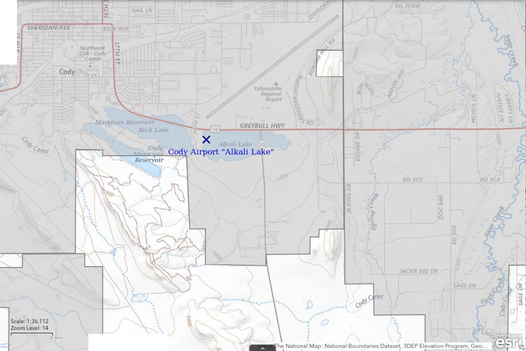
Cody Airport “Alkali Lake” is the eastern lake of the 2 lakes south and southwest of the municipal airport in Cody. It is shown on the 1:100,000-scale BLM map as a perennial lake with the name “Alkali Lake”. Cody Airport “Alkali Lake” is 1,500 m (4,920′) long and up to 500 m (1,640′) wide on the 1:100,000-scale BLM map. It occurs on both sides of Wyoming 120 and on the south side of US 14/16/20. The western lake, “Beck Lake”, has been developed for recreational activities and has likely been stocked with fish.
Although one could park on the shoulder of either of the highways next to Cody Airport “Alkali Lake”, it is probably better to turn south off US 14/16/20 onto a non-paved road between “Beck Lake” and “Alkali Lake”.
Elevation: 1,550 m (5,086′)
June 1, 1993
The water has pulled well back from the high-water mark and there are rushes along the shore. This evidence for variable water levels suggests there might be a chance for fairy shrimp. This lake doesn’t seem to be connected to “Beck Lake” to the west.
- Size and depth not estimated.
- Water clarity not estimated.
- No fairy shrimp.
- Other animals not noted.
431 Steele Roadside Pond (Worland BLM Office)
___This map is a screenshot of The National Map (Go to The National Map). The U.S. Geological Survey generally does not copyright or charge for its data or reports (unless printed). A pond location is indicated by an “X”, which corresponds to the coordinates given in the data spreadsheet. Labels in quotations are from 7.5-minute topographic quadrangles.
___Red lines are the U. S. National Grid with a spacing of 1,000 m and intersection labels consisting of the UTM zone (e.g., 11S, 12T), a 2-letter 100-km square designation (e.g., LC, XN), and a 4-digit number. The first 2 digits of the number represent the 1,000-meter Easting and the second 2 digits the 1,000-meter Northing, as seen in the example Easting and Northing. Unlike latitude and longitude, the National Grid is rectilinear on a flat map, the units of abscissa and ordinate have equal lengths, and the units (meters) are measurable on the ground with a tape or by pacing.
___Gray shading represents private land as traced from the PAD-US 2.0 – Federal Fee Managers layer of The National Map. Other lands are public or owned by the State of Wyoming.
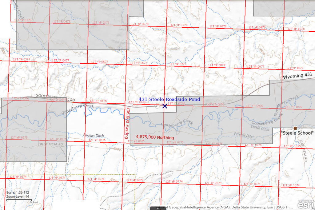
431 Steele Roadside Pond is off of Wyoming 431 approximately 3.4 km (2.1 miles) west of Steele School. This is approximaately 5.8 km (3.6 miles) east of the boundary between Hot Springs and Washakie counties. The straight-line distance to Worland is 38 km (24 miles) due east. The pond is not shown on the 7.5-minute topographic quadrangle.
My location information for this pond is very imprecise. I had no map with me and merely clocked distances with my odometer. According to my notes, the pond is 18 miles west of the junction of Wyoming 431 and US 20 south of Worland, 1.8 miles west of a ranch entrance with a mailbox, and 0.2 miles west of another ranch road. The location shown on the map here and the coordinates in the data spreadsheet (on the Data page) could be off by a couple of hundred meters. There are 2 small ponds at this location. The eastern one did not appear to have fairy shrimp. The notes below apply to the western one.
431 Steele Roadside Pond is less than 100 m (330′) south of Wyoming 431.
Elevation: 1,501 m (4,925′)
June 1, 1993
So far on this trip, I haven’t had any luck with stock ponds off Wyoming 120 between Cody and Meeteetse. This one isn’t a stock pond, it is in a ditch along the highway. I’ll give it a try.
- My notes indicate a width of about 5 m but no length(!); depth not estimated.
- Opaque brown water; 19 C at 1745.
- Pale gray fairy shrimp 10-17 mm long; most females have eggs.
- Salamander larvae, dragonfly larvae(?), amphipods(?), copepods.
Specimens were identified as Branchinecta lindahli by DB (archive #DB 1241).
Henry Draw Reservoir (Worland BLM Office)
___This map is a screenshot of The National Map (Go to The National Map). The U.S. Geological Survey generally does not copyright or charge for its data or reports (unless printed). A pond location is indicated by an “X”, which corresponds to the coordinates given in the data spreadsheet. Labels in quotations are from 7.5-minute topographic quadrangles.
___The U. S. National Grid layer was not available when this map was created. Thin gray section lines on the topographic base map have a nominal spacing of 1 mile (1.6 km).
___There is no private land on this map. All lands are public or owned by the State of Wyoming.
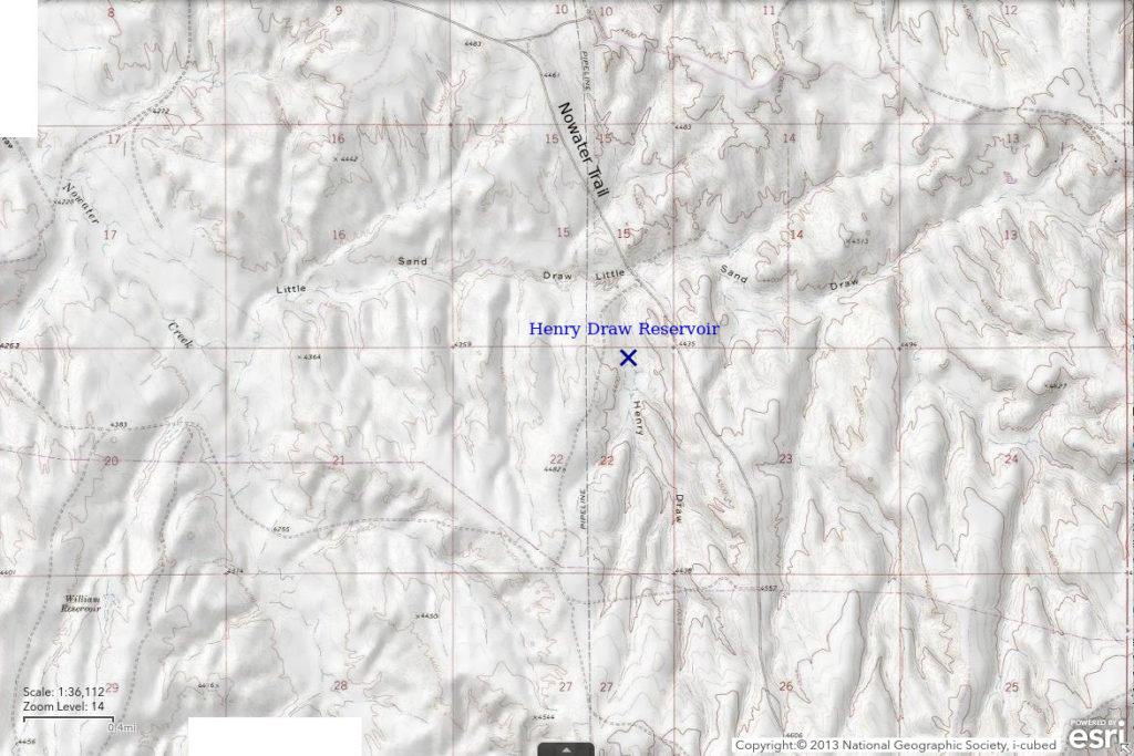
Henry Draw Reservoir is off Nowater Trail road 18.5 km (11.5 miles) southeast of Worland. Henry Draw is a small drainage that drains north into Little Sand Draw, which drains west into Nowater Creek. On the 7.5-minute topographic quadrangle, the reservoir is 280 m x 75 m (920′ x 250′) and is shown as intermittent. Henry Draw Reservoir is a little less than 400 m (1,310′) west of Nowater Trail.
Henry Draw Reservoir is accessible via Nowater Trail. Nowater Trail is a non-paved road that probably has a county road number but I don’t know what it is. It generally follows Nowater Creek from Worland to the Nowood River south of Big Trails. It passes through mostly public land with a few large ranches so it doesn’t get much use. To get on Nowater Trail, take Wyoming 432 south out of Worland. At the intersection where 432 makes a right angle turn to the west, continue to the south for about 3/4 miles. At the Upper Hanover Canal bridge, turn east. After about 1/4 mile, the road makes a right-angle turn to the south and after another 1/4 mile or so angles off to the southeast toward the hills. Within about 4 miles, Nowater Trail crosses Nowater Creek and then generally stays on ridges, where the chances of landslides and washouts are less.
Elevation: 1,327 m (4,354′)
June 1, 1993
I pulled off on an unimproved road just south of the Little Sand Draw crossing and hiked up the draw to see if there is any water in the reservoir.
- Size and depth not estimated.
- Opaque water.
- No fairy shrimp.
- Other animals not noted.
Nowater Creek Reservoir (Worland BLM Office)
___This map is a screenshot of The National Map (Go to The National Map). The U.S. Geological Survey generally does not copyright or charge for its data or reports (unless printed). A pond location is indicated by an “X”, which corresponds to the coordinates given in the data spreadsheet. Labels in quotations are from 7.5-minute topographic quadrangles.
___The U. S. National Grid layer was not available when this map was created. Thin gray section lines on the topographic base map have a nominal spacing of 1 mile (1.6 km).
___Gray shading represents private land as traced from the PAD-US 2.0 – Federal Fee Managers layer of The National Map. Other lands are public or owned by the State of Wyoming.
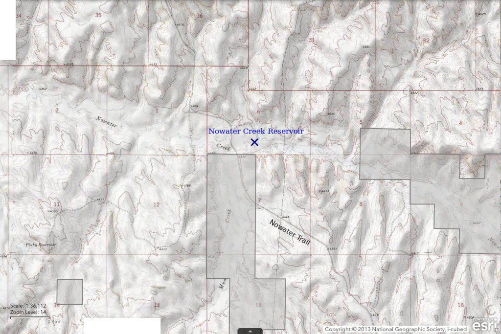
Nowater Creek Reservoir is off Nowater Trail road 25 km (15.5 miles) southeast of Worland. On the 7.5-minute topographic quadrangle, the reservoir is 140 m x 120 m (460′ x 390′) but it has a complex shape. USGS imagery for The National Map indicates that a smaller pond below the reservoir likely has the most persistent water. Nowater Creek Reservoir does not capture flows in Nowater Creek. It is just north of the Nowater Creek channel on a small drainage from the north. Dense vegetation around the lower pond suggests water persists, at least in the shallow subsurface, throughout the year.
For access, see Henry Draw Reservoir. Nowater Creek Reservoir is on the north side of Nowater Creek about 500 m (1,640′) east of Nowater Trail. A road leads to the reservoir.
Elevation: 1,331 m (4,367′)
June 1, 1993
The lower pond had water but I don’t remember if the rest of the reservoir did.
- Size and depth not estimated.
- Opaque water.
- No fairy shrimp.
- Other animals not noted.
Nowater 4623 Pond (Worland BLM Office)
Nowater 4623 Pond is off Nowater Trail road 37.5 km (23 miles) southeast of Worland. It is at the intersection of an unimproved road with Nowater Trail which has a spot elevation of 4,623′ (1,409 m) on the 7.5-minute topographic quadrangle. On that map, the pond is a narrow, intermittent pond about 110 m (360′) long, which appears to be ponded against the shoulder of Nowater Trail. It has no inlet or outlet. My notes say I looked at 2 ponds off Nowater Trail above Nowater Creek Reservoir. As this is 1 of 3 ponds shown on topographic maps and USGS imagery of The National Map less than 700 m (2,300′) from the road and is impossible to miss, I’m pretty sure I stopped here.
For access, see Henry Draw Reservoir. Nowater 4623 Pond is adjacent to Nowater Trail about 500 m (1,640′) east of the Nowater Creek crossing.
Elevation: 1,409 m (4,622′)
June 1, 1993
It’s a small pond alongside the road so why not stop?
- Size and depth not estimated.
- Opaque water.
- No fairy shrimp.
- Other animals not noted.
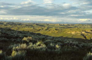
View northeast across the Bighorn Basin from Nowater Trail toward the Bighorn Mountains as the sun sinks slowly in the west. I didn’t record exactly where I took this photograph but the topography suggests it may have been on the drive between Nowater Creek Reservoir and Nowater 4623 Pond.
“Holland Reservoir” (Worland BLM Office)
___This map is a screenshot of The National Map (Go to The National Map). The U.S. Geological Survey generally does not copyright or charge for its data or reports (unless printed). A pond location is indicated by an “X”, which corresponds to the coordinates given in the data spreadsheet. Labels in quotations are from 7.5-minute topographic quadrangles.
___The U. S. National Grid layer was not available when this map was created. Thin gray section lines on the topographic base map have a nominal spacing of 1 mile (1.6 km).
___Gray shading represents private land as traced from the PAD-US 2.0 – Federal Fee Managers layer of The National Map. Other lands are public or owned by the State of Wyoming.
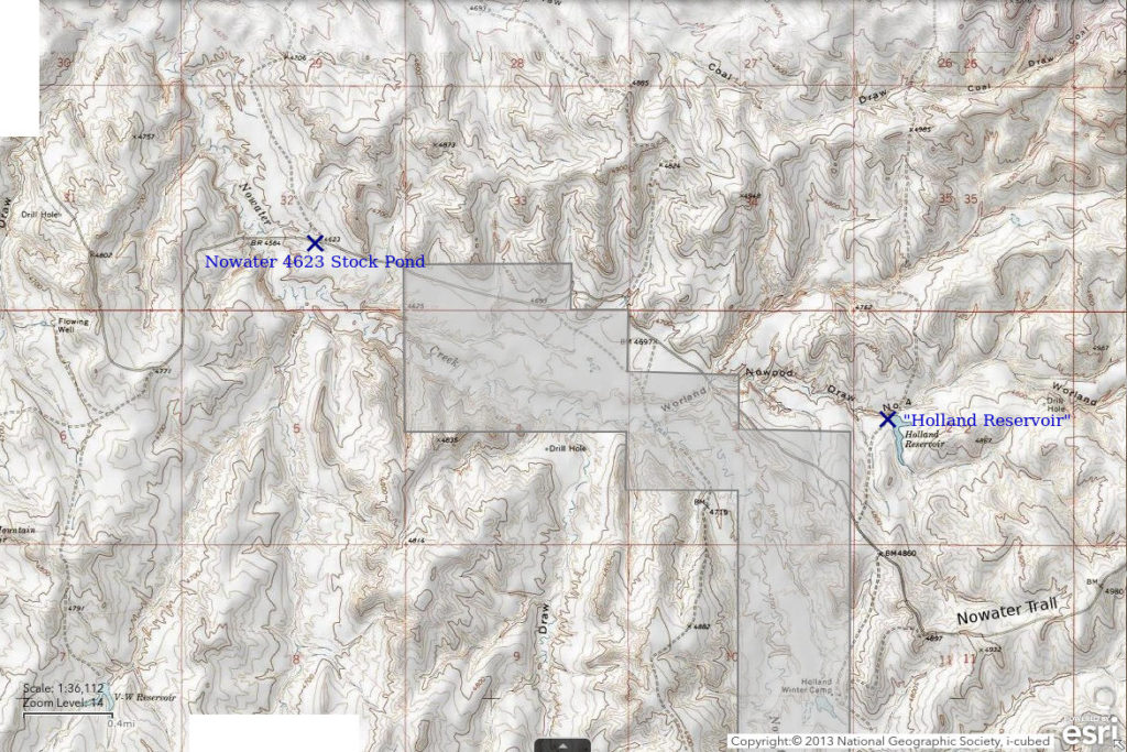
“Holland Reservoir” is off Nowater Trail road 41 km (25.5 miles) southeast of Worland. “Holland Reservoir” is shown with the perennial lake symbol on the 7.5-minute topographic quadrangle and dimensions of 350 m x 75 m (1,150′ x 250′). As this is 1 of 3 ponds shown on topographic maps and USGS imagery of The National Map less than 700 m (2,300′) from the road and is the only one shown on the 1:100,000-scale BLM map that I had with me, I’m pretty sure I stopped here. A reservoir at “Holland Winter Camp” is on the opposite side of Nowater Trail from “Holland Reservoir” in the same area. Although the winter camp reservoir is also accessible by road and not much farther from Nowater Trail, it is on private land so it’s less likely I stopped there.
For access, see Henry Draw Reservoir. “Holland Reservoir” is about 500 m (1,640′) northeast of Nowater Trail. A road leads to the reservoir.
Elevation: 1,442 m (4,731′)
June 1, 1993
A sizable reservoir with quite a bit of water – it looks like the best chance for fairy shrimp I have had all day.
- 75 m x 350 m based on 7.5-minute quadrangle; depth not estimated.
- Opaque water.
- No fairy shrimp.
- Other animals not noted.
Upper Joe Henry Fork Pond (Worland BLM Office)
___This map is a screenshot of The National Map (Go to The National Map). The U.S. Geological Survey generally does not copyright or charge for its data or reports (unless printed). A pond location is indicated by an “X”, which corresponds to the coordinates given in the data spreadsheet. Labels in quotations are from 7.5-minute topographic quadrangles.
___The U. S. National Grid layer was not available when this map was created. Thin gray section lines on the topographic base map have a nominal spacing of 1 mile (1.6 km).
___Gray shading represents private land as traced from the PAD-US 2.0 – Federal Fee Managers layer of The National Map. Other lands are public or owned by the State of Wyoming.
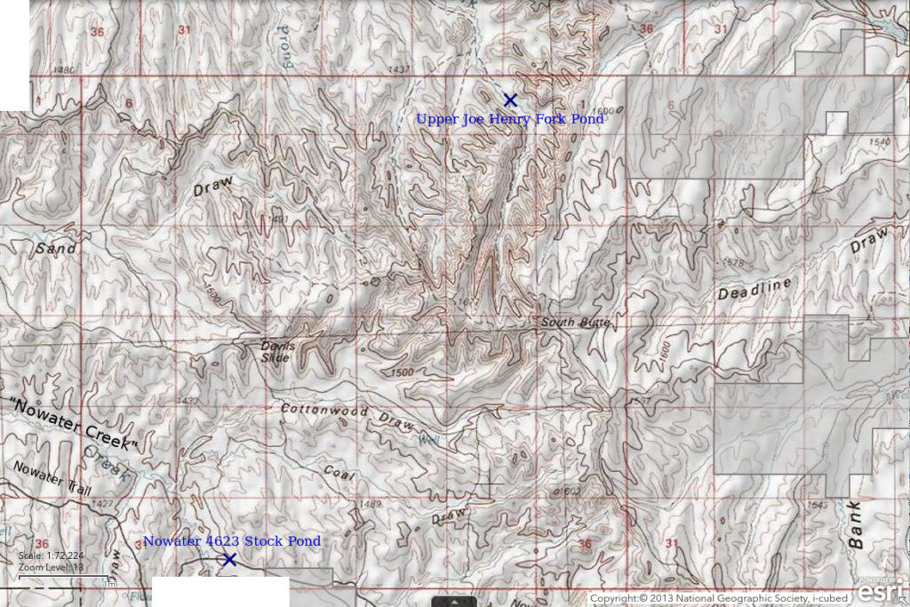
Upper Joe Henry Fork Pond is north of Nowater Trail road 46 km (28.5 miles) southeast of Worland. My notes say that I visited 4 stock ponds in the “upper gullies of Joe Henry Fork” “within a few miles of South Butte”. This is the uppermost pond in Joe Henry Fork on the 7.5-minute topographic quadrangle and on USGS imagery for The National Map so I’m pretty sure this is one of the ones I visited. It is only about 2.5 miles (4 km) north of South Butte. There are other ponds farther down the drainage and farther from South Butte and it would be hard to guess which other ones I visited. In any case, they all had the same fauna. Upper Joe Henry Fork Pond is 80 m x 25 m (260′ x 80′) on the 7.5-minute topographic quadrangle.
For access, see Henry Draw Reservoir. There is an unimproved road from Nowater Trail to South Butte on the Deadline Draw quadrangle but I don’t remember if it’s passable. From there, it’s a hike to Upper Joe Henry Fork Pond. Maps show unimproved roads up Joe Henry Fork from the northwest but they stop a few kilometers (miles) short of the pond.
Elevation: 1,453 m (4,766′)
June 1, 1993
The hills here are honeycombed with deep, steep gullies and the area from South Butte to North Butte is referred to as “The Honeycombs” on the 1:100,000-scale BLM map. Hiking on the ridges and along the major drainages is straightforward but going from one to the other can be tricky due to the steep, clayey slopes which are, in some cases, nearly vertical. I don’t think I expected to find any ponds here so any water I found was just a bonus to the scenery.
- Size and depth not estimated.
- Opaque water.
- No fairy shrimp.
- “Sizable” (according to notes) tadpoles and salamanders.
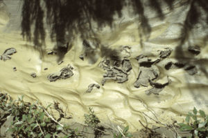
Gully in upper Joe Henry Fork with flakes of drying clay peeling off the underlying ripples. This indication of recent rain is a good sign.
“Cottonwood Trail Reservoir” (Worland BLM Office)
___This map is a screenshot of The National Map (Go to The National Map). The U.S. Geological Survey generally does not copyright or charge for its data or reports (unless printed). A pond location is indicated by an “X”, which corresponds to the coordinates given in the data spreadsheet. Labels in quotations are from 7.5-minute topographic quadrangles.
___The U. S. National Grid layer was not available when this map was created. Thin gray section lines on the topographic base map have a nominal spacing of 1 mile (1.6 km).
___Gray shading represents private land as traced from the PAD-US 2.0 – Federal Fee Managers layer of The National Map. Other lands are public or owned by the State of Wyoming.
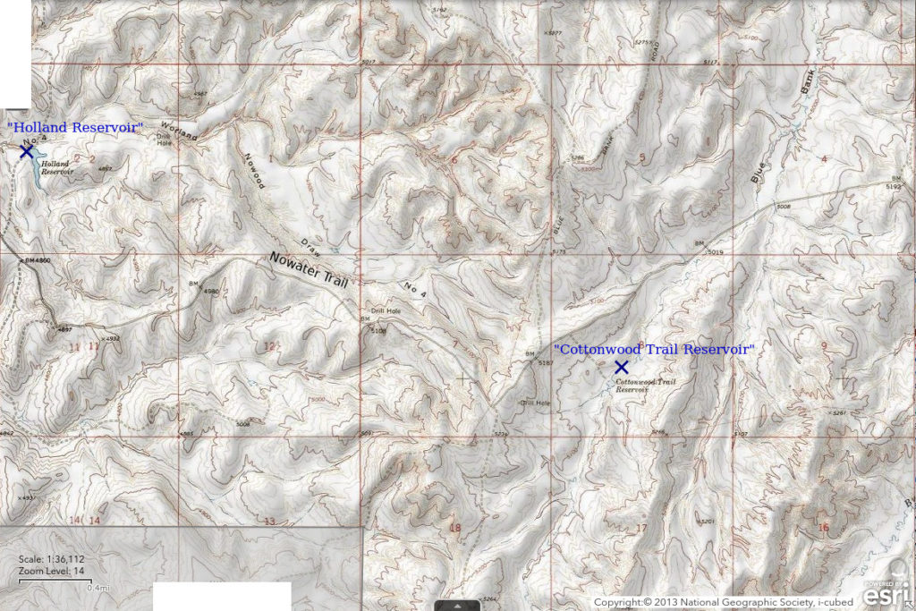
“Cottonwood Trail Reservoir” is off Nowater Trail road 46 km (28.5 miles) southeast of Worland. It is in Bluebank Draw immediately east of the Nowater Creek – Nowood River divide. My notes indicate I stopped at 1 pond on the drive out after visiting Upper Joe Henry Fork Pond before I got to Nowood River. This one is the only plausible candidate on the 7.5-minute topographic quadrangles and the USGS imagery for The National Map. The 7.5-minute quadrangle shows the reservoir as a round, intermittent pond about 75 m (250′) across but the USGS imagery shows a second pond of similar size to the north, which was the one with water when the imagery was acquired.
For access, see Henry Draw Reservoir. “Cottonwood Trail Reservoir” is 550 m (1,640′) south of Nowater Trail and is visible from the road. An unimproved road leads to the reservoir.
Elevation: 1,541 m (5,055′)
June 2, 1993
Still seeing stock ponds with water so still looking.
- Size and depth not estimated.
- Opaque water.
- No fairy shrimp.
- “Small” (according to notes) tadpoles and salamanders.
Lone Tree Ranch Reservoir (private)
___This map is a screenshot of The National Map (Go to The National Map). The U.S. Geological Survey generally does not copyright or charge for its data or reports (unless printed). A pond location is indicated by an “X”, which corresponds to the coordinates given in the data spreadsheet. Labels in quotations are from 7.5-minute topographic quadrangles.
___The U. S. National Grid layer was not available when this map was created. Thin gray section lines on the topographic base map have a nominal spacing of 1 mile (1.6 km).
___Gray shading represents private land as traced from the PAD-US 2.0 – Federal Fee Managers layer of The National Map. Other lands are public or owned by the State of Wyoming.
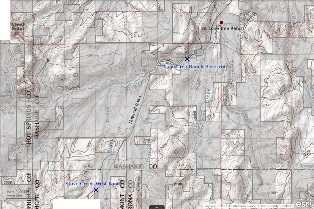
Lone Tree Ranch Reservoir is off the Nowood Road 28.5 km (18 miles) southwest of Big Trails. It is on the Nowood River 2.6 km (1.6 miles) southwest of Lone Tree Ranch (name shown on 7.5-minute topographic quadrangle). The reservoir is 375 m x 130 m (1,230′ x 430′) on that map. My notes say I looked at 3 ponds on the Nowood Road before I reached Lost Cabin. As this is the biggest, most visible, and closest to the road, I’m pretty sure this is one of them.
Lone Tree Ranch Reservoir is on private land but the northern shore is so close to the Nowood Road that it might be within the right-of-way.
The road south of Big Trails is the non-paved Nowood Road. It leads to Lost Cabin and Lysite and is shown on the official highway map of Wyoming. Lone Tree Ranch Reservoir is less than 50 m (165′) south of the Nowood Road.
Elevation: 1,777 m (5,829′)
June 2, 1993
No good place to park on the shoulder of the road but there’s no traffic. I’ll just take a quick look.
- 130 m x 375 m based on 7.5-minute quadrangle; depth not estimated.
- Water clarity not noted.
- No fairy shrimp.
- Other animals not noted.
Stove Creek West Pond (private)
Stove Creek West Pond is 36 km (22 miles) southwest of Big Trails. Stove Creek West Pond has dimensions of 150 m x 40 m (490′ x 130′) on the 7.5-minute topographic quadrangle. It is on a west branch of Stove Creek and adjacent to the Nowood Road. Its proximity to the road strongly suggests it is one of the 3 ponds I visited on the Nowood Road between the junction with Nowater Trail and Lost Cabin. There is another pond about 1 km (0.6 miles) southwest of Stove Creek West Pond but it may not be visible from the road. Another pond about 1.3 km (0.8 miles) south of Cottonwood Pass is close to a ranch so I probably wouldn’t have stopped there. I won’t hazard a guess for where the third pond is.
Stove Creek West Pond is on private land in an area with a complex configuration of private and public land that discourages one from wandering far from the county road.
Stove Creek West Pond is on the southeast side of Nowood Road about 2.3 km (1.4 miles) northeast of Cottonwood Pass.
Elevation: 1,977 m (6,485′)
June 2, 1993
A stop too easy to pass up.
- Size and depth not estimated.
- Water clarity not noted.
- No fairy shrimp.
- Other animals not noted.
What Can We Learn from the Ponds in the Bighorn Basin?
The ponds I looked at in the Bighorn Basin are almost all anthropogenic and used for stock watering. They may not be well suited for fairy shrimp but at least they have water for at least a few months in years with normal precipitation.
Of 10 ponds that I observed with water, 1 had fairy shrimp. It was a roadside pond rather than a stock pond.
The species found in the 1 pond with fairy shrimp also occurs in the similarly low-elevation Eastern Wind River Basin and in the somewhat higher Granite Mountains.
For most ponds, I neither listed aquatic animals that I saw nor wrote that I didn’t see any. However, I did record seeing salamanders in 3 ponds and tadpoles in 2. These predators may inhibit colonization of Bighorn Basin ponds by fairy shrimp even though fairy shrimp coexist with salamanders and frogs in some ponds in the Antelope Hills.
Anostracan species identified by Denton Belk are:
Branchinecta lindahli – 431 Steele Roadside Pond.