The base map is provided by OpenTopoMap’s volunteer servers.
“Coyote Lake”
Bull Canyon Pond
Blackbird Pond
Avocet Lake Northeast Pond
Avocet Lake Southwest Pond
Avocet Lake
Salamander Pond
“Silver Creek Reservoir”
Northeastern “Lewiston Lake”
Middle “Lewiston Lake”
Big “Lewiston Lake”
“Daley Lake”
Cuesta Pond
“Scotty Lake”
“McKay Lake”
“Murray Lake”
Chinook Pond
North “Scotty Lake” West Pond
Axolotl Pond
Joe Hay Rim East Pond
Section Marker Pond
Oregon Buttes Southwest Pond
Oregon Buttes North Pond
Upper Oregon Gulch Pond
“Woods Gulch Pond”
“Circle Bar Lake”
Diamond Springs Pond
McLean Spring Pond
“Stinking Springs Reservoir”
North “Scotty Lake” East Pond
Off South Fork Sulphur Creek Pond
What Can We Learn from the Ponds in the Antelope Hills?
The Antelope Hills are a poorly defined physiographic unit. The Lander and South Pass 30-minute x 60-minute topographic quadrangles have labels for the Wind River Mountains north of Wyoming 28 but no name for the hilly terrain between the highway and the Sweetwater River. The label Antelope Hills is a few kilometers south of the river and has rather small lettering. Historically, the term may have applied only to the hills near the branch of the Oregon-California emigrant trail south of the Sweetwater River. For this web site, the name Antelope Hills is applied to the area east of the continental divide and generally between Wyoming 28 on the north and the divide between the Sweetwater River and the Great Divide Basin on the south. The Sweetwater – Great Divide Basin divide extends from Oregon Buttes to Continental Peak, along Honeycomb Buttes and Cyclone Rim, and eventually up to Crooks Mountain. Northeast of the Antelope Hills is the Sweetwater Valley, which is considered part of the Granite Mountains region for this web site. For fairy shrimp purposes, Crooks Mountain is included in the Antelope Hills. The northern boundary of the Antelope Hills east of Atlantic City is the divide between the Sweetwater River, which flows to the east, and Beaver, Twin, and other creeks which take a roundabout route to the Wind River to the north. With this definition, the Antelope Hills are up to 60 km (37 miles) east-west and up to 30 km (19 miles) south-north. Notably, Antelope Hills is the only physiographic name shown on the official Wyoming highway map between Wyoming 28, the northern hydrologic divide of the Great Divide Basin, and US 287 as far east as Jeffrey City.
Elevations in the Antelope Hills are generally between 1,940 m (6,360′), at the junction of Alkali Creek and the Sweetwater River, and 2,300 m (7,550′). The hills around South Pass City and Atlantic City in the north are a little higher. Cyclone Rim in the south reaches 2,220 m (7,280′).
Mean Annual Precipitation according to the Wyoming Climate Atlas by the Water Resources Data System and State Climate Office at http://www.wrds.uwyo.edu/sco/climateatlas/precipitation.html, Parameter-Elevation Regressions on Independent Slopes Model, PRISM, with 1971-2000 data at very widely spaced weather stations (I have eyeballed the values from a very small scale map with 11 precipitation bins marked with indistinct colors and further obscured by a shaded relief base map):
11″-15″ (28-38 cm) or 16″-20″ (41-51 cm) at the northern edge
Sagebrush is dominant throughout the Antelope Hills. There are a few pine and aspen groves in the northern part of the hills and some patches of shortgrass prairie. Willows are abundant locally along the streams.
Most of the Antelope Hills are public lands managed by the Lander Field Office of the BLM. There are extensive, but generally narrow, areas of private lands along the Sweetwater River and most of the perennial creeks. However, the well traveled roads cross these lands without impediments. There are patented mining claims near the site of Lewiston on lower Strawberry Creek and at Wilson Gulch. There are small parcels of private land around many springs and at some other locations. In almost all Townships, sections 16 and 36 are owned by the state of Wyoming and there are many other parcels of state land of various sizes which are often associated with springs or creeks. State lands are not identified on the ground. South Pass City is a state park worth visiting. There are private lands and patented mining claims near the town of Atlantic City.
“Coyote Lake” (Lander BLM Office)
___This map is a screenshot of The National Map (Go to The National Map). The U.S. Geological Survey generally does not copyright or charge for its data or reports (unless printed). A pond location is indicated by an “X”, which corresponds to the coordinates given in the data spreadsheet. Labels in quotations are from 7.5-minute topographic quadrangles.
___Red lines are the U. S. National Grid with a spacing of 1,000 m and intersection labels consisting of the UTM zone (e.g., 11S, 12T), a 2-letter 100-km square designation (e.g., LC, XN), and a 4-digit number. The first 2 digits of the number represent the 1,000-meter Easting and the second 2 digits the 1,000-meter Northing, as seen in the example Easting and Northing. Unlike latitude and longitude, the National Grid is rectilinear on a flat map, the units of abscissa and ordinate have equal lengths, and the units (meters) are measurable on the ground with a tape or by pacing.
___Gray shading represents private land as traced from the PAD-US 2.0 – Federal Fee Managers layer of The National Map. Other lands are public or owned by the State of Wyoming.
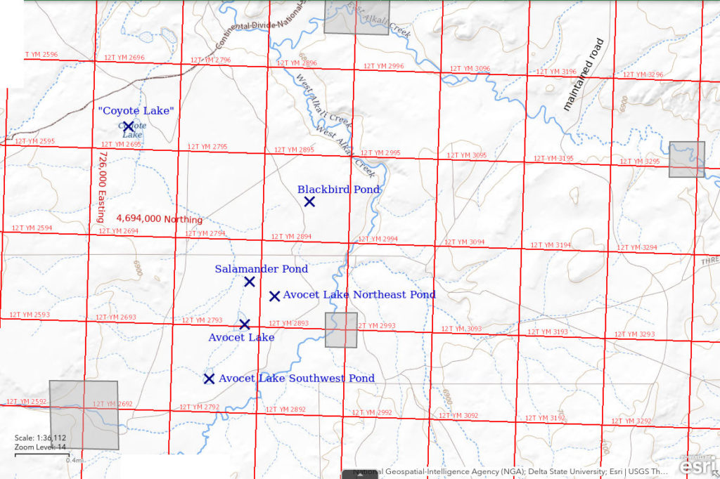
“Coyote Lake” is 42 km (26 miles) southeast of Atlantic City and 19 km (12 miles) south of Sweetwater Station. It is in a shallow depression in a rather flat area 3.6 km (0.7 miles) long and about 1.4 km (0.9 miles) wide between West Alkali Creek to the east and Coyote Gulch to the northwest. It does not receive flows from any significant drainages. It dries up seasonally in some years and may persist or never fill up in others. When dry, the lake bed can be identified by its lack of sagebrush and most other vegetation. In wet years, the water extends up into the sagebrush. There is no name or indication of “Coyote Lake” on the 1:100,000-scale BLM map. However, a 300 m (980′) long by 75 m (250′) wide intermittent lake symbol on the 7.5-minute topographic quadrangle is labeled “Coyote Lake”.
The Bison Basin road provides access to the “Coyote Lake” area. It is maintained by the county. Bison Basin is an oil field that was inactive in the 1980s. The “Bison Basin Oil Field” is in “Buffalo Basin” on the 7.5-minute topographic quadrangle. The Bison Basin road turns south off US 287 on the east side of the Sweetwater River at Sweetwater Station. It swings around the west side of Crooks Mountain to reach the oil field north of Flattop Buttes. At the crossing of East Alkali Creek, the road is 5 km (3 miles) east of “Coyote Lake”. A 2-track that turns west off the Bison Basin road about 2 miles north of East Alkali Creek was poor but passable the first times I visited the lake but was later washed out. It may be possible to drive a roundabout route to the lake from the Seminoe cutoff of the emigrant trail south of the Sweetwater River.
Elevation: 2,076 m (6,811′)
May 16, 1987
I was surprised to find fairy shrimp here on May 9 but was unprepared then so I came back. I brought a small aquarium net and a bird identification guide from the library. There is white mineral efflorescence on the southwestern shore of the lake.
- Visually estimated 450 m x 700 m; max depth not estimated but up to 5 cm deep where reachable from shore.
- Water generally murky but almost clear where vegetation is abundant.
- Very pale gray fairy shrimp of various sizes, most about 15 mm long; females commonly have white eggs.
- Northern leopard frog (Rana pipiens), dead tadpole shrimp (Notostraca) washed up by waves, whirligig beetles, other beetles, locally abundant copepods, unidentified larvae, avocets, Wilson’s phalaropes, coots, long-billed dowitchers, shovelers, cinnamon teals, ring-billed gulls, killdeers; red, round, fast, steady swimmers smaller than a BB may be water mites.
Specimens were identified as Branchinecta paludosa by DB (archive #DB 801-813, which includes specimens from other ponds).
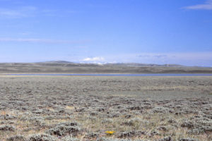
View to northwest across “Coyote Lake”, with Wind River Mountains on the horizon.
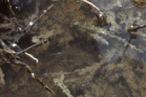
Fairy shrimp swimming amidst vegetation in “Coyote Lake”. The lower one is a female with pale brown eggs in its ovisac and 2 rows of white eggs, presumably in its oviducts. The upper one is a male.
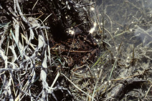
Northern leopard frog among the drowned sagebrush stems at the edge of “Coyote Lake”. This frog may have eaten fairy shrimp as a youngster.
June 7, 1987
Lake level doesn’t look much different than in May but there are more rushes growing along the shore and in the water. Algae is abundant in some areas. Cows have trampled the shore all the way around the lake. There are not as many birds as there were back in May.
- 430 m x 680 m, sizes arbitrarily reduced by 20 m compared to May 16; depth not estimated.
- Murky water.
- Fairy shrimp about the same size as on May 16 except for some distinctly smaller ones; specimens 12-17 mm; larger females have eggs.
- Dytiscid larvae (order Coleoptera, family Dytiscidae), backswimmers (sub-order Heteroptera, family Notonectidae), beetles, dragonflies and probably larvae, ostracods (some 3-4 mm) with brown or red or green colors, plentiful black copepods(?), various cladocerans (some 2 mm) including greenish ones with eggs, avocets, Wilson’s phalaropes, shovelers, other ducks, swallows, killdeers.
Specimens were identified as Branchinecta paludosa by DB (archive #DB 801-813, which includes specimens from other ponds).
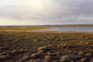
“Coyote Lake” at sunrise.
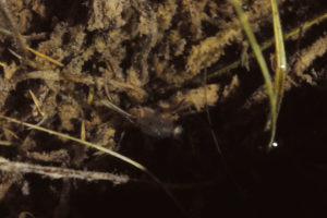
A fairy shrimp in “Coyote Lake”, with a beam of sunlight refracting through its head as it swims into the shadow. Superficially, this female appears to have 2 ovisacs with pale eggs. It is likely that one of the pale lines is food in the abdomen. To further complicate matters, there is an extra abdomen. It also has pale food material and curves toward the top of the photograph from the upper part of the female’s abdomen. This is probably the abdomen of an otherwise invisible male swimming below the female as if preparing to attempt copulation.
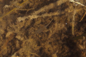
A male fairy shrimp in “Coyote Lake”. The fat proximal parts of the male’s antennae II are visible but the distal segments are not. This is because Branchinecta paludosa has short, tapered distal segments unlike the long bladed distal segments of Branchinecta coloradensis that cross over the thorax, like the male in photograph Bivouac Lake 1986-09-03, #0806c2 (see Wind River Mountains). The black spot in the middle of the fairy shrimp’s forehead is the ocellus, or “third eye”. Other black spots in the photograph which are a little smaller than the fairy shrimp’s eyes may be copepods.
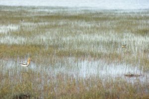
Avocet (left) and phalarope (right) amidst rushes in “Coyote Lake”. They may be looking for fairy shrimp to eat.
June 28, 1987
The shoreline is considerably overgrown with rushes.
- Size not estimated; depth at least 30 cm.
- Water clarity not noted.
- No fairy shrimp.
- Other animals not noted.
August 4, 1987
There is still plenty of water but the shape of the lake has changed considerably. The shoreline is thoroughly overgrown with rushes. There is lots of algae clinging to rushes and on the surface of the water.
- Size not estimated; depth at least 30 cm.
- Clear pale brown water.
- No fairy shrimp.
- Backswimmers (sub-order Heteroptera, family Notonectidae), beetles, blue dragonflies, mayflies, very small zooplankton apparently absent, ducks, geese, grebes, cows.
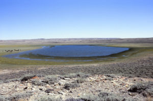
View south across shrunken “Coyote Lake”. This is more like the shape shown on the Happy Spring 7.5-minute topographic quadrangle. Maybe it has gotten too warm for fairy shrimp or maybe I just didn’t find them. A group of cows is to left of lake.
June 6, 1988
The shoreline is densely overgrown with rushes. Water level is similar to late June 1987. There is a stinky green algal scum washed up by the waves in places.
- Size and depth not estimated.
- Clear pale brown water.
- No fairy shrimp.
- Abundant black copepods(?) but not much other zooplankton, phalaropes, ducks, geese, grebes, coots, willets, killdeers.
May 28, 1989
The water level is the lowest I have ever seen it. Seeing anything in the water is difficult due to high winds. The bottom is so soft I couldn’t wade out very far.
- Size and depth not estimated.
- Cloudy water.
- No fairy shrimp.
- Abundant red copepods(?), amphipods about 5 mm long, phalaropes, avocets, ducks, geese, swallows, willets, killdeers.
June 5, 1990
“Coyote Lake” looked dry from the Bison Basin road so I didn’t turn off.
- Dry.
May 7, 1992
This is seriously dry.
- Dry.
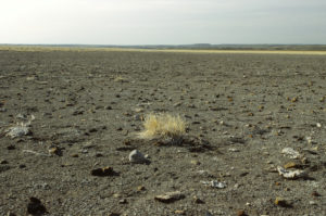
The very dry bottom of “Coyote Lake”.
June 11, 1993
There is only a small lake, far below the level of June 1987, but at least there is some water.
- Size and depth not estimated.
- Opaque brownish-white water; 18 C at 1615.
- Abundant pale gray to greenish-blue fairy shrimp of 2 kinds: with short distal segments of male antennae II or long distal segments of male antennae II; females have up to 50 eggs in long narrow ovisacs.
- Few beetles, backswimmers (sub-order Heteroptera, family Notonectidae), very abundant wriggly larvae, many ostracods, some clam shrimp (Conchostraca).
The fairy shrimp were identified as Branchinecta paludosa (most abundant; have short distal segments of antennae II) and Branchinecta readingi (sparse; have long distal segments of antennae II) (archive #DB 1243) and the clam shrimp as Caenestheriella belfragei (now Cyzicus belfragei of the sub-order Spinicaudata according to online Integrated Taxonomic Information System) by DB.
It doesn’t look like lake level per se affects fairy shrimp hatching as long as some eggs get inundated. Of course, the low volume of water may mean that the lake dries up come autumn this year.
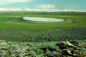
“Coyote Lake”, looking south. The lake has come back from the 1992 desiccation but it is pretty small. In June 1987, the water was up into the sagebrush. Cows at left, again.
June 17, 2005
Another dry year.
- Dry.
Bull Canyon Pond (Lander BLM Office)
___This map is a screenshot of The National Map (Go to The National Map). The U.S. Geological Survey generally does not copyright or charge for its data or reports (unless printed). A pond location is indicated by an “X”, which corresponds to the coordinates given in the data spreadsheet. Labels in quotations are from 7.5-minute topographic quadrangles.
___Red lines are the U. S. National Grid with a spacing of 1,000 m and intersection labels consisting of the UTM zone (e.g., 11S, 12T), a 2-letter 100-km square designation (e.g., LC, XN), and a 4-digit number. The first 2 digits of the number represent the 1,000-meter Easting and the second 2 digits the 1,000-meter Northing, as seen in the example Easting and Northing. Unlike latitude and longitude, the National Grid is rectilinear on a flat map, the units of abscissa and ordinate have equal lengths, and the units (meters) are measurable on the ground with a tape or by pacing.
___Gray shading represents private land as traced from the PAD-US 2.0 – Federal Fee Managers layer of The National Map. Other lands are public or owned by the State of Wyoming.
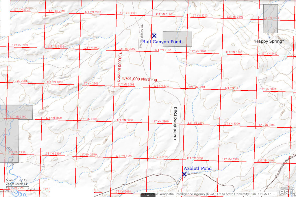
Bull Canyon Pond is a kidney-shaped pond in a small hollow on a bench on the west side of Crooks Mountain 11 km (7 miles) south of Sweetwater Station. It is surrounded by sagebrush but the pond bottom lacks sagebrush. The pond is about 350 m (1,150′) east of the Bison Basin road. On the 7.5-minute topographic quadrangle, the pond is 150 m x 70 m (490′ x 230′).
Bull Canyon Pond is close to the Bison Basin road but can be seen from only a short section of the road. The Bison Basin road turns south off US 287 on the east side of the Sweetwater River at Sweetwater Station. The pond is about 1 mile southeast of where the road makes a sharp turn from a northeast-southwest orientation to northwest-southeast.
Elevation: 2,193 m (7,195′)
May 15, 1987
I saw the pond while driving north back to the highway from “Coyote Lake” on May 9. It’s difficult to see while driving south. Having spotted fairy shrimp in “Coyote Lake”, NPPWOPII. Cows are grazing in the vicinity and there is considerable grass growing above the water surface. There are lots of cow pies around the pond.
- 60 m x 120 m; depth not estimated but more than 10 cm.
- Water generally clear where not disturbed by cows.
- Brownish-green fairy shrimp with long distal parts of male antennae II and salmon-colored fairy shrimp with short distal parts of male antennae II, all about 15 mm long; females have brown or white eggs. Some fairy shrimp are scraping the pond bottom or grass stems with their legs.
- Beetles, larvae, killdeers, blackbirds, cows.
The few specimens with long distal segments of antennae II were identified as Branchinecta coloradensis by DB (archive #DB 801-813, which includes specimens from other ponds). DB found the more common specimens with the short distal segments of antennae II to be similar to Branchinecta paludosa but thought they might be an undescribed species.
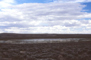
View to southwest across Bull Canyon Pond. There are some cows (pale spots and brown spots) in the distance at the right edge of the photograph.
June 6, 1987
The pond is mostly a bog now with a few pools 10 cm deep and others that may be deeper in spots.
- Pond “much reduced in size” (according to notes) so May 15 dimensions reduced by 20 m and 30 m to 40 m x 90 m; max depth not estimated but 10 cm in spots.
- Water clear and brownish.
- Pale brown fairy shrimp not as abundant as on May 15 and I had to wade in to deeper water to find them; specimens are bimodal within a range of 13-18 mm long; most females have eggs; some fairy shrimp are scraping the pond bottom, others are rising to the surface.
- 2 15-cm (6″) and 1 10-cm (4-inch) salamanders and several salamander larvae, abundant dytiscid larvae (order Coleoptera, family Dytiscidae), backswimmers (sub-order Heteroptera, family Notonectidae), beetles, little red spheres that may be water mites, very small zooplankton.
Most of the specimens were Branchinecta coloradensis, as identified by DB (archive #DB 801-813, which includes specimens from other ponds) and 1 was similar to Branchinecta paludosa.
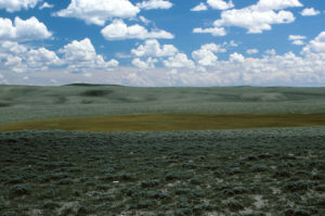
A completely overgrown Bull Canyon Pond, looking south with the head of Bull Canyon in the middle distance.
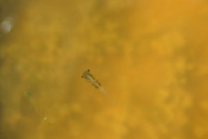
A male fairy shrimp in Bull Canyon Pond. This species has been identified as Branchinecta coloradensis by DB and this one has blade-like distal segments of antennae II which cross over the middle of the thorax and are characteristic of the species. Compare to photograph Bivouac Lake 1986-09-03, #0806c2 (in Wind River Mountains).
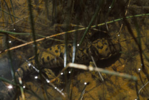
A mature salamander in Bull Canyon Pond. It barely budged when I walked by.
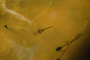
A salamander larva in Bull Canyon Pond. Salamander larvae eat fairy shrimp.
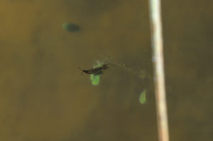
A rather small dytiscid larva on a leaf in Bull Canyon Pond. This is another fairy shrimp predator. I had earlier been made acutely aware of the dytiscid larvae when one bit my bare leg for no obvious reason. Was it actually trying to eat me?
June 28, 1987
Well, it was a very active pond full of animals while the water lasted but they are all gone now.
- Dry.
June 6, 1988
Overgrown with rushes. There is only one small puddle with a few adjoining pockets of water between the hummocks.
- 3 m x 6 m; depth not estimated.
- Water clear orange-brown.
- No fairy shrimp.
- Salamanders and salamander larvae, abundant backswimmers (sub-order Heteroptera, family Notonectidae), dytiscid larvae (order Coleoptera, family Dytiscidae), 2 mating whirligig beetles, other beetles and larvae, little red spheres that may be water mites.
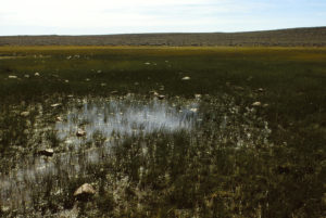
The last puddle of Bull Canyon Pond before it dries up. It has abundant aquatic fauna but no fairy shrimp.
May 28, 1989
I guess there wasn’t enough snow this winter.
- Dry.
June 5, 1990
Still hoping to catch that possible new species again.
- Dry.
May 7, 1992
No water even this early in the year.
- Dry.
June 11, 1993
Nothing but cracked mud. Maybe if I had gotten here sooner.
- Dry.
June 25, 1995
There’s not much water but it’s worth a look.
- Size not estimated; depth less than 20 cm.
- Water clear yellow-brown; 26 C at 1845.
- 2 kinds of fairy shrimp, most less than 15 mm but 1 male with long distal segment of antennae II about 20 mm; pale eggs.
- Backswimmers (sub-order Heteroptera, family Notonectidae), dytiscid larvae (order Coleoptera, family Dytiscidae), beetles, other larvae.
Most specimens were identified as the paludosa-like branchinectid and the 1 large male as Branchinecta coloradensis by DB. Maybe these additional specimens will provide DB with enough data to decide what to make of this possibly unrecognized species. After DB died, Rogers (2006) named the paludosa-like species Branchinecta serrata.
Blackbird Pond (Lander BLM Office)
Blackbird Pond is in a small depression between two low ridges on the west side of West Alkali Creek. It is 2,100 m (6,890′) southeast of “Coyote Lake” and 3,000 m (9,840′) southwest of the Bison Basin road crossing of East Alkali Creek. On the first visit, it was overgrown with vegetation and popular with blackbirds.
Blackbird Pond is a 3 km (1.9 miles) hike from the Bison Basin road at the East Alkali Creek crossing. The Bison Basin road turns south off US 287 on the east side of the Sweetwater River at Sweetwater Station.
Elevation: 2,091 m (6,861′)
May 16, 1987
The 1:100,000-scale BLM map shows 2 intermittent ponds southeast of “Coyote Lake” so I found this one on the way to the others. The pond is completely overgrown with grass and rushes but the water is swarming with life. The water has a definite yellowish-brown tint that may be due to organic acids.
- Size and depth not estimated.
- Water clear and yellowish-brown.
- Fairy shrimp smaller than those in “Coyote Lake”; most were females with greenish eggs.
- Lots of animals less than 2 mm and many larger larvae that I can’t identify, blackbirds.
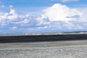
Looking north across Blackbird Pond. The pond is at center below the shadow.
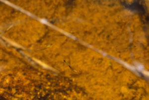
Several fairy shrimp swimming in the tinted water of Blackbird Pond. The fairy shrimp are blurry due to the slow shutter speed of 1/30 second. The fairy shrimp below center is a female with greenish eggs in the ovisac above its abdomen.
June 7, 1987
The pond is much reduced in size and is surrounded by a gooey bog filled with rushes. The water is choked with algae.
- Less than 20 m across; depth not estimated.
- Water clarity not noted.
- No fairy shrimp.
- Dytiscid larvae (order Coleoptera, family Dytiscidae), backswimmers (sub-order Heteroptera, family Notonectidae), water boatmen (sub-order Heteroptera, family Corixidae), beetles, salamander trails in the mud.
Avocet Lake Northeast Pond (State of Wyoming)
Avocet Lake Northeast Pond is about 1,200 m (3,940′) south of Blackbird Pond and 500 m northeast of Avocet Lake. It is also 2,400 m southeast of “Coyote Lake” and 3,700 m (7,870′) southwest of the Bison Basin road crossing of East Alkali Creek. It is west of West Alkali Creek in the flat area that extends south from “Coyote Lake”. The pond is in a closed contour indicative of a depression on the 7.5-minute quadrangle but there is no intermittent pond symbol there.
Avocet Lake Northeast Pond is in a section 36 so it is on land owned by the State of Wyoming.
Avocet Lake Northeast Pond is 4.5 km (2.8 miles) west of the Bison Basin road. Due to a bend in the road, hiking from the East Alkali Creek crossing would probably be closer. The Bison Basin road turns south off US 287 on the east side of the Sweetwater River at Sweetwater Station.
Elevation: 2,080 m (6,825′)
May 16, 1987
Still on the way to the intermittent ponds on the map. This pond is overgrown like Blackbird Pond.
- Size and depth not estimated.
- Water clarity not noted.
- Small, pale gray fairy shrimp; all appeared to be females but eggs not noted.
- Fauna “similar” (according to notes) to those in Blackbird Pond, which I couldn’t identify.
June 7, 1987
Just wet mud trampled by cows with mud cracks around the edges.
- Dry.
Avocet Lake Southwest Pond (State of Wyoming)
Avocet Lake Southwest Pond is about 700 m (2,300′) southwest of Avocet Lake. It is also 2,900 m (9,510′) south of “Coyote Lake” and 5,000 m (16,400′) southwest of the Bison Basin road crossing of East Alkali Creek. It is near the southern end of the flat area that extends south from “Coyote Lake” and only about 350 m (1,150′) west of West Alkali Creek. The pond is indicated by a 120 m x 200 m (390′ x 660′) intermittent pond symbol on the 7.5-minute topographic quadrangle.
Avocet Lake Southwest Pond is in a section 36 so it is on land owned by the State of Wyoming.
Avocet Lake Southwest Pond is 5 km (3 miles) west of the Bison Basin road. The Bison Basin road turns south off US 287 on the east side of the Sweetwater River at Sweetwater Station.
Elevation: 2,082 m (6,830′)
May 16, 1987
Like Avocet Lake, this pond is shown on the 1:100,000-scale BLM map. With clouds building, better to check out this more distant pond first before heading back by way of Avocet Lake. The pond is so overgrown that there is little open water. The shore is very marshy. There is considerable animal life but it is not as abundant as in the much smaller Blackbird Pond.
- 120 m x 200 m from 7.5-minute quadrangle; depth not estimated.
- Clear water with slight brown tint.
- Small fairy shrimp; didn’t see eggs.
- Many animals less than 2 mm but not as abundant as in Blackbird Pond, 2 willets.
June 7, 1987
There are still some deeper pools among the cow-stomped hummocks and a few large patches of very shallow water.
- Size and depth not estimated.
- Water murky.
- Saw only 1 female fairy shrimp; it had 2 rows of pale eggs in oviducts(?).
- Large northern leopard frog (Rana pipiens), dytiscid larvae (order Coleoptera, family Dytiscidae), beetles, ostracods, abundant brown copepods(?).
Avocet Lake (State of Wyoming)
Avocet Lake is about 2,400 m (7,870′) southeast of “Coyote Lake” and 4,300 m (14,110′) southwest of the Bison Basin road crossing of East Alkali Creek. It is near the southern end of the flat area that extends south from “Coyote Lake” and not much higher than West Alkali Creek. The lake is indicated by an intermittent lake symbol on the 1:100,000-scale BLM map. On the 7.5-minute topographic quadrangle, the intermittent lake symbol is 170 m x 250 m (560′ x 820′).
Avocet Lake is in a section 36 so it is on land owned by the State of Wyoming.
Avocet Lake is 5 km (3 miles) west of the Bison Basin road. Due to a bend in the road, hiking from the East Alkali Creek crossing would probably be closer. The Bison Basin road turns south off US 287 on the east side of the Sweetwater River at Sweetwater Station.
Elevation: 2,080 m (6,823′)
May 17, 1987
Avocet Lake is shown on the 1:100,000-scale BLM map not far from “Coyote Lake”. I visited the pond on May 16 but storm clouds were building so I hurried on to Avocet Lake Southwest Pond before making a dash back to my vehicle. Storm clouds are back today although it is earlier. There is a lot of vegetation along the shore.
- 170 m x 250 m from 7.5-minute quadrangle; depth not estimated.
- Murky water.
- Pale gray fairy shrimp, some with distinctly greenish-blue hue, generally 10-14 mm long; some females have brown eggs.
- Dead tadpole shrimp (Notostraca), lots of 2-3 mm ostracods, very small red and black zooplankton, larvae, red spheres 2 mm in diameter may be water mites, avocets, ducks.
Specimens were identified as Branchinecta paludosa by DB (archive #DB 801-813, which includes specimens from other ponds).
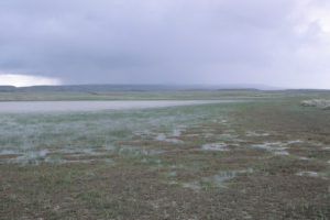
Avocet Lake and its marshy shore as a thunderstorm approaches.
June 7, 1987
The lake doesn’t look much smaller than on May 17 but it is more overgrown by rushes with little open water. 3 pairs of nesting avocets are being very vocal.
- Size and depth not estimated.
- Water clarity not noted.
- Pale gray fairy shrimp seem to be about the same size as on May 17; all appear to be females and most have eggs.
- Tadpole shrimp (Notostraca) carapaces, ostracods, avocets.
May 28, 1989
“Coyote Lake” has a little water but none here.
- Dry.
Salamander Pond (State of Wyoming)
Salamander Pond is north of Avocet Lake and west of Blackbird Pond on the flats south of “Coyote Lake”. It is about 2,000 m (6,560′) southeast of “Coyote Lake” and 4,000 m (13,120′) southwest of the Bison Basin road crossing of East Alkali Creek.
Salamander Pond is in the same section 36 as Avocet Lake, Avocet Lake Southwest Pond, and Avocet Lake Northeast Pond and is consequently on land owned by the State of Wyoming.
Salamander Pond is 5 km (3 miles) west of the Bison Basin road. Due to a bend in the road, hiking from the East Alkali Creek crossing would be closer. The Bison Basin road turns south off US 287 on the east side of the Sweetwater River at Sweetwater Station.
Elevation: 2,079 m (6,821′)
May 17, 1987
The pond is just a circle in the sagebrush overgrown by rushes with a little water between hummocks in the middle. Mud cracks have already appeared around the edges. Lots of minuscule zooplankton but I don’t know what they are. A salamander lying in the mud under less than 10 cm water pays no attention to me.
- 35 m x 50 m; depth up to about 15 cm.
- Clear water.
- Small, pale gray fairy shrimp, at least one distinctly greenish; some females have pale orange-brown eggs.
- Ostracods about 3 mm long, round black zooplankton less than 1 mm, 2 mm red zooplankton later identified under microscope as copepods, 5 mm cladoceran with eggs later identified under microscope, various larvae smaller than fairy shrimp.
Specimens were identified as Branchinecta paludosa by DB (archive #DB 801-813, which includes specimens from other ponds).
June 7, 1987
There are only a few pools of water left in the center between cow-stomped hummocks. Cows just ran off so the water is very turbid.
- Size and depth not estimated.
- Cloudy water due to cows.
- No fairy shrimp seen.
- Backswimmers (sub-order Heteroptera, family Notonectidae), beetles, “abundant minute zooplankton” (according to notes).
“Silver Creek Reservoir” (Lander BLM Office)
___This map is a screenshot of The National Map (Go to The National Map). The U.S. Geological Survey generally does not copyright or charge for its data or reports (unless printed). A pond location is indicated by an “X”, which corresponds to the coordinates given in the data spreadsheet. Labels in quotations are from 7.5-minute topographic quadrangles.
___Red lines are the U. S. National Grid with a spacing of 1,000 m and intersection labels consisting of the UTM zone (e.g., 11S, 12T), a 2-letter 100-km square designation (e.g., LC, XN), and a 4-digit number. The first 2 digits of the number represent the 1,000-meter Easting and the second 2 digits the 1,000-meter Northing, as seen in the example Easting and Northing. Unlike latitude and longitude, the National Grid is rectilinear on a flat map, the units of abscissa and ordinate have equal lengths, and the units (meters) are measurable on the ground with a tape or by pacing.
___Gray shading represents private land as traced from the PAD-US 2.0 – Federal Fee Managers layer of The National Map. Other lands are public.
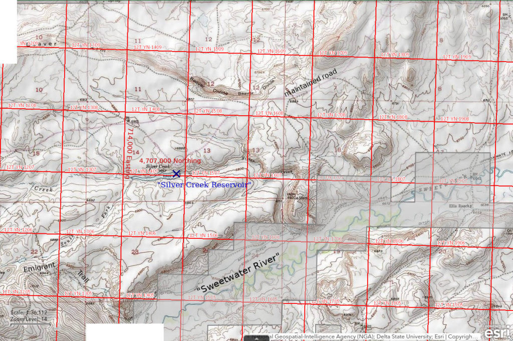
“Silver Creek Reservoir” is 28 km (17 miles) east of Atlantic City and about 2.5 km (1.5 miles) northeast of the confluence of Chimney Creek and the Sweetwater River. It is 1 km (0.6 miles) south of Fremont County road 2302 (according to the 1:100,000-scale BLM map), which connects Atlantic City to US 287 at Beaver Rim. On the 7.5-minute topographic quadrangle, the reservoir is 800 m (2,620′) long and up to 120 m (390′) wide. Silver Creek is shown as intermittent above and below the reservoir on the 7.5-minute quadrangle.
“Silver Creek Reservoir” can be reached from the maintained Atlantic City – Beaver Rim road. This road turns west off US 287 about 1 mile southeast of where the highway crests the Beaver Rim, or Beaver Divide, about halfway between Lander and Jeffrey City. An unimproved road that leads to the reservoir turns south off the Atlantic City – Beaver Rim road 8.5 miles or 9.5 miles west of US 287. 2 roads are shown on the 1:100,000-scale BLM map and I don’t remember which one I used or its condition.
Elevation: 2,075 m (6,807′)
June 5, 1987
Grasses and rushes are growing along the edges of the water.
- 120 m x 800 m based on 7.5-minute quadrangle; “fairly deep” (according to notes).
- Clear water.
- No fairy shrimp.
- Amphipods, beetles, water boatmen (sub-order Heteroptera, family Corixidae), blue and red dragonflies, “zooplankton not obvious”.
Northeastern “Lewiston Lake” (private?, Lander BLM Office?)
___This map is a screenshot of The National Map (Go to The National Map). The U.S. Geological Survey generally does not copyright or charge for its data or reports (unless printed). A pond location is indicated by an “X”, which corresponds to the coordinates given in the data spreadsheet. Labels in quotations are from 7.5-minute topographic quadrangles.
___Red lines are the U. S. National Grid with a spacing of 1,000 m and intersection labels consisting of the UTM zone (e.g., 11S, 12T), a 2-letter 100-km square designation (e.g., LC, XN), and a 4-digit number. The first 2 digits of the number represent the 1,000-meter Easting and the second 2 digits the 1,000-meter Northing, as seen in the example Easting and Northing. Unlike latitude and longitude, the National Grid is rectilinear on a flat map, the units of abscissa and ordinate have equal lengths, and the units (meters) are measurable on the ground with a tape or by pacing.
___Gray shading represents private land as traced from the PAD-US 2.0 – Federal Fee Managers layer of The National Map. Other lands are public or owned by the State of Wyoming.
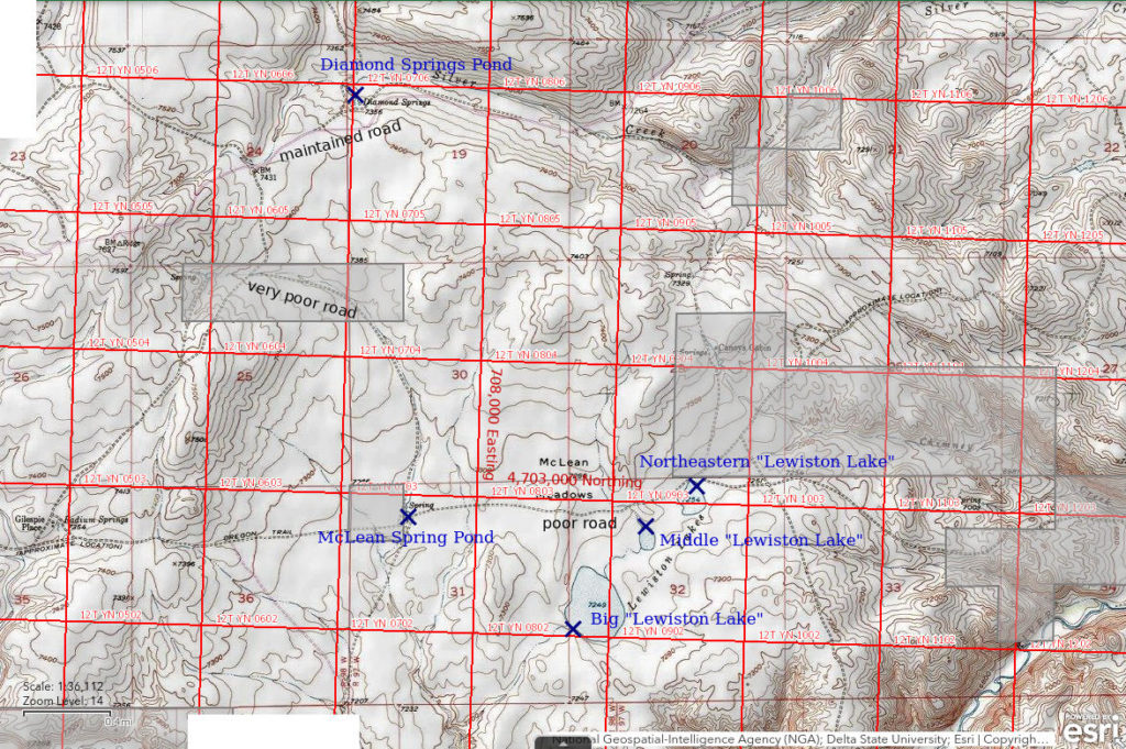
“Lewiston Lakes” are 23 km (14 miles) southeast of Atlantic City. The 3 “Lewiston Lakes” are referred to here as Northeastern “Lewiston Lake”, Middle “Lewiston Lake”, and Big “Lewiston Lake”. Northeastern “Lewiston Lake” is the one at the northeastern end of the northeast-southwest alignment of lakes. All 3 are north of Sweetwater River Canyon between Strawberry Creek and Chimney Creek and in the southeastern part of McLean Meadows. The Oregon – California Emigrant Trail passes less than 50 m (160′) north of the lake. The lakes have no significant stream inflows. Northeastern “Lewiston Lake” has an intermittent outlet to Chimney Creek. On the 7.5-minute topographic quadrangle, Northeastern “Lewiston Lake” is 240 m (790′) long and up to 190 m (620′) wide.
Northeastern “Lewiston Lake” is within a 40-acre (16 hectare) parcel of private land on the 1:100,000-scale BLM map. However, the PAD-US 2.0 – Federal Fee Managers layer of The National Map does not show this parcel. There may have been a land exchange between the time of publication of the BLM map in 1989 and my viewing of The National Map in 2022.
Although the Oregon – California Emigrant Trail is passable to vehicles in places, the safest approach to “Lewiston Lakes” is hiking from near Diamond Springs, which is on the maintained Atlantic City – Beaver Rim road. This road turns west off US 287 about 1 mile southeast of where the highway crests the Beaver Rim about halfway between Lander and Jeffrey City. Diamond Springs is 14.5 miles west of US 287 and a similar distance from Atlantic City. In this area, the Atlantic City – Beaver Rim road and the emigrant trail are approximately parallel and separated by 2-3 km (1.2-1.9 miles). An unimproved road that turns south off the Atlantic City road about 0.5 miles west of Diamond Springs connects to the emigrant trail but McLean Meadows has surprisingly deep mud holes at times and I got stuck in one once despite 4-wheel drive.
Elevation: 2,212 m (7,258′)
June 5, 1987
The lake is on sandy soil and doesn’t have much vegetation along the shores. There are masses of floating algae.
- 190 m x 240 m based on 7.5-minute quadrangle; depth not estimated.
- Clear to murky water.
- No fairy shrimp.
- Clam shrimp (Conchostraca), dytiscid larvae (order Coleoptera, family Dytiscidae), copepods, small red spheres that may be water mites, snails, ducks, phalaropes, long-billed dowitchers, killdeers, cows.
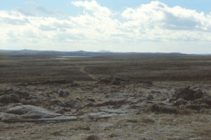
View westward along the Oregon – California Emigrant Trail from Rocky Ridge across the “Lewiston Lakes”. Continental Peak is on the horizon at center and the Oregon Buttes are barely visible on the horizon to the right. Rusty stains on the rocks in the foreground attest to the passage of the iron-rimmed wheels of emigrant wagons. The wagon track is below center and then curves to the right of the rock outcrop at center. This photo was taken the year before I searched the lakes for fairy shrimp.
June 11, 1993
I walked to the pond this morning because I got stuck trying to drive across McLean Meadows last night. The mud didn’t look bad and I thought I could avoid the ruts. The driver side wheels slipped into a rut and it just kept getting deeper. With no weight on the passenger side and no traction on the driver side, the vehicle stopped. 4-wheel drive doesn’t help when all 4 wheels are spinning. At least I didn’t get high-centered. With a lot of digging and jacking, I managed to get boards (which I carry for this purpose) under the driver side wheels. No luck. With more jacking, I managed to put chains on the front wheels. Got just enough traction to back out and save my ass.
The water level at the pond looks relatively high.
- 190 m x 240 m based on 7.5-minute quadrangle; depth at least 50 cm and probably less than 200 cm.
- Opaque grayish-white water; 14 C at 1015.
- Few pale gray fairy shrimp 15-23 mm long; rare eggs.
- Reddish-brown clam shrimp (Conchostraca), many tadpole shrimp (Notostraca) of various sizes, abundant ostracods, avocets.
What a treat! Found members of all 3 orders of large branchiopods compared to only 1 in 1987.
Fairy shrimp were identified as Branchinecta readingi (archive #DB 1248), clam shrimp as Caenestheriella belfragei (now Cyzicus belfragei of the sub-order Spinicaudata according to online Integrated Taxonomic Information System), and tadpole shrimp as Lepidurus lemmoni by DB.
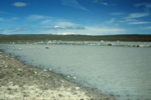
View to northwest across the west end of turbid Northeastern “Lewiston Lake”. Snowy peaks of the Wind River Mountains are on the horizon at center.
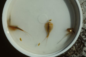
Fairy shrimp, tadpole shrimp, and clam shrimp from Northeastern “Lewiston Lake”. The 4 larger animals with a carapace covering half the body and a forked “tail” are tadpole shrimp (order Notostraca). The 3 small animals in oval bivalves are clam shrimp. There is 1 fairy shrimp at right next to a tadpole shrimp.
Middle “Lewiston Lake” (private?, Lander BLM Office?)
Northeastern “Lewiston Lake” map
Middle “Lewiston Lake” is less than 300 m (980′) southwest of Northeastern “Lewiston Lake”. It is the smallest of the 3 “Lewiston Lakes”. All 3 are north of Sweetwater River Canyon between Strawberry Creek and Chimney Creek. The California – Oregon Emigrant Trail passes about 175 m (570′) north of the lake. Middle “Lewiston Lake” has an intermittent outlet to Big “Lewiston Lake”. On the 7.5-minute topographic quadrangle, Middle “Lewiston Lake” is 170 m (560′) long and up to 120 m (390′) wide.
Middle “Lewiston Lake” is within a 40-acre (16 hectare) parcel of private land on the 1:100,000-scale BLM map. However, the PAD-US 2.0 – Federal Fee Managers layer of The National Map does not show this parcel. There may have been a land exchange between publication of the 1989 BLM map and my viewing of The National Map in 2022.
For access, see Northeastern “Lewiston Lake”.
Elevation: 2,214 m (7,262′)
June 5, 1987
There is more clay here than at Northeastern “Lewiston Lake” so the water is more turbid. It also looks shallower.
- 120 m x 170 m based on 7.5-minute quadrangle; depth not estimated.
- Murky water.
- No fairy shrimp.
- “Fauna similar to Northeastern ‘Lewiston Lake'” (according to notes).
June 11, 1993
The water level looks high, like Northeastern “Lewiston Lake”.
- 120 m x 170 m based on 7.5-minute quadrangle; depth not estimated.
- Opaque grayish-white water; 14 C at 1130.
- Pale gray fairy shrimp about 25 mm long; some eggs.
- Backswimmer (sub-order Heteroptera, family Notonectidae), a few clam shrimp (Conchostraca), many tadpole shrimp (Notostraca), ostracods.
Again, all 3 large branchiopod orders. It’s not one big happy Branchiopoda class though. One tadpole shrimp looked like it was eating a fairy shrimp.
Fairy shrimp were identified as Branchinecta readingi (archive #DB 1249) and tadpole shrimp as Lepidurus lemmoni by DB.
Big “Lewiston Lake” (Lander BLM Office)
Northeastern “Lewiston Lake” map
Big “Lewiston Lake” is about 350 m (1,150′) southwest of Middle “Lewiston Lake” and not quite 800 m (2,620′) southwest of Northeastern “Lewiston Lake”. It is the largest of the 3 “Lewiston Lakes”. The Oregon – California Emigrant Trail passes about 400 m (1,310′) north of Big “Lewiston Lake”. Big “Lewiston Lake” has an outlet to a small intermittent stream east of Strawberry Creek. On the 7.5-minute topographic quadrangle, Big “Lewiston Lake” is 575 m (1,890′) long and up to 410 m (1,350′) wide.
Big “Lewiston Lake” is on public land but it is within an 80-acre (32 hectare) parcel identified as “Public Water Reserve” on the 1:100,000-scale BLM map.
For access, see Northeastern “Lewiston Lake”.
Elevation: 2,214 m (7,265′)
June 5, 1987
The wind has become so strong that the water is almost opaque. The wave action undercuts the turfed banks so the banks are steep, though not high, most of the way around the lake.
- 410 m x 575 m based on 7.5-minute quadrangle; depth not estimated.
- Cloudy to opaque grayish-white water.
- No fairy shrimp.
- Caddisfly larvae (Trichoptera), otherwise “too turbid to see anything” in the water (according to notes), ducks, avocets, swallows.
June 11, 1993
The water level is below the shoreline and the outlet but higher than in 1987. The wind has picked up and the water is very choppy.
- 410 m x 575 m based on 7.5-minute quadrangle; depth not estimated.
- Opaque brownish-white water.
- A few pale gray fairy shrimp.
- Reddish-brown clam shrimp (Conchostraca), tadpole shrimp (Notostraca), ostracods.
All 3 “Lewiston Lakes” with all 3 orders of large branchiopods! This just confirms that the 3 orders of large branchiopods (i.e., not including cladocerans) are adapted to the same habitats and co-exist likely as a result of somewhat different feeding strategies. There is also a niche for the smaller ostracods.
Fairy shrimp were identified as Branchinecta readingi (archive #DB 1247), clam shrimp as Caenestheriella belfragei (now Cyzicus belfragei of the sub-order Spinicaudata according to online Integrated Taxonomic Information System), and tadpole shrimp as Lepidurus lemmoni by DB.
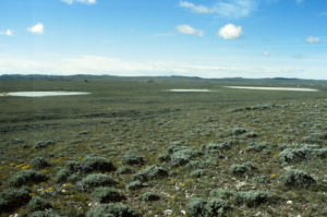
The 3 “Lewiston Lakes” with Big “Lewiston Lake” at upper right, looking south.
“Daley Lake” (Lander BLM Office, State of Wyoming)
___This map is a screenshot of The National Map (Go to The National Map). The U.S. Geological Survey generally does not copyright or charge for its data or reports (unless printed). A pond location is indicated by an “X”, which corresponds to the coordinates given in the data spreadsheet. Labels in quotations are from 7.5-minute topographic quadrangles.
___Red lines are the U. S. National Grid with a spacing of 1,000 m and intersection labels consisting of the UTM zone (e.g., 11S, 12T), a 2-letter 100-km square designation (e.g., LC, XN), and a 4-digit number. The first 2 digits of the number represent the 1,000-meter Easting and the second 2 digits the 1,000-meter Northing, as seen in the example Easting and Northing. Unlike latitude and longitude, the National Grid is rectilinear on a flat map, the units of abscissa and ordinate have equal lengths, and the units (meters) are measurable on the ground with a tape or by pacing.
___Gray shading represents private land as traced from the PAD-US 2.0 – Federal Fee Managers layer of The National Map. Other lands are public or owned by the State of Wyoming.
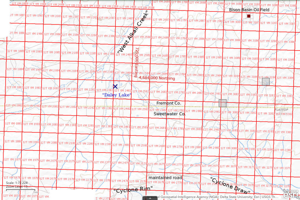
“Daley Lake” is 44 km (27 miles) southeast of Atlantic City. This puts it 8 km (5 miles) southwest of Bison Basin oil field and 5 km (3 miles) north of Cyclone Rim. It is in a flat area less than 1 km (0.6 miles) southeast of West Alkali Creek. On the 7.5-minute topographic quadrangle, the pond is 900 m long and 600 m wide (2,950′ x 1,970′).
All but the western shore of “Daley Lake” is on state land.
There are no good roads to “Daley Lake” but there are a few possibilities. Since I had visited the ponds at Big Bend Lost Creek earlier, I followed the road along the top of Cyclone Rim and found another road that led from the Rim down toward the lake. I vaguely remember stopping well short of the lake due to deteriorating road conditions.
Elevation: 2,106 m (6,908′)
June 8, 1987
The shore of the lake is grassy with some rushes in the water, which also has algae. I walked past 3 avocet(?) nests with 4 black-on-brown speckled eggs each. There is a dead sheep but the area hasn’t been trampled much.
- 600 m x 900 m based on the 7.5-minute quadrangle; depth not estimated.
- Cloudy water.
- Pale gray fairy shrimp 12-16 mm; most females with eggs.
- Numerous ostracods 3-4 mm, beetles, abundant red copepods, minuscule red spheres that may be water mites, avocets, phalaropes, ducks, geese, sheep.
Specimens were identified as Branchinecta paludosa by DB (archive #DB 801-813, which includes specimens from other ponds).
Cuesta Pond (Lander BLM Office)
Cuesta Pond is 38 km (23.5 miles) southeast of Atlantic City among a cluster of large, perennial lakes that includes “Scotty Lake”, “McKay Lake”, and “Picket Lake”. It is south of a small cuesta with a cliff on the south side and a moderate slope on the north. The pond is shown as an intermittent pond with dimensions of 70 m x 140 m (230′ x 460′) on the 7.5-minute topographic quadrangle but doesn’t appear on the 1:100,000-scale BLM map.
One route to Cuesta Pond is to take the maintained road south and then southeastward from Atlantic City. This road fords the Sweetwater River just west of Rock Creek, turns back to the east, crosses a large block of private land on Harris Slough, turns southeastward again to go up Buffalo Gulch, and then continues for several miles to a junction about 2 km (1.2 miles) north of “Picket Lake”. Take the road to the southwest and go around the west side of “Picket Lake” to another intersection south of the lake. Turn east at that intersection and go about 4.5 miles east to “Scotty Lake”. “Scotty Lake” is less than 200 m (660′) north of the road. The road turns to the south less than 1/2 mile east of “Scotty Lake”. One could park at this location for the hike to Cuesta Pond or try to get a little closer by following an unimproved road to the east.
Cuesta Pond can also be reached from the east by way of Bison Basin road, Big Bend Lost Creek, and Cyclone Rim. See “Daley Lake”.
Elevation: 2,129 m (6,984′)
June 8, 1987
The shoreline is grassy and the banks are all gooey clay. The water is so opaque I can’t see anything in the water. That doesn’t mean it can’t have fairy shrimp though. Good thing I brought my net. (This was the first time I saw pond water this opaque.)
- 70 m x 140 m based on the 7.5-minute quadrangle; depth not estimated.
- Opaque water.
- Pale gray fairy shrimp about 20 mm and about 15 mm; most females have eggs.
- Numerous reddish brown clam shrimp (Conchostraca) 6-7 mm long with 11 growth rings, ostracods, backswimmers (sub-order Heteroptera, family Notonectidae), lots of red copepods (1 almost 5 mm long), wriggly larvae, other larvae, snails, avocets, ducks.
Specimens were identified as Branchinecta readingi by DB (archive #DB 812). DB also identified conchostracan specimens as Caenestheriella setosa (now Cyzicus setosa of the sub-order Spinicaudata according to online Integrated Taxonomic Information System).
June 28, 1987
There is quite a bit of grass around the pond from where the water retreated.
- Size and depth not estimated.
- Opaque water.
- No fairy shrimp.
- All I could catch in my net were backswimmers (sub-order Heteroptera, family Notonectidae).
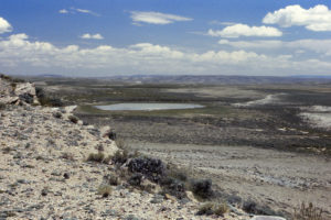
View of Cuesta Pond from the cuesta, looking northeast. There is still some water but no fairy shrimp. The bump on the horizon at left is Crooks Mountain and the bump on the horizon at right is Green Mountain.
May 29, 1989
In some years, there is a chance to hatch and in some years, there isn’t.
- Dry.
June 17, 2005
Not this year either.
- Dry.
“Scotty Lake” (State of Wyoming)
___This map is a screenshot of The National Map (Go to The National Map). The U.S. Geological Survey generally does not copyright or charge for its data or reports (unless printed). A pond location is indicated by an “X”, which corresponds to the coordinates given in the data spreadsheet. Labels in quotations are from 7.5-minute topographic quadrangles.
___Red lines are the U. S. National Grid with a spacing of 1,000 m and intersection labels consisting of the UTM zone (e.g., 11S, 12T), a 2-letter 100-km square designation (e.g., LC, XN), and a 4-digit number. The first 2 digits of the number represent the 1,000-meter Easting and the second 2 digits the 1,000-meter Northing, as seen in the example Easting and Northing. Unlike latitude and longitude, the National Grid is rectilinear on a flat map, the units of abscissa and ordinate have equal lengths, and the units (meters) are measurable on the ground with a tape or by pacing.
___Gray shading represents private land as traced from the PAD-US 2.0 – Federal Fee Managers layer of The National Map. Other lands are public or owned by the State of Wyoming.
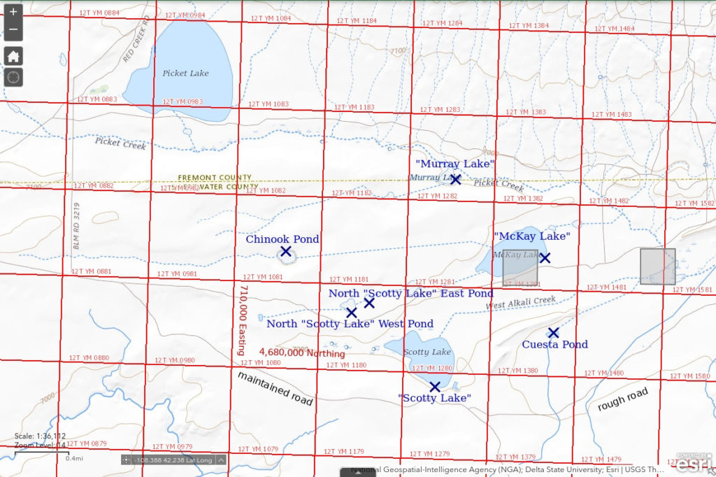
“Scotty Lake” is 37 km (22 miles) southeast of Atlantic City. It is north of Cyclone Rim and approximately 1,000 m (3,280′) west of Cuesta Pond. “Scotty Lake” is the southernmost of a trio of large, perennial lakes that also includes “McKay Lake” and “Picket Lake”. The lake is 750 m long and up to 550 m wide (2,460′ x 1,800′) on the 7.5-minute topographic quadrangle.
The State of Wyoming evidently traded its section 16 land in this township for a parcel enclosing “Scotty Lake” and a few other parcels nearby. Comsequently, section 16 in this township is federal land and all but the western tip of “Scotty Lake” is state land.
For access, see Cuesta Pond.
Elevation: 2,133 m (6,998′)
June 9, 1987
It rained almost continuously from 0730 to 1530 so I didn’t consider driving anywhere after I got up this morning. Walked around the lake in the afternoon. The shoreline is mostly undercut clay banks but it is sandy in spots. There is very little vegetation in the water. Shallow pools on clay east of the lake seem to have more birds than the lake itself. The avocets are acting very defensively. I was startled out of my wits by a duck flushing from its nest in the sagebrush. Worse than a sage grouse, it waited until I had walked about 3 m past it. The nest had 6 big eggs.
- 550 m x 750 m based on the 7.5-minute quadrangle; depth greater than 30 cm.
- Murky water.
- No fairy shrimp.
- Amphipods less than 10 mm long, backswimmers (sub-order Heteroptera, family Notonectidae), colorless copepods(?) or cladocerans(?), wriggly larvae, a few floating caddisfly larvae (note added later: or just cases?), avocets, phalaropes, ducks, coots, geese, grebes(?), gulls.
Later in the evening when the lake was still, I saw occasional circles on the water that might have been caused by rising fish. However, the presence of macroscopic aquatic animals is evidence against the presence of fish.
“McKay Lake” (Lander BLM Office and private land)
“McKay Lake” is 1 km (0.6 miles) northeast of “Scotty Lake”. It is 1,500 m (4,920′) from the road south of “Scotty Lake”. “McKay Lake” is shown as a perennial lake on the 7.5-minute topographic quadrangle. Its dimensions on that map are 800 m (2,620′) by 550 m (1,800′).
“McKay Lake” is mostly on public land but a 40 acre (16 hectare) parcel of private land takes a chunk out of the middle.
For access, see Cuesta Pond.
Elevation: 2,127 m (6,977′)
June 10, 1987
Like “Scotty Lake”, “McKay Lake” has mostly undercut clay banks and has little vegetation in the water.
- 550 m x 800 m based on the 7.5-minute quadrangle; depth greater than 30 cm.
- Murky water.
- No fairy shrimp.
- Small colorless amphipods, a few backswimmers (sub-order Heteroptera, family Notonectidae), a few beetles, abundant colorless 2-3 mm cladocerans or copepods, a few smaller red copepods(?), wriggly larvae, ducks, phalaropes.
“Murray Lake” (State of Wyoming)
“Murray Lake” is 950 m (3,120) northwest of “McKay Lake”. It is shown as an intermittent lake on the 1:100,000-scale BLM map and on the 7.5-minute topographic quadrangle. “Murray Lake” is a stock pond offset from the channel of Picket Creek. It has a triangular shape with an altitude of 220 m (720′) and a base of 190 m (620′).
“Murray Lake” is on state land except for the southern edge.
For access, see Cuesta Pond.
Elevation: 2,133 m (6,998′)
June 10, 1987
The pond has clay banks with grass and rushes. There is considerable seepage from the dam and another pond below it.
- 190 m x 220 m based on the 7.5-minute quadrangle; depth not estimated.
- Clear brown water.
- No fairy shrimp.
- Small backswimmers(?) (sub-order Heteroptera, family Notonectidae), large colorless cladocerans(?) and smaller colorless copepods(?), wriggly larvae, other larvae, ducks, avocets.
Chinook Pond (Lander BLM Office)
Chinook Pond is 2,200 m (3,120) west of “McKay Lake” and 2,500 m (8,200′) northwest of “Scotty Lake”. It is shown as an intermittent pond on the 1:100,000-scale BLM map and on the 7.5-minute topographic quadrangle. It is about 210 m (690′) long and about 170 m (560′) wide. Chinook Pond is 1,800 m (5,910′) north of the road that passes south of “Scotty Lake”. While I was there, 3 Army or National Guard Chinook helicopters flew overhead.
For access, see Cuesta Pond.
Elevation: 2,134 m (7,000′)
June 10, 1987
The pond is in an isolated clayey depression and has a little grass and rushes along the shore. Unlike “Scotty Lake”, “McKay Lake”, and “Murray Lake”, the water is “as clear as fresh milk”.
- 170 m x 210 m based on the 7.5-minute quadrangle; depth not estimated.
- Opaque water.
- Rare colorless fairy shrimp 15-20 mm; caught mostly males but 1 female has eggs.
- Abundant dark brownish red 4-6 mm long clam shrimp (Conchostraca) with 5-10 growth rings, 4 mm x 1.5 mm ostracods, dytiscid larvae (order Coleoptera, family Dytiscidae), beetles, red copepods up to 3 mm, wriggly larvae, other larvae, ducks, avocet.
Specimens were identified as Branchinecta readingi by DB (archive #DB 811). DB also identified conchostracan specimens as Caenestheriella setosa (now Cyzicus setosa of the sub-order Spinicaudata according to online Integrated Taxonomic Information System).
June 28, 1987
The water level is down and the extensive mud makes it hard to get close to the water. I can only reach water less than 3 cm deep with my net.
- Size and depth not estimated.
- Water clarity not noted.
- No fairy shrimp.
- The clam shrimp (Conchostraca) are still here and now there are abundant backswimmers (sub-order Heteroptera, family Notonectidae).
I saw the oddest thing in my net when I pulled it out of the water of Chinook Pond: almost all of the clam shrimps were stuck to other clam shrimps. There were never more than 2 stuck together and one of the stuck clam shrimp was always bigger than the other one. Because the valves of both were closed, there was nothing visible holding them together. I had to ask DB about this. He replied that clam shrimp mating like that can take several minutes. Fertilizing eggs that are held within the valves of the female presents some challenges but clam shrimp have it figured out. So . . . not only do clam shrimp swim, unlike clams, they copulate, unlike clams. Actually, calling them clam shrimp may be rather derogatory.
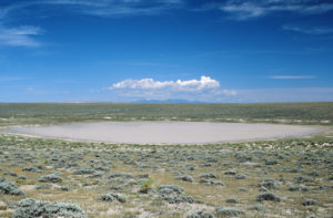
Chinook Pond, looking north to the southern end of the Wind River Mountains.
June 12, 1993
The pond is not quite dry but it is mostly mud and scum.
- Size not estimated; depth less than 5 cm.
- Water clarity not noted.
- No fairy shrimp.
- Other animals not noted.
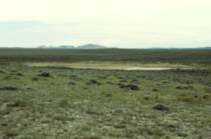
Chinook Pond, with Continental Peak (center) and Oregon Buttes (left) in the distance to the west.
June 17, 2005
Am I too late in the season or was there never enough water for hatching this spring?
- Dry.
North “Scotty Lake” West Pond (State of Wyoming)
North “Scotty Lake” West Pond is 1,500 m (4,920) west of “McKay Lake” and 600 m (1,970′) northwest of “Scotty Lake”. On the 7.5-minute topographic, it is a 170 m x 140 m (560′ x 460′) intermittent lake. It is also shown on the 1:100,000-scale BLM map.
North “Scotty Lake” West Pond is on land owned by the State of Wyoming.
For access, see Cuesta Pond.
Elevation: 2,135 m (7,005′)
June 10, 1987
The clay banks of the pond are thick with rushes except on the east side.
- 140 m x 170 m based on the 7.5-minute quadrangle; depth not estimated.
- Cloudy water.
- Abundant colorless fairy shrimp with females 11-13 mm and males 12-15 mm; many females with eggs.
- Backswimmers (sub-order Heteroptera, family Notonectidae), maybe a dytiscid larva (order Coleoptera, family Dytiscidae), ostracods, gazillions of colorless cladocerans about 2.5 mm, many smaller red copepods, wriggly larvae, other larvae, ducks, phalaropes.
Specimens were identified as Branchinecta readingi by DB (archive #DB 813). DB identified the cladocerans that got mixed in with anostracan specimens as of the genera Daphnia and Moina while the copepods were a species of the genus Diaptomus.
June 28, 1987
Had to come back for another look, and photographs.
- Size and depth not estimated.
- Cloudy water.
- Pale gray fairy shrimp 13-15 mm long; common eggs.
- Colorless cladocerans and red copepods are still abundant.
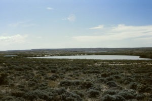
North “Scotty Lake” West Pond. I think this is looking southeast with “Scotty Lake” in the distance at center and North “Scotty Lake” East Pond at left. If so, that would be Cyclone Rim on the horizon.
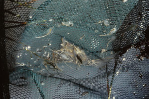
A net haul from North “Scotty Lake” West Pond. There are lots of fairy shrimp and many have eggs. There are also lots of much smaller colorless cladocerans, many of which have dark oblong features.
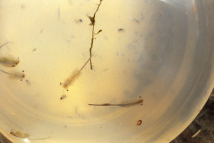
Fairy shrimp and cladocerans from North “Scotty Lake” West Pond swimming in a jar. The small animal below the head of the fairy shrimp at center is a cladoceran; its left swimming antenna is visibly branched.
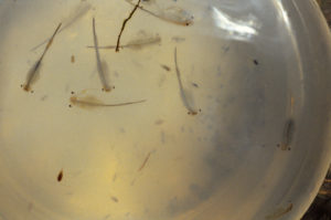
Fairy shrimp, copepods, and cladocerans from North “Scotty Lake” West Pond swimming in a jar. The long, tubular distal segments of antennae II of the males to the left of center and at top are clearly visible. The cladocerans are not as visible as in photograph North “Scotty Lake” West Pond 1987-06-28, #2708, because they are mostly below the focus of the camera. The dark reddish-brown, oblong animal at lower left is not a cladoceran. It is a copepod. It has a different shape than the cladocerans and the swimming antennae below its head are not branched.
June 12, 1993
After viewing the almost dry Chinook Pond, this is a surprise. The water level looks high and near its maximum. There is lush vegetation around parts of the pond.
- Size and depth not estimated.
- Opaque grayish-white water; 12 C at 1115.
- Abundant grayish-white fairy shrimp of various sizes, 12-20 mm long; females have eggs and some have a distinctly blue tint.
- Backswimmers (sub-order Heteroptera, family Notonectidae), innumerable cladocerans and copepods.
Specimens were identified as Branchinecta readingi by DB (archive #DB 1244).
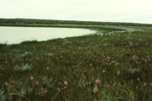
North “Scotty Lake” West Pond under a cold sky but with abundant shooting stars and irises along the shore.
June 17, 2005
The water is low but there’s enough to dip a net.
- Size and depth not estimated.
- Water clarity not noted.
- No fairy shrimp.
- Other animals not noted.
Axolotl Pond (State of Wyoming)
Axolotl Pond is a stock pond about 4,000 m (13,120) south of Bull Canyon Pond on the southwest side of Crooks Mountain. The pond is east of where the Bison Basin Road makes a big bend to the west. Axolotl Pond has dimensions of 240 m by 70 m (790′ x 230′) and is marked with the intermittent lake symbol on the 7.5-minute topographic quadrangle. An unimproved road passes south of the pond and continues up toward Crooks Mountain. The pond is named for salamanders, which were common on the first visit.
Axolotl Pond is on state land.
For access, see Bull Canyon Pond. Axolotl Pond is 250 m (820′) east of the Bison Basin road.
Elevation: 2,141 m (7,025′)
June 10, 1987
Some water is flowing around the dam. The steady flow suggests there may be a spring up the hill. When I first looked in the water, I saw 3 large subadult salamanders, with external gills and flattened tails floating head down. I considered that a bad omen and didn’t spend much time searching the pond.
- 70 m x 240 m based on the 7.5-minute quadrangle; depth not estimated.
- Clear brown water.
- No fairy shrimp.
- Salamanders.
Joe Hay Rim East Pond (Rock Springs BLM Office)
Joe Hay Rim East Pond is 37 km (23 miles) southwest of Atlantic City. It is high on the east side of the northern part of Joe Hay Rim 9 km (5.6 miles) south of Oregon Buttes. It is in a tributary drainage of Little Bar X Draw.
Joe Hay Rim East Pond is about 1,000 m (3,280′) east of the continental divide in the Great Divide Basin as shown on the 1:100,000-scale BLM map. Joe Hay Rim East Pond, Section Marker Pond, Oregon Buttes Southwest Pond, Oregon Buttes North Pond, and Upper Oregon Gulch Pond occur in the Antelope Hills, southeastern Green River Basin, and Great Divide Basin on both sides of the west branch of the continental divide near Oregon Buttes. They are all listed on the Antelope Hills web page for this web site for easier comparison.
For access, see Section Marker Pond. The 1:100,000-scale BLM map shows a road up Little Bar X Draw that is as close as about 2,000 m (6,560′) but I don’t know its condition. The map also shows a road that contours along the east side of Joe Hay Rim and passes right next to the pond. Such a road may have sections that pose the risk of a vehicle tipping over.
Elevation: 2,283 m (7,490′)
June 21, 1987
I was hiking along the top of Joe Hay Rim looking for evidence of the clues reported by Robert Stuart on the Astorians’ trek from the Pacific through the Great Divide Basin to the Missouri River in the winter of 1813 and here’s this pond. Came down for a look.
- Less than 40 m long; depth not estimated.
- Clear brown water.
- No fairy shrimp.
- Other animals not noted.
Section Marker Pond (Rock Springs BLM Office)
___This map is a screenshot of The National Map (Go to The National Map). The U.S. Geological Survey generally does not copyright or charge for its data or reports (unless printed). A pond location is indicated by an “X”, which corresponds to the coordinates given in the data spreadsheet. Labels in quotations are from 7.5-minute topographic quadrangles.
___Red lines are the U. S. National Grid with a spacing of 1,000 m and intersection labels consisting of the UTM zone (e.g., 11S, 12T), a 2-letter 100-km square designation (e.g., LC, XN), and a 4-digit number. The first 2 digits of the number represent the 1,000-meter Easting and the second 2 digits the 1,000-meter Northing, as seen in the example Easting and Northing. Unlike latitude and longitude, the National Grid is rectilinear on a flat map, the units of abscissa and ordinate have equal lengths, and the units (meters) are measurable on the ground with a tape or by pacing.
___There is no private land on this map. All lands are public or owned by the State of Wyoming.
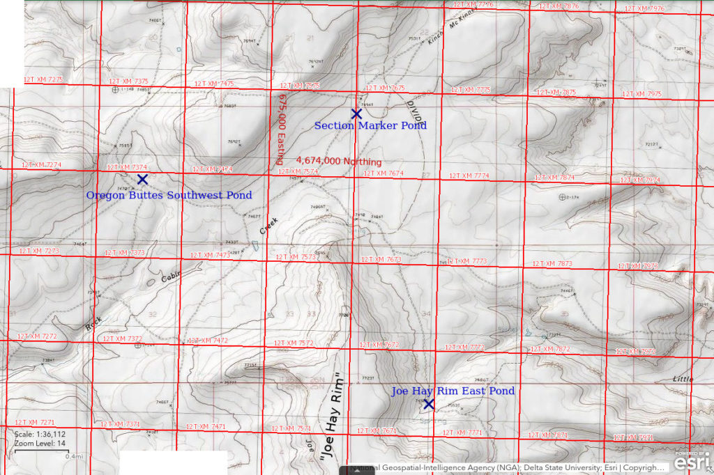
Section Marker Pond is in the saddle between Oregon Buttes and Joe Hay Rim 34 km (21 miles) southwest of Atlantic City and 3.5 km (2.2 miles) north of Joe Hay Rim East Pond. It is in an excavated hollow about 30 m in diameter, probably a stock pond. The pond is about 60 m (200′) southwest of the marker for the corner of sections 21, 22, 28, and 27 of Township 26 North, Range 101 West.
Section Marker Pond is about 550 m (1,800′) west of the continental divide in the eastern Green River Basin as shown on the 1:100,000-scale BLM map. Section Marker Pond, Joe Hay Rim East Pond, Oregon Buttes Southwest Pond, Oregon Buttes North Pond, and Upper Oregon Gulch Pond occur in the Antelope Hills, southeastern Green River Basin, and Great Divide Basin on both sides of the west branch of the continental divide near Oregon Buttes. They are all listed on the Antelope Hills web page for this web site for easier comparison.
To get close to Section Marker Pond from the west, turn off Wyoming 28 about 13 miles northeast of Farson. After about 4 miles, the road forks. I had followed the south fork up Jack Morrow Creek but that route doesn’t get close to Section Marker Pond. The north fork goes through a ranch (you may have to ask for permission) and then heads east over the Jack Morrow Hills. After about 8 miles, the road forks again where it bends sharply to the south. On the 1:100,000-scale BLM map, the southern fork is the thicker red line and goes to Rock Cabin Spring before crossing Joe Hay Rim about 9 km (5 miles) south of Section Marker Pond. The northern fork passes within 3 km (2 miles) of the pond. On the Great Divide Basin side, the road that passes by the east side of Oregon Buttes approaches to within 6 km (3.5 miles) of the pond. The BLM map shows a vehicle track extending from that road to the pond (see Oregon Buttes North Pond) but I don’t know its condition.
Elevation: 2,283 m (7,490′)
June 22, 1987
Still on the trail of Robert Stuart and the Astorians, it was quite a surprise to find a pond on this flat ridge top that just happens to be the west branch of the continental divide. Small, far from any other water, and yet a duck and a killdeer are here, too.
- Water about 10 m in diameter; depth not estimated.
- Opaque pale gray water; 12 C at 1000.
- Pale gray fairy shrimp with females 12-17 mm and males 15-20 mm; eggs present.
- Abundant large red copepods(?), colorless cladocerans(?), 1 duck, 1 killdeer.
Specimens were identified as Branchinecta paludosa by DB (archive #DB 801-813, which includes specimens from other ponds).
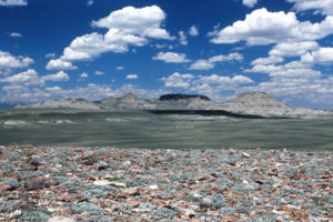
View north from Joe Hay Rim to Oregon Buttes. Section Marker Pond is somewhere out there in the sagebrush. The short, thin, white, horizontal feature near the center of the photograph may be a pile of excavated dirt by Section Marker Pond but I hadn’t yet found the pond when I took this photograph.
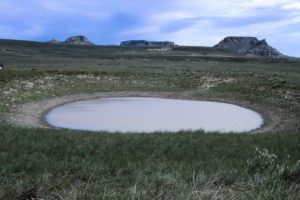
Section Marker Pond with Oregon Buttes in the distance. The excavation isn’t exactly full but there is enough water for fairy shrimp. The flowers at lower right are blurry due to the wind. They are probably irises.
Oregon Buttes Southwest Pond (Rock Springs BLM Office)
Oregon Buttes Southwest Pond is a stock pond in the saddle between 2 flat-topped hills about 7 km (4.3 miles) southwest of Oregon Buttes and 2,500 m (8,200′) southwest of Section Marker Pond.
Oregon Buttes Southwest Pond is about 3,250 m (10,660′) west of the continental divide in the eastern Green River Basin as shown on 1:100,000-scale BLM map. Oregon Buttes Southwest Pond, Section Marker Pond, Joe Hay Rim East Pond, Oregon Buttes North Pond, and Upper Oregon Gulch Pond occur in the Antelope Hills, southeastern Green River Basin, and Great Divide Basin on both sides of the west branch of the continental divide near Oregon Buttes. They are all listed on the Antelope Hills web page for this web site for easier comparison.
For access, see Section Marker Pond. The vehicle track that passes close to Oregon Buttes Southwest Pond connects to the track that passes close to Section Marker Pond.
Elevation: 2,278 m (7,475′)
June 22, 1987
Topographically, this area looks like a good place for the Astorians to have crossed into the Great Divide Basin but I still haven’t found Robert Stuart’s clues. I haven’t seen any volcanic rocks and certainly no lake. Oh, but here’s another pond.
- Size and depth not estimated.
- Cloudy water.
- No fairy shrimp.
- Other animals not noted.
Oregon Buttes North Pond (private land)
___This map is a screenshot of The National Map (Go to The National Map). The U.S. Geological Survey generally does not copyright or charge for its data or reports (unless printed). A pond location is indicated by an “X”, which corresponds to the coordinates given in the data spreadsheet. Labels in quotations are from 7.5-minute topographic quadrangles.
___Red lines are the U. S. National Grid with a spacing of 1,000 m and intersection labels consisting of the UTM zone (e.g., 11S, 12T), a 2-letter 100-km square designation (e.g., LC, XN), and a 4-digit number. The first 2 digits of the number represent the 1,000-meter Easting and the second 2 digits the 1,000-meter Northing, as seen in the example Easting and Northing. Unlike latitude and longitude, the National Grid is rectilinear on a flat map, the units of abscissa and ordinate have equal lengths, and the units (meters) are measurable on the ground with a tape or by pacing.
___Gray shading represents private land as traced from the PAD-US 2.0 – Federal Fee Managers layer of The National Map. Other lands are public or owned by the State of Wyoming.
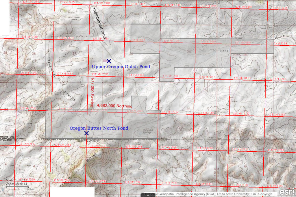
Oregon Buttes North Pond is a stock pond next to a vehicle track on the north side of Oregon Buttes 27 km (17 miles) southwest of Atlantic City. Incredibly, for the 1980 photorevision of the 1958 Dickie Springs 7.5-minute topographic quadrangle, a USGS topographer saw this itty-bitty pond and put a little purple (indicating a revision) speck on the map.
Oregon Buttes North Pond is about 180 m (1,640′) west of the continental divide in the eastern Green River Basin as shown on the The National Map. Oregon Buttes North Pond, Oregon Buttes Southwest Pond, Section Marker Pond, Joe Hay Rim East Pond, and Upper Oregon Gulch Pond occur in the Antelope Hills, southeastern Green River Basin, and Great Divide Basin on both sides of the west branch of the continental divide near Oregon Buttes. They are all listed on the Antelope Hills web page for this web site for easier comparison.
Oregon Buttes North Pond is on a large block of private land.
The closest access to Oregon Buttes North Pond is the maintained road that turns south off Wyoming 28 at the continental divide less than 1 mile southwest of the Sweetwater River crossing. That road is shown as continuous with a relatively heavy line weight on the 1:100,000-scale BLM map past Edmund Springs on the east side of Oregon Buttes and down into the Great Divide Basin. The vehicle track that passes close to the pond may not be passable but the pond is only about 1,300 m (4,270′) west of the maintained road at Edmund Springs.
Elevation: 2,422 m (7,946′)
June 22, 1987
I’m not sure why anyone would want to dig a pond up here but here it is. That cows would make the effort to get up here while there are lower sources of water that are easier to get to seems like wishful thinking. Rushes growing around the shore provide a nice bit of green against the very pale, clayey soil.
- Size and depth not estimated.
- Clear water with brown tint.
- No fairy shrimp.
- Backswimmers (sub-order Heteroptera, family Notonectidae), caddisfly larvae (Trichoptera).
Upper Oregon Gulch Pond (Rock Springs BLM Office)
Upper Oregon Gulch Pond is a stock pond on Oregon Gulch about 3 km (1.9 miles) north of Oregon Buttes and 25 km (15.5 miles) southwest of Atlantic City. Although upper Oregon Gulch is shown as intermittent on the 7.5-minute topographic quadrangle, Upper Oregon Gulch Pond is well placed to receive runoff from snow drifts on the lee side of Oregon Buttes. The 1980 photorevision of the Dickie Springs 7.5-minute quadrangle shows this pond in purple (indicating a revision). The narrow pond is about 180 m (590′) long. The 1:100,000-scale BLM map shows another reservoir on Oregon Gulch about 1,500 m (4,920′) downstream from Upper Oregon Gulch Pond.
Upper Oregon Gulch Pond is about 1,450 m (4,760′) east of the continental divide in the Antelope Hills as shown on The National Map. Upper Oregon Gulch Pond, Oregon Buttes North Pond, Oregon Buttes Southwest Pond, Section Marker Pond, and Joe Hay Rim East Pond occur in the Antelope Hills, southeastern Green River Basin, and Great Divide Basin on both sides of the west branch of the continental divide near Oregon Buttes. They are all listed on the Antelope Hills web page for this web site for easier comparison.
The maintained road that turns south off Wyoming 28 at the continental divide less than 1 mile southwest of the Sweetwater River crossing passes within 100 m (330′) of the pond. See Oregon Buttes North Pond.
Elevation: 2,360 m (7,742′)
June 22, 1987
It’s next to the road on the way out so NPPWOPII. There are thick rushes along the shore. The presence of ducklings suggests some ducks have been nesting here. There is a salamander tail in the dirt.
- Size and depth not estimated.
- Clear dark brown water.
- No fairy shrimp.
- Abundant snail shells along the shore, salamanders, ducks, coots, phalaropes.
“Woods Gulch Pond” (State of Wyoming)
___This map is a screenshot of The National Map (Go to The National Map). The U.S. Geological Survey generally does not copyright or charge for its data or reports (unless printed). A pond location is indicated by an “X”, which corresponds to the coordinates given in the data spreadsheet. Labels in quotations are from 7.5-minute topographic quadrangles.
___Red lines are the U. S. National Grid with a spacing of 1,000 m and intersection labels consisting of the UTM zone (e.g., 11S, 12T), a 2-letter 100-km square designation (e.g., LC, XN), and a 4-digit number. The first 2 digits of the number represent the 1,000-meter Easting and the second 2 digits the 1,000-meter Northing, as seen in the example Easting and Northing. Unlike latitude and longitude, the National Grid is rectilinear on a flat map, the units of abscissa and ordinate have equal lengths, and the units (meters) are measurable on the ground with a tape or by pacing.
___Gray shading represents private land as traced from the PAD-US 2.0 – Federal Fee Managers layer of The National Map. Other lands are public or owned by the State of Wyoming.
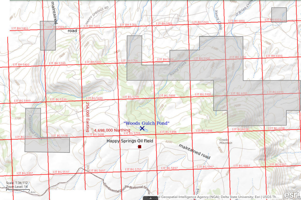
“Woods Gulch Pond” is in the Happy Springs oil field near the top of the eastern part of Crooks Mountain 14 km (9 miles) southwest of Jeffrey City. On the 7.5-minute topographic quadrangle, it is shown as a perennial pond about 260 m long (850′) and less than 50 m (165′) wide at the base of the cliff along the top of Crooks Mountain.
“Woods Gulch Pond” is in a section 16 owned by the State of Wyoming.
There is a maintained road to the northern part of the Happy Springs oil field that turns south off US 287 about 7.5 miles west of Jeffrey City and 11 miles east of the Sweetwater River crossing at Sweetwater Station. At the time, I was able to drive a road that loops to the west from the maintained road at the Cottonwood Creek crossing before turning back to the east and making the steep climb up to the top of Crooks Mountain. It then connects to a road following the gentle crest of Crooks Mountain. A route to the pond from Jeffrey City south to Crooks Gap and then up the south side of Crooks Mountain has better roads. The pond is 300 m (980′) north of the road on the crest and about 55 m (180′) lower than the top of the cliffs.
Elevation: 2,434 m (7,985′)
July 5, 1988
A guy at the BLM office in Lander told me about a pond on Crooks Mountain that had big fairy shrimp. So here I am.
- 50 m x 260 m based on the 7.5-minute quadrangle; depth not estimated.
- Clear dark brown water.
- No fairy shrimp.
- Other animals not noted.
June 5, 1990
Can’t give up after just one look. Unfortunately, the pond is now just a very shallow mud puddle.
- Size and depth not estimated.
- Clear brown water.
- No fairy shrimp.
- Other animals not noted.
June 10, 1993
The cornice at the top of the hill still has plenty of snow so that is a good sign. There is evidence of considerable beaver activity at the pond. An elk walked by.
- Size and depth not estimated.
- Water clarity not noted.
- No fairy shrimp.
- Abundant beetles.
“Circle Bar Lake” (Lander BLM Office, private land)
___This map is a screenshot of The National Map (Go to The National Map). The U.S. Geological Survey generally does not copyright or charge for its data or reports (unless printed). A pond location is indicated by an “X”, which corresponds to the coordinates given in the data spreadsheet. Labels in quotations are from 7.5-minute topographic quadrangles.
___Red lines are the U. S. National Grid with a spacing of 1,000 m and intersection labels consisting of the UTM zone (e.g., 11S, 12T), a 2-letter 100-km square designation (e.g., LC, XN), and a 4-digit number. The first 2 digits of the number represent the 1,000-meter Easting and the second 2 digits the 1,000-meter Northing, as seen in the example Easting and Northing. Unlike latitude and longitude, the National Grid is rectilinear on a flat map, the units of abscissa and ordinate have equal lengths, and the units (meters) are measurable on the ground with a tape or by pacing.
___Gray shading represents private land as traced from the PAD-US 2.0 – Federal Fee Managers layer of The National Map. Other lands are public or owned by the State of Wyoming.
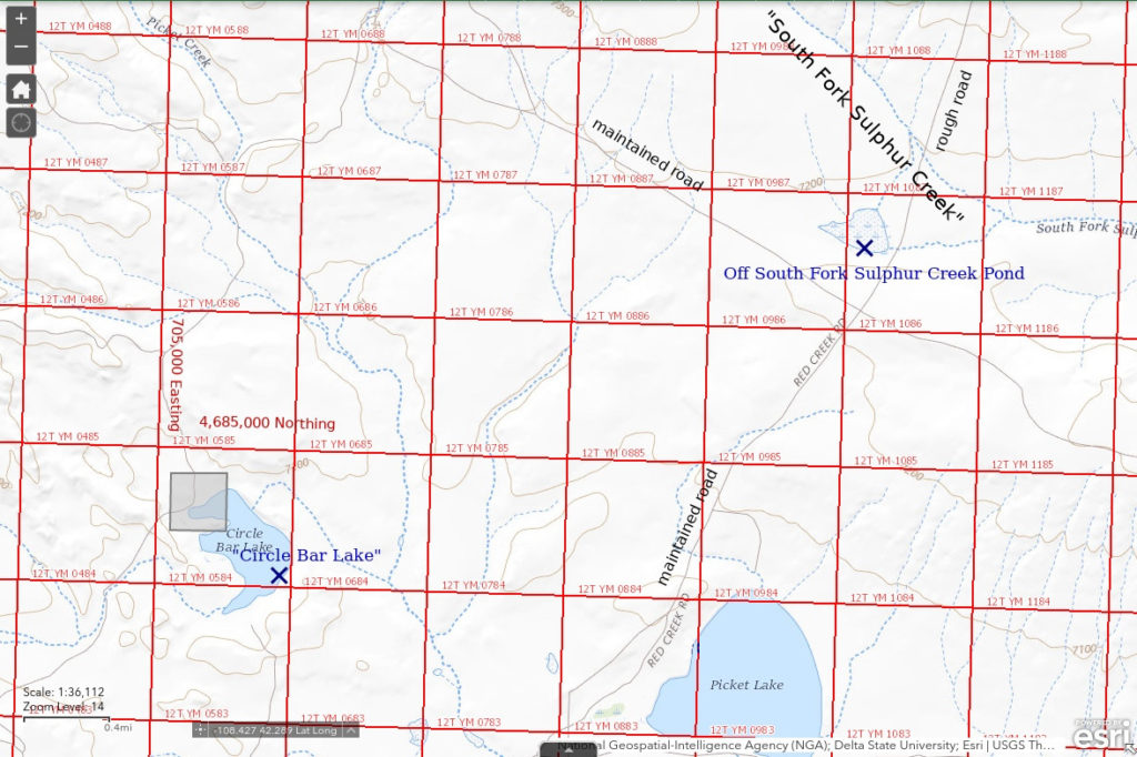
“Circle Bar Lake” is 30 km (19 miles) southeast of Atlantic City and 3 km (2 miles) northwest of “Picket Lake”. Like “Scotty Lake” and “Picket Lake”, it is shown with a perennial lake symbol on the 1:100,000-scale BLM map. On the map, it is 820 m long and 460 m wide (2,690′ x 1,510′).
The northwestern corner of the lake is within a 40-acres (16 hectares) parcel of private land.
For access, see “Scotty Lake”. The crossing of “Picket Creek” southwest of “Picket Lake” is about as close as the maintained road gets. “Circle Bar Lake” is 2,200 m (7,220′) northwest of the Picket Creek crossing.
Elevation: 2,152 m (7,060′)
May 29, 1989
This is a large lake with lots of birds. The water level appears to be about 1 m below the high-water mark. Because another perennial lake in the area, “Scotty Lake”, didn’t appear to have fairy shrimp in 1987, I wasn’t very hopeful. At least these clay-rich waters aren’t likely to have been stocked with fish.
- 460 m x 820 m based on the 7.5-minute quadrangle; depth not estimated.
- Opaque whitish-gray water; 16 C at 1310.
- Pale gray fairy shrimp 17-19 mm; most females have eggs.
- Abundant backswimmers (sub-order Heteroptera, family Notonectidae), big brown and small white amphipods(?), larvae, dark and translucent cladocerans, lots of geese, some ducks, avocets.
Specimens were identified as Branchinecta readingi by DB (archive #DB 941).
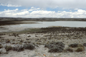
“Circle Bar Lake”, looking north. The opaque, clay-rich water is no obstacle for fairy shrimp; they’re here. The opacity may be particularly beneficial as the other big lakes nearby, “Scotty Lake” and “McKay Lake”, had clearer water and no fairy shrimp (based on 1 visit each).
Diamond Springs Pond (private?, Lander BLM Office?)
Northeastern “Lewiston Lake” map
Diamond Springs Pond is a stock pond adjacent to Diamond Springs near the source of Silver Creek. It is 21 km (13 miles) east of Atlantic City. There is another stock pond behind a dam on Silver Creek nearby. On the USGS imagery of The National Map, the pond is about 50 m (165′) across. There is a large grassy area surrounding the spring and pond.
On the 1:100,000-scale BLM map, the spring and pond are within a private parcel of about 40 acres (16 hectares). However, the PAD-US 2.0 – Federal Fee Managers layer of The National Map does not show this parcel.
For access, see Northeastern “Lewiston Lake”.
Elevation: 2,239 m (7,346′)
May 8, 1992
I’ve driven by this pond a few times over the years so now it’s time to stop and have a look.
- Size assumed to be 50 m based on USGS imagery; depth not estimated.
- Water clarity not noted.
- No fairy shrimp.
- Rare amphipods.
June 11, 1993
Lots of branchiopods in “Lewiston Lakes” this year so maybe this pond will have some.
- Size assumed to be 50 m based on USGS imagery; depth not estimated.
- Water clarity not noted.
- No fairy shrimp.
- Amphipods.
McLean Spring Pond (Lander BLM Office)
Northeastern “Lewiston Lake” map
McLean Spring Pond is a small stock pond next to the Oregon-California Emigrant Trail in a small drainage in McLean Meadows. The spring is not named on the 1:100,000-scale BLM map or on the 7.5-minute topographic quadrangle. McLean Spring Pond is 3 km (2 miles) south of Diamond Springs Pond. It is barely 20 m (66′) across on the USGS imagery of The National Map.
McLean Spring and the pond are adjacent to, but not within, a 40-acres (16 hectares) parcel of private land according to the PAD-US 2.0 – Federal Fee Managers layer of The National Map. This is odd as homesteaded lands are usually located on water sources.
For access, see Northeastern “Lewiston Lake”. One could walk from Diamond Springs or try the unimproved road that turns off the Atlantic City – Beaver Rim road less than 1 mile west of Diamond Springs. The unimproved road has muddy spots that may be impassable when wet. Alternatively, one could try driving the California – Oregon Emigrant Trail east from Radium Springs.
Elevation: 2,215 m (7,266′)
May 8, 1992
Given the relatively dry conditions this year, spring-fed ponds are some of the few that have water.
- Size assumed to be 20 m based on USGS imagery; depth not estimated.
- Water clarity not noted.
- No fairy shrimp.
- Amphipods, ostracods.
“Stinking Springs Reservoir” (private)
___This map is a screenshot of The National Map (Go to The National Map). The U.S. Geological Survey generally does not copyright or charge for its data or reports (unless printed). A pond location is indicated by an “X”, which corresponds to the coordinates given in the data spreadsheet. Labels in quotations are from 7.5-minute topographic quadrangles.
___Red lines are the U. S. National Grid with a spacing of 1,000 m and intersection labels consisting of the UTM zone (e.g., 11S, 12T), a 2-letter 100-km square designation (e.g., LC, XN), and a 4-digit number. The first 2 digits of the number represent the 1,000-meter Easting and the second 2 digits the 1,000-meter Northing, as seen in the example Easting and Northing. Unlike latitude and longitude, the National Grid is rectilinear on a flat map, the units of abscissa and ordinate have equal lengths, and the units (meters) are measurable on the ground with a tape or by pacing.
___Gray shading represents private land as traced from the PAD-US 2.0 – Federal Fee Managers layer of The National Map. Other lands are public or owned by the State of Wyoming.
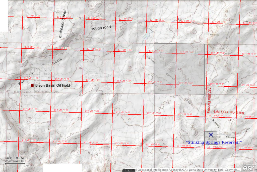
“Stinking Springs Reservoir” is 28 km (17 miles) south of the junction of US 287 and Wyoming 135 at Sweetwater Station and 55 km (34 miles) southeast of Atlantic City. It is also about 6 km (3.7 miles) southeast of the Bison Basin Oil Field. “Stinking Springs Reservoir” is identified on the 7.5-minute topographic quadrangle but not on the 1:100,000-scale BLM map. The reservoir has a length of about 100 m (330′) on the 7.5-minute quadrangle.
“Stinking Springs Reservoir” is on a 40-acres (16 hectares) parcel of private land.
To reach the “Stinking Springs Reservoir” from the north, turn south onto the Bison Basin road from US 287 on the east side of the Sweetwater River at Sweetwater Station and follow it toward the oil field. Turn east onto a maintained road about 1 mile north of the oil field before the road turns to the west. This road also leads to Big Bend Lost Creek Pond #1 and the major intersection southwest of the bend. About 1.5 miles from the Bison Basin Road, this road crosses Stinking Springs Draw below a usually dry reservoir and turns sharply to the south. After another 2.5 miles, the road climbs a hill, from which the reservoir is visible to the east. An unimproved road leads down to the reservoir about 850 m (2,790′) away but I had no need to drive it.
Elevation: 2,146 m (7,040′)
June 12, 1993
I didn’t have the 7.5-minute topo that shows the pond but I could see the water from the road. NPPWOPII.
- Less than 100 m long based on 7.5-minute quadrangle; depth not estimated.
- Cloudy grayish-white water.
- No fairy shrimp.
- Cladocerans, copepods, salamanders, avocets.
North “Scotty Lake” East Pond (Lander BLM Office, State of Wyoming)
North “Scotty Lake” East Pond is 600 m (1,970′) northwest of “Scotty Lake” and 150 m (490′) east of North “Scotty Lake” West Pond. It is smaller than North “Scotty Lake” West Pond with dimensions of about 100 m x 75 m (330′ x 250′) on the 7.5-minute topographic quadrangle.
North “Scotty Lake” East Pond is close to, or within, a parcel of state land northwest of “Scotty Lake”.
For access, see Cuesta Pond. North “Scotty Lake” East Pond is a short walk to the northwest of “Scotty Lake”.
Elevation: 2,135 m (7,004′)
June 12, 1993
Wish I had my gloves. It’s about noon and still chilly.
- Size assumed to be 75 m x 100 m based on 7.5-minute quadrangle; depth not estimated.
- Opaque grayish-white water.
- Fairy shrimp 10-15 mm long; eggs present.
- Other animals not noted.
Specimens were identified as Branchinecta readingi by DB (archive #DB 1245).
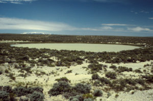
North “Scotty Lake” East Pond, with the Wind River Mountains off to the northwest.
June 17, 2005
A soggy shoreline and low water makes using the net difficult.
- Size and depth not estimated.
- Water clarity not noted.
- No fairy shrimp.
- Other animals not noted.
Off South Fork Sulphur Creek Pond (Lander BLM Office)
Off South Fork Sulphur Creek Pond is 31 km (19 miles) southeast of Atlantic City and 6.5 km (4 miles) north of “Scotty Lake”. It is an intermittent lake on the 1:100,000-scale BLM map and the 7.5-minute topographic quadrangle. The pond has a heart shape that is about 350 m (1,150′) across in both directions. It is on a broad, flat-topped ridge 500 m (1,640′) southwest of South Fork Sulphur Creek. Oddly, the 7.5-minute quadrangle shows it both receiving flow from and discharging to the creek even though it is off the main channel.
For access, see Cuesta Pond. Off South Fork Sulphur Creek Pond is 450 m (1,480′) north of the junction 2 km (1.2 miles) north of “Picket Lake”. An unimproved road extends northeast from the junction of the maintained roads and provides a closer approach.
Elevation: 2,190 m (7,184′)
June 25, 1995
The abundance of water today is encouraging. There is also an abundance of horse droppings. Considerable vegetation is growing up through the water.
- My visual estimate of 400 m across is not too different from the size on the 7.5-minute quadrangle but the water level is below the high-water mark so I’ll call it 350 m; depth possibly up to 100 cm (over waders).
- Clear yellowish water; 21 C at 1645.
- Sparse, translucent, pale gray fairy shrimp 15-20 mm long; eggs not noted.
- Backswimmers (sub-order Heteroptera, family Notonectidae), abundant ostracods, lots and lots of copepods and maybe cladocerans.
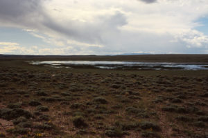
Off South Fork Sulphur Creek Pond, looking northwest with the Wind River Mountains in the distance. There are plenty of wildflowers.
June 17, 2005
No luck this year.
- Dry.
What Can We Learn from the Ponds in the Antelope Hills?
Off-stream, large and small ponds without fish are widespread in the Antelope Hills. Most dry up seasonally but some persist from year to year during wetter periods. Of the ponds visited, 18 (58%) had fairy shrimp during at least 1 visit and 13 did not.
The Antelope Hills have all 3 large branchiopods: fairy shrimp (Anostraca), clam shrimp (Conchostraca, or the orders Spinicaudata, Laevicaudata, and Cyclestherida), and tadpole shrimp (Notostraca). In some cases, species of all 3 occur in the same pond at the same time, e.g., all 3 “Lewiston Lakes”.
Including ponds where only carapaces were found, 5 ponds had notostracans, 5 ponds had conchostracans, and 3 ponds had both.
Uncommonly, 2 species of fairy shrimp occur in the same pond at the same time, e.g., “Coyote Lake”, Bull Canyon Pond.
Birds fly around a lot but nonetheless I saw avocets at 13 ponds and 8 of those had fairy shrimp. Phalaropes had a somewhat weaker association with fairy shrimp as I saw them at 9 ponds and only 4 of those had fairy shrimp.
Fairy shrimp coexist with the amphibian predators frogs and salamanders in a few ponds but this is insufficient evidence to determine the general impact of these predators on fairy shrimp populations in the region.
Repeated visits to some ponds illustrate the conditional nature of fairy shrimp hatches in the Antelope Hills. Fairy shrimp were observed in “Coyote Lake” in 1987, serendipitously my first year of fairy shrimping, and 1993 but not in 1988, 1989, 1990 (dry), 1992 (dry), or 2005 (dry). Bull Canyon Pond had fairy shrimp when visited in 1987 and 1995 but not in 1988, 1989 (dry), 1990 (dry), 1992 (dry), or 1993 (dry). Fairy shrimp appeared in Cuesta Pond, Chinook Pond, and North Scotty Lake West Pond in 1987. They reappeared in North Scotty Lake West Pond in 1993 but were absent from Cuesta Pond in 1989 (dry), absent from Chinook Pond in 1993, and absent from all 3 ponds in 2005 (2 were dry).
Anostracan species identified by Denton Belk are:
Branchinecta readingi (originally identified as Branchinecta mackini) – Cuesta Pond, Chinook Pond, North “Scotty Lake” West Pond, North “Scotty Lake” East Pond, “Circle Bar Lake”, Northeastern “Lewiston Lake”, Middle “Lewiston Lake”, Big “Lewiston Lake”, “Coyote Lake”;
Branchinecta paludosa – “Coyote Lake”, Avocet Lake, Salamander Pond, “Daley Lake”, Section Marker Pond;
“paludosa-like” branchinectid (DB) named Branchinecta serrata by Rogers (2006) – Bull Canyon Pond.
Branchinecta coloradensis – Bull Canyon Pond.
Conchostracan (order Spinicaudata) species identified by Denton Belk are:
Cyzicus belfragei – Northeastern “Lewiston Lake”, Big “Lewiston Lake”;
Cyzicus setosa – Cuesta Pond, Chinook Pond.
Notostracan species identified by Denton Belk are:
Lepidurus lemmoni – Northeastern “Lewiston Lake”, Middle “Lewiston Lake”, Big “Lewiston Lake”.
Cladoceran genera identified by Denton Belk are:
Daphnia – North “Scotty Lake” West Pond.
Moina – North “Scotty Lake” West Pond.
Copepod genera identified by Denton Belk are:
Diaptomus – North “Scotty Lake” West Pond.