Winnemucca Mud Flat Pond #1
Winnemucca Mud Flat Pond #2
What Can We Learn from the Ponds on “Winnemucca Lake” Playa?
“Winnemucca Lake” Playa is a very long, narrow playa between the Lake Range and the Nightingale Mountains 15-75 km (9-45 miles) north of Fernley. On the 1:100,000-scale BLM map, the name for the valley in which the playa occurs is simply “Winnemucca Lake”. I add the term playa to the name so that readers will not assume that there is a persistent body of water in the area. The stipple pattern for intermittent lake on the BLM map is 41 km (25 miles) long and 3.5-7 km (2-4 miles) wide.
Winnemucca is the name of a Northern Paiute chief who lived in Northwestern Nevada in the mid-1800s and frequented “Pyramid Lake”.
“Winnemucca Lake” Playa is more like the salt marshes of Teels Marsh Playa Lake and Rhodes Big Lake than like the clay flats of Main Smith Creek Playa Lake or Luning Playa Lake. The mud is very soft when saturated. I even saw salt crystals. In contrast, Main Smith Creek Playa Lake on March 19, 2019 and Luning Playa Lake on January 14, 2022 were slippery but otherwise not too soft when they had water.
“Winnemucca Lake” was a lake until recently. It was previously connected to “Pyramid Lake”, which is the terminus of the Truckee River. Water could flow into “Winnemucca Lake” from “Pyramid Lake” when the water level was above the approximately 1,180 m (3,870′) elevation of the “Mud Lake” sill (Benson, 1994; see References page). Due to irrigation withdrawals from the Truckee River, “Pyramid Lake” dropped below the sill in 1917 and “Winnemucca Lake” was dry by about 1938 (Benson and others, 2002). When “Pyramid Lake” was at the 1,265 m (4,150′) elevation of the Darwin sill to Humboldt Sink and Carson Desert about 15,000 years ago (Benson, 1994), “Winnemucca Lake” would have been about 115 m (380′) deep. Since July 1982, the level of “Pyramid Lake” has varied between 1,156 m (3,790′) and 1,164 m (3,820′) (data downloaded from waterdata.usgs.gov/nv/nwis/dv?referred_module=sw&site_no=10336500). In January 2023, “Pyramid Lake” was at 1,158.5 m (3,801′) over 20 m (65′) below the “Mud Lake” sill and is unlikely to replenish “Winnemucca Lake” before the next glacial period.
Because the elimination of fish from “Winnemucca Lake” is well dated by the 1938 desiccation, the subsequent ephemeral playa offers a case study of how long it takes fairy shrimp to colonize new habitat. Gulls at “Pyramid Lake” are no help because that lake lacks fairy shrimp but fairy shrimp eggs could be picked up by birds visiting ponds 100 km (60 miles) to the south on “Carson Lake” Playa or 130 km (78 miles) to the southwest in Fairview Valley. Parts of the Blackrock Desert to the north are even closer. The BLM brochure “Black Rock Desert – High Rock Canyon Emigrant Trails National Conservation Area, The Black Rock Playa” states that fairy shrimp and tadpole shrimp occur on the Black Rock Desert but doesn’t say where. Northerly winds are less common but may occasionally be strong enough to carry fairy shrimp eggs 80 km (48 miles) or so to the south.
“Winnemucca Lake” Playa lies within the 1,200 m (3,940′) contour on the BLM map. There is a closed 1,160 m (3,810′) contour in the southern part of the playa. That contour is about 6.5 km (4 miles) wide and and 4 km (2.4 miles) north-south. The Tohakum Peak NE 7.5-minute 1:24,000-scale topographic quadrangle has a 3,770′ (1,149 m) contour in the central part of the playa but I can only see parts of the contour on the downloaded pdf of the map. The lowest elevation may be between 1,149 and 1,100 m (3,770-3,610′).
“Winnemucca Lake” Playa lacks vegetation but desert scrub is encroaching on its periphery.
The southern tip of “Winnemucca Lake” playa is within the railroad checkerboard of private and public land but almost all the rest is public land managed by the Humboldt River office of the BLM in Winnemucca, coincidentally. The playa is generally east of the Pyramid Lake Paiute Reservation but a small section of the central part is within the reservation. Nevada 447 goes along the west side of “Winnemucca Lake” Playa on its way from Gerlach to Wadsworth. The BLM map shows unimproved roads on the east side of the playa but they can only be reached by going around the north or south ends of the playa or through the Nightingale Mountains.
Winnemucca Mud Flat Pond #1 (Humboldt BLM Office)
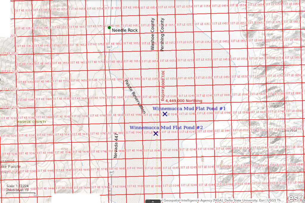
___This map is a screenshot of The National Map (Go to The National Map). The U.S. Geological Survey generally does not copyright or charge for its data or reports (unless printed). A pond location is indicated by an “X”, which corresponds to the coordinates given in the data spreadsheet. Labels in quotations are from 7.5-minute topographic quadrangles.
___Red lines are the U. S. National Grid with a spacing of 1,000 m and intersection labels consisting of the UTM zone (e.g., 11S, 12T), a 2-letter 100-km square designation (e.g., LC, XN), and a 4-digit number. The first 2 digits of the number represent the 1,000-meter Easting and the second 2 digits the 1,000-meter Northing, as seen in the example Easting and Northing. Unlike latitude and longitude, the National Grid is rectilinear on a flat map, the units of abscissa and ordinate have equal lengths, and the units (meters) are measurable on the ground with a tape or by pacing.
___There is no private land on this map. All lands are public or on the Pyramid Lake Paiute Reservation.

Winnemucca Mud Flat Pond #1 is in the central part of “Winnemucca Lake” Playa about 62.5 km (37.5 miles) north of Fernley. It has no distinct boundaries. It just happens to be the first sizable body of water I encountered while walking toward the water I had seen from the highway.
For access, I parked near Needle Rock along the highway west of the playa and walked southeast from there in order to avoid the “Pyramid Lake” Paiute Reservation. There is a sign at the boundary on the highway but the boundary fence doesn’t continue far into the playa.
Elevation: 1,149 m (3,770′)
April 5, 2023
With record snow pack in the Sierra Nevada and the December-March precipitation totals for Reno more than 6″ (15 cm) above normal, if “Winnemucca Lake” Playa ever has ponds, it should have them this spring. This unique opportunity to test my hypothesis is worth the cost of gas. From where I parked, I had a long walk to reach the water I had seen from the highway earlier and due to mirages at low viewing angles I couldn’t be sure where the water actually was. I headed to the southeast with hope. There was a wide zone of white mineral efflorescence at the edge of the playa and then wet, brown mud for kilometers. The mud was firm enough for me to keep going but so soft that it felt like I was climbing up a steep hill instead of walking on a perfectly flat playa. I passed many very shallow puddles less than 5 m (16′) across without any signs of life. This pond was the first that might be deep enough to have fairy shrimp.
- About 50 m long and 2-10 m wide; 1-2 cm of clear water above an opaque clay-water suspension more than 1 cm deep.
- Clear (above) to opaque (below) water.
- No fairy shrimp.
- No aquatic animals, no birds.
I took the GPS reading about 20 m (65′) east of the edge of the water as soon as I got to mud firm enough to allow a pause without getting stuck.

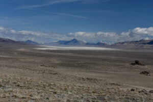
“Winnemucca Lake” Playa looking north from Nevada 447. The southern end is dry but maybe there’s water farther north. Purgatory Peak at the south end of the Selenite Range is on the north side of the playa and snowy Kumiva Peak is peeking above it.

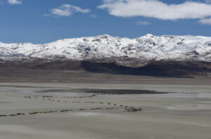
The north end of Winnemucca Mud Flat Pond #1 with the snowy eastern slope of Tohakum Peak in the Lake Range in the distance. The sharp changes in direction of my tracks coincide with stumbles in softer mud. Trying to read mud firmness from the surface appearance was a fool’s game but I did it anyway for the same reason that a drowning man will grasp at anything.
Winnemucca Mud Flat Pond #2 (Humboldt BLM Office)
Winnemucca Mud Flat Pond #1 map
Winnemucca Mud Flat Pond #2 is in the central part of “Winnemucca Lake” Playa 1.2 km (0.7 mile) south of Pond #1 and about 61 km (36.5 miles) north of Fernley. It is a long pond in the middle of the playa and there appears to be more water farther south.
For access, see Winnemucca Mud Flat Pond #1.
Elevation: 1,149 m (3,770′)
April 5, 2023
Because of the mirages, I continued to the east edge of the playa from Winnemucca Mud Flat Pond #1 just in case there were more ponds. On the east side, I walked far enough up the alluvial fan to reduce the mirage effect and thought I saw water to the south of where I had just crossed the playa. I decided to give it another try. While walking back across the mud flat, I saw places where small puddles had dried up and left little, cubic crystals of table salt on the surface of the mud. I came to the north edge of this pond and made a foray into the open water.
- Lack of contrast between wet mud and water makes the edge of the water poorly visible but the pond is probably more than 300 m long and 100 m across; 1-4 cm of clear water with an opaque clay-water suspension layer of unknown depth below.
- Clear (above) to opaque (below) water.
- No fairy shrimp.
- No aquatic animals, no birds.
I took the GPS reading about 10 m from the water before I started a search for fairy shrimp. No photographs though as I subsequently struggled to keep from sinking in too deep. While wading through the water, I stepped in a soft spot and fell down on my knees. My boots filled up with water and mud but, fortunately, I had enough forward momentum that I could stagger out. The mud didn’t firm up much so I had to keep staggering. Hit another soft spot and did a double hand plant. By then I was too tired to get up. The good news: if the mud is too soft for walking, getting down on hands and knees can keep you from sinking further. The bad news: the mud could get softer still. Be forewarned if you want to search for fairy shrimp on the broad mud flat of a salt marsh.
What Can We Learn from the Ponds on “Winnemucca Lake” Playa?
“Winnemucca Lake” Playa had ponds after a very wet winter for western Nevada.
The ponds I visited were very shallow and did not have fairy shrimp.
Is “Winnemucca Lake” Playa a lost cause for fairy shrimp? Maybe. It’s possible that there were fairy shrimp before my visit. The very extensive wet mud is an indication of much larger ponds earlier in the year. If there was enough non-frozen water for hatching in early March, fairy shrimp could have hatched and died off before I visited. Alternatively, if the water has TDS high enough for the genus Artemia, it may have been too cold for Artemia to hatch before most of the water disappeared. In that case, more favorable conditions than those offered in March 2023 would be needed for hatching. The eggs might be there.