Glaciation of the Toquima Range
Upper South Fork Pine Creek Pond
What Can We Learn from the Ponds in the Toquima Range?
The Toquima Range is one of the larger mountain ranges in Nevada. It is about 116 km (72 miles) from Hickison Summit at the north end to Baxter Spring at the south end. Widths are mostly 15-23 km (9-14 miles) but the range tapers to less than 3 km (2 miles) at the north end.
It is difficult to generalize about the Toquima Range. There is Mt. Jefferson and then there is the rest of the Toquima Range. Mt. Jefferson is an elongated plateau with dimensions of about 17 km by 17 km (10 miles). Much of that area is above 3,250 m (10,660′). The top of Mt. Jefferson has gentle topography with 3 summits – North, Middle, and South – but narrow canyons plunge steeply away from the top in all directions.
To the north of Mt. Jefferson, the Toquima Range is lower and narrower with a steeper east side and a gentler west side. To the south of Mt. Jefferson, the range remains rather wide and elevations drop rather gradually to The Bald Sister (2,800 m, 9,190′) northeast of Manhattan.
The 2,000-meter (6,560′) contour is a good approximation of the lower edges of the Toquima Range. On Mt. Jefferson, the North Summit, Middle Summit, and South Summit have elevations above 3,500 m (11,480′). To the north of Mt. Jefferson, Wildcat Peak reaches 3,200 m (10,500′). To the south, Shoshone Mountain and Spanish Peak top out at 3,325 m (10,910′) and 3,270 m (10,730′), respectively.
Given the large elevation range, vegetation in the Toquima Range is varied. Sagebrush is extensive and everywhere except on the summit rock fields. Pinyon and juniper are dispersed in some areas and form relatively dense woodlands in others. Sparse limber pines grow on some of the higher slopes. Cottonwoods, willows, and water birch occur along some of the streams and aspen cluster around streams, springs, and seeps at higher elevations. Low-growing alpine grasses and wildflowers cover the Mt. Jefferson plateau.
Pretty much the entire Toquima Range is within the Humboldt-Toiyabe National Forest but the Forest boundary doesn’t extend all the way to Hickison Summit. There are a couple of hiking trails through the Alta Toquima Wilderness on Mt. Jefferson but elsewhere you’ll have to find your own route or follow one of the numerous vehicle tracks. There is a 3.3 km (2.0 miles) by 4.2 km (2.6 miles) block of private land around the Northumberland gold mine at Northumberland Pass. North of this block, there appear to be only 2 tiny private in-holdings on Stoneberger Creek and at “Indian Ranch” off Stoneberger Creek. In the southern Toquima Range, there are numerous small blocks of private land around the towns of Belmont and Manhattan. There are also small blocks of private land near the Forest boundary on Moores Creek, Pasco Canyon, and Pine Creek around Mt. Jefferson and well within the Forest boundary in Meadow Canyon south of Mt. Jefferson. Other than that, there are a few patented mining claims, mostly in the southern part of the range in the vicinity of Manhattan.
Glaciation of the Toquima Range
Glaciation of the Toquima Range is limited to the Mt. Jefferson area. The plateau-like summit of Mt. Jefferson is mostly above 3,400 m (11,150′) and is bounded on all sides by cliffs. Some of the cliffs were formed by glaciers. On the north side of Mt. Jefferson there are glacial cirques above Anderson Creek and Moores Creek (Osborn and Bevis, 2001). On the east side, Bucks Creek, North Fork Pine Creek, north branch South Fork Pine Creek, and south branch South Fork Pine Creek all originate in cirques. Moores Creek valley has a terminal moraine about 3 km (1.8 miles) below the headwall. Osborn and Bevis (2001) correlated it with Angel Lake-age moraines in the Ruby and East Humboldt ranges. An Angel Lake-age terminal moraine in Seitz Canyon, Ruby Mountains, has an ice-off exposure age of 20,500 years ago (Laabs and others, 2013). This is discussed in more detail in the Glaciation section of the Ruby Mountains page.
Osborn and Bevis (2001) did not identify any Little Ice Age (1300-1850) glacial features. They considered the rock glaciers and small moraine segments less than 500 m (1,640′) from the headwalls of Anderson and Moores creeks as older.
On the east side of Mt. Jefferson, the glacial valleys below the headwalls are somewhat u-shaped but transition to stream cut v-shaped valleys as they drop below about 2,900 m (9,510′) more or less 2,700 m (8,860′) from the headwalls. The trail up Mt. Jefferson follows the south branch South Fork Pine Creek because it has the least impressive cirque. The north branch South Fork Pine Creek cirque forms the east face of Middle Summit Mt. Jefferson and is the most impressive. It also has the widest upper valley and also the only pond. The other cirques and glacial valleys lack ponds. The pond in the cirque of north branch South Fork Pine Creek is the only pond I’ve found on maps of the Toquima Range. That says something about the importance of glaciation to fairy shrimp. In terms of fairy shrimp colonization, the most I can say is that the pond became available at some time more recent than 20,500 years ago.
Toquima Range – top
Upper South Fork Pine Creek Pond (Tonopah Ranger District, Humboldt-Toiyabe National Forest; Alta Toquima Wilderness)
___This map is a screenshot of The National Map (Go to The National Map). The U.S. Geological Survey generally does not copyright or charge for its data or reports (unless printed). A pond location is indicated by an “X”, which corresponds to the coordinates given in the data spreadsheet. Labels in quotations are from 7.5-minute topographic quadrangles.
___Red lines are the U. S. National Grid with a spacing of 1,000 m and intersection labels consisting of the UTM zone (e.g., 11S, 12T), a 2-letter 100-km square designation (e.g., LC, XN), and a 4-digit number. The first 2 digits of the number represent the 1,000-meter Easting and the second 2 digits the 1,000-meter Northing, as seen in the example Easting and Northing. Unlike latitude and longitude, the National Grid is rectilinear on a flat map, the units of abscissa and ordinate have equal lengths, and the units (meters) are measurable on the ground with a tape or by pacing.
___There is no private or state land on this map. All lands are public.
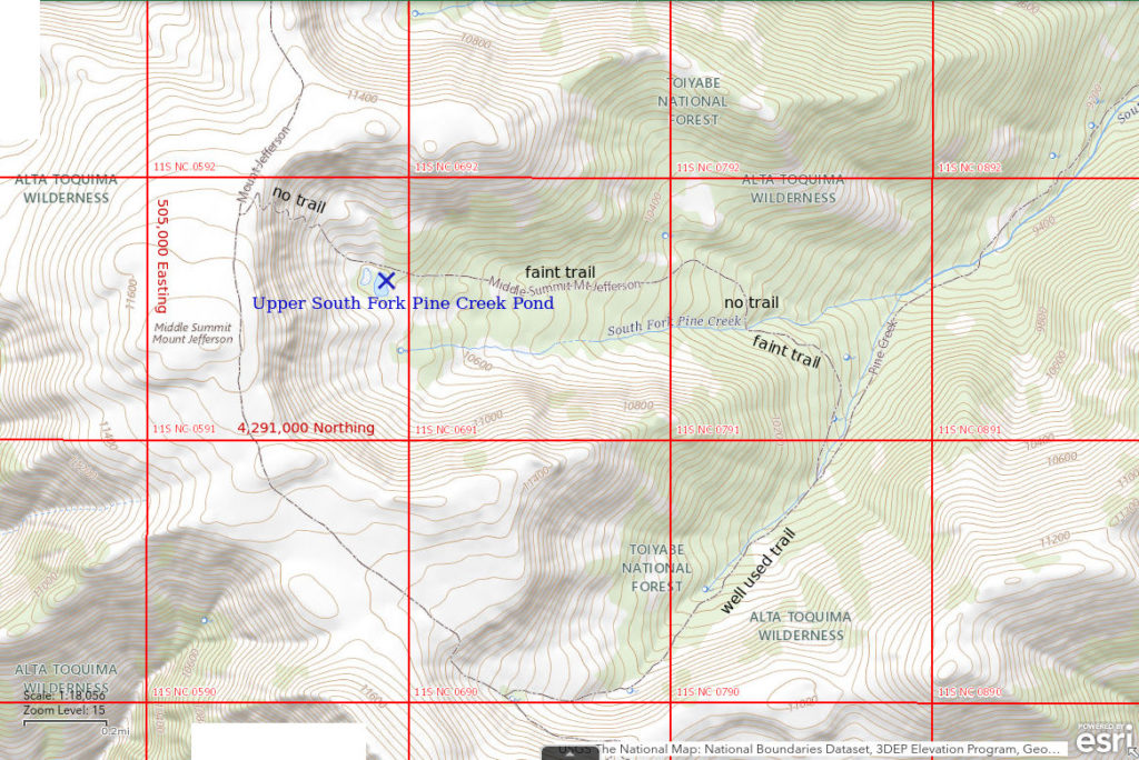
Upper South Fork Pine Creek Pond is 82 km (51 miles) northeast of Tonopah. This pond is below the cliffs on the east side of the Middle Summit of Mount Jefferson at the head of South Fork Pine Creek. If the snowbanks had gotten bigger 20,000-30,000 years ago, it would have become a cirque lake. It is not shown on the 1:100,000-scale BLM map. However, it is shown on the Humboldt-Toiyabe National Forest’s recreation map of the Tonopah Ranger District, on the 7.5-minute topographic quadrangle, and on The National Map.
Upper South Fork Pine Creek Pond is a strenuous day hike from the Pine Creek Trailhead. The trailhead and the adjacent Pine Creek Campground are accessible by most vehicles. The 3-mile spur from the county-maintained road to the campground is quite rocky but manageable at slow speeds. The main trail from the trailhead to Mt. Jefferson follows the South Fork of Pine Creek but does not go to the pond. It follows the south branch of the South Fork to the Mt. Jefferson plateau between the Middle and South summits. Upper South Fork Pine Creek Pond is up the north branch of the South Fork.
To reach South Fork Pine Creek Pond, turn off the main trail about 6 km (3.6 miles) from the trailhead where the trail crosses from the south side to north side of the south branch in an area of grassy meadows that may be boggy in the early summer. Go north-northwest from the ford. When you reach the sagebrush on the far side of the meadow, look for a trail through the denser brush and trees. Follow that trail or bushwhack around the low ridge and into the canyon of the north branch of South Fork Pine Creek. The trail drops down to and crosses the north branch but then disappears. The National Map shows the trail continuing north of the ford through the trees then turning west after a few hundred meters. If you continue through the trees to the northwest from the ford, you will enter a large meadow that has a couple of big rock cairns marking the trail. If you find the cairns, you can probably follow the somewhat discontinuous trail to the west through the meadow and then through trees to a little north of South Fork Pine Creek Pond. The National Map shows the trail continuing up the cliffs to the top of Mt. Jefferson but I found no evidence for this segment. Alternatively, you can pick your way across the steep side-slope on the south side of the north branch, fight through some thick young aspen, and then emerge into open meadows after 100-200 m (330-660′). Meadows can be followed on the south side of the north branch all the way up to the pond.
Elevation: 3,292 m (10,800′)
July 9, 2019
This was planned as just a day-hike to Mt. Jefferson. The lower 1 km or so of the Pine Creek trail had recently been destroyed by high spring run-off. There are several fords on the original trail but additional flood channels up to several meters wide had been created by the flood and large interchannel areas had 5-10 cm water. That water was numbingly cold. It doesn’t help that the brush and low branches hadn’t been cleared from the original trail in a long time. The flood deposited new piles of logs and broken branches as additional obstacles. I eventually got through the mess and followed the main trail to the Middle Summit of Mt. Jefferson. I saw the pond from there. Getting from there to the pond was a feat but now it’s time to look for fairy shrimp.
- Pond is about 60 m x about 100 m; may be only 100 cm deep in the middle.
- Water very clear.
- No fairy shrimp.
- Saw 1 black diving beetle; several dark 1-1.5 mm long animals swimming with the jerky motion of copepods; bottom of pond has patches of bright green algae.
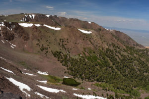
Upper South Fork Pine Creek Pond, looking north from near the Middle Summit of Mt. Jefferson to the North Summit, on skyline at upper left. The pond looks like great fairy shrimp habitat; fish certainly can’t get to it. Is finding fairy shrimp in that pond worth the risk of stumbling toward the trailhead with a flashlight? Yes. Will my legs even last that long? Maybe. But I can’t get down the cliffs from the Middle Summit. Wait! I see a trail down the ridge on the far side of the pond. Poorly visible on the photo, it starts at the right end of the snowbank just to the left of center and angles to the left down the green, less rocky, slope. It’s worth a try.
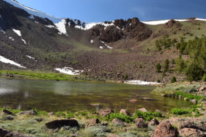
Very clear and visibly shallow water in Upper South Fork Pine Creek Pond with the cliffs north of Middle Summit Mt. Jefferson in the background. Looks good but no fairy shrimp. Why not? Maybe no bird has stopped by to drop off a few eggs in the past few hundred years and those blown up here from Big Smoky Valley aren’t suited for this habitat.
September 13, 2021
While compiling information for this web site, I found that The National Map shows a trail up the South Fork of Pine Creek (see map above). I had stumbled upon a small part of the trail south of the ford of the north branch of South Fork Pine Creek on my way down in 2019 but I was skeptical of the rest of the trail. That’s enough of an excuse for another hike up Pine Creek. I was also curious about whether the pond had dried up due to the dry winter and spring. This time, I lost the trail shown on The National Map north of the ford of South Fork Pine Creek but found it again due to rock cairns in a big grassy meadow. From there, I could follow the trail, off and on, almost all the way to the pond. Without markers, or vegetation, or soil to get beaten down by footsteps, following the trail across the rocks beyond the pond would be difficult in any case. I did manage to make it up the very steep talus slope where I thought the trail should be but it was difficult and I saw no evidence of a trail there. The trail should be to the left of the V-shaped snowbank in photograph Upper South Fork Pine Creek Pond 2019-07-09, #14. Going back down looked so scary I decided to take the trail I had followed down the ridge north of the pond back in 2019. That was a good choice as I met 3 young bighorn sheep. On the way down from the pond, I again hiked to the spring south of the pond and then generally followed the continuous grassy meadows (now dry) along the south bank. The route on the south side of the creek is good except for about 100 m (330′) above the mapped trail’s ford. That last 100 m or so is a steep, rocky slope with patches of thick young aspen.
The water level in the pond is obviously lower than on my previous visit, not only due to being later in the season but also due to the much drier winter. Nonetheless, there is enough water for fairy shrimp.
- Pond is about 50 m x about 80 m; probably less than 50 cm deep, maybe less than 30 cm.
- Water very clear.
- No fairy shrimp.
- Abundant backswimmers (sub-order Heteroptera, family Notonectidae) of various sizes, numerous dark 2 mm copepods, snails.
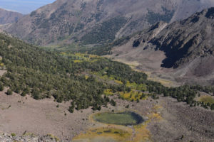
View from the Mt. Jefferson plateau down South Fork Pine Creek Canyon with Upper South Fork Pine Creek Pond at bottom. Fish cannot reach the pond by natural means because the pond doesn’t have a well developed outlet. Water just trickles out to the south (right) through big rocks. The spring at far right (marked by green grass at right edge of photograph) may be a more important source for the creek than the pond.
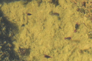
These dark, 2 mm long swimmers in Upper South Fork Pine Creek Pond are likely copepods. They have a prominent pair of antennae used for swimming attached near the top of the head and the 2 at right have round reddish egg sacs along their abdomens. Part of a backswimmer (sub-order Heteroptera, family Notonectidae) is at the right edge of the photograph.
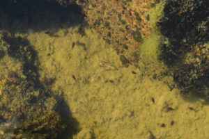
Pond life in Upper South Fork Pine Creek Pond. A temporarily motionless backswimmer (sub-order Heteroptera, family Notonectidae) is at center with ventral side up. This pose of hanging in the water a couple of centimeters below the surface with outstretched oar-like legs seems to be characteristic of backswimmers. Backswimmers are predators of fairy shrimp. There are also a few dark copepods.
What Can We Learn from the Ponds in the Toquima Range?
Glaciers created several cirques around the top of Mt. Jefferson but only 1 pond. That pond doesn’t have fairy shrimp. I don’t know of any natural ponds elsewhere in the Toquima Range but there may be few stock ponds.
Lack of fairy shrimp in apparently suitable habitat suggests a failure of colonization. That implies birds, the most likely dispersal agents, have rarely, if ever, visited the pond or have rarely, if ever, carried eggs from another pond, or both. If that is true, how did the copepods get there? Fairy shrimp do occur in Big Smoky Valley to the west and Monitor Valley to the east. Eggs from those locations could have blown into South Fork Pine Creek Pond but maybe those species could not tolerate alpine conditions. The nearest alpine ponds with fairy shrimp could be in the Sierra Nevada.
In contrast, fairy shrimp were able to colonize the anthropogenic Austin Summit Ponds (Toiyabe Range) in less than 160 years (since the 1862 silver discovery in Austin).