Glaciation of the Toiyabe Range
Austin Summit Ponds
What Can We Learn from the Ponds in the Toiyabe Range?
The Toiyabe Range is long, about 175 km (109 miles) long. It is less than 15 km (9 miles) wide over most of its length but spreads out to 25 km (16 miles) near its northern and southern ends. It is a particularly steep-sided mountain range as it has faults on both sides. Some faults have been active in the past 130,000 years (dePolo, 2008; see the References page).
The lowest elevations in the Toiyabe Range are about 1,900 m (6,230′) at the southeastern edge of the range near Peavine Creek. Peaks above 3,060 m (10,040′) include Mt. Callaghan, North Toiyabe Peak, Bunker Hill, Toiyabe Range Peak, South Toiyabe Peak, Arc Dome, Toiyabe Dome, Mahogany Mountain, and Peavine Mountain, from north to south (as named on the Humboldt-Toiyabe National Forest’s recreation map of the Austin Ranger District or the Nevada Highway Map). Arc Dome reaches 3,588 m (11,773′)
Sagebrush is the most extensive vegetation type and a low-growing species even occurs along the crest of the range. Juniper, pinyon, and mahogany are widespread. At higher elevations, there is sparse limber pine. Tundra wildflowers and grasses are somewhat limited by the steepness of the range but are extensive on broad summits, like Bunker Hill. There are several perennial streams in the southern part of the range and a few elsewhere with cottonwoods, dense willows, and water birch. Aspen are common on the higher slopes around Arc Dome and are particularly abundant along Stewart Creek.
Almost all of the Toiyabe Range is within the Humboldt-Toiyabe National Forest. There is private land around the towns of Austin and Kingston. There are small blocks of ranch lands along creeks. There are numerous patented mining claims scattered around but they are areally insignificant. The Toiyabe Range has a few hiking trails. They are not well maintained and I have never been able to find some which appear on the recreation map. Hiking off trail on the ridges is generally not a problem though except where there are dense stands of mahogany.
Glaciation of the Toiyabe Range
Glaciation of the Toiyabe Range has been minimal but it should be considered when assessing the favorability of the range for fairy shrimp. Although both sides of the Toiyabe Range are steep, the cliffs on the east side of the range crest were made by glaciers. Osborn (1989) specifically identified a cirque headwall on the northeast face of Arc Dome in the South Twin River drainage and 2 east-facing cirque headwalls north of Arc Dome in the North Twin River drainage. He further identified a north-facing cirque at the head of the middle tributary of Stewart Creek on the west side of the crest north of Arc Dome and a north-facing cirque east of the crest of the Toiyabe Range in the Jett Creek drainage. Up to 3 generations of moraines occur down valley from the cirques. The intermediate moraines are 1.9-3.0 km (1.1-1.8 miles) from the headwalls and the farthest moraines are a little farther (Osborn, 1989). The youngest moraines are in the cirques less than 0.5 km (0.3 mile) from the headwalls. The largest cirque is floored by a thick pile of bouldery rubble. Unfortunately for fairy shrimp, none of the cirques have ponds. The glacial valleys below the cirques also lack ponds.
Based on field characteristics, Osborn (198) correlated the intermediate moraines with Angel Lake-age terminal moraines in the Ruby Mountains. Such a moraine in Seitz Canyon of the Ruby Range has since been dated as 20,500 years old (see Glaciation in the Ruby Mountains). Ash deposits found on the youngest moraines are more than 1,100 years old and consequently rule out a Little Ice Age (1300-1850) origin for these moraines. These dates would provide constraints on when glaciers melted off ponds in the Toiyabe Range and consequently of when they became available for fairy shrimp colonization if there were any glacial ponds. The only ponds I know of in the Toiyabe Range are anthropogenic.
Toiyabe Range – top
Austin Summit Ponds (Austin Ranger District, Humboldt-Toiyabe National Forest)
___This map is a screenshot of The National Map (Go to The National Map). The U.S. Geological Survey generally does not copyright or charge for its data or reports (unless printed). A pond location is indicated by an “X”, which corresponds to the coordinates given in the data spreadsheet. Labels in quotations are from 7.5-minute topographic quadrangles.
___Red lines are the U. S. National Grid with a spacing of 1,000 m and intersection labels consisting of the UTM zone (e.g., 11S, 12T), a 2-letter 100-km square designation (e.g., LC, XN), and a 4-digit number. The first 2 digits of the number represent the 1,000-meter Easting and the second 2 digits the 1,000-meter Northing, as seen in the example Easting and Northing. Unlike latitude and longitude, the National Grid is rectilinear on a flat map, the units of abscissa and ordinate have equal lengths, and the units (meters) are measurable on the ground with a tape or by pacing.
___Gray shading represents private land as traced from the PAD-US 2.0 – Federal Fee Managers layer of The National Map. Other lands are public.
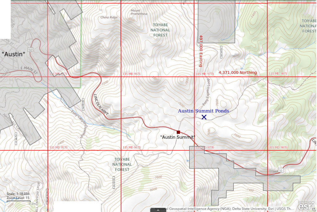
When I inquired about ponds in the Toiyabe Range, Steve Williams, the Austin-Tonopah District Ranger at the time, told me about these. Austin Summit Ponds are located in a small basin less than 200 m (660′) across only a few hundred meters (about 1,000′) north of the turnout at Austin Summit on US 50 east of Austin. The area is covered with sagebrush and there are only a few isolated pinyon. A small earthen dam was constructed many decades ago to capture water for a stock pond. The dam is no longer functional but there are 3 ponds less than 5 m (16′) across close to the dam that still collect water when the snow melts. I did not find fairy shrimp in these ponds the first time I looked and haven’t looked again. There are 5 other ponds farther from the dam that appear to be in depressions unrelated to the stock pond. They are probably not natural. The area was previously used as a brickyard and bits of brick can still be found scattered about in the dirt. I have seen fairy shrimp in each of these 5 ponds at least once. I use the terms “big pond”, “little pond”, “deep pond”, “kidney pond”, and “brick pond” (from south to north) to distinguish them.
- Big pond (about 10 m x about 20 m on 4/23/21) has a long, irregular shape about 50 m (165′) up-slope from the dam. The GPS coordinates in the data spreadsheet (on the Data web page) are for this pond.
- Little pond (about 5 m x about 7 m on 4/23/21) is oval, immediately northwest of big pond, and consistently shallower than big pond. It may merge with big pond during high-water periods.
- Deep pond (about 8 m x about 8 m on 4/23/21) is in an unnaturally round and deep depression north of little pond. It is deeper than the other ponds.
- Kidney pond (about 6 m x about 12 m on 4/23/21) is north of deep pond and has an elongate kidney-like shape. It is sometimes more turbid than the other ponds.
- Brick pond (about 5 m x about 25 m on 4/23/21) is to the west of kidney pond and next to, and on the west side of, National Forest road 43223. It is a narrow, trench-like feature but isn’t straight. It has steep, irregular banks and bits of brick.
Access to Austin Summit Ponds is easy. One could park at the turnout on top of Austin Summit and walk a few hundred meters (about 1,000′) to the ponds but there is also a poor dirt road that goes right by the ponds. This road is labeled 43223 on the 2011 Humboldt-Toiyabe National Forest Motor Vehicle Use Map for the Austin Ranger District and 233 on the 2006 recreation map for the Austin Ranger District. I think the sign on the ground is 43223 but I’m not sure. The road is rutted where it climbs the slope north of US 50 to the basin with the ponds. Maybe .2 miles (300 m) from US 50, a 2-track branches to the east toward the dilapidated stock pond dam. This is a good place to park.
Elevation (big pond): 2,302 m (7,550′)
March 31, 2013
Road 43223 is in poor condition due to snow, ruts, and mud. Snow under the cattleguard hasn’t melted yet. There is scattered snow on the flats. There is some water adjacent to the snowbanks and in depressions but there are not really ponds yet.
- Sizes and depths not estimated.
- Snowmelt is clear.
- No fairy shrimp.
- No other animals.
April 14, 2013
There is no snow on the flats and buttercups have started to bloom.
- Big pond about 10 m x about 15 m, kidney pond about 10 m long, others less than 5 m; depths not estimated.
- Water mostly cloudy grayish-brown.
- Pale gray fairy shrimp are less than 5 mm long and too small to see while swimming but can be seen in the net. They are present in big pond, kidney pond, and brick pond but apparently not in little or deep ponds.
- No other animals noted.
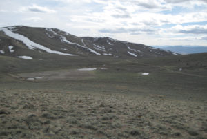
There’s been a hatch so it’s time to take photographs. View southwest across the area of Austin Summit Ponds with 3 small ponds adjacent to the stock pond dam at left, big pond at center, little pond immediately to the right of big pond, and kidney pond at right. The water of deep pond is not visible but it is located at the darker, thicker brush between little pond and kidney pond. Brick pond is to the right of National Forest road 43223 at far right. US 50 can’t be seen because of topography.
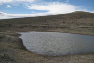
Austin Summit Ponds, with Mt. Prometheus at upper right. Big pond is in foreground and little pond is barely visible beyond it.
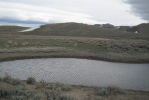
Austin Summit Ponds, looking south across kidney pond with big pond barely visible to right of center. Old stock pond dam is at left edge of photograph.
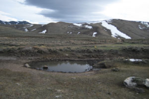
Austin Summit Ponds, looking south across brick pond and National Forest road 43223. Hills in the distance are south of US 50.
April 21, 2013
I brought a thermometer this time but didn’t take any photographs.
- Sizes and depths not estimated.
- Big pond has cloudy pale brown water, little pond has clear water, deep pond has clear water, brick pond has murky grayish-brown water; 18 C in little pond before noon.
- 10-15 mm long, pale gray fairy shrimp in big pond, little pond, and kidney pond but not seen in deep pond; a few fairy shrimp in brick pond are about 20 mm.
- No other animals noted.
May 5, 2013
The ponds are considerably reduced in size.
- Big pond less than 10 m long and less than 10 cm deep; little pond possibly dry as I didn’t mention it in notes; deep pond still about 5 m across with more than 20 cm depth; brick pond almost dry.
- Murky water according to photos.
- Pale gray fairy shrimp are sparse in big pond, abundant in deep pond, and sparse in brick pond.
- Dytiscid larvae (order Coleoptera, family Dytiscidae), few to abundant copepods(?) depending on pond, some wriggly larvae.
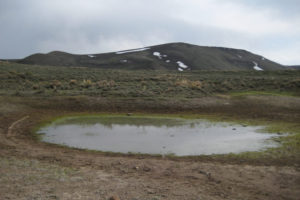
Austin Summit Ponds, looking south across what remains of big pond. The grass is doing well.
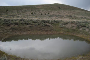
Austin Summit Ponds looking across deep pond toward Mt. Prometheus. It still has plenty of water. There are abundant fairy shrimp and a few copepods.
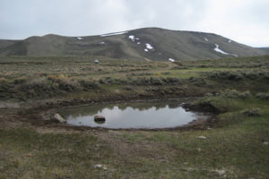
Austin Summit Ponds view to south. Brick pond has shrunken considerably but still has fairy shrimp. Compare to photograph Austin Summit Ponds 2013-04-14, #03.
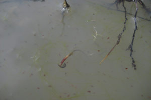
Life in the murky water of big pond at Austin Summit Ponds. There is a single, young dytiscid larva (order Coleoptera, family Dytiscidae) clinging to the stem at center. The abundant, small, dark animals are probably copepods because they are fatter at the front and at least one has visible swimming antennae that are not branched. Fairy shrimp are present but not visible in the photo.
May 19, 2013
Last visit of the season.
- Big pond and little pond are dry, brick pond is almost dry, deep pond still has water; sizes and depths not estimated.
- Murky water in brick pond.
- No fairy shrimp.
- Deep pond has black diving beetles; brick pond has copepods(?).
April 24, 2018
The buttercups are blooming and the road to the communications tower south of Austin Summit still has a snowbank. Ponds have the most water I have seen yet.
- Sizes and depths not estimated.
- Water color not noted.
- Most of the ponds have fairy shrimp but they are only about 10 mm long, pale gray, and nearly invisible.
- No other animals noted.
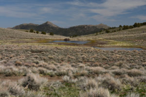
Austin Summit Ponds in a view to the east across the old stock pond in the middle distance and with big pond at the right edge of the photograph. This is considerably more water than in 2013.
April 23, 2021
No snow around the ponds but there’s a snowbank still on the road to the communications tower south of Austin Summit. Only a few buttercups have started blooming so I’m not too late but the ponds look low. It must not have been a good snow year. Did the eggs hatch? I almost hesitate to look.
- Big pond is about 10 m x 20 m (paced) and less than 30 cm deep, little pond is 5 m x 7 m (paced) and less than 10 cm deep, deep pond is 8 m x 8 m (paced) and probably greater than 40 cm deep, kidney pond is 6 m x 12 m (paced) and unknown depth, brick pond is 5 m x 25 m (visual) and less than 30 cm deep.
- Water ranges from cloudy pale brown in kidney pond, to murky pale brown in big pond, to clear in little and deep ponds.
- 10-15 mm long, pale gray fairy shrimp sparse in big pond, common in little pond, not seen in deep pond, and common in kidney pond; brick pond has sparse fairy shrimp less than 10 mm long; females have eggs.
- Occasional black diving beetles in little pond, deep pond, and brick pond.
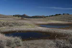
Austin Summit Ponds, similar view to the east as for photograph Austin Summit Ponds 2018-04-24, #01. It looks pretty dry even though the timing is right. Little pond is in the foreground and big pond is at right.
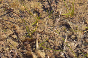
2 female fairy shrimp at center with pale greenish or brownish eggs in little pond of Austin Summit Ponds. They are blurry due to the 1/30th-second shutter speed.
Austin Summit Ponds Fairy Shrimp Video 2021-04-23 Part 1, Toiyabe Range.
For a 2-minute 35-seconds video of a search for fairy shrimp in big pond at Austin Summit Ponds, click on the video player above. There is no audio. The video starts with a look at the dry ground above the old stock pond dam. Big pond and little pond still have water in this dry year. It took quite a bit of looking (considerably more than is in the video) before I spotted a fairy shrimp at 1:25. I continued looking but had no further luck until I was surprised to see some fairy shrimp in an old rut through the pond at 2:09.
Austin Summit Ponds Fairy Shrimp Video 2021-04-23 Part 2, Toiyabe Range.
For a 1-minute 45-seconds video of a search for fairy shrimp in little pond at Austin Summit Ponds, click on the video player above. There is no audio. I continued the search at little pond. I had much better luck here. In my first look at the water, I saw fairy shrimp at 0:28 but I had to get closer for a good view. In most areas where I looked, I saw fairy shrimp and they seemed rather abundant in places.
Austin Summit Ponds Fairy Shrimp Video 2021-04-23 Part 3, Toiyabe Range.
For a 1-minute 48-seconds video of a search for fairy shrimp in deep pond at Austin Summit Ponds, click on the video player above. There is no audio. The water was clear and calm so visibility was not a problem but I didn’t see any fairy shrimp. Or even any other animals. Do you see any?
Austin Summit Ponds Fairy Shrimp Video 2021-04-23 Part 4, Toiyabe Range.
For a 2-minutes 48-seconds video of a search for fairy shrimp in kidney pond at Austin Summit Ponds, click on the video player above. There is no audio. The water in kidney pond was too turbid to see fairy shrimp unless they were right at the surface. After 1 minute, I took a scoop with my net. I caught quite a few fairy shrimp which I finally got in focus at about 1:17. I made a second scoop with similar results.
What Can We Learn from the Ponds in the Toiyabe Range?
There has been minor glacial activity in the Toiyabe Range but it didn’t create any ponds.
5 anthropogenic ponds in a small area north of Austin Summit each have fairy shrimp. They hatched in 2013, 2018, and 2021 and probably hatch in all but the driest years.
Fairy shrimp do not necessarily occur in all 5 ponds at the same time. if you don’t see fairy shrimp in one of the ponds, look in the others.
Fairy shrimp colonization succeeded at Austin Summit Ponds but it is not clear why. Although eggs could have been brought to the ponds in mud stuck to the legs of cows or other mammals, there is no yet-discovered nearby source for the eggs. Ducks visit the irrigation ditches and flooded fields along the Reese River west of the Toiyabe Range in the spring but I haven’t found fairy shrimp in the Reese River valley. Checks of a few ponds in roadside ditches and gravel pits there were negative. Maybe the eggs blew in from Smith Creek Valley, 40 km (25 miles) up wind.
The chances of finding other ponds in the Toiyabe Range are low.