Teels Marsh Playa Lake
Teels North Well Site Pond
Teels South Well Site Pond
Teels North Spring #2 Pond
What Can We Learn from the Ponds on Teels Marsh?
Teels Marsh is a salt marsh like Rhodes Salt Marsh and Columbus Salt Marsh, which are less than 35 km (22 miles) away, but the term “salt” is not included in its map name. Like the other salt marshes, it is always salty but it only rarely has enough water to create marshy conditions. On the 1:100,000-scale BLM map, the stipple pattern at Teels Marsh is about 6 km (3.7 miles) long and 2.5 km (1.6 miles) wide. The Excelsior Mountains wrap around the north and west sides of the basin but the hills to the south and east are not named on the 1:100,000-scale BLM map. The BLM map shows 3 pairs of 2 springs each along the northwestern margin of the salt marsh. I have named the northeastern-most pair Teels North Spring #2 and the pair to its southwest as Teels North Spring #1.
The playa does not have a smooth, clay floor. Rather, the floor has a rough surface of popcorn soil heavily encrusted with evaporite minerals and laced with irregular cavities on various scales. There are centimeters-high ridges of crusty dirt with hollow cores arranged in meter-scale polygonal patterns. There are mud cracks with and without precipitated minerals. When wet, the mud is very slippery. Standing in one place on wet mud results in gradual sinking that makes extrication progressively more difficult over time.
There is no vegetation on Teels Marsh playa but the surrounding areas have desert scrub.
Most of Teels Marsh is public land managed by the Stillwater Office of the BLM. It and the surrounding area are home to the Marietta burro herd and are part of the Marietta Wild Burro Range, which was established in 1991. The burros are often visible from the roads and frequent the spring at the southwestern tip of the playa in the spring and summer. The BLM does not appear to have any special rules for managing the range (“Marietta Wild Burro Range, the Nation’s First Formally Recognized Wild Burro Range” brochure by Bureau of Land Management). There is private land at the east end of the playa and at the town site of Marietta, which has a few inhabitants. There is also a large block of private land (maybe 160 hectares, 400 acres) at Marietta Mines, north of Marietta, and another (maybe 65 hectares, 160 acres) about 1 km (0.6 mile) southwest of Marietta.
Teels Marsh Playa Lake (Stillwater BLM Office)
___This map is a screenshot of The National Map (Go to The National Map). The U.S. Geological Survey generally does not copyright or charge for its data or reports (unless printed). A pond location is indicated by an “X”, which corresponds to the coordinates given in the data spreadsheet. Labels in quotations are from 7.5-minute topographic quadrangles.
___Red lines are the U. S. National Grid with a spacing of 1,000 m and intersection labels consisting of the UTM zone (e.g., 11S, 12T), a 2-letter 100-km square designation (e.g., LC, XN), and a 4-digit number. The first 2 digits of the number represent the 1,000-meter Easting and the second 2 digits the 1,000-meter Northing, as seen in the example Easting and Northing. Unlike latitude and longitude, the National Grid is rectilinear on a flat map, the units of abscissa and ordinate have equal lengths, and the units (meters) are measurable on the ground with a tape or by pacing.
___Gray shading represents private land as traced from the PAD-US 2.0 – Federal Fee Managers layer of The National Map. Other lands are public.
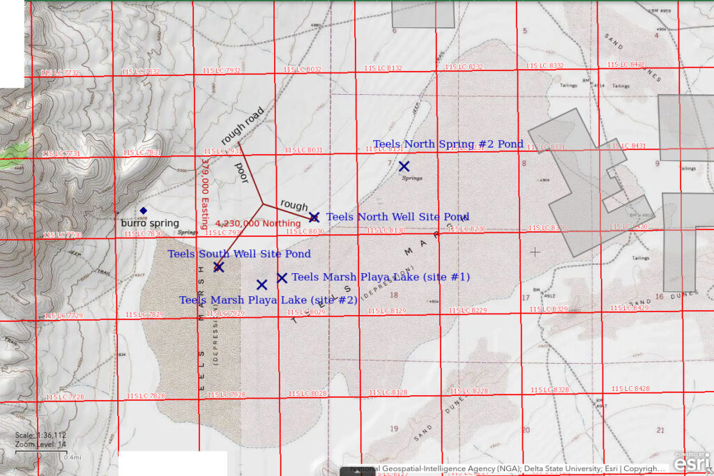
Teels Marsh is 43 km (27 miles) southeast of Hawthorne. Teels Marsh Playa Lake is the large water body on the playa itself, whenever it makes an appearance. There are no obvious low spots more likely to collect water than others, like the anthropogenic Rhodes Potholes (Rhodes Salt Marsh). As mentioned above, the stipple pattern for the Teels Marsh playa is about 6 km (3.7 miles) long and 2.5 km (1.6 miles) wide and is probably larger than any actual Teels Marsh Playa Lake.
Teels Marsh Playa Lake can be reached by turning west off Nevada 360 onto the Marietta road about 4 1/2 miles south of the junction of Nevada 360 with US 95 or 18 1/2 miles north of the junction with US 6. The Marietta road is a maintained gravel road but it is typically very bumpy. The town of Marietta is about 10 miles from the highway. Marietta has ruins dating from the late 1800s, buildings in various states of disrepair, and a few inhabited residences. Bear left (south) at 10.7 miles and left (south) again at the road intersection at 11.3 miles. This road along the northwest side of the playa is mostly more than 1 km (0.6 miles) from the playa. The easiest access to the playa (other than Teels South Well Site Pond, see below) is probably at the spring by the turn-off to the abandoned mine 13.5 miles from Nevada 360. This spring is choked with rooted vegetation and algae, has a variety of aquatic insects, and is an important water source for the burros in the area.
Elevation: 1,494 m (4,900′)
March 26, 2019
After a wet winter, maybe there is water.
- Not exactly dry, but no water.
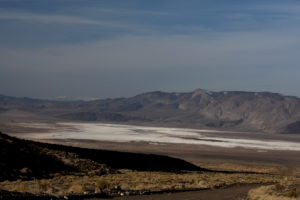
Looking southwest across Teels Marsh from the Marietta road with Sierra Nevada on the horizon. The playa is almost completely white due to precipitated evaporite minerals. The Excelsior Mountains are at right.
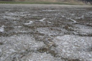
The very rough surface of a dry Teels Marsh Playa Lake. There are small ridges of mineral-encrusted dirt with cavities in a generally polygonal pattern. This photograph was taken a few years before.
April 7, 2021
Bad timing or just a dry year.
- Dry.
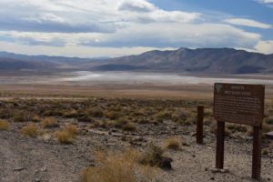
Another view southwest across Teels Marsh Playa Lake with no water. This is from the turnout on the Marietta road with the BLM sign for the Wild Burro Range at right.
January 14, 2022
After a wet December, maybe there is water this time. There is a surprising amount of snow on the Marietta road but it has been plowed at least once so it isn’t bad.
- Looks like all snow.
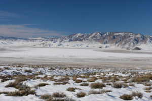
Teels Marsh Playa Lake, from the Marietta Burro Range turnout. Hmm. I guess I am a little early. At least the playa got a nice cover of snow. Maybe there will be enough water for the fairy shrimp to hatch once it melts. No point continuing down to the playa today.
February 10, 2022
Try again. There is still some snow on the margins of the playa but no visible water. The road along the northwest side of the playa has more snow than the road over the mountain into the basin but someone has made tracks before me. The burro spring has thick ice and only a little bit of open water. From that, I conclude that looking for a pond with water on the playa would be futile.
- No water.
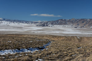
Teels Marsh Playa Lake, from the road to Marietta. Not as much snow as before but I don’t see any water. The central part of the playa is almost bare of snow so it may not have water this year unless there is more precipitation.
March 31, 2023
Yes, the playa does collect water, even if only once every 5 years. Getting to the water to search for fairy shrimp proved to be difficult and exhausting due to the soft mud. Tougher than post-holing through breakable crust on 45 cm (18″) of snow. Local patches of bottomless mud may be up to about 200 m (660′) from the water. The best chances of getting closer to the water are on the termini of old debris flows, as evidenced by occasional pebbles or cobbles of rock, common bits of woody material, and rare large chunks of wood or shrubs and in run-off channels, which are 10-20 cm (4-8″) deep, less than 2 m (6.5′) across, and usually floored with current ripples. These channels have a little more sand than elsewhere and somehow make the mud firmer. The last 25 m (80′) or so to the water’s edge is where it gets really dicey as the more thoroughly saturated mud tends to be really soft. Stopping, or even pausing, is not an option.
On my first attempt, I tried “sprinting” from relatively firm ground but had to turn around just short of the water as my lungs and legs let me know that they might not get me back to that firm ground, which wasn’t all that firm and was still another 100 m (330′) or so from somewhere safe to stop. The mud was just too sticky. On the second attempt (Site #1 on map), I was able to walk up to about 10 m (33′) into the water and up to about 30 m (100′) through the water sort of parallel to shore. On the next attempt, I got to the water at the end of a sandy debris flow (Site #2 on map) and took a few steps into the water. I also got close enough to see into the water about 100 m (330′) southwest of Teels South Well Site Pond. That’s clearly not an adequate survey of 300 hectares (740 acres) of playa lake but that’s all I could manage.
- Probably close to 3,000 m long and 1,000 m wide; depth greater than 10 cm as far as I got and might be much deeper.
- Clear water.
- No fairy shrimp.
- Nothing in the water, not even algae, but gulls overhead.
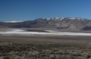
Teels Marsh Playa Lake, from the turnout at the Marietta Burro Range sign. I was quite disoriented by this view, especially with binoculars. It looked like there was a ridge in the middle of the marsh with white salt flats on both sides. But the ridge is actually a reflection. All the dark area is water. Hooray.
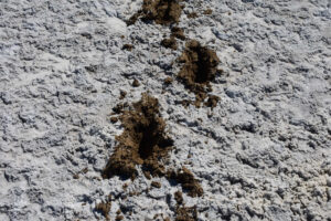
Mud of Teels Marsh Playa Lake. I decided to take this photograph after failing to even get close to the water. The thick mineral crust with its convoluted surface ridges hides soft, sticky mud that makes just walking feel like climbing Mt. Everest, or so I imagine.
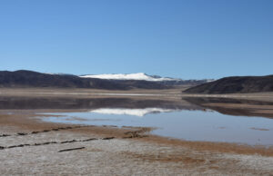
Teels Marsh Playa Lake, 1st attempt. The foot prints show I got to the water but I obviously didn’t spend much time looking for fairy shrimp. This view is to the south with unnamed snowy hills in the distance.
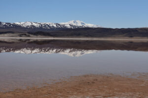
Teels Marsh Playa Lake, 2nd attempt (site #1 on the map). I’m standing on a short piece of log so I have time to take a photo without getting stuck. I had better luck here as I was able to get into the water and walk around a bit before I had to head back to the log before my legs gave out. That’s Boundary Peak in the White Mountains in the distance.
Teels North Well Site Pond (Stillwater BLM Office)
Teels North Well Site Pond was created by a lithium exploration project. Dajin Lithium Corp. is exploring for lithium brine under Teels Marsh (company web site is www.dajin.ca). In the summer of 2018, it constructed 2 drill pads and roads to them. It plans to drill 2 large-diameter wells at each site and has obtained water rights to test-pump the wells and sample the water. The drilling and pumping necessitates the use of sumps, or mud pits, to contain the water. The sumps are lined with plastic sheeting. The sumps are about 8 m x 20 m (26′ x 66′). They cannot receive water flowing across the surface of the ground but snowmelt or a good thunderstorm might fill them up enough to provide a home for fairy shrimp and attract birds carrying fairy shrimp eggs. Alternatively, a good dust storm could seed them with eggs from the playa, if the playa has fairy shrimp. It’s anybody’s guess when Dajin will drill the wells and how long the sumps will remain unreclaimed after the wells are drilled but it could be several years. The sumps thus provide an experiment in how long it takes fairy shrimp to colonize new habitat, at least at this location. Easier than trying to get a research grant.
For access to Marietta, see Teels Marsh Playa Lake. The new road to the drill pads turns off the road along the northwest side of Teels Marsh 12.4 miles from Nevada 360. The road is straight and was bladed and graveled when constructed but the latter features are less obvious now due to recent erosion. The 1:100,000-scale BLM map and The National Map show 2 straight roads which angle to the southeast from the road along the northwest side of the salt marsh but not the new road, which is farther to the southwest. The 2 roads on the map are no longer visible on the ground, at least not to me. Imagery for The National Map has been updated within the past 2 years and it now shows the new roads and the drill pads. I’ve traced these onto the Map of Teels Marsh Playa Lake.
Elevation: 1,500 m (4,920′)
October 15, 2018
I wasn’t looking for fairy shrimp but did find potential habitat. There is no casing for a drilled well and the sump doesn’t look like it has ever been used.
- Didn’t estimate the extent of water from a recent rain.
- Water is clear.
- No fairy shrimp.
- A burro.
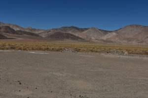
View northwest across the drill pad at Teels North Well Site Pond, with Excelsior Mountains in the distance. The 2 piles of rock are at 2 corners on the pond; the other 2 corners are off the right edge of the photograph. The burro at right was probably attracted by a puddle left over from a recent rain.
March 26, 2019
No sign yet that the wells have been drilled.
- Sump is dry.
April 7, 2021
Dry again and no sign the wells have been drilled.
- Dry.
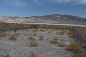
Looking east across Teels North Well Site Pond. Teels Marsh (white) is in the middle distance. The clay used to cover the pond’s plastic liner might make any pond suitable for clay-loving fairy shrimp like those in Candelaria Playa Ponds (Candelaria Hills), which are on the far side of the mountain in the distance.
February 10, 2022
The heavy December snows gave me hope that the sump could have a decent amount of water once the snow melted. There was plenty of snow on the playa on January 14 but today the playa has only a little snow and no water. Nonetheless, this pond could have melted snow. It’s worth a shot. Icy snow on the road around the northwest side of the playa and from that road to the pond indicates it may be a while before all the snow melts.
- A little snow.
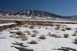
Teels North Well Site Pond, looking northeast. Well, there’s snow but no water. Unfortunately, it doesn’t look like there is enough snow to make a pond even when it finishes melting.
March 31, 2023
What used to be a very nice new access road has been significantly eroded due to flowing water. Not recommended without a high-clearance vehicle. The flat well pad is still in good shape. It doesn’t look like there has been any drilling here yet. From here, I walked to the northeast toward a visible fence enclosure that surrounds Teels North Spring #1. Maybe there are ponds there and, if not, maybe the approach to the playa lake from there won’t be too bad.
- Dry.
Teels South Well Site Pond (Stillwater BLM Office)
Teels South Well Site Pond was constructed as part of a lithium exploration project. See description for Teels North Well Site Pond for more details. Unlike for the northern well site, the drill pad for the southern well site is on the playa itself.
For access, see Teels North Well Site Pond.
Elevation: 1,493 m (4,900′)
October 15, 2018
Extensive rippled red mud off the side of the road to the drill pad suggests there was an intense rain storm recently. The mud now has mud cracks and curled flakes of red clay. There is no well casing or signs of drilling on the well pad.
- Sump is damp.
March 26, 2019
Dry again and no sign that the wells have been drilled.
- Sump is dry.
April 7, 2021
No indication the wells have been drilled yet so the experiment continues.
- Dry.
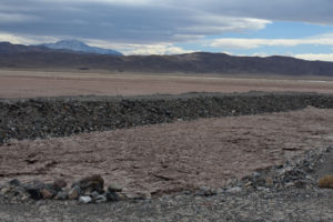
View to the south across Teels South Well Site Pond, with Boundary Peak in the White Mountains on the horizon at left. The rough, cracked, polygonally patterned floor of the sump indicates it is the playa surface and has not been excavated. Any water that collects in the pond would likely be chemically similar to that out on the playa. If Teels Marsh Playa Lake has fairy shrimp, then the dirt in Teels South Well Site Pond may already have fairy shrimp eggs.
March 31, 2023
No drilling here yet either. Unlike Teels North Well Site Pond, the sump here has water. Not much, but maybe enough for fairy shrimp. It’s a good thing that the pond bottom has enough of a slope for the water to collect at one end.
- 8 m by 10 m; depth up to about 5 cm.
- Cloudy pale brown water.
- No fairy shrimp.
- No aquatic animals.
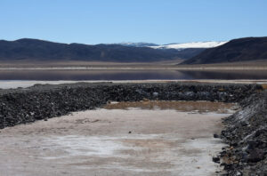
Looking south at Teels South Well Site Pond, with Teels Marsh Playa Lake in middle distance. The pond bottom isn’t as soft as the playa so I could do a thorough search here. The water of the playa is relatively close and a sandy run-off channel near the well pad offers more stable footing to the lake. I was able to get to, but not in, the water about 100 m (330′) from here but managed only a quick look.
Teels North Spring #2 Pond (Stillwater BLM Office)
Teels North Spring #2 Pond is at a spring about 1,300 m (4,270′) northeast of Teels North Well Site Pond. There are scattered puddles near the spring, several rivulets meandering in various directions, at least 1 pond that appears to have stagnant water with significant depth, and green grass. The grass is closely cropped by the burros. The area around the spring has what I call quaking bogs. These are areas of dense, hummocky turf that feels like it is not on hard ground but is, instead, floating on water. As you step from hummock to hummock to avoid the pools of water, the turf for several meters around shakes and quivers. It makes you wonder if you might break through and never be seen again.
Teels North Spring #2 is #2 because it is the second spring I visited. I went to Teels North Spring #1 first because it is surrounded by a fence that is visible from Teels North Well Site, where I parked. The vegetation there is very thick, and still brown, but there is no open water.
Elevation: 1,498 m (4,910′)
March 31, 2023
I saw the green from Teels North Spring #1. It’s not as promising as Smith Creek Cold Springs Ponds but at least there is 1 pond that might host fairy shrimp.
- 8 m by 12 m; depth up to about 10 cm.
- Clear to murky pale brown water; a little ice at 1045.
- No fairy shrimp.
- Rare, small caddisfly larvae, tiny swimmers that might be water mites, killdeer, what may have been a pair of spotted sandpipers, and a female duck hanging around a greasewood bush next to a rivulet as if it might have a nest.
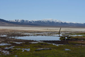
Teels North Spring #2 Pond, looking across the northern part of Teels Marsh with Miller Mountain in the Candelaria Hills in the distance. The pond at center looks like it might work for fairy shrimp but I didn’t find any.
What Can We Learn from the Ponds on Teels Marsh?
There was water on the playa in 1 of 4 spring seasons thanks to a very wet winter in 2022-2023.
I didn’t see any fairy shrimp on the playa in the 1 wet year but I was unable to adequately survey the playa due to the soft mud.
2 water well sumps constructed in 2018 are potential fairy shrimp habitat and provide an ongoing experiment in how long it takes fairy shrimp in this region to colonize new habitat. However, the sumps could be reclaimed at any time.
Teels South Well Site Pond has had sufficient water for fairy shrimp once but Teels North Well Site Pond has not.