Easy Chair Crater Reservoir
“Lunar Lake”
What Can We Learn from the Ponds in the Southern Pancake Range?
The Southern Pancake Range is here defined as the Pancake Range south of highway US 6 plus the Lunar Crater volcanic field that lies on top of it and extends north of US 6 to the west of Black Rock Summit. The southern Pancake Range extends south from US 6 to Nevada 375 east of Warm Springs. It is 45 km (27 miles) from Black Rock Summit southwest to Nevada 375. The range is 27 km (16 miles) wide, west-east, from the western edge of Palisade Mesa to the east edge of The Wall, above Railroad Valley. The margins of the southern Pancake Range are steep with 250 m (820′) cliffs at Palisade Mesa and The Wall but the top is rather flat with hills and mesas.
The highest elevation in the Southern Pancake Range is 2,287 m (7,503′) at Citadel Mountain. The 1,700 m (5,580′) contour rings the base of the range from Railroad Valley around the southern tip and into Hot Creek Valley.
The Lunar Crater volcanic field consists of basalt less than 2 million years old (nbmg.unr.edu/ScienceEducation/EarthCaches/BlackRockLavaFlow.html). The basalt forms both blocky lava flows with low relief and cinder or scoria cones up to about 150 m (490′) high. On aerial imagery, the craters of some of the cinder cones have pale, vegetation-free, mud flats that may host temporary ponds from time to time. The largest mud flat in a crater is in Lunar Crater, which is not a cone but a maar. Maars are craters created by lava below the surface causing ground water to boil instantaneously and explode (nbmg.unr.edu/ScienceEducation/EarthCaches/BlackRockLavaFlow.html). Easy Chair Crater is the big hill just south of US 6. It has a maar on the south side and that maar also has a sizeable mud flat at the bottom. There are trails from parking lots near both maars to their rims. If the mud flats have water, you’ll have to find your own way to get down to them and back up again.
There isn’t much vegetation or the soil it needs on the basalt due to its young age. Most of the Southern Pancake Range is felsic tuffs older than 15 million years. Some areas of tuff lack vegetation but there are also sandy flats and hills with sagebrush and greasewood. There are a few junipers on the higher mesas.
The Southern Pancake Range is all public land and several non-paved roads provide access from US 6. The road to Lunar Crater is maintained but there are soft sandy sections and a few cross-cutting channels that may be a problem after heavy precipitation.
Easy Chair Crater Reservoir (Tonopah BLM Office)
___This map is a screenshot of The National Map (Go to The National Map). The U.S. Geological Survey generally does not copyright or charge for its data or reports (unless printed). A pond location is indicated by an “X”, which corresponds to the coordinates given in the data spreadsheet. Labels in quotations are from 7.5-minute topographic quadrangles.
___Red lines are the U. S. National Grid with a spacing of 1,000 m and intersection labels consisting of the UTM zone (e.g., 11S, 12T), a 2-letter 100-km square designation (e.g., LC, XN), and a 4-digit number. The first 2 digits of the number represent the 1,000-meter Easting and the second 2 digits the 1,000-meter Northing, as seen in the example Easting and Northing. Unlike latitude and longitude, the National Grid is rectilinear on a flat map, the units of abscissa and ordinate have equal lengths, and the units (meters) are measurable on the ground with a tape or by pacing.
___There is no private land on this map. All lands are public.
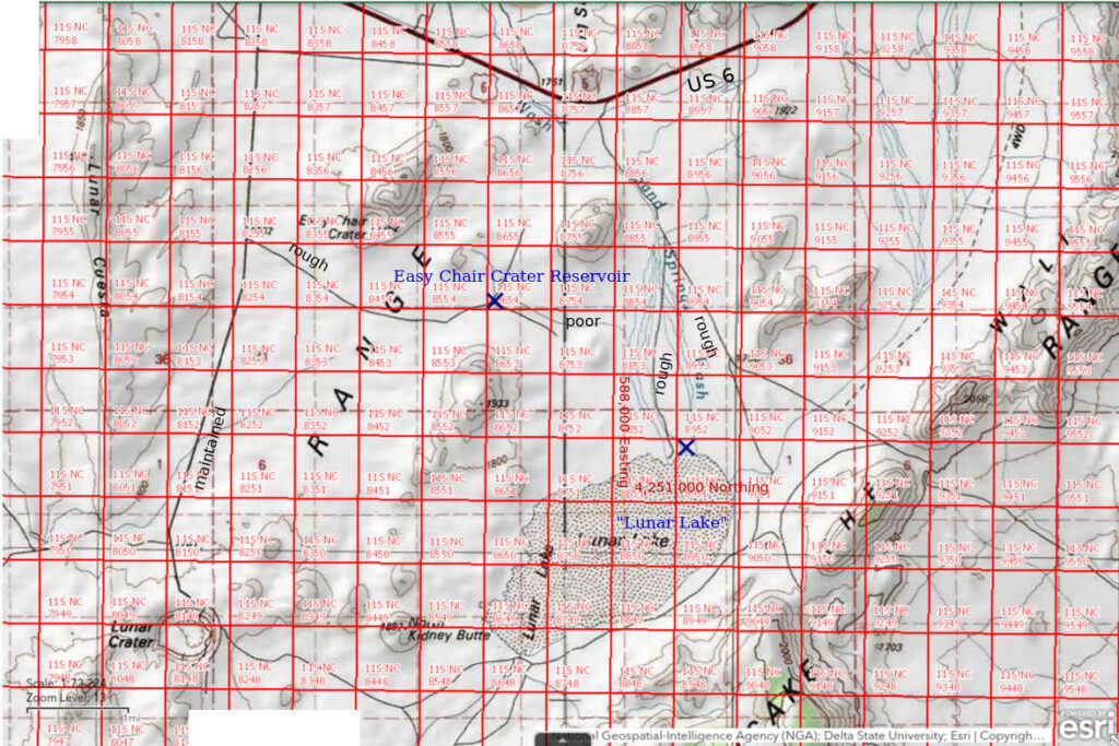
Easy Chair Crater Reservoir is 113 km (68 miles) northeast of Tonopah and 7 km (4 miles) northeast of Lunar Crater. It is on a road that leads from the maintained Lunar Crater road eastward to south of Easy Chair Crater and north of an unnamed cinder cone. The pond is 2 km (1.2 miles) southeast of Easy Chair Crater. Easy Chair Crater Reservoir is not on the 1:100,000-scale BLM map but is on the Lunar Crater 7.5-minute topographic quadrangle.
Easy Chair Crater Reservoir is easily reached from US 6. Turn south off the highway at the sign to Lunar Crater. Turn east off the road to Lunar Crater 2.5 miles south of US 6. There are stock-watering tanks at the intersection. The reservoir is a little over 2 miles from the Lunar Crater road.
Elevation: 1,758 m (5,770′)
April 13, 2023
I visited Lunar Crater first. There was a mud flat on the bottom and a herd of bighorn sheep near the top of the crater. They ran off as I hiked along the rim. There was no water on the mud flat. After that, I went looking for a very small “reservoir” shown on the 1:100,000-scale BLM map. The topography is so flat though that I couldn’t see it from the road or from a short walk. I hiked up one of the larger scoria cones to get a better look, maybe find water in the crater, and also to get a view of “Lunar Lake” to see if it has any water. The mud flat in the crater was damp. Snowmelt may not be sufficient for a pond; it might take a big thunderstorm. There was water in “Lunar Lake”. I saw that the “reservoir” on the BLM map was dry. I saw a different reservoir to the north of the cone I was on and it had water. Down I went. Luckily the road past Easy Chair Crater doesn’t end as shown on the map but continues all the way to Sand Springs Wash.
- Rectangular 30 m x 37 m; depth greater than 25 cm.
- Opaque pale brown water; 10 C at 1330 in 3 cm water.
- Fairy shrimp 10-20 mm long; white or brown eggs in ovisacs one-half to two-thirds the lengths of abdomens.
- Water boatmen (sub-order Heteroptera, family Corixidae) identified in video, where the speedy swimmers can be identified by pausing the replay.
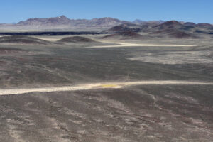
Easy Chair Crater Reservoir as seen from the volcanic cone to its south. Other scoria cones and the black basalt flow north of US 6 are in the middle distance with the northern part of the Pancake Range in the far distance. The road by the reservoir continues to Sand Springs Wash but is not shown on maps. Although the road was washed out by a few channels in the wash, I was able to drive to “Lunar Lake”.
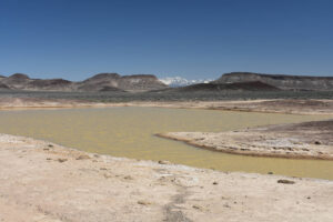
Looking east across Easy Chair Crater Reservoir. In the distance, the snowy Quinn Canyon Range is visible through a gap between cliff-bordered hills of The Wall on the east side of the Pancake Range.
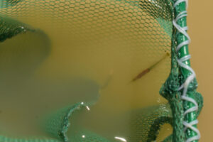
A large, near-surface female with abundant brown eggs and a small, deeper female with pale eggs in the net at Easy Chair Crater Reservoir.
Easy Chair Crater Reservoir Fairy Shrimp Video 2023-04-13a-cr, Southern Pancake Range.
For a 2-minutes 7-seconds video of fairy shrimp swimming in a white container at Easy Chair Crater Reservoir, click on the video player above. There is no audio. The video shows the pond and then fairy shrimp swimming in a white container, where they are more visible in the opaque water. I didn’t realize it at the time but in netting the fairy shrimp, I also netted a water boatman. It has a dark, oblong body, which is shorter than the fairy shrimp and it swims faster. It zooms across the container at 0:37 seconds and makes other appearances, such as at 0:57, 1:06, and 1:27.
Easy Chair Crater Reservoir Fairy Shrimp Video 2023-04-13b-csr, Southern Pancake Range.
For a 2-minutes 44-seconds video of the same fairy shrimp still swimming in a white container at Easy Chair Crater Reservoir, click on the video player above. There is no audio. To make the fairy shrimp more visible, I poured out some of the water and shot the video with the camera closer to the white container. The fairy shrimp are swimming relatively fast so I halved the speed of the playback after 10 seconds. This makes it easier to see the leg motions. Before I saw this slow motion version, I hadn’t realized the fairy shrimp sometimes impact the wall of the container head on, such as at 1:14, 1:18, 1:21, and 1:34. That might indicate that these fairy shrimp don’t see well but how could they see a smooth, curved, white wall with no corners or markings through cloudy water? The fairy shrimp don’t seem to be injured by the impacts but I have since used a magic marker on the container. The collision between a large and a small female at the edge of the container at 01:09 is also suggestive of poor vision but the wall of the container may be partly to blame. The water boatman makes a splendid appearance at 2:10. Its dark color indicates it is back side up whereas a backswimmer would have a pale color due to its lighter colored ventral surface. You can see the oar-like legs if you stop the video.
“Lunar Lake” (Tonopah BLM Office)
Easy Chair Crater Reservoir map
“Lunar Lake” is a large playa 113 km (68 miles) northeast of Tonopah and 4 km (2.5 miles) southeast of Easy Chair Crater Reservoir. On the 1:100,000-scale BLM map, the stippled area for the playa is 4.5 km long and up to 2.0 km wide (2.7 x 1.2 miles). The BLM map shows the playa as the terminus of Sand Springs Wash from the north, another wash to the east of Sand Springs Wash, and an intermittent stream (erroneously shown as perennial on the map, like all the other streams on this map) to the southwest.
Although “Lunar Lake” can be reached by way of Easy Chair Crater Reservoir, it can be directly accessed on a better road by turning south off US 6 onto a maintained but still rough road 3.6 miles east of the turn-off to Lunar Crater. 1.5 miles south of US 6, the road splits. The west fork goes to the north shore of “Lunar Lake” and the east fork goes around the east end of the lake and continues along the south side. The east fork is in better condition but I made it to the water’s edge on the west fork in spite of a few channel cuts.
Elevation: 1,752 m (5,750′)
April 13, 2023
The view I got from the cone south of Easy Chair Crater Reservoir was astounding. Almost the entire stippled area on the BLM map was covered by water. Only the southwestern end past a small island of black basalt looked like it was still dry. If there are not fairy shrimp now, there probably never are.
- About 4,500 m long and 2,000 m wide; depth 15 cm and getting deeper about 200 m from the water’s edge.
- Opaque pale brown water; 16 C at 1445 in 2 cm water but cooler in deeper water.
- Abundant fairy shrimp generally 10-20 mm long but swimming too fast to get good estimates; some females have eggs.
- No other aquatic animals observed.
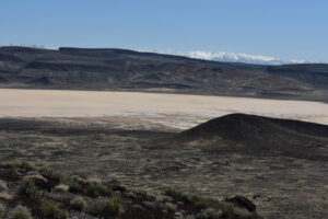
“Lunar Lake” from a volcanic cone to its northwest with the Quinn Canyon Range on the horizon. The water shown in this view is probably 2-3 km across from the left edge of the photo to the right edge. The near absence of brown mud flats around the paler water indicate a high water level without much recent evaporation.
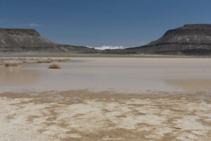
View to the southeast across the northeastern shore of “Lunar Lake” with the Quinn Canyon Range through the gap in The Wall. The nearly dry mud close to the water’s edge suggests the lake level hasn’t receded much. The mud remains relatively firm, though very slippery, for 200 m or more into the water. This was quite welcome and very different from my experience within the past month at “Winnemucca Lake” Playa and Teels Marsh Playa Lake.
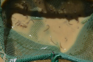
Abundant fairy shrimp in the net at “Lunar Lake”. These were captured from water less than 3 cm deep, where the fairy shrimp seem to be more abundant. I had to lift the net almost out of the water to make them visible through the opaque water. The male at center has long antennae II with tubular distal segments that rule out some species. There is a rather short ovisac with eggs at lower right.
Given the abundance of fairy shrimp and the size of the lake, I thought this might be a good place to find the giant, predatory fairy shrimp, Branchinecta gigas (as in Rabbit Dry Lake, Brown and Carpelan, 1971; see References page). I spent considerable time sweeping my net through the water but never found the big one.
What Can We Learn from the Ponds in the Southern Pancake Range?
“Lunar Lake” really is a lake, at least after a wet winter, even though the surrounding landscape does not look at all promising for large accumulations of water.
In spite of the presence of brush-free mud flats in Lunar Crater and other volcanic craters in the area, Lunar Crater was dry and the mud flat in a cone to the northeast (elevation 1,933 m, 6,342′, on the BLM map) was barely damp after a wet winter.
At least 1 stock pond reservoir in the southern Pancake Range had water and fairy shrimp after a wet winter and at least 1 other one was dry.
Fairy shrimp were abundant in “Lunar Lake” when the water level was near its maximum extent after a wet winter. That abundance could support one of the large, predatory species of fairy shrimp but none of the fairy shrimp I saw were longer than 25 mm.