The base map is provided by OpenTopoMap’s volunteer servers.
Wrecked Windmill Pond
Playa Wire Gate Pond
Luning Playa Lake
Luning Playa Narrow Pond
Luning Playa RR Grade Pond
Paymaster Canyon Road Stock Pond
Cross Playa Rivulet Pond
Winter 2022 Fairy Shrimp Hatching History in Soda Spring Valley and Rhodes Salt Marsh
What Can We Learn from the Ponds in Soda Spring Valley?
Soda Spring Valley curves around the north and east sides of the Garfield Hills forming a north arm and an east arm. It runs approximately west-east in the north arm and south-north in the east arm. The north arm is about 20 km (12.4 miles) long and 5-10 km (3.1-6.2 miles) wide. The east arm is about 19 km (11.8 miles) long from Luning to Sodaville and 6-8 km (3.7-5.0 miles) wide. The Gabbs Valley Range and the Pilot Mountains are east of Soda Spring Valley and the Gillis Range and Gabbs Valley Range are to the north. The valley is named for Soda Spring, which is at Sodaville about 2 1/2 miles south of Mina. Sodaville is at the south end of the valley on the divide with Rhodes Salt Marsh. It was previously the site of the Desert Lobster.
The stipple patterns in Soda Spring Valley on the 1:100,000-scale BLM map do not coincide well with playas or sandy areas. The north arm has 2 small areas of stipple enclosed by blue lines. This symbol is not included in the map legend but likely represents an interpreted playa as these areas do have clay-floored playa with negligible brush. However, the actual playa is more extensive. The north arm also has extensive stipple patterns representing “sand” but some are rather gravelly. The east arm has stipple patterns labeled “Sand Dunes” midway between Luning and Mina. This is definitely a sandy area but there is also a sparsely vegetated clay-floored playa mostly west and north of the “Sand Dunes” closer to Luning. The stipple pattern on The National Map (online) more accurately depicts the extent of playa in the east arm. The marsh pattern overlay on parts of the stippled area seems to correspond to areas of the playa with more brush, primarily greasewood. There is no pattern for sand dunes in the east arm.
Elevations in Soda Spring Valley are 1,340-1,500 m (4,400-4,920′). The lowest part is at the west end of the north arm.
Vegetation is exclusively desert scrub.
There are small blocks of private land at Luning, Mina, Sodaville, and at a few other locations. Probably more than 90% of the valley is public land managed by the Stillwater Office of the BLM. US 95 runs the full length of Soda Spring Valley. Nevada 361 crosses the valley between the north arm and the east arm.
Wrecked Windmill Pond (Stillwater BLM Office)
___This map is a screenshot of The National Map (Go to The National Map). The U.S. Geological Survey generally does not copyright or charge for its data or reports (unless printed). A pond location is indicated by an “X”, which corresponds to the coordinates given in the data spreadsheet. Labels in quotations are from 7.5-minute topographic quadrangles.
___Red lines are the U. S. National Grid with a spacing of 1,000 m and intersection labels consisting of the UTM zone (e.g., 11S, 12T), a 2-letter 100-km square designation (e.g., LC, XN), and a 4-digit number. The first 2 digits of the number represent the 1,000-meter Easting and the second 2 digits the 1,000-meter Northing, as seen in the example Easting and Northing. Unlike latitude and longitude, the National Grid is rectilinear on a flat map, the units of abscissa and ordinate have equal lengths, and the units (meters) are measurable on the ground with a tape or by pacing.
___Gray shading represents private land as traced from the PAD-US 2.0 – Federal Fee Managers layer of The National Map. Other lands are public.
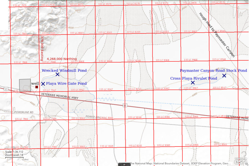
Wrecked Windmill Pond is at the northwest edge of the playa in the north arm of Soda Spring Valley approximately 21 km (13 miles) east of Hawthorne. It is a shallow stock pond next to a windmill with a vane for orientation but no blades to turn it. There is also wooden and metal debris at the site. The remains of the windmill can be seen from the highway if you look carefully.
Wrecked Windmill Pond is less than 1 km (0.6 miles) north of US 95. A non-maintained road turns off US 95 at a stop sign just east of a small block (about 40 acres, 16 hectares) of private land, known as Kinkaid, about 12 miles east of Hawthorne. The private land can be recognized by a few wrecked buildings, excavation equipment, and scattered junk. The road leads to the north through a barbed wire range fence and past a well (shown on the 1:100,000-scale BLM map) next to a shack and then turns to the northeast. The road to the wrecked windmill forks off to the right a short distance past the shack.
Elevation: 1,338 m (4,390′)
February 28, 2019
Saw the pond and although it seems early in the season, NPPWOPII.
- About 50 m long and about 10 m wide; depth probably less than 20 cm.
- Opaque pale brown water.
- Numerous pale gray fairy shrimp of two size classes, both less than 20 mm; larger females have yellowish-orange eggs in short, fat ovisacs; too windy to photograph them – the net goes horizontal.
- No other animals noted.
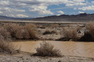
Looking southeast across the east end of Wrecked Windmill Pond with dust blowing up off the playa in the distance. The Garfield Hills are at right and the Pilot Mountains are on the horizon at center.
April 10, 2019
The pond is much smaller. The wooden pallets at the west edge are now out of the water entirely.
- About 30 m x 8 m; depth not estimated.
- Water opaque pale brown; ice before 0900.
- Few fairy shrimp, about 20 mm long.
- No other animals noted.
May 18, 2019
I guess I wanted to find out what it looks like when its dry.
- Dry.
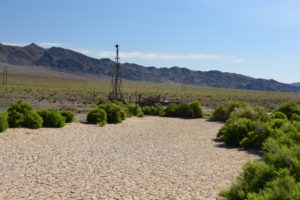
A dry Wrecked Windmill Pond and green greasewood. The dry pond bottom is relatively smooth and indicates that cows have not been using the pond. Otherwise, there would be deep hoof prints from when the mud was soft.
April 8, 2020
Water is so shallow that the pallets at the west end of the pond are dry.
- Size and depth not estimated.
- Opaque pale brown water.
- Sparse pale gray smaller and larger fairy shrimp of uncertain sizes; 1 female has 2 rows of white eggs.
- No other animals noted.
December 22, 2021
Heavy snow in Reno on December 13-14 after some earlier showers. Was it enough to fill up the pond?
- Solid ice up to 8 cm thick in hoof prints.
January 6, 2022
Another big storm on December 23.
- 11 m x 55 m; at least 6 cm deep.
- Water somewhat murky, possibly because I have to break the ice to see it.
- Probably no fairy shrimp but I can’t use the net because of the ice.
- Probably nothing else either.
January 18, 2022
Only a little ice along the shore today. The pond is smaller than it was on January 6.
- 10 m x 35 m; depth 10 cm in some hoof prints and possibly deeper in others.
- Opaque moderate brown water; ice.
- No fairy shrimp but can’t use net effectively due to cow-pocked pond bottom.
- Water boatmen (sub-order Heteroptera, family Corixidae) about 10 mm.
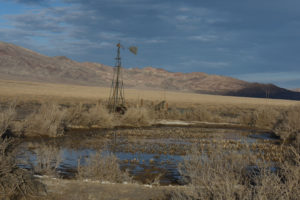
View to northeast across Wrecked Windmill Pond. The pond is markedly different than in May 2019 (see photograph Wrecked Windmill Pond 2019-05-18, #06). The bottom is now thoroughly pock-marked with cow hoof prints and there is abundant vegetation in the water, now brown and chewed off. Could these changes explain the absence of fairy shrimp here and their continued presence at nearby Playa Wire Gate Pond?
March 14, 2022
After my January 18 visit, Wrecked Windmill Pond didn’t look like good fairy shrimp habitat. Nonetheless, to learn, one should try to disconfirm one’s hypotheses. The pond looked much different today. There are solar panels by the derrick of the wrecked windmill. There is evidently a solar-powered pump in the well as a trickle of water flows into the pond. A similar trickle of water flows out of the pond through a low dam haphazardly constructed of wooden posts and mud with wooden pallets piled on top. Water flowing out of the pond spreads across a wide area of playa for another 30 m or so before sinking into the soil or evaporating.
The flowing water could result in some, but probably not most, fairy shrimp eggs being carried out of pond habitat onto the playa where they will likely never hatch. Although persistent water would be good for fairy shrimp, it might also make the pond more favorable for insect predators or it might allow vegetation to take over the pond and impede the survival of filter feeders. A lot would depend on how long water is pumped into the pond. Grazing permits for the surrounding public lands are generally not for an entire year. If the cows are removed after a few months and the pump is disconnected, then the pond would dry up as in the past and the impacts on fairy shrimp might be minimal. If cows stay and the water flows year-round, the ecology of the pond is likely to change dramatically.
Another big change: there is now a sign at the wire gate through the fence south of Wrecked Windmill Pond stating that the area north of the fence is “Critical Habitat” for longhorns. Silly me, I thought “critical habitat” was only designated by the U.S. Fish and Wildlife Service for the protection of endangered or threatened species. Maybe the BLM has designated this critical habitat so that it could issue a grazing permit that differs in major way(s) from the usual grazing permits. However, the sign refers to a Nevada law, NRS 207.220, that states “Any person or persons opening and passing through gates or bars when gates or bars are placed in fences enclosing fields, or in fences partly enclosing lands, and not shutting and fastening the same, shall be deemed guilty of a misdemeanor.” I wouldn’t expect the BLM to cite this regulation. There are thousands, maybe more, gates on public lands in Nevada that do not have signs referring to that law. Maybe the state of Nevada can designate “critical habitat” on public lands, whatever that means, and it decided to threaten the public with a misdemeanor on the same sign. All of this ignores the more fundamental question. Why is any part of Nevada designated “critical habitat” for a cow breed that is most associated with New Mexico and Texas?
As for the pond . . .
- 10 m x 42 m; mostly less than 3 cm deep but 10 cm in some hoof prints.
- Murky pale brown water; 18 C at 1730, likely influenced by temperature of ground water flowing into pond.
- Few fairy shrimp about 10 mm long and even fewer about 5 mm.
- Wriggly dark brown larvae about 5 mm long.
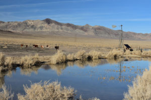
View to the northeast across Wrecked Windmill Pond, with Indian Head Peak in the distance at left. This view is turned to the left of the view in photograph Wrecked Windmill Pond 2022-01-18, #09, to show the cows walking away at left. These look more like hybrids than pure-bred longhorns to me but I don’t really know. There is a new solar panel by the windmill at upper right and a steady trickle of water flowing into the pond. The pond water is more clear than in the past. The vegetation in the water seems to have been eaten down some from its appearance on January 18 even though it was long dead then.
A fairy shrimp swimming in Wrecked Windmill Pond. The white color of the segments of the abdomen next to the thorax may be due to white eggs in paired oviducts. This is not the opaque water that previously characterized Wrecked Windmill Pond.
March 14, 2025
Water is trickling out of the well thanks to the solar-powered pump. Drainage around the well has been completely altered. The pond is dry and lacks all vegetation except the peripheral greasewood bushes, unlike January 18, 2022. Instead, the water is spread widely across the playa in irregular bands that are possibly related to the paths most heavily trampled by cattle. There is murky water with green algae in deeper hoof prints but it doesn’t have anything swimming in it.
- Dry.
Playa Wire Gate Pond (Stillwater BLM Office)
Playa Wire Gate Pond is at the west end of the north arm of Soda Spring Valley 20 km (12 miles) east of Hawthorne, more or less, and 900 m (2,950′) southwest of Wrecked Windmill Pond. Playa Wire Gate Pond is a shallow puddle along the barbed wire fence east of the wire gate through the fence on the road to Wrecked Windmill Pond. The puddle has a very irregular shape and extends to both sides of the fence but most of the water is north of the fence. The pond is less than 100 m (330′) east of the gate.
For access, see see Wrecked Windmill Pond.
Elevation: 1,334 m (4,375′)
April 10, 2019
I noticed this pond only on my second visit to Wrecked Windmill Pond. Like Wrecked Windmill Pond, it must have had water and been bigger in February. There are smaller puddles in the vicinity today that look less promising.
- About 10 m x about 20 m; depth shallow but not estimated.
- Water opaque pale brown; ice before 0900.
- There are a few (less than 1 per net), relatively large fairy shrimp; 2 females 20-25 mm have eggs in long, narrow ovisacs; netted 1 fairy shrimp less than 20 mm.
- No other animals noted.
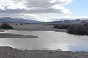
Playa Wire Gate Pond, looking east down (up?) north arm of Soda Spring Valley with Gabbs Valley Range in distance at left and Garfield Hills at right.
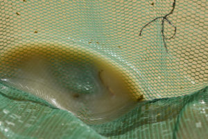
One fairy shrimp with eggs in the net at Playa Wire Gate Pond. Its head is at upper left and its ovisac with pale eggs is at lower right.
May 18, 2019.
I wasn’t sure I would be able to find the pond location on the dry playa but I did (see photograph below).
- Dry.
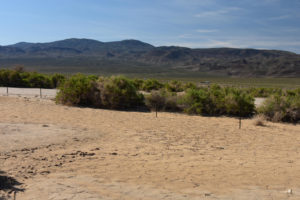
Dried up Playa Wire Gate Pond, looking south with Garfield Hills in distance. The pond location is marked by clay with a different color and more mud cracks. The shape of the pond bottom suggests water never gets deeper than about 15 cm. The vehicle in the middle distance to right of center is on US 95.
December 22, 2021
Heavy snow in Reno on December 13-14 after some earlier showers. I stopped here as well as at Wrecked Windmill Pond to see if they have any water.
- Solid ice up to 10 cm thick; I used a hammer and screwdriver to chisel through it.
January 6, 2022
Another big storm on December 23. Is it still all ice or is there water too?
- 13 m x 20 m; more than 6 cm deep.
- Water somewhat murky, possibly because I have to break the ice to see it.
- Probably no fairy shrimp; I can’t use the net because of the ice.
- Probably nothing else either.
January 18, 2022
The pond is bigger than on January 6 even though there has been no recent precipitation. There is only a little ice under the bushes around the edges of the pond.
- 15 m x 25 m; depth 12 cm and maybe up to 15 cm.
- Opaque moderate brown water; ice.
- Fairy shrimp 10-13 mm, with white eggs.
- Water boatmen (sub-order Heteroptera, family Corixidae) about 10 mm.
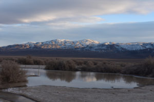
View to south across Playa Wire Gate Pond and fence toward Mable Mountain in the Garfield Hills.
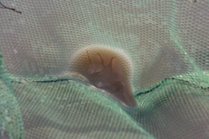
Several fairy shrimp from Playa Wire Gate Pond in the bottom of the net. Although blurry due to the 1/20th-second shutter speed, ovisacs with white eggs can be seen. Fairy shrimp usually swim vigorously when caught in a net. These did not so I had to raise the net almost out of the opaque water to make them visible. This abundance of fairy shrimp in the middle of January raises questions about the adequacy of their food. Ice cover in all but the afternoon (e.g., Paymaster Canyon Road Stock Pond was completely covered by ice until about noon on this day), not to mention the opaque water, must have an impact on phytoplankton growth and reproduction. Or is bacteria the only food?
February 10, 2022
The long drive to Teels Marsh was a bust so I had time to stop here. I was worried that after almost a month, most of the water might be gone but that wasn’t the case at all. Due to the extremely shallow slope of the playa floor, the water had receded significantly around the edges but there was still a lot of it. Nightly ice cover and generally calm days evidently restrained evaporation. I later looked up pan evaporation rates and found that the January rate at the Fallon Experiment Station is 1.1 mm/day (see “Pond Duration” on the About page). That suggests 2.5 cm would have been lost due to evaporation over the 23 days since January 18 whereas my depth estimates indicate 3 cm.
- 15 m x 18 m; depth up to 12 cm.
- Opaque pale brown water; 10 C in 4 cm water in sun at 1530.
- Fairy shrimp of various sizes up to 20 mm; larger females have eggs.
- Water boatmen (sub-order Heteroptera, family Corixidae) rarely greater than 10 mm.
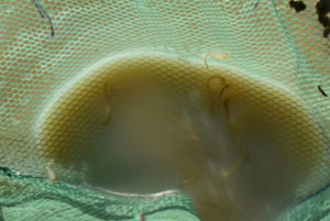
Several fairy shrimp in the net at Playa Wire Gate Pond. The low afternoon sun angle makes everything dark so many of the fairy shrimp are a blur due to the 1/50-second shutter speed. Nonetheless, one can see 3 ovisacs with pale eggs in this photograph. Also, the fairy shrimp have various sizes indicative of the population’s complex hatching and growth history.
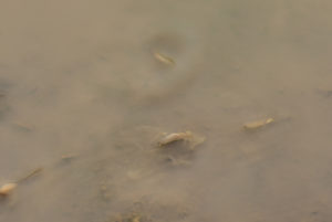
Fairy shrimp in very shallow water at Playa Wire Gate Pond. An arm of the pond with very shallow water and a bush to protect it from the breeze had lots of fairy shrimp. Here, the large male at center is a blur due to its rapid jerking motion and the 1/50-second shutter speed. The small female with eggs at right and the large female with eggs off the left edge of the photograph are going with the flow of the weakened breeze from right to left. The fairy shrimp above center is backside up and is scraping the mud with its legs.
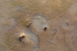
Fairy shrimp barely covered by water in Playa Wire Gate Pond. The male at lower left is making a rapid jerking motion. The 2 males above center have dug themselves into a hole by using their legs to scrape the pond bottom. They are going around in circles with half crawling, half-swimming motions. The legs of the male at right below center are still moving but death looks imminent. The fates of the 2 in the hole also look dark. I read somewhere (but didn’t save the article) that fairy shrimp are affected by a bacterial disease that darkens their bodies. Maybe that accounts for the dark color of the male at right and the darker color of the antennae II of the 2 in the hole. Could disease also account for behavior that results in fairy shrimp getting stuck in the mud at the edge of a pond?
Playa Wire Gate Pond Fairy Shrimp Video 2022-02-10b-r, Soda Spring Valley.
For a 1-minute, 35-seconds video of fairy shrimp swimming in an arm of very shallow water of Playa Wire Gate Pond, click on the video player above. There is no audio. The water is so shallow that a weak breeze is pushing it and the fairy shrimp from right to left. However, the wind here is less than elsewhere on the pond because it is partially blocked by a bush. At the beginning of the video, 2 fairy shrimp are using their legs to churn up the clay on the bottom of the pond and the suspended clay drifts to the left. At 0:25-0:30 and 0:68-0:70, some fairy shrimp are being rolled to the left by the current. The opening still photograph is from the January 18, 2022 visit when the pond was no longer in direct sunlight.
Playa Wire Gate Pond Fairy Shrimp Video 2022-02-10cc-r, Soda Spring Valley.
For a 45-seconds video of fairy shrimp swimming or stranded at the edge of Playa Wire Gate Pond, click on the video player above. There is no audio. This video is of the same shallow arm of Playa Wire Gate Pond as Playa Wire Gate Pond Fairy Shrimp Video 2022-02-10b-r but farther toward the end where there is not really enough water for swimming. Many fairy shrimp have been stranded and some have died. Those still living continue to swirl their legs and some have dug themselves into holes as they go ’round and ’round. The opening still photograph is from the January 18, 2022 visit when the pond was no longer in direct sunlight.
As shown in Playa Wire Gate Pond Fairy Shrimp Video 2022-02-10b-r other fairy shrimp are managing in the shallow water so why did these get stuck? Were they attracted by the warmth of the shallower water? Is there more food in the clay here than floating in the pond water? Some have darkened bodies like those in photograph Playa Wire Gate Pond 2022-02-10, #13, and could be diseased.
Moore (1963; see the References page) implied “old age” was a factor in the die off of a population of winter-hatching Eubranchipus holmani in a Louisiana pond which still had water and he cited other examples from the literature. Here, it appears that only larger fairy shrimp have become stranded; smaller ones seen or netted in the water are not on the mud here. The larger-sized Playa Wire Gate Pond population is at least 24 days and likely more than 34 days old (assuming a 1 mm/day growth rate before January 18, as for a Branchinecta mackini population in a clay-rich Alberta lake, Daborn, 1977) and has been sexually mature for a while. Maybe that is long enough for this population of this species. Most of the stranded fairy shrimp can be identified as males by their long antennae II. Although not all can be so identified, I don’t see any stranded fairy shrimp that are definitely females.
Males dying soon after mating seems to be a common theme in the invertebrate world so maybe that is happening here. Daborn (1976) reported that Eubranchipus bundyi females in an ephemeral Alberta pond died after producing 1 clutch of eggs and that “high mortality of males preceded that of females”. Daborn (1976) found no males more than 42 days after hatching. For a Branchinecta mackini population in Alberta subject to predation by Branchinecta gigas, most individuals “lived only 50-55 days, with males dying off slightly earlier than females” (Daborn, 1977).
Although I can’t say fairy shrimp have intent, if their time has come, why not head for a warm spot and get a glimpse of the sky and the larger world before the end? And of whatever that thing is that is looking at them.
Note added later: Some fairy shrimp in Stinking Springs Well Pond (on February 23, 2022, Rawhide Flats) were present in very shallow water at the edge of the pond while the pond was still half-covered by ice. Some of these were swimming normally and some seemed moribund. There were also a few corpses on the mud and these included females. None of the dead fairy shrimp had obviously darkened bodies. Contrary to speculation at Playa Wire Gate Pond, sex and disease do not seem to be mortality factors at Stinking Springs Well Pond. But the question remains: why are they dying?
March 14, 2022
The pond is definitely smaller but maybe still big enough for fairy shrimp. There is a new sign on the fence post next to the wire gate (see Wrecked Windmill Pond on this date).
- 5 m x 15 m; water mostly less than 2 cm deep but up to 4 cm in foot prints, which look like mine.
- Opaque pale brown water; 20 C at 1700.
- Fairy shrimp mostly about 5 mm but some are about 10 mm and a few are about 15 mm; larger females have eggs.
- Probable water boatmen (sub-order Heteroptera, family Corixidae) but they are swimming too fast, even in the net, for me to be sure.
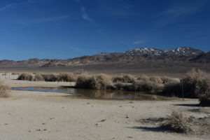
View of Playa Wire Gate Pond similar to photograph Playa Wire Gate Pond 2022-01-18, #10. The pond has shrunk to less than half its size in January but it’s been a good run, more than 65 days, in spite of negligible precipitation since December.
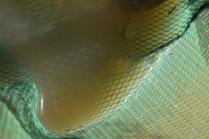
A couple of fairy shrimp in the net at Playa Wire Gate Pond. The large male at center is of an older generation. A smaller fairy shrimp of a younger generation is above it. Brightness and contrast have been enhanced to make the fairy shrimp more visible in the shadowed water.
I didn’t see any fairy shrimp as large as the 20 mm fairy shrimp I had seen on February 10. This suggests that the oldest generation that I had seen dying on February 10 did die out. But others hatched. Unfortunately for these current fairy shrimp, time for Playa Wire Gate Pond may be running out.
August 28, 2023
Earlier today, I saw abundant water and tadpole shrimp at Garfield 5890 Saddle Pond (Garfield Hills). This pond isn’t far out of the way. Could it also have water from the August thunderstorms? If so, are there summer-hatching tadpole shrimp at this lower elevation, too?
- About 15 m x 25 m; depth up to 15 cm.
- Opaque pale brown water; 30 C at 1230.
- Fairy shrimp 8-12 mm long and mostly reddish brown but some are pale gray; some females have ovisacs full of pale eggs.
- Tadpole shrimp (Notostraca), water boatmen (sub-order Heteroptera, family Corixidae).
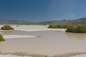
Looking east down the fence line at Playa Wire Gate Pond. This is a considerable amount of water.
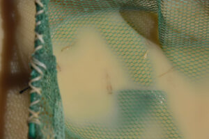
Fairy shrimp in net at Playa Wire Gate Pond. The female at center has an ovisac full of pale eggs while its abdomen below the ovisac is not visible. The significantly smaller size of the fairy shrimp above and to the right of the large female indicates the fairy shrimp did not all hatch at the same time.
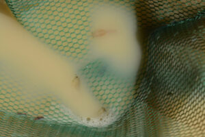
3 male fairy shrimp caught in the net at Playa Wire Gate Pond. The large antennae II of the males look like those previously observed in this pond rather than like those of Thamnocephalus platyurus recently seen in Win Wan Corral Pond (e.g., photograph Win Wan Corral Pond 2023-08-24, #04), 15 km, or so, to the north and at a higher elevation.
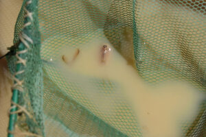
Fairy shrimp and tadpole shrimp in the net at Playa Wire Gate Pond. Notostracans are here, too. This one is almost 20 mm long. The eye pattern and markings on the carapace indicate it is Triops longicaudatus, like the one in photograph Garfield 5890 Saddle Pond 2023-08-01, #13.
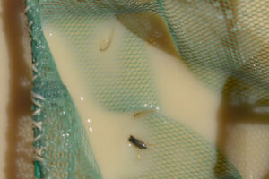
Lucky snap of a water boatman (sub-order Heteroptera, family Corixidae) in the net at Playa Wire Gate Pond. I happened to snap the photo when the water boatman was mostly out of the water but even with a 1/500 second shutter speed, it is still slightly blurred.
March 8, 2024
Stinking Springs Well Pond (Rawhide Flats) had fairy shrimp back on February 15. How is this pond doing? Well, it’s been trampled by cows but there is still some water. The pond bottom is too soft for me to estimate water depth.
- 9 m x 15 m; depth not estimated.
- Opaque water; 10 C at 1715.
- Lots of pale gray fairy shrimp 10-20 mm; probably eggs but opaque water makes it too hard to see ovisacs.
- No other animals observed.
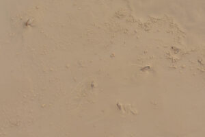
Fairy shrimp churning up the clay in very shallow water at edge of Playa Wire Gate Pond. The clay slurry is so shallow that the 3 fairy shrimp near center are on their sides. Other fairy shrimp are swimming in the deeper water. There may be a dead fairy shrimp at upper right.
March 14, 2025
Reno got some rain on the 5th and 12th. Maybe that was enough to get this pond started.
- Relatively low water but pond is bigger than in March 14, 2022; possibly as deep as 10 cm.
- Opaque pale brown water.
- Wide range of fairy shrimp sizes from about 8 mm to about 12 mm with greenish legs; no eggs seen.
- No other animals observed.
The wind is blowing my net horizontal so I can’t see what’s in it. However, there is a hoof print with clear water and several trapped fairy shrimp.
September 5, 2025
The August 23-27 thunderstorms dropped a little water on Garfield 5890 Saddle Pond but left Win Wan Corral Pond dry. What was the result down here on the playa?
- 10 m x 19 m; 8 cm deep.
- Opaque water; 22 C at 1400.
- Fairy shrimp 5-8 mm; no eggs seen.
- Tadpole shrimp (Notostraca) about 20 mm long.
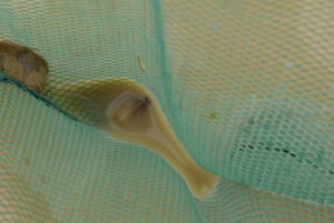
Tadpole shrimp (Notostraca) and fairy shrimp in net at Playa Wire Gate Pond. It looks like the tadpole shrimp grew a lot faster than the fairy shrimp but both are still less than full adult sizes.
Luning Playa Lake (Stillwater BLM Office)
___This map is a screenshot of The National Map (Go to The National Map). The U.S. Geological Survey generally does not copyright or charge for its data or reports (unless printed). A pond location is indicated by an “X”, which corresponds to the coordinates given in the data spreadsheet. Labels in quotations are from 7.5-minute topographic quadrangles.
___Red lines are the U. S. National Grid with a spacing of 1,000 m and intersection labels consisting of the UTM zone (e.g., 11S, 12T), a 2-letter 100-km square designation (e.g., LC, XN), and a 4-digit number. The first 2 digits of the number represent the 1,000-meter Easting and the second 2 digits the 1,000-meter Northing, as seen in the example Easting and Northing. Unlike latitude and longitude, the National Grid is rectilinear on a flat map, the units of abscissa and ordinate have equal lengths, and the units (meters) are measurable on the ground with a tape or by pacing.
___Gray shading represents private land as traced from the PAD-US 2.0 – Federal Fee Managers layer of The National Map. Other lands are public.
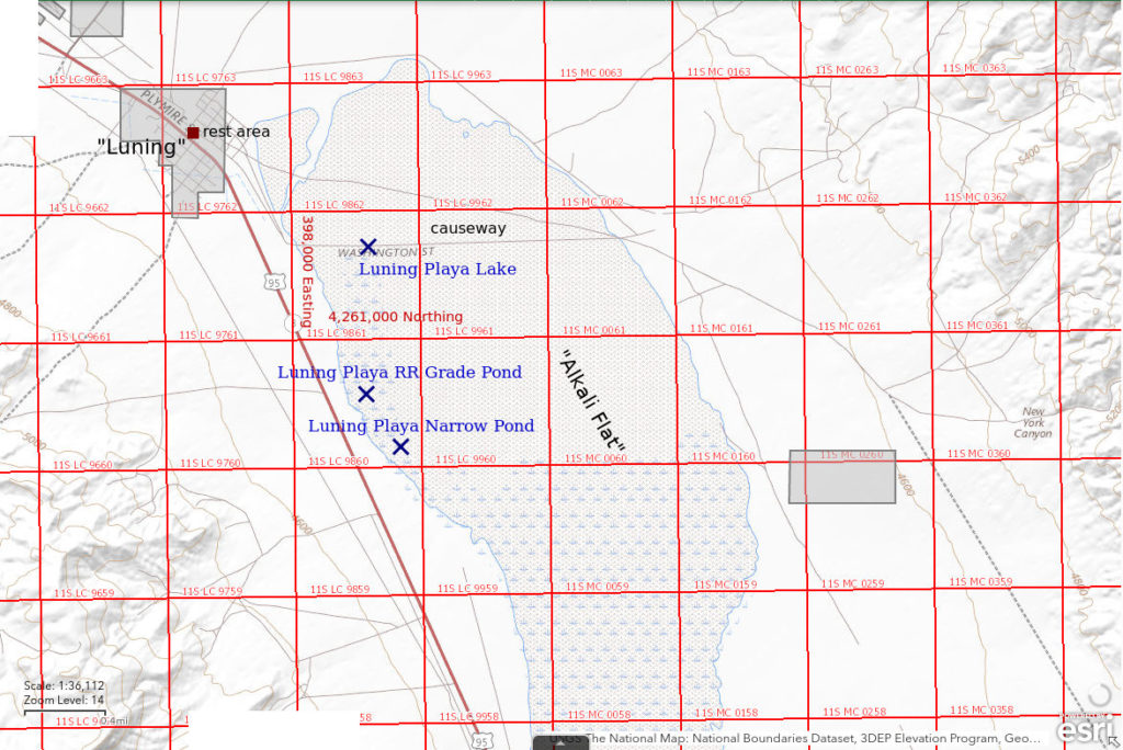
Luning Playa Lake is in the eastern arm of Soda Spring Valley 1 to several km (0.5 to a few miles) southeast of Luning, depending on size. The north end of the playa starts about 400 m (1,310′) east of the Luning rest area. The playa extends south-southeast for about 6 km (3 1/2 miles). The playa is up to 2 km (1 mile) wide at its widest. Although all the playa may be covered by water after heavy precipitation, the part that is more commonly inundated is south of the causeway that is about 1 km (0.6 miles) from Luning. If there is water on the playa it can be seen from US 95 south of Luning.
Access to the playa is easy. Turn off US 95 at the rest stop in the middle of the town of Luning and follow the road south from the southeast part of the gravel-covered parking area. Follow this road south across a cattleguard and then turn to the east onto the graveled causeway after about 1/2 mile. You could park along the causeway depending on where the water is. There is probably nothing to be gained by continuing across the causeway and following the sandy road down the east side of the playa. The old Southern Pacific railroad grade can be driven down the west side of the playa. The railroad track also starts at the southern end of the parking area at the rest area and can be distinguished from the vehicle road by being elevated and having more gravel.
Elevation: 1,354 m (4,440′)
January 14, 2022
When I walked out onto the playa lake, I saw a pair of gulls standing out near the middle. I thought they might have found a place where they could feed on fairy shrimp so I headed their way. I was surprised that as I got to within about 50 m, they didn’t fly off. I never saw them peck at the water. I turned away and left them alone.
- Greater than 1,000 m wide and greater than 2,000 m long; depth mostly less than 2 cm but probably up to 5 cm in places.
- Water opaque moderate brown.
- No fairy shrimp.
- Gulls.
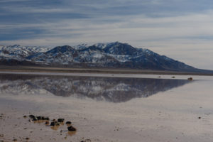
Luning Playa Lake, looking southeast from the causeway toward Pilot Mountains. The water doesn’t seem to have any depth anywhere. I took a zigzag route out to the greasewood bush at center and then turned away from the gulls and angled back toward the western (right) shore.
Luning Playa Narrow Pond (Stillwater BLM Office)
Luning Playa Narrow Pond is on the west edge of Luning playa in the east arm of Soda Spring Valley about 1,600 m (5,250′) south of the causeway across the playa. It is only about 20 m east of the old Southern Pacific railroad grade.
For access, see Luning Playa Lake. The railroad grade can probably be driven to the pond but there may not be sufficient room to pass another vehicle or turn around.
Elevation: 1,350 m (4,430′)
January 14, 2022
I had pretty much given up on Luning Playa Lake but then I came across Luning Playa Narrow Pond. It doesn’t look like much but I tested it with my net and it is surprisingly deep. Hmm, keep testing.
- 1 m x 30 m; depth up to 20 cm.
- Water opaque moderate brown; 8 C @1445.
- Pale gray fairy shrimp about 15 mm long; females have eggs in narrow ovisac about half the length of the abdomen.
- No other animals noted.
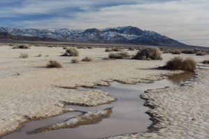
Luning Playa Narrow Pond, looking southeast toward Pilot Mountains. This doesn’t appear to be anthropogenic but how did it get to be more than 10 cm deep? The pool to the right of the nearest bush (cut off by right edge of photograph) is about 3 m across and about 20 cm deep.
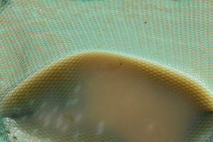
Fairy shrimp from Luning Playa Narrow Pond in net with very cloudy water. The upward pointing antennae II of the male above center are long and tubular. Although the features of antennae II are used in the identification of many fairy shrimp species, microscopic examination is needed in most cases (Belk, 1975; see the References page). The fairy shrimp at lower left appears to have an ovisac with pale eggs.
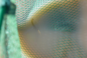
A female fairy shrimp in Luning Playa Narrow Pond. The ovisac has whitish eggs and appears to be about half as long as the abdomen.
Luning Playa RR Grade Pond (Stillwater BLM Office)
Luning Playa RR Grade Pond is on the west edge of Luning playa about 1,200 m (3,940′) south of the causeway and 400 m (1,310′) north of Luning Playa Narrow Pond. It is in a ditch along the west side of the old Southern Pacific railroad grade. Water extended onto the mud flat for about 10 m (33′) near the north end of water in the ditch on the January 2022 visit but it was less than 2 cm (0.8″) deep.
For access, see Luning Playa Lake. The railroad grade can probably be driven to the pond but don’t ask me how to turn around on it.
Elevation: 1,355 m (4,445′)
January 14, 2022
Surprise 2. I wandered across this on my way back from Luning Playa Narrow Pond. Most of the pond is less than 3 m wide but some parts may be up to 5 m wide. There are small snow and ice banks at the bases of the bushes lining both sides of the pond. The mud flat on the west side of the railroad grade has a film of water adjacent to the northern part of the water-filled ditch but it is not extensive.
- 5 m x greater than 200 m; depth mostly less than 7 cm but up to 15 cm.
- Water cloudy to opaque moderate brown; 8 C at 1545.
- No fairy shrimp.
- No other animals noted.
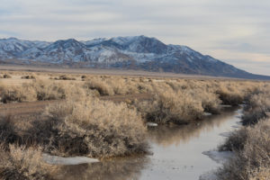
Luning Playa RR Grade Pond with the old Southern Pacific railroad grade at left and the Pilot Mountains in the distance. The abundance of ice around this pond and absence around Luning Playa Narrow Pond may be due to the shading effect of the bushes, as I guessed might be the case for Grimes Point West Pond (“Carson Lake” Playa) and Garfield Flat Stock Tank Pond (Garfield Hills).
Paymaster Canyon Road Stock Pond (Stillwater BLM Office)
Paymaster Canyon Road Stock Pond is in the northern arm of Soda Spring Valley about 13 km (8 miles) west of Luning and about 6 km (3.7 miles) east of Wrecked Windmill Pond. It is several hundred meters west of Paymaster Canyon Road (my name). There is a berm of excavated dirt around the south, west, and north sides so any water is generally not visible from a distance.
The pond is in a thin, 1,800 m (5,900′) long stippled area surrounded by a thin blue line, a non-standard symbol, on the 1:100,000-scale BLM map. The 7.5-minute topographic quadrangle shows the pond, remarkably, as a very small intermittent lake (blue cross-hatch pattern) within this stippled area.
The Paymaster Canyon Road turns north off US 95 about 17 miles east of Hawthorne and 7 miles west of Luning. After about 300 m (980′), it crosses the old railroad grade and then turns northwestward toward Paymaster Canyon. About 1.5 miles from the highway, it passes under a power line and forks. The fork to the northeast leads to Win Wan Flat and Win Wan Corral Pond in the Gabbs Valley Range. The fork straight ahead leads to Paymaster Canyon. There is also a fork to the west that follows the power line and is used for off-highway vehicle races. This fork is a convenient place to park. The pond is 650 m (2,100′) to the southwest.
Elevation: 1,340 m (4,395′)
January 18, 2022
As luck would have it, I caught a glint of sun off the water one evening while driving along Paymaster Canyon Road. By the time I got to the pond, it was too dark to see fairy shrimp so I returned on another day. This time, when I parked at the Paymaster Canyon Road fork, I saw a small group of cows to the southwest and guessed they were by the pond. It turned out they were conveniently standing on the pond’s berm. They ran off as I approached. The pond was still completely covered by 2-10 mm thick ice at mid-day. I walked around in my rubber boots to break up the ice and make it possible to use my net. The pond bottom was predictably soft and proved to be unusually sticky. It was also very irregular with deep pockmarks due to stomping by cows. Using the net didn’t work out so well as I mostly caught bits of ice as I brought the net to the surface. After spending a couple of hours walking around the playa looking for other ponds, I came back and the ice was gone.
- 35 m x 50 m; depth mostly less than 12 cm but locally up to 20 cm and possibly more in deepest holes.
- Water opaque moderate brown; ice cover at noon.
- No fairy shrimp.
- No luck catching anything else.
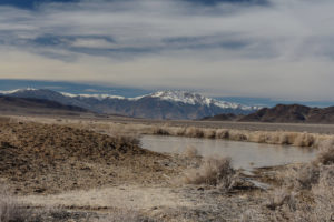
View to west across frozen Paymaster Canyon Road Stock Pond with Mt. Grant in the distance.
February 14, 2022
I don’t have my rubber boots but I decided to stop anyway. The shore of the pond has receded significantly and the water is surrounded by soft mud that has been somewhat trampled by cows. I can’t get close enough to dip the net so I may be out of luck. However, in the narrow northeast arm of the pond, water in cow pocks is somewhat clear as the pocks are too small for the wind to stir up the clay. So I peer into the pocks from a distance.
- Dimensions and depth of pond not estimated.
- Water opaque moderate brown.
- At least 2 fairy shrimp, less than 10 mm long.
- Didn’t see anything else.
What luck! I only saw 2 fairy shrimp but that was enough to prove the eggs are here. The absence of fairy shrimp on January 18 wasn’t due to lack of eggs; there was some environmental factor at play that delayed the hatch compared to Playa Wire Gate Pond.
Paymaster Canyon Road Stock Pond
September 5, 2025
Playa Wire Gate Pond had water and fairy shrimp and tadpole shrimp. It would be nice to see the same result here.
- Dry.
Cross Playa Rivulet Pond (Stillwater BLM Office)
The Cross Playa Rivulet Pond is in the northern arm of Soda Spring Valley about 14 km (8.7 miles) west of Luning and about 5 km (3 miles) east of Wrecked Windmill Pond. It is 1,100 m (3,600′) west of Paymaster Canyon Road Stock Pond. It has a zigzag shape and short, shallow trenches to the east and west that must be tributaries. Definitely odd.
The pond is in the thin, 1,800 m (5,900′) long stippled area surrounded by a thin blue line, a non-standard symbol, on the 1:100,000-scale BLM map. It is not shown as a water body on the 7.5-minute topographic quadrangle but that is not surprising considering its narrow width.
For access, see Paymaster Canyon Road Stock Pond. Just stay on the playa and walk to the west from there.
Elevation: 1,340 m (4,395′)
January 18, 2022
I had almost finished my search of this part of the north arm of Soda Spring Valley playa when I came across this. Although it goes across the entire brush-free playa, it doesn’t continue much into the brush on either side. The narrow, relatively deep channel is reminiscent of Luning Playa Narrow Pond but that pond is on the edge of, and parallel to the long dimension of, Luning playa. It’s hard to imagine how water could carve a channel across an ostensibly flat playa like this. Maybe the fairy shrimp decided to dig their own pond. I’d better have a close look.
- 2 m x 100 m; depth at least 12 cm but could be deeper in spots.
- Water opaque moderate brown; no ice in early afternoon.
- No fairy shrimp.
- No other animals noted.
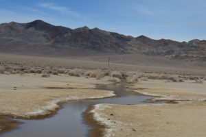
Looking north along Cross Playa Rivulet Pond with Indian Head Peak at upper left. The pond is narrow and relatively deep and has an irregular course.
Cross Playa Rivulet Pond
September 5, 2025
Back in January 2022 when Playa Wire Gate Pond had water and fairy shrimp, this one water but no fairy shrimp. Maybe there are fairy shrimp or tadpole shrimp eggs here that would prefer a late summer hatch. That was true of the tadpole shrimp eggs in Playa Wire Gate Pond in August 2023 and today.
- Dry.
Winter 2022 Fairy Shrimp Hatching History in Soda Spring Valley and Rhodes Salt Marsh
The presence of fairy shrimp in ponds in January and February after 2 major storms in December presents an opportunity to try to figure out when they hatched and why. The unusual weather pattern of winter 2021-2022 means the date when the ponds in western Nevada filled up with water (i.e., the earliest hatching date) can be determined easily. Temperature and precipitation data for Reno are available from NOAA Online Weather (NOW) Data at www.weather.gov/wrh/Climate?wfo-rev or from WFO monthly summaries at forecast.weather.gov/product.php?site=CRH&issuedby=RNO&product=CF6&format=CI&version=2&glossary=0 (“RNO” is the code for Reno and the last full month of data is on page 2). Although precipitation amounts at various ponds in western Nevada may have differed from those in Reno, the timing of large precipitation events is unlikely to have differed from Reno by more than 1/2 day (EIGWUU). The latest a particular generation of fairy shrimp in a particular pond could have hatched is constrained by my first observation of them. This constraint can be considerably tightened by assuming a reasonable growth rate and extrapolating back to zero body length.
Reno weather strongly suggests the earliest possible winter 2021-2022 hatching date for fairy shrimp in western Nevada was December 23. There was negligible precipitation in Reno in November. 7.4 cm of precipitation (as depth of water) fell during a big storm on October 24-25 but any ponds that formed then and any fairy shrimp in them are unlikely to have survived until January due to the mid-December freeze (see below). Reno received 7.1 cm of precipitation in the period December 12-26. Reno received 0 cm precipitation in January and 1.1 cm on February 21-23. Consequently, any ponds found before February 21 must have formed in the period December 12-26.
Hatching dates within the December 12-26 period can be further constrained by temperatures and the precise timing of precipitation. Reno received less than 0.5 cm of precipitation on December 6th, 9th, and 12th and then 2.1 cm on December 13-14 during the first big storm of December. Ponds likely formed as a result of this storm. However, averages of the daily high and low temperatures in Reno for December 14-21 were -1.9 to 2.2 C with only 2 daily averages above 0 C. On December 22, Wrecked Windmill Pond and Playa Wire Gate Pond were found to be frozen solid with up to 10 cm of ice and condensed snow just before the second December storm. Other ponds in Soda Spring Valley are less than 30 m (100′) higher than these 2. Even if fairy shrimp hatched before the water froze, they would have likely been frozen in the ice over the next few days. December 23 was the big dump of the second storm with 3.6 cm. Another 0.9 cm accumulated over the next 3 days. Temperatures were warmer on December 22-24 but then the daily averages of the high and low temperatures were 0.6 C or less from December 26 to January 2, except for 2.8 C on December 30. Most ponds likely froze solid again. Thus, while it is possible that liquid water and fairy shrimp that hatched as early as December 23 survived (e.g., due to greater water depths, insulating effects of snow cover), the most probable hatching dates are after January 2 as snow and ice in the ponds melted.
The latest that fairy shrimp could have hatched is the day before I observed them. A guess of how long before my observation they hatched can be based on a growth rate. Daborn (1977, see the References page) found an average rate of about 1 mm/day for a Branchinecta mackini population in a clay-rich Alberta pond. Other B. mackini populations on a playa in the Mojave Desert grew at rates of 0.6-2 mm/day at various times over 2 years (Brown and Carpelan, 1971). A winter generation of Eubranchipus holmani had growth rates of 0.87 mm/day for the first 9 days and then 0.32 mm/day (Moore, 1963). Brown and Carpelan (1971) inferred that the rapid growth of B. mackini in the Mojave Desert almost stopped once they reached a 10 mm length while the gonads developed. Growth resumed after maturation and the rate decreased as the maximum length was approached. Another consideration is that fairy shrimp grow more slowly in cold water than warm water, e.g. Mono Lake fairy shrimp as reported by Jones & Stokes Associates (1993b, p. J-2). To simplify the analysis I just assume a growth rate of 1 mm/day and then check to see if the result is reasonable.
How do you figure out why they hatched? Laboratory experiments have shown that fairy shrimp species hatch at some temperatures and TDS concentrations but not at others (e.g., Horne, 1967; Brown and Carpelan, 1971; Belk, 1977; see Habitats of Fairy Shrimp. I can’t measure TDS, or a TDS proxy like conductivity, but I know most ponds had their minimum TDS concentrations whenever the ice melted after the second December storm. Once all the ice and snow had melted, TDS would increase continually with slow winter evaporation. Thus, fairy shrimp either hatched at the minimum TDS of the thaw or during a later period of rising TDS, notwithstanding TDS changes related to daily freeze-thaw cycles of surface ice. As for temperature, I can use the maximum and minimum daily temperatures in Reno as reported on National Weather Service web pages (see above) to define temperature trends. These should be more or less the same throughout western Nevada. This gives me 4 possible causes to choose from:
- They hatched upon first pond filling/melting.
- They hatched during a period of rising temperature.
- They hatched during a period of falling temperature.
- They hatched during a period of trendless temperature.
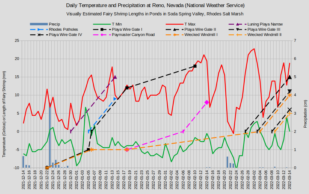
Fairy shrimp lengths are indicated by the dashed lines where 0 lengths are on the inferred days of hatching. The vertical dash symbol indicates a calculated length. From hatching to 15 mm length, the growth rate is assumed to be 1 mm/day.
-10 fairy shrimp lengths mark the date when solid ice filled the ponds.
-5 fairy shrimp lengths mark dates when fairy shrimp were not observed.
Playa Wire Gate Pond generations III and IV have been shifted to avoid obscuring Wrecked Windmill Pond generations I and II.
Rhodes Potholes generation II are not shown but were 5 mm on January 14.
Playa Wire Gate Pond was frozen solid on December 22, as indicated by the -10 fairy shrimp length on “Graph of Temperature and Precipitation in Reno and Fairy Shrimp Lengths in Playa Wire Gate Pond, Wrecked Windmill Pond, Paymaster Canyon Road Stock Pond, and Luning Playa Narrow in Soda Spring Valley and Rhodes Potholes in Rhodes Salt Marsh, Winter 2022”. On January 6, there was water under the ice but I did not see fairy shrimp.
My first observation of fairy shrimp in Playa Wire Gate Pond was on January 18. The oldest generation I was 12 mm long (range 10-13 mm). Extrapolating back to 0 length with a 1 mm/day growth rate indicates a hatching date of January 6, when I did not see fairy shrimp. Due to their small sizes, I could not have seen fairy shrimp which hatched within about 3 days of January 6. On the graph, I have shifted the -5 value for the apparent absence to January 5 for clarity. On February 10, the fairy shrimp in Playa Wire Gate Pond had a median length of about 18 mm long. Although a growth rate of 0.26 mm/day from January 18 is slower than rates reported in the scientific literature, it is faster than that observed for Garfield 5890 Saddle Pond generation II (Garfield Hills). The range in sizes up to 20 mm observed on February 10 is consistent with the range of sizes of generation I on January 18 and reasonable variations in individual growth rates.
On March 14, Playa Wire Gate Pond did not have any fairy shrimp longer than about 15 mm. Generation I had died off. As described in the February 10 entry, dead and dying fairy shrimp were observed in very shallow water at the edge of Playa Wire Gate Pond. The 12 cm of water observed on February 10 should have lasted about 60 days if it evaporated at about the same rate as the pan evaporation rate in Fallon. Drying up of the pond didn’t kill them off.
To add to the mystery of the fate of generation I, more or less 3 younger generations were observed on March 14. The pond water may have been freshened by minor precipitation during the period February 21-23, when 0.86 cm was recorded in Reno. There were rare individuals of generation II about 15 mm long, some individuals of generation III about 10 mm long, and many individuals of generation IV about 5 mm long. If they had grown at 1 mm/day, generations II, III, and IV hatched on February 27, March 4, and March 9, respectively. On the graph, generations III and IV are plotted 1 mm longer with hatching dates 1 day earlier than stated to avoid obscuring the 2 generations for Wrecked Windmill Pond. If the hatching dates are true, fairy shrimp in Playa Wire Gate Pond hatched during periods of strongly rising temperatures, strongly falling temperatures, and irregularly rising temperatures.
Wrecked Windmill Pond is within a few hundred meters of Playa Wire Gate Pond and at the same elevation but due to the installation of a solar-powered pump in the well within the observation period, the hatching history may not reflect natural conditions as in the other ponds. The pond was frozen solid on December 22. No fairy shrimp were observed on January 6 or January 18, when the pond was an expanse of cow pocks with abundant dead vegetation (see photograph Wrecked Windmill Pond 2022-01-18, #09). On March 14, water was dribbling from the well through the pond and fairy shrimp with lengths of about 10 mm (generation I) and 5 mm (generation II) had hatched. Like the similarly sized generations III and IV in Playa Wire Gate Pond, these generations likely hatched on about March 4 and March 9. I saw only a few fairy shrimp so whether there were 2 distinct hatching dates or a more continuous range of hatching dates is uncertain.
No fairy shrimp were observed in Paymaster Canyon Road Stock Pond when I visited it on January 18, in spite of my wading around to break up the ice and considerable efforts to try to net something. On February 14, I made a quick stop without rubber boots and was able to see only 2 or 3 individuals. They were about 8 mm long. They probably hatched somewhere around February 6. This was during a strong warming trend, when Garfield 5890 Saddle Pond generation II also hatched (Garfield Hills). Due to the extremely small sample size, there could have been other generations or a more continuous range of hatching dates.
In Soda Spring Valley about 20 km (12.5 miles) to the east of Playa Wire Gate Pond, Luning Playa Narrow Pond had mostly 15 mm fairy shrimp on January 14. With a 1 mm/day growth rate, these fairy shrimp would have hatched on December 30, the same day that Stinking Springs Well Pond generation I (Rawhide Flats) may have hatched. This is during a period of falling temperatures and is close enough to the second December storm that the hatch could have been caused by the initial influx of water, if it didn’t subsequently freeze solid. Hatching after temperatures began to rise on January 2 is possible if the average growth rate was greater than 1.3 mm/day.
Rhodes Potholes (Rhodes Salt Marsh) generation I fairy shrimp were about 9 mm long on January 14. Assuming a growth rate of 1 mm/day gives an approximate hatching date of January 5. This day is during a period of rising temperature following the New Year’s cold snap.
Rhodes Potholes generation II fairy shrimp (not shown on “Graph of Temperature and Precipitation in Reno and Fairy Shrimp Lengths in Playa Wire Gate Pond, Wrecked Windmill Pond, Paymaster Canyon Road Stock Pond, and Luning Playa Narrow in Soda Spring Valley and Rhodes Potholes in Rhodes Salt Marsh, Winter 2022” to avoid clutter) were about 5 mm long on January 14. If they grew at 1 mm/day, they would have hatched on January 9. January 9 followed 3 days of falling temperatures. I didn’t observe a large sample of the population in Rhodes Potholes so these generations may be part of a nearly continuous hatch over a few days following the warm spell.
Several generations of fairy shrimp in Soda Spring Valley and Rhodes Salt Marsh conformed to my pre-conceived notion that they should hatch during periods of rising temperature. These include: generations I of Playa Wire Gate Pond and Rhodes Potholes during the early January warming, Paymaster Canyon Road Stock Pond fairy shrimp during the early February warming, and Playa Wire Gate Pond generation II and possibly Playa Wire Gate Pond generation III and Wrecked Windmill Pond generation I during the end February warming. Contrariwise, Playa Wire Gate Pond generation IV and Wrecked Windmill Pond generation II and possibly generations III and I, respectively, hatched during the early March cooling. Finally, the fairy shrimp in Luning Playa Narrow Pond could have hatched within a day or two of the December 23 dump or during the following week-long freeze.
For further discussion, see “Winter 2022 Fairy Shrimp Hatching History on Carson Lake Playa and Rawhide Flats” on the “Carson Lake” Playa page and “Winter 2022 Fairy Shrimp Hatching History in the Garfield and Candelaria Hills and the Gabbs Valley Range” on the Garfield Hills page.
What Can We Learn from the Ponds on Soda Spring Valley?
Soda Spring Valley has fairy shrimp in rare ponds more than 5 cm deep but I haven’t yet found them on the playas. This is similar to Smith Creek Valley, where I didn’t find fairy shrimp in very shallow water on the playa during early visits but did find them in deeper ponds in the vicinity. That changed during the very wet year of 2023, when I found fairy shrimp in more than 10 cm of water on North Smith Creek Playa Lake. I might also have found them on Soda Spring Valley playas if I had visited before June 2023.
Searching for fairy shrimp can be a winter sport. Those in Playa Wire Gate Pond and Luning Playa Narrow Pond hatched in January and matured in spite of daily ice cover. This is also true of the fairy shrimp in Stinking Springs Well Pond on Rawhide Flats and the “Carson Lake” Playa ponds.
The hatching of fairy shrimp populations in Soda Spring Valley is evidently not a 1-time per year event. Populations in different ponds sometimes hatch at different times and different generations hatch at different times in the same pond due to conditions that have not been well constrained by my infrequent observations.
Fairy shrimp in Soda Spring Valley don’t hatch only in cold or cool weather. Some hatched in Playa Wire Gate Pond due to mid-August thunderstorms in 2023 and were living in 30 C water at the end of August.
The tadpole shrimp Triops longicaudatus also hatched in Playa Wire Gate Pond in August 2023.
Unlike some fairy shrimp populations in Smith Creek Valley which survived until water depth declined to less than 1 cm, some fairy shrimp populations in Soda Spring Valley died off before the pond they lived in dried up. This happened in Playa Wire Gate Pond in February 2022.
Installation of a solar pump in the well at Wrecked Windmill Pond in early 2022 may change the ecology of the pond.
Cows have severely pockmarked the bottoms of Wrecked Windmill Pond and Paymaster Canyon Road Pond. This makes finding fairy shrimp more difficult by impeding use of a net and by making balance while wading tricky.