The base map is provided by OpenTopoMap’s volunteer servers.
North Smith Creek Playa Lake
North Smith Creek Playa Channel Ponds
Smith Creek Ranch Road Long Ditch Ponds
Smith Creek Cold Springs Ponds
Main Smith Creek Playa Lake
Smith Creek Landing Field Pond
Smith Creek Windmill North Pond
Burnt Cabin Summit Playa Lake
Smith Creek US 50 Well Pond
Smith Creek US 50 Sagebrush Pond
What Can We Learn from the Ponds in Smith Creek Valley?
Smith Creek Valley is about 60 km (43 miles) long and 15 km (9 miles) wide and lies between the Desatoya and Shoshone Ranges. The southwestern end is separated from Ione Valley by a low divide on the basin floor. The New Pass Range is a narrower continuation of the Desatoya Mountains at the north end of the valley. There is a large, smooth playa in the central part of the valley. Smith Creek Valley is not Smith Valley, which is west of Yerington.
The main part of Smith Creek Valley lies between 1,850 and 1,900 m (6,070-6,230′). The southwestern end near Burnt Cabin Summit is up to 1,950 m (6,400′).
Smith Creek Valley is mostly public land managed by the Mount Lewis Office of the BLM but there a few important exceptions. There are large ranches on Smith Creek and Campbell Creek, on the west side of the valley. The Brown ranch is at the bend of Nevada 722 by the site of Peterson Station on the east side of the valley. There are smaller parcels of private land at Twin Springs, Porter Spring, the hot springs on the west side of the playa, and at unnamed springs between Long Canyon and Campbell Creek. In addition, there are a few other blocks of private land on the valley floor far from any named geographic feature. The smooth playa floor has sometimes been used for land sailing races. Others visit the valley for its dark skies. The peacefulness of the valley is sometimes disturbed by Navy jets from the Fallon Range Training Center.
Access to the valley is provided by Nevada 722, which is the old US 50. US 50 in Nevada is known as the Loneliest Road but Nevada 722 has even less traffic. I have occasionally driven the 22 miles from Railroad Pass to Carroll Summit without passing a single vehicle.
North Smith Creek Playa Lake (Mount Lewis BLM Office)
___This map is a screenshot of The National Map (Go to The National Map). The U.S. Geological Survey generally does not copyright or charge for its data or reports (unless printed). A pond location is indicated by an “X”, which corresponds to the coordinates given in the data spreadsheet. Labels in quotations are from 7.5-minute topographic quadrangles.
___Red lines are the U. S. National Grid with a spacing of 1,000 m and intersection labels consisting of the UTM zone (e.g., 11S, 12T), a 2-letter 100-km square designation (e.g., LC, XN), and a 4-digit number. The first 2 digits of the number represent the 1,000-meter Easting and the second 2 digits the 1,000-meter Northing, as seen in the example Easting and Northing. Unlike latitude and longitude, the National Grid is rectilinear on a flat map, the units of abscissa and ordinate have equal lengths, and the units (meters) are measurable on the ground with a tape or by pacing.
___Gray shading represents private land as traced from the PAD-US 2.0 – Federal Fee Managers layer of The National Map. Other lands are public.
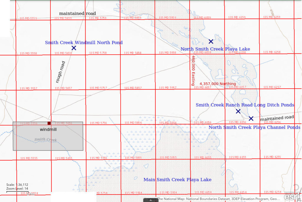
On the 1:100,000-scale BLM map, the stipple pattern for Smith Creek Valley playa is divided into a small northern part and a large main part. The stipple pattern for the northern part is 5 km (3 miles) long and 1 km (0.6 mile) wide and is aligned northwest-southeast. North Smith Creek Playa Lake is 35 km (22 miles) southwest of Austin.
The easiest access to North Smith Creek Playa Lake, and the northern part of Smith Creek Valley generally, is from the Smith Creek Ranch road. The Smith Creek Ranch road passes between the northern and main portions of the Smith Creek Valley playa. It turns off Nevada 722 about 1/2 mile west of Railroad Pass and is well maintained by the county.
Elevation: 1,850 m (6,070′)
March 17, 2013
This is my first intentional search for fairy shrimp in Nevada. I chose a playa because Brown and Carpelan (1971; see References page) had described fairy shrimp on a playa in the Mojave Desert and because I had previously found fairy shrimp in Jungo Flat Playa Lake (Desert Valley) and on the broad playa of “Lost Creek Lake” in Wyoming (Great Divide Basin). Nevada doesn’t seem to have many small ponds but playas are easy to find. The Smith Creek Ranch Road goes right across the southern tip of the northern playa so here I am. Most of the playa looks dry.
- At least one patch of water may be 50 m x 200 m; less than 5 cm deep.
- Opaque pale brown water.
- No fairy shrimp.
- Nothing in water.
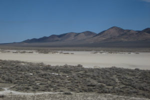
North Smith Creek Playa Lake, looking northeast toward the Shoshone Range north of Railroad Pass. Problem No. 1: how do you tell if there is water on a playa? The white part of the playa is obviously dry but what is that darker streak on the far side? Is it water, mud, or just a mirage? Time to put on the rubber boots and go have a look.
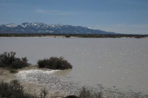
North Smith Creek Playa Lake, looking south with main part of Shoshone Range in the distance. OK, it’s water and there is quite a bit of it. This looks good to my naive eyes but the water is extremely shallow.
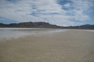
The drying southwest edge of North Smith Creek Playa Lake, looking southeast through Railroad Pass to the snowy Toiyabe Range. Where the mud is already cracking is relatively firm but with rubber boots I don’t have to worry about the watery part either.
May 9, 2023
Viewed from the west side of Smith Creek Valley, the playa looked dry because it was all white. When I got to North Smith Creek Playa Channel Ponds though, I discovered that view was clearly wrong. There is water on the playa lake on the other side of Smith Creek Ranch Road from the channel ponds. And it’s not just a centimeter or two. It is also my good fortune today that the wind is out of the northwest. It is blowing both the water and any fairy shrimp in it my way.
- Can’t see the extent of the water but probably more than 1,000 m x 2,000 m given the depth and flatness of the playa; maximum water depth is at least 15 cm.
- Opaque pale brown water; 13 C in 5 cm water at 1715.
- Fairy shrimp relatively common at this down wind location and ranging in size from 8 to 20 mm, some have eggs.
- No other aquatic animals observed.
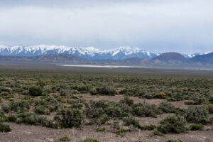
Looking across Smith Creek Valley from the road on the west side of the valley north of Smith Creek Ranch. North Smith Creek Playa looks like all dry white clay but it isn’t. At least some of that is water (see next photo). The imposing Toiyabe Range is on the horizon and the snowless Iron Mountain is at right.
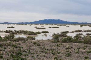
North Smith Creek Playa Lake, looking north from the Smith Creek Ranch road at North Smith Creek Playa Channel Ponds. Some of those greasewood bushes are half-buried by water. This view gives a new meaning to the term “white water”.
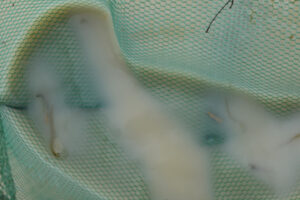
Fairy shrimp in the net at North Smith Creek Playa Lake. At left are a female about 12 mm long with eggs and a male about 18 mm long (assuming a mesh opening of 1.5 mm). They are blurry because the sky has clouded up and the shutter speed is only 1/50 second.
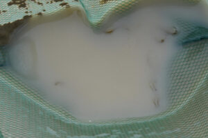
Fairy shrimp of North Smith Creek Playa Lake in opaque water in the net. There are 2 pairs of long male antennae II at lower right but the water is so opaque the bodies can’t be seen. The upper half of a male with visible antennae II is at upper right.
North Smith Creek Playa Channel Ponds (Mount Lewis BLM Office)
North Smith Creek Playa Channel Ponds map
The North Smith Creek Playa Channel Ponds are a series of small ponds in a dry stream channel immediately south of where the Smith Creek Ranch road crosses the south end of the North Smith Creek Playa Lake. There is no culvert under the Smith Creek Ranch road at this location. The 1:100,000-scale BLM map shows the channel originating southeast of the playa at the crest of the Shoshone Range north of Iron Mountain although the ponds in the channel appear to be lower than the playa. That is evidently an optical illusion. The depressions in the channel could fill from melting snow and precipitation events even if the channel doesn’t flow. There is an adjacent shallow ditch along the south side of the Smith Creek Ranch road that may have puddles more than 50 m long during wet years. At high water, the puddle merges with the channel ponds. The roadside ditch generally dries up before the last of the channel ponds.
The Smith Creek Ranch road turns off Nevada 722 about 1/2 mile west of Railroad Pass and is well maintained by the county. The ponds are less than 2 miles from the highway.
Elevation: 1,851 m (6,075′)
March 17, 2013
I looked at North Smith Creek Playa Lake first and didn’t find any aquatic animals. Having had little experience looking for fairy shrimp in Nevada, I did not find these ponds promising but WIDLA. I learned a lesson this day.
- Channel ponds up to 2 m x 8 m, roadside ditch 2 m x 30 m; depth probably at least 15 cm.
- Opaque pale brown water.
- Dense population (3-20 per sweep of net) of pale gray fairy shrimp, some about 10 mm long and some maybe 5-8 mm.
- Nothing else caught in net.
March 30, 2013
I didn’t know how long the ponds would last so I made an effort to come back quickly for another look. The ponds are now much reduced in size and have green algae, particularly near the edges.
- Channel ponds less than 5 m across; puddle in ditch along road less than 0.5 m wide but maybe 20 m long; depths probably less than 15 cm.
- Cloudy pale brown water.
- Still abundant pale greenish-gray and brownish-gray fairy shrimp mostly 10-15 mm but a few less than 10 mm; larger females have brown eggs in ovisacs about half the length of the abdomen.
- Other animals not noted.
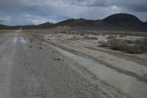
View east up Smith Creek Ranch road toward Railroad Pass. The roadside ditch has a puddle and the stream channel has a puddle just above center. Iron Mountain, in the Shoshone Range, is at right. North Smith Creek Playa Lake is on the other side of the road off the left edge of the photo and is dry.
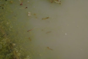
Cloudy water of North Smith Creek Playa Channel Ponds. There is a large female fairy shrimp with an ovisac full of brown eggs near the water surface just above center and 4 other fairy shrimp below it. There are also thin, brown and white plant sprouts that could be misidentified as fairy shrimp intestines and ovisacs but they don’t have a blur of legs along their sides. Some of the abundant algae can be seen at left. Contrast has been enhanced to make the fairy shrimp more visible. Like in Smith Creek Ranch Road Long Ditch Ponds, there are many dead or dying fairy shrimp in the mud adjacent to the remaining water.
April 21, 2013
The ponds here outlasted Smith Creek Ranch Road Long Ditch Ponds, which have all dried up. They were only about 5 cm deep on March 30.
- Channel puddles very small or dry but largest may be 4 m long; puddle along road less than 10 m long; most puddles less than 5 cm deep but the one farthest from road is greater than 10 cm deep.
- Opaque pale brown water; 18 C at 1300.
- Abundant, 15-20 mm, greenish-gray fairy shrimp.
- Reddish cladocerans also abundant.
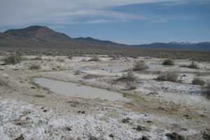
These are the remaining puddles of North Smith Creek Playa Channel Ponds, looking southeast away from Smith Creek Ranch road. Hard to believe, but there are still fairy shrimp in these puddles.
These fairy shrimp are survivors, or at least the population is! With so many dead bodies in the mud on March 30th, the future looked grim. The puddles now are much smaller and depths are much less than on March 30th but the water is filled with fairy shrimp. The higher density must be partly due to the smaller volume of water. If my lengths estimates were and are accurate, these fairy shrimp are only about 5 mm longer than those on March 30th. That implies a growth rate of 0.23 mm per day, which is slow but reasonable for mature fairy shrimp. If the previous generation did die off and these are a more recent hatch, they would have grown at an average of about 0.8 mm per day.
August 9, 2014
After a period of stormy weather, I decided to have a look. The puddles are very small. They don’t look promising.
- Very small but size and depth not estimated.
- Opaque pale brown water.
- A few fairy shrimp.
- Other animals not noted.
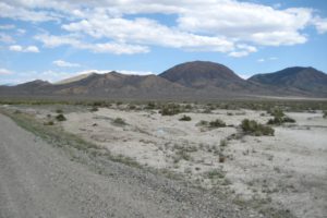
North Smith Creek Playa Channel Ponds with Iron Mountain in the distance near center. This looks shockingly bad for fairy shrimp. The roadside puddle is dry. Nonetheless, they are here.
Opaque, shallow water in North Smith Creek Playa Channel Ponds. There are fairy shrimp in there but you can’t see them. I was hoping the photograph would catch some close enough to the surface to see. No luck. The fact that this population hatched after a summer precipitation event demonstrates that they can hatch in warm weather as well as in cool weather. This again illustrates the robustness of this population. Whether or not this generation reaches maturity, the population has eggs for every season and maybe for every rain storm.
June 13, 2015
May was relatively wet. There is evidence of destructive flooding across US 50 and down the gully along the Smith Creek Ranch Road but the road has already been fixed by the county road crew.
- Channel ponds are small but size and depth not estimated.
- Water clarity not noted.
- Rare, relatively large fairy shrimp.
- Other animals not noted.
They did it again. Rain falls. Fairy shrimp hatch. There is no stopping them.
April 24, 2018
This was a brief look and I didn’t record any data. There are small puddles south of the road.
- Sizes and depths not estimated.
- Water clarity not noted.
- Sparse fairy shrimp.
- Other animals not noted.
Again, this population of fairy shrimp knows the game and is making use of even small amounts of water.
March 19, 2019
Ponds in the stream channel are essentially full and connected to a long puddle along the road which is continuous to the east and the west of the channel. This looks like fairy shrimp paradise.
- Ponds in channel connected and possibly 30 m long and 3 m wide, puddle in roadside ditch greater than 50 m long; depths maybe 30 cm in channel ponds and 20 cm along road.
- Water opaque pale gray.
- Found only 2 fairy shrimp with multiple sweeps of the net: one about 10 mm and the other about 15 mm.
- Other animals not noted.
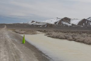
View east up Smith Creek Ranch road showing bank-full North Smith Creek Playa Channel Ponds. The ponds in the stream channel are merged with the puddle in the ditch along the road. There is now even a puddle on the east side of the channel (compare to photograph North Smith Creek Playa Channel Ponds 2013-03-30, #11).
The near absence of fairy shrimp is puzzling. Reno received an extraordinary 9.3 cm of precipitation (as water) during the period February 2 through February 17 (normal for the month is 2.6 cm). Maybe flow down the channel was sufficient to wash many eggs and any fairy that hatched within a few days of February 2 across the road onto the playa. 1.4 cm more precipitation in Reno on March 4 through March 6 could then have topped up the ponds and caused a second hatch due to the fresh influx of water but most of the eggs were gone. If fairy shrimp had hatched on March 3, the second day of significant precipitation, and on March 7, the day after the big dump on March 6, and grown at a rate of 1 mm/day, they would have been 16 mm and 12 mm long on March 19. These lengths are close to what I observed in a tiny sample of 2 fairy shrimp. For more background and further discussion of growth rates and hatching triggers see “Winter 2022 Fairy Shrimp Hatching History in the Garfield and Candelaria Hills and the Gabbs Valley Range” on the Garfield Hills page. Alternatively, the unusual amount of water may have somehow derailed some of the usual hatching triggers.
April 23, 2021
Stopped by after visiting Smith Creek Cold Springs Ponds, which do have water. The winter and spring were apparently too dry for the ponds to fill, or at least to persist into late April.
- Dry.
No worries, this population has proved its mettle.
May 9, 2023
This is a lot of water, as much as, and maybe more than, in 2019. Had to put my rubber boots on for a thorough search.
- The puddle along the road is about 100 m long and 3 m wide and the ponds in the channel are generally 2-5 m across; water depth up to 20 cm.
- Opaque pale brown water; 15 C in 2 cm water at 1630 (warmer than air).
- Rare fairy shrimp 6-10 mm long, didn’t see any eggs.
- No other aquatic animals observed.
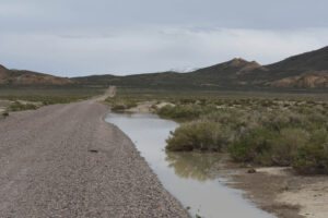
North Smith Creek Playa Channel Ponds, looking down the Smith Creek Ranch Road toward Railroad Pass, which is crossed by Nevada 722. A peak in the Toiyabe Range is visible beyond the Shoshone Range.
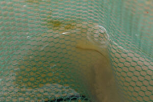
A fairy shrimp in the net at North Smith Creek Playa Channel Ponds. The fairy shrimp are so rare, like in 2019, that it took a long time to catch anything I could photograph. Based on the 1947-2005 pan evaporation rate at Ruby Lake of 5.8 mm per day (“Pond Duration” on the About page), this fellow can look forward to another good month of swimming.
Smith Creek Ranch Road Long Ditch Ponds (Mount Lewis BLM Office)
North Smith Creek Playa Channel Ponds map
Smith Creek Ranch Road Long Ditch Ponds are a short distance from North Smith Creek Playa Channel Ponds. Immediately west of where the Smith Creek Ranch road passes North Smith Creek Playa Channel Ponds and crosses the playa, it turns to the northwest and climbs onto a bench that separates the northern and the main parts of the playa. There are nearly continuous ditches along both sides of the road for a couple of km (miles). The ditch along the north side of the road about 1/2 mile past the channel ponds seems to be the most prone to have water. For reference, the most persistently wet part of the ditch is 2.7 miles west of Nevada 722.
The Smith Creek Ranch road turns off Nevada 722 about 1/2 mile west of Railroad Pass and is well maintained by the county.
Elevation: 1,853 m (6,080′)
March 17, 2013
I stopped earlier at the North Smith Creek Playa Channel Ponds. If you find one fairy shrimp pond, keep looking. So I drove along the Smith Creek Ranch road and was amazed by all the water in the ditch along the north side. I spent the rest of the day here.
- Puddle is greater than 200 m long, maybe 1.5 m wide; depth mostly less than 5 cm deep but up to 8 cm in spots.
- Opaque pale brown water.
- Moderately abundant population (0-4 per sweep of net) of pale gray 10-15 mm long fairy shrimp.
- Other animals not noted.
I collected a few live fairy shrimp to take home for observation. I was lucky enough to have access to a binocular microscope so I examined the fairy shrimp on March 25, after they had died. I had hoped they would live longer but didn’t have food for them. The distal segment of antennae II for 3 larger males is strongly flattened with a middle that is substantially wider than either end. The distal end is blunt but with a twist that gives it the appearance of a triangular protuberance. The base of the distal segment is bent about 60 degrees medially relative to the basal segment. No mounds, pegs, or spines were observed on the basal segments (criteria used by Belk, 1975; see the References page) but that may be due to the poor condition of the specimens. In contrast, a smaller male has a thin, tubular distal segment of antennae II that tapers to a point with a slight twist. The above described features are consistent with what I saw in Wyoming specimens identified by DB as Branchinecta coloradensis for the larger males and Branchinecta mackini for the smaller male. BTANSD. Belk (1975) indicated that both species have been found in Nevada.
How’s that for a fairy shrimp search? The North Smith Creek Playa Lake was a bust but ponds in a stream channel and along a road had abundant fairy shrimp. Moreover, one of the ponds had 2 different species.
March 30, 2013
Water in the long ditch has segmented into pools only a few m long.
- Individual puddles less than 10 m long and less than 5 cm deep.
- Cloudy pale brown water.
- Abundant, large, greenish-gray fairy shrimp; many are lying in the mud at the water’s edge and apparently dead.
- Other animals not noted.
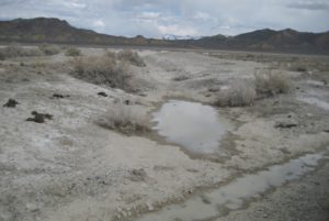
Puddles in Smith Creek Ranch Road Long Ditch Ponds along the road and in a drainage channel angled into the northern part of the playa. The Toiyabe Range is on the horizon above Railroad Pass.
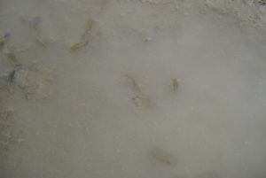
Greenish-gray fairy shrimp in very shallow water of Smith Creek Ranch Road Long Ditch Ponds. The fairy shrimp are swimming slowly or not at all. Many are not in the normal back-side-down position. This does not look healthy.
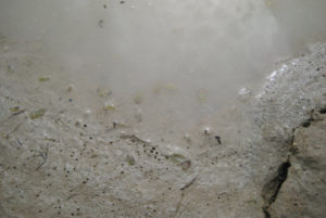
Fairy shrimp on the mud and in the water of Smith Creek Ranch Road Long Ditch Ponds. Those in the water are barely moving and those on the mud are evidently dead. Is the death blow from increasing TDS due to evaporation, decreasing oxygen concentration, inability to get enough oxygen because of restricted swimming, or the turbidity that makes the water seem like thin porridge? From a human perspective, this seems less horrifying than getting ripped to shreds by dytiscid larvae or birds but I don’t know if fairy shrimp even feel pain. The shallow, linear streaks in the mud are due to ice crystals from the night before that have melted. Freezing might also have killed the fairy shrimp.
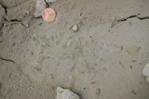
Fairy shrimp in a drying depression of Smith Creek Ranch Road Long Ditch Ponds. A ghastly sight or a snapshot of a species’s survival strategy that has endured for more than 300 million years (see “How Did Early Anostracans Live?” on the Taxonomy and Origin of Anostraca page)? I have no idea of how pond desiccation affects individual fairy shrimp but I’m pretty sure they don’t have enough neurons to rage against the unfairness of it all. Of course, as is often the case, a strategy that promotes survival of a species is not necessarily good for the well-being of individuals. Coin is 18 mm in diameter.
April 21, 2013
North Smith Creek Playa Channel Ponds still had a tiny bit of water and had fairy shrimp so it’s worth checking here. If there had been a precipitation event since March 30th that augmented those ponds, it wasn’t enough for this pond.
- Dry.
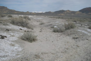
Same view of Smith Creek Ranch Road Long Ditch Ponds as photograph Smith Creek Ranch Road Long Ditch Ponds 2013-03-30, #06. The puddle is completely dry with cracked mud and cow tracks where the fairy shrimp had been. When will they return?
April 24, 2018
This was a brief look and I didn’t record any data.
- Almost dry; size and depth not estimated.
- Water clarity not noted.
- Fairy shrimp present.
- Other animals not noted.
The fairy shrimp are back! Or rather, they hatched again!
March 19, 2019
The playa has water so my hopes are up.
- Several puddles but I didn’t estimate dimensions or depths.
- Water clarity not noted.
- No fairy shrimp in the 4 puddles trawled with the net.
- Other animals not noted.
Rare fairy shrimp were found in the abundant water in North Smith Creek Playa Channel Ponds. I probably just didn’t look long enough here. The rarity or absence of fairy shrimp here raises the same questions as the rarity of fairy shrimp in North Smith Creek Playa Channel Ponds. Does too much water wash away eggs or somehow throw the hatching triggers out of whack?
April 23, 2021
Stopped by after visiting Smith Creek Cold Springs Ponds.
- Dry.
May 9, 2023
I tried to get here from Smith Creek US 50 Well Pond by following a road past the center-pivot sprinklers in the middle of the northern part of Smith Creek Valley. That worked as long as there was only a little water in one of the ruts in the road. When the water began covering half the road, I turned around. Water on a clay flat is a recipe for getting stuck. Luckily, a road that cut across to the road on the northwestern side of the valley was passable. I didn’t have to go all the way back to US 50. The road on the northwestern side of the valley was rougher as it is on the alluvial fan and it had wash-outs at some stream crossings but at least I didn’t have to worry about sinking up to the axles in the puddles. Once I got to here, I found the southeastern part of Smith Creek Ranch Road Long Ditch Ponds dry. I backed up and looked in a puddle about 120 m (390′) northwest of the coordinates in the spreadsheet on the Data page.
- 80 m long and up to 0.6 m wide; water depth up to 8 cm.
- Murky water; 18 C in 2 cm water at 1615 (warmer than air).
- No fairy shrimp.
- No other aquatic animals observed.
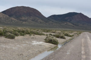
Smith Creek Ranch Road Long Ditch Ponds with Iron Mountain at left. The greasewood is greening up. Plenty of water but apparently no fairy shrimp.
Smith Creek Cold Springs Ponds (Mount Lewis BLM Office)
___This map is a screenshot of The National Map (Go to The National Map). The U.S. Geological Survey generally does not copyright or charge for its data or reports (unless printed). A pond location is indicated by an “X”, which corresponds to the coordinates given in the data spreadsheet. Labels in quotations are from 7.5-minute topographic quadrangles.
___Red lines are the U. S. National Grid with a spacing of 1,000 m and intersection labels consisting of the UTM zone (e.g., 11S, 12T), a 2-letter 100-km square designation (e.g., LC, XN), and a 4-digit number. The first 2 digits of the number represent the 1,000-meter Easting and the second 2 digits the 1,000-meter Northing, as seen in the example Easting and Northing. Unlike latitude and longitude, the National Grid is rectilinear on a flat map, the units of abscissa and ordinate have equal lengths, and the units (meters) are measurable on the ground with a tape or by pacing.
___Gray shading represents private land as traced from the PAD-US 2.0 – Federal Fee Managers layer of The National Map. Other lands are public.
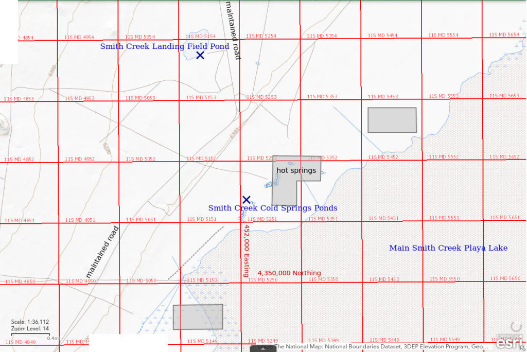
Smith Creek Cold Springs Ponds are on the west side of Smith Creek Valley playa about 600 m )1,970′) southwest of “hot springs” shown on the 1:100,000-scale BLM map. There are numerous pools of water in a boggy area with rushes and salt grass near the springs. The water is not warm to the touch. The locations of the springs themselves is not clear on the ground. Most of the ponds dry up by the end of the summer. On my visit of July 22, 2021, there were small pools of water that may have been spring outlets in 2 of the ponds.
The ponds vary widely in sizes, depths, and water color. They are more or less arrayed in two parallel lines. The northwestern tier consists of 3 relatively large ponds. The one at the northeastern end is the largest (about 100 m x 150 m, 330′ x 490′) and appears to have a spring orifice. It stays wet the longest. It had opaque pale brown water on April 2021. There is a spring to the northeast of it that contributes to the bog. The other 2 ponds of the northwestern tier were dry in April 2021. They paced off at about 75 m x about 100 m (250′ x 330′) for the middle pond and about 50 m x about 100 m (165′ x 330′) for the southwestern pond. The southeastern tier has several smaller ponds with oval to irregular shapes. Their maximum dimensions are less than 50 m (165′). On the April 2021 visit, one was oval and 15 m x 20 m (49′ x 66′) with dark red water and one was irregular and 10 m x 30 m (33′ x 98′) with very pale brown water. On the July 2021 visit, the pond that had had red water had a small pool of water among the rushes suggestive of a spring.
There is a road to the hot springs, which are on private land. To reach the hot springs road, turn northeast off Nevada 722 at the eastern base of the Desatoya Range onto a good county-maintained road that continues along the northwest side of the playa all the way to Smith Creek Ranch. The hot springs road is about 7 miles from Nevada 722. Because the hot springs road angles away from the cold springs ponds, it may be best to park along the county-maintained road up to 0.5 miles southwest of the hot springs turn-off or to drive a few hundred meters (several 100s’) down the hot springs road and find a parking spot. With favorable lighting, water in the ponds can be seen from the county road for about 1 mile south of the hot springs road turn-off.
Elevation: 1,846 m (6,055′)
February 16, 2015
It has been a dry winter and the playa is dry so I walked across it and found these ponds. NPPWOPII. I stopped peering into ponds at 5 because my hiking boots were not well suited to the marshy ground.
- Dimensions range from less than 10 m to up to 100 m; depths less than 5 cm in the shallowest and probably up to 30 cm in the deepest.
- Various colors from cloudy reddish brown to murky pale gray.
- At least 2 of the ponds have visible fairy shrimp and at least 2 don’t (based on short search times); fairy shrimp are less than 20 mm long and abundant where present.
- Other animals not noted.
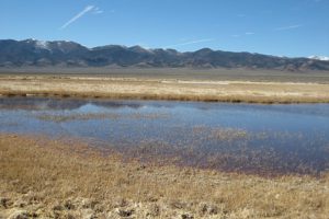
One of the Smith Creek Cold Springs Ponds in the northwestern tier looking northwest with the Desatoya Mountains in the distance. It has cloudy reddish-brown water and fairy shrimp. As there do not appear to be any ponds on the far side of this pond, this pond is probably in the northwestern tier of ponds, which I hadn’t distinguished at the time.
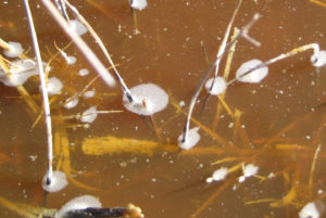
Fairy shrimp swimming in cloudy reddish brown water in Smith Creek Cold Springs Ponds. There are several fairy shrimp in this view, e.g., above the white bubbles at center, below and to the right of center, and at right.
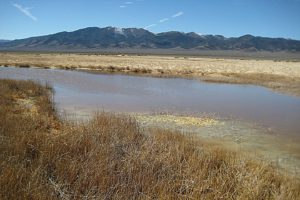
One of the Smith Creek Cold Springs Ponds in the southeastern tier, which I hadn’t distinguished at the time, with the Desatoya Mountains in the distance. This one has relatively clear water and fairy shrimp.
April 24, 2018
I only looked at 2 of the larger ponds.
- Didn’t estimate dimensions or depths of the ponds with water.
- Water clarity not noted.
- Fairy shrimp present.
- Other animals not noted.
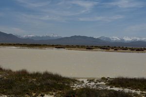
One of Smith Creek Cold Springs Ponds looking southeast with Toiyabe Range on the horizon, beyond the Shoshone Range. This one has fairy shrimp. The size of the pond suggests it is one of the ponds in the northwestern tier, which I hadn’t distinguished at the time.
April 23, 2021
The road to the hot springs has been bladed and is in very good shape but I only drove the first half mile and parked. Of the 3 large ponds in the northwestern tier, the northeastern one has water and the other 2 are dry. The dry ponds have white mineral crusts on the cracked mud. There are at least 4 small ponds in the southeastern tier that have water.
- Northern pond of northwestern tier: 100 m x 150 m, possibly 30 cm deep; cloudy brown water; 452,100E, 4,351,368N (this is the location in the data spreadsheet on the Data page); fairy shrimp 15-20 mm, some with eggs; abundant 2-3 mm cladocerans, common copepods, ducks, avocets.
- Middle pond of northwestern tier: vegetation-free 75 m x 100 m when dry; 451,909E, 4,351,263N.
- Southern pond of northwestern tier: vegetation-free 50 m x 100 m when dry; 451,897E, 4,351,119N.
- Pond of southeastern tier: irregular 10 m x 30 m, maybe 10 cm deep; murky very pale brown water; fairy shrimp about 10 mm; fast swimming black specks may be copepods.
- Another pond of southeastern tier: 15 m x 20 m, maybe 20 cm deep; murky dark red water; fairy shrimp 10-15 mm.
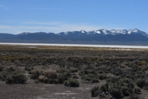
Smith Creek Cold Springs Ponds, looking south from near the road to the hot springs with the Shoshone Range in the distance. The largest pond with water is in the middle distance at left and a large dry pond is at right. Both ponds are in the northwestern tier. The ponds in the southeastern tier are also in the yellowish-brown grassy/rushy area on the near side of the white playa but are not individually visible.
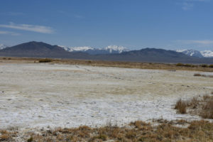
A large dry pond in the northwestern tier of the Smith Creek Cold Springs Ponds, looking east with the Toiyabe Range beyond a saddle in the Shoshone Range. The mud-cracked pond bottom is about 100 m (330′) across.
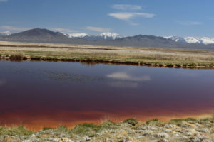
One of the Smith Creek Cold Springs Ponds in the southeastern tier with murky dark red water and fairy shrimp. The Toiyabe Range is on the horizon.
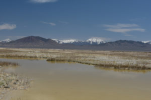
One of the Smith Creek Cold Springs Ponds in the southeastern tier with murky very pale brown water, a very irregular shape, and fairy shrimp. The Toiyabe Range is on the horizon.
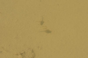
2 fairy shrimp in the Smith Creek Cold Springs Pond shown in photograph Smith Creek Cold Springs Ponds 2021-04-23, #04. Their eyes and shadows give them away.
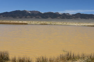
Smith Creek Cold Springs Pond, looking west with Desatoya Mountains in the distance. This is the largest pond, which is at the northern end of the northwestern tier of ponds. There are fairy shrimp in the cloudy brown water. Ducks and avocets (white bodies, heads under water) are barely visible near the far shore.
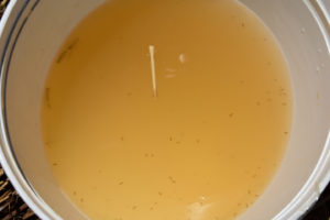
Aquatic life in the largest Smith Creek Cold Springs Pond, shown in photograph Smith Creek Cold Springs Ponds 2021-04-23, #08. The animals were transferred to a white container with pond water for better viewing. The rush stem floating on the water surface is 30 mm long. 3 fairy shrimp can be seen against the left edge of the container. 2 of these have eggs. There are abundant 2-3 mm long cladocerans. The dark spots less than 1 mm long are copepods. For how to identify cladocerans and copepods, see Other Crustaceans You May Find With Fairy Shrimp.
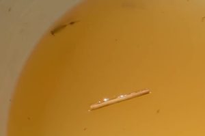
Female fairy shrimp swimming in white container at Smith Creek Cold Springs Ponds. This is a snapshot from Smith Creek Cold Springs Ponds Fairy Shrimp Video 2021-04-23r. The shape of the ovisac is distinct with the eggs bunched up in a bulge at mid-length.
Smith Creek Cold Springs Ponds Fairy Shrimp Video 2021-04-23r, Smith Creek Valley.
For a 3-minutes, 12 seconds video of the largest of the Smith Creek Cold Springs Ponds and of fairy shrimp, cladocerans, and copepods swimming in the white container, click on the video player above. There is no audio. The birds on the far side of the pond are ducks; the avocets flew off. The larger animals usually seen swimming against the container walls are fairy shrimp. The abundant small animals are cladocerans. The less common tiny dark animals are copepods.
July 22, 2021
The purpose of this trip was to determine if there are any springs providing water to the ponds or if all the ponds are fed only by runoff and snowmelt and consequently dry up at this time of year. The biggest, northeastern-most pond has a funnel-like pool less than 3 m across which is about 20 cm deep as far as I could reach with the net. The small pond in the southeastern tier of ponds that had dark red water on April 23 (photograph Smith Creek Cold Springs Ponds 2021-04-23, #03) is less than 3 m across and probably at least 10 cm deep but the surrounding mud was too soft for me to get close. These 2 pools of water are likely fed by springs. All the other ponds are dry.
- 2 ponds less than 3 m, all others dry; depths uncertain but at least 20 cm in one.
- Murky, pale gray water or pale brownish-gray water.
- No fairy shrimp.
- Several fast-swimming, brown and black beetles less than 3 mm long in large pond in northwestern tier.
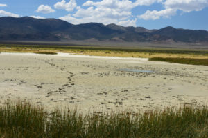
The northeastern-most pond in the northwestern tier of Smith Creek Cold Springs Ponds, with Desatoya Range in the distance. The small pool of water to right of center likely marks a spring. This is the pond also pictured in photograph Smith Creek Cold Springs Ponds 2021-04-23, #08.
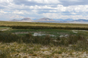
A pond in the southeastern tier of Smith Creek Cold Springs Ponds, with Shoshone Range in the distance. This is probably the small pond that had red water on April 23, 2021 (photograph Smith Creek Cold Springs Ponds 2021-04-23, #03). It now has a small pool of water with rushes that is likely spring-fed.
April 15, 2025
From December 1, 2024 through April 12, 2025, the precipitation in Reno has been 80% of normal. A third of that precipitation came 2 months ago on February 13. The pan evaporation rates at Fallon Experimental Station indicate about 21 cm (8.3″) of water could have dried up since then (evaporation rates by month). Most of the ponds in the basins of west-central Nevada are probably dry. With at least some ground water recharge, the Cold Springs Ponds have a better chance than most. I could see water in the bigger ponds from the county-maintained road so now the question is: did the fairy shrimp hatch? The budsage has started to bloom.
- Pond dimensions were not measured but most ponds look full with little or no bare clay flat or dry rush bog around the edges; all the ponds look deeper than 10 cm, I waded out to 15 cm in 2 of the smaller ponds of the southeastern tier and the big northeastern pond of the northwestern tier is more than 20 cm deep.
- There is the usual range in water colors for the ponds from cloudy reddish brown to murky pale brown to clear; some of the ponds have green algae floating below the surface and at least 1 has bubbly, pale brownish-gray surface scum; different small ponds of the southeastern tier have temperatures of 9 C at 0930, 10 C at 0940, 13 C at 1000, and 13 C at 1030 while the big northeastern pond is 13 C at 1045.
- The southwesternmost of the 3 big ponds in the northwestern tier has 8-10 mm fairy shrimp with no definite eggs and I might have seen one 10 mm fairy shrimp in the big northeastern pond in more than 20 minutes of searching; 2 of 4 small ponds in the southeastern tier have 10-15 mm fairy shrimp without obvious eggs but the fairy shrimp are almost invisible against the pale pond bottoms.
- Birds at various ponds include killdeer, ducks, geese, gulls, and willets or some other wading bird; wrigglers (6 of 8 ponds) and copepods (4 ponds) are common, cladocerans may be but most are translucent and really hard to see (4 ponds); the big northeastern pond has water boatmen.
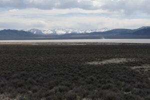
This view from the county-maintained road is encouraging. All 3 big ponds of the northwestern tier have water. The smaller ponds of the southeastern tier aren’t visible.
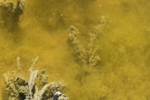
The vegetated near-shore part of the big southwestern pond of the northwestern tier is thick with algae. A fairy shrimp is visible against the shadow just below center. Smaller ones are visible against shadows above center and the pale, linear abdomens of at least 3 fairy shrimp are immediately to the left of the fairy shrimp below center. Dark elongate specks are copepods.
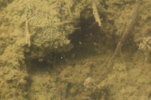
Close up view of cladocerans against a shadow at the bottom of one of the small ponds of the southeastern tier. They have fat, lenticular shapes only about 2 mm long. The 2 antennae of the one at center are just barely visible.
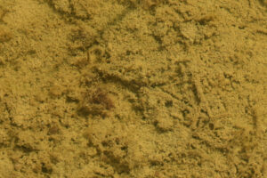
A stationary wriggler in one of the small ponds of the southeastern tier. Its head is clinging to the bottom just above center and its tubular form extends up and to the right toward the water surface. Its body ends in a Y shape with the breathing siphon as 1 branch and the anus as the other. This could be a mosquito larva but I don’t know if that is the only possibility.
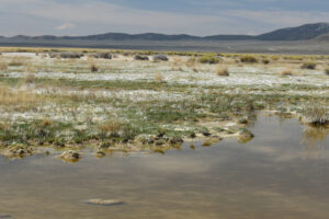
5 wading birds on the shore of the big northeastern pond of the northwestern tier that sort of look like willets but are rather small. Whatever they are and like the ducks, geese, and gulls, they could eat fairy shrimp and bring eggs here or carry them to other ponds.
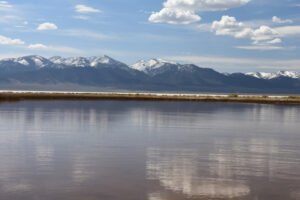
Looking across the big northeastern pond of the northwestern tier with the dry clay of Main Smith Creek Playa Lake in the middle distance and the Shoshone Range in the far distance.
Smith Creek Cold Springs Ponds Fairy Shrimp Video 2025-04-15ar
For a 3-minute, 31-second video of fairy shrimp swimming around the big southwestern pond of Smith Creek Cold Springs Ponds, click on the video player above. There is no audio. The fairy shrimp are translucent and not colored and very hard to see. However, their shadows are visible moving across the pond bottom. the smaller, lens-shaped animals that swim with a jerky motion are cladocerans. Dark specks that make short, jerky, swimming motions are copepods. At the start of the video, the shadow of a fairy shrimp moves steadily from the right toward the center. At 0:19-0:23, a relatively large fairy shrimp appears at lower right and swims toward the upper right. 2 smaller fairy shrimp are at upper left at 0:23-0:34. At 0:50-1:15, a fairy shrimp to right of center scrapes the pond bottom for food without much forward motion. A fairy shrimp swimming from near the center to the lower left at 1:20-1:52 appears to have a dark lump on its abdomen that could be eggs or at least an ovisac. In a possible precautionary, evasive maneuver, a fairy shrimp near the bottom edge of the video makes a sharp right-angle turn at 2:17-2:19 in the absence of any apparent stimulus. For the most part, the fairy shrimp swim on straight to gently curved trajectories and do not seem to be affected by the abundance of cladocerans and copepods.
Smith Creek Cold Springs Ponds Fairy Shrimp Video 2025-04-15br-c
For a 3-minute, 4-second video of fairy shrimp swimming around a small pond in the northeastern part of the southeastern tier of Smith Creek Cold Springs Ponds, click on the video player above. There is no audio. As in the previous video, their shadows are more obvious than the translucent fairy shrimp but they are not quite as hard to see. The fairy shrimp are toward the top and to the right of their shadows. This pond also has a lot of much smaller cladocerans and copepods that jerk about rather than swimming slowly and continuously like fairy shrimp. At 0:11-0:13, 2 fairy shrimp at upper left wrestle briefly. This is probably a case of a male clasping a female and the female contorting itself to shake the male off. For more on mating behaviors, see Fairy Shrimp Mating Dance on the Life Cycle of Fairy Shrimp page. After the encounter, the 2 swim slowly away from each other as if both decided that the time was not right. If the male is the one that swam off to the upper right and the female the one that swam to the lower right, the female could be indicating its non-receptive status (i.e., no eggs or already fertilized eggs) by swimming close to the pond bottom as observed by Rogers (2019). Because curious males approach females from below, swimming close to the pond bottom reduces the chances of encountering a male. At 0:32, a fairy shrimp at center makes a sharp 180-degree turn for no apparent reason. My guess is that such moves are random, precautionary, predator avoidance maneuvers but I haven’t read of anyone else suggesting anything like that. A sharp turn and spurt forward by a fairy to the left of and below center at 0:55 may be a similar behavior. At 1:01-1:04, 3 fairy shrimp near center swim closely past each other without apparent interactions. In contrast, at 1:21, one of 3 fairy shrimp to the left of and below center darts away from one of the others. If it is a female trying to avoid contact with a male, it must somehow know which fairy shrimp are males. At 1:41, a fairy shrimp above center turns and follows behind another fairy shrimp, as revealed by their shadows. This could be male following behavior of the mating dance. The follower turns away at 1:45, as a male would if it noticed that the female does not have unfertilized eggs. A wriggler (possible mosquito larva) moves from left to right below center at 1:51-1:54 by alternately bending and stretching its small, tubular, legless body. And then another appears below it and does the same thing. Another one that looked like a small stick through all of that then wriggles its way to the right at 2:10-2:14 but subsequently drifts back to the left with the breeze. At 2:28-2:33, a relatively large fairy shrimp spurts quickly forward and then continues to the upper right. This fairy shrimp has something dark brown near the end of its abdomen that could be shelled eggs. If so, this is contrary to Rogers (2019) as it would be a non-receptive female with fertilized eggs swimming close to the surface of the water. Concocting plausible narratives of fairy shrimp behavior is kind of fun but videos like this are a reminder of how little we know.
Main Smith Creek Playa Lake (Mount Lewis BLM Office)
___This map is a screenshot of The National Map (Go to The National Map). The U.S. Geological Survey generally does not copyright or charge for its data or reports (unless printed). A pond location is indicated by an “X”, which corresponds to the coordinates given in the data spreadsheet. Labels in quotations are from 7.5-minute topographic quadrangles.
___Red lines are the U. S. National Grid with a spacing of 1,000 m and intersection labels consisting of the UTM zone (e.g., 11S, 12T), a 2-letter 100-km square designation (e.g., LC, XN), and a 4-digit number. The first 2 digits of the number represent the 1,000-meter Easting and the second 2 digits the 1,000-meter Northing, as seen in the example Easting and Northing. Unlike latitude and longitude, the National Grid is rectilinear on a flat map, the units of abscissa and ordinate have equal lengths, and the units (meters) are measurable on the ground with a tape or by pacing.
___There is no private or state land on this map. All lands are public.
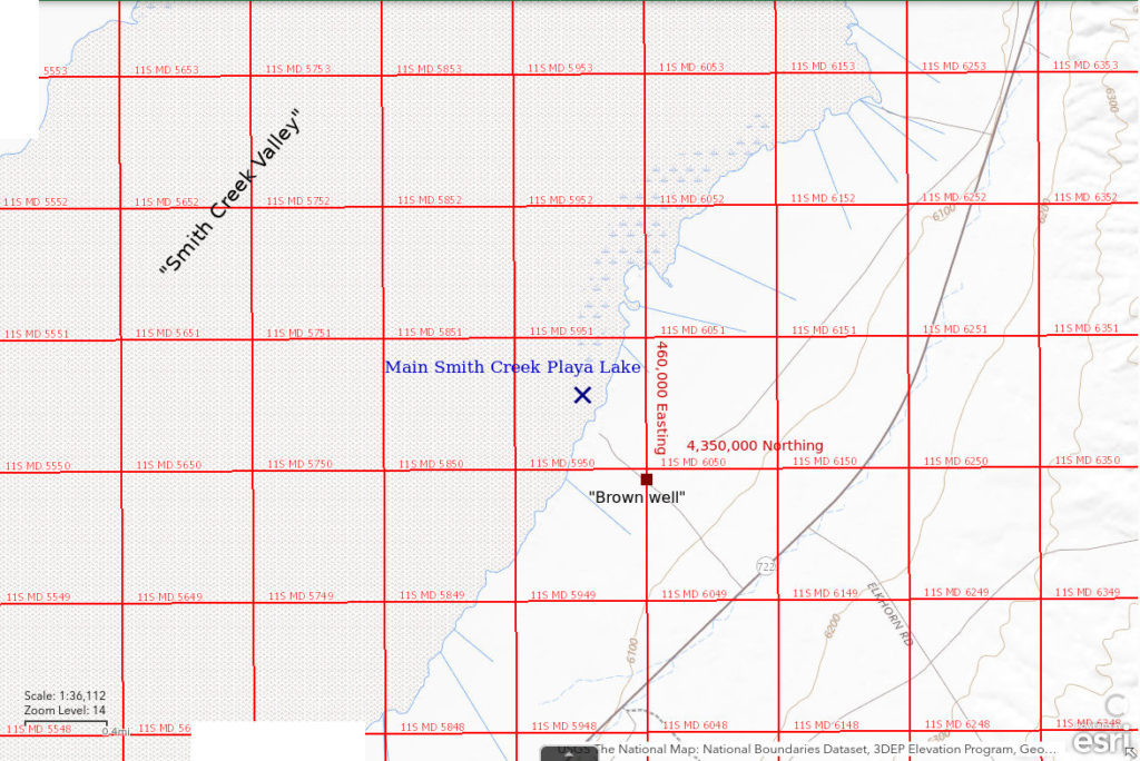
Main Smith Creek Playa Lake is the largest of the 2 playas in Smith Creek Valley that are marked with stipple patterns on the 1:100,000-scale BLM map. It is separated from the smaller North Smith Playa Lake by about 1 km (0.6 miles). The stipple pattern for Main Smith Creek Playa Lake is 11 km (7 miles) long and 5 km (3 miles) wide with a northeasterly trend.
It is easier to reach Main Smith Creek Playa Lake from the southeastern edge. There is a road that turns off Nevada 722 about 5 1/4 miles northeast of the Brown Ranch and 6 1/4 miles southwest of Railroad Pass. There is a corral, well, and stock tank on this road about 1/2 mile from the highway. The edge of the playa is about 1 mile from the highway. Another road turns off Nevada 722 closer to Railroad Pass but I haven’t tried it. Both allow vehicles to drive onto the playa. From the northwest, there is a county-maintained road all along the northwest side of the playa. To reach it, turn northeast off Nevada 722 at the eastern base of the Desatoya Range. The road to the hot springs on the west side of the playa is about 7 miles from Nevada 722. It ends several hundred meters short of the vegetation-free edge of the playa. Another road turns off the county-maintained road about 5.5 miles from Nevada 722. It appears to go to a small area of private land at the edge of the playa that sometimes has a trailer parked on it.
Elevation: 1,845 m (6,055′)
February 16, 2015
After a dry winter, I was able to walk across the playa without encountering any particularly troublesome muddy spots. But that’s okay as this is the day I discovered the cold springs ponds on the west side.
- Dry.
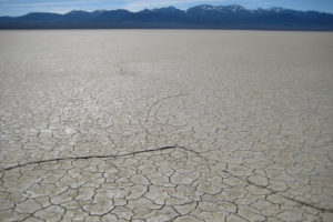
Main Smith Creek Playa Lake when dry, looking south toward the Shoshone Range.
March 19, 2019
At last, water on the playa at the right time of year. Still some snow in shady spots under brush around the playa but no ice on the playa. Playa mud is slippery but relatively firm if I don’t stand in one place too long.
- Maximum dimension easily greater than 1,000 m but less than 1 cm deep even 100 m from the edge.
- Water cloudy pale gray.
- No fairy shrimp.
- Other animals not noted.
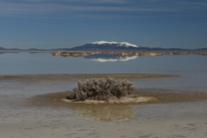
Main Smith Creek Playa Lake, with the New Pass Range in the distance. Hummocks of greasewood rise above the very shallow water.
April 23, 2021
After a relatively dry winter, I didn’t expect any water on the playa this late but but stopped at Smith Creek Cold Springs Ponds (had water) and North Smith Creek Playa Channel Ponds (dry).
- Dry.
Smith Creek Landing Field Pond (Mount Lewis BLM Office)
Smith Creek Cold Springs Ponds map
Smith Creek Landing Field Pond is a 400 m by 600 m (1,310′ x 1,970′) “intermittent lake” pattern 1 km (0.6 miles) south of the landing field southeast of Smith Creek Ranch on the 1:100,000-scale BLM map. I didn’t confirm the landing field still exists. The pond is close to the county-maintained road on the northwest side of the Smith Creek Valley playa.
For access to the county-maintained road, see the access for Smith Creek Cold Springs Ponds. A road from the county-maintained road on the northwest side of the playa leads to the pond but it is in poor condition. The hike to the pond from the main road is only about 1 km (0.6 miles).
Elevation: 1,869 m (6,130′)
April 24, 2018
Driving along the road on the northwestern side of the playa to Smith Creek Cold Springs Ponds, I passed a few gravel pits that the county uses to maintain the road. They are generally rather deep so they could hold water under favorable conditions. I stopped at at least 2 but found no water and didn’t record the locations. This pond has more clay than gravel but still no water.
- Dry.
Smith Creek Windmill North Pond (Mount Lewis BLM Office)
North Smith Creek Playa Channel Ponds map
Smith Creek Windmill North Pond is a roadside pond north of the windmill about 9 km (5.6 miles) southeast of Smith Creek Ranch on the 1:100,000-scale BLM map. My guess is that the pond is 0.6 miles south of the Smith Creek Ranch road and 1.4 miles north of the windmill (EIGWUU). The pond is at a dip in the road but there are other dips without ponds. Due to my poor record-keeping, the location on the map and in the data spreadsheet could be off 300 m (980′).
Smith Creek Windmill North Pond can be reached from the Smith Creek Ranch road and from the county-maintained road along the northwest side of the playa. The Smith Creek Ranch road turns off Nevada 722 about 1/2 mile west of Railroad Pass and is well maintained by the county. For access to the road northwest of the main playa, see the access for Smith Creek Cold Springs Ponds. The road north from the windmill is better than a 2-track but there are some bad spots. It would be very muddy when wet.
Elevation: 1,847 m (6,060′)
April 24, 2018
This is on my loop from the Smith Creek Cold Springs Ponds to the Smith Creek Ranch Road Long Ditch Ponds around the northwestern part of the main playa. I saw several puddles along the roads I followed. I checked out a few but only recorded this one, for the obvious reason.
- Dimensions and depth not estimated.
- Water clarity not noted.
- Fairy shrimp present.
- Other animals not noted.
Burnt Cabin Summit Playa Lake (Mount Lewis BLM Office)
___This map is a screenshot of The National Map (Go to The National Map). The U.S. Geological Survey generally does not copyright or charge for its data or reports (unless printed). A pond location is indicated by an “X”, which corresponds to the coordinates given in the data spreadsheet. Labels in quotations are from 7.5-minute topographic quadrangles.
___Red lines are the U. S. National Grid with a spacing of 1,000 m and intersection labels consisting of the UTM zone (e.g., 11S, 12T), a 2-letter 100-km square designation (e.g., LC, XN), and a 4-digit number. The first 2 digits of the number represent the 1,000-meter Easting and the second 2 digits the 1,000-meter Northing, as seen in the example Easting and Northing. Unlike latitude and longitude, the National Grid is rectilinear on a flat map, the units of abscissa and ordinate have equal lengths, and the units (meters) are measurable on the ground with a tape or by pacing.
___Gray shading represents private land as traced from the PAD-US 2.0 – Federal Fee Managers layer of The National Map. Patented mining claims in the southwestern corner of the map west of about Easting 433,500 and south of about Northing 4,326,000 are not shown. Other lands are public.
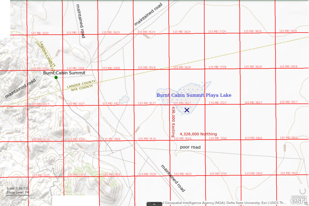
Burnt Cabin Summit Playa Lake is on a playa 2-3 km (1.2-1.9 miles) east of the intersection of 4 county-maintained roads near Burnt Cabin Summit. It is about 52 km (32 miles) southwest of Austin. The playa is not shown on the 1:100,000-scale BLM map or on the 7.5-minute topographic quadrangle. On The National Map it is oddly shown with both stipple and marsh symbols. The area is about 1,350 m x 800 m (4,430′ x 2,620′). It is not visible from the roads but can be seen from the nearby hills. Because the dry lake is close to the divide with Ione Valley, there is little drainage to it. It likely only has water from abundant snowmelt and heavy precipitation events.
4 county-maintained roads lead to the road intersection west of Burnt Cabin Summit Playa Lake.
- The road leading north from Burnt Cabin Summit intersects Nevada 722 after 14 miles about 3 miles south of Eastgate.
- The road leading northeast from Burnt Cabin Summit intersects Nevada 722 in Smith Creek Valley about 1/2 mile west of Brown Ranch/Peterson Station after 11 miles. [The 1:100,000-scale BLM map does not show the new alignment immediately south of the highway but does show a fence line, which is just east of the new road.]
- The road leading southeast from Burnt Cabin Summit reaches Ione after 14 miles. Ione is 6 miles north of paved Nevada 844, which goes to Berlin-Icthyosaur State Park. This and previous distances are those shown on the official Nevada highway map.
- The road leading southwest from Burnt Cabin Summit drops down to Lodi Valley and continues about 16 1/2 miles (estimated from the 1:100,000-scale BLM map) to Nevada 360 north of Gabbs. That intersection is about 1 mile north of the intersection of Nevada 360 with Nevada 844.
All these roads can be difficult or impassable when very wet. Burnt Cabin Summit Playa Lake is at least 1,500 m (4,920′) from the nearest maintained road. There is a narrow 2-track that turns east off the road to Ione about 1.9 miles southeast of the Burnt Cabin Summit intersection. The road is aligned east-west and passes about 1.5 km (0.9 miles) south of Burnt Cabin Summit Playa Lake. Heavy brush makes parking adjacent to the 2-track difficult.
June 6, 2019
Seeing water here was a complete surprise but NPPWOPII. Almost all the water is in the southeastern part of the playa.
- Puddles up to 10 m or so across in places but less than 2 cm deep.
- Generally clear but cloudy pale grayish brown where deepest.
- Pale gray fairy shrimp about 15 mm long; females have eggs in ovisacs 1/2-3/4 as long as abdomens.
- Other animals not noted.
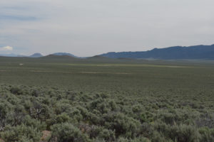
Looking northeast across Burnt Cabin Summit Playa Lake from the edge of the Paradise Range with the Shoshone Range in the distance at right and the rounded butte of Iron Mountain at left. The last remaining water with fairy shrimp is near the right edge of the green, sagebrush-free area. The pale streak across the middle of the photograph is the road to Ione. This photograph was taken the day after I saw the fairy shrimp.
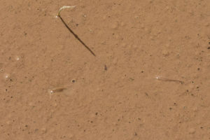
2 fairy shrimp in Burnt Cabin Summit Playa Lake. The water is so shallow they are swimming back-side-up and their backs are out of the water reflecting the sunlight.
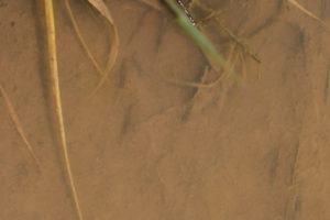
3 fairy shrimp in Burnt Cabin Summit Playa Lake. They are the 3 dark shapes above center with whitish abdomens due to pale matter in their intestines. They are inclined slightly “east” of “north” if the top of the photograph is “north”. There is a dark stick to the left of the topmost fairy shrimp. The fairy shrimp are swimming toward the top of the photo and deeper water but making no progress as the wind is pushing them back toward the bottom of the photo. They are uncharacteristically back-side-up as if trying to get traction from the mud. In the face of doom, they keep swimming.
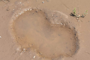
Double hoof print with water on Burnt Cabin Summit Playa Lake. As the mud on the surrounding playa cracks, 2 fairy shrimp swim on. They’re there but I can’t find them in the photograph, not even their black eyes. When you feel like you’re trapped and the world is closing in on you, be glad your world is not the water in a hoof print on a sunny day. For perspective, Burnt Cabin Summit Playa Lake is at a slightly lower latitude than Fallon Experimental Station and Lahontan Reservoir but at a higher elevation. June pan evaporation rates at those sites are 7.5 mm/day or 9.8 mm/day, respectively (see “Pond Duration” on the About page).
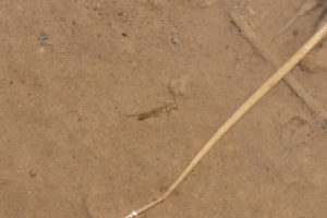
A female fairy shrimp on its side in Burnt Cabin Summit Playa Lake. Its legs are still moving. It carries eggs that may become the next generation. Looking at this, I would like to think that this is what a peaceful end looks like. The fairy shrimp likely lacks self-awareness though so it may pass on without ever knowing it lived. While that may seem sad, it is oddly comparable to what some Buddhists strive for: to realize that one’s personal life and identity are illusions so that perception of self is extinguished and one is freed from the unhappiness inherent in a self-centered life. I think they call that nirvana. For animals without self-awareness and for the enlightened, death is inconsequential because it doesn’t mark the end of anything of which they are aware.
After this, I saw another 2 fairy shrimp stranded on the mud flat not far from a hoof print. I made little channels in the mud with my finger and pushed them slowly along until they fell in. Inconsequential attempt to delay the inevitable for an individual that will likely not know the difference? Sure, but why not?
Smith Creek US 50 Well Pond (Mount Lewis BLM Office)
___This map is a screenshot of The National Map (Go to The National Map). The U.S. Geological Survey generally does not copyright or charge for its data or reports (unless printed). A pond location is indicated by an “X”, which corresponds to the coordinates given in the data spreadsheet. Labels in quotations are from 7.5-minute topographic quadrangles.
___Red lines are the U. S. National Grid with a spacing of 1,000 m and intersection labels consisting of the UTM zone (e.g., 11S, 12T), a 2-letter 100-km square designation (e.g., LC, XN), and a 4-digit number. The first 2 digits of the number represent the 1,000-meter Easting and the second 2 digits the 1,000-meter Northing, as seen in the example Easting and Northing. Unlike latitude and longitude, the National Grid is rectilinear on a flat map, the units of abscissa and ordinate have equal lengths, and the units (meters) are measurable on the ground with a tape or by pacing.
___Gray shading represents private land as traced from the PAD-US 2.0 – Federal Fee Managers layer of The National Map. Other lands are public.
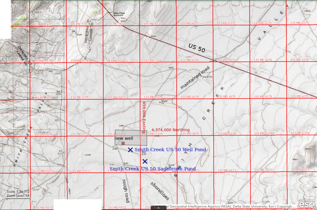
Smith Creek US 50 Well Pond is 3.0 km (1.8 miles) south of US 50 about 36 km (22 miles) west of Austin. It is not shown on the 1:100,000-scale BLM map. On the Mount Airy 7.5-minute topographic quadrangle, the pond is within a 920 m x 630 m (3,020′ x 2,070′) depression indicated by the closed 1,860 m (6,180′) contour. The pond is surrounded by a fence with the wire down that is somewhat co-extensive with the depression. The well shown on the 7.5-minute quadrangle near the southeast end of the pond has been replaced by a new well west of the pond. The new well is only about 50 m (160′) from the road.
Smith Creek US 50 Well Pond is easily accessible from US 50. The turn-off is about 2 miles east of New Pass Summit or 20.5 miles west of downtown Austin. It is a short distance east of a road that turns off to the north and a short distance west of a dry creek crossing. Follow the most used track of the occasionally maintained road past a couple of gravel pits for about 2.4 miles and park near the new well, which has a raised concrete enclosure and a power pole.
Elevation: 1,885 m (6,180′)
May 9, 2023
As has happened on other occasions, I saw a glint of sunlight off the pond as I was driving west on US 50 in the evening. After I got home, I checked the 1:100,00-scale BLM map. It has no ponds in the vicinity. The 7.5-minute topographic quadrangle has a small intermittent pond but it couldn’t account for the size of what I had seen. The aerial imagery is somewhat more encouraging. It shows a large brush-free area about where I thought the water I had seen was. Now that I’m here, I find a large body of water in the southeastern part of the brush-free area. The pond bottom is very soft. I can use bushes as stepping stones to get within a few meters of the water’s edge. The water is almost opaque with thick green algae. I try several quick steps into the water, a dip of the net, and a fast return to a bush. I also try perching on bushes out in the water but can’t perch too long without sinking.
- Approximately 150 m x 300 m; depth more than 8 cm but mud too soft to wade out and find out how much more.
- Murky water; 20 C in 2 cm water at 1315 (warmer than air).
- 8-12 mm long fairy shrimp, maybe eggs.
- No other aquatic animals observed.
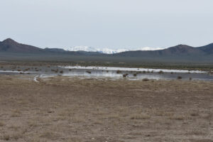
Smith Creek US 50 Well Pond with the Toiyabe Range above the US 50 crossing of Mount Airy Summit. The vegetation-free foreground is due to heavy cow use around a well (I’m standing on its raised concrete cover) and adjacent stock tank. The scattered sagebrush in the water indicates this pond doesn’t have this much water every year.
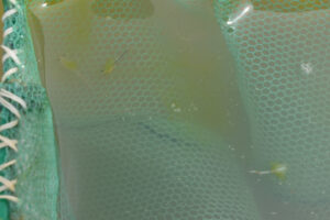
Fairy shrimp with green legs in the net with green algae at Smith Creek US 50 Well Pond. The water has so much floating green algae that it often fills up the net. The fairy shrimp at lower right appears to have 3 large air bubbles filling most of its intestine. That can’t be good.
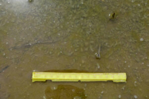
A puddle near Smith Creek US 50 Well Pond. The water level has dropped enough to isolate this puddle from the pond. The puddle is thick with green algae and has hundreds of dead fairy shrimp of various sizes. Maybe 5% of the fairy shrimp are still swimming and those are mostly the smaller ones. Were the fairy shrimp killed off by an algal toxin or has decomposition of the algae lowered oxygen concentrations to toxic levels? Or was it something else?
Smith Creek US 50 Sagebrush Pond (Mount Lewis BLM Office)
Smith Creek US 50 Well Pond map
Smith Creek US 50 Sagebrush Pond is 500 m (1,640′) southeast of Smith Creek US 50 Well Pond. It is marked by a 50 m x 110 m (160 x 360′) intermittent lake symbol on the 7.5-minute topographic quadrangle. The only distinctive thing about the pond is the abundant sagebrush surrounding it and numerous bushes within the water. Aerial imagery indicates Smith Creek US 50 Sagebrush Pond is within a broader area with less brush but it doesn’t look like much of a mud flat. In fact, the imagery shows a larger, more impressive, brush-free mud flat another 230 m (750′) to the southeast. The larger mud flat is in a depression circled by a closed contour. Its area is about 150 m x 310 m (490 x 1,020′). Although that suggests water accumulates there at times, there is a channel on the east side that may now inhibit ponding.
The odd, small-scale roughness of the topography in this area appears to be the result of sand dunes which have now been overgrown by sagebrush. The short, steep slopes on the south sides of Smith Creek US 50 Well Pond, Smith Creek US 50 Sagebrush Pond, and the larger mud flat to its southeast are likely slip faces of formerly northward-migrating sand dunes. Coincidentally, aerial imagery shows shorelines preserved south of the ponds and dunes that indicate a large lake in Smith Creek Valley almost over-topped the dunes during some previous more humid climate.
For access, see Smith Creek US 50 Well Pond. Smith Creek US 50 Sagebrush Pond is to the southeast through the fence and past the old well.
Elevation: 1,885 m (6,180′)
May 9, 2023
I’m confident that Smith Creek US 50 Well Pond was the source of the reflection I saw from US 50 even though it isn’t shown by an intermittent lake on the 7.5-minute quadrangle. What about the small intermittent lake that is shown on the quadrangle? It is only a short distance away to the southeast. I walk up the small ridge south of US 50 Well Pond and there it is, a pool of water in the sagebrush.
- My estimates of 80 m x 180 m are considerably larger than the map symbol; water depth more than 30 cm.
- Clear water; 16 C in 5 cm water at 1345.
- 10-12 mm long fairy shrimp and maybe some about 8 mm; some have eggs.
- Water boatmen (sub-order Heteroptera, family Corixidae), pale gray jerky swimmers less than 1 mm long (maybe only 0.5 mm) that stay close to the bottom may be copepods but I can’t make out their body shapes; ducks.
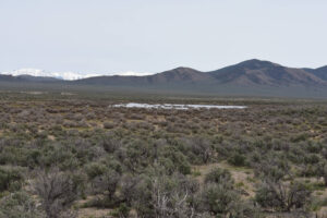
Smith Creek US 50 Sagebrush Pond on the hike from Smith Creek US 50 Well Pond. The abundance of sagebrush in the water indicates an unusually high water level. Some bushes are more than half covered by water. This is certainly not the playa environment of the valley to the south where most of the ponds I have visited are. Shoshone Range in the distance at right and Toiyabe Range at a greater distance at left.
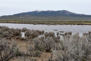
Smith Creek US 50 Sagebrush Pond from the southeastern shore of the pond. New Pass Range is in the distance and New Pass Summit on US 50 is at far left.
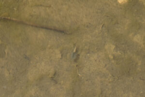
Blurred gray fairy shrimp with pale eggs in Smith Creek US 50 Sagebrush Pond. Despite the clear water, fairy shrimp were hard to find and photograph in the pond. They were not common in water shallower than my boot tops. Low light levels resulted in blurred images due to shutter speeds of about 1/50 seconds. The clear water here is a striking contrast to the murky, algae-rich water in the nearby Smith Creek US 50 Well Pond. The difference may be due to heavier cow use and manure around the new well by Smith Creek US 50 Well Pond.
What Can We Learn from the Ponds in Smith Creek Valley?
After failing to find fairy shrimp in water on North Smith Creek Playa Lake in 2013 and on Main Smith Creek Playa Lake in 2019, I had written off the playas as poor bets for finding fairy shrimp. Then, in 2023 I found fairy shrimp in North Smith Creek Playa Lake. 2023 was an unusual precipitation year so playas may still be poor bets but they are nonetheless bets worth taking.
Burnt Cabin Summit Playa Lake had fairy shrimp in early June 2019 but, with only 1 visit, it is not known whether that is a rare or common occurrence.
Deeper, small ponds are better bets than playas. These occur in stream channels, in roadside ditches, in the bog surrounding the cold springs on the northwestern side of the main playa, and may occur in other anthropogenic features.
The dark red to brown to very pale brown hues of the ponds at the cold springs suggest a variety of chemical conditions and fairy shrimp occur in all of them.
The population in North Smith Creek Playa Channel Ponds is remarkably robust. Fairy shrimp were observed there whenever there was water, from mid-March to early June and even in early August after stormy weather.
Fairy shrimp die when the pond they are living in dries up. What is remarkable about the instances of death observed in Smith Creek Valley is that the fairy shrimp lived until the last 5 mm of water. Increasing TDS concentrations and temperatures did not kill them off first.