The base map is provided by OpenTopoMap’s volunteer servers.
“Ramires Pond”
“Willow Pond”
Ruby “Dry Lake Flat”
Ruby Pony Express Station Pond
What Can We Learn from the Ponds in Ruby Valley?
Ruby Valley is 90 km (56 miles) long and 5-25 km (3-16 miles) wide. It is bounded on the west by the steep east side of the Ruby Mountains. The east side is not well defined but gives way to various hills such as the Maverick Springs Range, Medicine Range, West Buttes, and Valley Mountain (from south to north). Bald Mountain blocks the southern end of Ruby Valley and the northern end is pinched off between the Ruby Mountains and the East Humboldt Range.
Elevations in Ruby Valley are mostly 1,800-1,950 m (5,910-6,400′). The lowest elevations are probably at “Ruby Lake” and “Franklin Lake”. The 1968 7.5-minute topographic quadrangle indicates the water surface elevation of “Ruby Lake” was 5,964 feet (1,818 m) in the South Sump and the bottom(?) surface elevation was 5,961 feet (1,817 m) in the North Sump. A spot elevation on the edge of the marsh symbol for “Franklin Lake” was 5,951 feet (1,814 m). The Ruby Mountains has a few peaks above 3,000 m (9,840′). Maximum elevations in hills to the east are lower, at 2,467 m (8,090′) in the Maverick Springs Range, 2,819 m (9,250′) in the Medicine Range, and 2,256 m (7,400′) in West Buttes. Alluvial fans may climb up to about 2,000 m (6,560′) against the Ruby Mountains and around the eastern hills.
Vegetation is sagebrush and desert scrub with marsh at “Ruby Lake” and Franklin Lake.
“Ruby Lake” is not fairy shrimp habitat and likely never was. Brochures produced by the U.S. Fish and Wildlife Service indicate the Refuge was created primarily to protect migrating birds. It is also managed to support fishing and is stocked with largemouth bass (first stocked in 1932), rainbow, brown, eastern brook, cutthroat, tiger, and bowcut. The native relict dace has survived in a few locations. Although small, the dace is probably big enough to eat fairy shrimp. Fairy shrimp and other crustaceans are not listed in the Refuge’s wildlife checklist. The checklist does include one amphibian, the leopard frog, which might prevent colonization by fairy shrimp. According to the 1:100,000-scale BLM map, part of “Franklin Lake” is perennial so it likely also has, or has had, fish. More relevant for fairy shrimp are stippled areas indicative of playas on the 1:100,000-scale BLM map in eastern parts of the valley. The map also shows a couple of “intermittent lakes” east of “Franklin Lake”.
Most of Ruby Valley within 10 km (6 miles) of the base of the Ruby Mountains is private land or National Wildlife Refuge. There are also parcels of private land at Mountain Spring, Maverick Springs, Medicine Spring, and Quilici Spring. The rest of the land east of the Ruby Range is public land managed by the Wells Office of the BLM. There is a well maintained road along the west side of the valley with a paved northern portion. It services a few small communities, several ranches, the “Ruby Lake” National Wildlife Refuge, and Gallagher State Fish Hatchery. There is no fee for driving through the refuge.
“Ramires Pond” (“Ruby Lake” National Wildlife Refuge)
___This map is a screenshot of The National Map (Go to The National Map). The U.S. Geological Survey generally does not copyright or charge for its data or reports (unless printed). A pond location is indicated by an “X”, which corresponds to the coordinates given in the data spreadsheet. Labels in quotations are from 7.5-minute topographic quadrangles.
___Red lines are the U. S. National Grid with a spacing of 1,000 m and intersection labels consisting of the UTM zone (e.g., 11S, 12T), a 2-letter 100-km square designation (e.g., LC, XN), and a 4-digit number. The first 2 digits of the number represent the 1,000-meter Easting and the second 2 digits the 1,000-meter Northing, as seen in the example Easting and Northing. Unlike latitude and longitude, the National Grid is rectilinear on a flat map, the units of abscissa and ordinate have equal lengths, and the units (meters) are measurable on the ground with a tape or by pacing.
___There is no private or state land on this map.
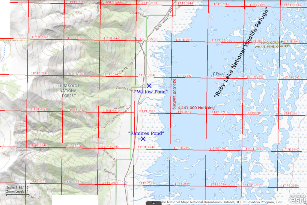
“Ramires Pond” is in the southern part of the “Ruby Lake” National Wildlife Refuge. The map in the Refuge brochure and in the “Fishing, Boating, and Hunting Information” brochure shows several small ponds on the west shore of the southern part of “Ruby Lake”. They are fed by numerous springs in the area. The maps don’t show clear connections to “Ruby Lake” so they might not be accessible to fish. “Ramires Pond” is labeled on the brochure map.
“Ramires Pond” is along the well-maintained road through the National Wildlife Refuge on the west side of Ruby Valley. Paved roads from Wells (US 93 then Nevada 229) and from Halleck (Nevada 229), on I-80, intersect this road at the north end of Ruby Valley. The road can be rocky and rough or muddy and slippery in spots but is not likely to pose a major obstacle to travel. Ruby Valley can also be reached from the south by turning north on Nevada 892 east of Eureka and then following various unpaved roads to the south end of “Ruby Lake” National Wildlife Refuge. The unpaved roads include well-maintained access roads to mines on Bald Mountain and less maintained roads that could become impassable when wet. Lack of signs at road intersections is a major inconvenience.
Elevation: 1,822 m (5,980′)
May 7, 2018
This is a long shot but WIDLA.
- Less than 50 m; depth uncertain.
- Water is clear.
- No fairy shrimp.
- Didn’t see fish.
“Willow Pond” (“Ruby Lake” National Wildlife Refuge)
“Willow Pond” is in the southern part of the “Ruby Lake” National Wildlife Refuge. The map in the Refuge brochure and in the “Fishing, Boating, and Hunting Information” brochure shows several small ponds on the west shore of the southern part of “Ruby Lake”. They are apparently fed by the numerous springs in the area and are not connected to the lake by more than trickles of water. “Willow Pond” is labeled on the brochure map. On the Sherman Mountain 7.5-minute topographic quadrangle, what appears to be “Willow Pond” is labeled “Brush Pile Pond”.
For access, see “Ramires Pond”.
Elevation: 1,823 m (5,980′)
May 7, 2018
“Ramires Pond” was a bust but I’ll give the spring-fed ponds one more try.
- Less than 50 m; depth uncertain.
- Water is clear.
- No fairy shrimp.
- Didn’t see fish.
Ruby “Dry Lake Flat” (Wells BLM Office)
___This map is a screenshot of The National Map (Go to The National Map). The U.S. Geological Survey generally does not copyright or charge for its data or reports (unless printed). A pond location is indicated by an “X”, which corresponds to the coordinates given in the data spreadsheet. Labels in quotations are from 7.5-minute topographic quadrangles.
___Red lines are the U. S. National Grid with a spacing of 1,000 m and intersection labels consisting of the UTM zone (e.g., 11S, 12T), a 2-letter 100-km square designation (e.g., LC, XN), and a 4-digit number. The first 2 digits of the number represent the 1,000-meter Easting and the second 2 digits the 1,000-meter Northing, as seen in the example Easting and Northing. Unlike latitude and longitude, the National Grid is rectilinear on a flat map, the units of abscissa and ordinate have equal lengths, and the units (meters) are measurable on the ground with a tape or by pacing.
___There is no private or state land on this map. All lands are public.
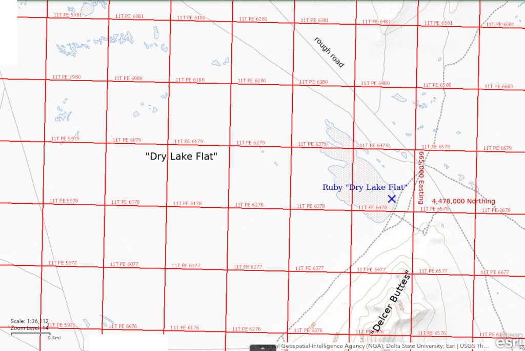
Ruby “Dry Lake Flat” is approximately 74 km (46 miles) southeast of Elko. On the 1:100,000-scale BLM map, “Dry Lake Flat” is a mud flat 6-10 km (3.5-6 miles) across on the east side of Ruby Valley north of Delcer Buttes. Ruby “Dry Lake Flat” is my name for the 800 m (2,620′) by 1,800 m (5,910′) area of stipple pattern at the eastern end of “Dry Lake Flat”. There is an obvious nomenclatural problem with this name but other playas in Ruby Valley could be considered “Ruby Dry Lake” and no other area is labeled “Dry Lake Flat”. The Delcer Buttes 7.5-minute topographic quadrangle has numerous small stipple patterns for “Dry Lakes” on “Dry Lake Flat” scattered over several km (miles) away from Ruby “Dry Lake Flat”. They are also potential fairy shrimp habitat and would need pond names of their own.
There is a reasonably good road that turns south off Nevada 229 6 miles west of the junction of Nevada 229 and US 93. The road passes within 600 m of the stipple pattern in “Dry Lake Flat”. A 2-track that skirts the west side of Delcer Buttes crosses the southeast end of the stipple pattern. Estimating visually from the BLM map, my guess is that Ruby “Dry Lake Flat” is about 17 miles south of Nevada 299. Although the road has some gravel, it is likely to be very difficult when wet.
Elevation: 1,833 m (6,015′)
May 9, 2018
The road south from Nevada 229 passes by 2 large areas of stipple pattern north of Ruby “Dry Lake Flat”. I didn’t see any water on either of them. Ironically, a little rain 2 days later slickened the roads so quickly that I decided to get out as fast as possible. It was like driving on ice except that the wheels were throwing mud everywhere.
- Dry.
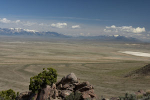
Ruby “Dry Lake Flat”, looking north from Delcer Buttes. The playa represented by the stipple pattern on the BLM map is the white area at far right. Smaller patches of white at left may be the “Dry Lakes” on the Delcer Buttes quadrangle. In the distance,the Ruby Mountains are at left and the East Humboldt Range at right.
Ruby Pony Express Station Pond (“Ruby Lake” National Wildlife Refuge, or maybe private)
___This map is a screenshot of The National Map (Go to The National Map). The U.S. Geological Survey generally does not copyright or charge for its data or reports (unless printed). A pond location is indicated by an “X”, which corresponds to the coordinates given in the data spreadsheet. Labels in quotations are from 7.5-minute topographic quadrangles.
___Red lines are the U. S. National Grid with a spacing of 1,000 m and intersection labels consisting of the UTM zone (e.g., 11S, 12T), a 2-letter 100-km square designation (e.g., LC, XN), and a 4-digit number. The first 2 digits of the number represent the 1,000-meter Easting and the second 2 digits the 1,000-meter Northing, as seen in the example Easting and Northing. Unlike latitude and longitude, the National Grid is rectilinear on a flat map, the units of abscissa and ordinate have equal lengths, and the units (meters) are measurable on the ground with a tape or by pacing.
___There is no private or state land on this map.
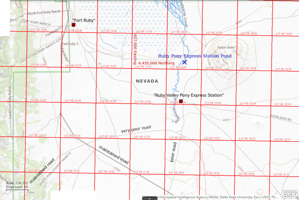
Ruby Pony Express Station Pond is about 89 km (55 miles) south of Elko. It is in southern Ruby Valley near the southern boundary of the “Ruby Lake” National Wildlife Refuge. North of the Ruby Valley Pony Express and Overland Stage Station, the intermittent Woodwards Creek (shown as perennial on the BLM map but mostly dry at the time of my visit) flows north into “Ruby Lake”. A small dam has created a shallow pond that is probably intended for livestock use. A perennial 50 m by 150 m pond shown on the Station Butte 7.5-minute topographic quadrangle on Woodwards Creek due west of Station Butte is probably Ruby Pony Express Station Pond. Because the 1:100,000-scale BLM shows lands within the refuge as white, like private land, land ownership at the pond is uncertain. The map in the brochure of “Ruby Lake” National Wildlife Refuge shows the Pony Express Station and lands to the north within the refuge boundary but the map does not identify private land anywhere.
The road along the west side of Ruby Valley south of the Refuge boundary is not as well maintained as that to the north but still fairly good. It curves to the east south of the boundary. About 4 miles south of the Refuge boundary, there is a road that leads due north to the Pony Express Station. This road is bad but is better than other options. It is likely impassable when wet. It has deep ruts full of bug dust when dry.
Elevation: 1,830 m (6,005′)
May 11, 2018
The area north of the Pony Express Station is marshy so I went looking for ponds. I didn’t find any open ponds in the marsh but came across a shallow pond on the dry channel of Woodwards Creek.
- Less than 50 m across; depth uncertain.
- Water is clear.
- No fairy shrimp.
- Frogs.
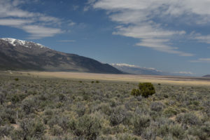
Southern Ruby Valley with the Ruby Mountains at left. Ruby Pony Express Station Pond is off the right edge but the photograph nonetheless illustrates the nature of the terrain. Tan areas are dried marsh vegetation. The maintained road through the Refuge is at far left. The East Humboldt Range at the north end of Ruby Valley is in the far distance at right, probably 80 km (50 miles) away.
What Can We Learn from the Ponds in the Ruby Valley?
Playa lakes and puddles in the eastern part of Ruby Valley are potential fairy shrimp habitat but didn’t have water when I visited.