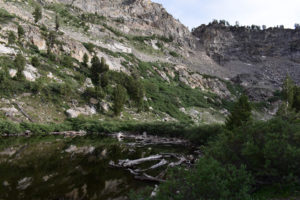
The base map is provided by OpenTopoMap’s volunteer servers.
Glaciation of the Ruby Mountains
Fish-stocking Zooicide in the Ruby Mountains
Watchful Beaver Pond
“Overland Lake” Upper Pond
“North Furlong Lake”
Willows and Rocks Pond
Toe of Talus Pond
Log Jam Pond
Above the Trail Pond
Pika Pond
Box Lake
Snow Lake
South Wall Kleckner Pond
“Castle Lake”
What Can We Learn from the Ponds in the Ruby Mountains?
The Ruby Mountains rise between Ruby Valley to the east and Lamoille and Huntington valleys to the west. They stretch for 98 km (61 miles) from Secret Creek in the north to Overland Pass in the south. They are up to 21 km (13 miles) wide south of Lamoille Canyon and narrower elsewhere.
The highest peaks in the Ruby Mountains are on a sharp east-west ridge south of Lamoille Canyon. They include Ruby Dome at 3,471 m (11,387′), Mount Fitzgerald (3,418 m, 11,215′), and Snow Lake Peak (3,396 m, 11,137′). Most other high peaks are along the central crest of the range. Soldier Peak, near the north end, has an elevation of 3,075 m (10,089′); King Peak, near the middle, is at 3,362 m (11,031′); and Pearl Peak, in the south, reaches 3,306 m (10,847′). The 2,000 m (6,560′) contour encloses pretty much all of the mountainous and hilly terrain. The east side of the range is, overall, steeper than the west side but the west side has long canyons with steep walls.
The vegetation of the Ruby Mountains seems to be unique to me. It differs from what I have seen in other high ranges of the Great Basin, such as the Jarbidge Mountains and Toiyabe Range. The paucity of trees and abundance of brush north of Harrison Pass suggests the Ruby Mountains have been burned repeatedly over the last century or two. Lower slopes south of Harrison Pass may have pinyon pine but I didn’t see any along the Ruby Crest Trail. Limber or white pine is scattered along the ridges or present in groves on the moister slopes. Aspen is surprisingly common at high elevations but not abundant. Instead of trees, dense shrubbery thrives on the relatively abundant moisture of the Ruby Mountains.
The brush in the Ruby Mountains is thick enough to pose a serious impediment to off-trail hiking. Unlike much of Nevada, sagebrush does not dominate the Ruby Mountains except on higher, rockier slopes. Paradoxically, it generally offers the easiest hiking. Also unlike much of Nevada, antelope bitterbrush and mahogany seem to be uncommon, at least along the Ruby Crest Trail. Instead, dense masses of the intricately branched, manzanita-like snowbrush are relatively common. Thickets of contorted aspen less than 2 m (6 1/2′) high are just as bad. Streams and wet meadows have willows that, like snowbrush, form impenetrable, intricately branched masses that can grow up to 2 m (6 1/2′) high. Getting to the edge of a pond to look for fairy shrimp can be a problem.
The redeeming feature of the vegetation in the Ruby Mountains is the wildflowers. They are diverse and locally abundant.
Almost all of the Ruby Mountains are within the boundaries of the Humboldt-Toiyabe National Forest. However, the northern part of the range is within the railroad checkerboard where sections of public land alternate with sections of private land. There are also areas where the public lands are separated from the Forest boundary by private land. This begs the question of why the boundary was placed within private land rather than at the edge of the public land. Otherwise, the inholdings of private land are minor. The largest are on the west side of the southern Ruby Mountains on Lindsay Creek, South Cass House Creek, Mitchell Creek, Sherman Creek, Sestanovich Creek, and Willow Creek. Close to half of the Ruby Mountains north of Harrison Pass lie within the Ruby Mountains Wilderness, which has a shape that is too bizarre to describe but may be a good illustration of the political process that created it.
Public access to the Ruby Mountains is limited because few public roads reach the Forest boundary. The 2 exceptions are the paved road in Lamoille Canyon and the partly paved road over Harrison Pass. Elsewhere, roads into the National Forest cross private land. In a few cases, such as to the “Overland Lake” trailhead, the Forest Service has an agreement with the land owner to allow public access. In other cases, it doesn’t. Consequently, the lower ends of many trails up the valleys of the Ruby Mountains are not accessible without specific landowner permission. That leaves the Ruby Crest Trail from Lamoille Canyon to Harrison Pass as the principal means of public access. Be aware that the southern trailhead of the Ruby Crest Trail is 2.8 miles north of Harrison Pass and can be reached only by high-clearance, 4-wheel drive vehicles. It is a very poor, locally steep, one lane road. Harrison Pass is at about 2,200 m (7,220′). The Lamoille Canyon end of the Ruby Crest Trail starts at pavement at about 2,700 m (8,860′).
Glaciation of the Ruby Mountains
The Ruby Mountains probably have the best developed and most extensive glacial features in Nevada although those in Great Basin National Park may be just as scenic (www.nps.gov/grba/learn/nature/glaciers.htm). According to Osborn and Bevis (2001) the glaciated crest of the East Humboldt and Ruby mountains is 110 km long (66 miles). Glaciers have carved long u-shaped canyons on the west side of the Ruby Mountains. The biggest and most accessible is Lamoille Canyon. The flatter floors of these valleys are more favorable for ponds, such as “Lamoille Lake”, than the usual v-shaped canyons. At the heads of some canyons, small cirques from the most recent glacial advances have ponds. Examples include ponds at the upper ends of Middle Fork Smith Creek and South Fork Smith Creek canyons. Hanging valleys also offer platforms for ponds. “Lost Lake” is in a hanging valley off Rattlesnake Creek canyon. Such glacial features explain why the Ruby Mountains have more ponds than any other mountain range in Nevada.
The east side of the Ruby Mountains was apparently too steep during the glacial periods for glaciers to do much good for ponds. The glaciers seemingly just plunged to the valley floor without forming substantial platforms where ponds could form. One exception is “Overland Lake”.
There were 2 periods of major glaciation in the Ruby Mountains. Lamoille-age glaciers were bigger and older than Angel Lake-age glaciers (Osborn and Bevis, 2001). The term Lamoille comes from Lamoille canyon, where the glacier was 20 km (12 miles) long (Osborn and Bevis, 2001). The cirque-hosted “Angel Lake” is a popular recreation area in the East Humboldt Mountains. There are prominent moraines below the lake. Only Angel Lake glaciation is relevant to the timing of fairy shrimp colonization.
Angel Lake moraines have been identified near the mouths of several valleys in the Ruby and East Humboldt mountains. Angel Lake moraines can be distinguished from Lamoille moraines by sharper crests and more boulders and by their positions “a few km” up valley from Lamoille moraines (Osborn and Bevis, 2001). Exposure ages of when the ice melted off moraines can be determined using cosmogenic beryllium-10 dating methods. For more on glacial features and exposure ages, see “Glaciation of the Wind River Mountains” on the Wind River Mountains page. The most convincing beryllium-10 exposure ages for Angel Lake moraines in the Ruby Mountains are those of Laabs and others (2013). They measured exposure ages for 29 boulders from the Angel Lake terminal moraine and 6 recessional moraines in Seitz Canyon. 1 standard deviation for analytical error ranged from 700 to 2,000 years. Ages for boulders from different moraines showed considerable overlap. As is commonly the case, determining whether some ages are too old due to inheritance of beryllium-10 that formed before the rock was covered by the glacier or are too young due to erosion or burial after the glacier melted off is largely guess work. However, by imposing the geologic constraint that moraine ages had to get younger up valley when calculating averages, Laabs and others (2013) determined that ice had melted off the terminal moraine 20,500 years ago (95% confidence interval: +700 years, -600 years) and off the uppermost recessional moraine 14,800 years ago (95% confidence interval: +800 years, -2,100 years). Because the uppermost recessional moraine is only 2 km (1.2 miles) up valley from the terminal moraine and the ponds are all at considerably higher elevations, 14,800 years ago is the best estimate of the earliest time when glaciers melted off the ponds of the Ruby Mountains. At best, I can say that ponds of the Ruby Mountains were not available for colonization before 14,800 years ago.
The Angel Lake moraine data of Laabs and others (2013) were also presented by Wesnousky and others (2016) with some of the ages recalculated in addition to new data for the Angel Lake terminal moraine and for a Lamoille moraine in Hennen Canyon. Wesnousky and others (2016) did not provide new recessional moraine data, did not address variability in excess of 1 standard deviation, and did not calculate averages.
On the east side of the Ruby Mountains, beryllium-10 exposure ages for rocks buried by the Overland Creek glacier are consistent with those of Laabs and others (2013). The terminal moraine was exposed 19,900 years ago (with standard deviation of 1,000 years). Of greatest importance for pond exposure, the glacier had retreated above the lip of the “Overland Lake” platform 14,700 years ago (with standard deviation of 300 years) and was well above the lake at 13,200 years ago (with standard deviation of 500 years). “Overland Lake” is lower than the majority of ponds in the Ruby Mountains. These results confirm that the exposure age of 14,800 years for the uppermost recessional moraine in Seitz Canyon is a maximum for pond exposure and that some ponds may not have been exposed until 13,200 years ago. However, due to topographic, ice-shed, and sun-shading differences, it is difficult to say which ponds were exposed when.
Some moraines close to cirque headwalls had previously been considered to have formed during the Little Ice Age (1300-1850) but Osborn and Bevis (2001) discounted this interpretation. Without exposure ages for such moraines, it cannot be determined how long cirque ponds have been available for colonization. However, as there is no evidence that Little Ice Age glaciers advanced more than 1 km (0.6 mile) in the Wind River Mountains or the Sierra Nevada, it is unlikely that any Little Ice Age glaciation affected ponds in the Ruby Mountains.
Fish-stocking Zooicide in the Ruby Mountains
The Ruby Mountains don’t have many ponds and those they do have are small. It wouldn’t seem to be a great place for fishing. No matter, people want fish. The web site rubymountains.net has a table of unknown vintage that lists 18 ponds in the Ruby Mountains (and several others in the East Humboldt Range). They range in size from 0.73 to 11.7 hectare (1.8-29 acres). The table doesn’t list Box Lake, Goat Lake, Snow Lake, or “Lost Lake” and also omits small ponds in cirques at the heads of Talbot Creek, Middle Fork Smith Creek, South Fork Smith Creek, and Segunda Creek or their tributaries as well as a pond on the south side of Echo Canyon and the pond above “Overland Lake”. Box Lake, Goat Lake, and Snow Lake are not named on 7.5-minute topographic maps. The topographic maps also show a few more ponds that are even tinier. All the ponds mentioned so far are north of Harrison Pass. The U.S. Forest Service’s recreation map for the Ruby Mountains shows only “Burro Lake” south of Harrison Pass. This pond is south of Sherman Mountain and there is apparently a trail leading to it from the south.
The rubymountains.net table indicates 13 of the ponds listed for the Ruby Mountains have fish and 5 don’t. However, a May 27, 2022 article in the Elko Daily Free Press by Joe Doucette (“Alpine fishing in Nevada: The lowdown on high mountain lakes”) stated that “Seitz Lake” is now periodically stocked by Nevada Department of Wildlife. That leaves 4 listed ponds without fish. The fish couldn’t have gotten to any ponds in the Ruby Mountains naturally due to one or more segments of very steep stream gradients. Moreover, 9 of the ponds have non-native brook trout and 2 also have mackinaw. The ponds with fish were stocked.
NDOW’s interactive map (www.fish.wildlifenv.com/map) has no information for “Seitz Lake” but confirms fish in those identified as having fish in rubymountains.net’s table.
Alpine ponds without fish commonly have populations of various invertebrate species, such as copepods, caddisflies, mayflies, diving beetles, backswimmers, water boatmen or, less commonly, amphipods, fairy shrimp, or ostracods. As explained in Fish-stocking Zooicide in the Sierra Nevada on the East-Central Sierra Nevada page, fish commonly eliminate populations of aquatic invertebrates which are larger than about 2 mm (0.08″). It is safe to say that the introduction of fish into ponds of the Ruby Mountains killed off more than 13 invertebrate populations. We will never know how many or which species. Small potatoes compared to the zooicides in the Sierra Nevada and Wind River Mountains but it all adds up globally.
Watchful Beaver Pond (Ruby Mountains Ranger District, Humboldt-Toiyabe National Forest; Ruby Mountains Wilderness)
___This map is a screenshot of The National Map (Go to The National Map). The U.S. Geological Survey generally does not copyright or charge for its data or reports (unless printed). A pond location is indicated by an “X”, which corresponds to the coordinates given in the data spreadsheet. Labels in quotations are from 7.5-minute topographic quadrangles.
___Red lines are the U. S. National Grid with a spacing of 1,000 m and intersection labels consisting of the UTM zone (e.g., 11S, 12T), a 2-letter 100-km square designation (e.g., LC, XN), and a 4-digit number. The first 2 digits of the number represent the 1,000-meter Easting and the second 2 digits the 1,000-meter Northing, as seen in the example Easting and Northing. Unlike latitude and longitude, the National Grid is rectilinear on a flat map, the units of abscissa and ordinate have equal lengths, and the units (meters) are measurable on the ground with a tape or by pacing.
___There is no private or state land on this map. All lands are public.
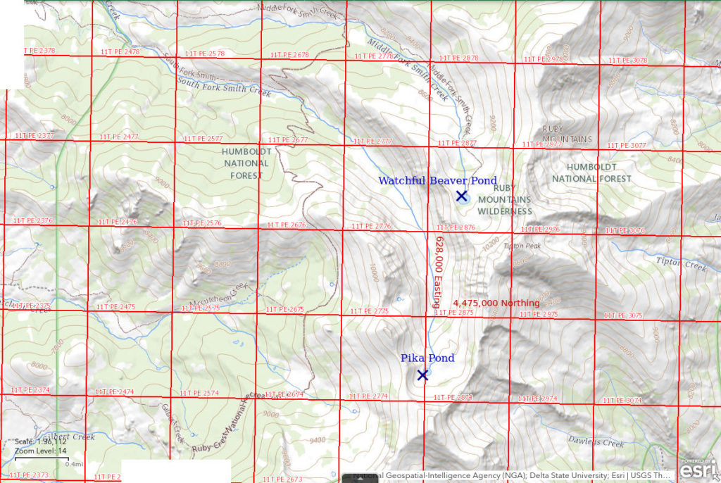
Watchful Beaver Pond is at the upper end of Middle Fork Smith Creek canyon 50 km (31 miles) southeast of Elko. On the 7.5-minute topographic quadrangle, Watchful Beaver Pond is a round pond about 150 m (490′) across. As I was scanning the water and trying to identify the aquatic animals, a beaver paddled by in the distance and watched me. The pond does not have a beaver-constructed dam or lodge; it just has a watchful beaver. There are plenty of willows for it to eat. Watchful Beaver Pond is not in the table of lakes at rubymountains.net.
Watchful Beaver Pond is reached via the Ruby Crest Trail. The trail crosses Middle Fork Smith Creek about 15.5 km (9.6 miles) from the Harrison Pass trailhead. A short distance north of the ford, there is a sign for Middle Fork trail. Although the 7.5-minute topographic quadrangle does not show a Middle Fork trail, The National Map does. The Middle Fork trail has essentially disappeared. However, if you follow what looks like the easiest route up the valley, you will sometimes find yourself on what appears to be a trail. This could be the remains of a human-used trail or a game trail. The same situation occurs in South Fork Smith Creek valley where no human trail is mapped. In any case, hiking up the valley is not bad since the valley floor lacks snowbrush and young aspen thickets.
Elevation: 2,896 m (9,501′)
July 14, 2022
Although there was not much of a trail, the hike was not difficult. The greatest annoyance was socks packed full of pointy grass seeds that took more than 10 minutes to remove. I had enough time to hike up to the pond from the Ruby Crest Trail and back and to complete the 9.2 km (5.7 miles) hike from South Fork Smith Creek to “Overland Lake” in one day.
- 120 m x 150 m; more than 100 cm deep and could be 200 cm deep.
- Water is clear; 22 C at 1130.
- No fairy shrimp.
- Abundant caddisfly larvae (Trichoptera), black beetles less than 10 mm long, gray-brown beetles about 15 mm long, water boatmen (sub-order Heteroptera, family Corixidae), rare 1-2 mm copepods, snails, beaver.
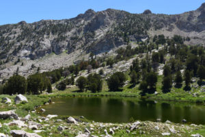
Watchful Beaver Pond, extreme wide-angle view looking east with Tipton Peak off right edge of photograph. Notice the dense willows along the shoreline.
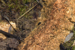
A black beetle in Watchful Beaver Pond.
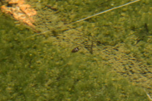
A gray-brown diving beetle with unusual colors in Watchful Beaver Pond. The back legs are extended after a swimming stroke. Could this be a dytiscid (order Coleoptera, family Dytiscidae)?
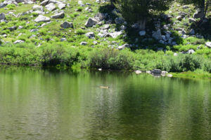
A watchful beaver in Watchful Beaver Pond. It never slapped its tail on the water so it was apparently not too concerned by my presence.
“Overland Lake” Upper Pond (Ruby Mountains Ranger District, Humboldt-Toiyabe National Forest; Ruby Mountains Wilderness)
___This map is a screenshot of The National Map (Go to The National Map). The U.S. Geological Survey generally does not copyright or charge for its data or reports (unless printed). A pond location is indicated by an “X”, which corresponds to the coordinates given in the data spreadsheet. Labels in quotations are from 7.5-minute topographic quadrangles.
___Red lines are the U. S. National Grid with a spacing of 1,000 m and intersection labels consisting of the UTM zone (e.g., 11S, 12T), a 2-letter 100-km square designation (e.g., LC, XN), and a 4-digit number. The first 2 digits of the number represent the 1,000-meter Easting and the second 2 digits the 1,000-meter Northing, as seen in the example Easting and Northing. Unlike latitude and longitude, the National Grid is rectilinear on a flat map, the units of abscissa and ordinate have equal lengths, and the units (meters) are measurable on the ground with a tape or by pacing.
___There is no private or state land on this map. All lands are public.
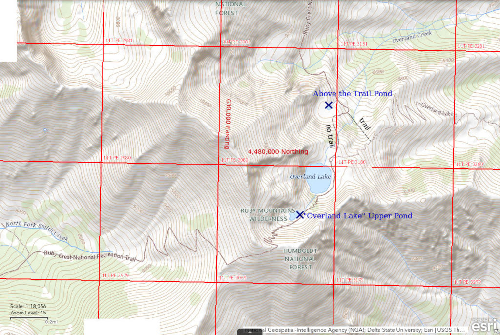
“Overland Lake” Upper Pond is 48.5 km (30.0 miles) southeast of Elko. It is about 70 m (230′) higher and 250 m (820′) southwest of “Overland Lake”. On the 7.5-minute topographic quadrangle, “Overland Lake” Upper Pond is about 150 m (490′) across. “Overland Lake” Upper Pond is not in the table of lakes at rubymountains.net. The outlet of “Overland Lake” Upper Pond disappears into boulders on a steep slope above “Overland Lake” so the pond is not accessible to fish in “Overland Lake” under natural conditions.
Being next to “Overland Lake”, “Overland Lake” Upper Pond is along the Ruby Crest Trail. “Overland Lake” is approximately 22.5 km (14.0 miles) from the trailhead north of Harrison Pass and considerably farther from Lamoille Canyon. “Overland Lake” can also be reached by a very steep hike from the trailhead off the Ruby Valley road. Because it is one of the most accessible lakes in the Ruby Mountains and has fish, “Overland Lake” probably has at least one camping party every night during the summer. A few moderately separated camping sites are available at the lake.
Elevation: 2,959 m (9,710′)
July 14, 2022
The pond is significantly higher than “Overland Lake” and clearly not accessible to fish in “Overland Lake”.
- 60 m x 100 m; probably more than 100 cm deep.
- Clear water; 20 C at 1730.
- No fairy shrimp.
- Fish guts.
“Overland Lake” Upper Pond is not an effortless climb from “Overland Lake” so no one would carry a fish up here to gut it. That’s basically all the organic matter I saw in the pond. I didn’t see any invertebrates at all, which is typical of ponds with fish.
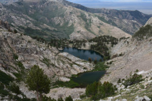
“Overland Lake” (center) and “Overland Lake” Upper Pond (below center) from the Ruby Crest Trail, looking northeast. Ruby Valley is in the distance. The collage of brushy and brush-free slopes without trees beyond the lake suggest burn scars.
“North Furlong Lake” (Ruby Mountains Ranger District, Humboldt-Toiyabe National Forest; Ruby Mountains Wilderness)
___This map is a screenshot of The National Map (Go to The National Map). The U.S. Geological Survey generally does not copyright or charge for its data or reports (unless printed). A pond location is indicated by an “X”, which corresponds to the coordinates given in the data spreadsheet. Labels in quotations are from 7.5-minute topographic quadrangles.
___Red lines are the U. S. National Grid with a spacing of 1,000 m and intersection labels consisting of the UTM zone (e.g., 11S, 12T), a 2-letter 100-km square designation (e.g., LC, XN), and a 4-digit number. The first 2 digits of the number represent the 1,000-meter Easting and the second 2 digits the 1,000-meter Northing, as seen in the example Easting and Northing. Unlike latitude and longitude, the National Grid is rectilinear on a flat map, the units of abscissa and ordinate have equal lengths, and the units (meters) are measurable on the ground with a tape or by pacing.
___There is no private or state land on this map. All lands are public.
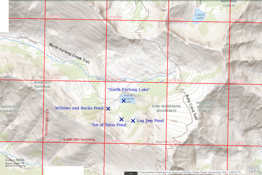
“North Furlong Lake” is 42.5 km (26.5 miles) southeast of Elko. It is 250 m (820′) long and 120 m (390′) wide on the 7.5-minute topographic quadrangle. In spite of its small size, it is labeled on the 1:100,000-scale BLM map. The lake is not connected to North Furlong Creek. The table at rubymountains.net indicates “North Furlong Lake” does not have fish.
“North Furlong Lake” is a short distance off the Ruby Crest Trail about 43.5 km (27.0 miles) from the Harrison Pass trailhead and probably half that distance from the Lamoille Canyon trailhead. There is a sign on the Ruby Crest Trail for the North Furlong Creek trail, which leads close to “North Furlong Lake”. The lake is a little more than 1 km (0.6 miles) away across easy terrain. The trail shown on the 7.5-minute quadrangle does not approach the lake while that on The National Map does. The trail depicted on The National Map better represents the most obvious trail today. The North Furlong Creek Trail goes all the way down the canyon but there is no public access to the lower end.
Elevation: 2,925 m (9,600′)
July 15, 2022
The broad area of flat ground to the north and west of “North Furlong Lake” seems to be covered by ground moraine of mixed mud and gravel. The lake is in an odd depression all by itself with no active outlet. Lots of mosquitoes.
- 100 m x 250 m; probably more than 100 cm deep.
- Clear water; 20 C at 1730.
- No fairy shrimp.
- Caddisfly larvae (Trichoptera), greenish-brown beetles less than 10 mm long scurrying around on the pond bottom, fast swimmers with multi-segmented bodies lacking distinct thoraxes and abdomens may be amphipods, abundant dark brown copepods 2+ mm long, snails.
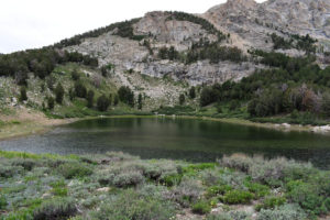
“North Furlong Lake”, looking east (extreme wide-angle view). There are small shoreline terraces on the slope on the left (north) side of the lake that mark the declines in water level after it fell below the spill point. They are not visible in the photograph. The lake is now stagnant with no outlet. I don’t know if the terraces formed annually or over longer intervals but there are a dozen or more of them. They could reflect recent drought or longer term changes in precipitation.
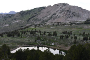
View of “North Furlong Lake” to the northwest on the way down from Log Jam Pond. North Furlong Creek is in the small groove with scattered trees in the middle distance. The bathtub ring around the lake indicative of declining water levels is quite apparent. Before the lake level dropped so low, the outlet would have been off the lower left edge of the photograph. How long has the lake been drying up?
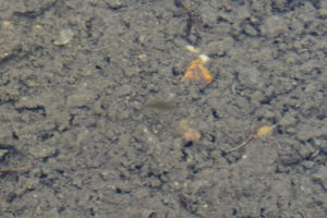
Possible amphipod in “North Furlong Lake”. The greenish-gray blur (slow shutter speed) at center is a little less than 10 mm long and has a segmented, rather flat body. There is no distinct head or abdomen and the body tapers slightly toward both ends. It is a fast swimmer. What else could it be?
Beetle in “North Furlong Lake”. This is one of the beetles that mostly scurry around on the bottom of the lake.
Abundant dark brown copepods at the edge of “North Furlong Lake”. I don’t think I have ever seen copepods this big. They are 2 mm or more long. They are fatter at the front and, so, unlikely to be cladocerans.
July 25, 2024
The visit to South Wall Kleckner Pond didn’t take long so I had time for a quick trip to this lake. I was curious to see if the aquatic fauna are as diverse as when I visited back on July 15, 2022. I was particularly interested in seeing the giant (2+ mm) copepods again.
- 120 m x 250 m (based on 7.5-minute topographic map); visually estimated as more than 100 cm deep.
- Water is clear; 25 C at 1400 in 6 cm water.
- No fairy shrimp.
- Black copepods about 1 mm long, amphipods (Crustacea: class Malacostraca, order Amphipoda), water boatmen (sub-order Heteroptera, family Corixidae), diving beetles with black and white markings, damselflies, caddisfly larvae (Trichoptera), frogs, spotted sandpipers.
I have confirmed that what I thought were amphipods on the previous visit really are amphipods. I can now say that what I called “greenish-brown beetles . . . scurrying around on the pond bottom” are water boatmen. The frogs and spotted sandpipers are new. The copepods aren’t as big this time. Maybe the frogs or tadpoles ate the bigger ones.
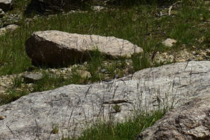
A spotted sandpiper at “North Furlong Lake”. The bird is at the center of the photograph but is difficult to see because its color is so similar to that of the rock it is standing on. I think this is the only water bird I have seen in the Ruby Mountains. It demonstrates the possibility that fairy shrimp eggs could be dispersed into the Ruby Mountains by water birds.
Willows and Rocks Pond (Ruby Mountains Ranger District, Humboldt-Toiyabe National Forest; Ruby Mountains Wilderness)
Willows and Rocks Pond is 250 m (820′) southwest of “North Furlong Lake” in a small meadow at the base of a cliff. Angular rocks on the west side of the pond are likely from a rock fall. The meadow is nearly filled with willows and difficult to cross. On the 7.5-minute quadrangle, Willows and Rocks Pond is less than 30 m (100′) across. I didn’t see a 2nd pond as shown on the map to the west of this pond.
For access, see “North Furlong Lake”.
Elevation: 2,913 m (9,560′)
July 15, 2022
Getting through the willows to reach the pond is a challenge but at least the rocks on the south shore provide some open space. Mosquitoes are bad.
- 20 m x 30 m; probably less than 100 cm deep.
- Water clear; 21 C at 1800.
- No fairy shrimp.
- Black beetle 12 mm long, rare amphipods(?) like those in “North Furlong Lake”, caddisfly larvae (Trichoptera), abundant copepods less than 1 mm long.
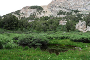
Willows and Rocks Pond, southwest of “North Furlong Lake”, wide-angle view looking east from a big rock.
Toe of Talus Pond (Ruby Mountains Ranger District, Humboldt-Toiyabe National Forest; Ruby Mountains Wilderness)
Toe of Talus Pond is 350 m (1,150′) south of “North Furlong Lake”. It is at the end of a pile of angular boulders forming talus at the base of the cliff to the southwest. Toe of Talus Pond is less than 30 m (100′) across on the 7.5-minute quadrangle.
For access, see “North Furlong Lake”. Rather than fight the willows, I hiked across the rocks at the southwest edge of the little valley from Willows and Rocks Pond to this pond.
Elevation: 2,961 m (9,715′)
July 15, 2022
The vegetation is so lush there must be a stream under the rocks and willows in the little valley with Willows and Rocks Pond and Toe of Talus Pond. Because of the willows, there are only a couple of spots where I can get to the water. Consequently, my observations can’t be considered comprehensive. More annoying mosquitoes. Thank goodness the repellent is working.
- 25 m x 40 m; doesn’t look deeper than 100 cm.
- Clear water; 20 C at 1830 (same as air temperature).
- No fairy shrimp.
- Dragonfly(?) larvae 15 mm long that are narrow at the front and fatter toward the rear and don’t swim much with their short legs, water boatmen (sub-order Heteroptera, family Corixidae), or possibly backswimmers (sub-order Heteroptera, family Notonectidae).
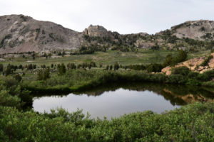
Toe of Talus Pond, looking north from a talus boulder. “North Furlong Lake” is out of sight below the lip on the far side of the pond. That is possibly Mount Fitzgerald above the low spot in the ridge on the far side of North Furlong Creek.
Log Jam Pond (Ruby Mountains Ranger District, Humboldt-Toiyabe National Forest; Ruby Mountains Wilderness)
Log Jam Pond is 400 m (1,310′) southeast of “North Furlong Lake” on a bit of a ledge about 75 m (250′) higher than the lake. The 7.5-minute quadrangle shows the pond as slightly larger than Willow and Rocks Pond and Toe of Talus Pond but still less than 50 m (165′) across. There are numerous logs in the water.
For access, see “North Furlong Lake”. Climbing through the limber pine directly from “North Furlong Lake” would be steeper but easier than following a more gentle, willow-clogged route past Toe of Talus Pond, unless you are coming from Toe of Talus Pond.
Elevation: 2,996 m (9,830′)
July 15, 2022
Was there an avalanche that dropped all these logs in the pond? No clues on the slope above, which has several standing limber pines. Willows are still a problem as I can only get to the water in a couple of places. I can’t walk on the logs because they are floating, as my wet boot proves. Fading light makes it hard to see what’s in the water. At least the thunderstorms have dissipated after a threatening day.
- 50 m x 70 m; depth greater than 100 cm.
- Water clear; 20 C at 1900.
- No fairy shrimp.
- Black beetles; black, oval, 2 mm long, fast swimmers that stay close to bottom and look like ostracods but I saw one come to surface for air, which ostracods don’t do; sparse 2+ mm copepods, snails.
Log Jam Pond, wide-angle view looking south along shoreline with logs. Willows are thick all the way around the pond. Cliff at left rises to Wines Peak.
Above the Trail Pond (Ruby Mountains Ranger District, Humboldt-Toiyabe National Forest; Ruby Mountains Wilderness)
“Overland Lake” Upper Pond map
Above the Trail Pond is 550 m (1,800′) north of “Overland Lake”. The pond is only 100 m (330′) or so southwest of the Ruby Crest Trail north of “Overland Lake” and about 30 m (100′) above it but it cannot be seen from the trail. Above the Trail Pond is a mere speck less than 25 m (80′) across on the 7.5-minute topographic quadrangle.
For access, see “Overland Lake” Upper Pond. Above the Trail Pond is about 100 m (330′) below “Overland Lake” and can be reached from the northwest end of the lake by scrambling down through the limber pine and across a boulder field. Contrary to The National Map, the Ruby Crest Trail, or at least the one used now, does not go north from “Overland Lake”. At the north end of the lake, it turns east toward the trailhead in Ruby Valley and switchbacks down the hill before branching off and contouring to the northwest below Above the Trail Pond.
Elevation: 2,772 m (9,090′)
July 16, 2022
This is another pond surrounded by aggressive willows and I can reach the water in only a few places.
- 60 m x 80 m; probably somewhat deeper than 100 cm.
- Clear water; 20 C at 1800.
- No fairy shrimp.
- Fish.
The fish I saw were mostly less than 6 cm (2.4″) but one jumped out of the water to grab an insect and made a big splash. It seems unlikely they made it down the hill from “Overland Lake” so this implies people are even stocking ponds this small.
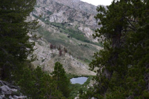
Wide-angle view looking down and to the north at Above the Trail Pond from the edge of a hill north of “Overland Lake”.
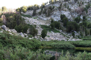
Looking south (wide-angle view) across Above the Trail Pond. Water gurgles down the hill from the vicinity of “Overland Lake” through the boulders with willows but the 7.5-minute quadrangle does not show this route as an outlet for the lake. Even if fish made it down through the boulders, there is no stream through the willows into the pond except maybe during periods of very high water. So the fish in Above the Trail Pond were most likely put here by people. The fish are so small I don’t think anyone would bother to try to catch them so what was the point?
Pika Pond (Ruby Mountains Ranger District, Humboldt-Toiyabe National Forest; Ruby Mountains Wilderness)
Pika Pond is 52 km (32 miles) southeast of Elko at the upper end of South Fork Smith Creek canyon. On the 7.5-minute topographic quadrangle, Pika Pond is 100 m (330′) across. Although the area around the pond is rocky, the willows nonetheless encroach on all sides. This makes the most accessible part of the pond the southern shore of angular boulders. Hiking over the rocks and boulders on the way up to the pond, I frequently heard the characteristic squeaks of pikas. Pika Pond is not in the table of lakes at rubymountains.net.
Pika Pond is about a 4 km (2.5 mile) hike from the Ruby Crest Trail crossing of South Fork Smith Creek. That crossing is 13.2 km (8.4 miles) from the trailhead north of Harrison Pass. Maps have no indication of a trail up the canyon to Pika Pond. However, if you backtrack on the Ruby Crest Trail a short distance from the ford, turn off through the mature aspen grove when the trail starts up the hill, and then follow what looks like the easiest route, you will occasionally find yourself on something that looks like a trail. There may well be multiple, little used game trails up the canyon (use both sides of the creek). Unlike the Middle Fork Smith Creek route, the best route up the South Fork Smith Creek passes through several mostly mature aspen groves, generally lacks the grass that leaves your socks filled with prickly seeds, and has several sections of traipsing through leafy flowers. It can be an enjoyable hike.
Elevation: 3,012 m (9,880′)
July 17, 2022
I started up the canyon on the 13th after the hike to the South Fork Smith Creek crossing but I was too tired and it was too late to make it to the pond. The shorter and easier hike from “Overland Lake” today with little food remaining in my pack was a more favorable opportunity. The problem today is the cloudy skies and frequent rumbling. To my surprise and relief, there were only a few sprinkles.
- 150 m x 200 m; depth probably greater than 200 cm.
- Water is clear with green tint; 18 C at 1500.
- No fairy shrimp.
- Black beetles, water boatmen (sub-order Heteroptera, family Corixidae), 10-12 mm long, mayfly larvae (Ephemeroptera), caddisfly larvae (Trichoptera), abundant 2+ mm copepods.
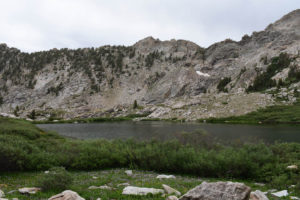
Wide-angle view of Pika Pond, looking east. Willows are thick along much of the shoreline.
Wide-angle view of Pika Pond, looking south with unnamed peak at head of South Fork Smith Creek canyon above. The boulders on the far side provide the best access to the water.
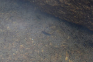
Out-of-focus mayfly larva in Pika Pond at center. It has the 3 filaments at the end of its abdomen which are typical of, but maybe not unique to, mayfly larvae.
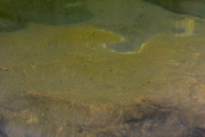
Dark brown copepods swimming below the rippling, reflective surface of Pika Pond.
Box Lake (Ruby Mountains Ranger District, Humboldt-Toiyabe National Forest)
___This map is a screenshot of The National Map (Go to The National Map). The U.S. Geological Survey generally does not copyright or charge for its data or reports (unless printed). A pond location is indicated by an “X”, which corresponds to the coordinates given in the data spreadsheet. Labels in quotations are from 7.5-minute topographic quadrangles.
___Red lines are the U. S. National Grid with a spacing of 1,000 m and intersection labels consisting of the UTM zone (e.g., 11S, 12T), a 2-letter 100-km square designation (e.g., LC, XN), and a 4-digit number. The first 2 digits of the number represent the 1,000-meter Easting and the second 2 digits the 1,000-meter Northing, as seen in the example Easting and Northing. Unlike latitude and longitude, the National Grid is rectilinear on a flat map, the units of abscissa and ordinate have equal lengths, and the units (meters) are measurable on the ground with a tape or by pacing.
___There is no private or state land on this map. All lands are public.
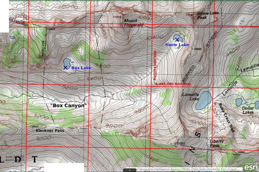
Box Lake is 39 km (23 miles) southeast of Elko and 3,850 m (12,630′) west of the end of the road in Lamoille Canyon. The name Box Lake is not on the 7.5-minute topographic map. However, the name is used by rubymountains.net and may be in general use in the Elko area. Box Lake is at the mouth of a short hanging valley on the north side of Box Canyon. There is a large marshy area east of the lake and the northern shore is heavily vegetated with willows. A couple of rock outcrops on the western shore provide the easiest access to the water.
Box Lake is far from any trail. The closest is the non-maintained Kleckner Creek trail below and west of “Favre Lake”. There is a sign to the trail where the Ruby Crest Trail fords Kleckner Creek. The trail is difficult to follow in places and goes through short sections of thick brush but is otherwise okay. It generally stays well up the hill from the willow-encased creek. The Kleckner Creek trail can be used as the first part of a route over Kleckner Pass to Box Lake.
Kleckner Pass, which is on the ridge between Box Canyon and Kleckner Canyon, is about 2,600 m (8,660′) northwest of the outlet of “Favre Lake”. Hints of a trail up to Kleckner Pass can be seen from the Kleckner Creek trail in the morning light. Crashing through the willows and across the creek to get there is difficult. There are a few boulders with single rocks on top in the meadow north of the creek. These lead to the lower end of the trail up to Kleckner Pass. I lost the trail to the pass about half way up the hill. However, the slope has only sparse brush so making one’s own way is not difficult – it is just steep and slippery.
The descent from Kleckner Pass to the bottom of Box Canyon is facilitated by one or more game (or possibly human) tracks that go northeast from the pass. These trails descend very gradually through mostly pine woodland (easy) but also through some willow thickets (difficult). There are also slopes of grass immediately below a line of steep rock outcrops. After my hike to Box Lake, I decided to go for the grass to stay out of the willows as much as possible on my trip to Snow Lake even though that involved more up and down. As the trail(s) approach the bottom of Box Canyon, turn north and pick a way across the wide meadow and the creek. It is a moderate northwestward climb up to Box Lake from there. The views on the descent from Kleckner Pass allow you to pick your route. The northern slope of Box Canyon below Box Lake is easy going with rocks, grass, a few pines, and very little brush.
An alternative to the trail down Kleckner Creek and then the climb up to Kleckner Pass is to follow the contours from the Ruby Crest Trail a few hundred meters north of “Favre Lake” all the way across the north slope of the canyon to Kleckner Pass. Brush is not a problem. Footing on the moderately steep slope becomes tiresome but is not particularly difficult. A rock slide a few hundred meters (less than 1,000′) wide of very large boulders is the biggest obstacle to an easy hike. Having done both routes, I’m not sure which I would choose if I were to do it again.
Elevation: 2,936 m (9,630′)
July 23, 2024
Hiking in yesterday, I was surprised to see a small frog on the Ruby Crest Trail just below Liberty Pass. NDOW has written that there are Columbia spotted frogs in the Ruby Mountains, as in the Jarbidge, Independence, and Toiyabe Mountains, but didn’t write that they are the only frogs there. I saw more frogs on the trail near “Favre Lake” and along Kleckner Creek today. They were all about the same size with body lengths of 4-5 cm (1.6-2.0″). Their hopping was rather ineffectual as an escape. In most cases that I saw, frogs casually waited until I got rather close. When they finally hopped, they generally didn’t clear the lip of the u-shaped depression of the trail in 1 hop and often slid back toward the middle of the trail. Thick grass and flowers at the edge of the trail could also stymie a 1-hop escape. In thick vegetation, they had a hard time jumping more than 10 cm (3.9″). Ironically, fish-stocking may have been almost as bad for Columbia spotted frogs as it has been for fairy shrimp. The Management section for Columbia Spotted Frogs in the Montana Field Guide stated: “Exotic warm- and cold-water fish have been implicated in the declines and losses of local Columbia Spotted Frog populations in Montana, Oregon, and Idaho.” A U.S. Forest Service report (Patla, D.A., and Keinath, D., 2005, Columbia Spotted Frog (Rana luteiventris formerly R. pretiosa): A Technical Conservation Assessment. Prepared for the USDA Forest Servive, Rocky Mountain Region, Species Conservations Project, 88 p.) cited several references for the statement that “Spotted frog populations are negatively affected by introduced predatory fish”. Frogs are predators of fairy shrimp but the 2 do co-exist at some ponds.
- 95 m x 180 m (based on 7.5-minute topographic map); visually estimated as more than 100 cm deep.
- Water is clear; 21 C at 1145 in 5 cm water.
- No fairy shrimp.
- Amphipods (Crustacea: class Malacostraca, order Amphipoda) about 5 mm long, backswimmers (sub-order Heteroptera, family Notonectidae), water boatmen (sub-order Heteroptera, family Corixidae), black diving beetles, diving beetles with black and white markings, dytiscid larvae (order Coleoptera, family Dytiscidae), caddisfly larvae (Trichoptera), lots of damselflies, lots of flies on surface, frogs.
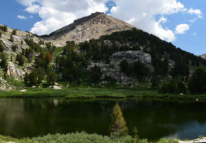
Box Lake with Mount Fitzgerald in the background.
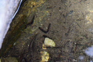
Caddisfly larvae on the bottom of Box Lake. The dark brown tubular objects are caddisfly larvae cases and there are larvae inside. The 2 at center which form an open v shape are wrestling each other head to head. I’ve never seen that before and don’t know what it means.
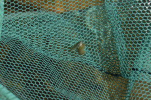
2 amphipods in the net at Box Lake. These 2 amphipods were swimming while attached together. Don’t know if they’re having sex or if the small one is trying to eat the large one, which is curled up. They would probably not be friendly to fairy shrimp.
Snow Lake (Ruby Mountains Ranger District, Humboldt-Toiyabe National Forest; Ruby Mountains Wilderness)
Snow Lake is 1,850 m (6,070′) east of Box Lake and 1,950 m (6,400′) west of the end of the road in Lamoille Canyon. Snow Lake is in a cirque on the southwest side of Snow Lake Peak. It is not named on the 7.5-minute topographic map or The National Map but the name of the peak is strongly suggestive. Rubymountains.net also uses the name Snow Lake. Snow Lake is unusual for the Ruby Mountains in that neither willows nor marsh inhibit access to the water’s edge, at least on the southern shore. There is a remarkable expanse of relatively flat ground with little vegetation south of the lake. The ground has abundant fine material left behind by a glacier’s grinding action. The small puddle shown south of the lake on the 7.5-minute topographic map did not have open water at the time of my 1 visit but the area is wet due to seepage from snowbanks on slopes southeast of the lake and maybe from the lake itself.
There is no trail to Snow Lake. Rubymountains.net described a route from the parking lot at the end of road in Lamoille Canyon over the ridge southeast of Snow Lake Peak. Go to the web site and search for Snow Lake if you are interested. Like Box Lake, Snow Lake can be reached from the Ruby Crest Trail near “Favre Lake” by way of Kleckner Pass (see Box Lake description). It is a moderate climb from the bottom of Box Canyon up through sparse pines and abundant grass and flowers to the lake.
Elevation: 3,097 m (10,160′)
July 24, 2024
There is quite a flower display along the southern shore of Snow Lake with shooting stars, elephantheads, marsh marigolds, cinquefoils, and others. Like the water in many ponds in the Wind River Mountains of Wyoming, the water here is so clear that you have to be careful not to step into it inadvertently. Parts of the bottom are pale silt and clay but there are also boulders scattered around.
- 90 m x 155 m (based on 7.5-minute topographic map); visually estimated as more than 100 cm deep.
- Very clear, slightly greenish water; 17 C at 1115 in 10 cam water.
- No fairy shrimp.
- The aquatic fauna is very sparse but it is diverse: black 1-2 mm copepods, amphipods (Crustacea: class Malacostraca, order Amphipoda), water boatmen (sub-order Heteroptera, family Corixidae), black diving beetles, mayflies and mayfly larvae (Ephemeroptera), caddisfly larvae (Trichoptera), frogs.
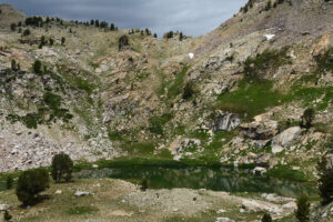
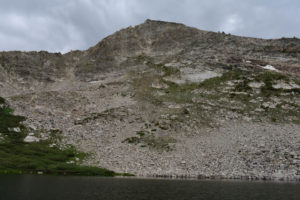
Snow Lake, looking northwest from a snowbank southeast of the lake. Snow Lake Peak is off the photograph at upper right.
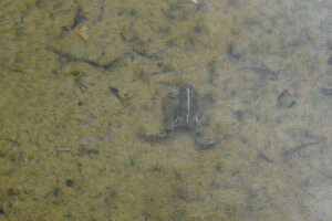
A frog in the water at Snow Lake in what seems to be an ambush posture. Could it catch an amphipod or diving beetle? Have its ancestors prevented fairy shrimp colonization? This frog is definitely spotted but that is probably not sufficient to prove that it is a Columbia spotted frog.
South Wall Kleckner Pond (Ruby Mountains Ranger District, Humboldt-Toiyabe National Forest; Ruby Mountains Wilderness)
South Wall Kleckner Pond is 2,550 m (8,370′) south of Box Lake and 4,900 m (16,080′) southwest of the end of the road in Lamoille Canyon. It is in a wide bowl below wall-like cliffs on the south side of Kleckner Canyon and about 500 m (1,640′) east of the peak with elevation 10,459 feet (3,188 m) on the 7.5-minute map. The pond consists of irregularly shaped, interconnected pools in an elongated marsh above a steep drop off. The pools are separated by heavily vegetated turf dikes. Some of the pools have grassy bottoms and some have bare clay bottoms that look like they may dry out at times. One of the pools has considerable floating algae. Although there are common willows, access to the water is not too difficult.
South Wall Kleckner Pond is about 800 m (2,620′) west of the Ruby Crest Trail but the hiking distance around the marsh below and east of the pond would be more like 1,000 m (3,280′). I picked a route around the south side of the marsh. A route around the north side of the meadow looks easier from above. The climb from the meadow to the pond is steep but poses no serious obstacles.
Elevation: 2,974 m (9,760′)
July 25, 2024
The small, elongated bit of water on the 7.5-minute topographic map is not impressive but at least I can be sure no one has stocked it with fish.
- 30 m x 120 m; visually estimated maximum depth is a good 50 cm deep.
- Water is clear; 19 C at 1100 in 6 cm water.
- No fairy shrimp.
- Backswimmers (sub-order Heteroptera, family Notonectidae), water boatmen (sub-order Heteroptera, family Corixidae), black diving beetles, dragonflies, caddisfly larvae (Trichoptera), snails, frogs.
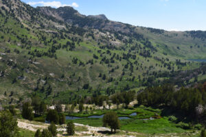
Looking down to the northeast at South Wall Kleckner Pond and across Kleckner Canyon. “Favre Lake” is at far right. Liberty Pass is behind the mountain at upper left.
“Castle Lake” (Ruby Mountains Ranger District, Humboldt-Toiyabe National Forest; Ruby Mountains Wilderness)
___This map is a screenshot of The National Map (Go to The National Map). The U.S. Geological Survey generally does not copyright or charge for its data or reports (unless printed). A pond location is indicated by an “X”, which corresponds to the coordinates given in the data spreadsheet. Labels in quotations are from 7.5-minute topographic quadrangles.
___Red lines are the U. S. National Grid with a spacing of 1,000 m and intersection labels consisting of the UTM zone (e.g., 11S, 12T), a 2-letter 100-km square designation (e.g., LC, XN), and a 4-digit number. The first 2 digits of the number represent the 1,000-meter Easting and the second 2 digits the 1,000-meter Northing, as seen in the example Easting and Northing. Unlike latitude and longitude, the National Grid is rectilinear on a flat map, the units of abscissa and ordinate have equal lengths, and the units (meters) are measurable on the ground with a tape or by pacing.
___There is no private or state land on this map. All lands are public.
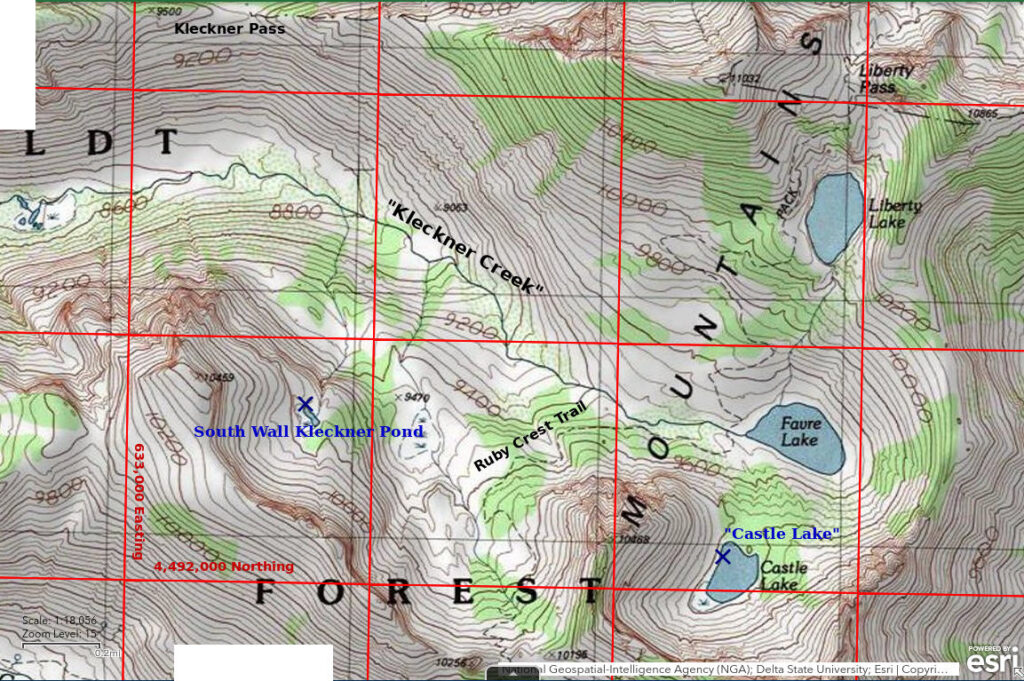
“Castle Lake” is 3,700 m (12,140′) southeast of Box Lake and 4,400 m (14,440′) south-southwest of the end of the road in Lamoille Canyon. “Castle Lake” is named on the 7.5-minute topographic map. It is in a north-facing cirque on the northwest side of Lake Peak. It is probably one of the most scenic lakes in the Ruby Mountains with near vertical cliffs encircling almost 180 degrees of the lake. The shore is marshy and has abundant willows. There is a large bog with a few pools of water at the southwestern end of the lake. Although large, “Castle Lake” does not have fish.
“Castle Lake” is about 9 km (5.4 miles) by trail from the end of the road in Lamoille Canyon. Although there is considerable relief going up and down Liberty Pass, a day hike visit may not be difficult for some people. Just follow the Ruby Crest Trail from the south end of the parking lot to the turn-off to “Favre Lake” west of that lake. There is no need to stop at “Lamoille Lake”, “Liberty Lake”, or “Favre Lake”, which have all been stocked with trout.
“Castle Lake” is a steep climb up from “Favre Lake”. The trail to “Favre Lake” turns southeast off the Ruby Crest Trail a couple hundred meters west of the lake. It leads to a ford near the outlet of “Favre Lake”. A trail has been constructed (maybe by CCC) up to “Castle Lake” but leaves much to be desired. It is not shown on the 7.5-minute topographic map, The National Map, or the 1990 Ruby Mountains Ranger District recreation map. After fording the outlet of “Favre Lake”, bear left (southeast) and pass 2 camp sites with big fire rings. Then start up the hill. The trail leads to the northwest corner of “Castle Lake”, where there is another camp site with a big fire ring. Alternatively, make a sharp left after the ford and follow a trail parallel to the shore for a few hundred meters (less than 1,000′) until reaching another camp site with a big fire ring. From there, there is a faint path almost straight up the hill. It is steep like the other trail but the footing through the pine woodland is far better.
Elevation: 2,985 m (9,790′)
July 26, 2024
“Castle Lake” is surrounded by dense willows but I was able to get to the water at a few places on the northern and western shores. One would expect the southern shore, which is directly below cliffs, would be accessible but a band of willows separates the rock from the water. The water level seems higher than normal because some grass along the shoreline is under a few centimeters of water.
- 170 m x 240 m (based on 7.5-minute topographic map); visually estimated as more than 100 cm deep.
- Clear water; 14 C at 0940 in 4 cm water.
- No fairy shrimp.
- Backswimmers (sub-order Heteroptera, family Notonectidae), water boatmen (sub-order Heteroptera, family Corixidae), black diving beetles, common dytiscid larvae (order Coleoptera, family Dytiscidae) all about 15 mm long, damselflies, caddisfly larvae (Trichoptera), flies on surface, frogs.
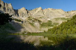
View to south-southwest across “Castle Lake”.
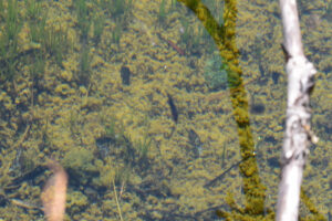
Dytiscid larva in “Castle Lake”. The elongate black object at center is a dytiscid larva swimming faster than the 1/30th-second shutter speed of my camera. These larvae were common and all about the same size.
What Can We Learn from the Ponds in the Ruby Mountains?
Glaciation has blessed the Ruby Mountains with more ponds than other mountain ranges in Nevada. The Ruby Mountains have more than 2 dozen lakes and ponds ranging in size up to 30 acres (12 hectares). These ponds have been available for colonization by fairy shrimp for up to 14,800 years. The colonization rate cannot be determined because most ponds have been stocked with fish within the last 2 centuries.
None of the 12 ponds I visited have fairy shrimp. 2 have fish in spite of areas less than about 1 hectare (2.5 acres). The fish-free ponds I visited do have a variety of macroscopic invertebrates: amphipods, backswimmers, water boatmen, diving beetles of at least 2 kinds, caddisfly larvae, and copepods. Ponds with fish don’t. The absence of fairy shrimp in ponds without fish that I visited suggests they may never have colonized the Ruby Mountains.
Frogs could have played a role in excluding fairy shrimp from Ruby Mountain ponds. Fairy shrimp are more abundant in the Wind River Mountains, which lack frogs, than in the Sierra Nevada, which has frogs. All of the ponds I visited in 2024 had frogs but I didn’t see any frogs or tadpoles in 2022. Lack of frogs in 2022 could have been due to drought or to the frogs’ population cycle. December 2022 through May 2022 precipitation in Elko was 5.6 cm (2.2″) below normal. In contrast, winter 2022-2023, spring 2023, and summer 2023 had above normal precipitation in Elko and winter 2023-2024 precipitation was also above normal.
The Ruby Mountains are a great place to visit for the scenery and the wildflowers but, like the east-central Sierra Nevada, not for fairy shrimp.
