Rhodes Grassy Pools
Rhodes Potholes
Rhodes Big Lake
Winter 2022 Hatching of Fairy Shrimp in Rhodes Potholes
What Can We Learn from the Ponds on Rhodes Salt Marsh?
Rhodes Salt Marsh is in a basin bounded on the west by the Excelsior Mountains and on the east by the Pilot Mountains. The basin connects with the Soda Spring Valley to the north but a rise of the valley floor south of Mina creates a low topographic divide. The Candelaria Hills are to the south of Rhodes Salt Marsh. Redlich Summit to the southeast separates Rhodes Salt Marsh from Columbus Salt Marsh. The salt marsh itself is shown on the 1:100,000-scale BLM map with a stipple pattern approximately 4.5 km (2.7 miles) long and 2.5 km (1.5 miles) wide at its widest. The basin is more like 17 km (10 miles) east-west and 11 km (6.5 miles) north-south.
“Marsh” seems like a misnomer. Rhodes Salt Marsh may be perennially marshy near the “flowing well” on its southeastern edge (as identified on the 1:100,000-scale BLM map) but most of the time most of the floor of the marsh is dry spongy clay that is variously encrusted with minerals formed by evaporation. The floor is definitely not a smooth clay flat like many playas in Nevada. It is similar to Teels Marsh.
The elevation of Rhodes Salt Marsh is between 1,300 m (4,270′) and 1,350 m (4,430′). Edges of the surrounding mountains are close to, or above, 1,500 m (4,920′). To the west, Moho Mountain is at an elevation of 2,684 m (8,810′) while the Candelaria Hills to the south rise to only 1,963 m (6,440′). The highest elevation in the Pilot Mountains to the east is 2,799 m (9,180′).
Vegetation is generally absent from the marsh itself but the marsh is surrounded by sparse desert scrub. Water from the “flowing well” supports grassy vegetation over about 12 hectares (30 acres) in the southern part of the marsh (as seen on the USGS imagery for The National Map). There is one tree or large shrub near the well.
There is a large block of private land covering the eastern tip and the southeastern edge of the stipple pattern on the 1:100,000-scle BLM map. There is also a 320-acre (130 hectares) block of private land in the north-central part of the stipple pattern. There are other blocks of private land north of the playa and among the sand dunes west and southwest of the playa. Otherwise, the land is public and managed by the Stillwater Office of BLM. Property boundaries are not marked on the ground.
US 95 passes less than 400 m (1,310′) west of the salt marsh. A dirt road turns east off the highway about 3/4 mile north of the junction of US 95 and Nevada 360. The dirt road proceeds about 200 m (660′) to a disturbed area with much wooden and metal debris, a pile of dirt, and a pile of white mineral(s). This location is labeled “Rhodes (site)” on the 7.5-minute topographic quadrangle. A vehicle track leading to the north from this location is the old Southern Pacific railroad grade. A much degraded causeway extends from the railroad grade northeastward into the central part of the playa. Parking at the railroad grade is recommended. The causeway is better negotiated on foot.
There is an inconspicuous, short, square, concrete historical marker near the highway at the turn-off from US 95. According to the marker, salt was shipped from Rhodes Salt Marsh to Virginia City, a mining town near present Reno, in the 1860-1880 period. The disturbed area near the railroad grade was probably the loading point for the salt.
Rhodes Grassy Pools (Stillwater BLM Office)
___This map is a screenshot of The National Map (Go to The National Map). The U.S. Geological Survey generally does not copyright or charge for its data or reports (unless printed). A pond location is indicated by an “X”, which corresponds to the coordinates given in the data spreadsheet. Labels in quotations are from 7.5-minute topographic quadrangles.
___Red lines are the U. S. National Grid with a spacing of 1,000 m and intersection labels consisting of the UTM zone (e.g., 11S, 12T), a 2-letter 100-km square designation (e.g., LC, XN), and a 4-digit number. The first 2 digits of the number represent the 1,000-meter Easting and the second 2 digits the 1,000-meter Northing, as seen in the example Easting and Northing. Unlike latitude and longitude, the National Grid is rectilinear on a flat map, the units of abscissa and ordinate have equal lengths, and the units (meters) are measurable on the ground with a tape or by pacing.
___Gray shading represents private land as traced from the PAD-US 2.0 – Federal Fee Managers layer of The National Map. Other lands are public.
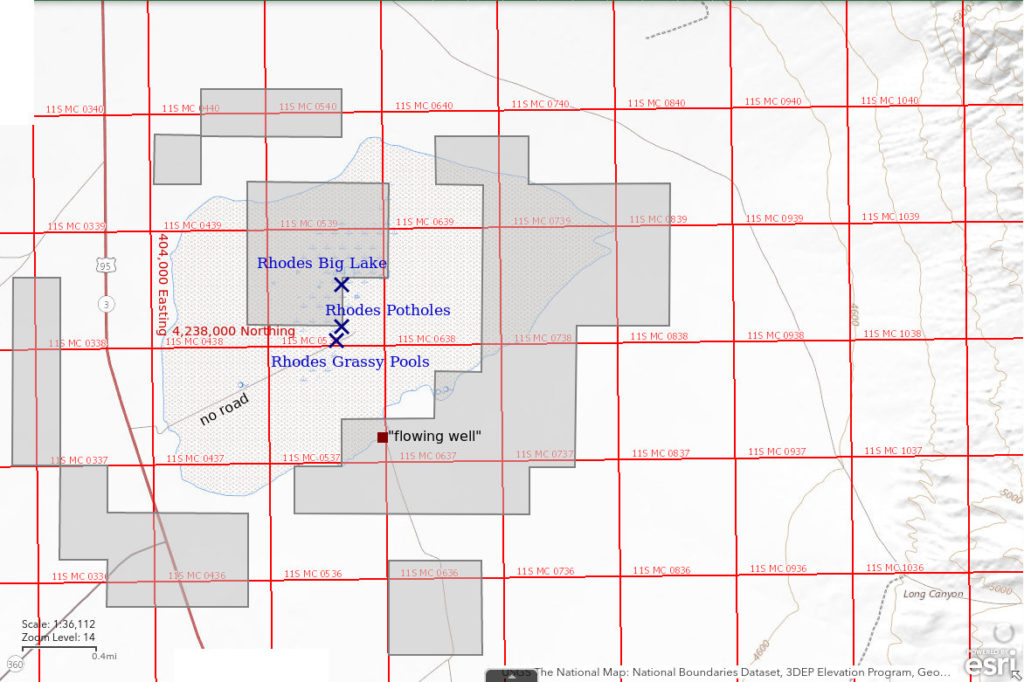
Rhodes Grassy Pools are in the south-central part of Rhodes Salt Marsh 12 km (7 miles) south of Mina. They are extensive, grassy, shallow pools of water about 2.0 km (1.2 miles) northeast of the area of junk by the railroad grade. On The National Map aerial imagery, there is a grassy area about 600 m (1,970′) long (south-southeast to north-northwest) and 350 m (1,150′) wide that extends from the “flowing well” at the south edge of the salt marsh to within about 50 m (164′) of the causeway. My GPS coordinates indicate some of the pools are outside the grassy area on the imagery and closer to the causeway. On the ground, it looks like individual ponds are up to about 50 m (164′) across but the extent of the interconnections is not readily apparent. During high water, such as on January 14, 2022, many of the ponds merge and water may cover most of the grassy area on the imagery. A small, slow-flowing outlet channel winds out of the grassy pools, loops around the northeast margin of the Rhodes Potholes area, and connects to Rhodes Big Lake. The abundance of grass along the outlet diminishes until disappearing entirely north of Rhodes Potholes. A white mineral efflorescence coats the soil adjacent to the pools.
Rhodes Grassy Pools are easily accessed from US 95. The road into the center of the playa shown on the 1:100,000-scale BLM map is the remains of a gravel causeway that previously carried railroad tracks. A few railroad ties, which have been split and shredded by crystallizing minerals, remain. There is also widely scattered angular gravel which must have been hauled in. The causeway now has ruts and almost no relief. There are vehicle tracks on the causeway and on the adjacent playa but the ruts and vehicle wallows indicate that driving anywhere on the marsh is not a good idea. When dry, the playa surface is popcorn clay with unpredictable cavities and uncertain traction; it is softer than walking across sand dunes. When wet, it is very sticky and possibly bottomless mud. Compaction on the causeway does make hiking to Rhodes Grassy Pools easier than hiking on the salt marsh, unless the ruts are muddy.
Elevation: 1,322 m (4,335′)
March 26, 2019
This large extent of water is a surprise as no water is visible from a distance due to the absence of relief. There are even ducks.
- Individual ponds less than 50 m across; depth not estimated.
- Cloudy pale brown.
- No fairy shrimp.
- Backswimmers (sub-order Heteroptera, family Notonectidae), ducks.
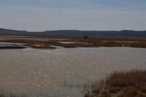
View southeast across Rhodes Grassy Pools with abundant water among many interconnected ponds. The lone tree in the distance is close to the “flowing well”.
April 7, 2021
There is ice on the surface of the ponds. The water is clear to a depth of 5 cm or more at the edges of the ponds.
- Ponds close to causeway up to 30 m across; depth maybe up to 20 cm in spots.
- Murky pale brown to orange-brown water; extensive thin ice before 0900.
- No fairy shrimp.
- Netted common backswimmers (sub-order Heteroptera, family Notonectidae) less than 10 mm long; rare caddisfly larvae (Trichoptera), ducks
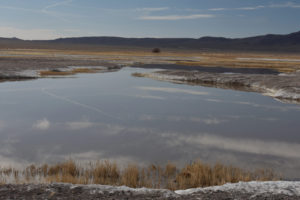
View southeast across Rhodes Grassy Pools with water less abundant than in 2019.
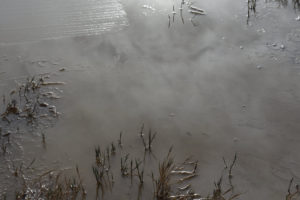
Looking into the water at Rhodes Grassy Pools. There are 2 dark, elongate objects below and to the right of center; the one on the left is a caddisfly larva (Trichoptera) in its case with tracks in the mud behind it and the one on the right is a bit of twig. There is a large ice crystal on the water at upper left.
January 14, 2022
The mud was surprisingly firm on the hike in but with soft mud below the mineral crust in places. The pools are much bigger than what I had seen before. The grass (all brown) is now all within the water and there are puddles on the playa around the periphery of the grassy pools. Dimensions of individual pools are meaningless as most pools are contiguous. The whole mass of water is well over 200 m across.
- Greater than 200 m; depth uncertain.
- Generally clear water, about half of which is covered by ice mostly less than 2 mm thick; 7 C at about 1 cm depth at 1100 in sun.
- No fairy shrimp.
- Caddisfly larvae (Trichoptera) quite active; gulls
Rhodes Potholes (Stillwater BLM Office, private)
Rhodes Potholes are in a disturbed area of the playa north of the causeway and Rhodes Grassy Pools. There are numerous, small, irregular depressions, piles of dirt, scattered railroad ties, and other junk. The disturbance does not look like the result of salt mining as salt is usually collected by evaporation from very large, diked ponds. It may be the result of exploring for, or attempting to mine, other minerals below the surface of the salt marsh. Individual potholes are connected at high water levels but become isolated as the water level drops. Once isolated, most of the potholes likely dry up during the summer. This leaves precipitated minerals on the dirt. The Potholes are tortuously connected to Rhodes Big Lake. During high water on January 14, 2022, most of the potholes were interconnected and some were connected to the outlet of Rhodes Grassy Pools.
Some of the Rhodes Potholes are likely on private land and some are likely on public land but there are no signs or fences to indicate the boundaries. Generally, the farther north the pothole, the more likely it is to be on private land. In any case, the mud makes reaching the northern potholes difficult.
For access, see Rhodes Grassy Pools. The disturbed area of Rhodes Potholes is visible from the causeway by Rhodes Grassy Pools. To visit individual potholes, work your way north over patches of drier ground from the causeway. In some cases, you may be able to use a railroad tie or other bit of wood to get across wet spots.
Elevation: 1,321 m (4,335′)
March 26, 2019
Another surprise after finding Rhodes Grassy Pools. This area has been completely trashed (decades or maybe a century or so ago). The garbage is helpful though. Walking among the potholes is difficult due to the soft mud so the salt-frayed woody or metal debris come in handy as stepping stones. The disturbance is a boon for fairy shrimp, too, as water depths in the potholes are greater than on a flat playa and deeper water takes longer to evaporative. This is an advantage compared to typical playas, like Smith Creek Valley.
- Individual ponds less than 10 m across; mostly less than 30 cm deep but some may be 50 cm deep.
- Most of the ponds have clear water and mineral crystals at the edges of the water; some are pale brown and some are colored with minor green algae or cyanobacteria.
- At least 4 ponds have pale gray fairy shrimp, several more do not; there are 2 size classes of fairy shrimp, both smaller than 15 mm; some ovisacs contain white masses of very small eggs.
- No other aquatic animals seen.
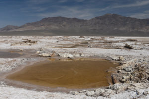
The disturbed area of Rhodes Potholes with the Pilot Mountains in the distance. Some of the debris are clearly railroad ties.
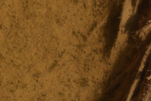
Fairy shrimp in Rhodes Potholes. The trash and chaotic digging paid off – there are fairy shrimp. Female with round gray ovisac below and left of center and another one with 2 whitish spots on ovisac to right of center. Their shadows are to the left of the fairy shrimp. Both females appear to have legs rearward of the ovisac, which is impossible. The extra legs belong to males hanging on below.
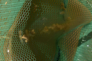
Fairy shrimp from Rhodes Potholes in various poses in the net. Female in sunlight at left has male attached below its whitish-gray ovisac. Legs adjacent to the female’s abdomen indicate a male below. Similarly, the extreme length of the intestine with pale food is the result of the male’s intestine superposed below the female’s. In the shadow to the right of the sunlit pair, there appears to be another pair viewed from the side with the smaller male to the right of the female.
The fairy shrimp in Rhodes Potholes appear to be of the genus Artemia (the same genus that lives in Great Salt Lake and Mono Lake) because the females have bulbous ovisacs and several female-male pairs remain attached while swimming. This was always the case with Artemia that I saw in Wyoming and that were identified by Denton Belk (BTANSD). Artemia species are restricted to waters with high TDS and the extensive mineral crusts at Rhodes Potholes is good evidence that the water has high TDS.
April 7, 2021
The winter and spring have been dry so this is likely too late if the potholes are from snowmelt. It is also worrying that there are large, colorless, translucent, and often tabular mineral crystals in the mud at the edges of the potholes and buoyed on the water surface by surface tension. This indicates an advanced stage of evaporation.
- Individual ponds up to 20 m across (the somewhat firmer mud allowed me to pace off a few, unlike in 2019); all probably less than 50 cm deep.
- Clear, yellow-brown to orange-brown water.
- Pale gray fairy shrimp of 2 size classes: about 10 mm long and less than 10 mm.
- Didn’t see other aquatic animals.
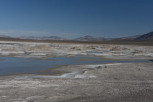
Rhodes Potholes, looking north from the top of a pile of dirt adjacent to the causeway. Gabbs Valley Range is in the distance and the foot of the Pilot Mountains is at far right. The low rise between here and Soda Spring Valley is in the middle distance. Rhodes Big Lake is barely visible at upper left.
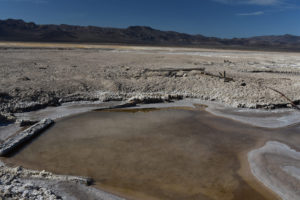
A Rhodes Pothole that has fairy shrimp. This is looking southwest toward the junction of US 95 and Nevada 360 with the Candelaria Hills in the background. This may be the same pothole as the one in photograph Rhodes Potholes 2019-03-26, #09, but looking in the opposite direction. Rhodes Grassy Pools are in the middle distance at left. The yellow is dry grass.
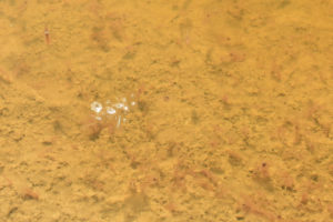
Numerous fairy shrimp in Rhodes Potholes. The contrast of the photo has been increased to make the pale round ovisacs more visible, as at upper left. Some ovisacs are dark. Intestines are dark near the heads and pale along the abdomens and appear in the photo as short straight lines. Some females have attached males and some do not. The bright reflections to the left of center are from mineral crystals on the surface of the water.
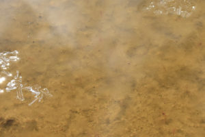
Mineral crystals (far left, upper right) on the water surface of a Rhodes Pothole. The shapes of the crystals indicate they are not table salt (i.e., halite, or sodium chloride). There are many almost invisible fairy shrimp. The obvious black specks are not fairy shrimp eyes but the really tiny black specks just to the right of center are. The photo contrast has been increased to make the short dark intestines more apparent but without much success. Right-click and open the photograph in a new tab and then enlarge it for better luck seeing the fairy shrimp.
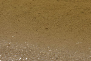
Minerals in the mud of a Rhodes Pothole. Like the floating minerals, this indicates the water has very high TDS. There are several fairy shrimp swimming in the water. Their small, gray, fuzzy bodies obscure the granular texture of the pond bottom and cast dark shadows if they are far enough above the bottom of the pond.
Given that the evaporation of the water has advanced to the point of saturation for some evaporite mineral, there may not be many days left for these fairy shrimp. Nonetheless, this is the habitat they are adapted to and almost no other order of animals is. Whatever trials and tribulations may befall individual fairy shrimp, this ecological strategy has assured the long-term survival of the order Anostraca.
January 14, 2022
While Donner Pass in the Sierra Nevada got record snowfall in December, western Nevada also got a substantial amount of snow and rain. Can the fairy shrimp in Rhodes Salt Marsh buck the frigid weather and take advantage of the water while it lasts? No snow remains on the playa but there is plenty of water. So many potholes are merged that size estimates are meaningless. Moreover, I can now see a direct connection from the outlet of Rhodes Grassy Pools into the potholes. in the other direction, the northern potholes are now within embayments of Rhodes Big Lake. The presence of caddisfly larvae in the southern tier of potholes connected to Rhodes Grassy Pools may be another indication of low-TDS inflow from Rhodes Grassy Pools. I didn’t see caddisfly larvae here before. Will all this water make the TDS too low for the fairy shrimp to hatch? On the other hand, there are flies, presumably alkali flies, congregated along the shores of some potholes. Streaks of algae have been blown up against the shorelines. Ice is absent although it was still melting on Rhodes Grassy Pools a little while ago.
- Greater than 50 m across; maximum depths more than 50 cm.
- Generally clear water locally colored to shades of orange; 13 C at 1230 but earlier measured 10 C in sun at less than 2 cm depth and icy Rhodes Grassy Pools were 7 C at 1100.
- Very pale mostly pinkish fairy shrimp of 2 size classes: 10 mm or somewhat less and rarely about 5 mm; fairy shrimp are not common and most males are swimming alone but all the females I saw have males hanging on; bulging whitish ovisacs suggest the presence of eggs.
- Flies (alkali flies?); rare caddisfly larvae (Trichoptera).
They did it. In spite of the cold and the possibly low TDS, the fairy shrimp of Rhodes Salt Marsh hatched and are already producing eggs in the middle of January. These guys are tough. Given that they were still alive on a warm April 7, 2021 when the water was precipitating minerals, they are also adaptable in the extreme.
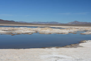
Looking north across Rhodes Potholes with Rhodes Big Lake at upper left. The photo is taken from the same location as Rhodes Potholes 2021-04-07, #03, but is turned more to the west (left). Gabbs Valley Range is in the distance.
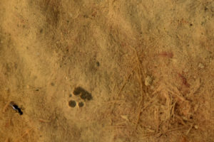
Pale pink fairy shrimp in Rhodes Potholes at upper right and possible alkali fly at lower left. The fairy shrimp lacks an ovisac so it is probably male. The apparently fat head may be due to male antennae II.
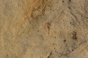
Male fairy shrimp in Rhodes Potholes. The shadow to its right reveals the angular shape of its antennae II, which is consistent with identification as the genus Artemia (BTANSD).
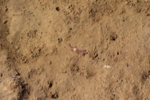
Paired fairy shrimp in Rhodes Potholes. The male is below and to the left of the whitish ovisac and the female is to the right. The bulging ovisac and the attached male suggests the fairy shrimp have reached sexual maturity.
Rhodes Big Lake (Stillwater BLM Office, private)
During wet years, Rhodes Big Lake might occupy the entire 2.5 km by 4.5 km (1.5 x 2.7 miles) area of the salt marsh shown by the stipple pattern on the 1:100,000-scale BLM map. In most years, it covers only part of the north-central part of the salt marsh, north of Rhodes Potholes. Most of the north-central part of the playa is private land. How often Rhodes Big Lake dries up completely is an open question.
For access, see Rhodes Grassy Pools. I haven’t been able to get to Rhodes Big Lake from Rhodes Potholes although that would be the most direct route. Instead, continue along the causeway to the northeast from Rhodes Potholes. At the outlet of Rhodes Grassy Pools, assess your chances. The outlet stream may be only a couple of steps across but the bottom mud may be deep. On April 7, 2021, I was able to cross on a plank I found but I didn’t chance it in January 2022. Once across the outlet, turn north and then swing to the northwest to reach the east end of Rhodes Big Lake.
Elevation: 1,321 m (4,335′)
March 26, 2019.
I angled off the causeway after a km or so because I thought I saw water but the crunchy popcorn clay became damp and then there was soft mud everywhere. Balance was difficult and the mud was very sticky. I got that sinking feeling and decided to back out. I couldn’t even get close enough to be sure it was water I saw and not a mirage or just differently colored dirt. Comparing the photos to what I saw in 2021 has convinced me the lake was there on this day too.
- Big; depth unknown.
- Clarity unknown.
- Presence of fairy shrimp unknown.
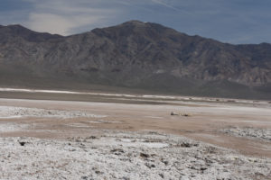
Looking northeast across Rhodes Big Lake toward Pilot Mountains. The darker surface in the middle distance is the water.
April 7, 2021
This time I found a way to the lake by crossing the Rhodes Grassy Pools outlet east of Rhodes Potholes on a plank. The lake has an irregular shoreline and uncertain dimensions as viewed from ground level but is clearly very large.
- Probably greater than 300 m across, possibly greater than 500 m; depth probably up to 50 cm but could be deeper if there are excavations like Rhodes Potholes.
- Clear orange-brown water without the mineral crystals seen in Rhodes Potholes today.
- Very pale fairy shrimp mostly less than 10 mm but some about 10 mm; not as common as in Rhodes Potholes but that is probably because of the larger water volume.
- Ducks, avocets, killdeer, large wading birds with long bills, and 1 gull; most ducks are paddling around far from shore but some are walking along the shoreline and dragging their bills back and forth through the water as if feeding on fairy shrimp.
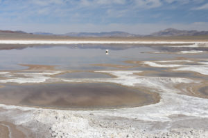
Looking north across the transition from Rhodes Potholes to Rhodes Big Lake, Gabbs Valley Range in the distance. White objects in the water are the mineral-encrusted tops of wooden posts. A few avocets and ducks are near the far shore. I didn’t venture closer to the lake from here; I went around the northeastern side of Rhodes Potholes.
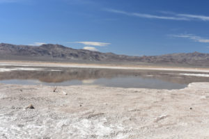
Looking southwest across Rhodes Big Lake toward the junction of US 95 and Nevada 360 with the Candelaria Hills in distance at left and Excelsior Mountains at right. Dark specks on the water are ducks.
Winter 2022 Hatching of Fairy Shrimp in Rhodes Potholes
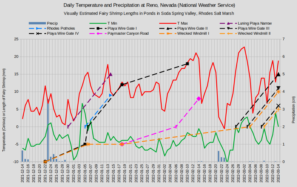
Fairy shrimp lengths are indicated by the dashed lines where 0 lengths are on the inferred days of hatching. The vertical dash symbol indicates a calculated length. From hatching to 15 mm length, the growth rate is assumed to be 1 mm/day.
-10 fairy shrimp lengths mark the date when solid ice filled the ponds.
-5 fairy shrimp lengths mark dates when fairy shrimp were not observed.
The approximate median lengths of the 2 size classes of fairy shrimp I observed on January 14 in Rhodes Potholes were 9 mm and 6 mm. If the fairy shrimp grew 1 mm/day following hatching, they would have hatched on January 5 and on January 8, respectively. The older generation I hatched at about the same time as generation I in Playa Wire Gate Pond (Soda Spring Valley), at about the same elevation and 35 km (22 miles) to the northwest, and generation I in Stinking Springs Well Pond (Rawhide Flats). This was during a period of rising temperature following the New Year’s cold snap. Generation II (not shown on the graph above) hatched a few days later as temperatures were falling. Alternatively, the lengths may not be bimodal and fairy shrimp hatched over a range of a few days starting near January 5.
Artemia monica eggs generally don’t hatch until water temperatures rise above 5 C (Jones & Stokes Associates, 1993b) and Artemia franciscana disappears from Great Salt Lake in the fall at water temperatures below 6 C (Pennak, 1978, p. 336; see the References page). The water temperature was likely above 5 C when Rhodes Potholes generation I hatched. On January 14, the temperature in one of the Rhodes Potholes was 13 C at 1230. The maximum water temperatures on January 4-7 were probably at least 13 C because the high and low temperatures on those days in Reno were higher than those on January 14.
Generation I in Rhodes Potholes matured in as little as 10 days in spite of the cold. Even if they had hatched with pond filling on December 24, they produced eggs in less than 21 days. Artemia monica (in Mono Lake) matured in 60 days under cool spring conditions according to Jones & Stokes Associates (1993b, p. J-2) while Pennak (1978, p. 336) reported Artemia franciscana matured in 18 days in laboratory experiments.
For further discussion, see “Winter 2022 Fairy Shrimp Hatching History in Soda Spring Valley and Rhodes Salt Marsh” on the Soda Spring Valley page.
What Can We Learn from the Ponds on Rhodes Salt Marsh?
Populations of Artemia occur at 2 locations on Rhodes Salt Marsh. Artemia is restricted to waters with high TDS and there is good evidence for high-TDS water at Rhodes Salt Marsh: mineral-encrusted soil and, at times, the presence of delicate, euhedral mineral crystals on shoreline mud and floating in the water.
The genus Artemia was identified based on ovisacs which are small and have bulbous forms, male antennae II which are angular rather than elongate, and the persistent clasping of females by males.
The fairy shrimp at Rhodes Salt Marsh live over a wide range of temperature and TDS from cool January to warm April, at least, and from water with input from a flowing well, albeit of unknown TDS, to water precipitating minerals.
The presence of an Artemia species at Rhodes Salt Marsh raises the question of whether or not it is Artemia monica. Artemia populations of western North America are the species Artemia franciscana except for those in “Mono Lake” (e.g. Ruebhart and others, 2008; see the References page), which happens to be 80 km (50 miles) from Rhodes Salt Marsh. Gulls could have transported A. monica eggs to Rhodes Salt Marsh. However, A. monica does not tolerate water with chemical compositions that differ much from those of “Mono Lake” (Eng, Belk, and Eriksen, 1990). Maybe the chemical composition of the water on Rhodes Salt Marsh is too different, maybe not.