Stinking Springs Well Pond
Winter 2022 Fairy Shrimp Hatching History on “Carson Lake” Playa and Rawhide Flats
What Can We Learn from the Ponds on Rawhide Flats?
Rawhide Flats is a northwest-trending valley between the Terrill Mountains to the southwest and the White Sand Mountains and Barnett Hills to the northeast. It ends against the Desert Mountains to the west and the southeast end is cut off by the Gabbs Valley Range. The valley is about 30 km (19 miles) long and 10 km (6 miles) wide. The 1:100,000-scale BLM map has a small area of stipple pattern on a drainage near the southeast end of Rawhide Flats on the Walker River Paiute Reservation. The western end of the Flats east of US 95 has extensive areas of mud flat with no brush but there are no stipple patterns on the BLM map.
Elevations are about 1,200-1,300 m (3,940-4,270′).
What little vegetation there is, is desert scrub.
Rawhide Flats is almost entirely within the Walker River Paiute Reservation or the Navy’s Fallon Range Training Center Bravo-19 bombing and helicopter gunnery range (U.S. Department of Navy, 2020 for final environmental impact statement; see the References page). The small area of Rawhide Flats north of the Walker River Paiute Reservation and west of the bombing range is public land managed by the BLM’s Stillwater Office in Fallon.
Stinking Springs Well Pond (Stillwater BLM Office)
___This map is a screenshot of The National Map (Go to The National Map). The U.S. Geological Survey generally does not copyright or charge for its data or reports (unless printed). A pond location is indicated by an “X”, which corresponds to the coordinates given in the data spreadsheet. Labels in quotations are from 7.5-minute topographic quadrangles.
___Red lines are the U. S. National Grid with a spacing of 1,000 m and intersection labels consisting of the UTM zone (e.g., 11S, 12T), a 2-letter 100-km square designation (e.g., LC, XN), and a 4-digit number. The first 2 digits of the number represent the 1,000-meter Easting and the second 2 digits the 1,000-meter Northing, as seen in the example Easting and Northing. Unlike latitude and longitude, the National Grid is rectilinear on a flat map, the units of abscissa and ordinate have equal lengths, and the units (meters) are measurable on the ground with a tape or by pacing.
___There is no private land on this map.
___Pink shading represents public land controlled by the Department of Defense.
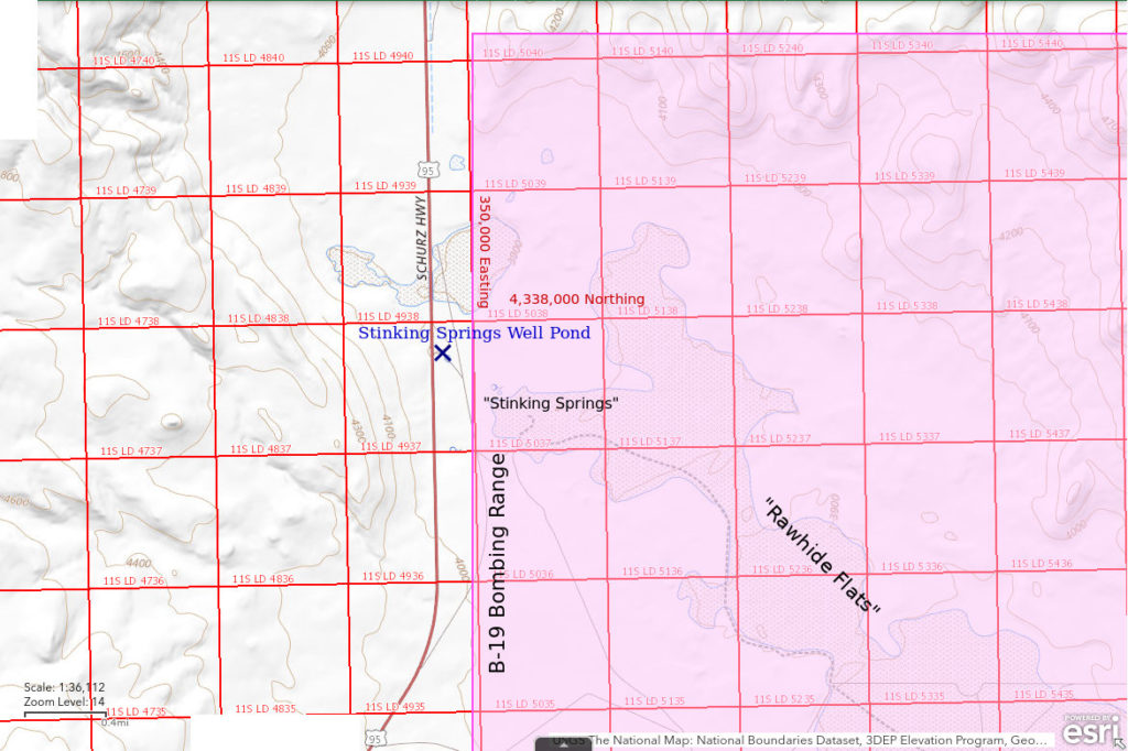
Stinking Springs Well Pond is near the northwestern end of Rawhide Flats about 33 km (20 miles) south of Fallon. The pond is on the east side of US 95 500-600 m (1,640-1,970′) northwest of Stinking Springs. It is on a clay flat among sandy hummocks that collects water even though The National Map (above) shows stippled areas to the north and southeast rather than here. A convenient landmark is a large, rusty, horizontal water tank next to the old well at the northeast corner of the clay flat. A new well has been drilled west of the pond on the west side of the barbed wire fence along US 95. The new well is inconspicuous as only a small part of the casing protrudes from the ground.
Because of the tank and old well, there is a non-paved ramp from US 95 to the pond. This ramp is 3.6 miles south of the turn-off to the Churchill County dump. There is a wire gate through the barbed wire highway fence but there is no need to drive through it toward the old water tank. The pond is right there. If there is water in Stinking Springs Well Pond, it is visible from the highway.
Due to the proximity of the pond to the bombing range, it is important to know where the location of the bombing range boundary is. I stopped at the new well when I saw someone working there during a period of highway construction along US 95. He told me that he thought the highway fence was the bombing range boundary because construction workers were forbidden from going east of the fence and were told not to even venture east of the toe of the highway fill. However, there are no signs of any kind attached to the highway fence or the wire gate. The bombing range boundary south of US 50 on Labou Flat (Fairview Valley) has frequent warning signs.
According to The National Map, the section line that marks the boundary of the bombing range is 315 m (1,030′) east of the highway shoulder whereas the highway fence is less than 50 m (160′) from US 95. About 3 km (2 miles) south of the pond, the main access road to the bombing range meets US 95. On the access road, there is a range-bounding fence far east of the highway fence, which curves to the west with the highway. It has a prominent gate with lots of warning signs. The easting at the gate is 349,940 m, which is about 70 m (230′) east of the east edge of the pond, which has an easting of about 349,870 m. In this area, section lines are angled slightly east of grid north so the distance from the pond to the bombing range boundary is more than 100 m (330′), as also indicated by The National Map.
Elevation: 1,190 m (3,905′)
March 31, 2019
Didn’t have my camera but I did take notes for this stop. There is water in scattered puddles that don’t cover the mud flat. Locally sandy ground and brush hummocks allow close approach to the water.
- Irregular ponds less than 5 m across but up to 20 m long; less than 8 cm deep.
- Opaque pale brown water; molds of ice crystals in mud at edge of water.
- Numerous dips of the net snared only one large female fairy shrimp about 25 mm long with a narrow, egg-filled ovisac almost as long as the abdomen and one male about 20 mm long.
- Abundant, small, water boatmen (sub-order Heteroptera, family Corixidae); 2 avocets; several killdeer.
January 13, 2022
Driving by in the morning, I noticed a lot of water in the area of the pond. I expected it to be mostly ice but stopped anyway. Sure enough, the entire pond was covered by ice, which was 5 mm thick where thinnest. The water temperature was 2 C below the ice but that was where it was only about 2 cm deep. On the way back in the afternoon, I stopped again, driven by WIDLA. Essentially all the ice is gone and the water temperature is up to 7 C. At least now I can use the net. The pond seems to be part of a network of connected puddles. There is water flowing into it through the north arm.
- Very irregular shape and about 50 x 100 m excluding various connected puddles; 12 cm deep in northern arm in afternoon.
- Cloudy to opaque pale brown water; ice covers 2 C water at 0900, 7 C in afternoon with no ice.
- Pale mostly 12-15 mm fairy shrimp but uncommon fairy shrimp less than 10 mm; larger fairy shrimp have eggs.
- Water boatmen (sub-order Heteroptera, family Corixidae) greater than 10 mm.
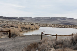
View to northeast through gate in highway fence across Stinking Springs Well Pond toward Blow Sand Mountains on the bombing range in the distance. The dark brown water tank next to the original well is in the middle distance on the far side of the pond.
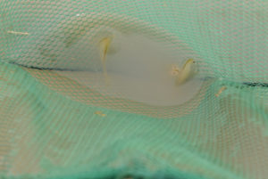
Fairy shrimp from Stinking Springs Well Pond caught in the net. They are blurry due to the long 1/40-second exposure time.
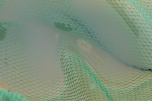
Male fairy shrimp from Stinking Springs Well Pond in net. The barely visible antennae II are almost as long as the leg-bearing thorax and cross at about 2/3 of the way down the thorax. The thinner distal segments are about as long as the basal segments.
I’m inclined to name these fairy shrimp Branchinecta honeybadgerensis. Water temperature less than 5 C? B. honeybadgerensis don’t care. They hatch anyway. Home covered by more than 5 mm of ice every night? B. honeybadgerensis don’t care. They keep swimming. Large daily temperature changes? B. honeybadgerensis don’t care, they just make more eggs. Water so opaque you can’t see more than 1 cm? B. honeybadgerensis don’t care. They keep their legs pointing up and scarf up more bacteria and phytoplankton (can phytoplankton even proliferate in freezing, opaque water?). As I enjoy a heated vehicle on the drive home, B. honeybadgerensis don’t care. It’s just another day for them.
February 9, 2022
I had to come back to see how these unassuming argonauts are doing. The water has receded a little along the shorelines but the overall size is nearly as big as a month ago. There evidently hasn’t been much evaporation or sublimation. For the fairy shrimp, extension of the pond’s duration may compensate for the near-freezing cold.
- about 50 x 100 m; depth mostly less than 5 cm but up to 15 cm deep in spots.
- Opaque pale brown water; minor ice under bushes at 1630.
- Fairy shrimp of various sizes 10-25 mm long; larger fairy shrimp have eggs.
- Water boatmen (sub-order Heteroptera, family Corixidae) 10 mm long and smaller.
A female fairy shrimp with ovisac full of pale eggs in Stinking Springs Well Pond. This is one of the larger fairy shrimp.
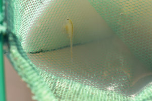
A large male fairy shrimp in Stinking Springs Well Pond. The antennae II to the left of the body are at least 3/4 the length of the thorax.
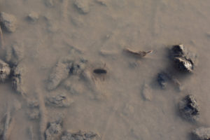
Stationary water boatman (sub-order Heteroptera, family Corixidae) in Stinking Springs Well Pond. There is barely enough water to cover the animal and it isn’t moving so its oar-like legs are not just a blur. Its head is at the right end. Clearly, water boatmen can handle the icy nights and are just as tough as the fairy shrimp. Fortunately, they are not predators.
February 23, 2022
After the recent cold snap (Reno highs dropped from 15.6 to 1.1 C and lows from -1.7 to -5.6 C from February 20 to 22), I decided to stop by and see what’s going on with B. honeybadgerensis. The water is lower and has pulled back some from the edges. About half is still covered by ice up to 7 mm thick in mid-afternoon. Temperatures of 3 C and 7 C were measured in 2 locations in 1-2 cm water in the sun. The air temperature is chilly and cold enough, with the breeze, to freeze water droplets on the net when I take it out of the water. That’s a new twist on my latest winter sport.
- 40 x 90 m; depth mostly less than 5 cm but 9 cm deep in spots.
- Opaque pale brown water; extensive ice, 3 C and 7 C at 2 locations at 1500.
- Few fairy shrimp with most 20-25 mm and at least one 12 mm long; minority of larger fairy shrimp have eggs.
- Water boatmen (sub-order Heteroptera, family Corixidae) too fast to estimate size; possible copepods seen in video.
A fairy shrimp swimming along the edge of the ice in Stinking Springs Well Pond. The edge of the ice is not really visible in the photograph but it extends across the upper part of the photograph and can be recognized by the presence of tiny air bubbles. The 2 black eyes of this fairy shrimp are at left and an ovisac full of eggs at right. So, yes, B. honeybadgerensis carries on in spite of the cold.
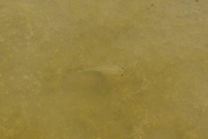
A fairy shrimp swimming above abundant algae on the bottom of Stinking Springs Well Pond. This algae more or less answers my question of January 13 (above) about the viability of phytoplankton at this time of year even though it appears to be growing from the bottom and, consequently, is not plankton. This algae seems to be filamentous and may not be easy for fairy shrimp, as filter feeders, to eat.
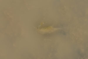
Side view of male fairy shrimp in very shallow water at edge of Stinking Springs Well Pond. The right-side antenna II has a fat, tubular, basal segment and a simple, thin, tubular, distal segment of about the same length, although it is seen with difficulty. The forward-pointing right-side antenna I is also visible. The legs are moving but the fairy shrimp isn’t going anywhere. This recalls the basking vs. stranding interpretation of the behavior of fairy shrimp swimming in the shallows at Macari East Stop Sign Pond (on January 31, 2022, “Carson Lake” Playa) and questions surrounding the deaths of fairy shrimp on the mud of Playa Wire Gate Pond (on February 10, 2022, Soda Spring Valley). It may also be worth noting that this fairy shrimp does not have darkened body parts like those dying at Playa Wire Gate Pond and might be a sign of disease.
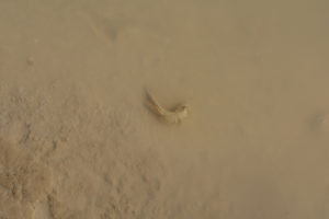
Corpse of female fairy shrimp at edge of Stinking Springs Well Pond. The fairy shrimp body seems to be coated with clay. This demonstrates that life isn’t easy for B. honeybadgerensis. They don’t all keep swimming until the pond dries up. At Playa Wire Gate Pond (on February 10, 2022, Soda Spring Valley), the fairy shrimp dying on the mud at the edge of the pond seemed to be all male but this female casts doubt on the hypothesis that those deaths were related to the sex of the individuals. This fairy shrimp is in very shallow water that was probably frozen to the bottom last night. Was its death related to ice formation or to something else?
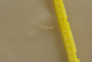
Fairy shrimp in Stinking Springs Well Pond swimming under the ice next to my yellow scale and churning up a little clay. This is the second time I have seen fairy shrimp swimming under ice. The first was at Bass Flat Southwest Pond (on February 9, 2022, “Carson Lake” Playa). For more, see the videos below.
Stinking Springs Well Pond Fairy Shrimp Video 2022-02-23a-f, Rawhide Flats.
For a 16-second video of a fairy shrimp swimming under the ice at Stinking Springs Well Pond, click on the video player above. There is no audio. The fairy shrimp is to the left of the yellow scale, that is resting on the ice. It is swimming mostly in the upper 1-2 cm of clear water above a layer of opaque, clay-rich water. The opening still photograph was taken on January 13, 2022, when there was considerably more water.
Stinking Springs Well Pond Fairy Shrimp Video 2022-02-23bc-r, Rawhide Flats.
For a 2-minutes 45-seconds video of a closer view of the same fairy shrimp as the one in Stinking Springs Well Pond Fairy Shrimp Video 2022-02-23a-f, click on the video player above. There is no audio. Initially, the fairy shrimp is head down with only its abdomen visible in the clear upper water layer. The abdomen sort of drifts slowly as the fairy shrimp does whatever it is doing in the opaque clay-rich water layer. At 0:59 seconds, the fairy shrimp jerks up and its whole body becomes visible. After a few turns, it again dives head first into the clay-rich layer. Much of the body becomes visible again at 2:26-2:32 before it turns and dives back into the clay. The opening still photograph was taken on January 13, 2022, when there was considerably more water.
There are black specks swimming in this video that may be copepods (based on size). They are visible in the shallowest water at lower left at: 0:28-0:31, 0:45-0:53 seconds, and 1:30-1:40.
April 5, 2022
The last half of March was warm so the odds that there is still water aren’t good but I was driving by.
- Dry.
How long might the pond have lasted? I estimated the deepest part was 10 cm on February 23. Reno received only traces of precipitation on 6 days from February 23 to April 5 so when the pond dried up depends on the evaporation rate. The March average daily observed pan evaporation rate at the Fallon Experiment Station from 1950 to 2005 is 3.6 mm/day (for more information on evaporation rates, see “Pond Duration” on the About web page). At that rate, 10 cm would dry up in about 28 days and the pond would last until March 22. That was 2 weeks ago and traces of moisture on the mud flat suggest the pond may have lasted several days longer. If the pond lasted until the peak of the March heat wave at 27 C in Reno on March 25, that would give it 92 days from the second December storm on December 23. In any case, the pond lasted long enough for at least 4 generations of fairy shrimp to hatch (see Winter 2022 Fairy Shrimp Hatching History on Carson Lake Playa and Rawhide Flats, below) and leave eggs for next time.
February 15, 2024
Reno got 2.2 cm precipitation on January 10 (16 cm snow measured), another 0.25 cm on January 22, and then 2.0 cm (21.6 cm snow) on February 4-5 so there is a good chance for water in the pond now. In fact, the considerable water in the pond extends to the old highway fill west of the water tank and is easily visible from US 95.
- 90 m x 120 m; 8 cm maximum depth.
- Opaque pale brown water; 14 C in 2 cm water at 1445.
- Pale gray fairy shrimp 6-10 mm long; the smallest ones stick to the net when it is lifted slowly out of the water rather than remaining in the water within the net; no eggs seen.
- Water boatmen (sub-order Heteroptera, family Corixidae).
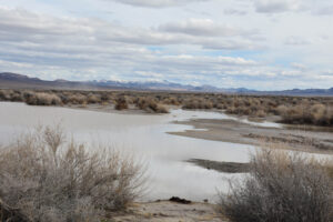
Looking southeast across Stinking Springs Well Pond. The water doesn’t quite extend as far west as the gate in the fence along the highway, which is off the right edge of the photo.
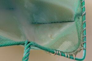
A single fairy shrimp in the net at Stinking Springs Well Pond. There aren’t many fairy shrimp in the pond as most net sweeps fail to catch any. Some of the fairy shrimp are considerably smaller than this one and must have hatched more recently. The fairy shrimp is blurred due to the 1/30th-second exposure time.
February 26, 2025
If this pond got any precipitation on February 13, when Reno got 2.90 cm, it wasn’t enough or has all dried up. The dry January with Reno getting only 19% of normal precipitation may have made the soil so dry that most of the water soaked into the ground.
- Dry.
Winter 2022 Fairy Shrimp Hatching History on Carson Lake Playa and Rawhide Flats
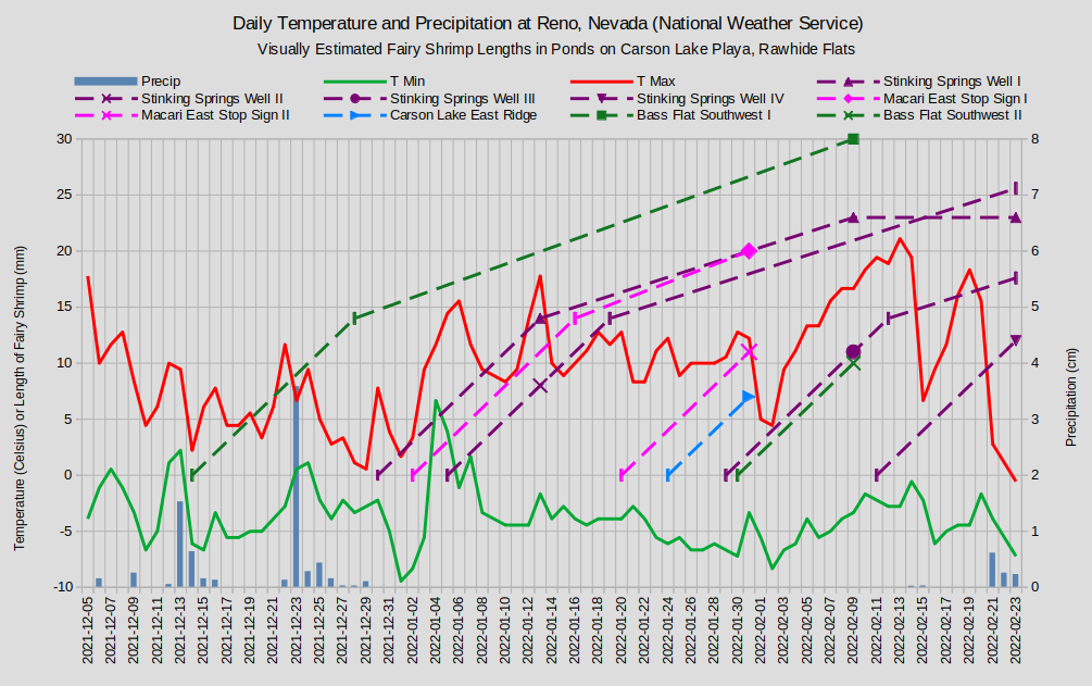
Fairy shrimp lengths are indicated by the dashed lines where 0 lengths are on the inferred days of hatching. The vertical dash symbol indicates a calculated length. From hatching to 14 mm length, the growth rate is assumed to be 1 mm/day. Lengths of Macari East Stop Sign Pond generation III coincide with those Carson Lake East Ridge Pond generation I and are not shown separately.
The different sizes of fairy shrimp observed on January 13, February 9, and February 23 indicate that not all fairy shrimp hatched at the same time. Assuming that the fairy shrimp grew at an average rate of 1 mm/day from hatching until I saw them, generation I hatched on December 30, generation II on January 5, generation 3 on January 29, and generation IV on February 11. Actual hatching dates may have been a few days before or after these calculated dates and single generations may have hatched over a few days rather than all on the same day. Warming temperatures could account for the January 5 and February 11 hatches and possibly the December 30 hatch if the overall cooling trend is ignored. It can’t account for a hatch on January 29.
For further discussion, see “Winter 2022 Fairy Shrimp Hatching History on Carson Lake Playa and Rawhide Flats” on the “Carson Lake” Playa page.
What Can We Learn from the Ponds on Rawhide Flats?
Only a small part of Rawhide Flats is open to the public but that part has a pond that has fairy shrimp.
In the winter of 2021-2022, fairy shrimp in Stinking Springs Well Pond hatched on multiple occasions from late December through mid-February. A complete explanation of the hatching times eludes me.
The winter-hatching fairy shrimp in Stinking Springs Well Pond survived routine freezing of the pond surface.
Fairy shrimping is a winter sport as well as a spring and summer sport. Dress warmly.