The base map is provided by OpenTopoMap’s volunteer servers.
Bald Mountain Rabbitbrush Flat Pond
Bald Mountain Big Dry Lake
Bald Mountain Dry VABM Saddle Pond
Small Rare Plant Habitat Pond
Large Rare Plant Habitat Pond
What Can We Learn from the Ponds in the Pine Grove Hills?
The Pine Grove Hills are a relatively low mountain range between the Wassuk Range to the east and the Sweetwater Mountains to the west, all in the rain shadow of the Sierra Nevada. The Pine Grove Hills are 47 km (29 miles) long and up to about 18 km (11 miles) wide, tapering to the north. The east side of the range is steeper than the west side. The top of the range is broad and undulating in the north and rises gradually to the top of Bald Mountain in the south. The range is bounded on the south by the East Walker River canyon and on the north by Wilson Canyon of the West Walker River. The hills continue north of Wilson Canyon as the Singatse Range. The Pine Grove Hills broaden and disappear south of the East Walker River.
Elevations in the Pine Grove Hills range from lows of 1,500 m (4,920′) along the East Walker River to the east and 2,100 m (6,890′) at Sweetwater Summit on the west to highs of 2,909 m (9,540′) at Bald Mountain in the south and about 2,500 m (8,200′) in the north.
The Pine Grove Hills are covered mostly by pinyon-juniper woodland but there are broad areas of sagebrush, particularly around Bald Mountain in the south and Lobdell Summit in the north. These are likely decades-old burn scars.
The Pine Grove Hills are within the Bridgeport Ranger District of the Humboldt-Toiyabe National Forest. There is a small block of patented mining claims at Wilson in Pine Grove Canyon and a few private parcels in Nye Canyon but that’s about it. The Wovoka Wilderness Area covers Bald Mountain and most of the Pine Grove Hills south of Nye Canyon. There are no hiking trails.
Bald Mountain Rabbitbrush Flat Pond (Bridgeport Ranger District, Humboldt-Toiyabe National Forest; Wovoka Wilderness)
___This map is a screenshot of The National Map (Go to The National Map). The U.S. Geological Survey generally does not copyright or charge for its data or reports (unless printed). A pond location is indicated by an “X”, which corresponds to the coordinates given in the data spreadsheet. Labels in quotations are from 7.5-minute topographic quadrangles.
___Red lines are the U. S. National Grid with a spacing of 1,000 m and intersection labels consisting of the UTM zone (e.g., 11S, 12T), a 2-letter 100-km square designation (e.g., LC, XN), and a 4-digit number. The first 2 digits of the number represent the 1,000-meter Easting and the second 2 digits the 1,000-meter Northing, as seen in the example Easting and Northing. Unlike latitude and longitude, the National Grid is rectilinear on a flat map, the units of abscissa and ordinate have equal lengths, and the units (meters) are measurable on the ground with a tape or by pacing.
___There is no private land on this map. All lands are public.
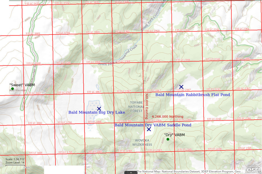
Bald Mountain Rabbitbrush Flat Pond is 37.5 km (23 miles) west of Hawthorne. The 1:100,000-scale BLM map has 2 dry lakes with stipple patterns east of Bald Mountain and Bald Mountain Rabbitbrush Flat Pond is the smaller one farther to the east. The pond is about 5.5 km (3.4 miles) east of the summit of Bald Mountain (as marked by the 9,544′, or 2,909 m, “Sweet” vertical azimuth benchmark) and about 3 km (1.9 miles) east of Bald Mountain Big Dry Lake. On the 1:100,000-scale BLM map, the stipple pattern is less than 500 m (1,640′) long and less than 300 m (980′) wide. I’m not certain this pond coincides well with the stipple pattern on the map. On the ground, it seems closer to the ridge to the west than shown on the map.
Access options for Rabbitbrush Flat Pond are the same as those for Bald Mountain Big Dry Lake but it is closer to the East Walker River road to the east.
Elevation: 2,128 m (6,980′)
March 23, 2017
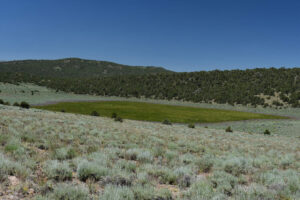
This is a surprise I stumbled upon after turning back from my attempt to get to Bald Mountain Big Dry Lake. There is no mudflat here but there is a distinctive change in vegetation. The water inundates rabbitbrush which is surrounded by sagebrush. There are snowbanks in the trees about 200 m (660′) above the pond elevation and some light snow from the previous day remains in the shadows on north-facing slopes.
- About 100 m x about 200 m; floor of pond is hummocky due to rabbitbrush so it could be up to 30 cm deep in places.
- Water is pale yellowish brown.
- Abundant pale gray fairy shrimp 15-20 mm long; most females have 1 or 2 rows eggs in long, thin ovisacs about 3/4 the length of their abdomens.
- Rare backswimmers (sub-order Heteroptera, family Notonectidae) and black diving beetles.
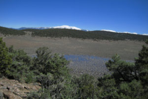
Bald Mountain Rabbitbrush Flat Pond, looking northeast. The pond lies in a broad, shallow basin at the head of Wichman Canyon. The abundance of brush suggests the pond doesn’t fill often. Brush in the water is primarily rabbitbrush but that outside is primarily sagebrush. Mt. Grant, in the Wassuk Range, is on the horizon.
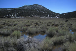
View southwest across Bald Mountain Rabbitbrush Flat Pond at the 8,136 ft (2,480 m) summit with the “Dry” vertical azimuth benchmark (according to the map, I didn’t climb the hill to find the VABM). The rabbitbrush is easily distinguished from the sagebrush by its long, skinny, less branched stems and lack of perennial leaves.
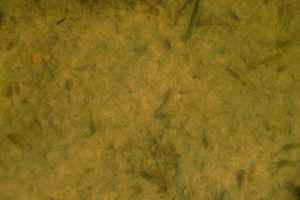
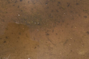
Several fairy shrimp in Bald Mountain Rabbitbrush Flat Pond. Those swimming above the bottom have shadows to their left. Photo contrast has been enhanced to make the fairy shrimp more visible.
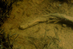
Fairy shrimp in Bald Mountain Rabbitbrush Flat Pond. One fairy shrimp is clearly visible against the shadow of the stick. The female at the left end of the stick appears to have a single row of pale eggs in its ovisac. Photo contrast has been enhanced to make the fairy shrimp more visible.
May 2, 2019
Success at Bald Mountain Big Dry Lake but not here.
- Dry, with mud cracks.
July 13, 2023
The water is well up into the sagebrush as a further demonstration of how much precipitation the Pine Grove Hills have received this year.
- About 150 m x 300 m; greater than 10 cm deep.
- Clear water, locally covered by pinyon pollen.
- Sparse fairy shrimp 25-30 mm long; females commonly have single row of white eggs.
- Clam shrimp (Conchostraca), water boatmen (sub-order Heteroptera, family Corixidae), black beetles less than 5 mm long, damselflies(?), mosquitoes out in force as the sun sinks behind Bald Mountain.
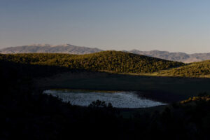
Bald Mountain Rabbitbrush Flat Pond is full of water and has grass, too, but is already in the evening shadow of the hill to the west. The Wassuk Range is in the distance.
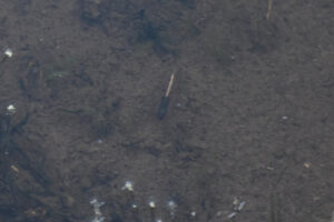
Female fairy shrimp with single row of white eggs in ovisac at Bald Mountain Rabbitbrush Flat Pond. Due to the fading light, I cranked the ISO up to 800 and the aperture down to F/6.3 but the exposure time is still only one-fifteenth of a second. In other cases, I saw the ovisac diverge from parallelism with the abdomen so this fairy shrimp really does have eggs and not just pale food in its intestine. Some other females have 2 rows of eggs, which must be in their oviducts.
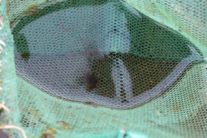
Clam shrimp (Conchostraca) in net at Bald Mountain Rabbitbrush Flat Pond. The exposure time is again only one-fifteenth of a second so the clam shrimp is blurred. In the water, they were scurrying along the bottom of the pond like those in Bald Mountain Dry VABM Saddle Pond (see photograph Bald Mountain Dry VABM Saddle Pond 2023-07-13 #22).
Bald Mountain Big Dry Lake (Bridgeport Ranger District, Humboldt-Toiyabe National Forest; Wovoka Wilderness)
Bald Mountain Big Dry Lake map
Bald Mountain Big Dry Lake is 40 km west of Hawthorne. It is the bigger of the 2 stippled areas on the 1:100,000-scale BLM map east of Bald Mountain. The lake is 2.7 km (1.6 miles) west of the summit of Bald Mountain, which is labeled as the “Sweet” vertical azimuth benchmark (VABM) on the Humboldt-Toiyabe National Forest’s recreation map of the Bridgeport Ranger District. The stipple pattern is 800 m long and up to 400 m wide (2,620′ x 1,310′).
Access is by foot. The lake is about 8 km (5 miles) east of Nevada 338 along Sweetwater Creek north of Bridgeport, California, and at least 7 km (4.3 miles) west of the county-maintained road along the East Walker River south of Flying M Ranch. It is a cross-country hike in either case. Although there are a few National Forest System roads that extend 1-3 km (0.6-1.9 miles) eastward from Nevada 338, hiking from the west requires crossing the higher elevations of Bald Mountain, which may have considerable snow when the dry lake has water. To the east, Paralde Spring is about 2 km (1.2 miles) from the East Walker road and can be located on the ground by a cottonwood nearby. The spring is accessible via the poor National Forest System Road 769D (relabeled 42786 on the Pine Grove Hills sheet of the more recent Motor Vehicle Use Map for the Bridgeport Ranger District). The recreation map shows a trail with a dashed black line (also on the 1:100,000-scale BLM map) and the Motor Vehicle Use Map shows a “Trail Open to All Vehicles” #22464 from near Paralde Spring. Trail #22464 is within the Wilderness area now, although there is no sign. The trail extends about 2.5 km (1.6 miles) up the lower slopes of the Pine Grove Hills. It’s in terrible condition for a vehicle but goes in the right direction and definitely speeds up hiking to or from Rabbitbrush Flat Pond, which is another 3 km (1.9 miles) from the end of the trail.
Alternatively, the recreation map shows National Forest System Road 367 (42367 on the more recent Motor Vehicle Use Map) extending north for about 4 km (2.5 miles) from a road on the north bank of East Walker River about 2 miles east of Nevada 338. It is a passable but terribly rough road. Depending on where you can’t take the bouncing anymore and start hiking, it would be 6-9 km (3.7-5.6 miles) straight-line distance to Bald Mountain Big Dry Lake. I did it once and won’t try it again.
Elevation: 2,336 m (7,665′)
June 1, 2017
I had hoped to get to the lake on March 23 (see Bald Mountain Rabbitbrush Flat Pond) but there was so much snow I didn’t get past the hill east of the lake. This time, I hiked from Road 367 but wouldn’t do it again. At least the spiny hopsage bushes at lower elevations are quite colorful with masses of pink or yellow flowers. There are still some patches of snow around Bald Mountain.
- Dry.
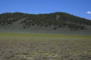
Looking east across the now grassy Bald Mountain Big Dry Lake. There may be a little water where the bear (brown speck at center) is but I thought it prudent not to check.
The visit wasn’t a total loss as I learned that bears could be dispersal agents for fairy shrimp eggs in the Pine Grove Hills. I later saw bear tracks in the mud at Bald Mountain Dry VABM Saddle Pond in 2019. The eggs could lodge in the fur or between the toes of a bear. Bears might even swallow fairy shrimp if they try to drink from the ponds and then leave their eggs in feces at another pond. Bears could be considered “directed” in the sense of Rogers (2015a; see the References page) because water holes are scarce and bears likely direct their wanderings to visit as many water holes as possible and those are exactly the locations most suitable for fairy shrimp. This may not be as exciting as finding fairy shrimp eggs in mammoth fur (Rogers and others, 2021) but has anyone else mentioned bears as possible dispersal agents?
May 28, 2018
Hiking from the east again. 2 tiny snowbanks on Bald Mountain. Bitterroot, phlox, and rayless daisy blooming at lower elevations.
- 2 puddles of water less than 10 m x less than 20 m and less than 3 cm deep.
- Water clarity not noted.
- No fairy shrimp.
- Saw one black diving beetle.
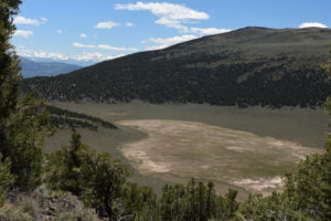
Bald Mountain Big Dry Lake, looking southwest with Bald Mountain off right edge of photo and Sierra Nevada at left. There are 2 small gray puddles of water along the prominent change in vegetation near the edge of the dry lake below center. The top of the tree touches one.
May 2, 2019
I finally got the timing right as the water covers most of the sagebrush-free area. However, it has pulled back some. Patches of snow extend about halfway down the northeast-facing slope from Bald Mountain.
- About 200 m wide by 700 m long; depth uncertain but likely less than 50 cm.
- Water is clear but deep brown where deepest.
- Pale gray or pale pinkish-gray fairy shrimp common near the southeast shore but sparse along the other shorelines; lengths mostly less than 20 mm long but a few about 20 mm and some may be less than 12 mm; some females have ovisacs about half the length of their abdomens and a few visible eggs.
- There are innumerable gnat-like flies, a few black diving beetles, and some very small wriggly larvae.
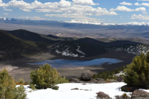
Bald Mountain Big Dry Lake, looking southeast from northeast ridge of Bald Mountain with Mt. Hicks at center and the White Mountains on the horizon above it. This photograph was taken about a week ago after visiting the Small and Large Rare Plant Habitat Ponds but I ran out of time then. After 2 busts, this view was a strong incentive to return soon.
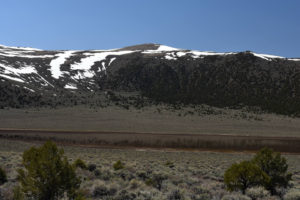
Bald Mountain Big Dry Lake with Bald Mountain in background. I finally made it while the dry lake has plenty of water.
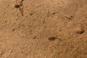
Fairy shrimp in Bald Mountain Big Dry Lake. The long, generally tubular, distal segments of antenna II of the male near center can be seen hanging below it while it swims back side up for a change.
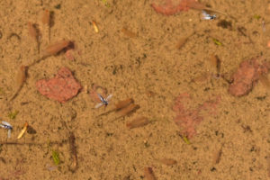
Several fairy shrimp in Bald Mountain Big Dry Lake. The female with its head to the left in the group of 3 below center has 6 pale eggs in a short ovisac. A wide range of sizes and hatching dates is indicated by the larger fairy shrimp at upper left compared to the smaller one below and to the right of center.
July 13, 2023
There’s lots of water and lots of grass in the water.
- Something like 500 m x 900 m; greater than 10 cm deep.
- Clear water; 26 C in 2 cm water at 1730.
- No fairy shrimp seen from shore.
- Lots of water boatmen (sub-order Heteroptera, family Corixidae), black diving beetles, dragonfly larvae(?), alkali(?) flies.
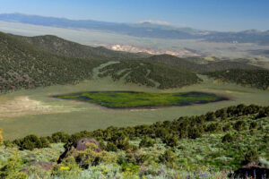
The pattern of Pine Grove Hills ponds with lots of water and lots of grass today continues at Bald Mountain Big Dry Lake. White Mountains, on the horizon, still have snow. This time I’m visiting after looking at Small and Large Rare Plant Habitat Ponds. The descent is steep but I lucked into a route that missed the big outcrops and wasn’t too challenging.
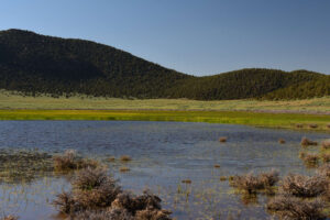
Water is still well up into the sagebrush on the eastern shore of Bald Mountain Big Dry Lake. Unfortunately, the bottom is too soft for wading so I can’t be sure that fairy shrimp aren’t here.
Bald Mountain Dry VABM Saddle Pond (Bridgeport Ranger District, Humboldt-Toiyabe National Forest; Wovoka Wilderness)
Bald Mountain Big Dry Lake map
Bald Mountain Dry VABM Saddle Pond is a small pond in the saddle northwest of spot elevation 8,136 feet (2,480 m), which is labeled “Dry” and has the vertical azimuth benchmark symbol on the Humboldt-Toiyabe National Forest’s recreation map of the Bridgeport Ranger District. It appears to have been constructed as a stock pond as there is a linear bump for a dam in the dirt at the northeast end of the pond. It is 2.0-2.5 km (1.2-1.6 miles) east-southeast of Bald Mountain Big Dry Lake and about 1 km (0.6 mile) southwest of Bald Mountain Rabbitbrush Flat Pond.
Access is the same as for Bald Mountain Rabbitbrush Flat Pond.
Elevation: 2,225 m (7,300′)
May 2, 2019
I found this pond on the way up to Bald Mountain Big Dry Lake from Bald Mountain Rabbitbrush Flat Pond. There is no snow at lower elevations and the phlox and bitterbrush are blooming. Water covers only a small part of the depression and is mostly within a ring of stones. There are conspicuous bear tracks in the mud.
- Less than 20 m across; less than 10 cm deep.
- Water clear with a brown tint.
- Abundant fairy shrimp about 20 mm long with colors of pale gray to brownish gray to darker greenish-brown; there are brown, pale green, or almost white eggs, usually in a single row and less than 30 per female.
- Large predacious diving beetle larvae (family Dytiscidae of order Coleoptera), several small wriggly larvae, and a few black diving beetles.
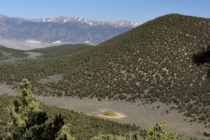
Bald Mountain Dry VABM Saddle Pond, looking back to east from hike up to Bald Mountain Big Dry Lake. The hill with the “Dry” vertical azimuth benchmark is at right. The Wassuk Range is in the distance on the far side of the East Walker River Valley.
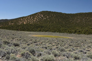
Bald Mountain Dry VABM Saddle Pond, looking southwest. Mostly green grass and only a little water.
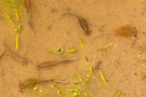
Fairy shrimp in Bald Mountain Dry VABM Saddle Pond. The male at upper right has crossed, blade-like distal segments of antennae II. This is similar to the tentatively identified Branchinecta coloradensis in Smith Creek Ranch Road Long Ditch Pond on March 17, 2013 (Smith Creek Valley). Photo contrast has been enhanced. The shutter speed of 1/200 sec was fast enough to freeze the male’s rear legs in mid-stroke. The black ocellus, like a third eye in the middle of the forehead, can also be seen. The other fairy shrimp are females with various numbers and colors of eggs. The different colors of these fairy shrimp are not likely indicative of different species.
Large predacious diving beetle larva (family Dytiscidae of order Coleoptera) at center in Bald Mountain Dry VABM Saddle Pond. The broad, pale abdomen has darker cross bars and a forked “tail”. Its head at upper left is obscured by a twig. Although dytiscid larvae are known predators of fairy shrimp, the fairy shrimp don’t seem to be avoiding this one, possibly because it isn’t moving.
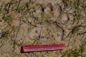
Front paw print of a bear in the mud adjacent to Bald Mountain Dry VABM Saddle Pond. The scale is 15 cm, 6 inches. This is evidence that bears could be dispersal agents for fairy shrimp eggs. I previously saw a bear scrounging in the damp bottom of Bald Mountain Big Dry Lake (see photograph Bald Mountain Big Dry Lake 2017-06-01, #21).
July 13, 2023
The pond is bigger than I have ever seen it. Like Bald Mountain Big Dry Lake, it has lots of grass in the water. As I came out of the trees and started across the sagebrush to the pond, a small bear on the far shore saw me and, after a brief hesitation, ran up into the trees on the far side of the pond.
- Approximately 75 m x 75 m; greater than 10 cm deep.
- Clear water, 26 C at 1900 in 2 cm water.
- No fairy shrimp.
- Clam shrimp (Conchostraca) about 8 mm long, lots of water boatmen (sub-order Heteroptera, family Corixidae), alkali(?) flies, bear.
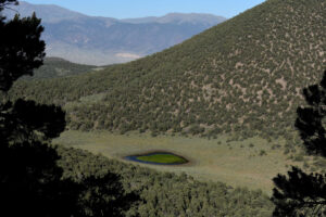
Same as the other Pine Grove Hills Ponds, Bald Mountain Dry VABM Saddle Pond has water up into the sagebrush and lots of grass.
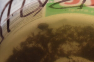
Clam shrimp (Conchostraca) swimming in white container at Bald Mountain Dry VABM Saddle Pond. The antennae used for swimming can be seen protruding from the left end of the bivalve.
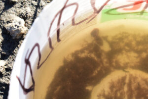
2 clam shrimp (Conchostraca) stuck together in water in white container at Bald Mountain Dry VABM Saddle Pond. This could be sexually explicit content but how can you tell with clam shrimp? Denton Belk told me that the clam shrimp that I had seen stuck together in Chinook Pond (Antelope Hills) were mating.
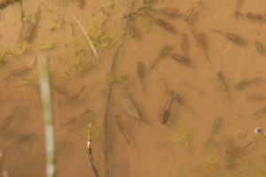
Water boatmen in Bald Mountain Dry VABM Saddle Pond. As in photograph Large Rare Plant Habitat Pond 2023-07-13 #05, the water boatmen are spaced out rather than clustered. It looks like the spacing is more regular than random. Is there a chemical (smell) that tells the water boatmen how far apart to place themselves?
A final shot of green: Bald Mountain Dry VABM Saddle Pond in the evening light. In contrast, the tall grass in the sagebrush has mostly dried out.
Bald Mountain Dry VABM Saddle Pond Clam Shrimp Video 2023-07-13a-cr
For a 1-minute, 12-second video of clam shrimp (Conchostraca) in Bald Mountain Dry VABM Saddle Pond, click on the video player above. There is no audio. The video opens with 4 clam shrimp in the left side of the view foraging in the pond bottom muck. One is on the surface of the pond bottom and the others are partially to almost entirely buried. At 0:12, one of the clam shrimp encounters a partially buried clam shrimp and digs down into the same hole. The partially buried clam shrimp just keeps digging. Whether it is oblivious to its surroundings or recognized the intruder as another clam shrimp only it can say. The scene shifts as other clam shrimp swim in from the upper left. The video ends with a view of the pond. These clam shrimp have dark gray shells with bits of mud or muck commonly stuck to them and are clearly bottom feeding rather than filter feeding, which fairy shrimp do. That is unlike the clam shrimp seen in the Bodie Hills (Beauty Peak West Pond 2019-06-12, #13c), which have clean, reddish brown shells and were not seen digging or disturbing the pond bottom. The Bodie Hills pond is about 28 km to the south.
Bald Mountain Dry VABM Saddle Pond Clam Shrimp Video 2023-07-13b-r
For a 57-second video of clam shrimp (Conchostraca) in Bald Mountain Dry VABM Saddle Pond, click on the video player above. There is no audio. This video shows a clam shrimp swimming along the surface of the pond bottom. At 0:21-0:26, it pauses to scrape the lower stems of vegetation growing up through the water. If it was searching for food, it evidently didn’t find anything that was appetizing.
Small Rare Plant Habitat Pond (Bridgeport Ranger District, Humboldt-Toiyabe National Forest; Wovoka Wilderness)
___This map is a screenshot of The National Map (Go to The National Map). The U.S. Geological Survey generally does not copyright or charge for its data or reports (unless printed). A pond location is indicated by an “X”, which corresponds to the coordinates given in the data spreadsheet. Labels in quotations are from 7.5-minute topographic quadrangles.
___Red lines are the U. S. National Grid with a spacing of 1,000 m and intersection labels consisting of the UTM zone (e.g., 11S, 12T), a 2-letter 100-km square designation (e.g., LC, XN), and a 4-digit number. The first 2 digits of the number represent the 1,000-meter Easting and the second 2 digits the 1,000-meter Northing, as seen in the example Easting and Northing. Unlike latitude and longitude, the National Grid is rectilinear on a flat map, the units of abscissa and ordinate have equal lengths, and the units (meters) are measurable on the ground with a tape or by pacing.
___Gray shading represents private land as traced from the PAD-US 2.0 – Federal Fee Managers layer of The National Map. Other lands are public.
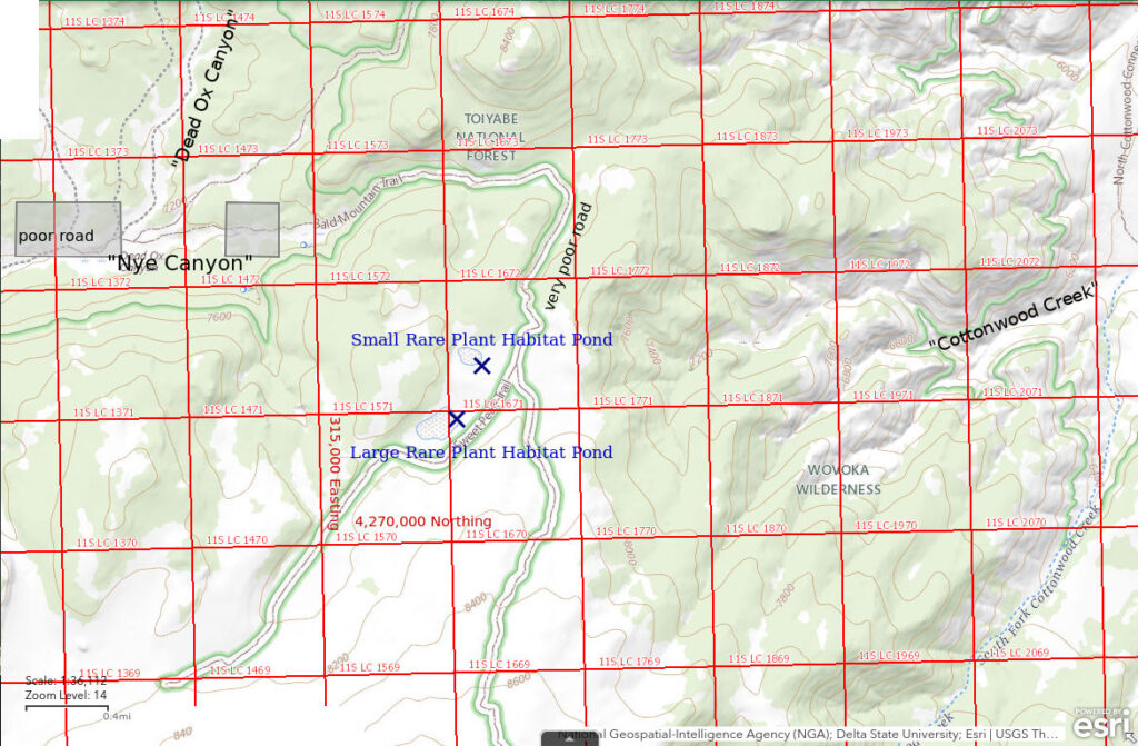
Small Rare Plant Habitat Pond is 42.5 km (26 miles) west of Hawthorne. The pond is 4 km (2.5 miles) north of the Sweet vertical azimuth benchmark (9,544 feet, 2,909 m) on the summit of Bald Mountain. It is one of 2 ponds labeled “Dry Lakes” on the Humboldt-Toiyabe National Forest recreation map of the Bridgeport Ranger District. The U.S. Forest Service has placed signs next to each pond prohibiting vehicle access and camping on “lake beds” because of “rare plant habitat”. Small Rare Plant Habitat Pond is the smaller, northern pond. The pond is not shown on the 1:100,000-scale BLM map but is on the Wichman Canyon 7.5-minute topographic quadrangle.
Small Rare Plant Habitat Pond is 8.5 km (5.3 miles) east of Nevada 338, north of Bridgeport, CA, and 10 km (6.2 miles) west of the county-maintained road along the East Walker River. Following the road up Nye Canyon from Nevada 338 looks easy but the Nye Canyon road is terrible. Even the first mile, which is across private land, is terrible. On the recreation map of the Bridgeport Ranger District, the Nye Canyon road is labeled “031” but on the newer Motor Vehicle Use Map, it is not a National Forest System road at all. Apparently, the U.S. Forest Service decided to wash its hands of the road and leave maintenance up to the county.
National Forest System “trail” 22510 on the Motor Vehicle Use Map (road 141 on the recreation map) starts at the end of the Nye Canyon road at Dead Ox Canyon. This “trail” leads up the north slope of Bald Mountain, almost to the top. “Trail” 22511 (141A on the recreation map) branches off 22510 near Small Rare Plant Habitat Pond and leads past Large Rare Plant Habitat Pond.
During the spring fairy shrimp season, the climb out of Nye Canyon is prone to mud, deep ruts, running water, and thick snowbanks. At and above Small Rare Plant Habitat Pond, 22511 and 22510 are, ironically, 2-tracks through low sagebrush with fewer obstacles than the Nye Canyon road. These 2-tracks have been excluded from the surrounding Wilderness area by the use of “cherry-stems” in the delineation of the Wilderness area in order to avoid angering vehicle enthusiasts. The best option for those with standard high-clearance vehicles may be to drive up the Nye Canyon road as far as you can tolerate and hike from there. Unfortunately, parking spots (and turnarounds!) in Nye Canyon are few and far between.
The climb up the east side of the Pine Grove Hills to Small Rare Habitat Pond is steeper and longer but doable in a day. Turn off the maintained road along the East Walker River about 2 miles south of the Flying M Ranch onto road 42786 (Motor Vehicle Use Map, or 769D on recreation map). Park where the road forks (42786A to the north on the MVUM) near Paralde Spring. The Cottonwood Creek crossing north of the fork is no longer passable. The first 3 km (2 miles) of the hike are easy due to the sporadic remains of road 42785 (769C on recreation map) along Cottonwood Creek and the wide gravel channel. The channel narrows and gets rockier, the vegetation becomes more obstructive, and the slopes on either side get steep in Cottonwood Creek canyon. After about 1 km, I chose a steep climb out of the canyon and followed a ridge to the southwest rather than continuing up the bottom of the canyon. This looked like the quickest route on the map but there may be better options.
Elevation: 2,415 m (7,925′)
April 24, 2019
Mud, running water, and a big snowbank make the road up from Nye Canyon impassable after the turn to the south. The pond itself has a snowbank on the north-facing slope to the south and a little melting mushy snow on the northeast shore.
- About 150 m x 230 m (i.e., all of bare area on aerial image); greater than 40 cm deep near center by comparison with July 2023 depth.
- Clear water.
- Pinkish-gray fairy shrimp less than 10 mm long and almost impossible to see but their shadows on the pond floor give them away; fairy shrimp are erratically distributed and often abundant where present.
- Lots of small black diving beetles; locally abundant animals that are less than 2 mm long and relatively stationary or swim with a jerky motion may be copepods.
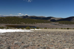
Small (right) and Large (left) Rare Plant Habitat Ponds, from the north slope of Bald Mountain looking north-northwest. The Pine Grove Hills north of Nye Canyon are in the distance.
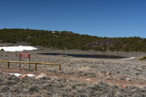
Small Rare Plant Habitat Pond and U.S. Forest Service’s “No camping” sign, looking west. “Trail” 25111 is in foreground.
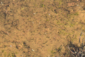
Numerous fairy shrimp in Small Rare Plant Habitat Pond. Their dark shadows on the pond bottom are easier to see than their translucent, pale pinkish-gray bodies, which are out of focus. My camera’s autofocus apparently caught something on the surface of the water and I failed to correct it. Rabbit pellets at lower left and upper right provide scale.
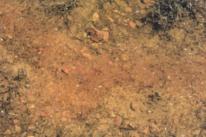
Dense mass of pale pinkish-gray fairy shrimp in Small Rare Plant Habitat Pond. Such dense masses are localized as most of the pond volume seems relatively free of fairy shrimp. Is this some sort of swarming behavior or is there some preferred environmental factor at play? Hemoglobin concentrations are known to increase in fairy shrimp subjected to high-TDS water or low oxygen concentrations and give them shades of pink to red but neither condition is likely in this snowmelt pond without abundant organic matter. So why the pink color?
July 13, 2023
I didn’t carry my rubber boots because of the weight but I brought a pair of running shoes for wading. I didn’t try wading in Large Rare Habitat Pond to save time but maybe if I wade in here, I’ll find fairy shrimp.
- Approximately 130 m x 200 m; greater than 40 cm deep.
- Clear water; 28 C at 1345 (warmer than air).
- One 25 mm fairy shrimp seen; has eggs.
- Tadpoles turning into frogs, rare water boatmen (sub-order Heteroptera, family Corixidae), backswimmers (sub-order Heteroptera, family Notonectidae), dytiscid larva (order Coleoptera, family Dytiscidae), black diving beetles, alkali(?) flies, dragonflies.
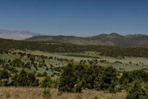
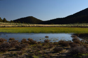
First sight of Small Rare Plant Habitat Pond after climb out of Cottonwood Creek canyon, looking northwest. The abundant water is encouraging but I’m not sure what to make of the grass. This is obviously not an early hatch situation like the May 2019 visit.
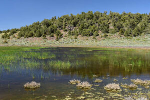
The view from the southeastern shore of Small Rare Plant Habitat Pond. Water still up into the sagebrush in mid-July suggests it was really deep in May. I wonder what that and all the emergent grass means for the ecology this time.
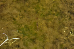
At least there is 1 fairy shrimp in Small Rare Plant Habitat Pond. This fairy shrimp has an ovisac with a single row of pale brown eggs. They don’t look much different from pale food in the intestine but there is a color change about two-thirds of the way down the abdomen from the brownish eggs to the greenish abdomen. Unfortunately, this is the only fairy shrimp I saw. I spent more than one-half hour wading in the pond and made a complete circle but never saw any others. I didn’t venture into the deepest water due to soft-bottom issues.
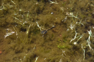
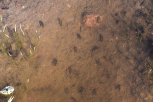
Tadpole at the surface of the water in Small Rare Plant Habitat Pond. It has a black tail and is speckled with yellow clots of pinyon pollen. Tadpoles were abundant and may have eaten most of the fairy shrimp.
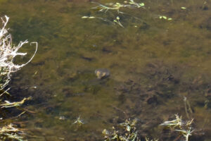
This tadpole in Small Rare Plant Habitat Pond is turning into a frog. It has a disk-like gray body with pale, yellowish hind limbs on either side of a fat gray tail. There are a lot of these that cluster together in the shallows at the edges of the pond.
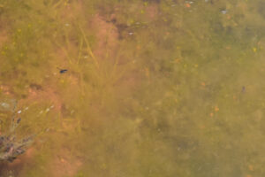
Backswimmer (to left and above center) in Small Rare Plant Habitat Pond. Its back and undersides are both dark so careful observation is needed to determine that it swims on its back and is, consequently, a backswimmer. In contrast, the brown smudge at center far right is a water boatman. It prefers to cling to the bottom or vegetation rather than to float just below the surface like a backswimmer. In some cases, I may not be sure that a pond has water boatmen or backswimmers unless I see both.
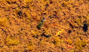
The greenish-gray animal at center may be a clam shrimp (Conchostraca) in Small Rare Plant Habitat Pond. Brightness, contrast, and saturation in this photograph were greatly increased to make the animal more visible and distinct from everything else. I took this photograph of something swimming quickly along the bottom but couldn’t identify it at the time. After seeing unmistakable clam shrimp in Bald Mountain Dry VABM Saddle Pond and Bald Mountain Rabbitbrush Flat Pond, I think this is probably a clam shrimp although the bivalve shape is complicated by 2 adjacent, gray blobs above and to the right of the shell.
Large Rare Plant Habitat Pond (Bridgeport Ranger District, Humboldt-Toiyabe National Forest; Wovoka Wilderness)
Small Rare Plant Habitat Pond map
Large Rare Plant Habitat Pond is the larger, southern pond of the 2 “Dry Lakes” 4 km (2.5 miles) north of the summit of Bald Mountain. U.S. Forest Service signs indicate both ponds are “rare plant habitat” and driving and camping on the dry beds is prohibited. Large Rare Plant Habitat Pond is not shown on the 1:100,000-scale BLM map but is on the Wichman Canyon 7.5-minute topographic quadrangle.
The access is the same as for Small Rare Plant Habitat Pond.
Elevation: 2,410 m (7,905′)
April 24, 2019
The water is up into the grass and low sagebrush and there are wide, somewhat firm marshy areas around the edges of the water in places.
- Roughly 250 m x 350 m (i.e., slightly larger than bare area on aerial image); likely greater than 10 cm deep near center.
- Clear water.
- Pale pinkish-gray fairy shrimp less than 10 mm long as in the Small Rare Plant Habitat Pond, but rare and nowhere abundant (at least as seen from the shore).
- Rare diving beetles; possible copepods less than 2 mm like those in Small Rare Plant Habitat Pond.
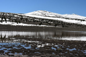
View south across Large Rare Plant Habitat Pond and up Bald Mountain. “Sweet” vertical azimuth benchmark is on the peak at center. The pond is surrounded by a wide marshy area in places, as in the foreground.
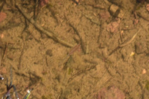
Single fairy shrimp in Large Rare Plant Habitat Pond. Neither antennae II nor ovisac are apparent in this photograph so the sex of the fairy shrimp is uncertain. I didn’t see any dense masses of fairy shrimp here like those in Small Rare Plant Habitat Pond but they may be out in deeper water.
July 13, 2023
Hiking up through the pinyon, I was met with a cloud of pollen every time I brushed a branch. Flowers blooming on the slopes above the pond include phlox, prickly phlox, lupine, and meadow chickweed with mariposa lily, prickly pear, aster, eriogonum, penstemon, and rare bitterroot at somewhat lower elevations while desert peach in Cottonwood Canyon and antelope bitterbrush have gone to seed. Large Rare Plant Habitat Pond is full of grass, from shore to shore.
- Approximately 200 m x 300 m; greater than 10 cm deep.
- Clear water; 28 C at 1300 (warmer than air).
- No fairy shrimp seen from shore.
- Abundant water boatmen (sub-order Heteroptera, family Corixidae), black diving beetles, alkali(?) flies.
Large Rare Plant Habitat Pond, in view to west. Although the pond appears to have gone to grass, there is still water wherever the bright green grass is and the water extends further up into the sagebrush at lower right. The top of the grass is generally 20 cm above the water.
Abundant water boatmen on bottom of Large Rare Plant Habitat Pond. Sizes of the water boatmen differ by about a factor of 2. They evidently prefer to spread out rather than to cluster together.
What Can We Learn from the Ponds in the Pine Grove Hills?
There aren’t many ponds in the Pine Grove Hills but 5 out of 5 of those visited have had fairy shrimp when adequate water was present before mid-May.
Fairy shrimp were less common in July in the wet year of 2023 and appeared to be absent from 3 of the 5 ponds.
More than one species of fairy shrimp may be present in the Pine Grove Hills. The distal segments of antennae II on males of Bald Mountain Dry VABM Saddle Pond are generally blade-like while those of males in Bald Mountain Big Dry Lake are tubular.
2 of the ponds in the Pine Grove Hills had clam shrimp (Conchostraca, or the orders Spinicaudata, Laevicaudata, and Cyclestherida) in July 2023, with and without fairy shrimp.
One of the ponds visited in July 2023 had abundant tadpoles (almost frogs) and only rare fairy shrimp.
The visited fairy shrimp ponds in the Pine Grove Hills are not easy to get to. However, if you do get there, the water is relatively clear and good for photography.
There are bears in the Pine Grove Hills, they visit the fairy shrimp ponds, and they may help spread fairy shrimp eggs.