The base map is provided by OpenTopoMap’s volunteer servers.
Martin Fire
“Silver Lake”
Wolf Creek Northeast Dry Lake
Owyhee Fence Line Dry Lake
“Corral Lake”
Owyhee 5802 Stock Pond
“Button Lake”
Monument Hills North Pond #1
Monument Hills North Pond #2
Twelvemile Flat Pond #1
Twelvemile Flat Playa Lake
Twelvemile Flat Pond #2
Monument Hills East Pond
Owyhee “Shallow Lake”
Surviving Sagebrush Pond
Resting Antelope Pond
Tumbleweed Basin Pond
Owyhee Middle Dry Lake
What Can We Learn from the Ponds in the Owyhee Desert?
The Owyhee Desert is in north-central Nevada and extends across the border into Idaho. It is something like 100 km (62 miles) long and 70 km (43 miles) wide, depending on how you define the edges. There are no paved roads or towns and only a few ranches near the margins. It is between the Calico Mountains on the west and Bull Run Mountains on the east. The Snowstorm Mountains are to the south.
Except for the canyons of Owyhee River, Little Owyhee River, and South Fork Owyhee River, the Owyhee Desert is relatively flat. Elevations within Nevada are from 1,550 m (5,090′) up to 1,850 m (6,070′) on the west side or 1,750 m (5,740′) on the east side. Due to the low relief, undrained depressions are scattered across the desert and the 1:100,000-scale BLM map shows several kilometer-scale dry lakes with stipple patterns.
In spite of the name, the Owyhee Desert in Nevada is all sagebrush, except where burned. After a fire, cheatgrass usually takes over. That didn’t happen after the Martin Fire due to timely herbicide treatments and reseeding.
The Owyhee Desert is about as remote as it gets in Nevada and the roads are bad. Other than a few ranchers hauling water or salt for cows, probably very few people venture west of “Wilson Reservoir”, east of Hardscrabble Road, or north of Midas and not many go to those places. The straight-line distance from “Wilson Reservoir” to Hardscrabble Road is about 76 km (47 miles). It is 85 km (55 miles) from Midas to the Idaho border and another 100 km (62 miles) to paved US 95 at Jordan Valley, on the Idaho-Oregon border. There is no mobile phone service. If a road you hoped to use is impassable, you will have to have enough vehicle fuel to find another way around or go back the way you came. Some roads shown on maps have been rerouted or abandoned and some roads on the ground are not shown on the maps. If you have a vehicle breakdown, tire problem, illness, or accident, you will have to rescue yourself. Even if you have a satellite-based, helicopter rescue service, it would take hours to reach you because there are no large airports nearby.
The Hardscrabble Road is a well-maintained road that can be reached from Nevada 290 at the town of Paradise Valley. The town of Midas can be reached via Nevada 789 and its non-paved continuation, which is maintained by the mining companies for ore trucks and other mine traffic. The road north from Midas is somewhat maintained and passable as far as I followed it once. There is a rough but passable service road along the gas pipeline through the northern part of the Owyhee Desert.
If you don’t want to read about my trouble getting into the Owyhee Desert in 2023 and how bad the roads are, skip to a brief summary of the Martin Fire with maps and a photograph of the recovery.
Roads within the Owyhee Desert are bad. There is a lot of clay. This makes for bottomless mud holes. Avoid puddles. Many sections of the roads may be impassable for days when wet from snowmelt or a thunderstorm. Deep ruts are common. Driving off the roads to get better traction won’t work in many places. Carrying chains would be a good idea. Cows are common in the Owyhee Desert and they make the roads worse. They leave big, deep hoof prints on muddy roads. When the roads finally dry, they become giant, concrete muffin pans. Driving over muffin pans may be even worse than driving over railroad ties. To add to the agony, basalt underlying the desert crops out in places and litters the surface with angular, grapefruit- to cantaloupe-size blocks of black rock. In places, it is impossible to steer around all the blocks.
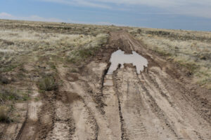
Small puddle in a road in the Owyhee Desert. Just gun it, right? Notice there are tracks at lower right of a tracked vehicle that stopped here. It appears that a small tracked vehicle was needed to extricate a wheeled vehicle from this seemingly innocuous puddle. How long did it take to get that tracked vehicle up here?
Based on my experience in 2023, I don’t recommend visiting the Owyhee Desert in the spring to look for fairy shrimp. Like in 2017, access may not be bad in some years but conditions are hard to predict.
Most of Nevada had a 2022-2023 winter that was considerably wetter than normal. I thought it would be a good chance to try the Owyhee Desert again. I guessed that the road over the Snowstorm Mountains from Midas would be snowed in. I first tried to reach the Owyhee from the west by way of the Hardscrabble Road. There had been significant flooding in Paradise Valley but the county had fixed the road. On the Hardscrabble Road, I drove through 3 snow banks. On the third, I did a little precautionary shovel work. At the longest, deepest, fourth snow bank, I stopped. I was getting worried about the ford over the North Fork Little Humboldt River. I was only about 4 km (2.4 miles) away so I hiked the rest of the distance to have a look. The river was out of its banks and flowing very fast. In 2017, the ford itself was rocky but I didn’t know if the approach, now under water, was. That was too risky. There is also a ford at the gas pipeline, which I had found sandy but somewhat soft in 2017. The road on the south side of the river to the gas pipeline presented serious mud problems and the river looked too deep at the gas pipeline ford.
I next tried to get to the Owyhee from Nevada 226 to the east. The road to “Deep Creek Reservoir” was in good shape but it deteriorated just beyond the gate to the IL Ranch on South Fork Owyhee River. A vehicle had already been up the road and left substantial ruts but the road had dried out a bit since then. I knew from previous experience that even small mud holes in the Owyhee can be bottomless so I steered around the puddles no matter how bad the ensuing bumps. Fortunately, there were culverts at major creek crossings, like Fourmile Creek and Winters Creek. I eventually came to a location where the road had captured a small stream and was flooded for 100 m (330′) or so. Someone had previously taken a very wide detour through the sagebrush but at the end there was still the problem of fording the stream that was now flowing down the road.
On the map, there was another option – the road that crossed the combined Chimney and Fourmile creeks below “Desert Ranch Reservoir”. I decided to give it a try. I followed the road down Fourmile Creek to “Desert Ranch Reservoir”. Parts were dry and parts were bad. There were long sections of very gooey mud. I think it took more than an hour to go 10 miles. At the end, I had to ford Fourmile Creek to get to the outlet of “Desert Ranch Reservoir”. The water was fast and deep. The banks and bottom had some gravel but maybe not enough. I tried wading across in my rubber boots. The bottom felt okay as far as I got but the water was too deep to walk all the way across. I decided to sleep on it, hoping a cool night might slow the flow. Next morning, the water had subsided only a little. No telling how long it would take to get help if my truck got stuck. Even if I got across going in, would I be able to get across coming out? Days were getting warmer and Fourmile Creek could rise.
I went back to the flooded road. There were no recent tracks. I would be the first to try this year. I explored the ford of the small stream carefully with my rubber boots on. I thought I could feel a good track and the stream was small enough that I would have momentum on my side. I drove a long route around the flooded road dodging puddles and burned sagebrush spikes. The stream crossing went okay but the road on the far side had deeper mud than expected. Wheels spun but I kept going forward and made it to the dry road. The culvert on Chimney Creek allowed me to clear the last hurdle. I continued into the Owyhee Desert. I was surprised that the interior of the Owyhee Desert was relatively dry in spite of all the streams from the surrounding mountains being out of their banks.
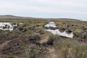
This road into the Owyhee Desert has captured a stream and is now flooded and impassable. This is where I turned around. But the ford of Fourmile Creek looked riskier so I came back. I followed older tracks far to the left of the flooded road and managed to ford the stream at the far end of the flooded section.
The moral of my 2023 story is don’t try to go into the Owyhee Desert when the streams and rivers are running high. If you do, take steps to ensure your safety. One possibility would be to carry 2 weeks of food and water so you could wait for stream flows to decrease or for mud holes to dry up somewhat. Another would be to take two 4-wheel drive vehicles with long tow chains, shovels, jacks, and plenty of boards for muddy spots.
Martin Fire
The Martin Fire probably had no short-term or long-term effects on fairy shrimp. All ephemeral ponds in the Owyhee Desert had probably dried up by the time the fire was started by humans on July 4, 2018. Fairy shrimp eggs can survive a temperature of 81 C for one hour (Pennak, 1978, p. 335). However, this web site is also about the public lands where so many accessible fairy shrimp habitats occur.
The most useful resources I found for the Martin Fire are on the sagebrusheco.nv.gov web site. Search for martin fire, e.g., Progression Map Martin Fire, Martin Fire ESR Treatments, 2020 Elko District BLM Fire Rehabilitation Update. The web site of the BLM’s Elko District office also has some useful information, such as Nevada BLM Fire Program Update, December 5, 2019, but the Winnemucca District office web site has very little.
From July 4 to July 21, the Martin Fire burned 1,760 square kilometers (680 square miles) in a broad swath across the southern Owyhee Desert. That area is contained within a rectangle about 88 km (53 miles) long, which is the actual west-east extent of the burn, and 20 km (13 miles) wide. As shown on the Martin Fire Progression Map, most of that area was burned over a period of 5 days with about half burned during a phenomenal wind-driven run on July 7. The North Fork Little Humboldt River canyon and existing fire breaks almost 100 m (330′) wide didn’t stop the fire and no fire crews could safely intervene. In data going back to 1985, only 1 small previous burn in the Monument Hills to the east of “Corral Lake” is listed. The burned area of the Martin Fire is clearly visible on the aerial imagery of the Owyhee Desert currently (2023) available on The National Map.
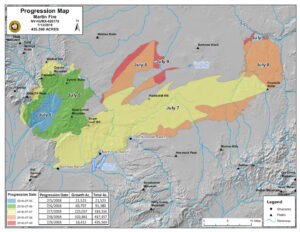
Map of the Martin Fire prepared by the Great Basin Interagency Management Team showing areas burned by the end of each day of the fire. The fire wasn’t declared contained until July 21. The stream on the east edge of the fire is South Fork Owyhee River. The North Fork Little Humboldt River canyon on the west stopped most of the July 6 run but was jumped on the 7th.
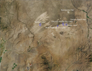
Screenshot of the U.S. Geological Survey aerial image of the Martin Fire for The National Map. The frame is approximately the same as that of the Martin Fire Progression Map.
The Owyhee Desert is important horse habitat. According to a September 2012 survey, the Owyhee and Little Owyhee Herd Management Areas (in the Nevada part of the Owyhee Desert) were home to 1,120 horses (U.S. Bureau of Land Management, 2012, Owyhee Complex Herd Management Area Gather, Final Environmental Assessment, DOI-BLM-NV-W010-2012-0055-EA). After the Martin Fire, an emergency horse gather collected 1,018 horses before the end of 2018.
The Owyhee Desert is also important sage grouse habitat. Most of the area has been classified as Priority Habitat Management Area (PHMA), which is the best sage grouse habitat. It is so good that most of the PHMA was designated as a Sagebrush Focal Area (SFA) in the “Record of Decision and Approved Resource Management Plan Amendments for the Great Basin Region, Including the Greater Sage-Grouse Sub-Regions of Idaho and Southwestern Montana, Nevada and Northeastern California, Oregon, Utah” by the BLM in September 2015. Mining is effectively prohibited in a SFA, like in Wilderness Areas, and oil and gas and geothermal development were also prohibited through a no-surface-occupancy stipulation. In addition, solar and wind development were prohibited in all PHMAs. Changes to the Management Plan Amendments with the change in President in 2016 eliminated SFAs. In any case, the PHMA protections went up in the smoke of the Martin Fire. 82% of the burned area was PHMA (including previous SFA) and the fire burned over about 8 active sage grouse leks east of North Fork Little Humboldt River (sagebrusheco.nv.gov/uploadedFiles/sagebrusheconvgov/content/Meetings/2018/WildfireReportforTour.pdf).
There has been less concern about other animals. NDOW has specified hunting seasons for antelope, elk, and mule deer in the area. The Owyhee Desert is probably home to most of the other common denizens of sagebrush steppe and maybe to some uncommon ones.
Restoration of burned habitat was planned and funded primarily by the Bureau of Land Management and Nevada Division of Wildlife but important cooperators included local ranchers, University of Nevada – Reno, Nevada Department of Agriculture, U.S. Fish and Wildlife Service, Nevada Division of Forestry, Nevada Cattlemen’s Association, and the National Weather Service.
In October and November 2018, a cheatgrass herbicide was sprayed aerially over 166 square km (64 square miles). To promote other species 352 square km (136 square miles) were aerially seeded, 577 square km (223 square miles) were broadcast seeded, and 93 square km (36 square miles) were drill seeded.
In fall 2019, an additional 98 square km (38 square miles) were sprayed with cheatgrass herbicide, 222 square km (86 square miles) were aerially seeded, and 62 square km (24 square miles) were drill seeded.
The Elko District Office planned 89 square km (34 square miles) of drill seeding and 61 square km (24 square miles) of aerial herbicide application in 2020 but didn’t post any documents that said the work was completed.
It all seems to have worked in the areas I visited. Burned areas were well vegetated with bunch grass and occasional sagebrush (see photograph Owyhee Desert 2023-04-29, #84) and I don’t remember seeing much, if any, cheatgrass. Although old tumbleweeds were abundant and piled up in the non-burned sagebrush, new growth was sparse.
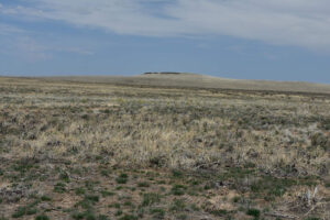
Area south of “Silver Lake” burned by Martin Fire 5 years ago. There is green bunch grass in the foreground, new sagebrush bushes in the middle distance, and a non-burned strip of sagebrush beyond that. The dried stems of a non-grass plant in the foreground are widespread and, along with some dried grass leaves, give the whole area a pale yellowish color but it’s not cheatgrass.
“Silver Lake” (Tuscarora BLM Office)
___This map is a screenshot of The National Map (Go to The National Map). The U.S. Geological Survey generally does not copyright or charge for its data or reports (unless printed). A pond location is indicated by an “X”, which corresponds to the coordinates given in the data spreadsheet. Labels in quotations are from 7.5-minute topographic quadrangles.
___Red lines are the U. S. National Grid with a spacing of 1,000 m and intersection labels consisting of the UTM zone (e.g., 11S, 12T), a 2-letter 100-km square designation (e.g., LC, XN), and a 4-digit number. The first 2 digits of the number represent the 1,000-meter Easting and the second 2 digits the 1,000-meter Northing, as seen in the example Easting and Northing. Unlike latitude and longitude, the National Grid is rectilinear on a flat map, the units of abscissa and ordinate have equal lengths, and the units (meters) are measurable on the ground with a tape or by pacing.
___There is no private land on this map. All lands are public.
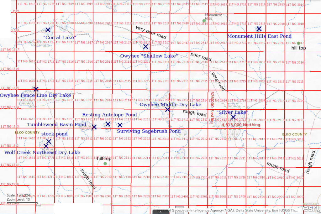
“Silver Lake” is 117.5 km (70.5 miles) northeast of Winnemucca and 120 km (72 miles) northwest of Elko. On the 1:100,000-scale BLM map, it is a stipple pattern 1,200 m x 2,000 m (3,940′ x 6,560′). It is 10 km (6 miles) west of “Desert Ranch Reservoir”, which is 18 km (11 miles) west of “Wilson Reservoir”. At about 35 km (22 miles) south of the Idaho border, it is rather centrally located within the Nevada portion of the Owyhee Desert. The lake may be named for the silver sagebrush growing over much of its bottom. The stock pond excavated in the middle of the dry lake next to the road may have the only water in the lake in most years.
With abundant silver sagebrush on the mud flat of “Silver Lake”, “Silver Lake” sets the pattern for many, if not most, ponds in the Owyhee Desert.
I followed the road past Scraper Springs north from Midas in 2017 and drove in from the east past “Deep Creek Reservoir” in 2023 but won’t attempt to describe the access in detail. See the introduction to the Owyhee Desert above.
Elevation: 1,618 m (5,310′)
May 23, 2017
On the road north of Midas, I saw deep swerving ruts in the mud where a single vehicle had been to a few stock tanks. So at least one rancher uses the road. The mud is more manageable now. At “Silver Lake”, there is a pond dug out in the middle of the lake that is probably for stock watering. The dirt piles are easily visible from the road across the lake bed.
- Water extends beyond the dugout pond over about 60 m x 80 m; depth not estimated.
- Water murky to clear.
- No fairy shrimp.
- Caught a few clam shrimp (Conchostraca) with the net, black diving beetles, avocets are defending nests on the island piles of dirt, ducks and phalaropes(?).
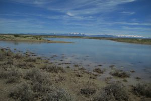
Looking east across pond dug in “Silver Lake” with Bull Run Mountains in the distance at left and the Independence Mountains at right. There are avocets and ducks in this view but they are too small to see clearly. One of the piles of dirt dug out of the stock pond is at left. Bushes in the foreground are silver sagebrush.
April 27, 2023
In contrast to my previous visit in May 2017, the only water this time is within the stock pond. There is none on the mud flat surrounding the stock pond. The mud is quite soft within about a meter (3′) of the water, particularly on the spoil piles. At least the pond hasn’t been pock marked by cows recently. I can easily get to the water on the southern shore between the spoil piles and I can reach pond water with the net rather than just water in hoof prints.
- 22 m x 60 m; depth seems to be about 10 cm at 1 step into the water but that may not fully account for my sinking in the mud.
- Opaque pale brown; 14 C in 2 cm water at 1330.
- Caught only a few fairy shrimp 10-12 mm long, at least 1 has eggs.
- Red copepods more than 1 mm long, probable cladocerans about 2 mm long, avocets and ducks are here again.
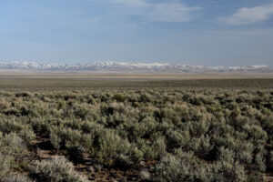
View to south across “Silver Lake” and the burned area beyond to the Snowstorm Mountains. Silver sagebrush of the “Silver Lake” basin is the lens at center which is gray rather than the gray-green of the closer sagebrush of a more widespread species. The pale terrain above the gray lens is the area burned by the Martin Fire in 2018. The pale color is not due to the much despised cheatgrass but is due to 20-40 cm (8-16″) dried stems of a non-grass plant I can’t identify and to dried leaves of seeded bunch grass.
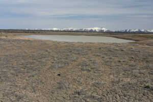
The stock pond in “Silver Lake”, with the spoil piles at far right and far left. There are avocets and ducks in the water and on the far shore, which can be seen if the photograph is greatly enlarged. This is a wide angle view with a short focal length of 31 mm so the pond is not as far away as it appears. Bull Run Mountains are in the distance.
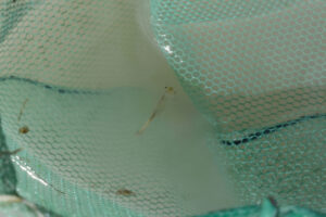
Fairy shrimp in the net at “Silver Lake”. Regrettably, it is too blurred to tell if it is a female with or without eggs but others do have eggs.
Wolf Creek Northeast Dry Lake (Tuscarora BLM Office)
Wolf Creek Northeast Dry Lake is an unnamed stipple-patterned area 9 km (5.6 miles) west of “Silver Lake”. On the 1:100,000-scale BLM map, it is 700 m (2,300′) by 1,200 m (3,940′). It is 3 km (1.9 miles) northeast of the eastern start of Wolf Creek, which is tributary to Milligan Creek. There is a stock pond dug out near the eastern edge. In 2023, I also looked at a natural pond about 250 m (820′) south of the stock pond. A useful landmark is the poor 2-track road toward the stock pond from the road which is 500 m (1,640′) east of the lake.
Like “Silver Lake”, Wolf Creek Northeast Dry Lake is a mud flat with common silver sagebrush.
For access, see “Silver Lake”.
Elevation: 1,630 m (5,350′)
May 23, 2017
Water extends well beyond the stock pond and there are marshy areas around much of the water’s edge.
- Dimensions and depths not estimated.
- Water is generally clear.
- No fairy shrimp.
- Copepods, ostracods(?), and black diving beetles; 3 avocets.
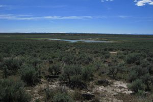
Wolf Creek Northeast Dry Lake, looking west with the Santa Rosa Range barely visible on the horizon. Most of the “lake” is covered by silver sagebrush but a small area around the stock pond on the east side is a grassy area with water. The basalt blocks in the foreground are similar to those that make some sections of road seriously bouncy.
April 28, 2023
Water is not as extensive as on the previous visit in 2017. There are 2 bodies of water: an excavated stock pond and a natural pond on a small part of the mostly dry lake bed. I describe them separately below. I didn’t see the natural pond in 2017. The mud flat around the natural pond is not too bad but the bottom and shoreline of the stock pond is too soft for wading into the water. The stock pond has not been used by cows recently so at least I can get to the water without staggering through the cow pocks.
Natural pond on dry lake bed:
- 32 m x 42 m; depth at least 3 cm.
- Cloudy pale brown water; 28 C in 2 cm water at 1545 (warmer than air).
- 6-8 mm long fairy shrimp; didn’t see eggs.
- Very abundant, pale yellowish brown ostracods less than 1 mm long.
Stock pond at east end of dry lake bed about 250 m northeast of the natural pond:
- 32 m x 65 m; depth at least 10 cm.
- Cloudy pale brown water; 24 C in 3 cm water at 1615 (warmer than air).
- 6-10 mm long fairy shrimp; some eggs.
- Pale yellowish brown ostracods less than 1 mm long, ducks.
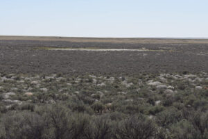
Wolf Creek Northeast Dry Lake, looking southwest. The natural pond occupies a small, nearly brush-free mud flat amidst the extensive silver sagebrush. The pale terrain in the distance beyond the pond was burned during the Martin Fire in 2018. The round, silver-gray features in the sagebrush are tumbleweeds, which proliferated after the fire.
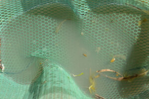
Fairy shrimp and at least 1 ostracod in net at Wolf Creek Northeast Dry Lake pond. The pale brownish yellow ostracod at right is bigger than most, at almost 2 mm long.
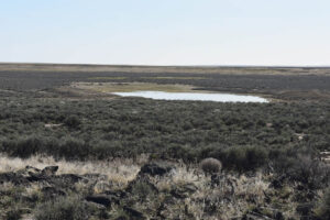
The stock pond in Wolf Creek Northeast Dry Lake in a view similar to photo Wolf Creek Northeast Dry Lake 2017-05-23 #10 but taken from a location closer to the pond. The vegetated berms are to the left and to the right of the pond. The natural pond is off the left edge of the photograph. Basalt blocks in foreground.
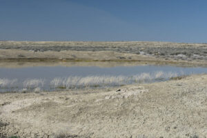
Looking north across the stock pond in Wolf Creek Northeast Dry Lake with ducks near the far shore, 1 to left of center and 2 just to the right of center.
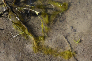
Fairy shrimp in very shallow water at edge of stock pond in Wolf Creek Northeast Dry Lake. The female at center has a single row of pale eggs in its ovisac.
Owyhee Fence Line Dry Lake (Tuscarora BLM Office)
Owyhee Fence Line Dry Lake is 110 km (68 miles) northeast of Winnemucca. It is shown on maps as a stipple pattern 3 km (1.9 miles) northwest of Wolf Creek Northeast Dry Lake and about 500 m (1,640′) west of the road. On the 1:100,000-scale BLM map, it has an irregular shape about 1,000 m by 1,200 m (3,280′ x 3,940′). The BLM map shows a straight, black-dashed “trail” crossing the western part of the lake. The “trail” is a fence line that is continuous for 10s of kilometers. BLM has slashed a fire break through the sagebrush more than 30 m (100′) wide along part of this fence line. A helpful landmark is a 2-track that turns east (away from the dry lake) off the road at the same latitude as the lake.
For access, see “Silver Lake”.
Elevation: 1,630 m (5,350′)
May 23, 2017
On the BLM map, this dry lake is about the same size as Wolf Creek Northeast Dry Lake but it doesn’t have water.
- Dry.
“Corral Lake” (Tuscarora BLM Office)
“Corral Lake” is 3 km (1.9 miles) north of Owyhee Fence Line Dry Lake and 10 km (6 miles) northwest of “Silver Lake”. The Corral Lake 7.5-minute topographic quadrangle and The National Map also have labels for “Corral Lake Reservoir”, which apparently apply to an excavated stock pond on “Corral Lake”. “Corral Lake” is a narrow, irregularly shaped stipple pattern on the 1:100,000-scale BLM map about 1,400 m (4,590′) long and no more than 400 m (1,310′) wide. The BLM map has another stipple-pattern dry lake about 400 m (1,310′) to the southwest of “Corral Lake”. “Corral Lake” is 1.5 km (0.9 miles) east of the road on a well defined 2-track “trail”, which is shown on the 1:100,000-scale BLM map. The “trail” continues across the dry lake to the east.
For access, see “Silver Lake”.
Elevation: 1,628 m (5,340′)
May 23, 2017
This lake is easy to find because the 2-track goes right through it in order to avoid the sagebrush. But no water.
- Dry.
Owyhee 5802 Stock Pond (Humboldt River BLM Office)
___This map is a screenshot of The National Map (Go to The National Map). The U.S. Geological Survey generally does not copyright or charge for its data or reports (unless printed). A pond location is indicated by an “X”, which corresponds to the coordinates given in the data spreadsheet. Labels in quotations are from 7.5-minute topographic quadrangles.
___Red lines are the U. S. National Grid with a spacing of 1,000 m and intersection labels consisting of the UTM zone (e.g., 11S, 12T), a 2-letter 100-km square designation (e.g., LC, XN), and a 4-digit number. The first 2 digits of the number represent the 1,000-meter Easting and the second 2 digits the 1,000-meter Northing, as seen in the example Easting and Northing. Unlike latitude and longitude, the National Grid is rectilinear on a flat map, the units of abscissa and ordinate have equal lengths, and the units (meters) are measurable on the ground with a tape or by pacing.
___There is no private land on this map. All lands are public.
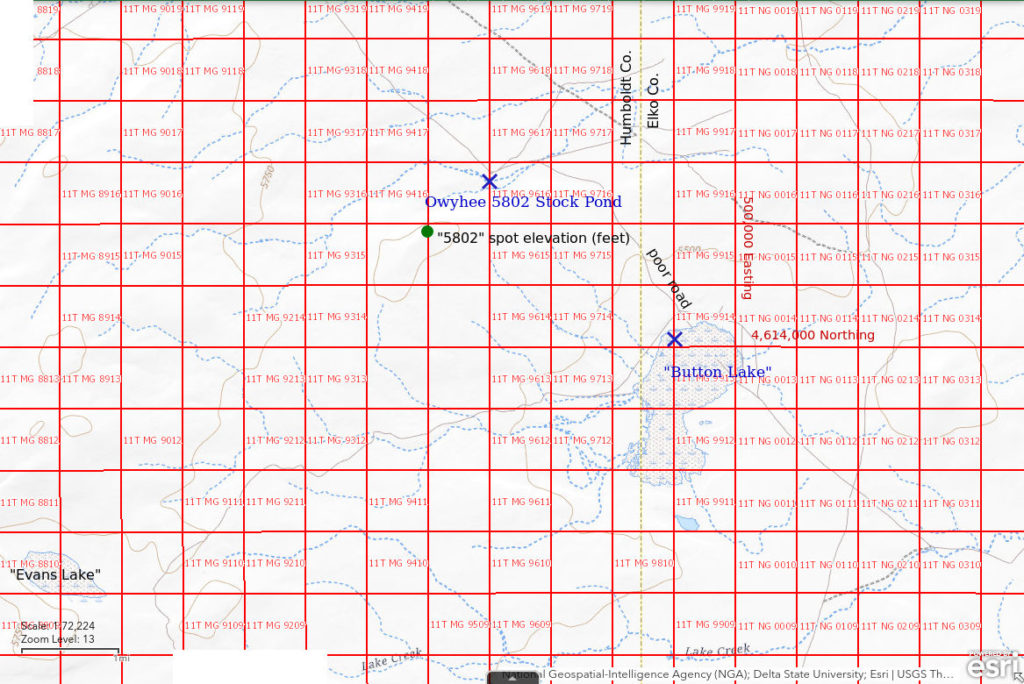
Owyhee 5802 Stock Pond is a pond about 1,500 m (4,920′) northeast of spot elevation 5802 feet (1,768 m) shown on the “Button Lake” 7.5-minute topographic quadrangle and the 1:100,000-scale BLM map northwest of “Button Lake”. It is in the drainage just south of the 2-track to “Button Lake” where the road bends sharply from southeasterly to easterly.
For access, see “Button Lake”.
Elevation: 1,691 m (5,550′)
May 24, 2017
This pond is on the slow drive from the gas pipeline to “Button Lake”. Just a small stock pond but NPPWOPII.
- Dimensions, depths not estimated
- Water clarity not noted.
- No fairy shrimp.
- Copepods, black diving beetles, possibly ostracods.
“Button Lake” (Humboldt River BLM Office)
“Button Lake” is 98 km (61 miles) northeast of Winnemucca. It is a 1,500 m by 2,500 m (4,920′ x 8,200′) stipple pattern on the 1:100,000-scale BLM map 20 km (12 miles) straight east of Hardscrabble Road at Greeley Flat. It is just east of the boundary of the North Fork Little Humboldt River Wilderness Study Area. There are 2 depressions less than 100 m (330′) across near the north end of the dry lake that hold water longer than the rest of the lake.
Access to “Button Lake” is relatively straightforward and easy to describe. Turn east off Hardscrabble Road 1 km (0.6 miles) south of Mud Spring to get onto the service road which follows the gas pipeline. The gas pipeline comes into view well south of Mud Spring so you can be ready to make the turn. There are bad spots on the pipeline road and the road becomes worse the farther it gets from Hardscrabble Road but at least there is never any doubt as to where the road is. After crossing the North Fork Little Humboldt River at the ford by Greeley Flat (private land), continue northeast for about 7 miles and turn south onto a rather poor 2-track road. The 2-track is easy to spot because the BLM has cut a wide firebreak along it. Follow the 2-track southeast to the north end of “Button Lake”.
Elevation: 1,655 m (5,430′)
May 24, 2017
There is water in the 2 ponds at the north end of the lake but almost nowhere else. The mud is so sticky and soft around the ponds that walking in the water is very difficult.
- Dimensions and depths not estimated.
- Very cloudy water.
- No fairy shrimp.
- Some copepods, small backswimmers (sub-order Heteroptera, family Notonectidae), possibly a fast-swimming amphipod or water boatman (sub-order Heteroptera, family Corixidae).
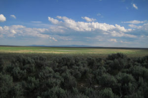
Looking southeast across “Button Lake” with the Snowstorm Mountains in the distance. The 2 non-green and non-yellow horizontal streaks near center are ponds with water. Lush sagebrush in foreground.
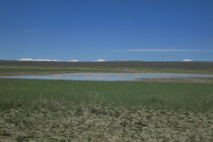
View west across one of the ponds in “Button Lake” with the peaks of the Santa Rosa Range barely poking above the horizon. The abundance of vegetation in the mud and mud cracks suggest that water was much more extensive earlier. Maybe I’m too late.
Monument Hills North Pond #1 (Tuscarora BLM Office)
Twelvemile Flat Playa Lake map
Monument Hills North Pond #1 is on the north side of Monument Hills 123 km (74 miles) northeast of Winnemucca. The Monument Hills are one of the few labeled topographic features on the 1:100,000-scale BLM map and the highest point has a spot elevation of 5,591 feet (1,704 m) on the “Silver Lake” 7.5-minute topographic quadrangle. The pond is about halfway between “Silver Lake” and Twelvemile Flat. The pond is not shown on the 1:100,000-scale BLM map, but it is in a 250 m x 400 m (3,940′ x 6,560′) stipple pattern shown on the “Silver Lake” 7.5-minute quadrangle. There are 3 small intermittent lake symbols within the stipple pattern and Monument Hills North Pond #1 may be the southern one, which is the smallest. Unlike Monument Hills North Pond #2, Monument Hills North Pond #1 appears to be natural except for a largely filled-in trench that connects it to Pond #2.
Like many ponds in the Owyhee Desert, Monument Hills North Pond #1 is on a mud flat with silver sagebrush.
After reaching the Owyhee Desert from “Deep Creek Reservoir” to the east, I turned north onto the road west of Chimney Creek. I followed that road northeast and then turned northwest toward Twelvemile Flat at an intersection about a mile northwest of the dam at “Desert Ranch Reservoir”. At times, the road was a barely discernible 2-track. I parked at the intersection with an even poorer 2-track that angled north-northwest to Twelvemile Flat and hiked approximately 4 km (2.4 miles) (straight line) southwest from there. This area had not been recently burned. Hiking through the sagebrush was a bit slow.
Elevation: 1,645 m (5,400′)
April 26, 2023
After almost 3 days of driving, it was nice to get feet on the ground and to start looking for fairy shrimp. Map-and-topography or map-and-compass methods are generally fine for my hiking needs but the Owyhee Desert is flat and distant peaks may or may not be visible for azimuth control so I also collected my GPS track to make sure I didn’t wander too far off course. I had used The National Map to get the pond coordinates beforehand. That was important because when I thought I had walked the 4 km based on the time, the coordinates showed I still had a ways to go. When I finally saw the water glinting in the sun, it was a relief. What would the Owyhee Desert ponds reveal this year?
- 18 m x 21 m; water depth greater than 7 cm.
- Opaque pale brown water; 25 C in 3 cm water at 1600.
- Various sizes of fairy shrimp 8-12 mm long, at least a few have eggs.
- Brownish-green ostracods less than 2 mm long, red copepods about 1 mm long, smaller black copepods or water mites, avocets.
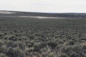
Monument Hills North Pond #1 (below) and Monument Hills North Pond #2 (above) with the Santa Rosa Range on the horizon. This view does not show evidence of a third pond to the right of these 2, as indicated on the “Silver Lake” 7.5-minute quadrangle.
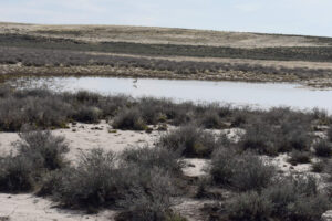
Monument Hills North Pond #1 with 2 avocets in the water. The sagebrush-free area in the background is due to a 2006 fire not to the Martin Fire.
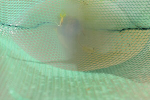
2 or maybe 3 fairy shrimp in the net at Monument Hills North Pond #1.

An ostracod in the net at Monument Hills North Pond #1. The mesh openings in the net are about 1.5 mm, for scale.
Monument Hills North Pond #2 (Tuscarora BLM Office)
Twelvemile Flat Playa Lake map
Monument Hills North Pond #2 is in the same depression and in the same stipple pattern on the BLM map as Monument Hills North Pond #1. It is about 100 m (330′) northwest of Pond #1. The pond has been excavated into an approximately rectangular shape with berms on the 2 long sides. There may have been a natural pond at this location prior to excavation. The western of the 3 intermittent lake symbols on the “Silver Lake” 7.5-minute quadrangle could be Monument Hills North Pond #2 as it has approximately the same size and shape. If so, the excavation is older than the 1972 aerial photographs used to make the “Silver Lake” quadrangle.
Like many ponds in the Owyhee Desert, Monument Hills North Pond #2 is on a mud flat with silver sagebrush.
For access, see Monument Hills North Pond #1.
Elevation: 1,645 m (5,400′)
April 26, 2023
Excavated material around the shore of Monument Hills North Pond #2 forms softer mud than the natural mud flat of Monument Hills North Pond #1 so wading in could be treacherous. Fortunately, the edge of the pond hasn’t been trampled by cows and the water is clear enough and shallow enough for me to see fairy shrimp if they are here.
- 35 m x 75 m; water depth greater than 5 cm.
- Cloudy pale brown water; 22 C in 2 cm water at 1615.
- Various sizes of fairy shrimp 8-12 mm long, a few have eggs.
- Dark diving beetles about 3 mm and about 8 mm long.
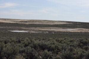
Monument Hills North Pond #2 (right) and Monument Hills North Pond #1 (left) with the 2006 burn in the background. Except for the 2 ponds, the basin floor is almost entirely covered by silver sagebrush.
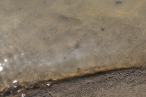
A fairy shrimp and its shadow in barely a centimeter (1/2″) of water at the edge of Monument Hills North Pond #2. There appears to be a thin row of eggs above the female’s similarly pale abdomen.
Twelvemile Flat Pond #1 (Tuscarora BLM Office)
Twelvemile Flat Playa Lake map
Twelvemile Flat Pond #1 is a stock-watering pond close to the southern edge of the stipple pattern for Twelvemile Flat shown on the 1:100,000-scale BLM map. Twelvemile Flat is 128 km (77 miles) northeast of Winnemucca. The pond is not shown on the BLM map or on the Twelvemile Flat 7.5-minute topographic quadrangle. It may not have been visible on the 1972 aerial photographs used to make the 7.5-minute quadrangle or it may have been constructed more recently than 1972.
For access, see Monument Hills North Pond #1. The track from where I parked to hike to Monument Hills North Pond #1 to Twelvemile Flat has sagebrush up to 50 cm (20″) high between the 2 tracks, which disappear in places. The 2-track forks at Twelvemile Flat Pond #2 with 1 fork to the north and 1 to the west. I followed the track to the north to Twelvemile Flat. The Twelvemile Flat 7.5-minute quadrangle shows the northerly track passing through a fence to the north side of Twelvemile Flat but there is no gate in the fence at that location and I couldn’t even see a road approaching the fence there. There is no evidence of vehicle traffic at a gate to the west. Twelvemile Flat Pond #1 is a few hundred meters (thousands of feet) south of the fence and west of the vehicle track.
Elevation: 1,605 m (5,270′)
April 27, 2023
As I began my search for water on Twelvemile Flat, I noticed a group of cows clustered off to my southwest. Although that was off my planned route, the cows might be hanging around a source of water. They were. It was great to find a pond but the mud was so soft and sticky and the pond had been so trampled by cows that I couldn’t hardly get to the water, and then it was only water in the hoof prints.
- 16 m x 23 m; water depth greater than 5 cm (in cow pocks).
- Opaque pale brown water; 10 C in 2 cm water at 0945.
- Caught only 2 fairy shrimp, about 8 mm and about 10 mm long; neither had eggs.
- No other aquatic animals observed.
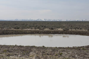
Twelvemile Flat Pond #1, with water recently muddied by cows. The Snowstorm Mountains are on the horizon to the south.
Twelvemile Flat Playa Lake (Tuscarora BLM Office)
___This map is a screenshot of The National Map (Go to The National Map). The U.S. Geological Survey generally does not copyright or charge for its data or reports (unless printed). A pond location is indicated by an “X”, which corresponds to the coordinates given in the data spreadsheet. Labels in quotations are from 7.5-minute topographic quadrangles.
___Red lines are the U. S. National Grid with a spacing of 1,000 m and intersection labels consisting of the UTM zone (e.g., 11S, 12T), a 2-letter 100-km square designation (e.g., LC, XN), and a 4-digit number. The first 2 digits of the number represent the 1,000-meter Easting and the second 2 digits the 1,000-meter Northing, as seen in the example Easting and Northing. Unlike latitude and longitude, the National Grid is rectilinear on a flat map, the units of abscissa and ordinate have equal lengths, and the units (meters) are measurable on the ground with a tape or by pacing.
___There is no private land on this map; all lands are public.
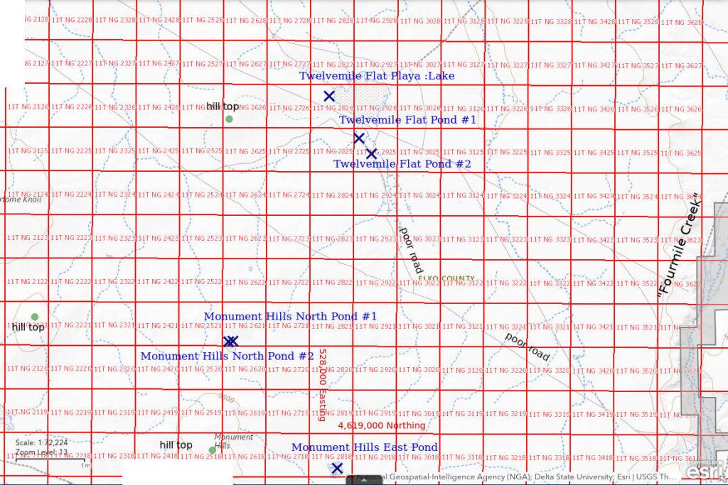
Twelvemile Flat Playa Lake is 128 km (77 miles) northeast of Winnemucca, 8 km (5 miles) southwest of the South Fork Owyhee River Wilderness Study Area, and 12 km (7 miles) northwest of “Desert Ranch Reservoir”. On the 1:100,000-scale BLM map, the northwest end of the flat has a 900 m x 1,200 m (2,950′ x 3,940′) stipple pattern. The Twelvemile Flat 7.5-minute topographic quadrangle does not show any intermittent lakes within the stipple pattern.
Twelvemile Flat has silver sagebrush around the margins but the stippled area on the map is a nearly barren clay flat.
For access, see Twelvemile Flat Pond #1.
Elevation: 1,605 m (5,270′)
April 27, 2023
In my search for water, I made a loop from the southeastern edge of the playa to the western side and then back to the east and south, including the detour to Twelvemile Flat Pond #1. To my surprise, abundant onions were sprouting over much of the mud flat, in some cases at a spacing of less than 10 cm (4″).
- Dry.
Although I didn’t find any water, there were places with brown, curly flakes of mud that suggested water had recently dried up. I collected the GPS coordinates at 1 of those locations.
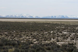
Looking southeast across Twelvemile Flat Playa Lake with the Bull Run Mountains in the distance. The white mud flat in the foreground has silver sagebrush, small bunch grass, and wild onions. The pale mud flat in the middle distance lacks vegetation and is quite dry now. The brown areas likely had the most recent water.
Twelvemile Flat Pond #2 (Tuscarora BLM Office)
Twelvemile Flat Playa Lake map
Twelvemile Flat Pond #2 is a round stock-watering pond about 450 m (1,480′) southeast of Twelvemile Flat Pond #1 and about 600 m (1,970′) south of the fence across Twelvemile Flat. It is hard to miss as it is next to the road to Twelvemile Flat, which is visible at this location. The Twelvemile Flat 7.5-minute topographic quadrangle, which was made with 1972 aerial photographs, does not show an intermittent water body near this location.
For access, see Twelvemile Flat Pond #1.
Elevation: 1,605 m (5,270′)
April 27, 2023
Like Twelvemile Flat Pond #1, Twelvemile Flat Pond #2 has soft, sticky mud that has been thoroughly cow-pocked. At the edge of the water, I am already sinking 10 cm (4″) into the mud so wading farther in is out of the question.
- 20 m x 21 m; water depth greater than 5 cm (in cow pocks).
- Opaque pale brown water; 14 C in 2 cm water at 1115.
- Caught only a few fairy shrimp that ranged in size from about 6 mm to about 10 mm long; some eggs.
- Ducks.
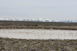
Twelvemile Flat Pond #2 with 2 ducks on the water and the Bull Run Mountains in the distance.
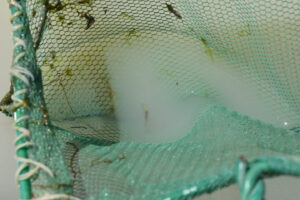
A nearly invisible fairy shrimp with visible eggs in the net at Twelvemile Flat Pond #2.
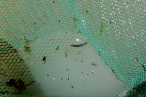
Male fairy shrimp in the net at Twelvemile Flat Pond #2. The fat basal segments of antennae II are clearly visible while the fainter distal segments are thinner, almost as long, probably tubular, and cross each other above the fairy shrimp’s mid-section. The small, black, oblong animals are not swimmers, they are on the surface of the water.
Monument Hills East Pond (Tuscarora BLM Office)
Monument Hills East Pond is in the eastern part of the Monument Hills about 2,800 m (9,190′) east of the highest point, which has spot elevation 5,591 feet (1,700 m). The pond is 4.8 km (2.9 miles) north of the stock pond in the middle of “Silver Lake”. On the “Silver Lake” 7.5-minute topographic quadrangle, Monument Hills East Pond is in a 280 m x 330 m (920′ x 1,080′) stippled area with 5 small intermittent lakes. Monument Hills East Pond probably corresponds to part of the northeastern intermittent lake, which is also the largest of the 5, but that is uncertain as other water bodies were not observed.
Like many ponds in the Owyhee Desert, Monument Hills East Pond is on a mud flat with silver sagebrush.
For access, see “Silver Lake”. From the stock pond in the middle of “Silver Lake”, follow the road to the north-northwest (dry at the time of my visit) for about 2 miles and park where it terminates at a road going southeast-northwest. On the “Silver Lake” 7.5-minute quadrangle, this intersection has a spot elevation of 5,448 feet (1,660 m). Monument Hills East Pond is about a 2 km (1.2 miles) hike through non-burned sagebrush to the northeast.
Elevation: 1,635 m (5,360′)
April 27, 2023
The stippled area for Monument Hills East Pond on the “Silver Lake” 7.5-minute quadrangle is overgrown with silver sagebrush with few brush-free areas. Although not trampled by cows, the mud is too soft and sticky to wade in much. However, I can dip my net while standing on sagebrush bushes in the water.
- 19 m x 30 m; water depth at least 3 cm.
- Opaque pale brown water.
- 6-10 mm long fairy shrimp, some with eggs.
- No other aquatic animals observed.
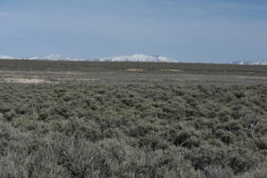
Monument Hills East Pond, looking east with Bull Run Mountains in distance. This doesn’t look good as all I can see is silver sagebrush. It is the grayer area that stretches across the middle of the photograph and is beyond the grayish-green sagebrush of a different species in the foreground.
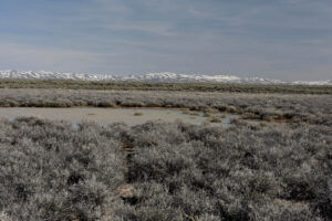
Encouragement, there is at least some water in Monument Hills East Pond. The relatively dense silver sagebrush is actually an advantage here as I can use the bushes as stepping stones into the water.
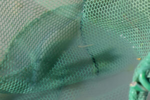
A very small fairy shrimp in the net at Monument Hills East Pond. This one looks to be about 6 mm long.
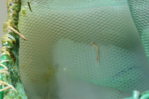
A larger fairy shrimp in the net at Monument Hills East Pond. This one is more like 10 mm long. It appears to be a female with brown eggs in a narrow ovisac to the left of its abdomen.
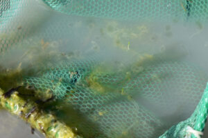
Monument Hills East Pond with some kind of gelatinous plant or algae with translucent, rounded forms in the net. I’ve never seen this before and don’t know what it is. It may say something about the ecology though.
Owyhee “Shallow Lake” (Tuscarora BLM Office)
Owyhee “Shallow Lake” is 6 km northwest of the stock pond in “Silver Lake” and 116 km (70 miles) northeast of Winnemucca. It is named “Shallow Lake” on the BLM and 7.5-minute maps. The pond has an irregular shape that is about 1,300 m (4,270′) long and up to 400 m (1,310′) wide on the 1:100,000-scale BLM map. The “Silver Lake” 7.5-minute topographic quadrangle has 2 intermittent lakes about 130 m and 90 m across within the stippled area. The pond I visited is closer to the southeastern intermittent lake, which is the smaller of the 2.
Like many ponds in the Owyhee Desert, Owyhee “Shallow Lake” is on a mud flat with silver sagebrush.
For access, see Monument Hills East Pond. From the parking spot for the hike to Monument Hills East Pond, follow the road to the northwest for about 2 miles. The BLM and 7.5-minute maps show a fork a short distance east of the lake with a “jeep trail” continuing to the northwest and an unimproved road turning due west. I never saw that intersection and may never have reached it. I also never reached the edge of a dry lake, playa, or silver sagebrush-covered area as the unimproved road does so I can’t verify that the unimproved road and jeep trail are as shown on the maps. In any case, the condition of the road gets even worse to the west of where I parked near the lake.
Elevation: 1,634 m (5,360′)
April 28, 2023
It was quite fortunate that I caught the sunlight glinting off some water as the road didn’t seem to be getting to Owyhee “Shallow Lake” as shown on the maps. The water seemed to be too far south of the road I was on to be Owyhee “Shallow Lake” but it was water so I couldn’t pass it up. I decided to camp at the first level spot and check out the water the next day. The water turned out to be a sizable pond, the mud wasn’t too soft and sticky, the mud hadn’t been cow-pocked, and silver sagebrush and chunks of basalt provided stepping stones into the water. What a treat. Lomatium and phlox have just started to bloom and there are wild onions sprouting from the cracked mud of the flats away from the water.
-
- About 100 m x 150 m; water depth at least 3 cm but maybe not much more.
- Cloudy pale brown water; 16 C in 1 cm water at 0945.
- Fairy shrimp 6-10 mm long, some have eggs.
- Abundant ostracods, red and black copepods about 1 mm long or less, a few ducks.
In spite of the difficulty of getting here at this time of year, I might have missed this pond if I had waited for lower stream flows. The pan evaporation rate is 4.3 mm/day in April at Ruby Lake, which is the most climatically similar pan evaporation station in Nevada (see “Pond Duration” on the About page). 3 cm of water would evaporate in about 7 days in a typical year. The water in Surviving Sagebrush Pond, Tumbleweed Basin Pond, Monument Hills East Pond, and the natural pond at Wolf Creek Northeast Dry Lake would dry up in about the same number of days. That suggests that the risk of driving past the flooded road was worth taking, except that I haven’t gotten out yet.
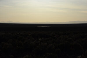
Sunlight glinting off a pond in Owyhee “Shallow Lake”. The mountains on the horizon to the southwest might be a pointed Adam Peak at the north end of the Osgood Mountains on the left, a rounded Winnemucca Mountain at center, and the Bloody Run Hills at the south end of the Santa Rosa Range at right.
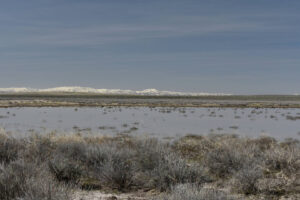
View to the south across Owyhee “Shallow Lake” with the Snowstorm Mountains on the horizon. Silver sagebrush bushes extend into the water and there are also black chunks of basalt for stepping stones near the far shore. Ducks near the far shore at right can be distinguished from the dark rocks by heads which stick up.
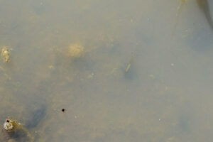
Barely visible female fairy shrimp with single row of white eggs near center swimming in cloudy water of Owyhee “Shallow Lake”.
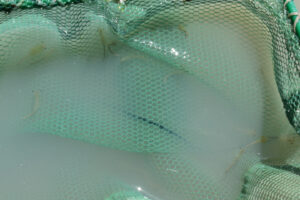
Several fairy shrimp of various sizes in the net at Owyhee “Shallow Lake”.
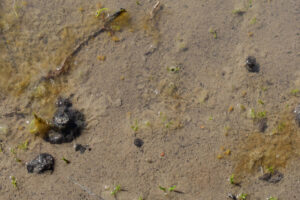
Oblong, brownish-yellow ostracods in very shallow water at edge of Owyhee “Shallow Lake”. There are a few near the stick at upper left and a couple at lower right. Some are almost twice as big as others. This suggests both the ostracods and fairy shrimp have hatched at different times in the past 1-3 weeks. For more on multiple hatches see “Winter 2022 Fairy Shrimp Hatching History on “Carson Lake” Playa and Rawhide Flats” at “Carson Lake” Playa.
Surviving Sagebrush Pond (Tuscarora BLM Office)
Surviving Sagebrush Pond is 3.8 km (2.3 miles) northeast of Wolf Creek Northeast Dry Lake and about 6 km (3.6 miles) east of the stock pond in “Silver Lake”. It is not shown on either the 1:100,000-scale BLM map or the “Silver Lake” 7.5-minute topographic quadrangle. The pond is a little north of the edge of the 2018 Martin Fire but there is a strip of sagebrush to its south that survived.
For access, see Owyhee Middle Dry Lake. From Owyhee Middle Dry Lake, follow the north edge of the burned area 2,600 m (8,530′) to the west and a little south. Hiking through the drill-seeded bunch grass is a lot easier than hiking through the sagebrush and tumbleweeds.
Elevation: 1,632 m (5,350′)
April 28, 2023
Surviving Sagebrush Pond is a serendipitous discovery on my way to Resting Antelope Pond, which is on both the BLM and 7.5-minute maps. However, there is so little water that I don’t hold out much hope for fairy shrimp. The mud is firm so I can walk right through the pond. Most of the water is in small depressions that are probably old hoof prints. There has been no recent cow use.
-
-
- 2 puddles no more than 10 m across; water depth probably not more than 4 cm.
- Cloudy pale brown water or clear water in different depressions; 26 C in 1 cm water at 1230.
- Fairy shrimp 8-10 mm long, some have eggs.
- Ostracods, abundant red copepods about 1 mm long, dytiscid larva (order Coleoptera, family Dytiscidae) about 10 mm long.
-
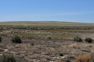
The larger, eastern puddle of Surviving Sagebrush Pond at center. The hill to the southwest is capped by the Wolf vertical azimuth benchmark on the “Corral Lake” 7.5-minute topographic quadrangle. The hill was thoroughly scorched by the Martin Fire 5 years ago but has been seeded and is recovering well. The sagebrush on the far side of the mud flat survived the fire, as did the few bushes in the foreground.
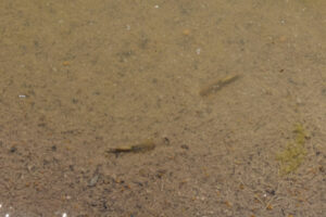
2 female fairy shrimp with eggs swimming in relatively clear water in Surviving Sagebrush Pond.
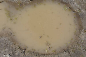
Abundant fairy shrimp partially visible in opaque water in Surviving Sagebrush Pond.
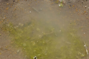
Some fairy shrimp in algae-rich water in Surviving Sagebrush Pond. This view has the same rounded gelatinous plants or algae that were also seen in Monument Hills East Pond. The striped upturned abdomen of a dytiscid larva is below center. 2 dark filaments point to the right from the dark end of the abdomen at the surface of the water.
Surviving Sagebrush Pond Fairy Shrimp Video 2023-04-28a-cr
For a 2-minute, 17-seconds video of fairy shrimp swimming in clear and cloudy water in very small depressions in Surviving Sagebrush Pond, click on the video player above. There is no audio. The surrounding area and an overview of the pond are shown in the first 35 seconds. The video then zooms in on a small depression with clear water. At 1:03, the video moves to a different depression with murkier water and then at 1:31 to a depression with almost opaque water. Very small, round, yellowish-brown ostracods can be seen swimming quickly, without the jerkiness of cladocerans or copepods, at several points in the video. My camera has the annoying habit of going out of, and then back into, focus but since I am recording things at different distances from the camera, I can’t use a single manual focus.
Resting Antelope Pond (Tuscarora BLM Office)
Resting Antelope Pond is 3.3 km (2.0 miles) northeast of Wolf Creek Northeast Dry Lake. It is within a stippled area on the 1:100,000-scale BLM map that is about 700 m (2,300′) long and 300 m (980′) wide. The “Silver Lake” and “Corral Lake” 7.5-minute topographic quadrangles show an intermittent lake about 100 m (330′) long within the stippled area. As I approached the pond, an antelope (pronghorn) that had been lying down stood up and watched me for a while before running off.
For access, see Owyhee Middle Dry Lake. From Owyhee Middle Dry Lake, follow the north edge of the burned area 3,200 m (10,500′) to the west. Or, from the road by Wolf Creek Northeast Pond, hike about 2,500 m (8,200′) to the northeast across the Martin Fire burn scar.
Elevation: 1,632 m (5,350′)
April 28, 2023
The area around Resting Antelope Pond was burned in the 2018 Martin Fire but there is still silver sagebrush to the north and west of the pond and, beyond that, non-burned sagebrush of a different species. The water is very shallow and the mud isn’t too soft so I can reach the water without using brush stepping stones. As with Surviving Sagebrush Pond, cows haven’t used the pond in recent years. Maybe they have been excluded from this grazing allotment since the fire to allow the vegetation to recover.
-
-
- 27 m x 120 m; water depth at least 5 cm.
- Cloudy pale brown water; 26 C in 2 cm water at 1315.
- 10-12 mm long fairy shrimp with eggs.
- Ostracods about 1 mm long.
-
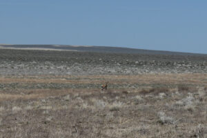
The previously resting antelope near Resting Antelope Pond. After I took a photograph of Resting Antelope Pond, the antelope was still watching me so I took a photograph of it, too. The area in the middle and far distance was not burned by the Martin Fire except for the 2 pale strips.
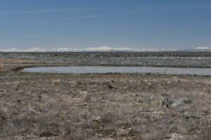
Resting Antelope Pond, with the Santa Rosa Range on the horizon to the west. The foreground was burned by the Martin Fire but there is non-burned silver sagebrush (gray) on the far side of the pond. The thick accumulation of silver-gray tumbleweeds in sagebrush at the edge of the burn is rather striking.
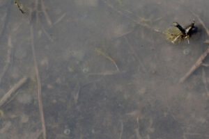
A female fairy shrimp with yellowish eggs and whitish food in its abdomen in Resting Antelope Pond.
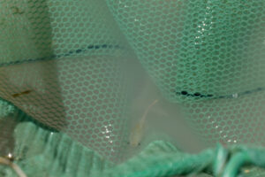
Male fairy shrimp in net at Resting Antelope Pond. The fat basal segments of antennae II are visible but the distal segments are thinner and much less visible.
Tumbleweed Basin Pond (Tuscarora BLM Office)
Tumbleweed Basin Pond is about 2 km (1.2 miles) northeast of Wolf Creek Northeast Dry Lake. It is a stippled area 900 m (2,950′) long and 400 m (1,310′) wide on the 1:100,000-scale BLM map. Unlike Resting Antelope Pond, Tumbleweed Basin Pond does not have any intermittent lakes on the “Corral Lake” 7.5-minute topographic quadrangle. It is in a shallow basin almost entirely covered by silver sagebrush. Because the pond is at the north edge of the Martin Fire burn, vast numbers of tumbleweeds blown off the burned area to the south have collected in its vicinity.
For access, hike about 1,300 m (4,270′) to the northeast from the road by Wolf Creek Northeast Pond. It’s quicker to hike across the recently burned area rather than to take a more direct route through the non-burned sagebrush.
Elevation: 1,631 m (5,350′)
April 28, 2023
Tumbleweeds are piled up against the silver sagebrush at the south edge of the basin, which is the north edge of the Martin Fire burn. They form a surprisingly formidable barrier that probably won’t do the displaced sage grouse any good. I walked through most of the depression and didn’t see water except in 2 puddles of opaque water. The water is mostly in small, shallow depressions that are probably old hoof prints, as in Surviving Sagebrush Pond.
-
-
- 2 puddles no more than 12 m across; water depth probably not more than 5 cm.
- Opaque pale brown water.
- Fairy shrimp of various sizes 6-10 mm long, some have eggs.
- No other aquatic animals observed.
-
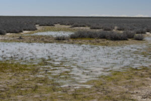
Tumbleweed Basin Pond. It’s just a couple of puddles with a little water. The surrounding brush is silver sagebrush. The Santa Rosa Range is on the horizon.
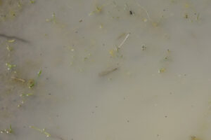
Fairy shrimp in Tumbleweed Basin Pond, a larger one at center and a smaller one above it. The black, oblong animals are not swimming; they are on the surface of the water.
Tumbleweed Basin Pond Fairy Shrimp Video 2023-04-28b-r
For a 1-minute, 48-seconds video of fairy shrimp swimming in opaque water in Tumbleweed Basin Pond, click on the video player above. There is no audio. The video shows fairy shrimp swimming near the surface or at the edges of the opaque water in a very small depression on the floor of Tumbleweed Basin Pond. Starting at 1:20, the video gives an overview of the pond and the surrounding landscape. I set the manual focus for the beginning of the video so the more distant views at the end are out of focus.
Owyhee Middle Dry Lake (Tuscarora BLM Office)
Owyhee Middle Dry Lake is about 3.5 km (2.1 miles) west of the stock pond in “Silver Lake”. It’s stippled area is smaller than that of “Silver Lake” and a little bigger than that of Wolf Creek Northeast Dry Lake. It measures 1,300 m (4,270′) long and up to 1,100 m (3,610′) wide on the 1:100,000-scale BLM map. It has no intermittent lakes on the “Silver Lake” 7.5-minute topographic quadrangle. It is rather centrally located between “Silver Lake” and Wolf Creek Northeast Dry Lake and south of Owyhee “Shallow Lake”.
Like other Owyhee Desert dry lakes, Owyhee Middle Dry Lake is mostly covered by silver sagebrush with some small bunch grass.
For access, see “Silver Lake”. From the stock pond in “Silver Lake’, follow an unmapped 2-track due west through the silver sagebrush for about 0.5 miles and then on a more winding route for another 1.5 miles. The road passes a guzzler with minimal fire damage. The guzzler offers water to pronghorns, which can duck under the lowest bar or wire, but cows and horses have been excluded. The water in the guzzler is inhabited by backswimmers (sub-order Heteroptera, family Notonectidae).
Elevation: 1,624 m (5,330′)
April 28, 2023
It was a stroke of good luck to find a road to Owyhee Middle Dry Lake. Without it, I probably would not have had time to visit all of Surviving Sagebrush, Antelope Resting, and Tumbleweed Basin ponds and Wolf Creek Northeast Dry Lake. I spent some time walking around on the clay flat but didn’t find any water, mud, or even a brush-free area more than 100 m (330′) across.
-
-
- Dry.
-
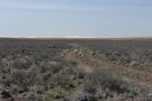
The track to Owyhee Middle Dry Lake through the silver sagebrush of “Silver Lake”. Although in the direct path of the Martin Fire, the silver sagebrush here did not burn. That may be because silver sagebrush is not as aromatic as most other species (Shultz, L., 2014, Pocket Guide to Sagebrush: Point Blue Conservation Science, 83 p.). A lower concentration of oil may make it less combustible.
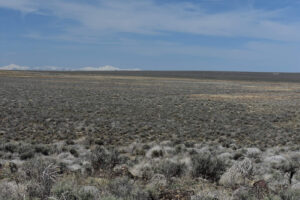
View to the west across Owyhee Middle Dry Lake from a small bench. There is lots of gray silver sagebrush and common silver-gray tumbleweeds. The Martin Fire burned through the southern part of the dry lake but not through this northern part. Snowy peaks of the Santa Rosa Range are visible on the horizon. I took the GPS reading on a less brushy mud flat out in the middle.
What Can We Learn from the Ponds in the Owyhee Desert?
Ponds in the Owyhee Desert are so hard to get to when they are likely to have water, the roads are so bad, and the consequences of a vehicle problem are so dire that I don’t recommend going to the Owyhee Desert for fairy shrimp in the spring.
Fairy shrimp were present in all 11 ponds that had water when I visited in 2023. 2 ponds were dry. In 2017, 0 of 4 ponds had fairy shrimp and 2 were dry. Repeat observations of “Silver Lake” and Wolf Creek Northeast Dry Lake found they had fairy shrimp in 2023 but not in 2017. This reinforces the lesson that failure to find fairy shrimp on one visit does not mean they aren’t there.
The aquatic fauna changed in other ways. I found clam shrimp in 2017 but not in 2023 and ostracods in 2023 but not in 2017.
In spite of very low water levels in many of the ponds in 2023, they collectively had a rich aquatic fauna of ostracods, copepods, probably cladocerans, and dytiscid larvae in at least 1 pond each in addition to fairy shrimp.
Although not abundant, ducks and avocets were present at Owyhee Desert ponds in both 2017 and 2023 and are the obvious dispersal agents. There were many ducks at “Desert Ranch Reservoir” in 2023, which is less than 21 km (13 miles) from Wolf Creek Northeast Dry Lake and closer to the other wet ponds that I visited.
Areas shown as stippled on the 1:100,000-scale BLM maps as well as on the 7.5-minute quadrangles are mostly covered with silver sagebrush, albeit on a mud flat floor. This differs from stipple patterns in many other areas of Nevada which indicate largely brush-free playas (or sand). Did the Owyhee Desert dry lakes become overgrown with silver sagebrush during the last few decades since the maps were made or did the topographers use a playa (or sand) symbol for silver sagebrush mud flats as the least misleading of the available symbols?
Using 1:24,000-scale 7.5-minute topographic quadrangles by the U.S. Geological Survey really does improve the chances for success in a search for fairy shrimp. In 2017, I used only 1:100,000-scale BLM maps, visited the larger dry lakes shown on the BLM maps, and found no fairy shrimp. In 2023, I planned visits to the Monument Hills North Ponds and Monument Hills East Pond using the 7.5-minute quadrangle and found fairy shrimp in both.