The base map is provided by OpenTopoMap’s volunteer servers.
8A Culvert Pond
“Fortynine Lake”
Fortynine North Pond
“Calcutta Lake”
“Horse Lake”
Frog Chorus Reservoir
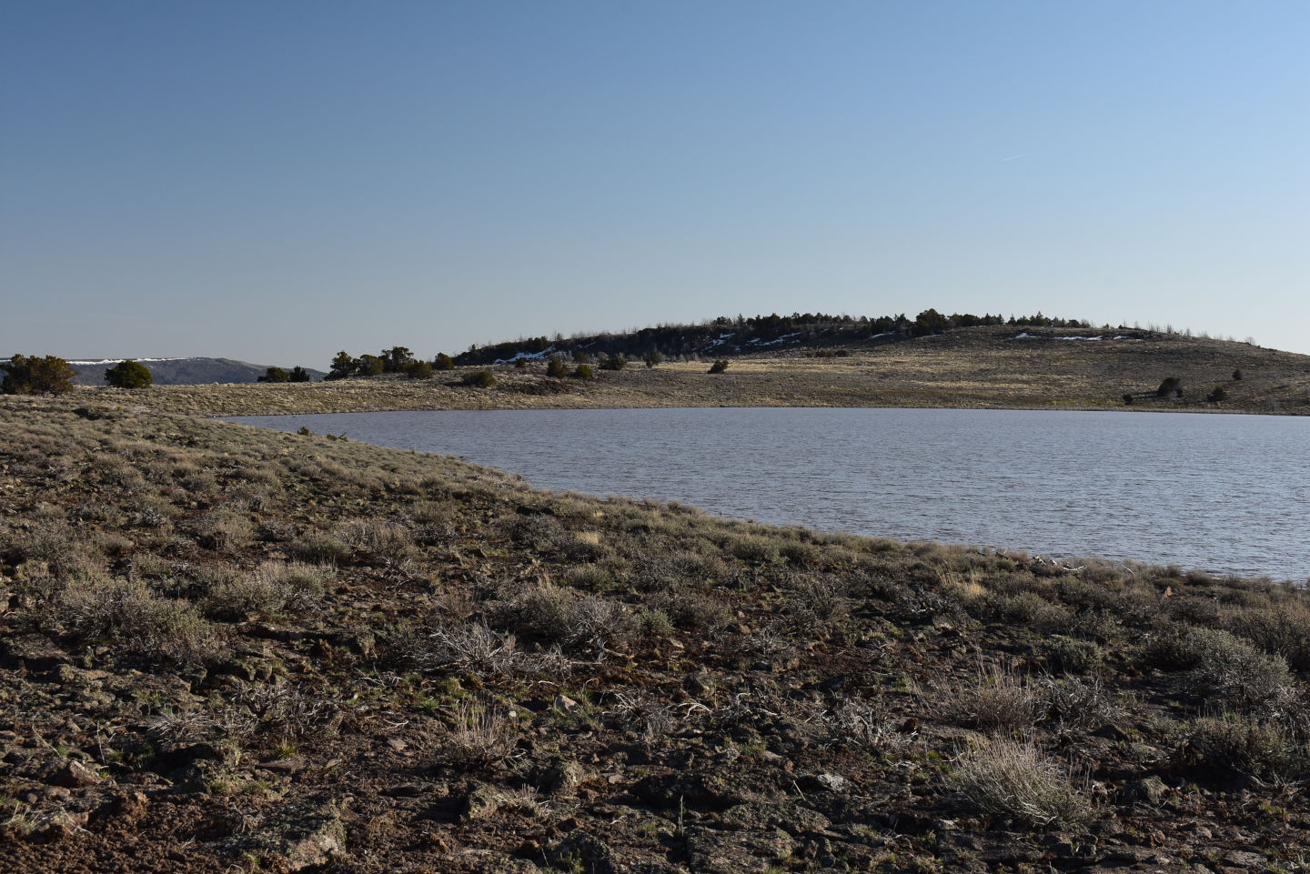
Townsend Dry Lake
Townsend North Stock Pond
“Cow Lake”
Upper Macy Lake
What Can We Learn from the Ponds in Northern Washoe County?
There are several playa lakes scattered across northern Washoe County in topographic features large and small. Rather than create separate web pages for each one, it is easier to just lump them together in northern Washoe County. They represent similar habitats for fairy shrimp and are likely to have the same species.
A convenient southern boundary of northern Washoe County is the southern boundary of Township 40 North. More practically, the area of northern Washoe County is north of the Hays Canyon Range, which has its own web page. There is probably no need to precisely define the eastern half of the southern boundary of northern Washoe County. With these guidelines, northern Washoe County includes, from south to north, Box Flat, Long Valley, the “Massacre Lake” depression, “Crooks Lake”, Mosquito Valley, Macy Flat, and the intervening areas. This area is about 75 km (45 miles) from south to north and 56 km (34 miles) from west to east.
Northern Washoe County has a modest elevation range. “Alkali Lake” is about the lowest point in northern Washoe County and serves as the terminus for most of the internal drainage. It has an elevation of 1,680 m (5,510′) on The National Map. The extreme northwestern corner of the county and Coleman Valley, just south of the Oregon border are somewhat lower. At 2,192 m (7,190′), Bald Mountain is the highest point in northern Washoe County exclusive of Fortynine Mountain, which doesn’t count because it is private land and no one can go there. A few other high points include Nellie Spring Mountain at 2,082 m (6,830′), Painted Point at 1,918 m (6,290′), Table Butte at 2,000 m (6,560′), and the crest of Massacre Rim at 2,000-2,070 m (6,560′-6,790′). Most of the area is below 1,900 m (6,230′).
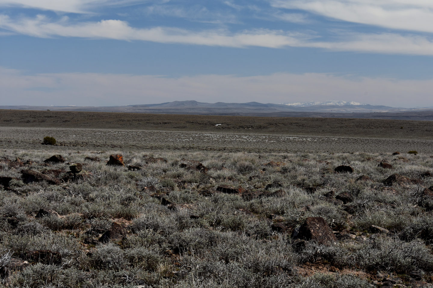
Sagebrush reigns supreme in northern Washoe County. The floor of Long Valley also has some greasewood, rabbitbrush, and budsage. Higher elevations have scattered to dense juniper, depending largely on how recently it has burned. The juniper particularly likes rocky outcrops, which have abundant fractures for collecting water.
Fairy shrimp have previously been found in northern Washoe County. Rogers and Fugate (2001) reported collecting Branchinecta hiberna on March 17 from a “vernal pool” at 1,850 m (6,070′) off Washoe County Road 8A on Fortynine Mountain. B. hiberna is adapted to cold conditions. It can hatch at 4 C and live under 2.5 cm of ice. The species lives in clear to turbid water.
There are large blocks of private land in northern Washoe County, such as Fortynine Mountain, “Boulder Lake” and areas to the south and east, southern Long Valley, in Long Valley west of Black Hills, surrounding “Massacre Lake”, from Vya up the west side of “Alkali Lake”, between “Alkali Lake” and “Mosquito Lake”, circling “Mosquito Lake”, “Crooks Lake”, north of Mosquito Valley, and in Coleman Valley. The Sheldon National Wildlife Refuge occupies the northeastern part of northern Washoe County and extends into Humboldt County.
There are no paved roads in northern Washoe County. The nearest is California 299, which ends at the border west of Fortynine Mountain. Oregon/Nevada 140 passes from Adel, Oregon, southeast through Sheldon National Wildlife Refuge to Denio, Nevada, but just misses the northeastern corner of Washoe County. There are 2 access routes from the south. Nevada 447 leads from Gerlach to Surprise Valley and Cedarville in California. From Cedarville, paved California 299 goes east to, and becomes, non-paved Washoe County Road 8A at the border. 8A crosses Fortynine Mountain to Vya. From Vya, 8A continues east and provides access to US 140 within the Refuge as well as to “Summit Lake” Indian Reservation. The other southern access road is non-paved Washoe County Road 34 from Gerlach across Hualapai Flat, up Leadville Canyon to west of High Rock Canyon, and on to Vya. The main non-paved roads across the Refuge from US 140 are probably okay, except in winter or when wet.
8A Culvert Pond (Applegate BLM Office)
“Fortynine Lake” map
8A Culvert Pond is adjacent to the first culvert on 8A east of Washoe County Road 34 at a distance of 1.2 km (0.7 mile) from that intersection. The culvert has 2 corrugated metal pipes. 8A Culvert Pond is on the north side of the road. Water was also present in other places along the drainage channel in April 2025 all the way to “Fortynine Lake” and at least a short distance to the north.
8A Culvert Pond is 22 miles east of Cedarville, California, via paved Modoc County 299 as far as the Nevada border and non-paved Washoe County 8A over Fortynine Mountain. Although there is little traffic on 8A, one can pull off the road 30-40 m east of the culvert where the shoulder is low. From the Nevada border to this point, 8A is well maintained by the county. It would be passable to most passenger vehicles except under adverse weather conditions, such as significant snow or rain.
Elevation: 1,688 m (5,540′)
April 9, 2025
Many of the low elevation ponds in west-central Nevada have dried out. The December 2024 through March 2025 precipitation in Reno has been about 80% of normal. However, weather forecast maps over the winter have often predicted precipitation in southern Oregon and northernmost Nevada when west-central Nevada was predicted to be dry. Long Valley is worth a try. I planned to stop at “Fortynine Lake” first but this pond appeared before I got there. NPPWOPII.
- 11 m x 16 m; greater than 20 cm deep.
- Opaque pale brown water; 20 C at 1315 in 5 cm water.
- Fairy shrimp about 15 mm long; females have eggs.
- A male and a female duck flew off on my approach. Would they actually consider building a nest in a pipe under the road?
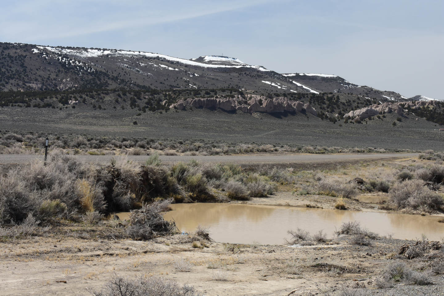
8A Culvert Pond on north side of Washoe County Road 8A, with Fortynine Mountain in the distance. Although there is water elsewhere in the channel, water in the pond is not flowing because the 2 corrugated metal pipes under the road are higher than the water level in the pond.
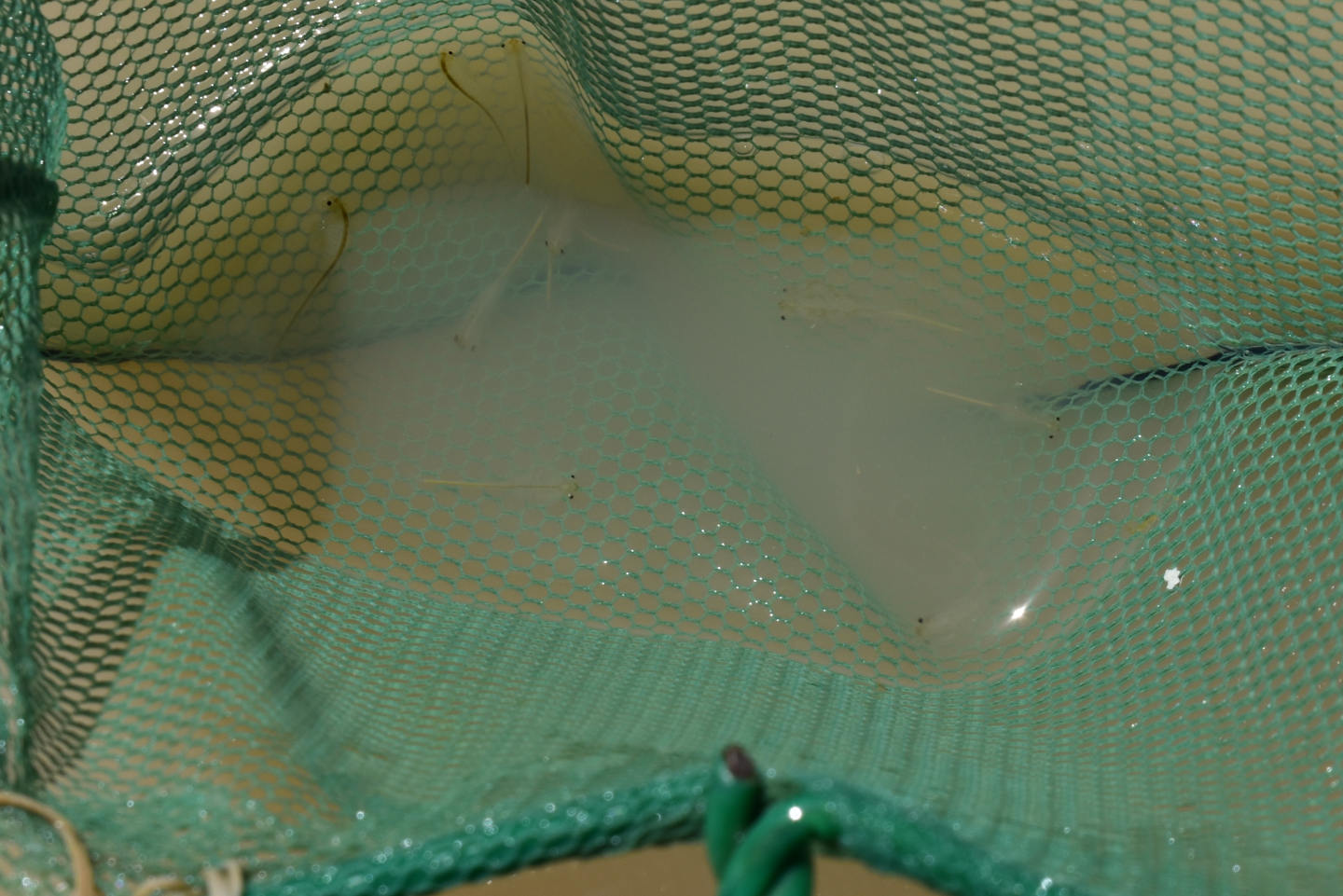
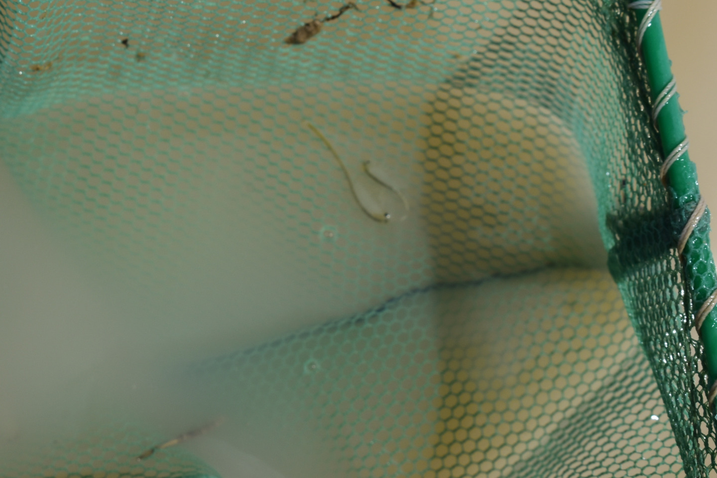
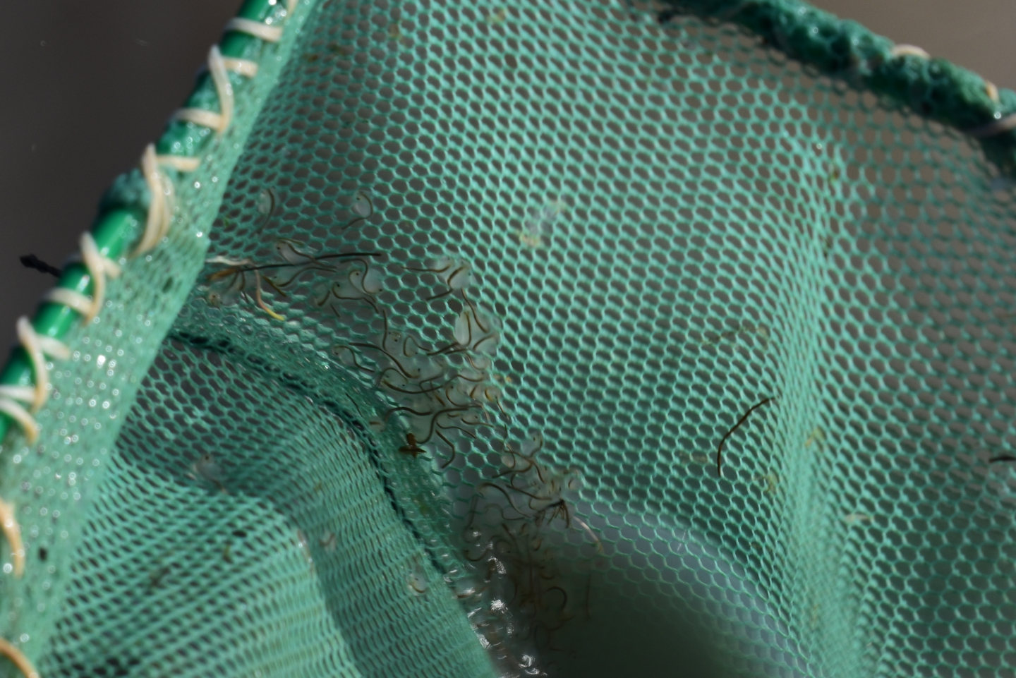
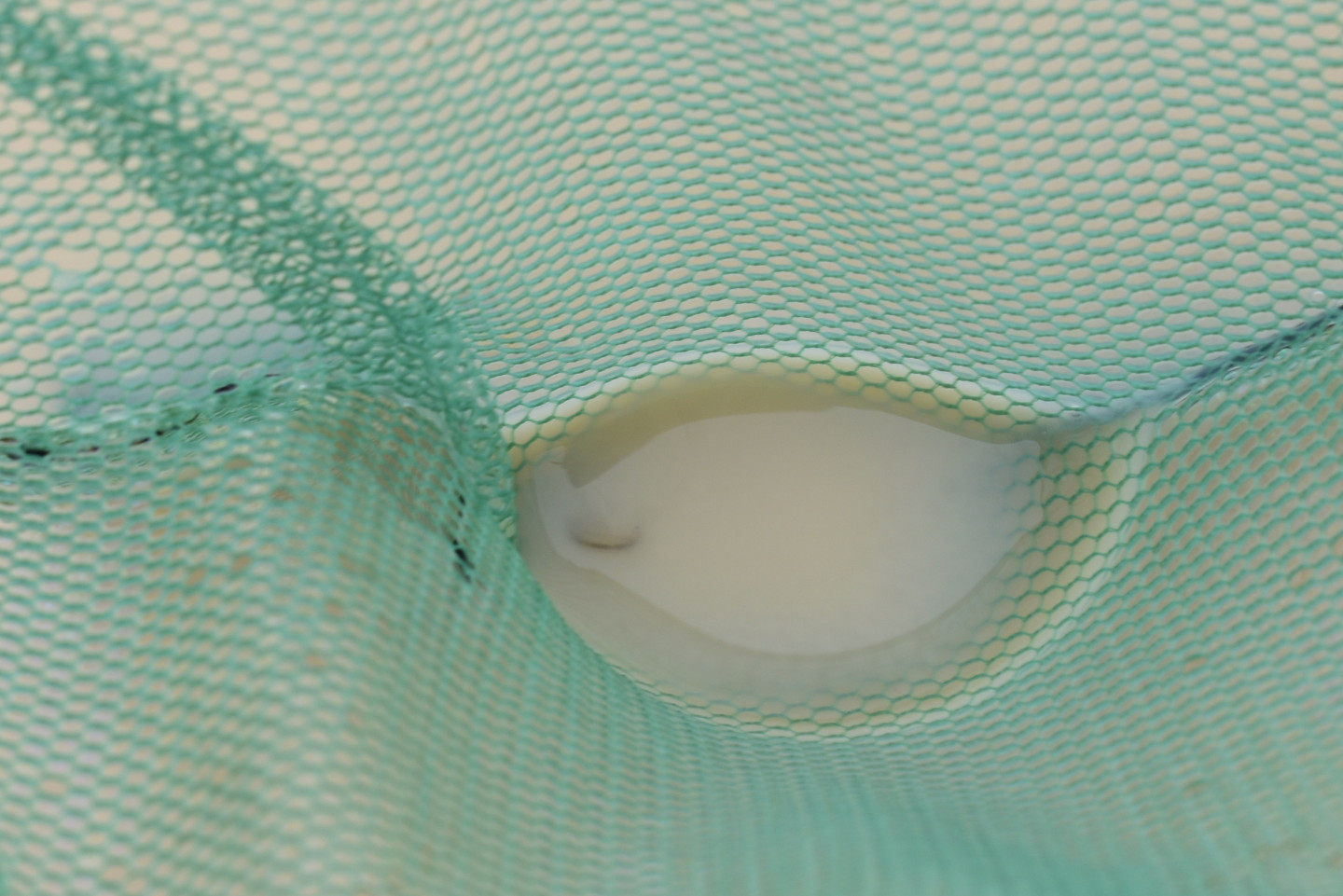
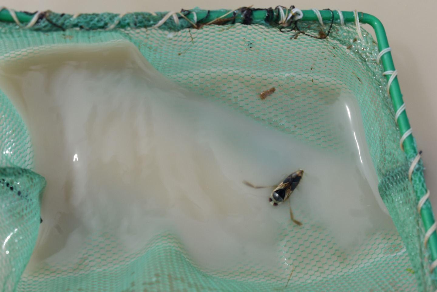
Several fairy shrimp in the net at 8A Culvert Pond. The slightly larger one above center is a male with barely visible large antennae II. Most of the others look like females. None of these have visible eggs but a few others did.
“Fortynine Lake” (Applegate BLM Office)
___This map is a screenshot of The National Map (Go to The National Map). The U.S. Geological Survey generally does not copyright or charge for its data or reports (unless printed). A pond location is indicated by an “X”, which corresponds to the coordinates given in the data spreadsheet. Labels in quotations are from 7.5-minute topographic quadrangles.
___As of April 2025, the National Grid overlay with red lines in UTM coordinates does not load in The National Map.
___Gray shading represents private land as traced from the PAD-US 2.0 – Federal Fee Managers layer of The National Map. Other lands are public.
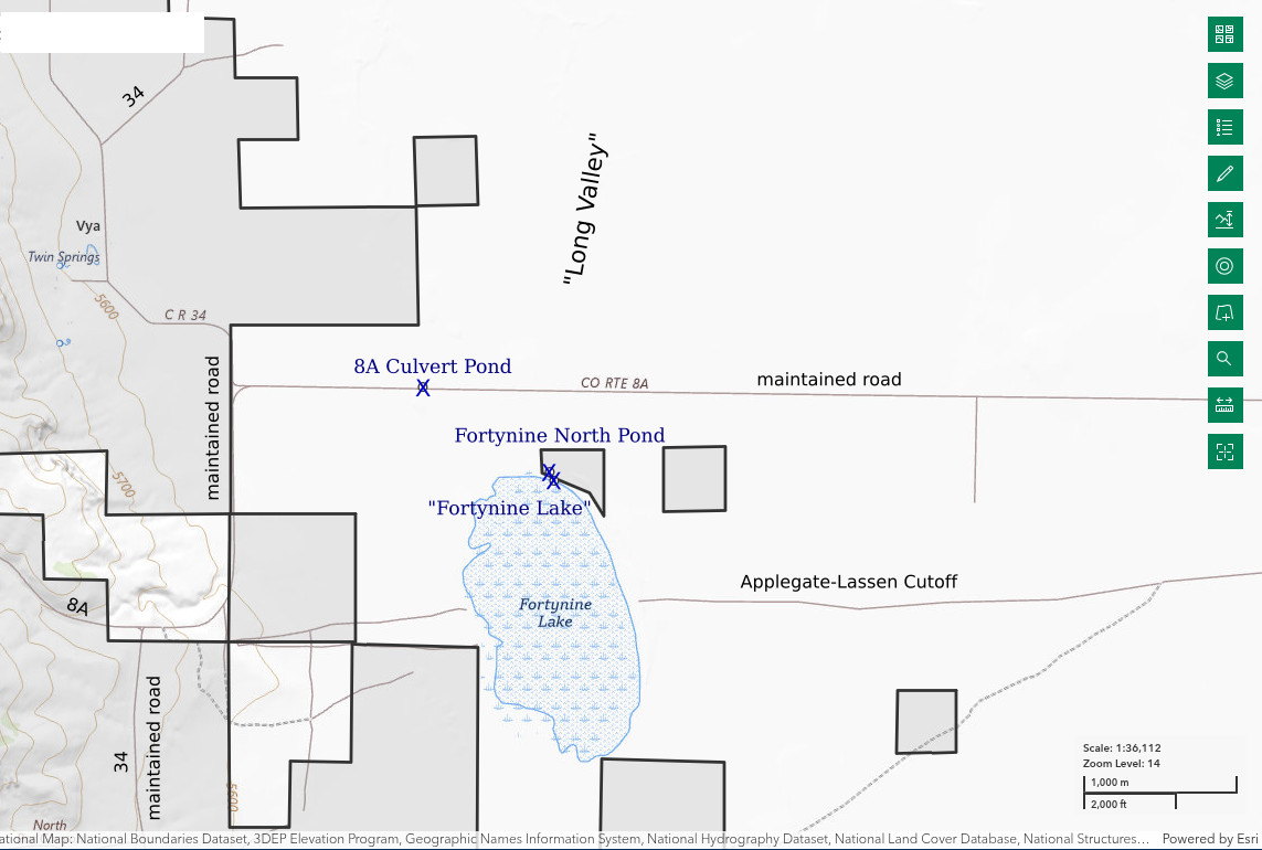
“Fortynine Lake” is in the middle part of Long Valley 3.5 km southeast of the site of Vya, which seems be a few old, unused ranch buildings, but it is on the state highway map. On the 1:100,000-scale BLM map, the lake is 2.0 km long and 0.8 km wide (6,560′ x 2,620′). The valley floor is very flat in this area but the map shows channels flowing into “Fortynine Lake” from the east, south, and southwest. They disappear into alluvium before reaching the lake. A channel at the north end of the lake likely flows north to “Alkali Lake”.
“Fortynine Lake” is named for the gold seekers who followed the Applegate (or Applegate-Lassen) Cutoff of the Oregon-California Trail in 1849. The Applegate trail goes through the middle of the lake from east to west. Of course, in most years, the lake was dry by mid-summer but, if not, the travelers detoured around the north end of the lake (according to the historical marker on 8A south of the junction with 34). The Applegate trail comes from the Humboldt River west of Winnemucca and heads northwest and north across the Black Rock Desert to Mud Meadows. From there it goes west to “High Rock Lake”, up High Rock Canyon, and then northwest to south of “Massacre Lake” before turning due west toward Vya. From Vya, the trail follows 8A, more or less, over Fortynine Mountain into Surprise Valley. On the west side of Fortynine Mountain, the trail goes northwest between “Upper Alkali Lake” and “Middle Alkali Lake” rather than west across “Middle Alkali Lake” to what is now Cedarville. From the west side of “Upper Alkali Lake”, the trail crosses the Warner Mountains at Fandango Pass.
Washoe County Road 8A provides access to “Fortynine Lake” as it does to 8A Culvert Pond. In addition to the route from Cedarville, one can reach the intersection of 8A and 34 at Vya by following non-paved Washoe County Road 34 north from Gerlach, Nevada, or south from Adel, Oregon. The lake is a 1.0 km (0.6 mile) walk from 8A Culvert Pond. For a slightly shorter walk, one could drive farther east on 8A before parking.
Elevation: 1,688 m (5,540′)
April 9, 2025
The trip got off to a good start at 8A Culvert Pond. What will I find in “Fortynine Lake”? Luckily, the lake bottom was relatively firm. Although I could wade more than 100 m (330′) from the shore, the water didn’t get deeper than 10 cm.
- Map dimensions 800 m x 2,000 m; greater than 10 cm deep.
- Opaque pale brown water; 20 C in 5 cm water at 1415.
- Fairy shrimp 10-15 mm long; didn’t see eggs.
- Tadpole shrimp (Notostraca), 3-4 mm brown beetles, ducks, avocets.
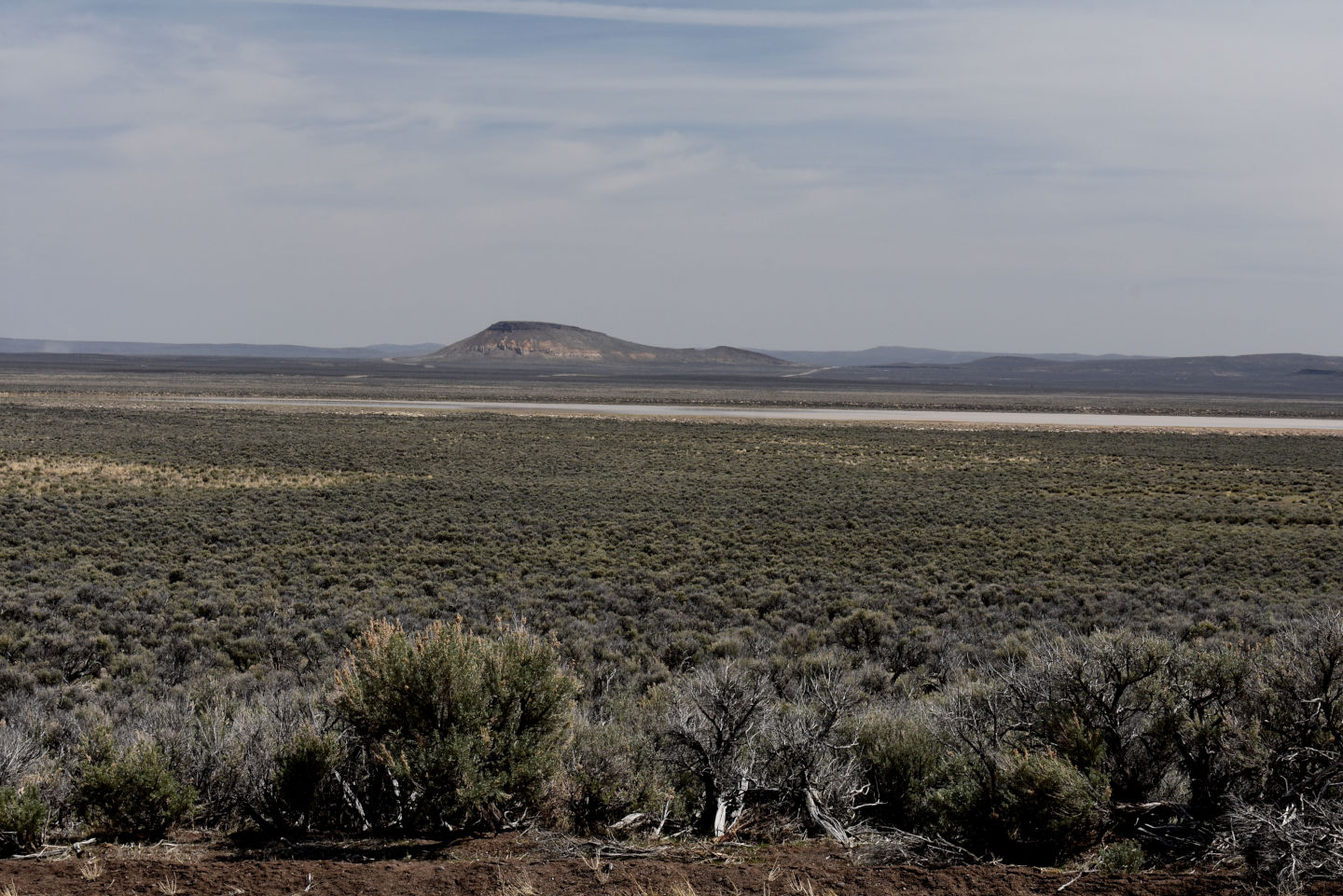
View east across “Fortynine Lake” from the historical marker on road 8A. The hill on the far side is Painted Point, which was a landmark on the Applegate Cutoff.
A larger fairy shrimp about 15 mm long and a smaller one about 10 mm long in the net at “Fortynine Lake”. The greatly different lengths indicate they hatched at different times. Different hatching times were related to precipitation events for a population of Branchinecta mackini in the Mojave Desert (Brown and Carpelan, 1971).
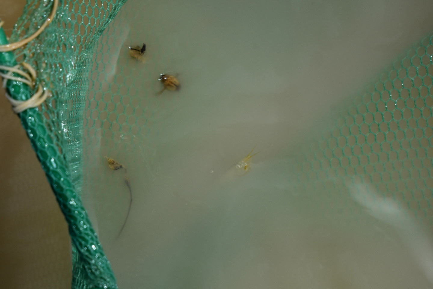
A little brown beetle (upper left) and a young, translucent tadpole shrimp (near center) in the net at “Fortynine Lake”. The tadpole shrimp can be identified by the 2 tail-like features extending to the upper right from the end of its abdomen. The faint outline of a carapace is visible in another photograph. All the mature tadpole shrimp I have seen are considerably larger and less translucent (e.g., tadpole shrimp in Hays Canyon Range).
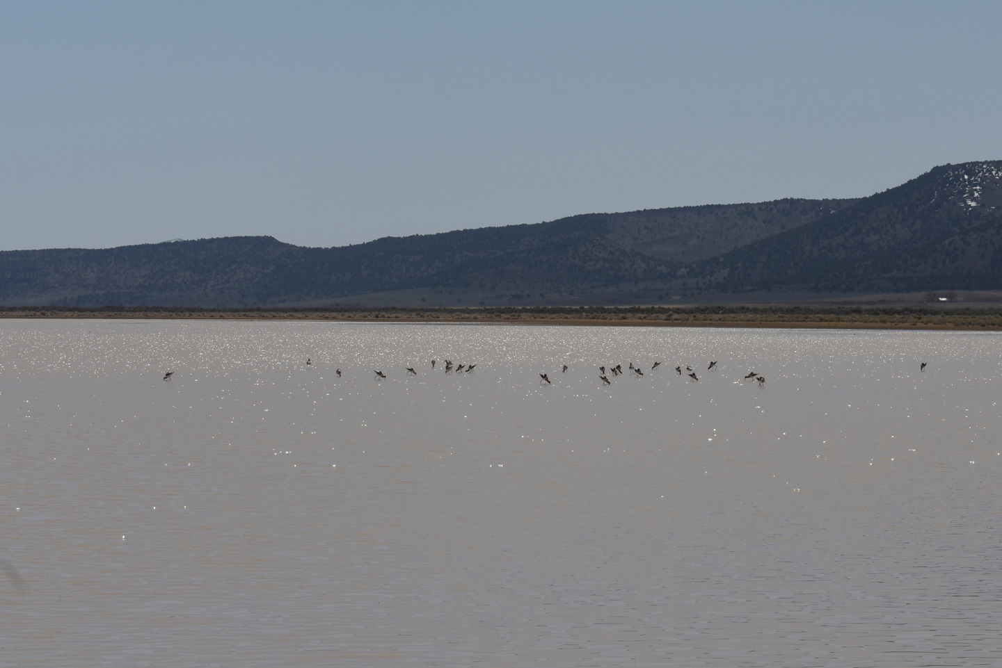
A flock of avocets poking in the water of “Fortynine Lake”. I don’t know how they manage to feed on fairy shrimp under these conditions. I’m pretty sure they don’t have x-ray vision that allows them to see what’s in the opaque water. Maybe they just poke at random and hope to catch one in their bills. The success of such a method would obviously be dependent on the population density of fairy shrimp. Maybe there are a lot of fairy shrimp out there. The avocets are more than 150 m (490′) from shore but the water can’t be deep because most of their legs are above the water.
Fortynine North Pond (Applegate BLM Office)
“Fortynine Lake” map
Fortynine North Pond is in a long, very shallow depression about 60 m (200′) north of “Fortynine Lake”. It consists of a string of puddles well over 100 m (330′) long. Lengths of individual puddles are maybe 10-30 m (33-100′) and widths are generally less than 10 m (33′). Maybe the depression is what remains of wagon ruts over 150 years old.
When I plotted the location where I collected GPS coordinates on The National Map with a land ownership overlay, I discovered it was in a small piece of private land (less than 1/3 of a 1/16th section, or 13 acres, or 5.3 hectares) on the north shore of the lake. If there were a fence or signs, I could have avoided the private land but there weren’t.
Access is the same as for “Fortynine Lake”.
Elevation: 1,689 m (5,540′)
April 9, 2025
Soon after I started walking back toward my vehicle, I came across this pond. As I had already found fairy shrimp in the lake, I was inclined to dismiss it. But then I looked closer. The mud wasn’t soft so I could walk through the puddles to get a good look.
- Dimensions of individual puddles weren’t measured; maximum depth about 8 cm.
- Water looks clear thanks to the shallow depth.
- Fairy shrimp 10-15 mm long; larger ones have eggs.
- Young dytiscid larvae less than 15 mm long.
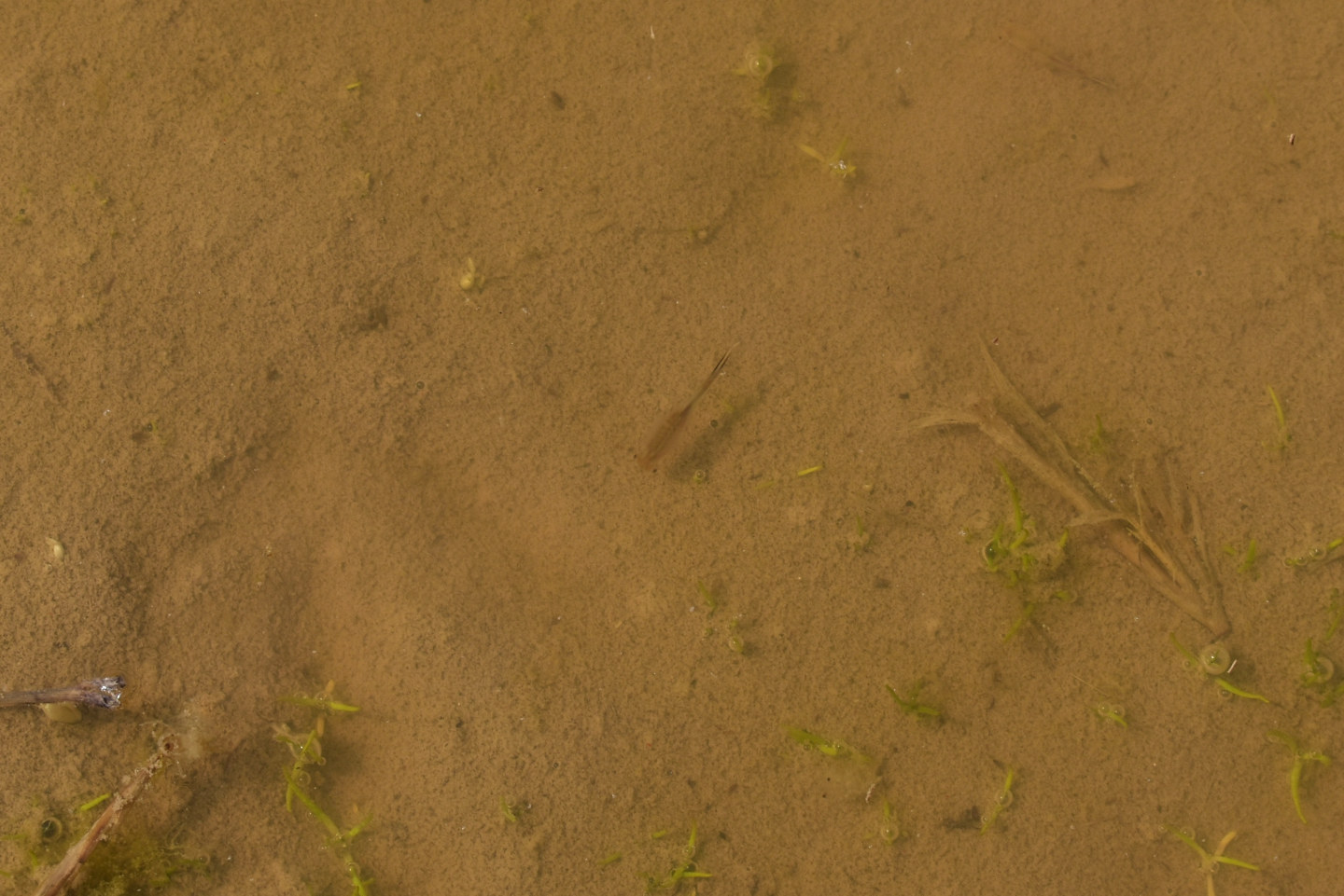
Fairy shrimp in Fortynine North Pond at center. There is a less visible fairy shrimp near the upper right edge of the photograph.
Fortynine North Pond Fairy Shrimp Video 2025-04-09ar
For a 3-minute, 21-second video of fairy shrimp in Fortynine North Pond, click on the video player above. There is no audio. The opening view of the pond surroundings is intentionally out of focus because I manually set the focus for the fairy shrimp in the water. The camera’s automatic focus goes crazy on pond scenes without sharply defined objects. Numerous fairy shrimp can be seen swimming slowly through the relatively clear, shallow water. Their dark shadows on the pond bottom are more visible than their pale, translucent bodies. The shadows are below or to the right of the bodies, depending on body orientation. The closer the fairy shrimp is to the surface, the farther apart the body and shadow are. The fairy shrimp all seem to be going their separate ways without forming schools, or clusters. At 1:36, 2 fairy shrimp at upper left closely approach each other but then jerk sharply and swim rapidly apart. This appears to be an example of a female shaking off a male that had clasped the female with its antennae II preparatory to copulation (see Fairy Shrimp Mating Dance, Life Cycle of Fairy Shrimp). Something similar occurs at 1:52 (lower left), 1:54 (center), and at 2:24 (center). 2 fairy shrimp approach each other from opposite directions but turn and swim rapidly away before getting really close. In this case, the female may be rejecting the male before it gets close enough to attempt clasping or the male may be discovering that the female lacks unfertilized eggs so copulation would be pointless. There are other cases of 2 fairy shrimp turning away from each other upon a close approach (e.g., 0:41, 1:08, 1:25, 3:14) that may be avoidance for other than mating-related reasons, such as generalized predator avoidance. Precautionary predator avoidance might explain single fairy shrimp turning sharply and darting off in a different direction even without other animals nearby (e.g., 1:59). In one such example at 1:43 (center), the fairy shrimp almost jumps out of the water. Fairy shrimp also dart strongly forward in the same direction they were going before at 0:53 (center) and 1:15 (above center). Throughout the video, there is no evidence the fairy shrimp are avoiding me although my footsteps sometimes create waves that push them around. Would they act differently if I were an avocet?
“Calcutta Lake” (Applegate BLM Office)
“Horse Lake” map
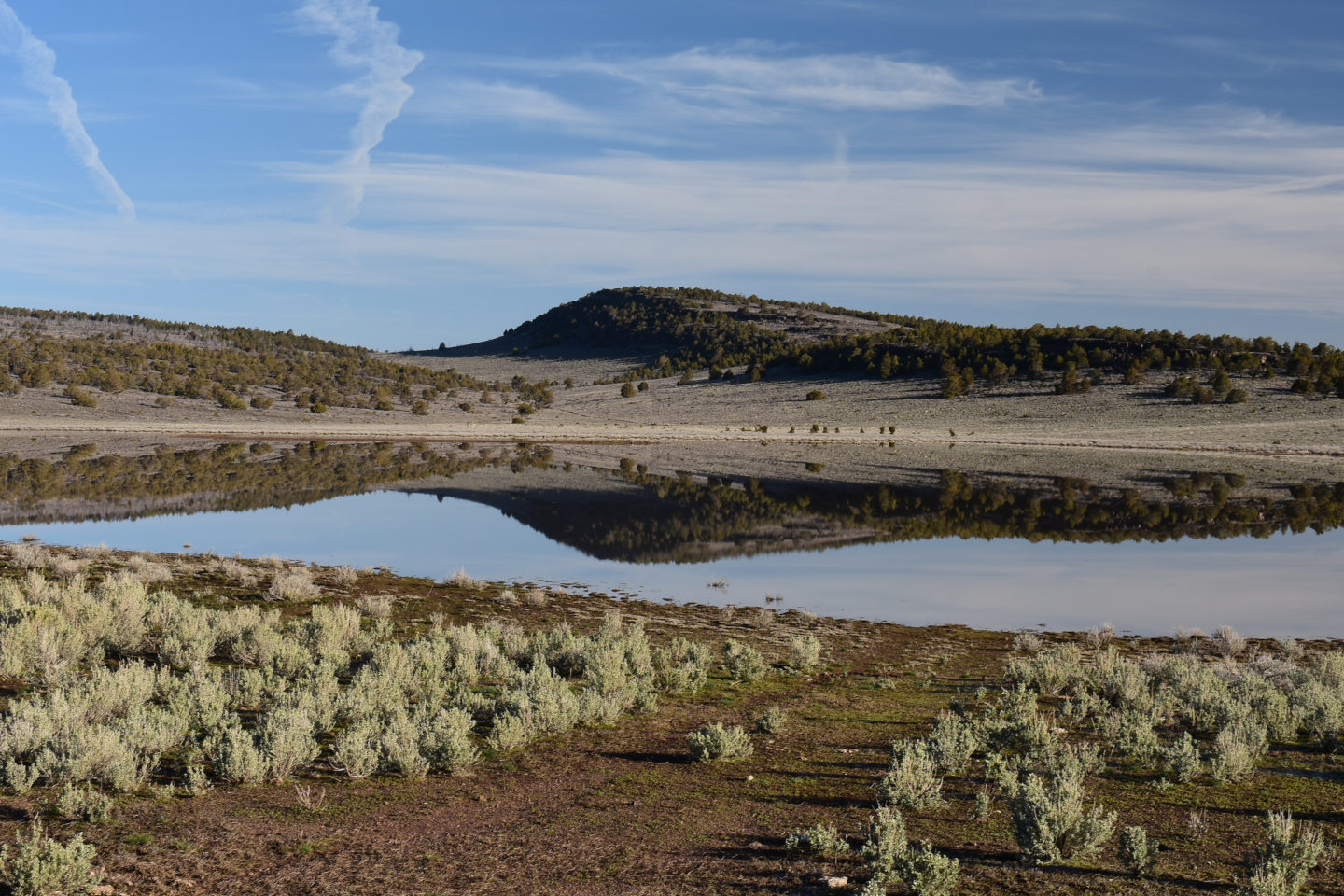
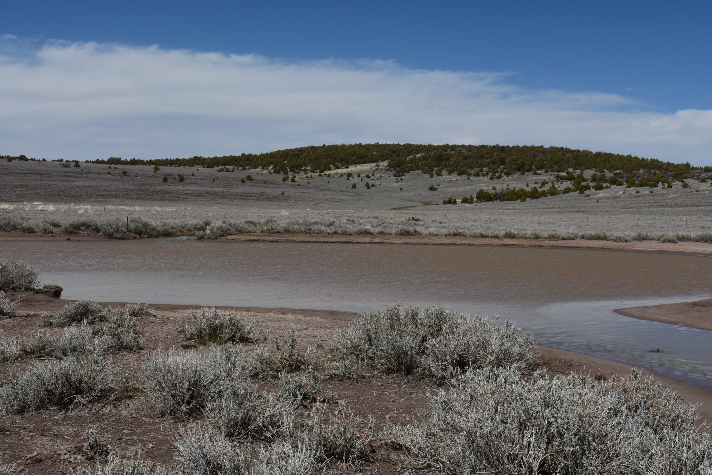
“Calcutta Lake” is near the northern end of Long Valley 30 km (18 miles) northeast of Vya. A small portion of the western boundary of Sheldon National Wildlife Refuge touches the eastern shore of the lake. There is a ranch on the southwestern shore of the lake and other pieces of private at the northwestern and southeastern corners. The lake is 3.5 km long by 2 km wide (2.1 x 1.2 miles) on the 1:100,000-scale BLM map. The valley floor is narrow with 250 m (820′) high cliffs close to the east side of the lake and hills to the west. This increases the chances for significant spring runoff but most snowmelt may just seep into the fractured volcanic rocks. The map does not show an outlet. An abundance of small rock chips at the south end of the lake give the lake bottom there an unusual firmness. Wading is remarkably stable.
A ranch road which turns northwest off Washoe County Road 34 1.5 km (0.9 mile) south of the west entrance to Sheldon National Wildlife Refuge provides access to “Calcutta Lake”. The lack of deep ruts suggest it is generally passable. It is best to park within a short distance of reaching the lake to avoid the private ranch land farther west. The BLM map shows a road going southwest past the west side of “Cow Lake” from where the access road reaches “Calcutta Lake” but I couldn’t find it on the ground.
Much of the eastern shore of “Calcutta Lake” is less than 500 m (1,640′) from 34. Private land separates the lake from 34 in the vicinity of the western entrance to Sheldon National Wildlife Refuge.
Elevation: 1,686 m (5,530′)
April 9, 2025
I put on my rubber boots with some trepidation. This is a big playa lake with lots of water. The mud could be quite soft. I was delighted to find the lake bottom had rock chips.
- Map dimensions 2,000 m x 3,500 m; greater than 20 cm deep.
- Opaque pale brown water; 14 C at 1615 in 8 cm water.
- Most fairy shrimp are less than 10 mm long, some are 30-40 mm long; none have eggs.
- No other animals seen.
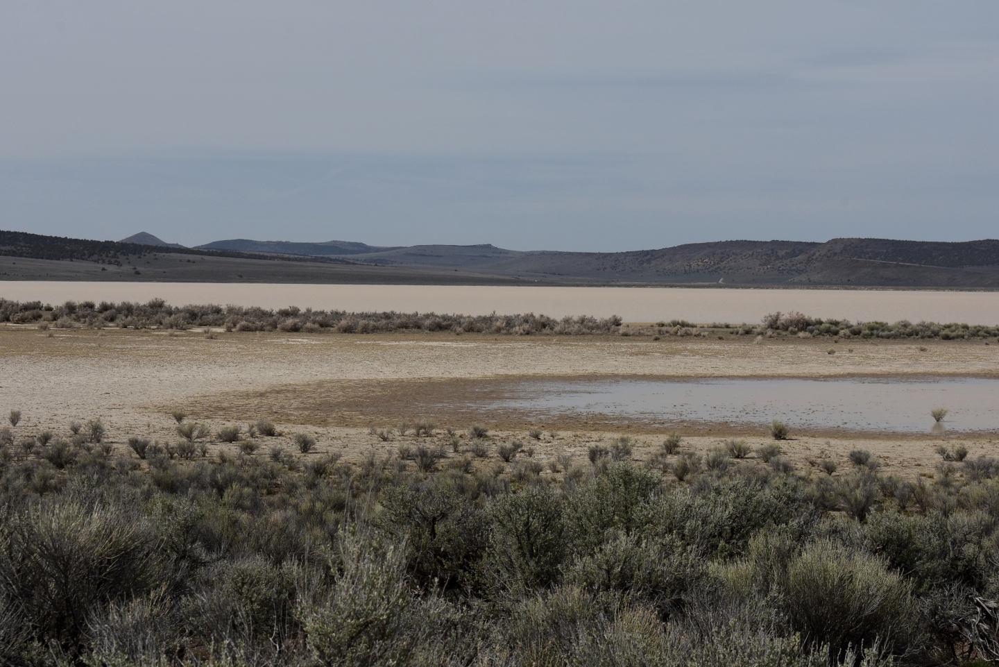
View north across “Calcutta Lake” and its little southern embayment. The brown ring of mud indicates the water level has dropped slightly from the winter maximum.
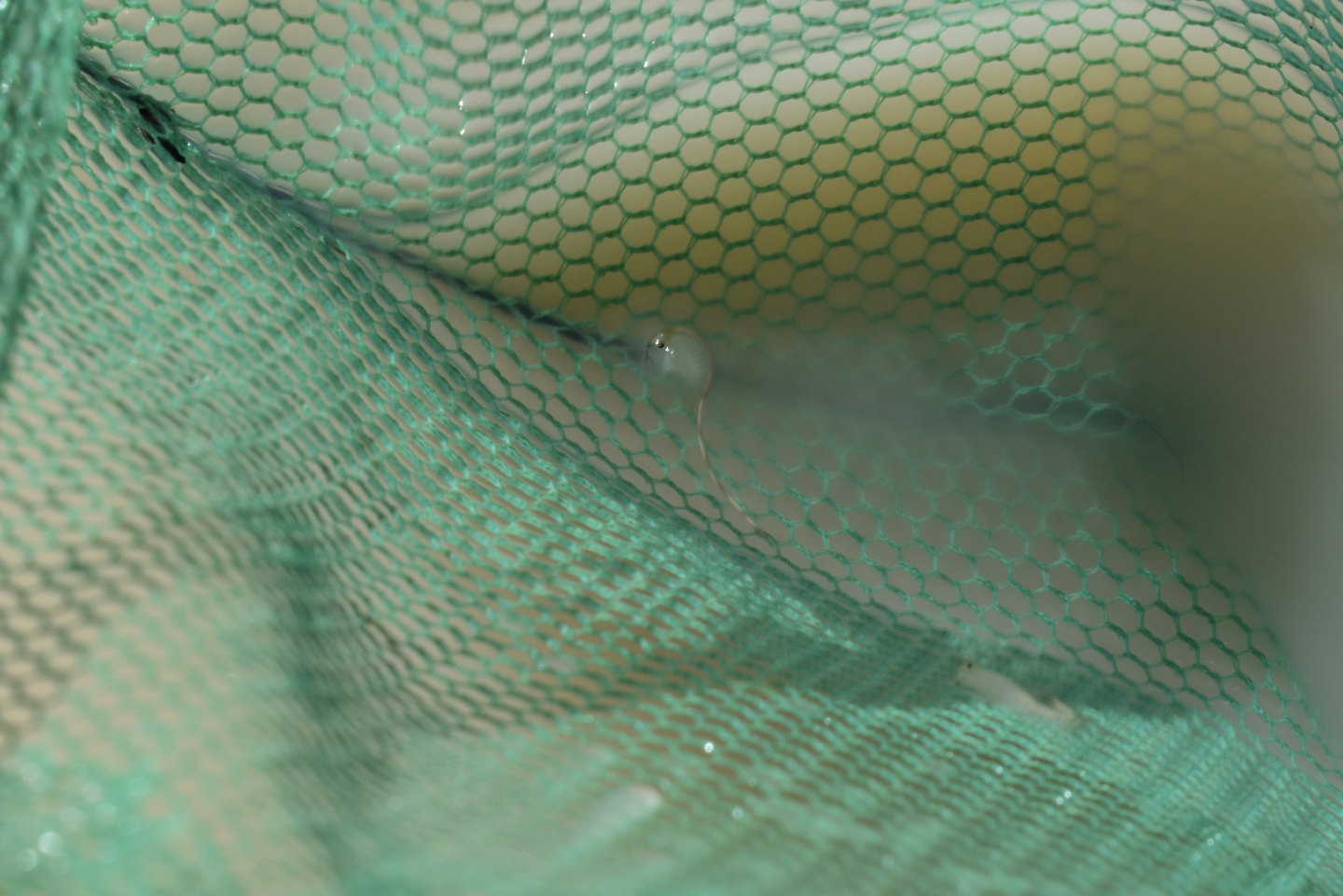
A fairy shrimp in the net at “Calcutta Lake”. This one is close to 10 mm long.
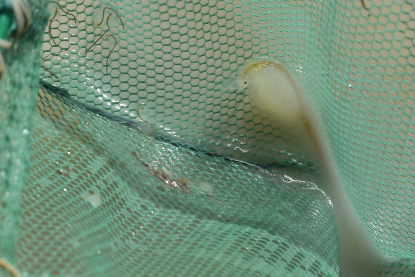
A fairy shrimp in the net at “Calcutta Lake”. This one is huge. It is hard to estimate its length with the sharp bend of the thorax but it is in the range of 30-40 mm. There are much smaller fairy shrimp to the left of the big one. The extreme difference in size suggests 2 different species.
“Calcutta Lake” Fairy Shrimp Video 2025-04-09br-c
For a 2-minute, 28-second video of 2 different-sized species of fairy shrimp from “Calcutta Lake” in a white bucket, click on the video player above. There is no audio. Even in the shallow water in a white bucket, the water is so opaque that the fairy shrimp are hard to see. For scale, the bucket is 14.5 cm (5.7″) in diameter. Wind blowing the water doesn’t help. The dark material in the intestines of most fairy shrimp does help. At 0:29-0:40, one the large fairy shrimp just below the water surface is moving its legs vigorously without forward motion. At times, its dark abdomen is visible. A second large fairy shrimp comes into view at 0:37 but then goes back into deeper water to the left. Several small fairy shrimp become visible when they swim to the shallow, right edge of the water at various times. A large fairy shrimp surfaces again at 1:29 but then rolls over and goes deeper at 1:39. At 1:45, the full length of a large fairy shrimp extends across half the width of the video. Using the markings on the outside of the bucket for scale, it’s length is about 50 mm. In contrast, the length of a large fairy shrimp exposed at 2:02 is a little less than 35 mm. A large fairy shrimp makes several rapid jerks and rolls over at the surface at 2:06-2:09.
The size of the big fairy shrimp in “Calcutta Lake”, as shown in the previous photograph and in the video, suggests they are the giant, predatory fairy shrimp, Branchinecta gigas. At 2:15-2:17 in the video, it’s possible a larger fairy shrimp is trying to catch and eat a smaller one but they both disappear below the surface before the denouement is clear. Another big fairy shrimp in Upper Macy Lake is more stretched out and measures about 40 mm. Fairy shrimp longer than 30 mm aren’t common, especially in my experience in Nevada. B. gigas lives in similar habitat nearby. It was collected from “Middle Alkali Lake” just west of the Nevada border near Cedarville, California, when the water temperature was 8-21 C (Eng, Belk, and Eriksen, 1990; Rogers and Timms, 2017). “Calcutta Lake” is about 47 km (28 miles) from northern “Middle Alkali Lake”.
A length of 40 mm is not conclusive for the identification of B. gigas. In his key to the Anostraca, Pennak (1978, p. 342) gave the species’s length as 50-100 mm long. Nonetheless, the binary alternative in the key of 8-25 mm is certainly suggestive that longer fairy shrimp are B. gigas. More recently, another very large, predatory fairy shrimp, Branchinecta raptor, was found in playa lakes in southern Idaho (Rogers and Hill, 2013; Rogers and Timms, 2017). That is close enough for B. raptor to be a plausible alternative to the tentative identification of B. gigas.
“Horse Lake” (Applegate BLM Office)
___This map is a screenshot of The National Map (Go to The National Map). The U.S. Geological Survey generally does not copyright or charge for its data or reports (unless printed). A pond location is indicated by an “X”, which corresponds to the coordinates given in the data spreadsheet. Labels in quotations are from 7.5-minute topographic quadrangles.
___As of April 2025, the National Grid overlay with red lines in UTM coordinates does not load in The National Map.
___Gray shading represents private land as traced from the PAD-US 2.0 – Federal Fee Managers layer of The National Map. Other lands are public.
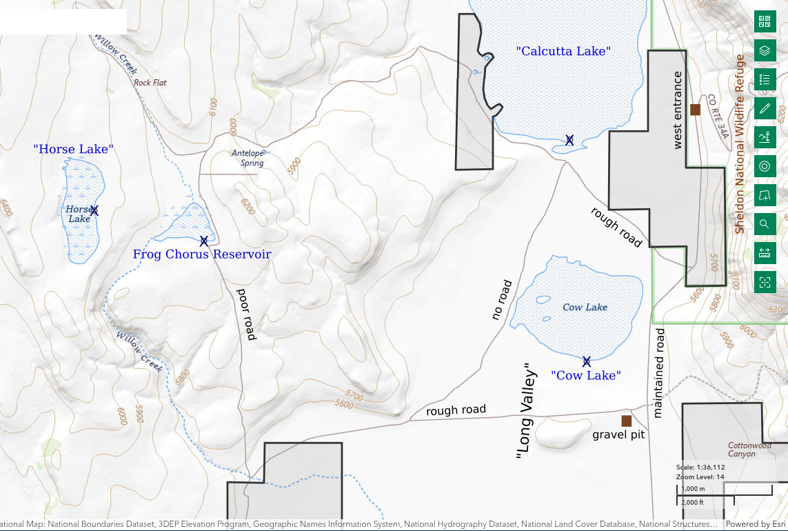
“Horse Lake” is about 27 km (16 miles) north-northeast of Vya in the hills southwest of “Calcutta Lake” and about 200 m higher. It’s only 1 km (0.6 mile) west of Frog Chorus Reservoir. Dimensions on the 1:100,000-scale BLM map are 1,100 m by 400 m (3,610′ x 1,310′). It has no inlet streams and no outlet streams. The drainage area is very small. The map doesn’t show any springs nearby and higher elevations in the vicinity are limited in any case. But water collects here anyway.
The access road turns off Washoe County Road 34 by some gravel pits on a ridge south of “Cow Lake”. The turnoff is 3.0 km (1.8 mile) south of the entrance to Sheldon National Wildlife Refuge. The road goes to a ranch on the west side of Long Valley. It clips a corner of the private land. A very poor, little used road to Frog Chorus Reservoir turns due north off the ranch road just before the ranch entrance. 4-wheel drive is recommended. It is a short, easy walk from Frog Chorus Reservoir to “Horse Lake”.
Elevation: 1,890 m (6,200′)
April 9, 2025
The snow is gone but the ground is still wet and the buttercups are blooming. Sporadic juniper and abundant sagebrush give a much different look than the valley floor. The lake looks full.
- Map dimensions 400 m x 1,100 m; greater than 20 cm deep.
- Opaque pale brown water; 13 C at 1800 in 3 cm water.
- Very small fairy shrimp stick to the net, a few may be 10 mm long but the rest are smaller; no eggs.
- Water boatmen, heard frogs.
“Horse Lake”, looking to the south-southwest. A tiny bit of snow remains on the far ridge. The cliffs on the east side of Long Valley can be seen at far left.
Lots of very small fairy shrimp in the net at “Horse Lake”. I had to lift the net out of the water (briefly) so they could be seen.
Frog Chorus Reservoir (Applegate BLM Office)
“Horse Lake” map
Frog Chorus Reservoir is 1 km east of “Horse Lake” and also 27 km (16 miles) north-northeast of Vya. The reservoir is much larger than shown on the 1:100,000-scale BLM map. The dam must have been raised since 1966, when aerial photographs for the 7.5-minute topographic quadrangle were taken. The reservoir has a triangular shape with the base about 800 m and the height maybe 700 m (2,620′ x 2,300′). The reservoir is on Willow Creek (yet another one), which flows for about 7 km (4.2 miles) before reaching the valley floor on the ranch. The first time I visited the reservoir, the frogs were making a lot of noise. I never saw a frog but didn’t look for them.
For access, see “Horse Lake”. Contrary to what is shown on the BLM map, the road does not continue around Frog Chorus Reservoir. It is under water.
Elevation: 1,843 m (6,050′)
April 10, 2025
The mud softens quickly away from the shoreline. I hope whatever is in the water is swimming close to shore.
- 700 m x 800 m; greater than 20 cm deep.
- Cloudy pale brown water; 11 C at 0945 in 3 cm water.
- Very small fairy shrimp probably less than 8 mm long and without eggs.
- Heard frogs, geese, and ducks. The geese may have just been flying over.
Looking across Frog Chorus Reservoir from the current end of the road on the south shore.
Townsend Dry Lake (Applegate BLM Office)
___This map is a screenshot of The National Map (Go to The National Map). The U.S. Geological Survey generally does not copyright or charge for its data or reports (unless printed). A pond location is indicated by an “X”, which corresponds to the coordinates given in the data spreadsheet. Labels in quotations are from 7.5-minute topographic quadrangles.
___As of April 2025, the National Grid overlay with red lines in UTM coordinates does not load in The National Map.
___Gray shading represents private land as traced from the PAD-US 2.0 – Federal Fee Managers layer of The National Map. Other lands are public.
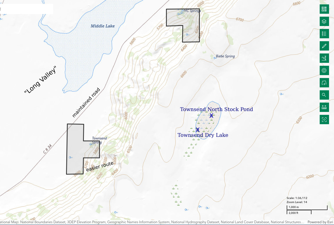
Townsend Dry Lake is 21.5 km (13 miles) northeast of Vya on the mesa east of Long Valley. The 1 km x 0.5 km (0.6 x 0.3 mile) dimensions on the BLM map overestimate the current extent of the area likely to be inundated. My GPS coordinates for Townsend North Stock Pond are within the stippled area for the lake on the 1:100,000-scale BLM map whereas the pond is north of the typically inundated area on the ground. Consequently, I estimate the size of Townsend Dry Lake as 650 m long and 500 m wide (2,130′ x 1,640′). The dry lake on the BLM map is not named so I’ve borrowed the name from Townsend Spring, which is 2.5 km (1.5 miles) west of the lake.
On the 1:100,000-scale BLM map, Townsend Dry Lake is shown with a stipple pattern rather than with the diagonal blue line pattern of intermittent lakes (on the paper map) used for all the other lakes I visited in Long Valley. The difference is Townsend Dry Lake does not have a clay flat which is barren of vegetation. Instead, sagebrush is scattered all across the lake bottom. This is similar to some of the dry lakes in the Owyhee Desert except that the sagebrush in Townsend Dry Lake is some kind of big sagebrush rather than silver sagebrush.
Day-hike access to Townsend Dry Lake requires a climb up the steep slope of Massacre Rim on the east side of Long Valley. There is no trail but a draw that angles up the slope south of Townsend Spring provides a do-able route without a cliff to scale at the top. Most, but not all, of the areas of big-boulder rubble can be avoided. Once on top, it is an almost flat walk to Townsend Dry Lake. For parking, find a dry spot off 34 near Townsend Spring to park. There is a short 2-track road that turns off 34 toward Townsend Spring but it is on private land and doesn’t even shorten the hike by 1 km (0.6 mile).
There is an old 2-track road on the west side of Townsend Dry Lake. It is not shown on the 1:100,000-scale BLM map, the 1:24,000-scale 7.5-minute topographic quadrangle, or on an off-highway vehicle map prepared by Nevada Department of Conservation and Natural Resources (see ohv.nv.gov). Furthermore, the non-dated OHV map shows the entire mesa southwest of Sheldon National Wildlife Refuge as within the Massacre Rim Wilderness Study Area. That effectively rules out access by vehicle even if there is a legal way to cross the private land around “Massacre Lake”.
Elevation: 1,962 m (6,440′)
April 10, 2025
Great views from the top of the cliff. It’s worth the climb. The walk across the mesa was surprisingly soft in spots even though it is all rock. The snow hasn’t been gone for long.
- 450 m x 600 m; possibly no more than 15 cm deep.
- Clear to murky water thanks to the sagebrush blocking the wind; 19 C at 1345 in 3 cm water.
- Very small fairy shrimp 8 mm long or less; no eggs.
- Water boatmen, wrigglers, heard frogs.
Warning! The mud in Townsend Dry Lake is extremely soft and sticky. On the approach to the water, mud will build up on your boots and get quite heavy. Once at the water, use the sagebrush bushes as stepping stones. Otherwise, you could sink rapidly into the muck. Your boots might then get sucked off your feet as you try to get out.
View to the west at Townsend Dry Lake. Paler areas between the sagebrush at center are water.
Townsend North Stock Pond (Applegate BLM Office)
Townsend Dry Lake map
Townsend North Stock Pond is on the north edge of Townsend Dry Lake 22 km (13 miles) northeast of Vya. It is not shown on the 7.5-minute quadrangle. The pond is on a stream channel that drains a hill with elevation 2,069 m (6,790′) on the BLM map about 2 km (1.2 miles) north of Townsend Dry Lake. The pond does not have a dam but has been excavated. The ridges of dug up clay have become quite low. Nonetheless, the pond seems to be deeper than Townsend Dry Lake. Townsend North Stock Pond has an outlet that disappears on the playa within about 30 m (100′). The pond bottom is so soft I didn’t venture more than 2 m (6.5′) from the shore. Townsend North Stock Pond might have water after Townsend Dry Lake dries up; at least that is what the rancher and BLM hoped.
For access, see Townsend Dry Lake.
Elevation: 1,843 m (6,050′)
April 10, 2025
I saw the stock pond on the hike to Townsend Dry Lake. I had such a difficult time finding aquatic animals in Townsend Dry Lake that I wasn’t sure what to expect here. WIDLA. There is some firm ground above water with a few sagebrush bushes on the south shore.
- Too muddy to pace off but I’ll guess 20 m x 30 m; greater than 20 cm deep.
- Cloudy pale brown water; 13 C at 1445 in 5 cm water.
- Fairy shrimp 8 mm long or less; too small for eggs.
- 1 mm copepods(?), 3 mm cladocerans(?), 3 mm dark beetles, wrigglers, frogs.
Looking north across Townsend North Stock Pond. The inlet is on far side at left and has water. The outlet is at right and is flowing slightly.
A small frog in the outlet of Townsend North Stock Pond. It initially tried to hide in a sagebrush bush but I guess it decided not to worry about me.
“Cow Lake” (Applegate BLM Office)
“Horse Lake” map
“Cow Lake” is only 1.0 km ((0.6 mile) due south of “Calcutta Lake”. That puts it 28.5 km (17 miles) northeast of Vya. “Cow Lake” is smaller than most other lakes on the floor of Long Valley. On the 1:100,000-scale BLM map, it measures 1,000 m by 1,300 m (3,280′ x 4,270′). However from the road to “Calcutta Lake”, I saw water on the clay flat within a couple hundred meters of “Calcutta Lake”. I don’t know if that water was continuous with “Cow Lake”. If it was, the north-south length of “Cow Lake” would be closer to 1,800 m (5,910′) than to 1,000 m. “Cow Lake” has no inlets or outlets on the map. It could receive overflow from “Calcutta Lake” as the lakes have essentially the same elevation.
The shortest access to “Cow Lake” is from Washoe County Road 34, which is as close as 200 m (660′) to the east. Another option is to turn off 34 on the ranch road to “Horse Lake” and hike about 500 m (1,640′) north to the lake shore. This route seemed like a good idea because the ranch road follows a ridge of rock chips for about 2.5 km (1.5 miles). Rock chips firmed up the bottom of southernmost “Calcutta Lake”. Unfortunately, the rock chips south of “Cow Lake” disappear south of the shoreline. The result is a softer, less stable lake bottom than in “Calcutta Lake”.
Elevation: 1,686 m (5,530′)
April 11, 2025
A stock pond has been excavated at the southern end of “Cow Lake”. The stock pond might have deeper water than the lake itself so it’s worth a look. Unfortunately, the mud in both is so soft that I didn’t risk getting far from shore.
- Map dimensions 1,000 m x 1,300 m; I got into water only as deep as 10 cm so I can’t say it’s 20 cm deep even though there is a good chance that it is.
- Opaque pale brown water; 8 C at 0930 in 3 cm water.
- Fairy shrimp up to about 10 mm long; none have eggs.
- Geese in vicinity.
Looking north across “Cow Lake”. The stock pond is at left.
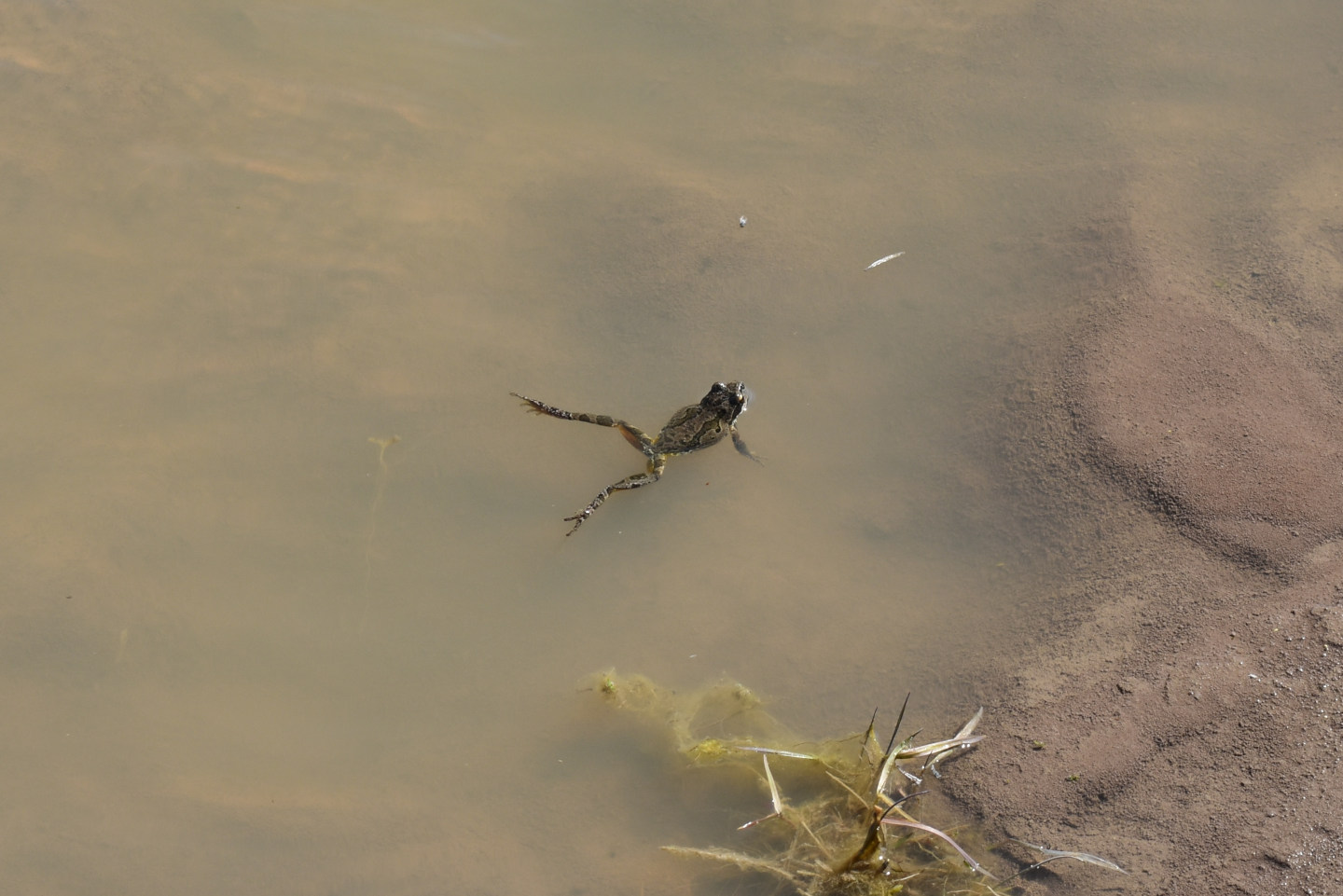
A small fairy shrimp in the net at “Cow Lake”. The prominent dark intestine and the curled posture are reminiscent of the large species of fairy shrimp in “Calcutta Lake”. In addition, this and similar fairy shrimp are quite active in the net in contrast to individuals of the small species, which are generally only visible when stuck to a net lifted out of the water (compare both species in “Calcutta Lake”). But this fairy shrimp is only about 10 cm long (using the mesh openings for scale). It’s possible that the few fairy shrimp I caught just happened to be recently hatched B. gigas but that doesn’t seem particularly likely.
Upper Macy Lake (Applegate BLM Office)
___This map is a screenshot of The National Map (Go to The National Map). The U.S. Geological Survey generally does not copyright or charge for its data or reports (unless printed). A pond location is indicated by an “X”, which corresponds to the coordinates given in the data spreadsheet. Labels in quotations are from 7.5-minute topographic quadrangles.
___As of April 2025, the National Grid overlay with red lines in UTM coordinates does not load in The National Map.
___Gray shading represents private land as traced from the PAD-US 2.0 – Federal Fee Managers layer of The National Map. Other lands are public.
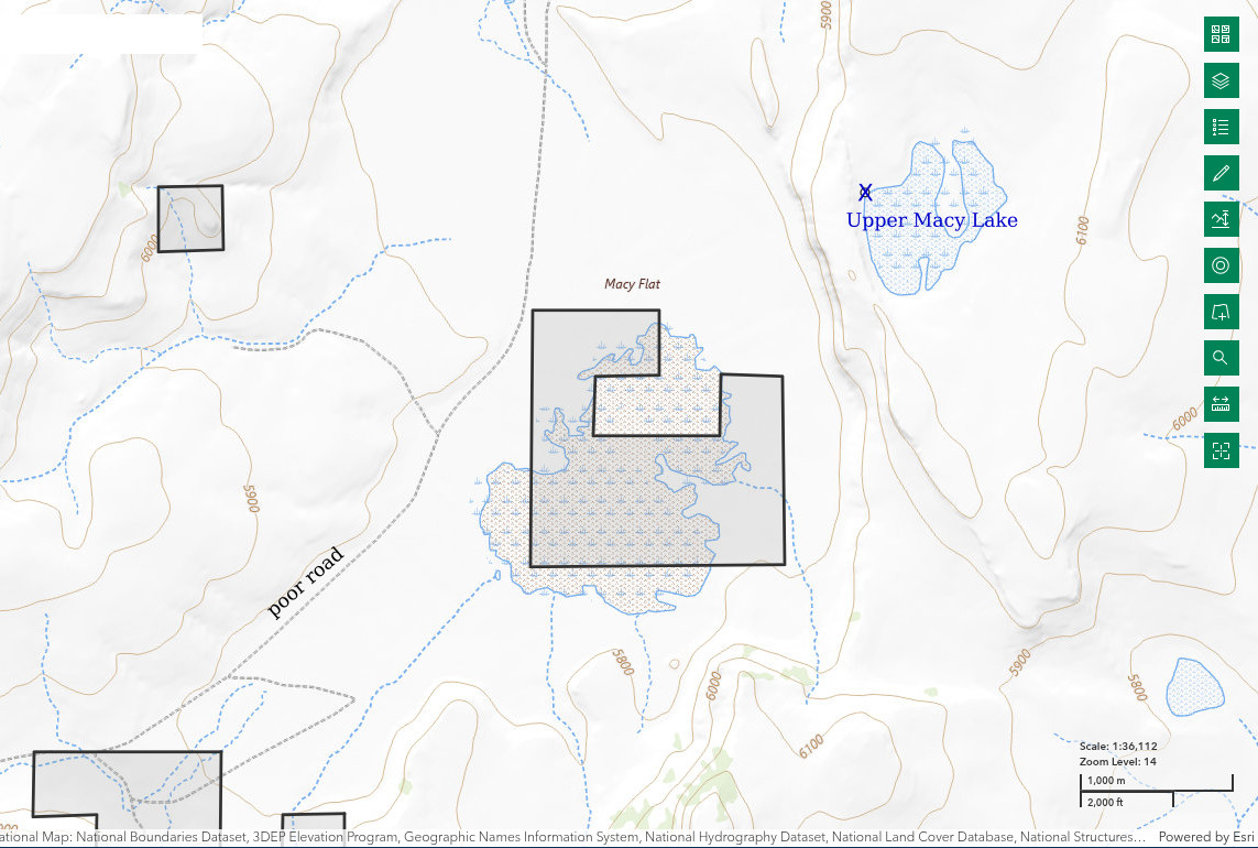
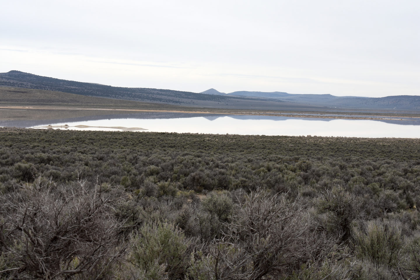
Upper Macy Lake is adjacent to Macy Flat between Long Valley and the Oregon border. It is 46 km (27.5 miles) northeast of Vya. Its irregular shape has maximum length and width of about 1.0 km (0.6 mile) each on the 1:100,000-scale BLM map. Like “Horse Lake”, it is in a small depression with no inlets or outlets. The lake is about 50 m (160′) above the floor of Macy Flat. The BLM map also shows a larger dry lake on Macy Flat with a stipple pattern but that lake is mostly on private land.
To reach Macy Flat, turn north off Washoe County Road 34 about 7 miles north of the west entrance of Sheldon National Wildlife Refuge and drive up a small hill. Do not follow the curve of 34 to the northwest and into Coleman Canyon. The ranch road to Macy Flat is rough and sporadically rutted. After 0.5 mile, it curves to the east. After another 1 mile or so, the road passes the ranch entrance, curves to the northeast, and becomes very poor with nearly continuous ruts and bumps. Continue along the bad road for about 3 miles and find a dry spot to park. At this location, the ephemeral lake is well to the south and there are 2 small ridges on Macy Flat to the east. Beyond the ridges is a hill of flat-lying volcanic rock with a moderately steep, rubbly western slope. Upper Macy Lake is through the low spot in the western slope of that hill.
Elevation: 1,829 m (6,000′)
April 11, 2025
Like the playa lakes in Long Valley, the ephemeral lake on Macy Flat has plenty of water. In spite of all the volcanic rocks along the shore, Upper Macy Lake does not have a firm bottom. The few big, submerged rocks on the bottom are more of a balance problem than a help.
- Map dimensions 1,000 m x 1,000 m; greater than 20 cm deep.
- Opaque pale brown water; 13 C at 1215 in 5 cm water.
- Caught only 2 fairy shrimp, which were 30-40 mm long; neither had eggs.
- 4 mm brown beetle, 10-12 mm water boatmen, non-biting gnats/midges on water and in air, tiny white worms that are curled on the net, cows.
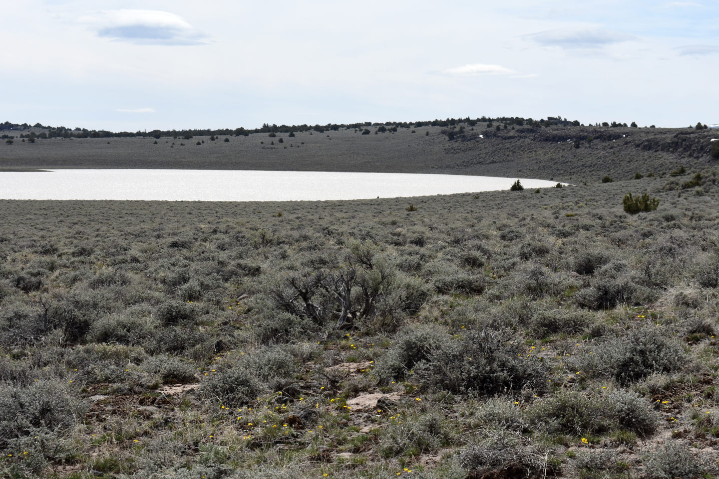
A view to the south along the western shore of Upper Macy Lake. The moderately steep, rocky slope at right is similar to the western slope of this hill as seen from the road up Macy Flat.
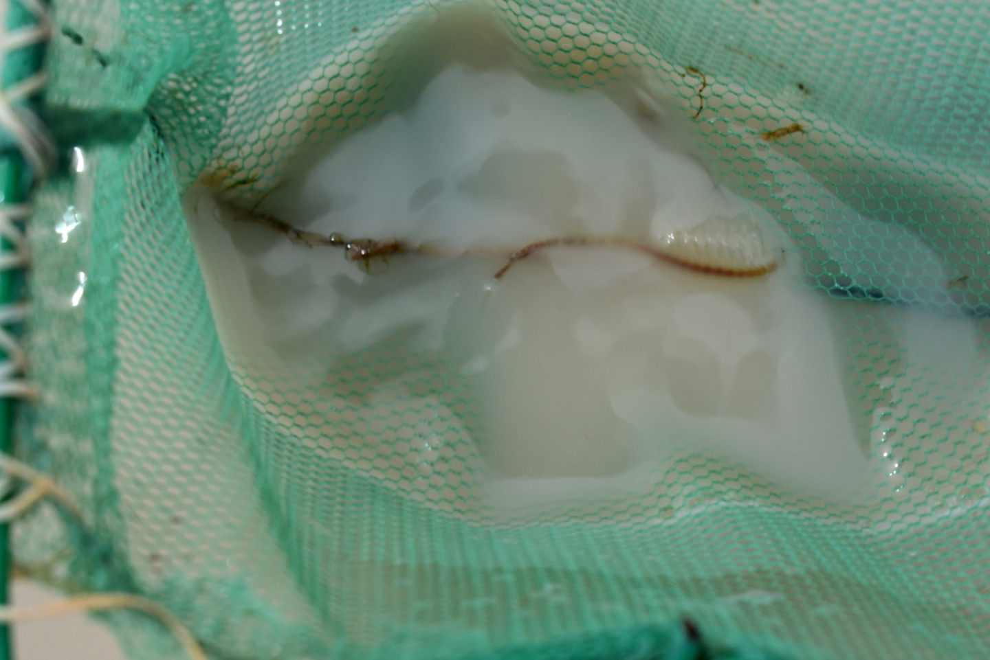
A large fairy shrimp in the net at Upper Macy Lake. For scale, the distance from the left edge of the photograph to the net handle (dark exposed wire) is 5.7 cm. Like the large fairy shrimp in “Calcutta Lake”, this one is probably Branchinecta gigas. To me, the legs look fatter than those of other fairy shrimp.
A tiny white worm is in the water droplet on the net to the right of center. The wind may be partly responsible for the blurring. I caught more of these in Upper Macy Lake than anything else. Could they be the larvae of the non-biting gnats/midges flying around?
A large, well-posed water boatman in the net at Upper Macy Lake.
What Can We Learn from the Ponds in Northern Washoe County?
10 of the 10 ponds I visited in northern Washoe County had fairy shrimp. This suggests that the distribution of fairy shrimp in northern Washoe County has been efficient and that most fishless lakes in the area are likely to have fairy shrimp.
“Calcutta Lake” and Upper Macy Lake had fairy shrimp that were unusually large, 30-40 mm and maybe 50 mm long. They are probably young Branchinecta gigas. “Calcutta Lake” also had fairy shrimp less than about 10 mm long that could be prey for B. gigas. I did not see smaller fairy shrimp in Upper Macy Lake but since I saw only 2 of the large ones, that could be because I searched in a part of the lake where any fairy shrimp were rare. Populations of B. gigas, as predators, are much less dense than than those of other playa-lake fairy shrimp (Brown and Carpelan, 1971). It is quite possible that I failed to find them in other lakes in northern Washoe County where they are present.
Young tadpole shrimp (Notostraca) were present in “Fortynine Lake” in mid-April. Tadpole shrimp eggs may have been present but not yet hatched in other lakes due to cooler temperatures or other factors or the tadpole shrimp may have been even younger and harder to see than those in “Fortynine Lake”. Tadpole shrimp were common in opaque ponds with fairy shrimp in the “Burnt Lake” area of Middle Washoe County. Some “Burnt Lake” ponds also had clam shrimp (Conchostraca or orders Spinicaudata, Laevicaudata, Cyclestherida). It would be reasonable to expect clam shrimp in Northern Washoe County but their small sizes and camouflage colors make them difficult to spot.
Individuals of the smaller species of fairy shrimp in Northern Washoe County were mostly less than 10 mm long in mid-April. Consequently, early to mid-May may be a better time to see fully grown fairy shrimp. Pan evaporation rates of 4.3 mm/day in April and 5.8 mm/day in May at “Ruby Lake” (see Pond Duration on About page) indicate that about 15 cm of water would evaporate from April 12 to May 12 in most years. If the amount of water I observed in mid-April is typical, “Fortynine Lake”, Fortynine North Pond, and Townsend Dry Lake but not the other lakes would be at risk of drying up before mid-May.
The topography and bedrock of “Horse Lake”, Townsend Dry Lake, and Upper Macy Lake are very similar to those of the “Burnt Lake” area in Middle Washoe County. Fairy shrimp were also present in all the lakes I visited in that area. Low relief plateaus and mesas, poorly developed drainage systems, and mostly flat-lying volcanic rocks are a good combination for fairy shrimp. Rogers and Fugate (2001) previously found this to be the case for the Modoc Plateau of northeastern California.