The base map is provided by OpenTopoMap’s volunteer servers.
“Burnt Lake” Road Pond #1
“Burnt Lake” Mud Bar Pond
“Burnt Lake” Double Mud Bar Pond
“Burnt Lake” Three Ducks Pond
“Steer Lake”
“Burnt Lake”
Rowland Spring North Pond
“Dry Steer Lake”
“Burnt Lake” In Between Pond
“Willow Lake”
“SOB Lake”
What Can We Learn from the Ponds in Middle Washoe County?
There does not seem to be a distinct topographic name for the hills west of Gerlach and south of Duck Flat in middle Washoe County. Wilderness Study Areas south of the “Burnt Lake” area explored for fairy shrimp in 2019 have been named Buffalo Hills and Twin Peaks but these topographic features are very localized. For this web site, the region east of the California border, south of Duck Flat, west of Squaw Creek and NV 447, and north of the Smoke Creek Desert and Smoke Creek is referred to as middle Washoe County to give readers a general idea of the location. From the California border to Squaw Creek is about 40 km (25 miles) and from Smoke Creek to Duck Flat is about 53 km (33 miles).
This area does not have the basin-and-range topography typical of much of Nevada. Instead, it is plateau and canyon country due to the more or less flat-lying basalt flows, which are resistant to erosion. The tops of the plateaus do not have extensive or well developed drainage networks so water, when present, collects locally in hollows and depressions. Ponds are filled by snowmelt or storm runoff from small areas and are unlikely to persist for long periods. The temporary nature of the ponds is favorable for fairy shrimp but they may not form in some years and could dry up too quickly for fairy shrimp to mature, depending on precipitation.
Elevations in middle Washoe County rise from 1,430 m (4,690′) on Duck Flat in the north, 1,400 m (4,590′) on Squaw Valley in the east, and 1,200 m (3,940′) on Smoke Creek Desert in the southeast. Peak elevations are 2,080 m (6,820′) on both Rowland Mountain in the north and Poodle Mountain in the east and 2,009 m (6,591′) on Twin Peaks in the south.
Most of middle Washoe County is covered by sagebrush. There are dispersed pinyon and juniper and local groves of pinyon woodland.
The “Burnt Lake” area is public land managed by the Surprise Office of the BLM. The Buffalo Hills Wilderness Study Area covers some of the land southeast of “Burnt Lake”. There are a few undeveloped, unfenced parcels of private land scattered about, such as southwest of “Garden Lake” and south and west of “Willow Lake”. The closest paved road is Nevada 447 from
Gerlach.
“Burnt Lake” Road Pond #1 (Surprise BLM Office)
___This map is a screenshot of The National Map (Go to The National Map). The U.S. Geological Survey generally does not copyright or charge for its data or reports (unless printed). A pond location is indicated by an “X”, which corresponds to the coordinates given in the data spreadsheet. Labels in quotations are from 7.5-minute topographic quadrangles.
___Red lines are the U. S. National Grid with a spacing of 1,000 m and intersection labels consisting of the UTM zone (e.g., 11S, 12T), a 2-letter 100-km square designation (e.g., LC, XN), and a 4-digit number. The first 2 digits of the number represent the 1,000-meter Easting and the second 2 digits the 1,000-meter Northing, as seen in the example Easting and Northing. Unlike latitude and longitude, the National Grid is rectilinear on a flat map, the units of abscissa and ordinate have equal lengths, and the units (meters) are measurable on the ground with a tape or by pacing.
___Gray shading represents private land as traced from the PAD-US 2.0 – Federal Fee Managers layer of The National Map. Other lands are public.
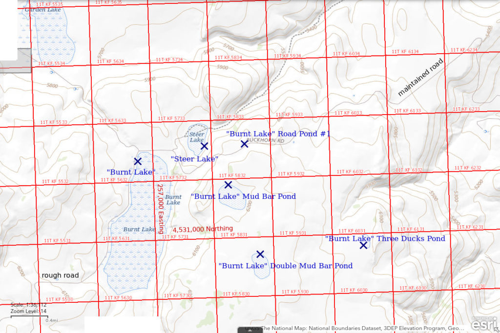
“Burnt Lake” Road Pond #1 is 51 km (32 miles) northwest of Gerlach. It is a small pond on the north side of the road from “Burnt Lake” to Nevada 447. It is about 20 m down hill from the road. Remarkably, this pond is shown on the Rye Patch Canyon 7.5-minute quadrangle so it likely has water in most years. Although it has been excavated, it seems too far from the road to have been used as a borrow pit and it seems to be an unlikely location for a stock pond. It has a negligible drainage area. It is a little more than one mile east of the north end of “Burnt Lake”.
The “Burnt Lake” road is a well-maintained county road but can be very muddy and impassable when wet. The turn-off from Nevada 447 is roughly 32 miles from Gerlach. It is at the west end of a straight, west-east section of the highway about 1/3 mile east of the highway’s turn to the northwest and about 2 1/2 miles west of the highway’s turn from northwest to west at the east end of Duck Flat. The “Burnt Lake” road goes south for a few miles before crossing Cedar Canyon and switchbacking up onto the basalt plateau and then heading west to “Burnt Lake”. The “Burnt Lake” road is not the road up Rye Patch Canyon. That is farther to the west.
On The National Map, the “Burnt Lake” road is labeled “Buckhorn Rd”.
Elevation: 1,869 m (6,130′)
May 7, 2019
The sight of this pond was unexpected as there seems to be no reason for it to exist but NPPWOPII. I had seen some puddles near the road earlier on the drive and stopped at a couple, without luck. Some phlox and yellow eriogonum are blooming and there are still patches of snow on the shady edges of basalt outcrops so the timing looks good.
- About 10 m x 30 m; depth uncertain but probably more than 10 cm given the sloping banks.
- Water is pale brown and nearly opaque.
- Fairy shrimp about 20 mm long; some females have single rows of yellowish eggs in ovisacs about 2/3 the length of the abdomen.
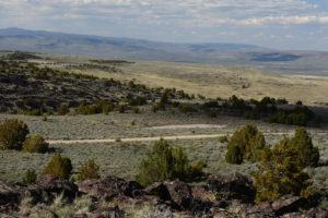
View to north of “Burnt Lake” Road Pond #1 with the “Burnt Lake” road in the foreground. Duck Flat is the large basin in the middle distance and the Hays Canyon Range is beyond it. The peak on the horizon at far left may be Hays Canyon Peak.
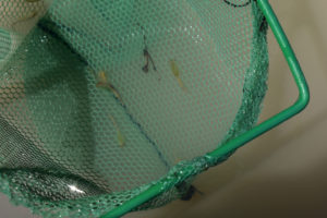
A trio of fairy shrimp in the net at “Burnt Lake” Road Pond #1. The one to the left of center is a female with a few eggs in a long ovisac.
“Burnt Lake” Mud Bar Pond (Surprise BLM Office, Buffalo Hills WSA)
“Burnt Lake” Mud Bar Pond is the first pond south of “Burnt Lake” road and east of “Burnt Lake”. It is shown with the intermittent lake symbol on the 1:100,000-scale BLM map and is about 350 m x 500 m (980′ x 1,640′). “Burnt Lake” Mud Bar Pond is about 500 m (1,640′) from the road and about 900 m (2,950′) east of “Burnt Lake”. A curved pile of mud rises above the water in the middle of the pond. It is likely the spoil from an excavated stock pond.
For access, see “Burnt Lake” Road Pond #1. Parking near “Burnt Lake” Road Pond #1 or a little farther west would be the closest.
Elevation: 1,883 m (6,180′)
May 7, 2019
Some sand lilies are sprouting along the shore.
- Probably larger than the 350 m x 500 m shown on the 1:100,000-scale BLM map but hard to say by how much; often more than 10 cm deep between basalt cobbles near shore and probably more than 20 cm deep farther out.
- Murky pale brown water with local surface scum of green algae.
- Abundant pale gray fairy shrimp about 15 mm long; no eggs seen.
- Tadpole shrimp (Notostraca) about 20 mm long; small dark specks that may be copepods; a few black tadpoles; rare goose turds along shore.
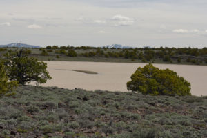
“Burnt Lake” Mud Bar Pond with pile of mud sticking out of clay-rich water and Rowland Mountain in the distance to the southwest.
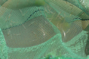
Numerous, very pale gray fairy shrimp from “Burnt Lake” Mud Bar Pond in the net. Their abdomens are made visible by pale material (including clay?) in their intestines.
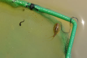
Net with tadpole shrimp (Notostraca) at right and actual tadpole at left at “Burnt Lake” Mud Bar Pond. Is it needless to say that tadpole shrimp look nothing like tadpoles? They look more like tiny horseshoe crabs (convergent evolution?). Dark elongate specks may be copepods. This tadpole shrimp has a small, paddle-like supra-anal plate that projects from the last abdominal segment, between the 2 long, thin, tail-like features. That suggests it belongs to the genus Lepidurus rather than to the only other genus in North America, Triops (Pennak, 1978, p. 338, 346-347).
“Burnt Lake” Double Mud Bar Pond (Surprise BLM Office, Buffalo Hills WSA)
“Burnt Lake” Double Mud Bar Pond is the second pond south of “Burnt Lake” road and east of “Burnt Lake”. It is shown with the ephemeral lake symbol on the 1:100,000-scale BLM map and is about 300 m x 400 m (980′ x 1,310′). It is about 1,000 m (3,280′) south of “Burnt Lake” Mud Bar Pond and about 1,500 m (4,920′) east of “Burnt Lake”. 2 piles of mud rise above the water in the middle of the pond. They are probably from 2 excavated stock ponds.
For access, see “Burnt Lake” Road Pond #1. Parking near “Burnt Lake” Road Pond #1 or a little farther east would be the closest.
Elevation: 1,896 m (6,220′)
May 7, 2019
There is a small snowbank against the basalt outcrop on the southwest side of the pond. That the water inundates the silver sagebrush around the edges suggests a higher than average water level. The 2018-2019 winter brought deeper than normal snow to western Nevada.
- Probably a little larger than the 300 m x 400 m on the 1:100,000-scale BLM map; depth not estimated.
- Cloudy pale brown water, lacks the green algae of “Burnt Lake” Mud Bar Pond.
- Common pale gray fairy shrimp less than 20 mm long.
- Common tadpole shrimp (Notostraca) about 20 mm, probably clam shrimp (Conchostraca), heard an avocet but didn’t see it.
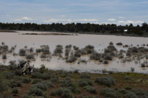
“Burnt Lake” Double Mud Bar Pond. The partially submerged silver sagebrush indicates an unusually high water level.
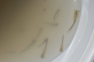
Fairy shrimp from “Burnt Lake” Double Mud Bar Pond swimming in white container. The different sizes of the 2 adjacent fairy shrimp below center suggest there may have been 2 hatches. The intestines of these fairy shrimp, unlike those in photograph “Burnt Lake” Mud Bar Pond 2019-05-07, #06, have dark material even though the water is similarly rich in pale clay. The large fairy shrimp at upper right has a black speck midway between its 2 eyes that is the ocellus. The small, dark, rounded object above center is probably a clam shrimp (Conchostraca) but I didn’t notice it at the time.
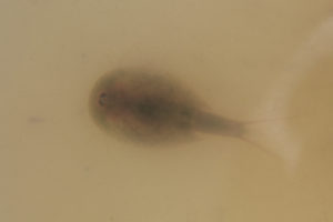
Looking straight down on a tadpole shrimp (Notostraca) in a white container with cloudy water from “Burnt Lake” Double Mud Bar Pond. The dark kidney-shaped spots near the left edge of the carapace are the eyes. The small, dark, rounded object to the left of the tadpole shrimp may be a clam shrimp (Conchostraca) but I didn’t notice this one either. I’m lucky the clam shrimp happened to be in the photograph. Like the tadpole shrimp in photograph “Burnt Lake” Mud Bar Pond 2019-05-07, #05, this one has a supra-anal plate indicative of the genus Lepidurus (Pennak, 1978, p. 346-347) but it is barely visible.
“Burnt Lake” Three Ducks Pond (Surprise BLM Office, Buffalo Hills WSA)
“Burnt Lake” Three Ducks Pond is approximately 49 km (30 miles) northwest of Gerlach. It is shown with the intermittent lake symbol shown on the 1:100,000-scale BLM map. The pond is 1.7 km (1.1 miles) east of “Burnt Lake” Double Mud Bar Pond and 3.5 km (2.2 miles) east of “Burnt Lake”. The pond has dimensions of 100 m x 150 m (330′ x 490′) on the 1:100,000-scale BLM map. The shore is more accessible than at Double Mud Bar Pond and Mud Bar Pond because it is rockier. There were 3 ducks on the water when I arrived but they flew off.
For access, see “Burnt Lake” Road Pond #1. Parking near “Burnt Lake” Road Pond #1 or to the east would be the closest.
Elevation: 1,853 m (6,080′)
May 7, 2019
The presence of ducks suggests there may be something to the name “Duck Flat”, which is to the north.
- About 100 m x 150 m, same as map; depth uncertain due to low relief and small pond size.
- Very cloudy pale brown water, now more churned up by the wind.
- Fairy shrimp about 20 mm long but waves make netting them difficult.
- Tadpole shrimp (Notostraca) about 20 mm; clam shrimp (Conchostraca) about 5 mm long with pale brown shells.
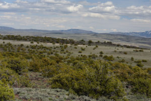
“Burnt Lake” Three Ducks Pond in the middle distance at left as seen on the hike from “Burnt Lake” Double Mud Bar Pond. The north end of Granite Mountain is at far right and what is probably Wagon Tire Mountain is at center. This is a good illustration of the low relief around ponds near “Burnt Lake”.
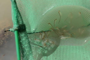
Got lucky with this net sweep and snagged a whole bunch of fairy shrimp from “Burnt Lake” Three Ducks Pond. These have dark intestines that show up well in the pale water. The photo is somewhat blurry because the net was shaking in the wind. As in Mud Bar Pond and Double Mud Bar Pond, I cannot distinguish males and females even though they seem big enough to be sexually mature.
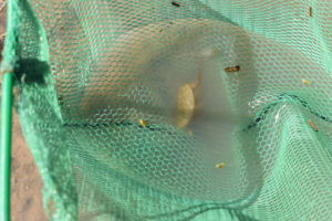
Bingo, all 3 large-bodied branchiopods in the net at “Burnt Lake” Three Ducks Pond. There is a tadpole shrimp (Notostraca) at center and small, pale clam shrimp (Conchostraca) to the left, to the right, and below center while a fairy shrimp cruises along above center. The different orders probably have different feeding strategies here so they can co-exist without much trouble. For more information on tadpole shrimp and clam shrimp, see Other Crustaceans You May Find With Fairy Shrimp.
“Steer Lake” (Surprise BLM Office)
“Steer Lake” is an ephemeral lake in a hollow north of the “Burnt Lake” road and about 400 m (1,310′) northeast of the north end of “Burnt Lake”. The 1:100,000-scale BLM map gives it dimensions of about 400 m x 600 m (1,310′ x 1,970′). It is at a lower elevation than “Burnt Lake” and drains directly into Rye Patch Canyon. There is a u-shaped mound of dirt in the southern part of the lake and a linear mound in the northern part. As in “Burnt Lake” Mud Bar Pond and Double Mud Bar Pond, these are likely spoil piles for stock ponds.
For access, see “Burnt Lake” Road Pond #1. Parking west of “Burnt Lake” Road Pond #1 would be the closest.
Elevation: 1,790 m (5,875′)
May 7, 2019
The water is up into the brush around the edges of the lake. There were several geese on the water when I arrived and some might be nesting on the u-shaped mound in the southern part of the lake.
- Probably a little bigger than the 400 m x 600 m on the 1:100,000-scale BLM map; depth not estimated.
- Cloudy pale brownish-gray water with green algae.
- Fairy shrimp about 20 mm long but hard to net between the brush along the shore.
- Large tadpole shrimp (Notostraca) 25-30 mm long; lots of dark swimming specks, which may be copepods; a few tadpoles less than 15 mm long, also heard a frog.
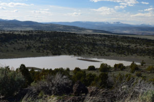
“Steer Lake” with the Warner Mountains in California to the northwest at upper right. Although “Steer Lake” is in a relatively deep depression, the 1:100,000-scale BLM map shows it has an outlet (off right edge of photo) into a tributary of Rye Patch Canyon and that may limit the water depth. It is close to, and at a lower elevation than, “Burnt Lake” so it may receive groundwater recharge from that lake but there is no surface in-flow. The mud bars in this pond have brush on them.
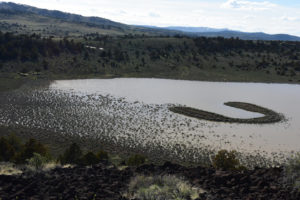
Inundated sagebrush at southern end of “Steer Lake” is more evidence of high water levels in the “Burnt Lake” area this year. There is still a small snowbank on the far side of the lake.
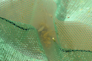
Fairy shrimp caught in net at “Steer Lake”. Due to all the brush along the shore, it was hard to sweep the net through the water but I caught a few fairy shrimp this time. These have no obvious eggs or large antennae II to distinguish the males from the females.
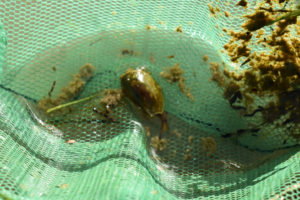
A tadpole shrimp (Notostraca) from “Steer Lake” along with a lot of muck. I caught tadpole shrimp more often than fairy shrimp here. The fairy shrimp may prefer more open water away from the shore while tadpole shrimp like to feed on the bottom.
“Burnt Lake” (Surprise BLM Office)
“Burnt Lake” is 53 km northwest of Gerlach and is labeled on the 1:100,000-scale BLM map. On the map, it is 2.5 km (1.6 miles) long and 0.9 km (0.6 miles) wide. Like reservoirs of this size, “Burnt Lake” would probably be stocked with fish by Nevada Division of Wildlife if it weren’t intermittent, as indicated by the symbol on the 1:100,000-scale BLM map. So there’s hope.
For access, see “Burnt Lake” Road Pond #1. The “Burnt Lake” Road reaches the lake at its north end and continues most of the way down the west side.
Elevation: 1,810 m (5,940′)
May 7, 2019
With the sun sinking in the west, I stopped at the northwest end of the lake. The water is opaque and choppy due to the wind. Fortuitously, there is a ditch on the opposite side of the road with water, which I can also search.
- Lake is 2,500 m x 900 m as on map but I didn’t estimate ditch size; depth in lake not estimated, depth in ditch is less than 20 cm.
- Opaque pale brown water in lake but clear and only slightly brown in ditch.
- Abundant very pale gray fairy shrimp about 15 mm long in lake; common easily visible greenish-gray fairy shrimp about 20 mm long in ditch; larger females in ditch have eggs.
- No other animals caught in lake; none noted in ditch.
What a day! 6 for 6 for fairy shrimp, 4 ponds also had tadpole shrimp, and 2 ponds also had clam shrimp.
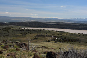
Overview of ponds in “Burnt Lake” area looking east from hill with spot elevation 2,052 m (6,732 ft) north of Rowland Spring North Pond. “Steer Lake” is to the left of “Burnt Lake” and “Burnt Lake” Mud Bar Pond is on the plateau above “Burnt Lake”. The “Burnt Lake” road passes between “Burnt Lake” and “Steer Lake” at left. Granite Mountain is on the horizon at far right. “Steer Lake” is not about the same elevation as “Burnt Lake” as it appears in the photograph. It is actually in a deep basin and only the eastern shore is visible here.
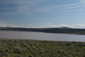
“Burnt Lake” from the “Burnt Lake” road before ithe road drops down to the north end of the lake. The lake is impressively big. Rowland Mountain is in the distance to the southwest at right.
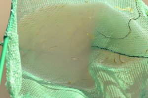
Numerous small, very pale fairy shrimp snatched from the waves of “Burnt Lake”.
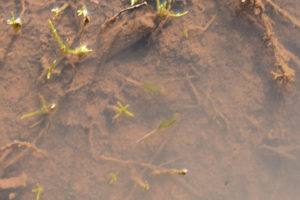
Larger, greenish-gray fairy shrimp in the road-side ditch at the northwestern end of “Burnt Lake”. These 2 somewhat out-of-focus females have pale eggs in their ovisacs. The tips of their abdomens extend beyond the ends of the ovisacs.
Rowland Spring North Pond (Surprise BLM Office)
___This map is a screenshot of The National Map (Go to The National Map). The U.S. Geological Survey generally does not copyright or charge for its data or reports (unless printed). A pond location is indicated by an “X”, which corresponds to the coordinates given in the data spreadsheet. Labels in quotations are from 7.5-minute topographic quadrangles.
___Red lines are the U. S. National Grid with a spacing of 1,000 m and intersection labels consisting of the UTM zone (e.g., 11S, 12T), a 2-letter 100-km square designation (e.g., LC, XN), and a 4-digit number. The first 2 digits of the number represent the 1,000-meter Easting and the second 2 digits the 1,000-meter Northing, as seen in the example Easting and Northing. Unlike latitude and longitude, the National Grid is rectilinear on a flat map, the units of abscissa and ordinate have equal lengths, and the units (meters) are measurable on the ground with a tape or by pacing.
___Gray shading represents private land as traced from the PAD-US 2.0 – Federal Fee Managers layer of The National Map. The BLM version of the Gerlach 1:100,000-scale 30 x 60-minute quadrangle shows additional small blocks of private land, including at Rowland Spring.
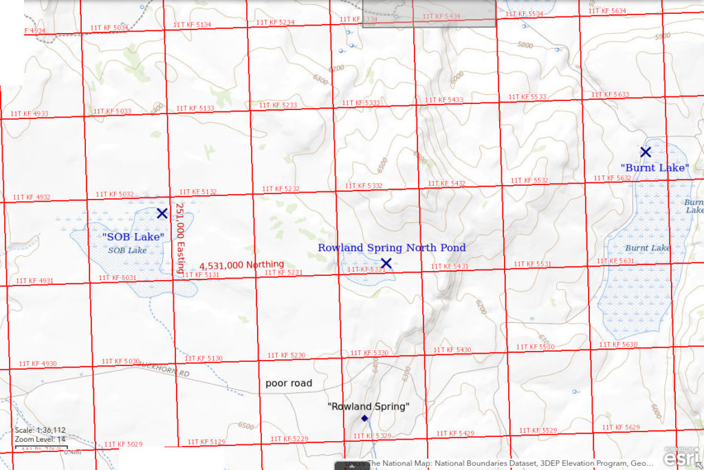
Rowland Spring North Pond is shown on the 1:100,000-scale BLM map as a 300 m x 700 m (980′ x 2,300′) intermittent lake 1.7 km (1.1 miles) north of Rowland Spring. It is 2.7 km (1.7 miles) west of the south end of “Burnt Lake”. It is about 1 km (0.6 miles) north of the track north of Rowland Spring.
For access, see “Burnt Lake” Road Pond #1. The “Burnt Lake” road continues past the west edge of “Burnt Lake” but the quality deteriorates as it climbs to the southwest. Where the road passes north of Rowland Spring is the closest approach to Rowland Spring North Pond but the road condition by then is poor and the track may be impassable when wet.
Elevation: 1,944 m (6,380′)
May 8, 2019
The water is well up into the brush and the area around the outlet east of the pond is very boggy. There are small snowbanks south and west of the pond. Bluebells are blooming.
- Bigger than the 300 m x 700 m on the 1:100,000-scale BLM map; depth not estimated.
- Very cloudy pale brown water.
- Netted only 1 fairy shrimp about 20 mm long after numerous tries.
- Tadpole shrimp (Notostraca) are more common and 15-20 mm long; caught some clam shrimp (Conchostraca) too but didn’t realize it until I looked at the photographs; lots of dark 1-2 mm multi-segment animals with short legs mostly on surface of water.
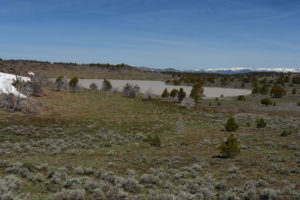
View northwest across Rowland Spring North Pond with the Warner Mountains on the horizon at right. The greener, low-lying area below the pond in the middle distance includes the outlet and is very boggy.
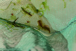
2 tadpole shrimp (Notostraca) at center and 2 smaller, brown clam shrimp (Conchostraca) at upper left from Rowland Spring North Pond in net. These clam shrimp are rounder, darker, and a little bigger than those in “Burnt Lake” Three Ducks Pond (see photograph “Burnt Lake” Three Ducks Pond 2019, #14). The tadpole shrimp at lower right has a supra-anal plate indicative of the genus Lepidurus, like those in photographs “Burnt Lake” Mud Bar Pond 2019-05-07, #05, and “Burnt Lake” Double Mud Bar Pond 2019-05-07, #11.
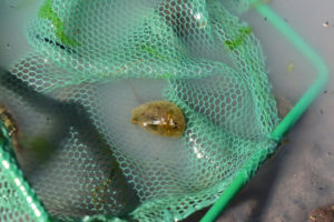
Tadpole shrimp (Notostraca) in net at Roland Spring North Pond. In this view, the ridge at the center of the carapace is particularly prominent. It is a hinge that can flex while the tadpole shrimp is swimming. The dark specks near the surface of the water appear to be segmented, have a few very short legs, and have a pair of rather short antennae. I can’t even guess what they are.
“Dry Steer Lake” (Surprise BLM Office)
___This map is a screenshot of The National Map (Go to The National Map). The U.S. Geological Survey generally does not copyright or charge for its data or reports (unless printed). A pond location is indicated by an “X”, which corresponds to the coordinates given in the data spreadsheet. Labels in quotations are from 7.5-minute topographic quadrangles.
___Red lines are the U. S. National Grid with a spacing of 1,000 m and intersection labels consisting of the UTM zone (e.g., 11S, 12T), a 2-letter 100-km square designation (e.g., LC, XN), and a 4-digit number. The first 2 digits of the number represent the 1,000-meter Easting and the second 2 digits the 1,000-meter Northing, as seen in the example Easting and Northing. Unlike latitude and longitude, the National Grid is rectilinear on a flat map, the units of abscissa and ordinate have equal lengths, and the units (meters) are measurable on the ground with a tape or by pacing.
___Gray shading represents private land as traced from the PAD-US 2.0 – Federal Fee Managers layer of The National Map. The BLM version of the Gerlach 1:100,000-scale 30 x 60-minute quadrangle shows additional small blocks of private land, including at Rowland Spring.
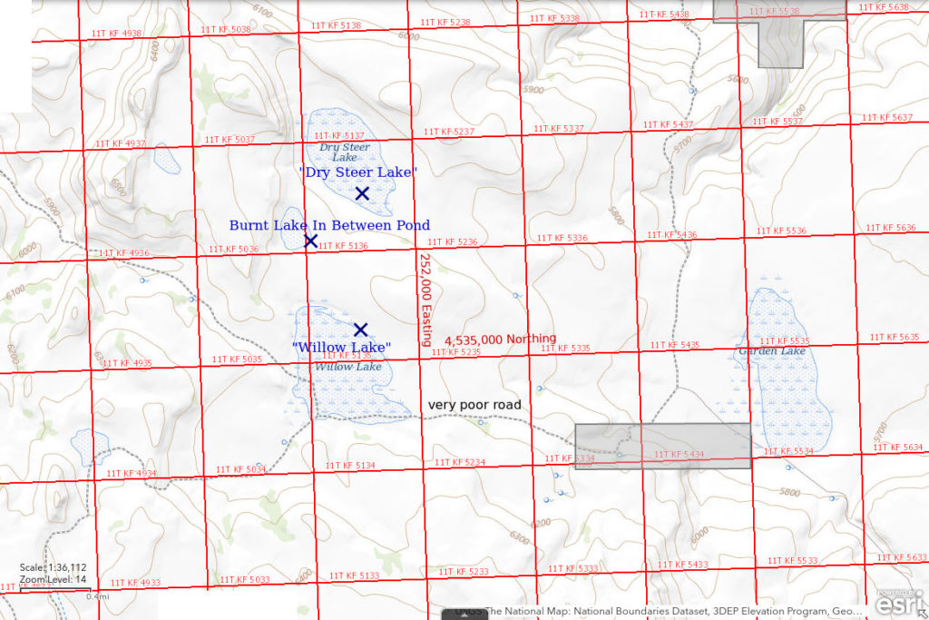
“Dry Steer Lake” is 60 km (37 miles) northwest of Gerlach. It is 7 km (4 miles) northwest of “Burnt Lake”. On the 1:100,000-scale BLM map, “Dry Steer Lake” is shown as a 600 m x 1,100 m (1,970′ x 3,600′) intermittent lake. It is not named on that map or on the 1980 “Burnt Lake” 7.5-minute quadrangle but it is named on The National Map. There is brush across the entire area of the lake. This suggests it rarely has water. The pond bottom is mostly clay, like other “dry” lakes. A probable stock pond has been excavated in the southern part of the lake. There is a barbed wire range fence at the southwestern edge of the lake.
For access, see Rowland Spring North Pond. “Dry Steer Lake” is 6.5 km (4 miles) north of the track north of Rowland Spring and 2 km (2 miles) north of the track across the south end of “Willow Lake”. The track to “Willow Lake” extends from the northwest end of “Burnt Lake”, past “Garden Lake” and up a steep hill west of “Garden Lake”. At “Willow Lake”, the track was partially flooded and lacked signs of recent use. Hiking from the north end of “Burnt Lake” would have less relief than hiking from north of Rowland Spring.
Elevation: 1,826 m (5,990′)
May 8, 2019
Water appears to cover all of the potential lake area. The stock pond within it is inaccessible due to boot-swallowing mud and insufficient brush to use as stepping stones. The shallowest water at the edge of the pond is relatively clear and that is all I can get to. Shooting stars are blooming on the slope south of the pond.
- Likely larger than the 600 m x 1,100 m on the 1:100,000-scale BLM map; depth probably less than 20 cm but could be deeper in the probable stock pond.
- Murky water with very pale brownish-gray color.
- Saw only 1 fairy shrimp about 20 mm long.
- Numerous black tadpoles about 20 mm long; geese and ducks on the probable stock pond; lots of tiny unidentified swimming animals.
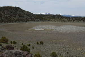
“Dry Steer Lake” with probable stock pond near center and Warner Mountains in the distance. Brush covers the entire lake bed. The water is more extensive than the reflective surfaces in the photograph.
Tadpoles in “Dry Steer Lake”. There are lots of tiny, dark swimming animals but I hesitate to guess that they are copepods.
“Burnt Lake” In Between Pond (Surprise BLM Office)
“Burnt Lake” In Between Pond is midway between “Dry Steer Lake” (400 m away, 1,300′) and “Willow Lake” (600 m away, 1,970′). It is shown as a 200 m x 400 m (660′ x 1,300′) intermittent lake on the 1:100,000-scale BLM map. There are 2 piles of dirt near the center that may have been excavated for stock pond(s). The rocky shore makes getting close to the water easier than for most other ponds in this area.
For access, see “Dry Steer Lake”. “Burnt Lake” In Between Pond is 1.8 km (1.1 miles) north of the track to “Willow Lake” and 6.3 km (3.9 miles) north of the track north of Rowland Spring.
Elevation: 1,866 m (6,120′)
May 8, 2019
This pond was an obvious stop on the hike from “Dry Steer Lake” to “Willow Lake”.
- 200 m x 400 m as on 1:100,000-scale BLM map; depth not estimated.
- Cloudy pale brownish-gray water.
- Abundant, pale gray fairy shrimp 15-20 cm long.
- Rare tadpole shrimp (Notostraca) about 15 mm (smallest I’ve yet seen in this area) only netted on the less rocky south shore; probable clam shrimp (Conchostraca) in photograph “Burnt Lake” In Between Pond 2019-05-08, #39 but not noticed in pond.
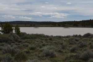
View to southwest across “Burnt Lake” In Between Pond. There are 2 prominent piles of dirt rising from the water that are probably the diggings from a stock pond.
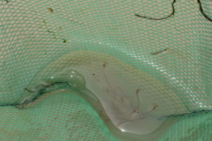
Fairy shrimp in net at “Burnt Lake” In Between Pond. They are not in focus but at least the eyes and the dark intestines are clearly visible. The translucent, pale brown, oval object at upper left is probably a clam shrimp (Conchostraca).
“Willow Lake” (Surprise BLM Office)
“Willow Lake” is shown as a 800 m x 1,300 m (2,620′ x 4,270′) intermittent lake on the 1:100,000-scale BLM map. There are no longer any willows at “Willow Lake”. There may be 2 40-acre (16 hectares) parcels of private land at the southeast end of the lake (as shown on the 1:100,000-scale BLM map but not on the PAD-US 2.0 – Federal Fee Managers layer of The National Map) but they are not marked on the ground.
For access, see “Dry Steer Lake”. The 1:100,000-scale BLM map shows a road going to the lake from “Garden Lake” and then splitting to go to the west or northwest. At the lake, the track looks like it hasn’t been used in a long time. “Willow Lake” is 5 km (3.1 miles) north of the track north of Rowland Spring.
Elevation: 1,866 m (6,120′)
May 8, 2019
The north shore of the lake is very mucky. Some rocks along the east shore allow access to the water. The vehicle track from “Burnt Lake” across the southern end of the lake is deeply rutted or covered by water.
- 800 m x 1,300 m according to 1:100,000-scale BLM map and too big for me to estimate; depth up to about 8 cm within reach of shore.
- Cloudy pale brownish-gray water.
- Sparse pale gray fairy shrimp about 15 mm long.
- Lots of tiny, dark, swimming animals.
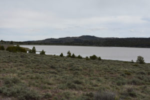
Looking south along east shore of “Willow Lake”. It takes a while to walk around this lake.
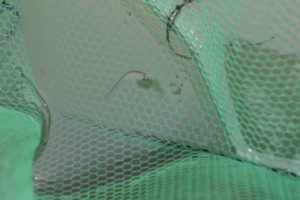
This is the one fairy shrimp that I caught in “Willow Lake” after numerous tries. I walked the east shore because the wind is from the west and could push the fairy shrimp that way but maybe they are hanging out in deeper water. Time to move on to “SOB Lake”.
“SOB Lake” (Surprise BLM Office)
“SOB Lake” is 58 km (36 miles) northwest of Gerlach. On the 1:100,000-scale BLM map, it is shown as an intermittent lake. Unlike the other lakes and ponds near “Burnt Lake”, it has an irregular shape – sort of like a flying bird – and maximum dimensions of about 1,100 m (wings to breast) x 1,600 m (beak to tail) (3,610′ x 5,250′). It is 2.7 km (1.7 miles) south of “Willow Lake”, about 1.8 km (1.1 miles) west of Rowland Spring North Pond, and only 800 m (0.5 miles) north of the track which passes north of Rowland Spring.
For access, see Rowland Spring North Pond. If the road is passable, the closest approach to “SOB Lake” would be about 3 km (1.9 miles) west of the turn-off to Rowland Spring.
Elevation: 1,952 m (6,405′)
May 8, 2019
The water level is into the brush around the edges of the lake. There are a few geese and a couple of ducks on the water. I’m running out time but luckily I can get close enough to the north shore to dip the net.
- 1,100 m x 1,600 m according to 1:100,000-scale BLM map and too big for me to estimate; depth not estimated.
- Almost opaque pale brownish-gray water as the wind has picked up.
- Pale gray fairy shrimp about 20 mm long.
- Netted 1 tadpole shrimp about 20 mm long; geese, ducks.
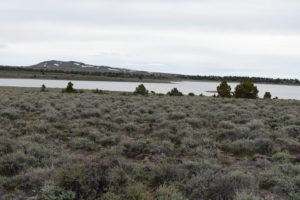
View south across eastern half of “SOB Lake”, with Rowland Mountain in distance.
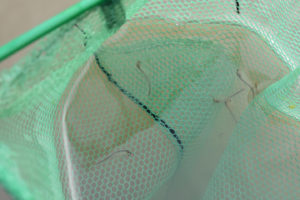
A few fairy shrimp from “SOB Lake” in the net. As for most other fairy shrimp in the “Burnt Lake” area, these don’t have obvious ovisacs or antennae II for sex determination.
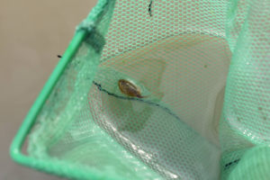
A tadpole shrimp (Notostraca) in the net at “SOB Lake”.
Another great day as 5 of 5 ponds have fairy shrimp, 3 have tadpole shrimp, and 2 have clam shrimp. After a snowy winter, the “Burnt Lake” area ponds have proven to be a branchiopod bonanza with all 3 extant large branchiopod orders – fairy shrimp (Anostraca), tadpole shrimp (Notostraca), and clam shrimp (Conchostraca, or the 2 orders Spinicaudata and Laevicaudata).
What Can We Learn from the Ponds in Middle Washoe County?
Middle Washoe County is a great place for branchiopods, at least after a snowy winter. I found fairy shrimp in all 11 ponds that I visited and also found tadpole shrimp (Notostraca) and clam shrimp (Conchostraca, or the orders Spinicaudata, Laevicaudata, and Cyclestherida) in many of the ponds.
The presence of supra-anal plates indicate the tadpole shrimp here, like those in the Hays Canyon Range, belong to the genus Lepidurus rather than to the genus Triops, which has been found in McLeans Valley, Monte Cristo Valley, Soda Spring Valley, and the Garfield Hills (e.g., Windy Gravel Pit Pond 2023-09-01, #04, Kibby Flat Playa Lake 2023-09-06, #07). Lepidurus and Triops are the only 2 notostracan genera in North America (Pennak, 1978, p. 338). The species can’t be determined from macroscopic observations.
Plateau country like middle Washoe County seems more favorable for fairy shrimp than the typical block-faulted mountains of the Basin and Range. The gentle topography offers more opportunities for ponds than steep, strongly dissected hills. The Owyhee Desert has similar topography and basalt substratum and also has many ponds with fairy shrimp.
The presence of ducks and geese on the middle Washoe County ponds indicates a ready agent for dispersal of fairy shrimp resting eggs.
Maps show that there are many more ponds in the area.