Kibby Wells Road Junction Pond
Windy Gravel Pit Pond
What Can We Learn from the Ponds in McLeans Valley?
In my description of Big Smoky Valley, I limited my use of that name to the valley between the Toiyabe and Toquima ranges north of Wall Canyon. Maps by the U.S. Geological Survey label the valley between the Monte Cristo Range and the Weepah Hills and Lone Mountain as also Big Smoky Valley. This valley is 70 km (42 miles) southwest of what I call Big Smoky Valley and differs from it in terms of elevation, physiography, climate, hydrology, and ecology. On this web site, I use the term McLeans Valley to refer to this southern segment of Big Smoky Valley. “McLeans” is shown on the 1:100,000-scale BLM map as the name of a railroad stop in the middle of McLeans Valley. The railroad from Tonopah to Hawthorne has long since been abandoned but parts of the railroad grade are still present and shown on U.S. Geological Survey maps.
McLeans Valley extends northeastward from the Silver Peak Range with the Monte Cristo Hills to the north and the Weepah Hills and Lone Mountain to the south. The northeastern end is poorly defined as it transitions to a north-trending valley between the Royston Hills and the San Antonio Mountains. Ione and Peavine washes are prominent features of the north-trending valley but are more or less lost on the valley floor somewhere north of Millers. Millers is on US 6/US 95 21.5 km (13 miles) west of Tonopah and is adjacent to the rest stop shown on the state highway map. From 6 km (3.6 miles) north of Millers to Emigrant Pass over the Silver Peak Range is 53 km (32 miles). The Weepah Hills do not close off the southern corner of the valley but there is a drainage divide approximately 15 km (9 miles) north of the town of Silver Peak. Mcleans Valley is 9 km to about 20 km (5.4-12 miles) wide, narrowest in the middle northwest of Lone Mountain and fatter at both ends.
Due to the gentle topography, the boundary between the hills and the valley is gradational. Most of what could be considered the valley floor is below the 1,500-meter (4,920′) contour. The lowest elevation found on The National Map is about 1,440 m (4,720′). The highest elevation in the nearby portion of the Monte Cristo Range is 2,437 m (8,000′). Lone Mountain is 2,776 m (9,110′) high and has impressive relief.
McLeans Valley looks rather barren from the highway. The desert scrub in most of the valley is sparse. The density of vegetation doesn’t increase much on the surrounding hills. I’ve seen a few cholla cactus on the alluvial fans above the valley floor. There is a vegetation-free playa about 8 km long and 1.5 km wide (4.8 x 0.9 miles) as measured on The National Map aerial imagery and there are other large clay flats. The 1:100,000-scale BLM maps inconveniently show both playas and sand dunes with stipple patterns.
The combined US 6 and US 95 highway passes through the length of McLeans Valley. Nevada 265 crosses the southwestern part from US 6/US 95 to the town of Silver Peak. There is a block of about 5 square kilometers (less than two 1-square mile sections) of private land at Millers but very little elsewhere in the valley.
Kibby Wells Road Junction Pond (Tonopah BLM Office)
___This map is a screenshot of The National Map (Go to The National Map). The U.S. Geological Survey generally does not copyright or charge for its data or reports (unless printed). A pond location is indicated by an “X”, which corresponds to the coordinates given in the data spreadsheet. Labels in quotations are from 7.5-minute topographic quadrangles.
___Red lines are the U. S. National Grid with a spacing of 1,000 m and intersection labels consisting of the UTM zone (e.g., 11S, 12T), a 2-letter 100-km square designation (e.g., LC, XN), and a 4-digit number. The first 2 digits of the number represent the 1,000-meter Easting and the second 2 digits the 1,000-meter Northing, as seen in the example Easting and Northing. Unlike latitude and longitude, the National Grid is rectilinear on a flat map, the units of abscissa and ordinate have equal lengths, and the units (meters) are measurable on the ground with a tape or by pacing.
___There is no private or state land on this map. All lands are public.
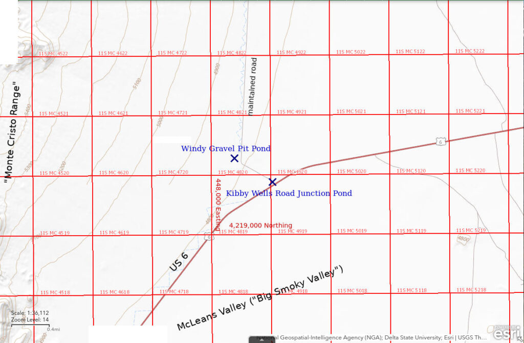
The Kibby Wells Road Junction Pond is at the intersection of Kibby Wells Road (aka Esmeralda County Road 169) and US 6/US 95 13.7 highway miles east of Nevada 265 and 20.3 miles west of Tonopah. The name “Kibby Wells Road” is given on the Nevada Department of Transportation’s Esmeralda County Zone 1 map (northern part), which is available at www.dot.nv.gov/travel-info/county-maps. The pond is on the southwest side of the road although puddles may be scattered over a wide area of the greasewood-populated clay flat after significant precipitation events. The pond is not in a roadside ditch as it has not been excavated. Rather Kibby Wells Road is a causeway built across the clay flat on substantial fill. Kibby Wells Road Junction Pond is, in effect, ponded against Kibby Wells Road and US 6.
When water is present, Kibby Wells Road Junction Pond is visible to drivers in at least the west-bound lane of US 6. There are signs on US 6 for a road intersection but I don’t remember if they have a road name and, if so, what the road name is. The turn-off coincides with a bend in US 6 that is a good landmark. To visit the pond, turn north off US 6 onto the Kibby Wells Road. There is a large area for parking within a few 10s of meters from the highway.
Elevation: 1,456 m (4,780′)
September 1, 2023
I had hoped to stop at Kibby Flat to look for water on the playa in Monte Cristo Valley on my way back from Big Smoky Valley. After using 4-wheel drive to cross 2 washed out drainages on the best part of Kibby Wells Road, I decided my chances of getting to Kibby Flat were slim and turned around. If you can’t get to the pond you want, check out the pond you’re at. I hadn’t stopped earlier because I was in a hurry to get to Kibby Flat but now I had time.
- 30 m x 115 m not counting all the isolated puddles; depth not estimated but at least a little greater than 5 cm.
- Opaque brown water; 20 C in 2 cm water at 1500.
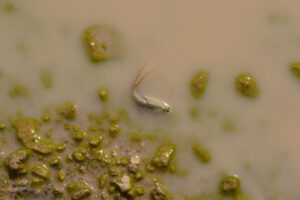
- Reddish-gray fairy shrimp 8-10 mm long; no eggs seen but probably present because same size fairy shrimp in Windy Gravel Pit Pond (below) have eggs.
- Tadpole shrimp (Notostraca) 25-30 mm long.
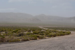
Kibby Wells Road Junction Pond, looking away from US 6 across and along Kibby Wells Road. The brown color adjacent to the road in the foreground represents water. The white color farther from the road represents dried clay. The pale, brush-free, horizontal streak in the middle distance is the gravel pit where Windy Gravel Pit Pond is located. Blowing dust obscures the Monte Cristo Range.
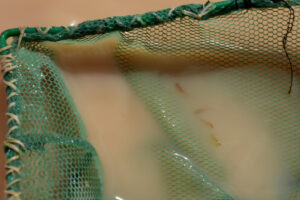
Reddish fairy shrimp in net at Kibby Wells Road Junction Pond.

Tadpole shrimp (Notostraca) in net at Kibby Wells Road Junction Pond.
March 19, 2025
After 36% of normal precipitation in January and 15% of normal in February, Tonopah got 0.41 cm on March 5th, 0.61 cm on March 13th, and smaller amounts on the 14th and 17th. I was driving by so I stopped for a look.
- A little mud.
Windy Gravel Pit Pond (Tonopah BLM Office)
Kibby Wells Road Junction Pond map
Windy Gravel Pit Pond is at the bend in the Kibby Wells Road 800 m (2,620′) from US 6/US 95 and 20.3 miles west of Tonopah. Unlike many gravel pits, the gravel pit with Windy Gravel Pit Pond is an actual pit that is mostly below the surface. The gravel pit itself is approximately circular with a diameter of about 110 m (360′) but the pond is in a curved depression in the western and southwestern parts of the pit. At the time of the September 2023 visit, it was very windy with dust blowing off the playa in McLeans Valley. While there may be hundreds of other episodically windy gravel pits in Nevada, I didn’t have any other inspiration for a name.
The gravel pit with Windy Gravel Pit Pond has no signs of recent activity. In theory, it could be reclaimed or reactivated at any time but it seems that Nevada Department of Transportation (NDOT) rarely reclaims its gravel pits on public lands. Moreover, NDOT commonly creates a new gravel pit for a new highway project even if there is an old gravel pit in the vicinity. Consequently, Windy Gravel Pit Pond may persist for decades or centuries.
For access, see Kibby Wells Road Junction Pond. Windy Gravel Pit Pond is at the bend in the road 750 m (2,460′) northwest of Kibby Wells Road Junction Pond.
Elevation: 1,462 m (4,800′) Because of the way The National Map estimates elevations, this is most likely the surface elevation at the top of the gravel pit, not the elevation of the water at the bottom of the gravel pit.
September 1, 2023
Gravel “pits” are often flat and just have piles of unused gravel but this one was in a large excavation so I looked. There is lots of water. NPPWOPII. The wind is so strong that it blows my net closed and horizontal as soon as I pull it out of the water so I can’t see what I have caught, if anything. I have to hope that if there are fairy shrimp here, they occasionally swim to the surface or that they venture into water less than 2 cm deep around the edges of the pond.
- The pond has an irregular, arcuate shape about 100 m long and up to 20 m across but there are also isolated puddles; maximum depth greater than 25 cm.
- Opaque pale brown water; 18 C in 3 cm water at 1615.
- Pale gray and reddish-gray fairy shrimp 8-10 mm long; eggs present.
- Tadpole shrimp (Notostraca) 15-20 mm long.
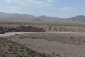
Looking northwest across Windy Gravel Pit Pond and its gravel pit. The pond forms a long arc in the bottom of the gravel pit but there are also puddles on the far sides of the gravel piles and on the flat area at center. The Monte Cristo Range is in the distance through the dust.
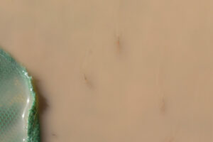
3 fairy shrimp next to the net in water less than 2 cm deep in a puddle next to Windy Gravel Pit Pond. The 2 below the center of the photograph have ovisacs with pale eggs. All 3 are swimming upstream toward the bottom of the photograph against the wind-driven water.
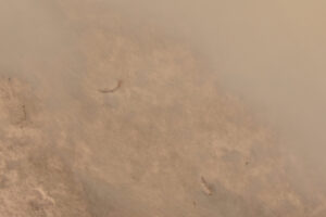
Fairy shrimp in a puddle next to Windy Gravel Pit Pond. The water is less than 1 cm deep and these fairy shrimp are scraping the mud with their legs.
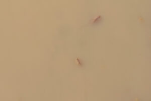
2 tadpole shrimp (Notostraca) near the surface of the opaque water in Windy Gravel Pit Pond.
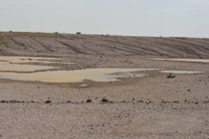
Shallow puddles on the floor of the gravel pit next to Windy Gravel Pit Pond. The puddles have tadpole shrimp even though they have little mud for the tadpole shrimp to forage in.
A tadpole shrimp (Notostraca) in a puddle on the flat area next to Windy Gravel Pit Pond. This puddle has a rocky bottom, unlike the muddy bottoms most commonly found in tadpole shrimp ponds. The configuration of the eyes, the markings on the carapace, and, most importantly, the lack of a paddle-like supra-anal plate at the end of the abdomen between the 2 long, thin, tail-like features indicate this species is Triops longicaudatus.
Windy Gravel Pit Pond Tadpole Shrimp Video 2023-09-01-cr
For a 1-minute, 23-seconds video of tadpole shrimp (Notostraca) swimming in a shallow puddle next to Windy Gravel Pit Pond, click on the video player above. There is no audio. The tadpole shrimp are common in the puddle but I do a poor job of following them with the camera. The best scenes are at 0:20-0:36 and 1:08-1:11. At 1:20, 2 tadpole shrimp can be seen.
March 19, 2025
This pond seems to be dryer than Kibby Wells Road Junction Pond in spite of recent precipitation in Tonopah.
- Damp.
What Can We Learn from the Ponds in McLeans Valley?
In late summer after mid-August and possibly other thunderstorms, both fairy shrimp (Anostraca) and tadpole shrimp (Notostraca) were found in 2 of 2 ponds.
Both ponds are adjacent to US 6/US 95 and are very easy to visit.
Visits to 1 roadside pond and 1 gravel pit pond hardly scratch the surface of potential fairy shrimp habitats in McLeans Valley.
Macroscopic characteristics indicate the tadpole shrimp are the species Triops longicaudatus, which has also been found at Garfield 5890 Saddle Pond in the Garfield Hills and at Kibby Flat Playa Lake in Monte Cristo Valley. They can be distinguished from Lepidurus tadpole shrimp in Middle Washoe County (e.g., Rowland Spring North Pond 2019-05-08, #30, Burnt Lake Mud Bar Pond 2019-05-07, #05) by the absence of a supra-anal plate (Pennak, 1978, p. 346-347).
The presence of tadpole shrimp in puddles with gravel bottoms shows that they are not restricted to ponds with muddy bottoms, where they are so good at digging.