Box Canyon Pond
Squaw Flat Playa Lake
What Can We Learn from the Ponds in “Little Fish Lake” Valley?
“Little Fish Lake” Valley is not a typical basin of the Basin and Range physiographic province. It is more like an intermontane basin with the Monitor Range to the west, the Hot Creek Range to the east, the Antelope Range closing off the north end, and hills of volcanic rock separating it from the Hot Creek drainage to the south. It has a lenticular shape about 55 km (33 miles) long and up to 15 km (9 miles) wide. Remarkably, “Little Fish Lake” Valley is segmented into 3 sub-basins by subdued drainage divides. At the south end, Squaw Flat is the sink for the smallest sub-basin. “Little Fish Lake” is the sink for the next sub-basin to the north, which is also the next smallest. “Upper Fish Lake” is at the south end of the next sub-basin to the north. The valley from there to the north is relatively flat for 20 km (12 miles) or so to the convergence of Savory Creek and Sevenmile Wash. Because Squaw Flat is lower than “Little Fish Lake”, which is lower than “Upper Fish Lake”, “Little Fish Lake” Valley drained to the south into Hot Creek in some past, more humid climate. Box Canyon was cut more than 67 m (220′) down through volcanic rocks south of Squaw Flat as a result but now has an insignificant ephemeral stream.
A benchmark next to Squaw Flat represents the lowest measured elevation in “Little Fish Lake” Valley at 1,929 m (6,330′). The alluvial wash ranges from about 800 m to 2,500 m (2,620-8,200′) across and rises to the north, reaching 2,060 m (6,760′) at the junction of Savory Creek and Sevenmile Wash. The alluvial fans may be up to about 150 m (500′) higher to the west of the wash and 100 m (330′) higher to the east.
Box Canyon is included in “Little Fish Lake” Valley here for convenience. It is a generally dry tributary of Hot Creek, which cuts through the Hot Creek Range. There is a low drainage divide between Box Canyon and Squaw Flat.
The small playas of “Little Fish Lake” Valley are potential fairy shrimp habitat. On aerial imagery, Squaw Flat and “Upper Fish Lake” have pale, relatively brush-free floors. There is another smaller, playa lake feature 4.5 km north of “Little Fish Lake”. There are other areas in the relatively flat alluvial wash where water might pond after spring run-off or accumulate from snowmelt. Although spring ponds aren’t normally conducive to fairy shrimp (Smith Creek Cold Springs Ponds are an exception), there are several springs in the wash. “Little Fish Lake” has abundant water in aerial imagery views but if it had dried up in recent droughts, the fish might be gone.
There is abundant sagebrush around Squaw Flat and that is probably the case for the rest of “Little Fish Lake” Valley. There is also some greasewood at Squaw Flat and more in Box Canyon. Pinyon-juniper woodland is extensive on the hills bordering the valley but essentially absent from the alluvial fans.
The southern two-thirds of “Little Fish Lake” Valley are on the Humboldt-Toiyabe National Forest and the part north of about Fish Springs is managed by the BLM. There are several long parcels of private land generally along the alluvial wash: north of “Little Fish Lake” for about 1 km (0.6 mile), south of “Upper Fish Lake” for about 2 km (1.2 miles), from about 1 km (0.6 mile) north of “Upper Fish Lake” north for 6 km (3.6 miles), for about 3 km (3.6 miles) south of the National Forest boundary and 400 m (1,310′) to the north, and for about 1.7 km (1.0 mile) north of Fish Springs but not Fish Springs itself. The warm springs northeast of “Upper Fish Lake” are also on private land. Clear Creek Ranch is along Clear Creek well to the west of, and above, the valley bottom.
From the north, the maintained Antelope Valley road (Eureka County 82) turns off US 50 20 miles west of Eureka. From there, the straight-line distance to “Little Fish Lake” is 104 km (62 miles) but I don’t know what the road conditions are like. From the south, the maintained East Stone Cabin Valley road turns off US 6 34 miles east of Tonopah and from there it is 55 km (33 miles, straight-line) to “Little Fish Lake”. Roads across the Monitor or Hot Creek ranges are few and far between, are rough to poor, and are likely to be blocked by snow in the spring.
Box Canyon Pond (Tonopah BLM Office)
___This map is a screenshot of The National Map (Go to The National Map). The U.S. Geological Survey generally does not copyright or charge for its data or reports (unless printed). A pond location is indicated by an “X”, which corresponds to the coordinates given in the data spreadsheet. Labels in quotations are from 7.5-minute topographic quadrangles.
___Red lines are the U. S. National Grid with a spacing of 1,000 m and intersection labels consisting of the UTM zone (e.g., 11S, 12T), a 2-letter 100-km square designation (e.g., LC, XN), and a 4-digit number. The first 2 digits of the number represent the 1,000-meter Easting and the second 2 digits the 1,000-meter Northing, as seen in the example Easting and Northing. Unlike latitude and longitude, the National Grid is rectilinear on a flat map, the units of abscissa and ordinate have equal lengths, and the units (meters) are measurable on the ground with a tape or by pacing.
___Gray shading represents private land as traced from the PAD-US 2.0 – Federal Fee Managers layer of The National Map. Other lands are public.
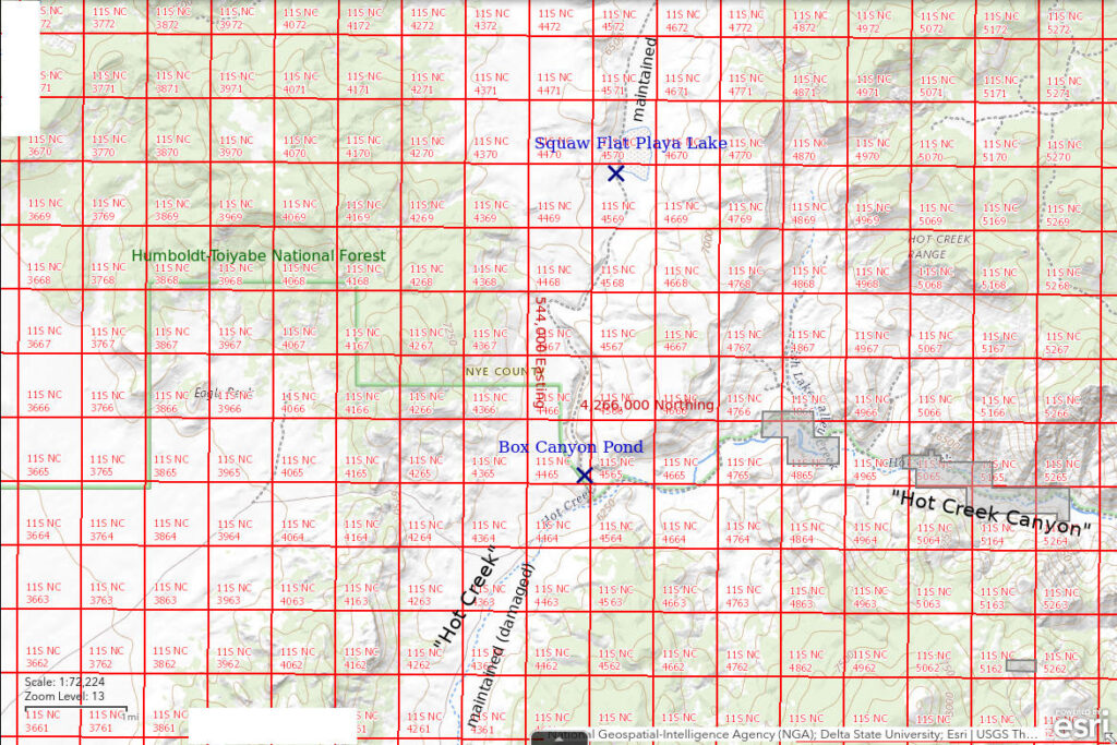
There is no evidence on maps or aerial imagery that there is ever a pond at the lower end of Box Canyon. On the imagery, it is a pale flat about 250 m (820′) long and 100 m (330′) wide with very little vegetation. The ephemeral channel joins Hot Creek.
Box Canyon Pond is 82 km (49 miles) northeast of Tonopah.
Box Canyon Pond can be reached by following the maintained road up the west side of East Stone Cabin Valley. Turn north off US 6 about 0.5 mile east of the ranch at Fivemile Spring.
Elevation: 1,884 m (6,181′)
April 16, 2023
The road north of McKintyre Summit had been extensively eroded by recent flows down and across the road but the Nye County road crew had made the worst spots passable. The blading stopped at the mouth of Box Canyon. The maps do not show any intermittent water bodies in Box Canyon so I was not prepared to see brown water from wall to wall at the lower end of Box Canyon. I scouted a road on the west edge of Box Canyon on foot for about 2.5 km (1.5 miles) as I contemplated a day of hiking only rather than also looking for fairy shrimp. The road I followed joined the main road at some point. They had dried out some and the washouts didn’t look too terrible. It was only on the walk back to my vehicle that I decided to dip a net in the brown pond. I didn’t think a newly flooded area would have fairy shrimp eggs but WIDLA.
- About 150 m x 300 m; depth greater than 15 cm.
- Opaque brown water.
- Fairy shrimp 8-12 mm long; some eggs.
- Black diving beetles, ducks.
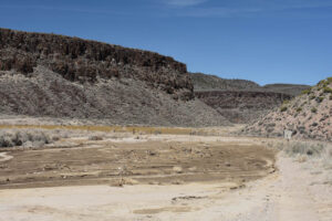
Box Canyon Pond. Recent flooding of Hot Creek down the road the photographer is standing on washed out the road and may have built up a dam that helped back up water in Box Canyon. Why else wouldn’t the channel in Box Canyon drain into Hot Creek? The Hot Creek channel (wet, brown mud in photo) makes a right-angle turn here off the right edge of the photograph. The main road may have continued through the gate at center. I took a road along the west edge of the canyon on the far side of the pond (see photo Box Canyon Pond 2023 #04).
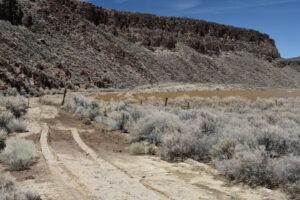
West edge of Box Canyon Pond. The water is up to the edge of the road but the road has dried out some and is not too muddy. The water is well up into the greasewood surrounding the sand flat on the aerial imagery. The gate through the fence is relatively small and suggests that this is not the main road but an older version. The tire tracks are not mine.
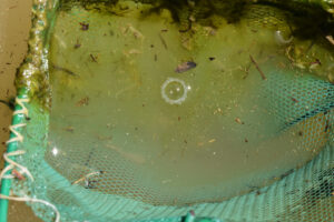
Pale gray fairy shrimp in the net at Box Canyon Pond with lots of plant debris. There is one at upper right that is curved and against the edge of the net. At least 2 others, of different sizes, are to the left of center below the water surface.
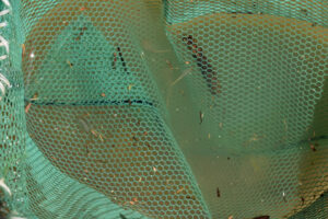
Fairy shrimp in the net at Box Canyon Pond. With less debris, these are easier to see. The female at left has pale yellow eggs.
“Little Fish Lake” Valley – top
Squaw Flat Playa Lake (Tonopah BLM Office)
Squaw Flat Playa Lake is 87 km (52 miles) northeast of Tonopah and 4.7 km (2.8 miles) north of Box Canyon Pond. Squaw Flat Playa is a sort of parallelogram up to 830 m long and 470 m wide (2,720 x 1,540′) at the south end of “Little Fish Lake” Valley. There are relatively steep hills to the east and west and gentle slopes to the south and north. The drainage divide above Box Canyon is only about 300 m (980′) to the south of the edge of the playa as shown on the 7.5-minute topographic quadrangle.
See Box Canyon Pond for access. After ascending Box Canyon, the maintained road to “Little Fish Lake” Valley passes close to the western shore of Squaw Flat Playa Lake.
Elevation: 1,927 m (6,322′)
April 16, 2023
The road up Box Canyon was considerably damaged but still passable with care and 4-wheel drive. The meter or so of water on the road past Squaw Flat told me I wasn’t going any further. It was already too late in the day to consider hiking to “Little Fish Lake”. After finding fairy shrimp in Box Canyon Pond, I speculated their eggs might have been washed down from Squaw Flat. That was before I took a careful look at the map.
- Probably 500 m x 1,000 m (it’s bigger than on the map and aerial imagery); depth greater than 25 cm.
- Cloudy brown water; 15 C in 2 cm water at 1330.
- Fairy shrimp ranging in length from about 10 mm to about 30 mm in at least 2 size classes; eggs are common.
- Didn’t see any other animals in the water.
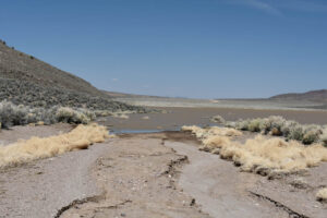
End of the road at Squaw Flat Playa Lake.
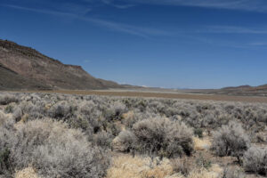
The brown water of Squaw Flat Playa Lake completely covers the floor of the valley. I had the zoom lens cranked out to 32 mm so the photograph compresses a wide angle view that is more impressive than it looks here.
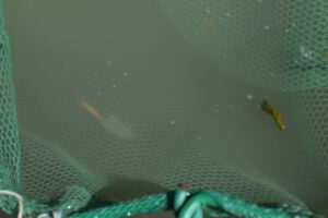
Fairy shrimp in the net at Squaw Flat Playa Lake. This female has abundant pale yellow eggs in a rather long ovisac.
Side view of fairy shrimp in the net at Squaw Flat Playa Lake. This fairy shrimp apparently lacks an ovisac but also appears to lack the long antennae II of males of the family Branchinectidae. It may belong to a different family.
Squaw Flat Playa Lake Fairy Shrimp Video 2023-04-16-cr, “Little Fish Lake” Valley.
For a 2-minutes 4-seconds video of fairy shrimp swimming in a white container at Squaw Flat Playa Lake, click on the video player above. There is no audio. The video opens with a view to the north across Squaw Flat Playa Lake and then shows the container with fairy shrimp. The stick floating on the water is 2 cm long. The fairy shrimp are of various sizes. One female that may be about 30 mm long swims mostly close to the bottom but approaches the surface at 0:38, 1:14, and 1:37. As in Easy Chair Crater Reservoir Fairy Shrimp Video 2023-04-13b-cmr (Southern Pancake Range), fairy shrimp occasionally swim head-on into the right side of the container, such as at 0:28, 0:37, 0:44, 0:54, 1:21, and 1:37. Glancing impacts seem to be more common. As in the discussion of Easy Chair Crater Reservoir Fairy Shrimp Video 2023-04-13b-cmr, the impacts may not suggest poor vision but merely the difficulty of seeing a smooth, curved, white wall through cloudy water. Notably, the right side of the container lacks large lettering, such as that at the top of the video (and the bottom, where it is not visible). I have since used a magic marker to draw various squiggles on the container.
“Little Fish Lake” Valley – top
What Can We Learn from the Ponds in “Little Fish Lake” Valley?
In the extraordinary year of 2023, there was a large pond, Box Canyon Pond, where there is likely almost never a pond. It nonetheless had a hatch of fairy shrimp. Perhaps there was previously a roadside ditch in the canyon that had fairy shrimp in the past.
I got to only 1 pond in “Little Fish Lake” Valley proper before the road became impassable but it was big and it had fairy shrimp.
Other mud flats in “Little Fish Lake” Valley are also potential fairy shrimp habitat.