The base map is provided by OpenTopoMap’s volunteer servers.
Glaciation of the Jarbidge Mountains
Fish-stocking Zooicide in the Jarbidge Mountains
“Emerald Lake”
Cougar North Boulder Pond
Cougar North Meadow Pond
Marys River Peak South Pond
Marys River Peak Middle Pond
Marys River Peak North Pond
Top of White Cliffs Pond
Fox Creek Peak Pond
What Can We Learn from the Ponds in the Jarbidge Mountains?
The Jarbidge Mountains are just south of the Idaho border north of Elko. The main crest of the range is bounded by the deep canyons of the Jarbidge River and East Fork Jarbidge River. This crest is 9.5 km (5.9 miles) long from Jarbidge Peak to Marys River Peak and the central range is 10 km (6 miles) wide at its widest. North of Jarbidge Peak, the range merges with the gently north-sloping table land of Wilkins Island within 6-7 km (3.7-4.3 miles). South of Marys River Peak and the deep canyons draining north to the Snake River, the Jarbidge Mountains are a series of ridges and hills about 25 km (16 miles) wide and continue south for another 20 km (12 miles) or so.
The Jarbidge Mountains have considerable relief, approaching 1,400 m (4,590′). Across the main crest of the range, elevations range from 1,900 m (6,230′) at the town of Jarbidge on the Jarbidge River to 3,304 m (10,840′) on Matterhorn Peak and down again to 1,950 m (6,400′) at the confluence of Slide Creek and East Fork Jarbidge River.
Outside of the burn scars, the Jarbidge Mountains have abundant trees. There are pinyon, juniper, and mahogany on the drier slopes; fir, spruce, and limber pine on the higher slopes; and aspen in the wetter areas. The table lands east of the mountains and open areas within the mountains are thick with sagebrush. Unusual for Nevada, there are also lush meadows with big-leaved plants like mule ears and corn lily.
All but the southern end of the Jarbidge Mountains is in the Jarbidge District of the Humboldt-Toiyabe National Forest. The Jarbidge Wilderness covers the higher mountains and the East Fork Jarbidge River and its tributaries within the Forest. There are a few hiking trails in the Jarbidge Mountains. More information on the trails can be found at the web site of Friends of Nevada Wilderness (www.nevadawilderness.org/jarbidge_wilderness_trails). There are blocks of patented mining claims in the mined area near the town of Jarbidge. Private land for the town itself is remarkably narrow. There are several 40-acre (16 hectares) parcels of private land scattered elsewhere about the Jarbidge Mountains.
The Jarbidge Mountains are a long way from any city and there is no paved road to them. The closest paved road ends about 15 miles north of the town of Jarbidge. It connects to US 93 at Rogerson, Idaho, north of Jackpot, Nevada. The best developed access from the north other than the road to Jarbidge is the Pole Creek road. It turns south off the paved road to Rogerson about 2 miles west of Three Creek and 2 miles east of Big Flat Creek. It climbs gradually to the Forest Service’s Pole Creek site (white buildings) in about 18 miles. The Slide Creek trailhead is a roundabout 1.5 miles or so from the Pole Creek site. Stay on the Pole Creek road, go past the white buildings off to the west, and turn west onto road #285 (according to the outdated recreation map) where the Pole Creek road turns to the east.
From the south, there are 2 county-maintained roads up the west and east sides of the Jarbidge Mountains from Deeth, on I-80. From the Deeth exit, proceed south on Nevada 230 for about half a mile and then turn east onto a gravel road north of the railroad tracks to Deeth. Follow that road past a few buildings to a T-junction with a sign.
Continue east to O’Neill Basin for the eastern route. In O’Neill Basin, turn off the main road to get onto the road that climbs to the table north of Canyon Creek. The best bet (labeled Elko Co. 753 on the recreation map for the Mountain City and Jarbidge Ranger Districts) is to turn back to the west a little over a mile north of Cottonwood Creek. Before driving into Cottonwood Ranch, turn northwest onto road #074 (according to the outdated recreation map). Road #074 soon turns north, gets difficult and makes serious creek crossings over the South and East Forks of Canyon Creek and Canyon Creek itself before climbing steeply onto the table. On the table, #074 turns west. Where the road turns north and becomes the Pole Creek road, continue straight west to the Slide Creek trailhead. The distance from Deeth to the trailhead is 86 miles (odometer).
For the western route to Jarbidge, turn north at the T-junction. The sign reads “Charleston 50”. Charleston may once have been a town but it is little more than a road intersection now. The road to Jarbidge takes a circuitous and remarkably windy route (don’t drive this while drowsy or distracted!) in crossing from the Humboldt River watershed to the Snake River watershed. It is 67 miles to Jarbidge according to the Nevada State highway map. 8.7 miles north of Deeth, turn northwest at the “Charleston 42” sign. The road makes a sharp bend to the west within half a mile. Cell phone reception is lost within a few more miles. At the sign 34 miles from Deeth, follow the “Charleston Res” arrow to the northwest, not the “Marys River” arrow to the north. Charleston Reservoir is no more but there is a “Jarbidge 27” sign there at the road junction 43.5 miles from Deeth. Go north, not west. At 50 miles from Deeth, there is a handmade “Jarbidge” sign at a road intersection that I guess is Charleston (at least the distance is right). There are old buildings at 2 ranches nearby. Bear north, not northwest. The road enters Seventysix Creek canyon and begins to climb. The turn-off to the Camp Draw trailhead is 9 miles from the Jarbidge sign at Charleston. To reach the Pine Creek trailhead on the Jarbidge River, continue over Coon Creek Summit and almost all the way to Jarbidge.
Glaciation of the Jarbidge Mountains
Glaciation of the Jarbidge Mountains hasn’t been as effective as that in the Ruby Mountains in creating fairy shrimp habitat. The main crest of the Jarbidge Mountains has the form of a glacial arête with nearly continuous cirque headwalls along the eastern side (Osborn, and Bevis, 2001). The horns of Cougar Peak, Matterhorn, Square Top, Jumbo Peak, and Jarbidge Peak, are studded along the crest from south to north. The upper valleys on the east side tend to be u-shaped but they become v-shaped within about 2 km (1.2 miles). Valleys on the west side lack u shapes.
Osborn and Bevis (2001) did not mention the cirques with “Emerald Lake” and “Jarbidge Lake”, which are the 2 largest ponds in the Jarbidge Mountains. The “Emerald Lake” cirque is south of Cougar Peak and faces east. Its cliffs are not as high and its floor is not as bouldery as the cirque north of Cougar Peak. The north-facing “Jarbidge Lake” cirque at the head of the Jarbidge River is comparatively subdued and may be older than the other cirques. The northeast side of Marys River Peak is a steep but relatively linear (cirque). The bench at 2,810-2,850 m (9,220-9,350′) east of the range crest north of Marys River has only occasional boulders protruding from the soil. It may be a remnant of an older moraine. 7.5-minute topographic quadrangles show a few tiny ponds in the cirques north of Cougar Peak, north of Squaretop, and north of Jumbo Peak and on the bench north of Marys River Peak but none in valleys below the cirques.
Osborn and Bevis (2001) identified moraine remnants in the valleys of Fall Creek and Cougar Creek that they correlated with Angel Lake-age moraines in the East Humboldt and Ruby mountains. A terminal Angel Lake moraine in Seitz Canyon on the west side of the Ruby Mountains has a cosmogenic beryllium-10 exposure age of 20,500 years ago (see Glaciation of the Ruby Mountains on the Ruby Mountains page). Younger moraines in Jarbidge cirques were believed to be older than the eruption of Mount Mazama, which deposited ash deposits across much of the western United States 7,700 years ago (www.usgs.gov/volcanoes/crater-lake/science/climactic-eruption-mount-mazama-formed-crater-lake) but Osborn and Bevis (2001) did not rule out a Little Ice Age glacial advance. The ridge with a pale downhill slope midway down the talus slope in this photo is the upper moraine identified by Osborn and Bevis (2001) in the Cougar Peak cirque.
If Osborn and Bevis’s (2001) moraine interpretations are correct, all the ponds in the Jarbidge Mountains were covered by glacial ice 20,500 years ago. Cirque moraines are so close to the headwalls that ponds anywhere but in the upper parts of the cirques themselves could have been exposed before, and have remained exposed, during the last cirque glaciation. Consequently, the timing of the last cirque glaciation does not provide an age for the exposures of ponds outside the cirques. All that can be said about the timing of pond exposure in the Jarbidge Mountains is that all the ponds were covered by glaciers at least until 20,500 years ago.
Jarbidge Mountains – top
Fish-stocking Zooicide in the Jarbidge Mountains
7.5-minute topographic maps show only 2 named ponds in the Jarbidge Mountains that are large enough to support fish: “Jarbidge Lake” and “Emerald Lake”. I read online somewhere that “Jarbidge Lake” has been stocked. I saw fish in “Emerald Lake”. NDOW’s interactive map (www.fish.wildlifenv.com/map) confirms “Emerald Lake” has brook trout but has no information for “Jarbidge Lake”. The fish could not have gotten there without human help.
Both lakes could have supported various invertebrate populations, including fairy shrimp, prior to stocking with fish. As explained in Fish-stocking Zooicide in the Sierra Nevada on the East-Central Sierra Nevada page, fish commonly eliminate populations of aquatic invertebrates which are larger than about 2 mm (0.08″). We will never know which invertebrate species were living in these lakes before fish were introduced but it is safe to assume that a few were. Eliminating invertebrate populations from just 2 lakes cannot really be considered zooicide by itself but it is part of the pattern that extirpated populations from thousands of lakes in the Sierra Nevada, from hundreds of lakes in the Wind River Mountains, and from maybe hundreds of thousands of lakes worldwide.
“Emerald Lake” (Jarbidge Ranger District, Humboldt-Toiyabe National Forest, Jarbidge Wilderness)
___This map is a screenshot of The National Map (Go to The National Map). The U.S. Geological Survey generally does not copyright or charge for its data or reports (unless printed). A pond location is indicated by an “X”, which corresponds to the coordinates given in the data spreadsheet. Labels in quotations are from 7.5-minute topographic quadrangles.
___Red lines are the U. S. National Grid with a spacing of 1,000 m and intersection labels consisting of the UTM zone (e.g., 11S, 12T), a 2-letter 100-km square designation (e.g., LC, XN), and a 4-digit number. The first 2 digits of the number represent the 1,000-meter Easting and the second 2 digits the 1,000-meter Northing, as seen in the example Easting and Northing. Unlike latitude and longitude, the National Grid is rectilinear on a flat map, the units of abscissa and ordinate have equal lengths, and the units (meters) are measurable on the ground with a tape or by pacing.
___There is no private land on this map. All lands are public.
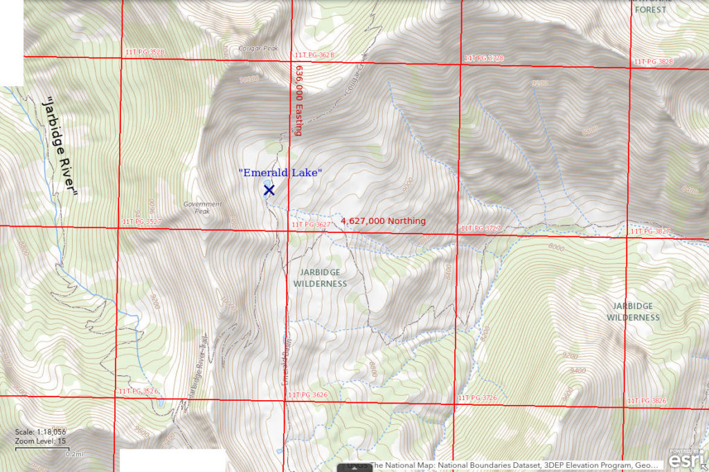
“Emerald Lake” is 11 km (7 miles) southeast of Jarbidge. It is a small lake on the east side of the divide between the Jarbidge River and the East Fork Jarbidge River north of Marys River Peak and south of Cougar Peak. It cannot be reached by fish swimming upstream. It is not shown on the 1:100,000-scale BLM map but is shown on The National Map (although not labeled) and on the 7.5-minute topographic quadrangle.
Visiting the lake requires a strenuous hike. The shortest route is up the Jarbidge River from Pine Creek Campground to “Jarbidge Lake” and then over the divide to “Emerald Lake”. Another route is from the Slide Creek Trailhead down Slide Creek and then up the East Fork Jarbidge River to the lake. Some people may be able to get to the lake and back in one day using the Jarbidge River trail but an overnight trip would be more practicable for most.
Elevation: 2,867 m (9,405′)
July 3, 1998
I didn’t plan this hike just for fairy shrimp but I saw the lake on the recreation map and thought it would be interesting to check. I had read that “Jarbidge Lake” has fish so that was of no interest. I started at the Camp Draw Trailhead and approached the lake from the southwest. What could have been a pleasant hike turned out to be exhausting as I had to post-hole through knee-deep snow over the crest of the range. Needless to say, I couldn’t see the trail and there were no tracks to follow. In spite of the snow, I somehow found the lake the next morning.
- Dimensions and depth not estimated due to extensive snowbanks.
- Water is clear but mostly covered by snow and ice.
- No fairy shrimp.
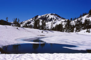
Looking south across a snowbound “Emerald Lake” with Marys River Peak in the background.
June 23, 2020
My 1998 visit had sparked my interest. I really wanted to know if “Emerald Lake” has fairy shrimp. It’s such a beautiful place and fairy shrimp would make it even better. My timing was good for this drier year. I hiked from the Slide Creek Trailhead and didn’t encounter much snow. There is some snow on the banks of the lake and some ice on the surface but this time it really looks like a lake.
- Less than 50 m long; deepest part can’t be seen from shore but is likely less than 300 cm.
- Although the water does look somewhat greenish from a distance, it is very clear.
- No fairy shrimp.
- Fish.
The lake has been stocked.
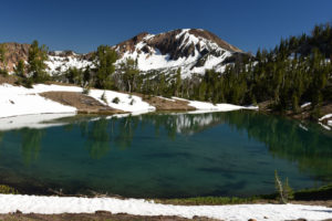
Looking south across “Emerald Lake” toward Marys River Peak in similar view to photo “Emerald Lake” 1998-07-03, #0222.
Cougar North Boulder Pond (Jarbidge Ranger District, Humboldt-Toiyabe National Forest, Jarbidge Wilderness)
___This map is a screenshot of The National Map (Go to The National Map). The U.S. Geological Survey generally does not copyright or charge for its data or reports (unless printed). A pond location is indicated by an “X”, which corresponds to the coordinates given in the data spreadsheet. Labels in quotations are from 7.5-minute topographic quadrangles.
___Red lines are the U. S. National Grid with a spacing of 1,000 m and intersection labels consisting of the UTM zone (e.g., 11S, 12T), a 2-letter 100-km square designation (e.g., LC, XN), and a 4-digit number. The first 2 digits of the number represent the 1,000-meter Easting and the second 2 digits the 1,000-meter Northing, as seen in the example Easting and Northing. Unlike latitude and longitude, the National Grid is rectilinear on a flat map, the units of abscissa and ordinate have equal lengths, and the units (meters) are measurable on the ground with a tape or by pacing.
___There is no private land on this map. All lands are public.
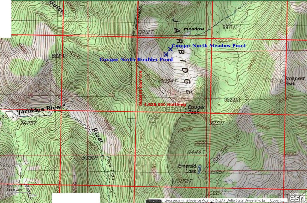
Cougar North Boulder Pond is 10 km (6 miles) southeast of Jarbidge and 780 m (2,560′) north of Cougar Peak. It is shown on the 7.5-minute 1:24,000-scale topographic map. The pond lies at the northwestern edge of a great mass of coarse rock rubble that litters the northern slopes of Cougar Peak rather than being organized into neatly arcuate moraines. Although there are many depressions within the rubble, they don’t hold water. Cougar North Boulder Pond is an exception. Several fir trees have fallen into and around the pond. There is a boulder about 2 m long at the edge of the water on the south side of the pond.
For access, see Cougar North Meadow Pond. Cougar North Boulder Pond is 100 m (330′) southwest of Cougar North Meadow Pond.
Elevation: 2,841 m (9,320′)
July 12, 2024
On the hike over the ridge from “Jarbidge Lake” to “Emerald Lake” this morning, I was flabbergasted to encounter Mormon crickets on top of the divide at about 2,990 m (9,800′). To get away from me, they hop down hill. That means the ones above the trail may wind up in the trail just in front of me. I don’t like the sound of crunching crickets so I dodge them as well as the loose rocks. It’s a good thing I collected the UTM coordinates of this pond from The National Map before leaving home. The pond is in a depression and can’t be seen from more than about 50 m (165′) away. It is not on a stream that drains to the north as shown on the 1:24,000-scale map.
- 23 m x 9 m; maximum depth visually estimated as 30 cm.
- Clear water; 20 C at 1315 in 3 cm water.
- No fairy shrimp.
- Caddisfly larvae (Trichoptera) about 10 mm long; pale greenish-yellow worm about 25 cm long and less than 2 mm in diameter – it looks like a grass stem – swimming like a snake with side-to-side undulations of its body.
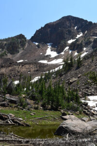
The north face of Cougar Peak with Cougar North Boulder Pond in the foreground. The “Boulder” is at right.
Cougar North Meadow Pond (Jarbidge Ranger District, Humboldt-Toiyabe National Forest, Jarbidge Wilderness)
Cougar North Meadow Pond is 830 m (2,720′) north of Cougar Peak and 100 m (330′) northeast of Cougar North Boulder Pond. It is the tiny pond shown on the 7.5-minute 1:24,000-scale map at the upper end of Cougar Creek. That creek does not continue farther south to Cougar North Boulder Pond as indicated on the map. The pond lies at the southern edge of a meadow among fir trees and is contained behind a turf dam. Water leaking from the dam becomes Cougar Creek. There are 3 other small ponds upstream in the meadow to the north, which have broadly similar aquatic fauna but were not examined. The area of Cougar North Meadow Pond has more soil and organic matter than the coarse rock rubble around Cougar North Boulder Pond.
Cougar North Meadow Pond can be reached by a traverse from the Cougar Creek trail about 900 m (2,950′) (straight line) to the east. Fortuitously, most of the traverse is across moderate slopes. While descending the Cougar Creek trail from the ridge between Cougar Peak and Prospect Peak, it is possible to see 2 spots of green on the western side of the bowl north of Cougar Peak. The larger, lower one is a meadow shown with a marsh symbol on the 7.5-minute topographic map. The smaller, upper one is probably the meadow around Cougar North Meadow Pond. Aiming for the larger meadow from the Cougar Creek trail provides an easier route than heading directly toward Cougar North Meadow Pond or Cougar North Boulder Pond. Such a lower traverse avoids most of the rock rubble and the steeper slopes and is graced with a sizable, scenic meadow at the end. Proceeding due south from the larger meadow to the creek and then following the creek up to Cougar North Meadow Pond is not a bad route and is a sure way to find the pond.
Elevation: 2,840 m (9,317′)
July 12, 2024
On my way to Cougar North Boulder Pond, I had gone to the large meadow below Cougar North Meadow Pond to check if it had any ponds. There were no ponds but the view of Cougar Peak above the green meadow is worth it. On my way southwest from the large meadow, I found this pond. The UTM coordinates I had collected from The National Map web site indicated this was not the pond on the 7.5-minute map that I was going for. I continued toward the coordinates to see if they were wrong. At Cougar North Boulder Pond, I realized there are 2 ponds. After a look at Cougar North Boulder Pond, I came back to this one.
- 18 m x 12 m; maximum depth visually estimated as 50 cm.
- Clear water; 22 C at 1345 in 4 cm water.
- No fairy shrimp.
- Caddisfly larvae (Trichoptera), backswimmers (sub-order Heteroptera, family Notonectidae), black diving beetles, greenish-brown diving beetles with black and white markings, tiny black animals with steady swimming motions are probably water mites rather than copepods, which usually swim with jerky motions.
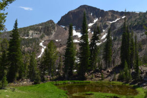
Cougar North Meadow Pond and the north face of Cougar Peak with a few large fir trees for scenic interest.
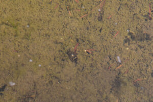
A diving beetle with distinctive black and white markings in Cougar North Boulder Meadow Pond. Its head is toward the top of the photograph.
Marys River Peak South Pond (Jarbidge Ranger District, Humboldt-Toiyabe National Forest, Jarbidge Wilderness)
___This map is a screenshot of The National Map (Go to The National Map). The U.S. Geological Survey generally does not copyright or charge for its data or reports (unless printed). A pond location is indicated by an “X”, which corresponds to the coordinates given in the data spreadsheet. Labels in quotations are from 7.5-minute topographic quadrangles.
___Red lines are the U. S. National Grid with a spacing of 1,000 m and intersection labels consisting of the UTM zone (e.g., 11S, 12T), a 2-letter 100-km square designation (e.g., LC, XN), and a 4-digit number. The first 2 digits of the number represent the 1,000-meter Easting and the second 2 digits the 1,000-meter Northing, as seen in the example Easting and Northing. Unlike latitude and longitude, the National Grid is rectilinear on a flat map, the units of abscissa and ordinate have equal lengths, and the units (meters) are measurable on the ground with a tape or by pacing.
___There is no private land on this map. All lands are public.
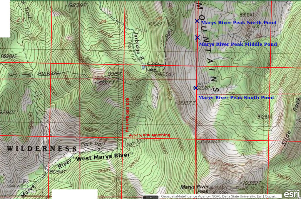
Marys River Peak South Pond is 13 km (7.8 miles) southeast of Jarbidge. It is about 1,400 m (4,590′) north of Marys River Peak and 1,500 m (4,920′) south of “Emerald Lake”. The pond is the southernmost of 3 ponds on a bench on the east side of the ridge between Marys River Peak and Cougar Peak and is shown on the 7.5-minute topographic map. The pond can be seen from the trail to “Emerald Lake” as it descends the east side of the divide between the Jarbidge River and East Fork Jarbidge River. A snowbank was still present south of the pond after an unusually hot June and early July and may be a helpful landmark before August for the next several years.
N.B. The trail over the divide from “Jarbidge Lake” to “Emerald Lake” has been rerouted since creation of the provisional edition of the Gods Pocket Peak 7.5-minute topographic quadrangle in 1986, which is the “historical” 7.5-minute topographic map that can be downloaded from the U.S. Geological Survey web site and is the “USA Topo Map” base map displayed on The National Map web site. The National Map itself (“USGS National Map” base map on the web site) does not show the trails now although it showed the correct trail position when I made the “Emerald Lake” map a couple of years ago. The trail up the Jarbidge River now meets the trail up West Marys River in the saddle south of “Jarbidge Lake”, not on the steep slope east of “Jarbidge Lake”. The trail over the ridge makes a few short switchbacks up the slope east of the trail junction before making the long traverse to the north. The trail down the eastern side of the ridge toward “Emerald Lake” does not traverse as far north as the previous trail before making the first switchback and makes more switchbacks before reaching the elevation of the junction with the trail up from East Fork Jarbidge River south of “Emerald Lake”. Consequently, the trail on the east side of the divide is now closer to all 3 of the ponds north of Marys River Peak than shown on the 7.5-minute map.
Marys River Peak South Pond is easily accessible from the trail south of “Emerald Lake”. If coming down the ridge from the west, you can see the pond and cut off the trail wherever you like. If ascending from the East Fork Jarbidge River, you won’t be able to see the pond. Turn south at the Cougar Creek trail junction south of “Emerald Lake”. Look for a discontinued trail that forks to the southeast and has been littered with dead branches to discourage hikers from using it. That trail passes close to all 3 ponds north of Marys River Peak.
Elevation: 2,841 m (9,320′)
July 13, 2024
I saw the pond on my way to the Cougar North ponds yesterday. This morning, I cut off the trail to “Emerald Lake” after the lowest switchback. There’s boggy ground around the north side of the pond. The water has floating green algae. The outlet is flowing. I added some snow from the snowbank to my water bottle to replace what I drank after reaching the top of the divide.
- 45 m x 30 m; maximum depth visually estimated as greater than 50 cm.
- Clear water; 14 C at 1130 in 6 cm water.
- No fairy shrimp.
- Backswimmers (sub-order Heteroptera, family Notonectidae), black diving beetles, alkali(?) flies on surface of water.
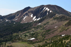
Marys River Peak South Pond at lower left and Marys River Peak. It’s lucky I took this photo yesterday on my way to the north of Cougar Peak as the view is washed out today due to the partially overcast skies.
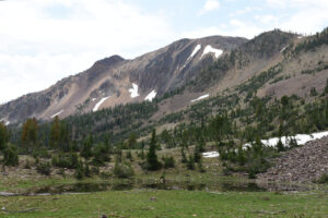
A closer view of Marys River Peak South Pond and the snowbank with a very wide angle camera setting.
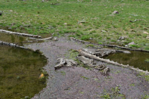
A grayish mass of floating dead Mormon crickets in Marys River Peak South Pond. I guess water more than a couple of centimeters deep is like a roach motel for Mormon crickets. They can get in but they can’t get out.
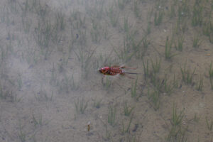
This is a Mormon cricket floating in Marys River Peak North Pond before it has died.
Marys River Peak Middle Pond (Jarbidge Ranger District, Humboldt-Toiyabe National Forest, Jarbidge Wilderness)
Marys River Peak South Pond map
Marys River Peak Middle Pond is 690 m (2,260′) north of Marys River Peak South Pond. The pond is the middle one of 3 ponds on a bench on the east side of the ridge between Marys River Peak and Cougar Peak. Marys River Peak Middle Pond is shown on the 7.5-minute topographic map. It is visible from the trail down the east side of the ridge between Marys River Peak and Cougar Peak. The pond is within a strip of green grass on the otherwise barren bench of very pale gray tuff. There is a small cluster of trees on the east shore.
For access, see Marys River Peak South Pond.
Elevation: 2,817 m (9,242′)
July 13, 2024
There are red shooting stars and white bistort in the grass all around the pond. While the South and North ponds have clear water, this one has opaque water. It’s time to go wading with the net. Nobody’s looking so I can take my pants off.
- 35 m x 8 m; maximum depth at least 40 cm.
- Opaque pale brown water; 21 C at 1230 in 5 cm water.
- No fairy shrimp.
- Backswimmers (sub-order Heteroptera, family Notonectidae), water boatmen (sub-order Heteroptera, family Corixidae), damselflies, alkali(?) flies on surface of water.
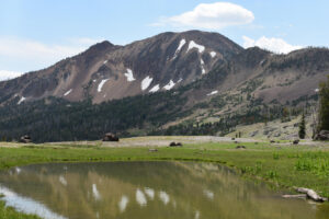
Opaque water of Marys River Peak Middle Pond surrounded by green grass and with Marys River Peak in the distance.
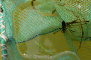
Big backswimmer in the net at Marys River Peak Middle Pond. I had a hard time figuring out if this pond has backswimmers, or water boatmen, or both because the backswimmers have pale markings on the back rather than on the front like others I have seen. This pose confirms the case for backswimmers. The water boatmen are brown on both sides.
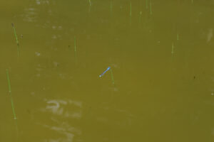
Blue damselfly perching on top of a rush stem in Marys River Peak Middle Pond. The opaque water really makes them stand out. The wings aren’t visible at this distance (but are with enlargement of the photograph) because, unlike dragonflies, damselflies hold their wings parallel to their bodies when at rest.
Marys River Peak North Pond (Jarbidge Ranger District, Humboldt-Toiyabe National Forest, Jarbidge Wilderness)
Marys River Peak South Pond map
Marys River Peak North Pond is 900 m (2,950′) north of Marys River Peak South Pond and 220 m (720′) north of Marys River Peak Middle Pond. The pond is the northernmost of 3 ponds on a bench on the east side of the ridge between Marys River Peak and Cougar Peak. Marys River Peak North Pond is not shown on the 7.5-minute topographic map. On black-and-white aerial photographs, clear water and vegetation are both dark. The photographs for the Gods Pocket Peak quadrangle were taken in 1980. The irregular shape of the pond and its division into 2 pieces would also make recognition difficult. There is less grass around this pond than around the South and Middle ponds. Frankly, after looking at the current aerial photography on The National Map web site, I don’t how the topographers recognized the water at the South Pond, much less at this smaller one.
For access, see Marys River Peak South Pond.
Elevation: 2,817 m (9,242′)
July 13, 2024
Although there is less grass here, there are still red shooting stars and white bistort and some purple asters, too. Unlike the other 2 ponds, Marys River Peak North Pond lacks the abundant alkali(?) flies on the surface of the water. Maybe the water striders ate them all.
- 27 m x 21 m but irregular shape sort of like a handgun and with a small piece isolated by a strip of turf; visual estimate of maximum depth greater than 30 cm.
- Clear water; 16 C at 1400 in 10 cm water.
- No fairy shrimp.
- Backswimmers (sub-order Heteroptera, family Notonectidae), water boatmen (sub-order Heteroptera, family Corixidae), black and dark brown diving beetles, caddisfly larvae (Trichoptera), dragonflies.
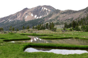
Marys River Peak North Pond and Marys River Peak under poor lighting conditions.
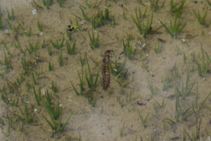
The molted exoskeleton of a dragonfly larva floating on the water of Marys River Peak North Pond. It was too far from shore to measure but I think it is about 3 cm long. Because it is not in the pond bottom muck and is not moving, this is more illustrative than seeing a live larva.
Top of White Cliffs Pond (Jarbidge Ranger District, Humboldt-Toiyabe National Forest)
___This map is a screenshot of The National Map (Go to The National Map). The U.S. Geological Survey generally does not copyright or charge for its data or reports (unless printed). A pond location is indicated by an “X”, which corresponds to the coordinates given in the data spreadsheet. Labels in quotations are from 7.5-minute topographic quadrangles.
___Red lines are the U. S. National Grid with a spacing of 1,000 m and intersection labels consisting of the UTM zone (e.g., 11S, 12T), a 2-letter 100-km square designation (e.g., LC, XN), and a 4-digit number. The first 2 digits of the number represent the 1,000-meter Easting and the second 2 digits the 1,000-meter Northing, as seen in the example Easting and Northing. Unlike latitude and longitude, the National Grid is rectilinear on a flat map, the units of abscissa and ordinate have equal lengths, and the units (meters) are measurable on the ground with a tape or by pacing.
___There is no private land on this map. All lands are public.
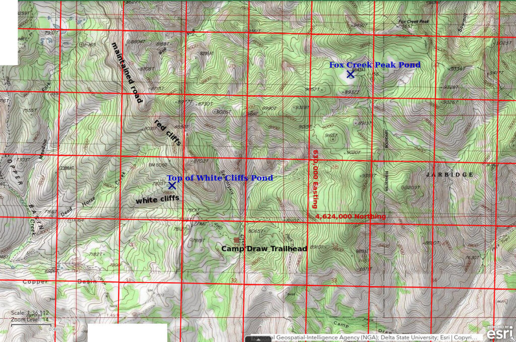
Top of White Cliffs Pond is 13 km (7.8 miles) south-southwest of Jarbidge. It is 73 m (240′) vertically below the closest point on the road to Jarbidge. It is poorly visible from the road, unlike a much larger, overgrown pond which is 3 km to the northwest. On the 7.5-minute topographic map, it has dimensions of 50 m by 110 m (165′ x 360′). Top of White Cliffs Pond lies on a bench at the top of cliffs of white ash tuff and is below the more dramatic cliffs of red welded tuff above the Jarbidge road.
Although one could hike down to Top of White Cliffs Pond from the Jarbidge road, it is probably easier and safer to park in the clearing at the turn-off to the Camp Draw trailhead and to traverse gentle and moderate slopes through sagebrush and aspen to the pond. Top of White Cliffs Pond is a straight line distance of 600 m (1,970′) northwest of that parking spot. There is a very old, overgrown vehicle track to the pond that forks off the Jarbidge road less than 50 m (165′) northwest of the hairpin turn above the turn-off to the Camp Draw trailhead.
Elevation: 2,382 m (7,815′)
July 14, 2024
Rushes along the shore were too thick to make good use of the net so I waded in. Unfortunately, the green algae in the water was so dense that the net was pretty useless anyway.
- 100 m x 60 m; greater than 50 cm depth.
- Murky brown water; 24 C at 1530 in 8 cm water.
- No fairy shrimp.
- Clam shrimp (Conchostraca)(?), backswimmers (sub-order Heteroptera, family Notonectidae), dark brown diving beetles, dragonflies, damselflies, mayflies, copepods(?) less than 1 mm long, frog 3 cm long, swimming snake about 30 cm long, several swallows to eat the copious flying insects.
The 1 animal I saw that might have been a clam shrimp was about 3 mm long and had yellow markings on its black shell. I could see legs protruding from the slightly opened shell. Unlike an ostracod, it did not swim in straight lines. It swam in loops up to about 30 cm across and spun around at times and did so continuously. It was among the rushes rather than in open water so I couldn’t catch it with my net. It swam up and down the water column and weaved among the vegetation and I was unable to catch it in a photograph.
NDOW has written that there are Columbia spotted frogs in the Jarbidge Mountains, as in the Ruby, Independence, and Toiyabe Mountains, but didn’t write that they are the only frogs there.
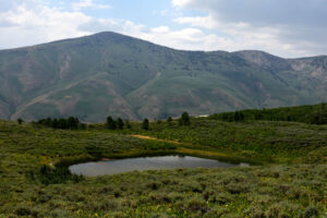
Top of White Cliffs Pond, looking northwest with Copper Mountain in the distance. The water level is below the outlet on the far side of the pond. There is rain to the north (right) but it didn’t rain here until evening.
Fox Creek Peak Pond (Jarbidge Ranger District, Humboldt-Toiyabe National Forest, Jarbidge Wilderness)
Fox Creek Peak Pond is 11 km (6.6 miles) south of Jarbidge and 1,100 m (3,610′) southwest of Fox Creek Peak. It is in a clearing close to the spot elevation of 8,843 feet (2,695 m) on the 7.5-minute 1:24,000-scale topographic map. On that map, it is almost perfectly round with a diameter of 55 m (180′). The outlet of Fox Creek Peak Pond drains southeast to West Marys River.
Fox Creek Peak Pond is closest to the Camp Draw trailhead. The hike from there is unexpectedly easy. Follow the West Marys River trail from the trailhead to the divide between Seventysix Creek and Camp Draw. At the crest, there is a well trod elk trail (based on tracks and turds) that heads to the northeast. This trail traverses the western slopes of the hills with elevations 8,910 feet (2,715 m) and 9,352 feet (2,850 m). It is almost a straight shot with minimal change in elevation to the saddle with spot elevation 9,020 feet (2,750 m) northwest of hill 9,352. The trail is within fir forest that is relatively cool on a hot day and relatively dry on a rainy day. Although there is a lot of downfall, I think it is the easiest trail I have ever followed in the Jarbidge Wilderness. From saddle 9,020, go over or around hill 9,165, contour across the eastern slope of hill 9,328, then turn northeast and hike down to the pond using Fox Creek Peak as a guidepost when visible through the trees.
Elevation: 2,696 m (8,845′)
July 15, 2024
Skies are overcast but there is no thunder yet. The outlet is a bog that may or may not be flowing. The shore is boggy all the way around the pond and there are rushes in the water near the shore so I can’t do much good with the net. It’s time for wading. Woops, the bottom is mostly very soft and the water is already up to my knees. I can’t risk venturing more than about 3 m from the shore. At least the water is clear so I can see farther out.
- 42 m x 40 m; greater than 40 cm depth.
- Clear water; 18 C at 1130 in 10 cm water.
- No fairy shrimp.
- Black diving beetles, dragonflies, damselflies, abundant tadpoles, a few swallows.
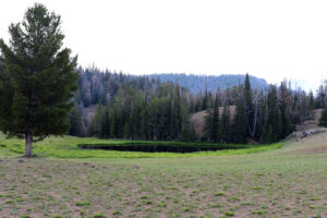
View looking northeast at Fox Creek Peak Pond under horrible lighting conditions.
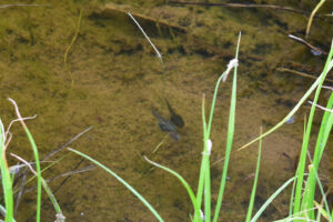
A gray and a dark brown tadpole swimming side by side in Fox Creek Peak Pond with what may be the tail of another gray one below them. The map does not suggest any easy way for frogs to get here. Top of White Cliffs Pond, the closest static water body, is 3.3 km (2 miles) to the southwest across very rugged terrain. After seeing frogs near the top of Liberty Pass at an elevation of about 3,170 m (10,400′) over 500 m (1,640′) from “Lamoille” and “Liberty” lakes in the Ruby Mountains, I no longer consider their presence at Fox Creek Peak Pond unusual or unexpected. Maybe webbed feet are good for rock climbing.
What Can We Learn from the Ponds in the Jarbidge Mountains?
Glaciers have excavated a series of cirques along the eastern side of the mountains but have created only a few small to tiny ponds.
The 2 largest ponds in the Jarbidge Mountains have been stocked with fish and are no longer potential fairy shrimp habitat. Of the 7 other ponds that I visited, none had fairy shrimp. That suggests they may never have been present.
2 of the visited ponds had frogs. Fairy shrimp are less common in ponds with frogs than in ponds without frogs but that does not necessarily mean that frogs prevented colonization by fairy shrimp or eliminated them from ponds which they did colonize.
In spite of the lack of known fairy shrimp ponds, the Jarbidge Mountains offer alpine scenery, flower displays, rushing streams, and challenging hiking trails without crowds.