Pegleg Canyon Edge Pond
“The Dry Lake”
Pegleg Butterfly Stock Pond
Pegleg Breached Dam Stock Pond
What Can We Learn from the Ponds in the Hays Canyon Range?
The Hays Canyon Range is at the very western edge of northern Nevada. It is about 61 km (38 miles) long from near Vya to the confluence of Wall Creek and Cherry Creek, east of Duck Flat. It is thin in the north at Fortynine Mountain (8 km, 5 miles) and fat in the south between Murphy Spring and The Buttes (23 km, 14 miles). There are several large intermittent lakes scattered across the range according to the 1:100,000-scale BLM map. As in middle Washoe County, nearly flat-lying basalt flows result in plateau topography favorable for ponds.
The Hays Canyon Range has a steep western edge at Surprise Valley (edge at 1,300 m; 4,270′) and gradual slopes to the north, east, and south. Hays Canyon Peak is 2,413 m (7,920′) while Big Hat Mountain at the north end of the range is 2,081 m (6,830′). To the east, upper Wall Creek valley is 1,700 m (5,580′). The south end of the range borders Duck Flat at 1,400 m (4,590′).
The area is dominated by sagebrush with some dispersed pinyon and juniper and local groves of pinyon woodland.
There are large blocks of private land around Divine Peak, Mare Pasture Spring, and along Boulder Creek. Although there is probably public access to the fish-stocked Wall Canyon Reservoir, at the southeast edge of the range, the road which continues north up Mountain View Creek is on private land for more than 5 km (3 miles).
Pegleg Canyon Edge Pond (Surprise BLM Office)
___This map is a screenshot of The National Map (Go to The National Map). The U.S. Geological Survey generally does not copyright or charge for its data or reports (unless printed). A pond location is indicated by an “X”, which corresponds to the coordinates given in the data spreadsheet. Labels in quotations are from 7.5-minute topographic quadrangles.
___Red lines are the U. S. National Grid with a spacing of 1,000 m and intersection labels consisting of the UTM zone (e.g., 11S, 12T), a 2-letter 100-km square designation (e.g., LC, XN), and a 4-digit number. The first 2 digits of the number represent the 1,000-meter Easting and the second 2 digits the 1,000-meter Northing, as seen in the example Easting and Northing. Unlike latitude and longitude, the National Grid is rectilinear on a flat map, the units of abscissa and ordinate have equal lengths, and the units (meters) are measurable on the ground with a tape or by pacing.
___Gray shading represents private land as traced from the PAD-US 2.0 – Federal Fee Managers layer of The National Map. Other lands are public.
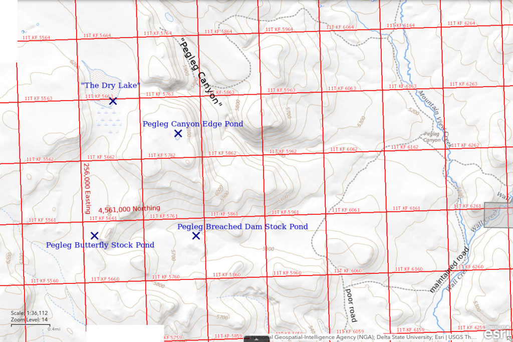
Pegleg Canyon Edge Pond is about 73 km (45 miles) northwest of Gerlach. It is a sizable pond in a shallow depression near the edge of the basalt plateau west of the mouth of Pegleg Canyon. It is not shown on the 1:100,000-scale BLM map but is shown on the Pegleg Canyon 7.5-minute topographic quadrangle, where it is 130 m by 80 m (430′ x 260′).
For access, turn east off Nevada 447 north of Duck Lake toward Wall Canyon Reservoir. There is no sign. Continue east for about 3.5 miles and then turn off to the northeast on to a bad, less traveled road. Depending on your tolerance of bad roads, you can proceed northeast for 1-2 miles. Continuing farther down from a saddle toward the mouth of Pegleg Canyon would lose elevation without much change in distance to the pond.
Elevation: 1,937 m (6,355′)
May 9, 2019
Came across this pond while hiking up to “The Dry Lake” west of Pegleg Canyon.
- 80 m x 130 m according to map; probably less than 30 cm deep near center.
- Cloudy pale brown water.
- Pale gray 10-15 mm fairy shrimp.
- Netted 1 tadpole shrimp 20-25 mm and 1 clam shrimp; 2 ducks on water when I approached.
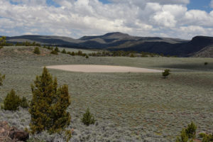
Pegleg Canyon Edge Pond, looking north with Hays Canyon Peak in the distance beyond Pegleg Canyon.
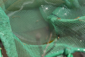
Small, pale gray fairy shrimp caught in the net at Pegleg Canyon Edge Pond.
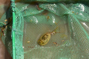
Tadpole shrimp (Notostraca) at center from Pegleg Canyon Edge Pond and clam shrimp (Conchostraca) to its left in the net. The clam shrimp is like those in “Burnt Lake” Three Ducks Pond (Middle Washoe County), which are also pale, rather than like the dark brown ones in Rowland Spring North Pond (Middle Washoe County). The tadpole shrimp has a paddle-like, supra-anal plate at the end of the abdomen between the 2 long thin features like those in the “Burnt Lake” area of Middle Washoe County. That indicates it is the genus Lepidurus (see Pennak, 1978, p. 346-347).
“The Dry Lake” (Surprise BLM Office)
“The Dry Lake” is approximately 74 km (46 miles) northwest of Gerlach in the southern Hays Canyon Range south of Red Mountain. it is only 1 km (0.6 mile) west of Pegleg Canyon. This dry lake must be special because “The” is in the label on the 1:100,000-scale BLM map, unlike all (or most) of the other dry lakes in Nevada. On the map, “The Dry Lake” has a water-drop shape with dimensions of 500 m x 900 m (1,640′ x 2,950′). It is in an extensive depression with relief of close to 50 m (164′) west of the lake. There are 2 double mud bars that rise above the water, when present. They are probably the result of excavating stock ponds.
Access is the same as for Pegleg Canyon Edge Pond but the walk is a little further.
Elevation: 1,871 m (6,140′)
May 9, 2019
The water is well up into the silver sagebrush south of the lake. The winter-spring here must have been wet like in the “Burnt Lake” area (Middle Washoe County) 30 km (19 miles) to the south.
- 500 m x 900 m according to map but a little bigger now; depth possibly up to 50 cm in excavated stock ponds.
- Very cloudy pale brown water but clearer in the brush.
- Brush makes using net difficult but caught a few pale gray fairy shrimp about 15 mm; some females have single row of eggs in ovisac.
- Tadpole shrimp (Notostraca) 15-20 mm.
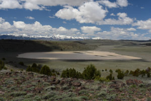
“The Dry Lake”, looking northwest with Warner Mountains in California in the distance.
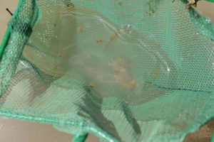
A few fairy shrimp from “The Dry Lake” in the net. The female above center has a single row of eggs in ovisac. The reddish animal to the left of the female has a bunch-of-grapes-like egg mass at one end and may be a copepod in spite of its large size. The fairy shrimp below and a little to the left of center is markedly smaller than the others.
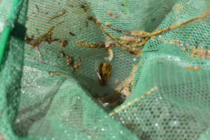
A tadpole shrimp (Notostraca) from “The Dry Lake” in the net. It has its abdomen curled under its carapace. There are also a couple of fairy shrimp hanging on to the net while they are temporarily out of the water.
Pegleg Butterfly Stock Pond (Surprise BLM Office)
Pegleg Butterfly Stock Pond is a small stock pond near the 90-degree bend in the drainage south of “The Dry Lake”, above where the drainage cuts through a basalt flow. The drainage does not have a distinct channel above this cut, contrary to the 1:100,000-scale BLM map. When I first approached the pond, several colorful butterflies were resting on the damp soil along the shore.
Access is the same as for Pegleg Canyon Edge Pond but this pond is only about 3 km (2 miles) from where the road crosses the saddle to Pegleg Canyon.
Elevation: 1,804 m (5,920′)
May 9, 2019
Another discovery, this time on the hike down from “The Dry Lake”.
- 15 m x 15 m; the high bank on the south side of the pond suggests considerable excavation and a depth possibly up to 50 cm near the center.
- Clear brown water.
- No fairy shrimp.
- Tadpoles about 10 mm, copepods with paired black egg sacks, black diving beetles, and caddisfly larvae (order Trichoptera) with intriguingly complex multimedia cases.
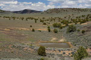
Pegleg Butterfly Stock Pond from the south. “The Dry Lake” is off the upper left edge of the photograph.
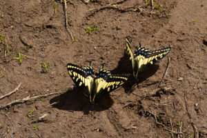
Butterflies at Pegleg Butterfly Stock Pond – the ones that haven’t flown off yet.
Pegleg Breached Dam Stock Pond (Surprise BLM Office)
Pegleg Breached Dam Stock Pond is in the west-east canyon on the drainage south of “The Dry Lake” and below Pegleg Butterfly Stock Pond. It is south of the mouth of Pegleg Canyon. There is now a channel through the dam holding the pond.
Access is the same as for Pegleg Canyon Edge Pond but this pond is only about 2 km (1.2 miles) from where the road crosses the saddle to Pegleg Canyon. A faint 2-track leads through the sagebrush from that road past the pond.
Elevation: 1,711 m (5,615′)
May 9, 2019
Yucky-looking water but WIDLA.
- 10 m x 20 m; no depth estimate.
- Clear brown water.
- No fairy shrimp.
- Some tadpoles less than 10 mm, lots of copepods, saw 1 dytiscid larva (family Dytiscidae, order Coleoptera).
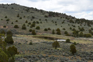
Pegleg Breached Dam Stock Pond from the southwest. A 2-track passes through the sagebrush in the foreground. Climbing the slope on the far side of the valley would lead up to Pegleg Canyon Edge Pond.
What Can We Learn from the Ponds in the Hays Canyon Range?
Like those in the “Burnt Lake” area of Middle Washoe County, natural ponds in the Hays Canyon Range have turbid water and multiple branchiopod orders. Tadpole shrimp (Notostraca) were seen in “The Dry Lake” and Pegleg Canyon Edge Pond and clam shrimp (Conchostraca) in Pegleg Canyon Edge Pond in addition to fairy shrimp.
No fairy shrimp were seen in 2 stock ponds. These ponds differ from the ponds with branchiopods in having clear rather than turbid water and in having colored water suggestive of high organic acid content. Predators may also be an issue as both stock ponds have tadpoles.
The presence of fairy shrimp in 2 of 2 natural ponds makes the other natural ponds in the Hays Canyon Range good bets.
Supra-anal plates seen on at least some tadpole shrimp in the Hays Canyon Range indicate the tadpole shrimp belong to the genus Lepidurus, like those in the “Burnt Lake” area of Middle Washoe County rather to the genus Triops, like those in McLeans and Monte Cristo valleys and in the Garfield Hills (e.g., Windy Gravel Pit Pond 2023-09-01, #04, Kibby Flat Playa Lake 2023-09-06, #07, Garfield 5890 Saddle Pond 2023-08-01, #13).
The Hays Canyon Range is a short distance northwest of Duck Flat, which has abundant water birds at times. Water birds are probably the primary dispersal agents for fairy shrimp and other branchiopod eggs in the Hays Canyon Range.