Labou Playa North Pond
What Can We Learn from the Ponds in Fairview Valley?
Fairview Valley is between the Sand Springs Range to the west and the Fairview Range to the east. It transitions northward into Dixie Valley and terminates southward against hills linking the Sand Springs Range to Slate Mountain and the Fairview Range. It is 30-35 km (19-22 miles) long, depending on where one puts the boundary with Dixie Valley, and up to 15 km (9 miles) wide. From the 1:100,000-scale BLM map, the best chance for fairy shrimp habitat appears to be on the playa in the central part of the valley at Labou Flat. There may also be puddles along the roads.
Elevations in Fairview Valley are 1,250-1,500 m (4,100′-4,920). The low spot is along and just south of US 50. Fairview Peak to the east has an elevation of 2,531 m (8,300′). To the west, the Sand Springs Range tops out at 2,276 m (7,470′).
Fairview Valley has only desert scrub for vegetation.
Most of Fairview Valley is within the Navy’s Fallon Range Training Center and is not open to the public. The valley south of US 50 is the Navy’s primary bombing range, Bravo-17, for air-to-ground munitions, such as laser-guided weapons, HELLFIRE, Joint Direct Attack Munitions, and Dual Mode Laser Guided Bombs (U.S. Department of Navy, 2020; see References page). The valley north of US 50 is within the Dixie Valley Training Area. This area is used for search and rescue, convoy, helicopter mountain flying, and night-vision device training and other non-live-fire activities. Some public access is allowed in the Dixie Valley Training Area but it is subject to poorly articulated Navy management. Like most EISs, the Navy’s neglects to mention any crustaceans, or even any invertebrates.
US 50 crosses the valley from west to east and Nevada 839 provides a paved roadway along the west side of the valley. The thin strip of public land along US 50 and the highway right-of-way enable access for pond viewing on Labou Flat.
Labou Playa North Pond (Stillwater BLM Office)
___This map is a screenshot of The National Map (Go to The National Map). The U.S. Geological Survey generally does not copyright or charge for its data or reports (unless printed). A pond location is indicated by an “X”, which corresponds to the coordinates given in the data spreadsheet. Labels in quotations are from 7.5-minute topographic quadrangles.
___Red lines are the U. S. National Grid with a spacing of 1,000 m and intersection labels consisting of the UTM zone (e.g., 11S, 12T), a 2-letter 100-km square designation (e.g., LC, XN), and a 4-digit number. The first 2 digits of the number represent the 1,000-meter Easting and the second 2 digits the 1,000-meter Northing, as seen in the example Easting and Northing. Unlike latitude and longitude, the National Grid is rectilinear on a flat map, the units of abscissa and ordinate have equal lengths, and the units (meters) are measurable on the ground with a tape or by pacing.
___There is no private land on this map.
___Pink shading represents public land controlled by the Department of Defense.
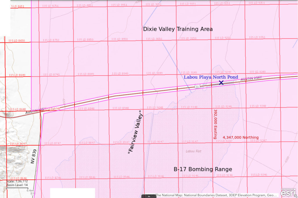
Labou Playa North Pond is on Labou Flat in the northern part of Fairview Valley 50 km (31 miles) southeast of Fallon. On the 1:100,000-scale BLM map, the Labou Flat stipple pattern is 4.5 km west-east and 4.5 km north-south but it has a sort of triangular shape. The stipple pattern along US 50 is about 3 1/2 miles east of the intersection of US 50 and Nevada 839. In my limited experience, when water collects anywhere on Labou Flat, it also collects on Labou Playa North Pond on the north side of the US 50 causeway. Because the pond is on the narrow corridor of BLM-managed land along the highway, fairy shrimp can be viewed without Navy permission.
Access is easy because the location is on US 50 about 35 miles east of Fallon but parking is tricky. Because US 50 is on a raised causeway, parking on the narrow shoulder is not a good idea. Possible parking places are wider level areas on the tops of culverts and a couple of ramps to little used dirt roads. There is also ample parking space at a gravel road to a locked, unmanned gate south of the highway but that is well west of the pond.
Elevation: 1,266 m (4,155′)
March 19, 2019
This was not the first time I had seen water here while driving by on US 50 but this time I stopped. Maybe I was feeling less rushed by life. My expectations were low but since I had seen fairy shrimp in roadside puddles in Smith Creek Valley, WIDLA. The playa south of US 50 is dry. The mud at the edge of the water has needly ice crystals.
- Maybe 200 m parallel to the highway and up to 100 m wide (my estimates in January 2022 are bigger for about the same amount of water but I don’t know which estimates are more accurate); generally less than 2 cm deep.
- Opaque pale brownish-gray water; ice in the mud but no longer on the water at about 0800.
- Pale gray fairy shrimp less than 15 mm long.
- A couple of gulls, a small flock of ducks.
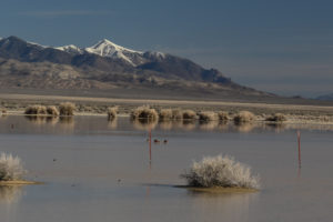
Labou North Playa Pond, looking north across Fairview Valley to the Stillwater Range. A group of ducks are standing in the water beyond the fence because it’s too shallow to float.
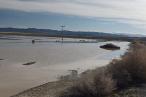
Labou North Playa Pond, looking east along the north side of US 50. The Clan Alpine Range is in the distance at left and the snowy Desatoya Range is at right.
What’s going on here?. There is not enough water to float on so gulls and ducks are walking through the water with most of their legs exposed. Why are they here? Certainly not to drink the clay-rich, probably high-TDS water. For a while, ducks were dragging their bills back and forth through the water. Are they eating the fairy shrimp? In any case, their presence indicates that possible egg-dispersal agents visit the pond.
January 31, 2022
After finding fairy shrimp in Stinking Springs Well Pond (Rawhide Flats) earlier this winter, I was hopeful that fairy shrimp would hatch here too because of the similarly low elevation. I was even more hopeful when I drove up as the pond was big. There was even a small pond south of the highway. Although ice (mostly greater than 5 mm thick) covered about 90% of the water, much of it was clear. I might be able to see fairy shrimp beneath it. In practice, this proved to be difficult. As I walked on the ice (with rubber boots), I depressed the ice and this pushed water away from where I stepped. That whipped up the clay making the water opaque in spots and also pushed dark air bubbles (some about the size and shape of tadpole shrimp) streaming radially away from my foot. Any fairy shrimp would also be pushed away from my foot and could be hard to distinguish from bubbles or bits of vegetation. More problematically, the water beneath the ice was barely 1 cm deep and that didn’t leave much room for fairy shrimp. I spent at least an hour looking through the ice and searching areas of ice-free water near the shore. Fairy shrimp could be swimming in deeper water but deeper water had thicker ice which I couldn’t see through. I didn’t venture north of the highway fence because the ice was too thick to see through.
- 300 m or so long parallel to the highway and more than 100 m wide; maximum water depth below ice uncertain but less than 3 cm everywhere I walked.
- Murky very pale brown water where undisturbed; 3 C at 1215, 90% of pond still covered by ice.
- No fairy shrimp.
- Didn’t see anything else under the ice either.
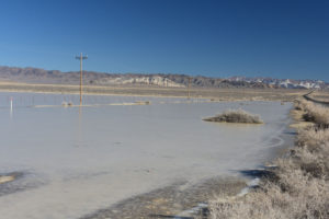
View east along the north side of US 50, similar to photograph Labou Playa North Pond 2019-03-19, #02, but zoom at 38 mm rather than 28 mm. The pond is covered by ice which is only starting to melt at the edges. The white hill is Chalk Mountain.
March 17, 2023
Coming down US 50 east of Sand Springs Pass, my fears of a dry pond after the disappointment at Macari East Stop Sign Pond (“Carson Lake” Playa) were allayed. Not only was there abundant water in Labou Playa North Pond, there was also water in the central part of Labou Flat. The central part of Labou Flat is within the bombing range but at least we’ve got Labou Playa North Pond.
- Maybe 400 m by 200 m; measured 10 cm depth but it could be deeper in spots.
- Opaque pale brown water; 9 C at 3 cm depth in the shade at 1345.
- Abundant fairy shrimp with many swimming close enough to the surface to see, lengths 10-13 mm, some females have eggs.
- No other animals visible in water and no birds either.
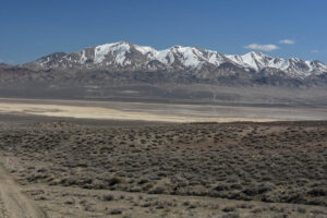
Looking east across a wet Labou Flat to Fairview Peak from US 50 east of Sand Springs Pass. The reflections in the water (seen with binoculars) prove that it really is water. The paler water is surrounded by darker brown mud, which is surrounded by dry, pale yellow mud flat.
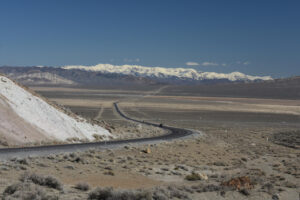
Labou Playa North Pond is the pale gray streak on the left side of US 50 in the middle of Fairview Valley. The paler color south of the highway indicates dry mud. At the right is wet, brown mud toward the center of Labou Flat. The white hill at far left is Chalk Mountain. The Desatoya Mountains are in the distance.
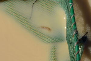
Fairy shrimp in the net at Labou Playa North Pond. There is a hint of a dark ovisac to the left of the legs. The material in its intestine is about the same color as the water.
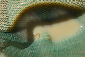
Male fairy shrimp in the net at Labou Playa North Pond. Its long antennae II are angled away from its body. There is a brown ovisac with eggs above it but the rest of that female is barely visible.
Labou Playa North Pond Fairy Shrimp Video 2023-03-17ab-cr
For a 2-minutes, 46-seconds video of fairy shrimp swimming in opaque water of Labou Playa North Pond, click on the video player above. There is no audio. The fairy shrimp display a variety of swimming behaviors. Some swim relatively fast in nearly straight lines, some meander around making broad turns, and some barely move at all. Fast swimmers, often trailing a “cloud” of paler clay, streak across the scene at 0:45, 1:17, and 1:54. Others make slower, 180-degree turns at 0:33, 0:51, and 1:50, and even a 360-degree loop at 2:05-2:10. In addition to lateral motions, some fairy shrimp come to the surface or dive suddenly, popping into or out of view at 0:41 and 0:42. At 2:00, almost the entire body of 1 fairy shrimp becomes visible and disappears so suddenly that it is reminiscent of a breaching whale. It is not clear to what extent individual fairy shrimp are aware of other fairy shrimp. There are a few apparent collisions, or at least very close approaches, at: 1:02, 1:08, 1:09, 2:18, and 2:20.
Labou Playa North Pond Fairy Shrimp Video 2023-03-17c-mr
For a 1-minute, 1-second video of more fairy shrimp swimming farther from shore in opaque water of Labou Playa North Pond, click on the video player above. There is no audio. This video has good examples of fairy shrimp interactions at 0:10, 0:31, and 0:39 when 2 fairy shrimp approach each other and at least 1 responds with a sharp jerk and change in direction. These could involve females avoiding males.
Labou Playa North Pond Fairy Shrimp Video 2023-03-17d-cr
For a 1-minute, 40-seconds video of fairy shrimp swimming in Labou Playa North Pond next to a culvert under US 50, click on the video player above. There is no audio. The video opens with a view across US 50 and Labou Flat to the Sand Springs Range and then moves to a view of fairy shrimp swimming in relatively deep water near the culvert. There are fewer streakers than in video 2023-03-17ab-c-r and many fairy shrimp seem to drift with the wind from upper left to lower right. There are examples of fairy shrimp suddenly popping into view at 0:34, 0:44, and 0:47 and many more examples of them gradually appearing or disappearing.
What Can We Learn from the Ponds in Fairview Valley?
Labou Flat playa has fairy shrimp.
Fairy shrimp were present in March 2019 but had apparently not hatched in late January 2022 although the extent of inundation was similar. Ice was thicker and more extensive in January 2022. They hatched again after a wet winter by March 2023.
Extensive water on Labou Flat south of US 50 in March 2023 suggests fairy shrimp are also present on the B-17 bombing range.
It doesn’t get any easier than this. If you happen to be driving between Fallon and Austin and you see water, stop and have a look.