Edwards Creek Playa Lake
What Can We Learn from the Ponds in Edwards Creek Valley?
Edwards Creek Valley is a southwest-northeast oriented basin about 45 km (27 miles) long and 15 km (9 miles) wide. It has a broad playa floor. It is bounded to the northwest by the Clan Alpine Mountains and to the southeast by the Desatoya Range. The New Pass Range borders the eastern and northeastern ends of Edwards Creek Valley. Edwards Creek is a major drainage that flows northwest out of the Desatoya Range. It joins a northeastward draining wash that heads at the low drainage divide by Cold Springs.
Edwards Creek Valley is well delineated by the 1,750 m (5,740′) contour, which stays close to the break in slope on the 1:100,000-scale BLM map. The 7.5-minute topographic quadrangle has a spot elevation of 1,560 m (5,116′) in the bottom of the valley at the northeastern end of the playa.
Edwards Creek Valley is mostly public land. There are half-sections (320 acres, 130 hectares) of private land with center-pivot irrigation systems in the northeastern and southwestern parts of the valley. There is a ranch at the mouth of Cherry Creek and a few other parcels of private land in the southwestern part of the valley. A few of the seeps shown on the BLM map are surrounded by parcels of private land with areas of 16-130 hectares (40-320 acres). Ormat operates a geothermal plant near Tungsten Mountain and Stone Canyon on the northwestern side of the valley. That probably means that the road on the northwest side of the valley is well maintained.
US 50 passes through the full length of the valley on the southeast side. On the official Nevada State highway map, there are maintained roads on the northwest and east sides of the valley that meet at the northeastern end of the valley.
Edwards Creek Playa Lake (Stillwater BLM Office)
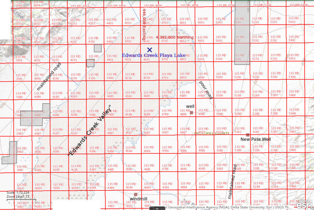
___This map is a screenshot of The National Map (Go to The National Map). The U.S. Geological Survey generally does not copyright or charge for its data or reports (unless printed). A pond location is indicated by an “X”, which corresponds to the coordinates given in the data spreadsheet. Labels in quotations are from 7.5-minute topographic quadrangles.
___Red lines are the U. S. National Grid with a spacing of 1,000 m and intersection labels consisting of the UTM zone (e.g., 11S, 12T), a 2-letter 100-km square designation (e.g., LC, XN), and a 4-digit number. The first 2 digits of the number represent the 1,000-meter Easting and the second 2 digits the 1,000-meter Northing, as seen in the example Easting and Northing. Unlike latitude and longitude, the National Grid is rectilinear on a flat map, the units of abscissa and ordinate have equal lengths, and the units (meters) are measurable on the ground with a tape or by pacing.
___Gray shading represents private land as traced from the PAD-US 2.0 – Federal Fee Managers layer of The National Map. Other lands are public.

Edwards Creek Playa Lake is 53 km (32 miles) west-northwest of Austin and 100 km (60 miles) east-northeast of Fallon, more or less. On the 1:100,000-scale BLM map, the stipple pattern for the playa is 13 km (8 miles) long and up to 4.5 km (3 miles) wide. All of the area within the stipple pattern is public land.
Edwards Creek Playa Lake is accessible from US 50. The maintained road to Alpine turns off US 50 at the southwestern end of the valley several miles north of Cold Springs and the maintained road to Antelope turns off at the northeastern end of the valley several miles west of New Pass Summit. The Antelope road (at sign to Antelope on US 50) may be the most direct route to the playa lake. There is a turn-off to the New Pass Well about 4 miles north of US 50. About 300 m (980′) north of the New Pass Well road, an unimproved road turns off to the northwest. This road is deeply rutted but poses no major obstacles when dry. It reaches the edge of the brush-free playa after about 2 miles. I hiked to the northwest from there. The width of the stippled area for the playa at this location is about 4.5 km (3 miles). Any roads in the lower parts of Edwards Creek Valley are impassable when wet due to the mud and roads on the alluvial fans may be washed out at channel crossings.
Elevation: 1,560 m (5,120′)
May 9, 2023
I had seen water on Edwards Creek playa while driving west on US 50 soon after seeing the water at Smith Creek US 50 Well Pond. May seems a bit late for playas since I hadn’t seen fairy shrimp in Main Smith Creek Playa Lake in March. WIDLA. Stepping onto the dry playa, I was rather mud-shy after my experiences at Winnemucca Lake and Teels Marsh. The mud-cracked, dry playa was easy walking to start off. It became damp, brown mud as I continued to the northwest. At the edge of the mud, I took my camera and net out of my pack as there would be no dry spots from there on. The mud was slippery but still firm. After a while, clayey water began to fill the cracks between the mud polygons. Still firm. As I walked on, the mud polygons got smaller and smaller and started to disappear. To reassess, I looked down at my rubber boots and boot prints. The water was less than 1 cm (0.4″) deep. I was sinking into the mud less than about 2 cm (0.8″). The mud was quite slippery and a little sticky but the bottom was firm. I continued. Periodically, I pressed my net into the water to check the depth. It never seemed to get more than about 1 cm (0.4″) deep. And so it went. I had no problems.
- Can’t see the full extent of the water but it’s big, I’ll guess 3 km x 6 km; maximum depth 1 cm.
- Opaque pale brown water, more like a clay slurry than water.
- A few stranded fairy shrimp about 75 mm long; they are lying with backs up so I can’t see ovisacs or eggs.
- Tadpole shrimp (Notostraca) 12-15 mm long with pale translucent carapaces.

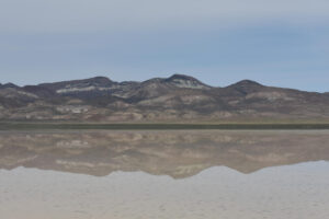
Edwards Creek Playa Lake and the Clan Alpine Mountains to the northwest. The darker tops of mud polygons can still be seen in places amidst the very shallow pale brown water.

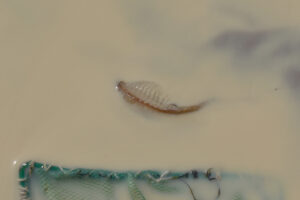
A giant fairy shrimp stranded on Edwards Creek Playa Lake. The width of the net is 12.5 cm but the right corner is barely visible. In more than half an hour of walking across water of about this depth, I came upon 3 fairy shrimp like this – resting on the mud back side up with legs fluttering. All were about the same size. Due to their orientations, I couldn’t see if any had eggs. Based on size, this fairy shrimp could be Branchinecta gigas, which has been previously reported in Nevada (Belk, 1975), or Branchinecta raptor, which occurs in Idaho not that far to the north (Rogers and Hill, 2013). The coordinates of this lake given in the Data spreadsheet are for the location of the first fairy shrimp I saw rather than at the edge of the water. Although this photo opportunity is better than I would ever have imagined, the circumstances are rather disheartening.

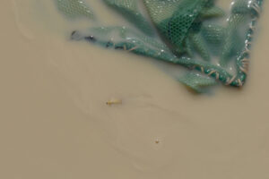
Tadpole shrimp (Notostraca) in Edwards Creek Playa Lake. The net is resting on the mud. This tadpole shrimp isn’t having any problems swimming through the clay slurry. 2 of the 6 swimming branchiopods that I saw were swimming legs up and looked rather like fairy shrimp. I am now pretty sure they were all tadpole shrimp. The giant fairy shrimp must have been feeding on smaller fairy shrimp but I didn’t see any. Maybe, the giant fairy shrimp somehow outlived them. I also never found any water deep enough for the giant fairy shrimp to swim in.
What Can We Learn from the Ponds in Edwards Creek Valley?
Edwards Creek Playa Lake has giant fairy shrimp, likely of the species Branchinecta gigas or Branchinecta raptor. The presence of a giant predatory species implies a smaller prey species of fairy shrimp but I didn’t see them.
Edwards Creek Playa Lake also has tadpole shrimp (Notostraca).
Like North Smith Creek Playa Lake, Main Smith Creek Playa Lake, Labou Playa North Pond, Luning Playa Lake, and “Lunar Lake”, Edwards Creek Playa Lake has a relatively firm bottom, at least on the one time I visited.