East Stone Cabin Corral Pond
East Stone Cabin Road Pond
East Stone Cabin Lower Reservoir
What Can We Learn from the Ponds in East Stone Cabin Valley?
East and West Stone Cabin valleys are separated by a range of hills north of US 6 and merge into Stone Cabin Valley south of the highway. The Monitor Range is west of West Stone Cabin Valley and the Hot Creek Range is east of East Stone Cabin Valley. East Stone Cabin Valley is 33 km (20 miles) long from McKintyre Summit at the divide with Hot Creek in the north to highway US 6. It widens to the south to a maximum of about 15 km (9 miles). The lowest point is 1,725 m (5,660′) where Stone Cabin Creek crosses US 6. McKintyre Summit is at an elevation of 2,060 m (6,760′). The alluvial fans extend up to about 2,010 m (6,590′) on the east side of the valley but to only 1,800 m (5,910′) on the west side. The valley lacks playas.
As I only drove through, I didn’t see much of the vegetation in East Stone Cabin Valley. From the road, I did see rabbitbrush and greasewood. There was sagebrush along the banks of Stone Cabin Creek where it crosses the road on the west side of the valley and on the approach to McKintyre Summit.
East Stone Cabin Valley is almost all public land. There is a ranch adjacent to US 6 at Fivemile Spring and a block of private land along Stone Cabin Creek (which apparently becomes Willow Creek in West Stone Cabin Valley) and an adjacent marsh with springs west of the road on the west side of the valley.
The road on the west side of East Stone Cabin Valley is well maintained and provides good access to the length of the valley. Some roads crossing to the east side of the valley are shown on maps but one I tried deteriorated rather quickly.
East Stone Cabin Corral Pond (Tonopah BLM Office)
___This map is a screenshot of The National Map (Go to The National Map). The U.S. Geological Survey generally does not copyright or charge for its data or reports (unless printed). A pond location is indicated by an “X”, which corresponds to the coordinates given in the data spreadsheet. Labels in quotations are from 7.5-minute topographic quadrangles.
___Red lines are the U. S. National Grid with a spacing of 1,000 m and intersection labels consisting of the UTM zone (e.g., 11S, 12T), a 2-letter 100-km square designation (e.g., LC, XN), and a 4-digit number. The first 2 digits of the number represent the 1,000-meter Easting and the second 2 digits the 1,000-meter Northing, as seen in the example Easting and Northing. Unlike latitude and longitude, the National Grid is rectilinear on a flat map, the units of abscissa and ordinate have equal lengths, and the units (meters) are measurable on the ground with a tape or by pacing.
___Gray shading represents private land as traced from the PAD-US 2.0 – Federal Fee Managers layer of The National Map. Other lands are public.
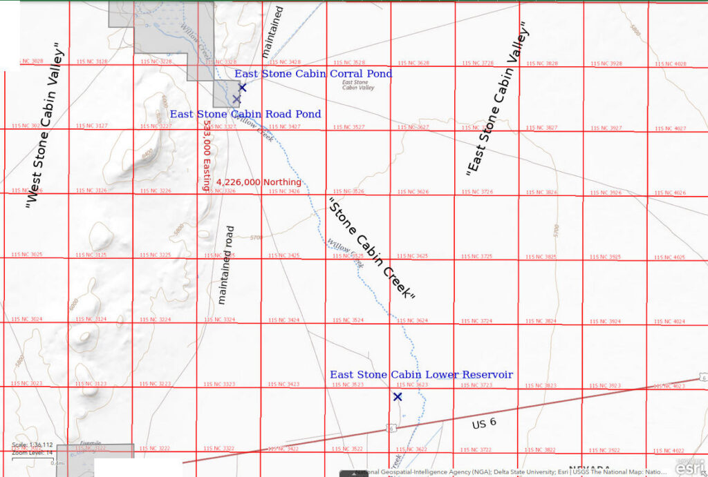
What is labeled “Willow Creek” on The National Map is labeled “Stone Cabin Creek” on the 7.5-minute topographic quadrangle. “Willow Creek” may only apply to that part of the creek in West Stone Cabin Valley.
East Stone Cabin Corral Pond is 55 km (33 miles) east of Tonopah along the maintained East Stone Cabin Valley road. A corral and a stock pond are a little farther from the road than East Stone Cabin Corral Pond. The stock pond is shown on the 7.5-minute topographic quadrangle but East Stone Cabin Corral Pond is not. A ditch for water from springs to the northwest of the corral skirts the stock pond and passes through a culvert under the East Stone Cabin Valley road immediately north of East Stone Cabin Corral Pond. The pond is apparently filled by water overflowing from this ditch and backing up from the road fill.
East Stone Cabin Corral Pond is very close to, if not on, a 40-acre (16 hectares) parcel of private land but the boundary is not marked. The pond is accessible from the road shoulder in any case.
East Stone Cabin Corral Pond is adjacent to the East Stone Cabin Valley road 4 miles north of US 6.
Elevation: 1,747 m (5,730′)
April 16, 2023
Bonus of the day: a pond along the road from “Little Fish Lake” Valley back to US 6.
- Triangular with 25 m height x 50 m base; depth greater than 5 cm and possibly up to 10 cm.
- Cloudy pale brown water.
- Fairy shrimp 8-12 mm long; some eggs.
- No other aquatic animals observed.
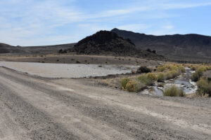
East Stone Cabin Corral Pond, looking west. The water in the pond is apparently overflow from the ditch at right. There is a culvert under the road for the ditch water. The fence at far right is part of a corral and there is a stock pond next to the corral.
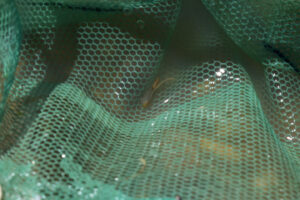
A fairy shrimp with eggs in the net at East Stone Cabin Corral Pond.
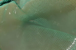
A small male in the net at East Stone Cabin Corral Pond has visible antennae II.
East Stone Cabin Road Pond (Tonopah BLM Office)
East Stone Cabin Corral Pond map
East Stone Cabin Road Pond is around a bend in East Stone Cabin Valley road about 200 m (660′) south of East Stone Cabin Corral Pond. It is in a long ditch on the west side of the road.
East Stone Cabin Corral Pond is very close to, if not on, a 40-acre (16 hectares) parcel of private land but the boundary is not marked. The pond is accessible from the road shoulder in any case.
For access, see East Stone Cabin Corral Pond. East Stone Cabin Road Pond is only about 100 m (330′) north of the junction with the road to West Stone Cabin Valley.
Elevation: 1,747 m (5,730′)
April 16, 2023
The deck is stacked for this pond. It is only a couple hundred meters from East Stone Cabin Corral Pond, which has fairy shrimp.
- About 75 m long and up to 2.5 m wide; depth greater than 5 cm and possibly up to 15 cm.
- Cloudy pale brown water.
- Fairy shrimp 6-12 mm long; some white and yellow eggs but due to the small size of the fairy shrimp, the ovisacs hold less than about 20.
- No other aquatic animals observed.
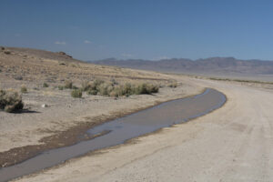
East Stone Cabin Road Pond, in a long ditch along the East Stone Cabin Valley road. This view is to the northeast looking across East Stone Cabin Valley to the Hot Creek Range.
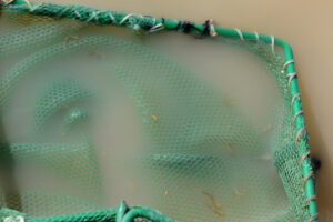
Several small fairy shrimp in the net at East Stone Cabin Road Pond. The females have pale eggs. Where they can be counted, the eggs in a single ovisac total only about a dozen. The small numbers of eggs may be due to young ages of the fairy shrimp but when they hatched is not known.
East Stone Cabin Lower Reservoir (Tonopah BLM Office)
East Stone Cabin Corral Pond map
East Stone Cabin Lower Reservoir is 57 km (34 miles) east of Tonopah and only 500 m (1,640′) north of US 6. It is 1 of 2 reservoirs in East Stone Cabin Valley shown as specks on the 1:100,000-scale BLM map. The other reservoir is a stock pond 2.3 km northeast of East Stone Cabin Valley Corral Pond and is fed by a pipeline, or ditch, from the creek by the corral. On the 7.5-minute topographic quadrangle, East Stone Cabin Lower Reservoir has a somewhat square shape about 40 m (130′) across.
Stone Cabin Lower Reservoir is accessible by way of an unmarked, unimproved road north of US 6. The turn-off is 0.4 miles west of the main access road to a ranch south of the highway or 2.5 miles east of East Stone Cabin Valley road.
Elevation: 1,727 m (5,670′)
April 16, 2023
Last stop of the day and it seems like a slam dunk. Both East Stone Cabin Corral Pond and East Stone Cabin Road Pond have fairy shrimp and this pond is bigger and downstream.
- About 100 m x 150 m; depth greater than 30 cm.
- Opaque pale brown water.
- No fairy shrimp.
- Backswimmers (sub-order Heteroptera, family Notonectidae) 5-10 mm long, ostracods, cladocerans.
I couldn’t believe there are no fairy shrimp here so I waded well out into the water and spent more than half an hour dragging the net through the water. Of course, they could be in deeper water.
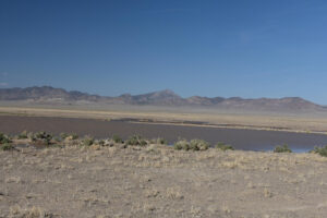
View to northeast across East Stone Cabin Lower Reservoir, with the Hot Creek Range in the distance. The reservoir on the map is apparently the small body of water behind the berm with brush at left. The rest of the water appears to be overflow onto the desert from East Stone Cabin Creek, in the middle distance. Even if the constructed reservoir had fairy shrimp in the past, there may not have been enough eggs to populate this body of water with a discoverable density of fairy shrimp.
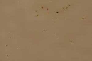
Ostracods and cladocerans less than 2 mm long in East Stone Cabin Lower Reservoir taking their time to swim away after being released from the net. The ostracods are the brownish-green, closed bivalves. The cladocerans are pale gray, oval animals with black eyes. Some have a black tube (possibly intestines) extending down their backs. I couldn’t photograph the ostracods I saw in Wyoming because they were always swimming too fast. I’m not sure why these aren’t swimming faster but I still think they are ostracods.
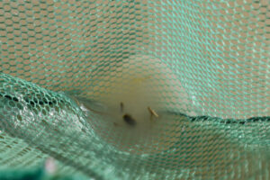
Backswimmer (sub-order Heteroptera, family Notonectidae) at bottom of net in East Stone Cabin Lower Reservoir. In this case, the backswimmer is not in its normal swimming position. Its dark back is facing up. However, I caught enough of them in the net to see them swimming back side down.
What Can We Learn from the Ponds in East Stone Cabin Valley?
I found fairy shrimp in 2 of the 3 ponds I visited in East Stone Cabin Valley.
Paradoxically, I didn’t see any other animals in the 2 ponds with fairy shrimp but the pond that didn’t have fairy shrimp had backswimmers, ostracods, and cladocerans.
All the ponds that I visited are anthropogenic and I didn’t see any natural ponds. That suggests potential fairy shrimp habitat in East Stone Cabin Valley is limited to reservoirs, stock-watering ponds, and roadside ditches.