Candelaria Playa Ponds
Winter 2022 Fairy Shrimp Hatching History in the Garfield and Candelaria Hills and the Gabbs Valley Range
What Can We Learn from the Ponds in the Candelaria Hills?
The Candelaria Hills are south of Rhodes Salt Marsh, west of Columbus Salt Marsh, and east of Teels Marsh. To the south, they run into the White Mountains. They are about 23 km (14 miles) broad from Little Summit on Nevada 360 to Redlich Summit on US 95 and 25 km (16 miles) long from US 6 to Rhodes Salt Marsh basin. They are dry and rugged and not the kind of place one would normally think of to look for ponds with fairy shrimp. However, there is a broad valley in the northern part of the hills that has enough of a depression for a playa.
The Candelaria Hills range in elevation from about 1,500 m (4,920′) adjacent to the Rhodes Salt Marsh basin in the north and the Columbus Salt Marsh basin in the east to 2,661 m (8,730′) on Miller Peak, in the south.
Vegetation in the Candelaria Hills is mostly desert scrub. There are probably some sagebrush and associated plants at the higher elevations.
The Candelaria Hills are on lands managed by the Stillwater Office of the BLM. There are large blocks of private land on the south side of Miller Mountain, at the Belleville mill site, and near the Giroux Mine, off Nevada 360. The open pit of the reclaimed Candelaria Mine and surrounding smaller mines are on a mix of patented claims and public land.
The Candelaria Hills are in the triangle formed by US 95, US 6, and Nevada 360. A crumbling paved road leads from US 95 west to the town site and mine of Candelaria.
Candelaria Playa Ponds (Stillwater BLM Office)
___This map is a screenshot of The National Map (Go to The National Map). The U.S. Geological Survey generally does not copyright or charge for its data or reports (unless printed). A pond location is indicated by an “X”, which corresponds to the coordinates given in the data spreadsheet. Labels in quotations are from 7.5-minute topographic quadrangles.
___Red lines are the U. S. National Grid with a spacing of 1,000 m and intersection labels consisting of the UTM zone (e.g., 11S, 12T), a 2-letter 100-km square designation (e.g., LC, XN), and a 4-digit number. The first 2 digits of the number represent the 1,000-meter Easting and the second 2 digits the 1,000-meter Northing, as seen in the example Easting and Northing. Unlike latitude and longitude, the National Grid is rectilinear on a flat map, the units of abscissa and ordinate have equal lengths, and the units (meters) are measurable on the ground with a tape or by pacing.
___There is no private or state land on this map. All lands are public.
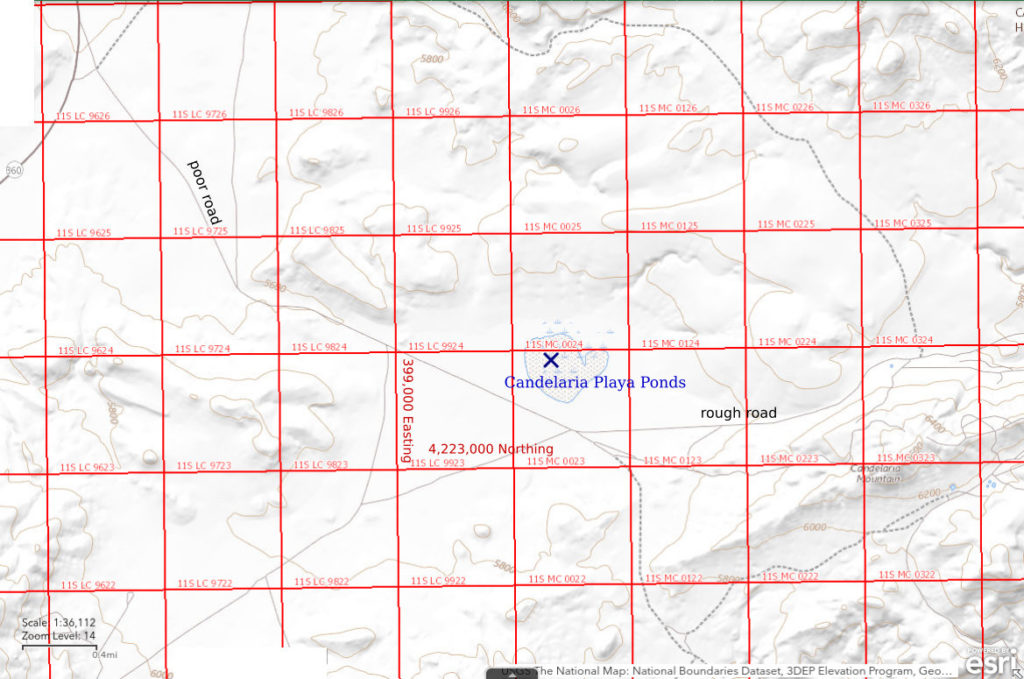
Candelaria Playa Ponds are about 4 km (2.5 miles) west of the closed Candelaria Mine. They are on a 600 m x 700 m (1,970′ x 2,300′) playa shown with a stipple pattern on the 1:100,000-scale BLM map. The playa is 59 km (37 miles) southeast of Hawthorne.
The entirety of the Candelaria playa appears to have been excavated to a depth of 1-3 m (3-10′) but there are no piles of excavated material. There are sharp, straight banks on the west and south sides. The southeastern part and some other areas of the excavation have been irregularly filled by very fine grained material that looks the same as that exposed in the excavation. The floor of the excavation has 2 general levels, one about 1 m (3′) below the ground surface around the south, west, and north sides and the other another 2 m (7′) or so deeper. The cut banks have been deeply furrowed by erosion. It could be that the playa was excavated to provide fine material to use as liner for the leach pads at the Candelaria Mine. Depressions within the excavated area now collect sufficient snow or water to form ponds after precipitation events.
The playa shown on the 1:100,000-scale BLM map likely predates the excavation. An unlabeled stipple pattern is shown for the Candelaria playa on the Belleville 7.5-minute quadrangle, which was prepared from 1966 aerial photographs. It has the same shape as the stipple pattern on the current National Map and the BLM map. Current satellite imagery shows that the original shape of the playa has been modified by human activities. If excavation of the Candelaria playa is related to mining, the timing of mining could provide an estimate of the time available for fairy shrimp to colonize the ponds. The main phase of large-scale, open-pit, heap-leach mining at Candelaria occurred in the 1980s, (Stevens, 2001, which was still on the web in 2021; see the References page). The playa could have had fairy shrimp before the excavations, just not in the current Candelaria Playa Ponds.
Candelaria Playa Ponds can be reached from the east or west. From Nevada 360 to the west, a non-paved road turns off about 4 1/4 miles south of the turn-off to Marietta, or about 10 miles from US 95 at Rhodes Salt Marsh. The turn off is about 13 miles north of US 6 at Basalt. This was previously a very wide mine-access road but is now extremely bumpy. The Candelaria playa is about 3 1/2 miles from the highway. There is a metal water tank at the west end of the playa. A wide road that is not quite so bumpy continues to the Candelaria Mine from an intersection at the east edge of the excavated playa.
From the east, there is a crumbling paved road from US 95 as far as the Candelaria Mine area. There is a sign and a historical marker at the US 95 turn-off. The pavement ends about 9 1/2 miles from US 95. A graded gravel road continues over the hill to Candelaria playa.
Elevation: 1,720 m (5,645′)
March 15, 2017
I wasn’t looking for fairy shrimp but stopped at the playa to see what the excavation was all about.
- 2 large ponds up to about 20 m x 30 m and 2 smaller ones; depths uncertain but probably less than 50 cm.
- Opaque brownish-gray water; ice on the water before 0800.
- Netted fairy shrimp in 3 of 4 ponds; fairy shrimp less than 10 mm long in 2 of the ponds and 10-15 mm in the other one.
- Birds on one of the larger ponds.
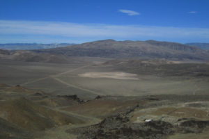
Distant view of Candelaria Playa Ponds, looking to the northwest from Candelaria Mountain. 1 pond is visible near the center and another near the right edge of the pale brush-free area when the photo is enlarged. The mountain in the distance is on the far side of Nevada 360 and Teels Marsh is on the far side of it.
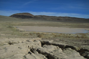
Looking southeast across a large fairy shrimp-bearing pond in Candelaria Playa Ponds, with Candelaria Mountain in the distance. This is probably the middle pond but I hadn’t made the distinction at the time.
April 7, 2021
The presence of an antelope possibly looking for water inspired some hope but this is apparently too late in the season for such a dry location.
- Dry.
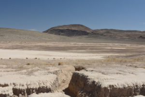
View to the southeast across a dry pond of Candelaria Playa Ponds, with Candelaria Mountain in the distance. The furrow in the foreground is almost 1 m (3′) deep and leads from the upper level to the lower level within the excavated area. The dry pond at left is separated from another to the right of center by a ridge of very fine grained material partially covered by dark, angular pebbles. The ridge could be tailings covered by slope wash from the surrounding hills. In any case, this is not a natural landscape.
February 10, 2022
Western Nevada had lots of snow in December and I had found fairy shrimp in Playa Wire Gate Pond in Soda Spring Valley on January 18. Earlier today, I saw that Teels Marsh still has snow but no water so I was out of luck there. Considering that Candelaria playa is at a higher elevation than Teels Marsh (1,720 m versus 1,500 m), I was hesitant. WIDLA. As luck would have it, there are several ponds with ample water. It looks promising. There is even a herd of burros as an audience. Their tracks in the mud indicate they are potential fairy shrimp dispersal agents, which would be good, but they could also be pond guzzlers, which would be bad (see Wild Horse Rock Pool in the Granite Mountains).
I took measurements of the 3 larger ponds, which are labeled southern, middle and northern below. There are 2 smaller ponds more than a few centimeters deep between the southern and middle ponds and 2 small ponds less than 5 cm deep east of the northern pond on the upper bench of the excavation.
- Southern pond: 12 m x 40 m, at least 8 cm deep, cloudy pale brown, 8 C at 4 cm depth at 1245 in sun, some ice; 400,543E, 4,223,654N; no fairy shrimp.
- Middle pond: 35 m x 45 m, at least 14 cm deep, cloudy pale brown, 8 C at 2 cm depth in sun, some ice; 400,333E, 4,223,913N; no fairy shrimp (this is the location in the data spreadsheet on the Data page).
- Northern pond: 15 m x 70 m, at least 16 cm deep, opaque pale brown, 9 C at 2 cm depth at 1345 in sun, minor ice; 400,295E, 4,224,074N; no fairy shrimp.
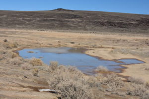
The southern pond of Candelaria Playa Ponds, looking north with burros in the distance. There is some ice on the far side of the pond.
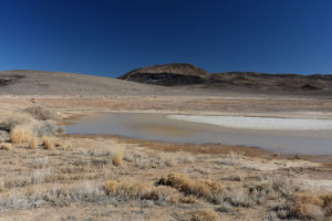
The middle pond of Candelaria Playa Ponds, looking east with Candelaria Mountain in the distance. There is considerable ice at right.
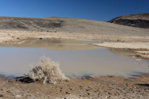
The northern pond of Candelaria Playa Ponds, looking northeast with burros in the distance at left and Candelaria Mountain at right. There is just a little bit of ice on the far side of the pond. The object in the water at left is a twisted piece of corrugated metal. These ponds all look like they could provide a home for fairy shrimp like those currently swimming in Soda Spring Valley or Rawhide Flats but something hasn’t clicked for the eggs to hatch.
February 28, 2022
The water is still here and so are the burros. However, all the ponds are clearly smaller than on February 10. The 2 smaller ponds between the southern and middle ponds are almost gone. They are less than 10 m across and less than 3 cm deep. The 2 small ponds east of the northern pond are dry. The big question: did the fairy shrimp hatch or are they taking this year off?
- Southern pond: 6 m x 27 m, at least 6 cm deep, cloudy pale brown, 10 C at 1 cm depth at 1215 in sun, tiny bit of ice; no fairy shrimp.
- Middle pond: 30 m x 42 m, at least 11 cm deep, cloudy pale brown, 13 C at 1 cm depth at 1240, few bits of ice; 4-7 mm fairy shrimp.
- Northern pond: 12 m x 60 m, at least 15 cm deep, opaque pale brown, 13 C at 3 cm depth at 1300, tiny bit of ice; 4-7 mm fairy shrimp.
So the fairy shrimp in Candelaria Playa Ponds did hatch. They just waited a little longer than those in Soda Spring Valley, Rawhide Flats, and “Carson Lake” Playa.
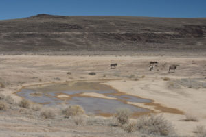
The southern pond of Candelaria Playa Ponds, with burros. The pond is much reduced in size; compare to photograph Candelaria Playa Ponds 2022-02-10, #01. Most of the burros are off to the east (right). These are the stragglers.
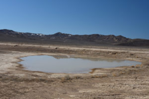
The middle pond of Candelaria Playa Ponds, looking south with more of the Candelaria Hills in the distance.
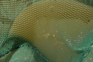
Fairy shrimp from the middle pond of Candelaria Playa Ponds in the net. The 2 fairy shrimp above center are 5-6 mm long as the mesh size is a little more than 1 mm. The fairy shrimp oriented sub-parallel to the long dimension of the photograph and below and to the right of center (its pale intestine is most visible) is smaller, possibly 4 mm long.
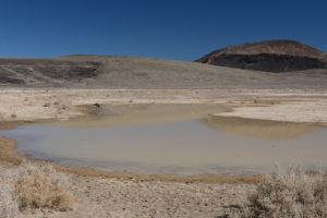
The north pond of Candelaria Playa Ponds, similar view as photograph Candelaria Playa Ponds 2022-02-10, #03. Although the pond is smaller than on February 10, the water is still 15 cm or so deep. That should keep the pond from drying up for at least the next couple of weeks. That’s enough time for the fairy shrimp to finish growing up.
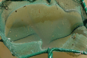
Several fairy shrimp in the net at the north pond of Candelaria Playa Ponds. These fairy shrimp also seem to range in size from 4 to 7 mm.
Candelaria Playa Ponds (North) Fairy Shrimp Video 2022-02-28ac1m-r
For a 1-minute, 10-seconds video of the north pond of Candelaria Playa Ponds and of fairy shrimp swimming in a hoof print along the shore, click on the video player above. There is no audio. The video starts with a view of the pond and then zooms in to the hoof print with the fairy shrimp. The fairy shrimp are swimming in the clay-water boundary layer below 1-2 cm of clear water. Individual bodies cannot generally be seen but they make dark fuzzy streaks through the clay-water layer and occasionally kick up a puff of pale clay. I don’t know why the fairy shrimp prefer to swim in the clay-water layer but would guess that it is because that is where the best food is. In this and the following videos on this day, the fairy shrimp are behaving very similarly to those in “Carson Lake” East Ridge Pond (“Carson Lake” Playa). What seemed like unusual behavior there due to my ignorance isn’t.
Candelaria Playa Ponds (North) Fairy Shrimp Video 2022-02-28ac2m-r
For a 1-minute, 44-seconds video of fairy shrimp swimming in the same hoof print as in Candelaria Playa Ponds (North) Fairy Shrimp Video 2022-02-28ac1m-r, click on the video player above. There is no audio. This is a continuation of Candelaria Playa Ponds (North) Fairy Shrimp Video 2022-02-28ac1m-r. I split the videos to make smaller file sizes. The fairy shrimp make dark curving streaks through the clay-water layer and sometimes leave a “dust” trail of pale clay, like a vehicle driving on a dusty Nevada road.
Candelaria Playa Ponds (North) Fairy Shrimp Video 2022-02-28cc-r
For a 2-minutes video of the north pond of Candelaria Playa Ponds and of fairy shrimp swimming near the shore, click on the video player above. There is no audio. The video opens briefly with a still photograph of the north pond and then shows the edge of the water with the view of the mud helping to keep the video in focus. Consequently, all the action is in the upper part of the frame. As in the previous 2 videos of the north pond on 2022-02-28, the fairy shrimp are mostly seen as dark shapes cruising through the pale clay-water layer. However, at times the fairy shrimp bodies become visible as they swim into the clear water at the very edge of the pond, such as at: 0:26, 0:38, 0:49, 1:23, and 1:47. There is a lot of action in this video as the fairy shrimp seem to be abundant at this location.
Candelaria Playa Ponds (North) Fairy Shrimp Video 2022-02-28dc-r
For a 1-minute, 46-seconds video of the north pond of Candelaria Playa Ponds and of fairy shrimp swimming near the shore, click on the video player above. There is no audio. Again, the video opens briefly with a still photograph of the north pond. This video makes it inescapably clear that these fairy shrimp like clay. The brown mud on the pond bottom is visible through about 2 cm of clear water with bubbles on the top of the water blowing gently to the right. That’s not where the fairy shrimp are; they are in the pale brown clay-water layer trapped at the bottom of a small trough. None are interested in the clear water. At times there is so much turbulence in the clay-water layer that it seems like the fairy shrimp must be crawling over each other.
Winter 2022 Fairy Shrimp Hatching History in the Garfield and Candelaria Hills and the Gabbs Valley Range
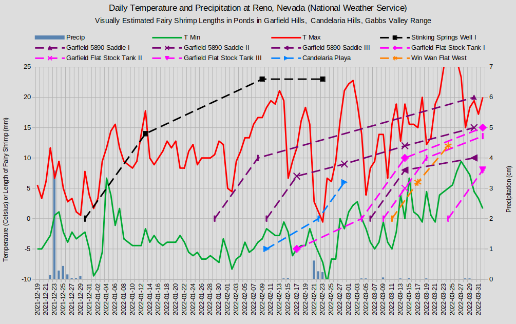
Fairy shrimp lengths are indicated by the dashed lines where 0 lengths are on the inferred days of hatching. The vertical dash symbol indicates a calculated length. From hatching to 10 mm length, the growth rate is assumed to be 1 mm/day. For post-10 mm growth rates, see text below. -5 fairy shrimp lengths mark dates when fairy shrimp were not observed. Garfield 5890 Saddle Pond generation IV is not shown because it would obscure Garfield Flat Stock Tank Pond generation III. Growth of the first generation in Stinking Springs Well Pond is shown for comparison.
After good December snowfalls and dry January and February 2022, fairy shrimp in Candelaria Playa Ponds did not hatch upon initial melting of the snow as there was ample water but no fairy shrimp on Feb. 10. Assuming a 1 mm/day growth rate, the 6 mm fairy shrimp observed on February 28 hatched on about February 22. Hatching was probably stimulated by precipitation on February 21 even though temperatures on February 21-23 were much colder than on preceding and succeeding days.
For further discussion, see “Winter 2022 Fairy Shrimp Hatching History in the Garfield Hills, Candelaria Hills, and the Gabbs Valley Range” on the Garfield Hills page.
What Can We Learn from the Ponds in the Candelaria Hills?
Ponds on the excavated floor of Candelaria playa have fairy shrimp.
If the playa did not have ponds with fairy shrimp before the excavation, then the date of excavation provides a constraint on how long it takes for a pond to be colonized. If the excavation was related to operation of the Candelaria Mine in the 1980s, then the current ponds were colonized within 37 years. If fairy shrimp eggs were present on the playa before the excavations, then construction activities and wind could have spread them across the excavation immediately.
The hatching of fairy shrimp eggs in February 2022 was most likely triggered by a decrease in TDS due to precipitation.
Like the fairy shrimp on “Carson Lake” Playa, the fairy shrimp in Candelaria Playa Ponds seem to really like clay.