West Northumberland Road Ponds
Smoky Thistle Pond
Smoky Hawthorn Pond
Smoky Comma Pond
Smoky Cutbank Pond
Smoky Sinuous Pond
The Granites Playa Lake Inlet
The Granites Playa Lake
Aiken Playa Lake
Smoky Tamarisk Slough
What Can We Learn from the Ponds in Big Smoky Valley?
The Big Smoky Valley, as the term is used here, is a classic basin of the basin and range topography of the Great Basin. It is bounded by a fault and the steep mountain front of the Toiyabe Range on the west side and by moderate slopes of the west-tilted Toquima Range on the east side. Hot springs occur along the faulted west side (and at Spencer Hot Springs associated with a fault closer to the east side) and there are numerous cold springs where the groundwater levels reach the surfaces of the alluvial fans ringing the valley. A convenient spot for the north end is at the junction of Simpson Park Canyon and Rye Patch Canyon, north of US 50. The south end is defined here as the low topographic divide about 3 km (2 miles) south of Hadley. The drainage from Pablo Canyon turns north on reaching the valley at this divide while the drainage of Wall Canyon turns south. These 2 ends give the Big Smoky Valley a length of 110 km (68 miles). The width varies from 10 to 20 km (6-12 miles).
The 1:100,000-scale Ione Valley, Tonopah, and Goldfield 30 x 60-minute topographic quadrangles apply the name Big Smoky Valley to low-lying lands that continue south of the Toiyabe Range, merge with lower Ione Valley, separate the San Antonio Mountains from the Monte Cristo Range, cross US 6 west of Tonopah, and finally end against the Silver Peak Range west of Nevada 265. If I go looking for fairy shrimp in this area, I would make up another name for it.
The 1,750-m (5,740′) contour provides a good outline of the valley but doesn’t rise up the fans to the mountain fronts. The lowest contour on the 1:100,000-scale BLM maps is 1,700 m (5,580′). The maps have a few spot elevations on the valley floor that suggest the lowest point could be about 1,650 m (5,410′). There is a 1,734-m (5,690′) elevation at a road junction north of Spencer Hot Springs; a 1,689-m (5,540′) elevation west of Willow Canyon; a 1,679-m (5,510′) elevation at the road junction next to West Northumberland Road Pond #8 (see below); a 1,665-m (5,460′) elevation at a section corner east of Park Canyon; elevations of 1,691 m, 1,684 m, and 1,692 m (5,525-5,550′) at intersections along the Moores Creek Road; and an elevation of 1,724 m (5,660′) at a section corner near Jakes Well east of Carvers.
The lowest parts of Big Smoky Valley playa generally have greasewood and other desert scrub vegetation but the alluvial fans are thick with sagebrush. There are grassy areas near springs that may also have willows or other saprophytes. Farm land on the valley floor is irrigated for hay.
Although most of Big Smoky Valley is public land managed by the Mount Lewis BLM office, there are too many blocks of private land to describe here. Most of the private land is in large ranches on the west side of the valley but east of Nevada 376 between Carvers and Gilman (east of Globe Canyon) but there are other parcels as well. The Birch Creek Ranch farther north is well up on the fan rather than on the valley floor.
West Northumberland Road Ponds (Mount Lewis BLM Office)
___This map is a screenshot of The National Map (Go to The National Map). The U.S. Geological Survey generally does not copyright or charge for its data or reports (unless printed). A pond location is indicated by an “X”, which corresponds to the coordinates given in the data spreadsheet. Labels in quotations are from 7.5-minute topographic quadrangles.
___Red lines are the U. S. National Grid with a spacing of 1,000 m and intersection labels consisting of the UTM zone (e.g., 11S, 12T), a 2-letter 100-km square designation (e.g., LC, XN), and a 4-digit number. The first 2 digits of the number represent the 1,000-meter Easting and the second 2 digits the 1,000-meter Northing, as seen in the example Easting and Northing. Unlike latitude and longitude, the National Grid is rectilinear on a flat map, the units of abscissa and ordinate have equal lengths, and the units (meters) are measurable on the ground with a tape or by pacing.
___Gray shading represents private land as traced from the PAD-US 2.0 – Federal Fee Managers layer of The National Map. Other lands are public.
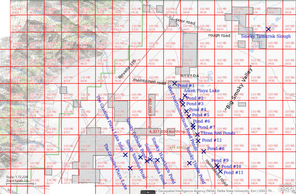
The West Northumberland Road Ponds occur in ditches along the western 6 miles of Northumberland Mine road, before it starts up the alluvial fan toward West Northumberland Canyon. They are generally less than 2 m (6.6′) across and may be up to 100 m (330′) long. Pond #1 is 41 km (25 miles) south of Austin. The Northumberland Mine Road eventually leads to the closed Northumberland Mine high in the Toquima Range, over Northumberland Pass, through East Northumberland Canyon, and down into Monitor Valley. It is constructed with gravel and is maintained by the county. Due to different sizes and drainage characteristics, individual ponds may fill up to different degrees from snowmelt or from rain storms and dry up at different times. Road maintenance could change the configurations of the ponds from time to time. The locations given below of individual ponds are those measured on March 1, 2022 and they may not be valid for prior or subsequent dates.
The Northumberland Mine Road turns east off Nevada 376 about 22 miles north of Carvers and about 5 miles south of the main turn-off to Kingston. It is marked by small green signs on the highway. West Northumberland Road Pond #1 occurs at the big bend in the Northumberland Mine road about 1.7 miles from Nevada 376. The other ponds are numbered consecutively to the southeast. Odometer mileages as measured during the March 1, 2022 visit are given below. Ponds are on the northeast side of the road unless otherwise noted. I had previously given the UTM coordinates for each pond here and made only 1 entry in the spreadsheet on the Data page for West Northumberland Road Ponds but have now included rows in the spreadsheet for each pond with individual location and biological data. This will give others a better chance of finding and distinguishing between individual ponds, if they care to.
- West Northumberland Road Pond #1: 1.7 miles; at sharp bend in road to south, on south side.
- West Northumberland Road Pond #2: 2.6 miles; puddles on both sides.
- West Northumberland Road Pond #3: 2.7 miles; at slight bend in road to east.
- West Northumberland Road Pond #4: 2.9 miles.
- West Northumberland Road Pond #5: 3.1 miles; possibly has puddles also on southwest side of road at times.
- West Northumberland Road Pond #6: 3.4 miles; at channel crossing road, puddles on both sides.
- West Northumberland Road Pond #7: 3.5 miles; at slight bends in road to south and then back to east; had small puddle on south side in August 2023.
- West Northumberland Road Pond #12: no odometer reading as pond was found in August 2023; it is between ponds #7 and #8 in a drainage channel at a high angle to the road.
- West Northumberland Road Pond #8: 4.5 miles; in drainage channel perpendicular to road, across from junction with road that leads more southeasterly.
- West Northumberland Road Pond #9: 5.3 miles.
- West Northumberland Road Pond #10: 5.4 miles; northwest of slight bend to east.
- West Northumberland Road Pond #11: 5.6 miles; on southwest side of road.
Elevations: 1,676-1,685 m (5,500-5,530′)
In addition, Three Red Ponds are located in an excavation on the north side of Northumberland Mine Road between West Northumberland Road Ponds #7 and #8. They are 3.8 miles from Nevada 376 at 494,968E, 4,327,003N (39.09213, -117.05819). The excavation is up to about 60 m x 120 m (200-390′) and the individual ponds may be up to 30 m (100′) across. There is abundant vegetation in the ponds and on March 1, 2022, at least 2 of the ponds had small amounts of dark brownish-red water. I don’t think these ponds are likely habitat for fairy shrimp. The thick vegetation would interfere with swimming by filter feeders. Three Red Ponds are not considered further here. However, they may be of interest to some for other reasons.
July 18, 2013
It was quite a surprise to see a puddle here in the middle of the summer but it was after a period of thunderstorms in the area. I didn’t take notes of this observation but I took a photograph. My guess is that the location is West Northumberland Road Pond #7, based on the view of Bunker Hill in the photograph.
- 1 m x maybe 15 m; depth not estimated.
- Cloudy pale brown water.
- Fairy shrimp present.
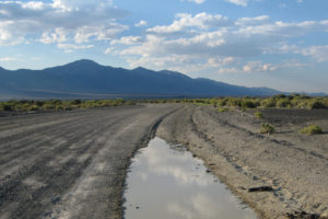
Afternoon view of one of the West Northumberland Road Ponds, looking northwest with Bunker Hill the highest peak at left. This is probably Pond #7, which I didn’t name until 9 years after this photograph.
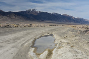
West Northumberland Road Pond #7 in March 2022. Although this photograph looks somewhat different than photograph West Northumberland Road Pond #7 2013-07-18, #01, there is the same bend in the road, the same perspective of the Toiyabe Range, and both have 2 white rocks on the darker desert pavement to the right of the road. The closer white rock is on the near side of a small greasewood bush, which is green in 2013. This is why I now take photographs of every pond I visit.
March 19, 2019
From February 2 to March 6, Reno got 28.6 cm (11.3″) of precipitation (www.weather.gov/wrh/Climate?wfo-rev), which is way above normal. Although daily high temperatures were below 15 C from February 24 to March 7, lows were above 0 C. There are extensive puddles along the Northumberland Mine road but the playa is dry where it can be seen from this road and Nevada 376. Temperatures may have been a little cooler in Big Smoky Valley as the ponds are about 260 m (850′) higher than Reno. There are dust devils in the distance to the south.
I visited only a few ponds and I didn’t name them. The names below are based on my March 2022 visit and a comparison of road distances and photographs.
- West Northumberland Road Pond #1: less than 1 m x 15 m; 15 cm deep; cloudy pale gray water; fairy shrimp about 10 mm long.
- West Northumberland Road Pond #2: has water, size and depth not estimated; no fairy shrimp seen but they may be too small to notice.
- Likely West Northumberland Road Pond #4: has water, size not estimated; depth less than 8 cm; no fairy shrimp seen but they may be too small to notice.
- Likely West Northumberland Road Pond #5: 1 m x 100 m or more; 12 cm deep; cloudy pale gray water; fairy shrimp less than 8 mm long and very hard to see – if they hadn’t stuck to the net I would have missed them.
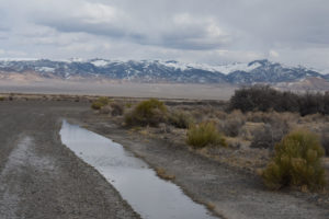
West Northumberland Road Pond #1 at the big bend in the road, looking southeast across Big Smoky Valley toward the Toquima Range. The highest peak at right is probably Wildcat Peak. Another section of the pond continues around the corner. The snow in the mountains documents substantial, relatively recent precipitation although there was likely less on the valley floor.
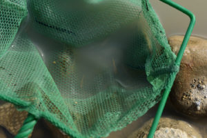
Fairy shrimp in the net at West Northumberland Road Pond #1. They are small now but they should have enough time to grow up with this amount of water.
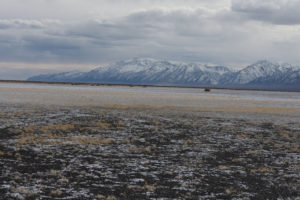
The playa of Big Smoky Valley near West Northumberland Road Pond #1 is white with mineral efflorescence, not with snow. Toiyabe Dome of the southern Toiyabe Range is to left of center and the mouths of South and North Twin River canyons are close together at right.
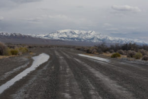
West Northumberland Road Pond #2 with puddles on both sides of road, looking southeast with Mount Jefferson in the distance. I didn’t see fairy shrimp here but that was before I noticed tiny fairy shrimp sticking to my net at West Northumberland Road Pond #5. What may be a puddle on the left side of the road in the middle distance may be West Northumberland Road Pond #3 as the 2022 GPS coordinates are only 167 m (550′) away.
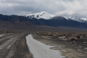
Part of the very long West Northumberland Road Pond #5, looking northwest at Bunker Hill in the Toiyabe Range. It looks like there is a small puddle on the left side of the road, too. I barely noticed the fairy shrimp here because they were so small.
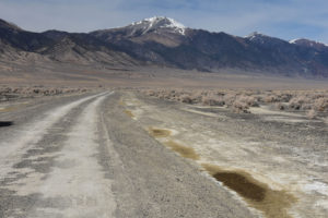
Same view as photograph West Northumberland Road Pond #5 2019-03-19, #05. Because I didn’t have a GPS in 2019, I have to compare photographs to identify ponds with the names I gave them in March 2022. Similar focal lengths (50 mm and 55 mm) make the resemblance clear, even down to the white patches on the playa to the right of the road.
March 1, 2022
I finally decided I needed to make a better effort to document the positions of the ponds along the western Northumberland Mine Road so I noted odometer mileages from Nevada 376 (listed in pond description above) and took GPS readings at anything that looked like it could be a pond. My timing was late as some puddles had dried up but I didn’t want to get here before any fairy shrimp had hatched. It’s been a dry January and February for Reno and probably most of western Nevada so any water is probably from December snow.
Here is the list of ponds I came up with and whether they have fairy shrimp or not. I used a tape measure for pond sizes.
- West Northumberland Road Pond #1: 0.4 m x 7 m; 3 cm deep in hoof print; 15 C at 1215; no fairy shrimp.
- West Northumberland Road Pond #2: 1 m x 15 m; 6 cm deep; 16 C at 1230; 5-8 mm fairy shrimp; small brownish-black diving beetle.
- West Northumberland Road Pond #3: 0.9 m x 22 m; 3 cm deep; 18 C at 1300; no fairy shrimp.
- West Northumberland Road Pond #4: dry.
- West Northumberland Road Pond #5: dry.
- West Northumberland Road Pond #6: 1.2 m x 21 m; 10 cm deep in ruts; 16 C at 1350; no fairy shrimp.
- West Northumberland Road Pond #7: 1.7 m x 12 m; 4 cm deep; 18 C at 1415; 6 mm fairy shrimp; big brownish-black diving beetle.
- West Northumberland Road Pond #8: 2 m x 34 m; 4 cm deep; 16 C at 1500, ice under bush; no fairy shrimp.
- West Northumberland Road Pond #9: dry.
- West Northumberland Road Pond #10: 0.7 m x 16 m; 3 cm deep; 15 C at 1540; no fairy shrimp.
- West Northumberland Road Pond #11: 0.7 m x 10 m; 6 cm deep; 14 C at 1600; no fairy shrimp.
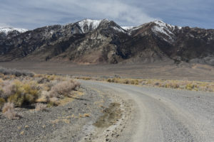
West Northumberland Road Pond #1, looking west with Toiyabe Range in distance. It’s almost dry now but the pond extended well around the corner in March 2019.
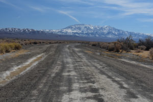
West Northumberland Road Pond #2, looking southeast with Mount Jefferson in distance. Compare to photograph West Northumberland Road Pond #2 2019-03-19, #04. The puddle on the right side of the road has fairy shrimp.
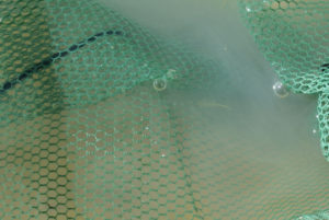
A small fairy shrimp in the net at West Northumberland Road Pond #2.
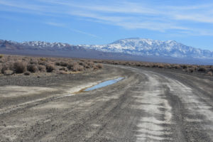
West Northumberland Road Pond #3, looking southeast with Mount Jefferson in distance. I didn’t find fairy shrimp here. The puddle is only 3 cm deep.
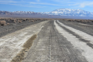
West Northumberland Road Pond #4 could be long but it’s dry now.
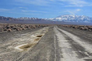
West Northumberland Road Pond #5 didn’t make it either. This pond had fairy shrimp after a wetter winter in 2019, when it was 100 m or so long.
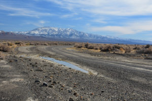
West Northumberland Road Pond #6 has a significant depth of water in the tire rut but no fairy shrimp. A small drainage crosses the road here and there is also a small puddle on the right (southwest) side of the road.
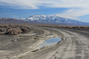
West Northumberland Road Pond #7, looking southeast with Mount Jefferson in distance. It’s not big but it has fairy shrimp. It also had fairy shrimp under very different circumstances in July 2013.
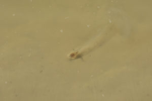
That’s a fairy shrimp skimming across the top of the opaque clay-water boundary layer in West Northumberland Road Pond #7. 1-2 cm of clear water lies above the boundary layer. For more, see the video below.
West Northumberland Road Pond #7 Fairy Shrimp Video 2022-03-01r, Big Smoky Valley.
For a 1-minute 56-seconds video of a fairy shrimp swimming in West Northumberland Road Pond #7, click on the video player above. There is no audio. The video opens with a view to the south-southeast and then shows a close view of the location in the pond with a fairy shrimp. This little guy is powering across the top of the opaque clay-water boundary layer with its legs moving at a furious pace. This is another variation on the clay diving theme. For example, the fairy shrimp in Macari East Stop Sign Pond Fairy Shrimp Video 2022-01-27 (“Carson Lake” Playa) dove in to and out of the clay layer and often swam almost vertically oriented. Those in “Carson Lake” East Ridge Pond Fairy Shrimp Video 2022-01-31c (“Carson Lake” Playa) were plowing slowly through the clay-rich layer. It may also be notable that this fairy shrimp doesn’t invert to swim with its legs down and scrape the pond bottom as those in Macari East Stop Sign Pond did. It evidently gets what it needs swimming with its legs up.
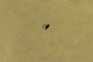
Brownish-black beetle about 10 mm long in West Northumberland Road Pond #7. I saw only one beetle and only one fairy shrimp in this pond. I don’t know what kind of beetle this is but if it’s carnivorous, maybe it ate everybody else.
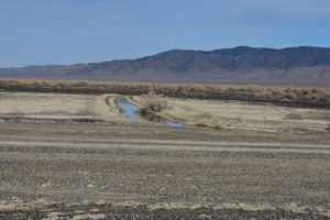
West Northumberland Road Pond #8, looking northeast with Toquima Range in distance. It’s a sizable pond with decent depth but I didn’t find any animals. There’s a little bit of ice yet under the bush although the water temperature in the sun is up to 16 C.
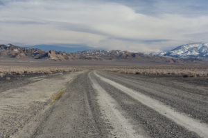
West Northumberland Road Pond #9, looking southeast with Toquima Range in distance and Mount Jefferson at right. It’s not much now but it could be a sizable puddle in wet years like 2019.
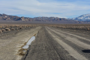
West Northumberland Road Pond #10, looking southeast with Toquima Range in distance and Mount Jefferson at right. There’s a little water left but no fairy shrimp.
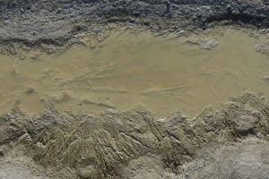
Looking down on West Northumberland Road Pond #10. The lines in the mud at the edge of the puddle are molds of ice crystals. The fact that there are similar features on the bottom of the puddle suggests this part of the puddle freezes solid at night. That’s another hazard for winter-hatching fairy shrimp. They might get frozen in ice days before the puddle finally dries up.
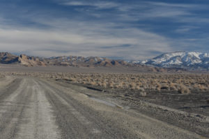
West Northumberland Road Pond #11. Well, here I am at the last pond 5.6 miles from Nevada 376. This makes for 11 possibilities in a short distance. Under different conditions, there were hatches in Pond #7 in 2013 and 2022, in Ponds #1 and #5 in 2019, and in Pond #2 in 2022.
March 1, 2022 Score: Fairy Shrimp 2, No Fairy Shrimp 6, Dry 3
August 30, 2023
The main reason for coming to Big Smoky Valley this time was to look for ponds on the playa that may have filled up due to the mid-August thunderstorms but, of course, I was also interested to see if the numbered ponds along the West Northumberland Road had water. Driving down the road to where I was going to start my hike across the playa, I saw that several of the ponds had water. That presented a good opportunity to verify that the ponds I collected GPS coordinates for in 2022 were, in fact, the most likely locations to have water and to find out what proportion have fairy shrimp.
- West Northumberland Road Pond #1: 2 puddles on south side, 0.5 m x 15 m and 0.6 m x 20 m; both 7 cm deep; water clear or murky (smaller puddle); pale gray, 10-12 mm long fairy shrimp with eggs in smaller puddle; water boatmen.
- West Northumberland Road Pond #2: 2 puddles, south side puddle 1.2 m x 40 m; 5 cm deep; murky water, 29 C at 1715 in 3 cm water; pale gray 10-15 mm fairy shrimp, with eggs; no other animals observed.
- West Northumberland Road Pond #3: 1 m x 30 m; 4 cm deep; murky water; pale gray, 12 mm fairy shrimp, with eggs; water boatmen, dytiscid larvae.
- West Northumberland Road Pond #4: 0.5 m x 10 m; 2 cm deep; opaque water, 30 C at 1645 in 2 cm water; 15 mm fairy shrimp, with eggs; no other animals observed.
- West Northumberland Road Pond #5: dry.
- West Northumberland Road Pond #6: 1 m x 20 m; greater than 5 cm deep; unswimmable clay mush; no fairy shrimp; no other animals observed.
- West Northumberland Road Pond #7: 2 puddles, puddle on north side is unswimmable clay mush, puddle on south side 0.5 m x 1 m; 3 cm deep; opaque water, 30 C at 1620 in 2 cm water; 15 mm fairy shrimp, with eggs; no other animals observed.
- West Northumberland Road Pond #12 (not identified in 2022): 2 m x 27 m; 8 cm deep; murky water; no fairy shrimp; water boatmen.
- West Northumberland Road Pond #8: 1.5 m x 50 m; 5 cm deep; murky water, 29 C at 1515 in 2 cm water; 10-15 mm fairy shrimp, with eggs; black diving beetles.
- West Northumberland Road Pond #9: dry.
- West Northumberland Road Pond #10: 1 m x 30 m; 5 cm deep; cloudy water; brownish 12-15 fairy shrimp, with eggs; no other animals observed.
- West Northumberland Road Pond #11: 0.7 m x 15 m; 4 cm deep; cloudy water; no fairy shrimp; black diving beetles.
Of the ponds with water, 7 had fairy shrimp and 3 did not. 2 were dry.
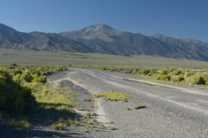
Pond #2 has puddles on both sides of the road. The one on the left (south) side has fairy shrimp. Bunker Hill in the distance.
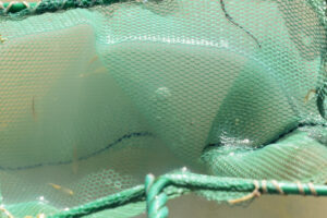
Fairy shrimp in the net at Pond #2, including one that has eggs at lower left.
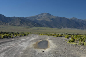
Pond #3 on the north side of West Northumberland Road. Bunker Hill is in the distance.

2 sizes of fairy shrimp in the net at Pond #3. The smaller female at left has eggs.
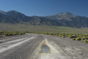
Pond #4 has almost dried up.
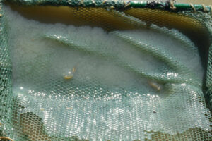
With only about 2 cm of water remaining, Pond #4 still has fairy shrimp. 2 are in the net, a female at left and a male at right.
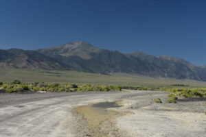
Most of the puddle of Pond #7 north of the road is milkshake-thick clay mush (pale brown in foreground). Bunker Hill is in the distance.
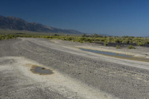
The 2 puddles of Pond #7. The mushy one north of the road at right does not have fairy shrimp. The small puddle south of the road at left does.
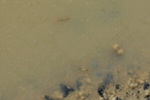
2 fairy shrimp in the clay-rich, opaque water in the smaller puddle of Pond #7 south of the road. The egg-filled ovisac of the fairy shrimp below center is visible but the rest of its body is not. The elongate dark shape above center is also a fairy shrimp.
West Northumberland Road Pond #7 Fairy Shrimp Video 2023-08-30b-cr, Big Smoky Valley.
For a 2-minutes, 20-seconds video of fairy shrimp swimming in West Northumberland Road Pond #7, click on the video player above. There is no audio. The video is of fairy shrimp swimming in the small, southern puddle of Pond #7. The fairy shrimp are steadily moving, dark, elongate shapes that appear near the surface from time to time. One of the more obvious fairy shrimp appears near the center of the view at 1:56, swims toward the lower right to reach the shore, turns to swim to the upper right, turns back toward the shore, and finally drops out of sight at 2:16.
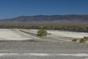
Pond #8, on the north side of West Northumberland Road, is about 50 m long but only 5 cm deep.
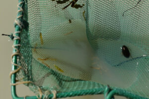
Fairy shrimp and a black diving beetle in the net at Pond #8. Some of the fairy shrimp have eggs. The beetle is likely a predator but fortunately is clinging to the net away from where the fairy shrimp are. After taking the photograph, I quickly dumped the animals back in the water to avoid giving the beetle an unfair advantage should it start moving around.
West Northumberland Road Pond #8 Fairy Shrimp Video 2023-08-30a-cr, Big Smoky Valley.
For a 3-minutes, 5-seconds video of fairy shrimp swimming in a white container at West Northumberland Road Pond #8, click on the video player above. There is no audio. There are several fairy shrimp swimming energetically in a container of cloudy water from Pond #8. Many have ovisacs full of eggs. The container is tilted so that the water is shallower at the bottom of the view and the fairy shrimp are more visible. The fairy shrimp also seem to be attracted to the wall of the container at bottom center, perhaps due to lighting effects. I used a magic marker to scribble on the container walls to make them more visible after I saw in Easy Chair Crater Reservoir Fairy Shrimp Video 2023-04-13b-csr (Southern Pancake Range) that fairy shrimp were swimming straight into them. These Pond #8 fairy shrimp do the same thing though perhaps not as much. For example, at 1:44-1:45 a larger fairy shrimp swims directly into the wall at lower right and then at 1:46, a smaller fairy shrimp turns away before touching the wall at nearly the same location. At 2:35-2:41, 3 successive fairy shrimp loop away from the wall at bottom center before colliding with it. A small, dark, fast-swimming animal briefly appears at 1:39-1:42 and 2:23 and 2 appear at 2:52-2.55. They are the size of a copepod but don’t swim with the jerky motion typical of a copepod. There’s always more to learn.
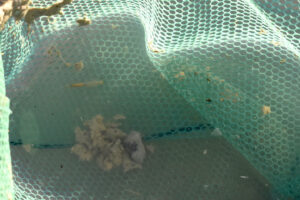
Female fairy shrimp with eggs in the net at West Northumberland Road Pond #10.
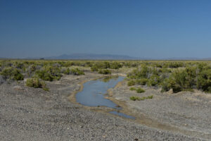
View to the north across Pond #12, with the Simpson Park Range in the far distance. The pond has up to about 5 cm of water but no fairy shrimp.
Smoky Thistle Pond (Mount Lewis BLM Office)
West Northumberland Road Ponds map
Smoky Thistle Pond is 46 km (27.5 miles) south of Austin and 1,050 m (3,440′) southwest of West Northumberland Road Pond #8. The pond is not shown on maps and does not have a clear expression on aerial imagery. Subtle color changes on the imagery suggest its maximum wetted area would be about 90 m x 230 m (300′ x 750′). Thistles are rather uncommon on playas but there were numerous dried stalks east of the pond at the time of the visit.
The pond can be reached by hiking from the West Northumberland Road.
Elevation: 1,673 m (5,490′)
August 30, 2023
The mid-August thunderstorms gave me a chance to look for ponds on the playa even though the chances of fairy shrimp hatching were probably less than in March, when I had previously visited Big Smoky Valley. I decided to scout the playa south of the West Northumberland Road because that would give me a chance to check out the ponds along the road, too. There are ranches west of the “Salt Marsh” that is indicated with the swamp symbol on the 1:100,000-scale BLM map. Hiking east from the West Northumberland Road is the better option and would take me past 2 intermittent ponds shown on the 1:24,000-scale 7.5-minute topographic quadrangle and other features on The National Map aerial imagery that might be dry ponds. I hadn’t identified this location as being a possible pond on the aerial imagery but I saw water not long after leaving the West Northumberland Road. So here I am.
- Approximately 55 m x 130 m; maybe up to 5 cm deep.
- Clear water; 22 C at 1 cm depth at 0945.
- No fairy shrimp.
- No other animals.
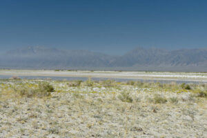
View to southwest across Smoky Thistle Pond with dried stalks of thistles in foreground. The mouths of North and South Twin River canyons in the Toiyabe Range are in the distance at center.
Smoky Hawthorn Pond (Mount Lewis BLM Office)
West Northumberland Road Ponds map
Smoky Hawthorn Pond is 2,770 m (9,090′) west-southwest of West Northumberland Road Pond #8. It is not shown on maps but is outlined by a closed contour on the 7.5-minute topographic quadrangle. On The National Map aerial imagery, it is a bare area within a discontinuous landscape of shrubs and grasses. Its maximum wetted area inferred from subtle pale-dark differences is 75 m x 180 m (250 x 590′). There are small thorny trees, which I guess are hawthorns, in the immediate vicinity.
The pond can be reached by hiking from the West Northumberland Road.
Elevation: 1,672 m (5,490′)
August 30, 2023
I came upon this pond on the way from Smoky Thistle Pond to the easternmost pond shown on the 7.5-minute quadrangle, Smoky Cutbank Pond. The brush and thorny trees indicate the water can’t be too far below the surface even in late summer. There are prismatic or bladed minerals about 1 cm long along the southeastern shore of the pond so TDS is probably quite high. The mud is so soft I had to retreat rather quickly after venturing into the water. Nonetheless, the water is so clear I should be able to see any animals 10 mm long or longer.
- Approximately 50 m x 135 m; likely less than 5 cm deep.
- Clear water.
- No fairy shrimp.
- No other animals.
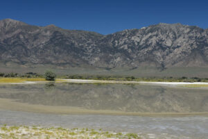
Smoky Hawthorn Pond, with the Deckers Creek area of the Toiyabe Range in the distance. The tree on the far side of the pond has thorns and may be a hawthorn. There are dark green cottonwood trees on ranches in the middle distance.
Smoky Comma Pond (Mount Lewis BLM Office)
West Northumberland Road Ponds map
Smoky Comma Pond is 3,170 m (10,400′) west-southwest of West Northumberland Road Pond #8. It is not shown on maps but is within a closed contour on the 7.5-minute topographic quadrangle. Subtle pale-dark differences on The National Map imagery do not correspond to the observed pond shape. The pond has a curved, comma-like shape with fat ends, concave to the west. Like Smoky Hawthorn Pond, it is within an area of discontinuous grass and shrubbery.
The pond can be reached by hiking from the West Northumberland Road.
Elevation: 1,672 m (5,490′)
August 30, 2023
I still haven’t gotten to the pond shown on the 7.5-minute quadrangle but here’s more water. The mud here is even softer than at Smoky Hawthorn Pond but at least water visibility is good. There are rectangular, tabular crystals on the shore in places.
- About 100 m x 115 m; likely less than 5 cm deep.
- Clear water.
- No fairy shrimp.
- No other animals.
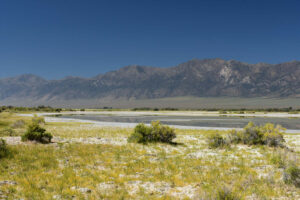
Smoky Comma Pond, looking southwest with the Toiyabe Range in the distance.
Smoky Cutbank Pond (Mount Lewis BLM Office)
West Northumberland Road Ponds map
Smoky Cutbank Pond is 3,400 m (11,150′) west-southwest of West Northumberland Road Pond #8. The middle of the pond is only about 200 m (660′) southwest of the middle of Smoky Comma Pond. On the 7.5-minute topographic quadrangle, the intermittent lake symbol for this pond has dimensions of 100 m x 150 m (330 x 490′). A distinct pale-dark boundary on The National Map imagery has the same shape and dimensions as the map symbol. The northern edge of the pond (but not the water at the time of the visit) is marked by a sharp cutbank up to 50 cm (20″) high. The cutbank decreases gradually to nothing around the east side of the pond. The mud along the shore is firmest where the cutbank is highest. The pond is near the southern edge of a zone of discontinuous grass and shrubs. It has a very shallow drainage channel onto the playa to the south.
The pond can be reached by hiking from the West Northumberland Road.
Elevation: 1,672 m (5,490′)
August 30, 2023
This is the pond on the 7.5-minute quadrangle that I was looking for. The cutbank gives it a well defined shape although the water doesn’t now get up to the cutbank. Unlike Smoky Hawthorn Pond and Smoky Comma Pond, which are somewhat protected from the wind by brush, this one is open to the south. Maybe the cutbank was formed by strong winter winds splashing water against the northern shore. Like the barren ponds I’ve previously seen today, the mud is soft and the water is very clear.
- About 135 m x 200 m (this is inconsistent with the larger National Map and imagery dimensions but was paced off); greater than 5 cm deep.
- Clear water; 28 C at 1140.
- No fairy shrimp.
- No other animals.
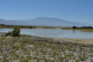
Looking to south across Smoky Cutbank Pond, with Mount Jefferson in the distance. The cutbank along the northern shore starts by the bush at left.
Smoky Sinuous Pond (Mount Lewis BLM Office)
West Northumberland Road Ponds map
Smoky Sinuous Pond is 3,725 m (12,220′) west-southwest of West Northumberland Road Pond #8. The southern end is 370 m (1,210′) northwest of the middle of Smoky Cutbank Pond. The 7.5-minute topographic quadrangle shows an intermittent lake symbol about 580 m long and 90 m wide (1,900 x 395′) for the pond. On the ground, the pond area is a curving, elongate feature connecting puddles of water. The appearance of sinuosity is enhanced by the discontinuous, curving puddles. Smoky Sinuous Pond is at the western edge of a zone of discontinuous grass and shrubs. It evidently drains to the northwest into the inlet to The Granites Playa Lake.
The pond can be reached by hiking from the West Northumberland Road.
Elevation: 1,672 m (5,490′)
August 30, 2023
This is the other pond that is shown on the 7.5-minute quadrangle in addition to Smoky Cutbank Pond. It’s just a few isolated puddles now and they are surrounded by very soft mud.
- Approximately 20 m x 50 m and 15 m x 30 m for 2 puddles; both likely less than 5 cm deep.
- Clear water.
- No fairy shrimp.
- No other animals.
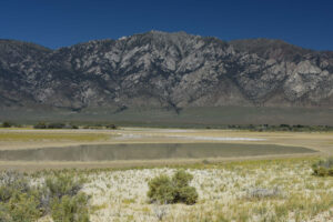
The southernmost puddle of Smoky Sinuous Pond. Another puddle can be seen in the middle distance at right below the dark green cottonwood trees on a ranch. The Deckers Creek area of the Toiyabe Range is in the distance.
The Granites Playa Lake Inlet (Mount Lewis BLM Office)
West Northumberland Road Ponds map
The Granites Playa Lake Inlet is 4.6 km (2.8 miles) west of West Northumberland Road Pond #8 and 5.0 km (3.0 miles) southwest of Pond #1. It is not a pond. The channel can be seen on both the 7.5-minute topographic quadrangle and The National Map imagery. Upstream of the fairy shrimp locality, the 7.5-minute quadrangle shows a western branch of the inlet continuing to the northeast across an “Alkali Flat” to Aiken Playa Lake.
At the fairy shrimp locality, there are relatively deep troughs in the inlet channel and there is vegetation along the banks. Immediately below the fairy shrimp locality, the channel turns to the west and cuts a deeper hole through the mud. There were no fairy shrimp in that deeper section during the August 2023 visit. Less than 50 m downstream of the deeper section, the channel turns to the south and water eventually disappears before reaching the water on the playa. At the time of the visit, water in the channel was visibly flowing but high spots with vegetation between the troughs may have kept the fairy shrimp from being carried downstream. Water velocities could have been negligible close to the bottoms of the troughs.
The inlet locality can be reached by hiking from the West Northumberland Road.
Elevation: 1,671 m (5,480′)
August 30, 2023
As I was heading for the playa lake directly from the northern part of Smoky Sinuous Pond, the mud got too soft. I turned west and crossed the inlet hoping to find a route with firmer mud. I was surprised to see water in the inlet and fortuitously looked at the water long enough to notice fairy shrimp. Although slow swimmers, the fairy shrimp weren’t struggling to avoid being carried away by the current. I don’t know whether the fairy shrimp were swept to this location from a pond somewhere upstream or they hatched from eggs stuck in the mud or vegetation here but I thought it would be worthwhile to document the occurrence.
- Channel is up to 1 m across and water depths greater than 2 cm extend for 50 m or so; depth is greater than 20 cm in one trough of the channel.
- Clear water; 28 C at 1240.
- 10-15 mm fairy shrimp and maybe some 8 mm; didn’t see eggs.
- Black diving beetle about 10 mm long, water boatmen (sub-order Heteroptera, family Corixidae) less than 5 mm long, maybe cladocerans 1-2 mm long.
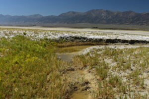
The Granites Playa Lake Inlet fairy shrimp locality. Fairy shrimp are swimming in the trough of water at bottom but not in the deeper trough at center. Grass and mud separating the troughs may help keep the fairy shrimp from being carried farther downstream. The mud flat of The Granites Playa Lake is in the middle distance and the Toiyabe Range is in the far distance.
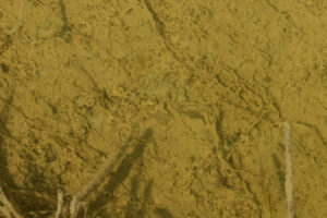
Fairy shrimp in The Granites Playa Lake Inlet. There is a pale gray, translucent fairy shrimp longer than 10 mm at center and possibly another smaller one below it about half way to the bottom of the photograph.
The Granites Playa Lake (Mount Lewis BLM Office)
West Northumberland Road Ponds map
The Granites Playa Lake is 46 km (27.5 miles) south of Austin and 4.7 km (2.8 miles) west-southwest of West Northumberland Road Pond #8. The 1:100,000-scale BLM map has an area of marsh symbol labeled “Salt Marsh” that almost fills up a 1 square mile section (2.6 square kilometers). On the 7.5-minute topographic quadrangle, there is an approximately rectangular, perennial lake symbol 1,200 m wide by 1,800 m long (3,940′ x 5,910′) that is indented on the south side. The nearly straight northern, western, and eastern sides suggest the lake was excavated. Even so, it is in a natural low. The lake receives water from irrigated lands on the ranches to the west and from a few generally dry streams.
The Granites Playa Lake can be reached by hiking west from the West Northumberland Road. There is private land to the west and northwest of the lake.
Elevation:1,671 m (5,480′)
August 30, 2023
Water on the playa is fairly extensive. I tried to get to the water from the north but couldn’t even get close because of the soft mud. It was clear I wouldn’t be able to find out if it has fairy shrimp or not today. I continued looking for a better approach that I might use in the future and found this, on the eastern side. Here the mud is a little firmer and there is an embayment where I can actually walk into the water, briefly, although it is not even a centimeter deep.
- Too big and flat to estimate size but greater than 500 m in both dimensions; depth unknown.
- Clear water.
- Couldn’t get to water so presence of fairy shrimp and other animals is indeterminate.
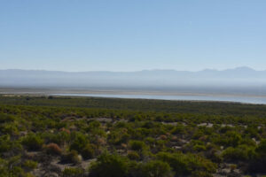
The northern part of The Granites Playa Lake, from Nevada 376. There are extensive mud flats to the north (left) and on the far side of the water. I don’t know where the smoke is coming from but it is true to the name Big Smoky Valley.
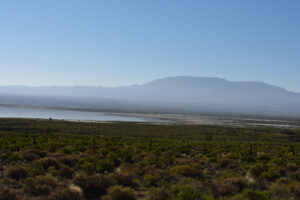
The southern part of The Granites Playa Lake, from Nevada 376. The brush-free playa does not extend much beyond the water’s edge. Maybe the mud would be firmer on this end of the lake.
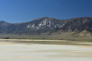
Looking west across the eastern lobe of The Granites Playa Lake. Cliffs and spires of The Granites locality in the Toiyabe Range are in the distance. The dark cottonwood trees mark ranches. Paler colors in the foreground indicate drier mud.
Aiken Playa Lake (Mount Lewis BLM Office)
West Northumberland Road Ponds map
Aiken Playa Lake is 42 km (25 miles) south of Austin. The southwestern edge of the lake is 140-200 m (460′-660′) north of the West Northumberland Road between Pond #1 and Pond #2. On the 7.5-minute topographic quadrangle, the intermittent lake symbol has an approximately triangular shape with a base of 890 m (2,920′) parallel to West Northumberland Road and a height of about 1,000 m (3,280′).
Elevation: 1,675 m (5,500′)
August 30, 2023
Shrubs in the water on the southwestern side suggest a high water level but a shoreline several meters from the greasewood on the southeastern side suggests the lake is not full. The mud on the southeastern shore is firmer than that around The Granites Playa Lake so I can walk to the edge of the water but not much further.
- Probably about 700 m x 900 m for base and height; depth at least 20 cm based on mostly submerged avocet legs.
- Clear water; 28 C at 2 cm depth at 1740.
- No fairy shrimp.
- Avocets.
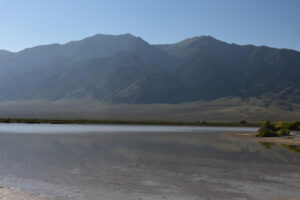
View to the west across Aiken Playa Lake. Aiken Creek is in the deeper valley in the Toiyabe Range in the distance. The steeper slope and firmer mud of the shoreline by the bushes at right allowed me to walk along the edge of the water in my search for fairy shrimp.
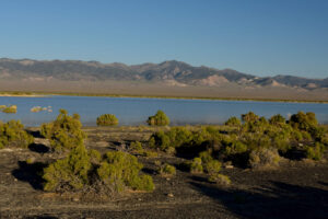
Aiken Playa Lake, looking southeast from near the West Northumberland Road with the Toquima Range in the distance. The dark rock is gravel that was hauled in for the road. Greasewood bushes in the water here suggest a high water level but that is not the case elsewhere around the lake. It is less apparent on the ground but The National Map aerial imagery shows that West Northumberland Road forms the linear southwestern boundary of the lake. Aiken Playa Lake may be entirely anthropogenic or there may previously have been a natural depression encompassing part of the lake. Spot elevations provided by The National Map for my collected GPS localities indicate the shore of Aiken Playa Lake is about 4 m higher than the shore of The Granites Playa Lake.
Smoky Tamarisk Slough (Mount Lewis BLM Office)
West Northumberland Road Ponds map
Smoky Tamarisk Slough is 39 km (23 miles) south-southeast of Austin. It is 6.4 km (3.8 miles) northeast of West Northumberland Road Pond #1. The 7.5-minute topographic quadrangle has an irregular, perennial lake symbol for the Slough that is 840 m (2,760′) long, up to 100 m (330′) wide, and has a hook at the northeastern end. This shape and extent cannot be corroborated with current National Map aerial imagery but the 1983 aerial photographs must have had something for those who made the topographic quadrangle to work from.
Access to Smoky Tamarisk Slough is tricky because recent reconstruction along Nevada 376 did not provide a ramp to the access road. However, the wire gate through the fence is still there. The access road is identified as the “Old Hay Rd” on The National Map. It turns east off Nevada 376 18.8 miles south of US 50 and 0.8 miles south of the county boundary. The turn is 130 m (430′) north of a good ranch access road and on the north side of the ditch for Bowman Creek. The access road is rough and disused and diverges from a fence line about 280 m (920′) from the highway. After another 0.7 miles, the access road joins a better road from the ranch. It is about another 1.5 miles to the junction with a road that goes almost due south. You could park there or follow the road to the south a ways to get around the fences.
The parking spot is close to private land and an uninhabited ranch with big cottonwood trees. Fences around the ranch do not follow the public-private property boundary so one must use inference and discretion in avoiding the private land and crossing the fences. One must cross at least 1 fence to get to Smoky Tamarisk Slough.
Elevation: 1,685 m (5,530′)
September 1, 2023
I had to park on the shoulder of the highway and walk around to figure how to get through the wire gate from the highway. In spite of the perennial lake symbols on the 7.5-minute quadrangle for Smoky Tamarisk Slough and nearby ponds, they all looked dry until I spotted some water from a low, vegetated sand dune. There are green grass and tamarisk along the shores of the slough and floating green algae in the water. The water is segmented into pools so length is highly uncertain. The coordinates were collected at the southwestern end of the largest pool that I saw. The mud below the shoreline is too soft for wading.
- Likely more than 500 m long, up to 50 m wide in places; depth not estimated.
- Cloudy water but locally clear in lee of shrubs; 16 C at 1115 in 2 cm water.
- No fairy shrimp.
- Ducks, wading birds, water boatmen, a few alkali(?) flies.
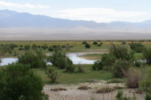
Looking across Smoky Tamarisk Slough to the Toquima Range. There is a wading bird at center.
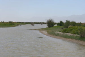
Looking south along Smoky Tamarisk Slough to dust blowing up off the floor of Big Smoky Valley and obscuring the Toiyabe Range. Blowing dust is good for spreading fairy shrimp eggs around but bad for cameras and for viewing pond inhabitants. The larger shrubs are tamarisk.
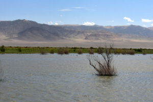
Ducks on the water of Smoky Tamarisk Slough, with the Toquima Range in the distance.
What Can We Learn from the Ponds in Big Smoky Valley?
Several ponds in ditches along the western part of the Northumberland Mine Road have fairy shrimp. They have hatched in both late winter (March) and summer (July, August). Fairy shrimp have been seen at least once in 8 of 12 ponds and more than once in 3 of the ponds. Like fairy shrimp of “Carson Lake” Playa and the Candelaria Hills, these roadside fairy shrimp can tolerate high levels of turbidity due to suspended clay.
6 natural ponds on the floor of Big Smoky Valley did not have fairy shrimp after thunderstorms in August 2023. 2 of these had water with high TDS concentrations as indicated by the presence of macroscopic, euhedral mineral crystals along their shorelines. 3 others nearby in the same environment probably did.
2 playa lakes had water after a wet winter-spring and thunderstorms in August 2023. One did not have fairy shrimp and the other could not be reached due to soft mud. Mud in and around the playa lakes may be more firm in the spring as water levels rise from winter/spring snowmelt after having been dry for several months. The playa lake that could not be reached is labeled “salt marsh” on the 1:100,000-scale BLM map and could be suitable habitat for the genus Artemia, which was not found in any roadside pond.
Fairy shrimp that were not of the genus Artemia were found in the slowly flowing inlet to the unreachable playa lake. It would be interesting to find out if this is a persistent population.