“Alkali Lake”
Snowmelt Swales Ponds
Burkham Tank Pond
What Can We Learn from the Ponds in Alkali Valley?
Alkali Valley is a small valley which extends north from the northeast end of the “Mono Lake” basin. The valley is bounded to the east by uplifted rocks of the Wassuk Range but to the west are volcanic rocks less than 4 million years old. Such young volcanic rocks are common in the “Mono Lake” area. The southern part of the valley is a broad area of flat land 7-10 km (4-6 miles) across. The northern part is more like a valley, being about 7 km (4 miles) long and 4 km (2.5 miles) wide.
The floor of Alkali Valley is at 2,150-2,200 m (7,050-7,220′). The top of Mt. Hicks to the west is 2,869 m (9,410′) but most of the area to the west is below 2,500 m (8,200′). Powell Mountain in the Wassuk Range to the northeast is 2,905 m (9,530′) but the mountains decrease in elevation to the south along the east side of Alkali Valley.
Much of Alkali Valley is covered by sagebrush but rabbitbrush is also common. No perennial streams enter or leave the valley. Only a few short intermittent streams are shown on the 1:100,000-scale BLM map.
Alkali Valley is entirely within the Bridgeport Ranger District of the Humboldt-Toiyabe National Forest. There are no in-holdings of private land. California 167 and Nevada 359 (the numbers change at the border) crosses the southern edge of Alkali Valley.
“Alkali Lake” (Bridgeport Ranger District, Humboldt-Toiyabe National Forest)
___This map is a screenshot of The National Map (Go to The National Map). The U.S. Geological Survey generally does not copyright or charge for its data or reports (unless printed). A pond location is indicated by an “X”, which corresponds to the coordinates given in the data spreadsheet. Labels in quotations are from 7.5-minute topographic quadrangles.
___Red lines are the U. S. National Grid with a spacing of 1,000 m and intersection labels consisting of the UTM zone (e.g., 11S, 12T), a 2-letter 100-km square designation (e.g., LC, XN), and a 4-digit number. The first 2 digits of the number represent the 1,000-meter Easting and the second 2 digits the 1,000-meter Northing, as seen in the example Easting and Northing. Unlike latitude and longitude, the National Grid is rectilinear on a flat map, the units of abscissa and ordinate have equal lengths, and the units (meters) are measurable on the ground with a tape or by pacing.
___There is no private land on this map. All lands are public.
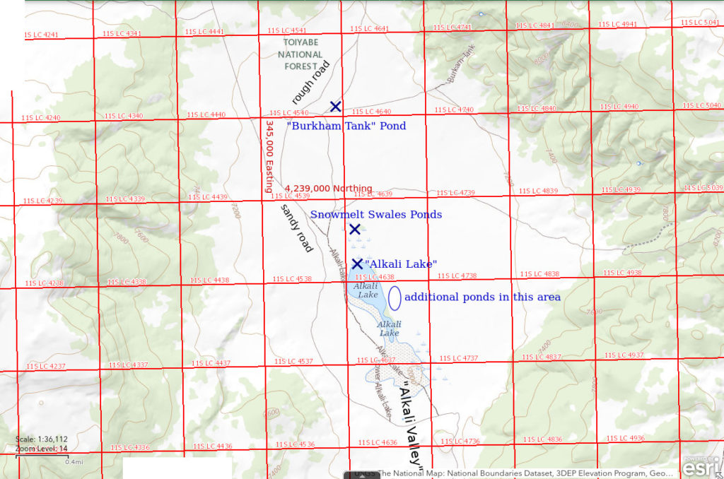
“Alkali Lake” is in the northern part of Alkali Valley approximately 30 km (19 miles) southwest of Hawthorne. The intermittent lake symbol on the 1:100,000-scale BLM map is only about 250 m x 850 m (820′ x 2,790′) and is less than the actual size of the nearly barren mud flat. The National Map and the 7.5-minute topographic quadrangle have an additional stippled area bordering and to the south of the intermittent lake symbol. This adds about 100 m (330′) to the width and 700 m (2,300′) to the length of the potential playa lake.
There is another “Alkali Lake” in the northwestern corner of Nevada. It is in Long Valley 9 km (5.4 miles) north of Vya and is shown on the official State Highway map.
“Alkali Lake” is about 11 km (6.8 miles) south of the Borealis Mine and 12 km (7.4 miles) east of Aurora. Easiest access is from the north on Forest Service System road #158 (as shown on the Humboldt-Toiyabe National Forest’s recreation map of the Bridgeport Ranger District). Except near the lake, mud is not a problem but sand can be. Alkali Valley has abundant sand blown from the “Mono Lake” basin during periods of colder, drier climate. A short track leads from road #158 to the northwestern edge of the lake. It is safer to park at the edge of the sagebrush than to drive across the grass toward the lake as the ground can be very soft when wet and it may not look soft when it is.
Locally abundant obsidian debris near the lake indicates use by native Americans. There is an obsidian source on Mt. Hicks and the spring at the northwest end of “Alkali Lake” may have attracted the obsidian artisans. During wetter times, there may also have been abundant ducks and duck eggs.
Elevation: 2,135 m (7,005′)
June 7, 2017
Although this is late in the season, the spring has been relatively wet overall. Water is present and surrounded by a mineral-crusted mud flat. The ground is too soft to approach the water without the rubber boots I didn’t bring. The cool-water spring on the northwest side of the lake has tadpoles and lots of flies, possibly alkali flies.
- Possibly 100 m across and maybe 200 m long; looks very shallow.
- Clarity not noted.
- Couldn’t get close enough to look for fairy shrimp.
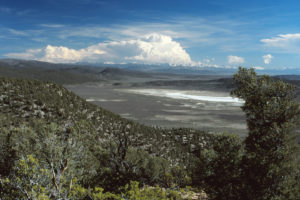
“Alkali Lake” from the north, with thunderheads building over the Sierra Nevada in the distance. “Mono Lake” basin is in the middle distance at far right. This photo is from May 2001, when I did not visit the lake, but is a good overview.
June 14, 2017
Only a few shallow pools of water remain on the playa in spite of recent precipitation that made me hopeful for more water, not less. There are abundant mineral precipitates on the bottom of the very shallow water and even some floating white and yellowish minerals. A few dead flies (alkali flies?) are floating on the surface. The spring still has tadpoles.
- Pools less 50 m across on playa; probably less than 10 cm deep.
- Water is clear except for floating minerals.
- No fairy shrimp.
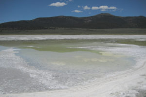
Rapidly shrinking pools of water on the mineral-crusted shore of “Alkali Lake”. Mt. Hicks is in the distance to the west.
May 23, 2018
There is clear water over about one-quarter of the surface of the playa following a significant rain and it is up to the grass on the west side. Tufts of vegetation allow the water to be approached without rubber boots. The spring has frog eggs and backswimmers (family Notonectidae of insect sub-order Heteroptera).
- Could be 200 m x 300 m; depth probably less than 20 cm deep.
- Clarity not noted.
- No fairy shrimp.
- Flies (alkali flies?) on water surface.
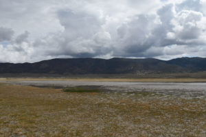
View north across “Alkali Lake” from west side. The Wassuk Range is in the distance. The spring is off the left edge of the photograph, not in the green grass at center.
March 15, 2019
Road #158 is blocked by snow about 5.5 km (3.4 miles) north of the lake. I abandoned the attempt to get to the lake.
March 25, 2019
Road #158 is still blocked by snow but I came prepared and walked. Water in the lake is extensive, even reaching the grass on the north shore of the lake. Strong wind makes the water too turbulent to see animals in it. Abundant bits of churned up vegetation also make it difficult to see if small fairy shrimp are caught in the net.
- Looks like 300 m x 500 m or more; depth not estimated.
- Water cloudy due to turbulence.
- Water too turbulent to see if fairy shrimp are here or not.
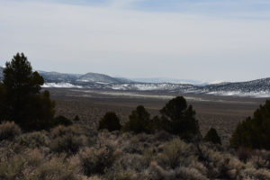
Finally, a watery “Alkali Lake”. View is looking south with Glass Mountain to the southeast of “Mono Lake” on the horizon.
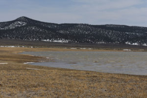
White caps on the water of “Alkali Lake”, looking northeast from north end of lake. Turbulence and suspended clay and vegetation debris make it impossible to see if fairy shrimp are present. White at edge of water to left of center is foam, not snow. Snowmelt Swales Ponds are in the brush on the far side of the lake.
April 18, 2019
No snow on the road in. The lake level has fallen but is still up to the grass on the west and north shores. Mineral precipitates along east shore suggest high TDS concentration in water. The spring has clear, brown, scummy water with numerous black diving beetles of various sizes up to 25 mm.
- Probably at least 200 m x 400 m; depth up to 20 cm as far as I waded.
- Water nearly opaque but bottom can be seen at shallowest, grassy edges.
- Common (2-10 per net) pale gray fairy shrimp 15-20 mm long.
- Few water boatmen (sub-order Heteroptera, family Corixidae), flock of ducks, maybe some phalaropes, and what could be a white-faced ibis.
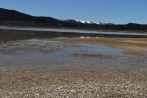
View southeast across very shallow lobe of “Alkali Lake” where water is up into grass in the foreground and fairy shrimp were observed.
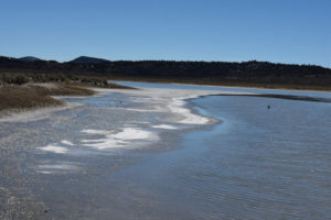
Looking southeast along the sandy northeast shore of “Alkali Lake”. White minerals precipitated on the shore suggest higher TDS than for the contemporaneous Snowmelt Swales Ponds. The dark object in the water is a wooden post.
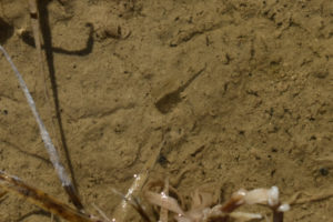
Single male fairy shrimp in lobe of shallow water of “Alkali Lake” north of spring. Although indistinct, the antennae II appear to be long with stout tubular basal segments. This is sufficient to conclude that this fairy shrimp is not of the genus Artemia, which one would expect based on the observations of June 14, 2017.
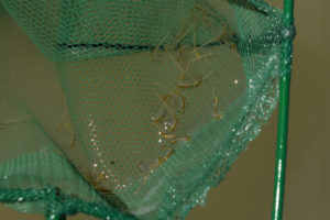
Fairy shrimp netted along the north shore of “Alkali Lake”. These are smaller than those in the Snowmelt Swales ponds and the females have shorter, fatter ovisacs. The ovisacs are not like those of the genus Artemia, which inhabit high-TDS water. Antennae II can be seen on some of the males at upper right. The distal segments are tubular, bent near the junction with the basal segments, and approximately as long as the basal segments. This further distinguishes this species from Artemia species. The distal segments are not observably different from those of the males in Snowmelt Swales Ponds (e.g., photograph Snowmelt Swales Ponds 2019-04-18, #09c, below). Maybe the “Alkali Lake” and Snowmelt Swales Ponds species are the same, maybe not.
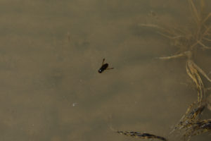
A water boatman (Corixidae family of sub-order Heteroptera) on “Alkali Lake”. These are not predators of fairy shrimp. Water boatmen inhabit waters with a wide range of TDS, up to and greater than that of seawater (Van de Meutter and others, 2010; see the References page). The presence of water boatmen in “Alkali Lake”, then, doesn’t help me guess what the TDS of the lake is but they’re fun to watch.
June 19, 2019
The lake still has extensive water. The water is so clear I can see quite a ways just standing on the shore.
- Less than 200 m across; depth probably less than 10 cm.
- Water is clear.
- No fairy shrimp.
- Common 10 mm long insect larvae (alkali flies?) floating at or near surface of water and piling up in masses along the shore due to the wind; 10 gulls standing around on the shoreline and not doing much.
April 2, 2021
Too late for fairy shrimp. The playa now has extensive white mineral crusts. It also has small patches and streaks of water along the north shore where groundwater is apparently seeping out onto the playa.
- Dry.
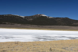
View west across “Alkali Lake” with Mt. Hicks in the distance. The gray areas have thin films of water which have seeped out onto the playa.
July 6, 2023
I had unexpectedly seen water in “Alkali Lake” while hiking in the Wassuk Range. There seemed to be a lot of water. There was no rim of white mineral efflorescence around the water. I managed to visit within a couple of weeks. The down side of thunderstorms that may provide life-giving waters to fairy shrimp is that roads get washed out. What had been a manageable rut in Forest Service System Road #158 now takes up half the road. It can’t be straddled and it is so deep that allowing the wheels of one side to follow the rut results in a severe tipping hazard even if the vehicle doesn’t get high-centered on the edge of the rut. There is an alternate route from the north but I can’t recommend it and I haven’t tried the route from California 167 to the south.
- Likely 500 m wide and more than 1,000 m long; depth greater than 30 cm.
- Water is clear; 21 C at 0945.
- 15-20 mm long fairy shrimp; females very rarely have visible short ovisac with eggs.
- Water boatmen, backswimmers, black diving beetles, alkali flies(?), blue dragonflies, gulls, ducks, grebes.
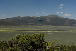
Looking west across “Alkali Lake” with Mount Hicks on the far side. The water covers all of the mud flat and extends up into the vegetation along the shore.
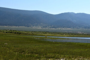
Gulls, probably sated, taking it easy at the north end of “Alkali Lake”. There are no safe nesting locations here so they may be from “Mono Lake”. The haze is not from a wildfire, it is apparently pinyon pollen.
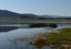
View to southeast down the length of “Alkali Lake”. Ducks and grebes are circling around the spring, which is marked by the tall vegetation. I have never seen the water this high before. There were thundershowers in late May, early June, and mid-June but this depth of water suggests some of the water may be snowmelt from the winter, too. The Snowmelt Swales Ponds north of the lake do not have water.
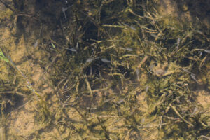
Common fairy shrimp in “Alkali Lake”. Here, they are swimming above inundated grass. They are blurred due to the slow 1/40-second shutter speed. Only 1 of the fairy shrimp in this view looks like it might have an ovisac with eggs.
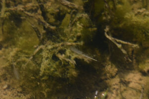
A male fairy shrimp in “Alkali Lake”. Its antennae II are extended above the legs and are visible against the shadowed background. The distal segments appear to be bladed rather than tubular and fatter in the middle than at either end. I had previously surmised that the distal segments of antennae II of males in “Alkali Lake” were tubular based on photographs “Alkali Lake” 2019-04-18, #06c and “Alkali Lake” 2019-04-18, #13. Those photographs aren’t clear enough for a definitive choice. The case for tubular distal segments is somewhat better for the males in Snowmelt Swales Ponds based on photographs Snowmelt Swales Ponds 2019-04-18, #09c and Snowmelt Swales Ponds 2019-04-18, #11c. Bladed distal segments would be consistent with the species Branchinecta campestris, which is adapted to waters with high-TDS, (and Branchinecta coloradensis, which is not) whereas tubular distal segments would be consistent with the species Branchinecta mackini, which is common in clay-rich waters, BTANSD.
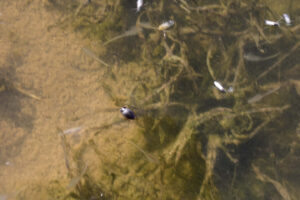
A small black, diving beetle came up for air in “Alkali Lake”. This might be a predator but I can’t identify different kinds of beetles.
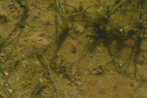
Water boatmen in “Alkali Lake”. There is a water boatman at center, above the fairy shrimp, and another to the right. They are on the bottom of the pond and well camouflaged but each has a glint of light reflecting from the end of its body.
“Alkali Lake” Fairy Shrimp Video 2023-07-06a-cr, Alkali Valley.
For a 1-minute, 3-seconds video of fairy shrimp in “Alkali Lake”, click on the video player above. There is no audio. There are abundant fairy shrimp swimming between the grass stems. There are also numerous alkali(?) flies on the surface of the water, which create distracting shadows. The different sizes of fairy shrimp indicate they did not all hatch on the same day. A particularly large fairy shrimp swims to right of center at 0:18. A small, black diving beetle comes up to the surface for air at 0:56.
“Alkali Lake” Fairy Shrimp Video 2023-07-06b-csr, Alkali Valley.
For a 2-minutes, 2-seconds video of fairy shrimp in “Alkali Lake”, click on the video player above. There is no audio. The video slows to half speed after 7 seconds to make it easier to follow individual fairy shrimp. A few fairy shrimp have a bright white splotch near or at the upper end of the abdomen. This could be eggs in the ovisac or oviducts, respectively. In spite of the presence of likely unfertilized eggs, I do not see any males trying to copulate with females. A large male with long antennae II swims to right of center at 1:09-1:13. None of the fairy shrimp appear to take evasive action, such as flicks of the abdomen, unlike many of the fairy shrimp in clay-rich water. Whether the evasive maneuvers in the clay-loving fairy shrimp are instinctive and automatic or a response to a stimulus, such as a predator, the fairy shrimp in “Alkali Lake” aren’t doing it as I view them. Predators such as gulls and ducks are present at the lake but not in my vicinity. If the fairy shrimp in “Alkali Lake” do take evasive action in the presence of gulls or ducks, they evidently don’t confuse me with a gull or duck.
“Alkali Lake” Fairy Shrimp Video 2023-07-06c-r, Alkali Valley.
For a 1-minute, 49-seconds video of fairy shrimp in “Alkali Lake”, click on the video player above. There is no audio. In walking slowly through the water as I film this video, I find that the density of fairy shrimp doesn’t change much and that they don’t engage in any sort of flocking behavior. There may be a complete lack of coordination of swimming behavior as it’s hard to find even 2 fairy shrimp swimming in the same direction for more than a moment. This may actually be a good defensive strategy, though, as the confusing appearance of fairy shrimp going every which way could make it hard for a predator to choose which one to eat. The end of the video shows about a dozen gulls watching me unperturbed from the north end of the lake.
September 15, 2023
There were thunderstorms in western Nevada in mid-July, mid-August, and a few days ago. The water in “Alkali Lake” is still high, the spring is still under water, and there is still no white mineral efflorescence around the edge of the lake. The shoreline has pulled back maybe 20 m from where it was in early July. This lake will last into the winter. Based on the pan evaporation rates for “Ruby Lake” (see “Pond Duration” on the About page), the lake could lose 8 cm during the rest of September (5.3 mm/day rate), 10 cm in October (3.2 mm/day rate), and maybe 6 cm in November (1.9 mm/day rate at Fallon Experimental Station). Would the fairy shrimp hatch next year if the lake never dries up?
- Maybe 400 m x 1,000 m; depth greater than 20 cm and probably still deeper than 30 cm.
- Clear water; 17 C at 1030.
- Indeterminate – couldn’t see any fairy shrimp from the shore.
- Water boatmen, lots of alkali(?) flies, ducks, grebes.
With this much water, TDS can’t be a problem. Cooler weather is unlikely to be a problem because many fairy shrimp species hatch at temperatures down to 5 C (including Branchinecta campestris and Branchinecta mackini, see Temperature on the Habitats of Fairy Shrimp page). I don’t think the birds could have eaten them all. Maybe fairy shrimp are still here.
To follow up, I got a glimpse of water, or ice, in “Alkali Lake” on November 21 while hiking in the vicinity. The water will probably last through the winter.
March 14, 2024
There were no tracks on the road south of the Borealis Mine past the turn-off to the water well that the mine crew evidently visits from time to time. Snow drifts across shadowed parts of the road were firm and passable. I parked before reaching the section of road washed out last year as the snow across the road was getting more continuous. The lake looks almost as full as it was last September. The edge of the water is just above the spring on the northwestern side of the lake. There is mushy ice up to 3 m across along parts of the western and northern shores where I walked.
- Probably up to 450 m wide and 1,500 m long; maximum depth greater than 25 cm as on April 16 visit.
- Clear to murky water; 3 C at 1215.
- No fairy shrimp.
- No other animals observed.
With this much water, it’s clear the lake never dried up over the winter. Using an April pan evaporation of 4.3 mm/day for “Ruby Lake” (see Pond Duration on the About page), 20 cm of water could last until the 1st of May. Unlike the case for Snowmelt Swales Ponds, there’s plenty of time yet.
April 16, 2024
The access road from the north has been bladed from the Borealis Mine to the northwestern end of Alkali Valley and I drove it without using 4WD. The huge rut is gone but the road is still rough in spots. The lake area is less than on the March visit but not by much. There is a bit of land showing adjacent to the spring on the northwestern side of the lake but there is still a very mushy, wet zone west of the spring. Consequently, the lake surface is probably very close to that shown on the 7.5-minute topographic quadrangle but maybe a little longer.
- Probably up to 400 m wide and 1,200 m long; maximum depth greater than 25 cm.
- Murky water; 18 C at 1200 in 3 cm water, warmer than air.
- Pale gray fairy shrimp of various sizes from 10 to 20 mm or so; large and small sizes have eggs.
- Rare water boatmen less than 5 mm long (sub-order Heteroptera, family Corixidae), alkali(?) flies, wrigglers, avocets, ducks, willets or similar sand piper-like birds; a strange noise by the spring may have been a frog.
The persistence of “Alkali Lake” through the summer, fall, and winter of 2023 due to the unusually wet weather and through the winter and spring of 2024 offer the opportunity of testing the hypothesis that the eggs of fairy shrimp inhabiting ephemeral ponds need a period of drying before they will hatch (e.g., Vanschoenwinkel and others, 2010). These fairy shrimp have disconfirmed that hypothesis. They remained wet and they hatched. Of course, there may be some populations that do need a period of drying but observing that no wet eggs hatched in one year doesn’t mean they need to be dried. Wet eggs might hatch under the same or other conditions in a different year.
The above disconfirmation of the need for drying is not perfect. The wet eggs that hatched this year could have been old eggs that had dried in a previous year.
The above proof of falseness is not new. Brown and Carpelan’s (1971) experiments demonstrated that some eggs of Branchinecta mackini from “Rabbit Dry Lake” hatch without being dryed.
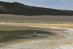
2 pairs of avocets on the northern shore of “Alkali Lake”. After a couple of reconnaissance sorties, they have calmed down and are not dive-bombing me anymore.
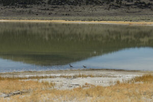
These 2 birds on the northern shore of “Alkali Lake” may be willets. They have long, straight bills and long necks like willets but their plumages do not match what my Audubon Field Guide to North American Birds says. Instead, the heads and necks are uniform gray, the backs are speckled brown and gray, the wings are dark, and the chests and bellies are pale.
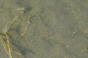
A fairy shrimp in shallow water along the northeastern shore of “Alkali Lake”. The fairy shrimp is backside up and presumably feeding on the sandy bottom. Net sweeps in this area along the bottom of the lake 5-10 cm deep often caught numerous fairy shrimp even if they weren’t visible in place.
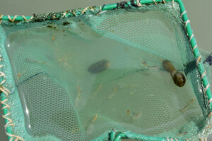
Fairy shrimp and water bird turds caught in the net along the northwestern shore of “Alkali Lake”. I didn’t catch any fairy along the northwestern shore of the lake until I got out into deeper water south of the spring beyond the previously inundated vegetation. The lake bottom in areas of previously inundated vegetation is covered by microbial mats. The large range in sizes of the individuals in the net may reflect episodic warmings of the water and hatching of eggs in March and April. The eggs are generally pale, brownish-yellow but the ovisacs commonly contain dark brown material secreted by the shell glands (e.g., Moore, 1963). I don’t think I’ve seen such conspicuous shell gland secretions before. The presence of eggs in the ovisacs of large and small fairy shrimp indicates that the females of this population continue growing as they produce successive clutches. This is contrary to the natural growth patterns of Eubranchipus bundyi (Daborn, 1976) and Branchinecta mackini (Daborn, 1977) which slowed down after sexual maturity. This could be due to a temperature effect as Branchinecta orientalis that were raised at a temperature of 12 C grew faster after reaching sexual maturity than those raised at higher temperatures (Atashbar and others, 2012).
May 16, 2024
It’s been warm in western Nevada the past couple of weeks so there could have been a lot of evaporation from “Alkali Lake”. Parking by the lake, I notice the grassy soil for hundreds of meters around the lake has abundant white mineral efflorescence as the surface finally dries out. The shore of the lake, though, has only a narrow band of white crust, generally less than 10 m across. The big question then is has the TDS increased enough to exceed the tolerance limit of the fairy shrimp I saw a month ago? If so, have they been replaced by a species of Artemia that is more tolerant of high TDS concentrations?
- Maybe 375 m wide, now, and 1,100 m long; maximum depth greater than 25 cm.
- Clear water but it looks murky due to the pale microbial mat on the bottom; 26 C at 1500 in 5 cm water.
- Pale gray fairy shrimp 15 to 25 mm; most have eggs; many fairy shrimp corpses and some are barely swimming.
- Alkali(?) flies, legless cylindrical larvae about 10 mm long, gulls, avocets, ducks or grebes too far away to distinguish, northern phalaropes.
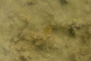
A male fairy shrimp with conspicuous, long antennae II in “Alkali Lake”. This is definitely not the genus Artemia. This is probably the same species and the same generation that I saw a month ago. The pond bottom is covered by a pale microbial mat here and pretty much everywhere else I went. I don’t remember seeing such extensive microbial mats before. I wonder what they do to the ecology.
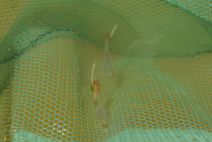
2 female fairy shrimp in net at “Alkali Lake”. The one on the left has pale yellow eggs and a brown substance in its ovisac and the one on the right has the brown substance but no visible eggs. Both have translucent flaps on either side of the ovisac that are slightly tinted brown. These may be the lateral “outpocketings” Lynch (1960) referred to in his description of Branchinecta campestris.
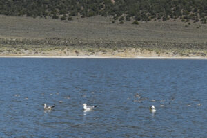
3 gulls and a flock of what are probably northern phalaropes floating on the water of “Alkali Lake”. The lake also still has at least 2 pairs of avocets near the spring.
“Alkali Lake” Fairy Shrimp Video 2024-05-16-cr
For a 21-seconds video of a fairy shrimp in “Alkali Lake”, click on the video player above. There is no audio. The female initially at the center of the view is not really swimming although its legs are moving. It may be trying to clear small pieces of what are probably microbial mat from between its legs. The small waves are pushing this fairy shrimp to the edge of the water, where it may die. There are bodies of dead fairy shrimp nearby. To the left of the live fairy shrimp, there is a pale gray male with its antennae II uncharacteristically extended away from its body toward the top of the photograph. Above it is a darker gray object that may be a fairy shrimp body with the abdomen curled under the thorax. After 0:12 seconds, a disarticulated pale brownish gray body with 2 black eyes can be seen at lower right. It is mostly above the wave action. There may be other bodies or pieces of bodies in the video. It’s possible the dead fairy shrimp died by stranding as the waves previously pushed them out of the water but have now pulled them back into the water. The live female in the video was stranded soon after the video ended but I flicked it back into the water with my finger. The fairy shrimp could be dying due to high TDS or temperature but most seem to be doing fine out in deeper water. Perhaps there is a problem with the microbial mat covering the bottom.
High TDS might also explain the disappearance of water boatmen.
June 27, 2024
A recent thunderstorm rendered the Lucky Boy Pass road impassable until the county got a dozer and loader on it. 2 days later, there were still 2 vehicles in the road up to their axles in gravel of a debris flow that came down part of the road. The access road to the lake was severely damaged and has deep ruts in many spots. All the bad parts that were repaired this spring are now bad again, some worse, some a little better than before. The road is barely passable with 4WD and high clearance. The lake is smaller now with a narrow waist between northern and southern lobes. My net gets stiff when I pull it out of the water so the TDS has definitely increased but there are no mineral encrustations along the shoreline.
- 300 m wide and maybe 900 m long; I waded out to a depth of about 15 cm but then stepped in a soft spot, got water in 1 boot, and turned back so maximum depth greater than 15 cm.
- Clear to murky brown water with a lot of fine, pale gray floating debris that may be bits of algal mat; 29 C at 1630 in 5 cm water.
- No fairy shrimp.
- Lots of alkali(?) flies, rare wriggly larvae, gulls, avocets, whimbrel(?).
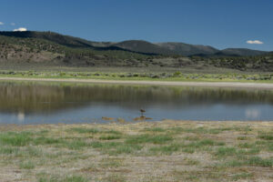
A single large wading bird on the shore of “Alkali Lake”. From the descriptions in the Audubon Society Field Guide to North American Birds – Western Region, it has the appearance of a whimbrel but the call of a long-billed dowitcher (“high sharp keek”) and the range of a willet.
Snowmelt Swales Ponds (Bridgeport Ranger District, Humboldt-Toiyabe National Forest)
The area north and east of “Alkali Lake” has partially vegetated sand dunes with shallow hollows, or swales, between the small ridges of sand. The floors of the swales evidently have enough clay to prevent rapid seepage so water can collect from melting snow or heavy rain. The BLM and 7.5-minute topographic maps do not show the ponds but imagery of The National Map does show white, brush-free areas north and east of “Alkali Lake”. As seen on my “Alkali Lake” map, The National Map showed a marsh symbol north and east of “Alkali Lake” in late 2022 but this is gone in late 2023.
Ponds to the east of the lake are more than 1 km (0.6 miles) south of those to the north and might have different water chemistry or different aquatic species but for simplicity I consider them all Snowmelt Swales Ponds.
Access is the same as for “Alkali Lake”.
Elevation: 2,140 m (7,020′)
March 25, 2019
Because I was hiking to “Alkali Lake” from the northwest rather than from the road to the west, I happened upon the pools of water in the swales. If snow hadn’t been blocking the road and preventing me from driving to the lake, I might have missed them. I looked at a larger pond (the GPS coordinates in the data spreadsheet refer to this pond) and a smaller one to its southwest.
- 10 m x 30 m for larger pond; depth less than 10 cm.
- Clear yellowish water.
- Sparse, pale gray fairy shrimp maybe 6-8 mm long in the larger pond; didn’t see any in the smaller pond.
- Saw 2 black diving beetles.
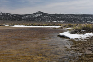
Looking east across the larger Snowmelt Swales Pond north of “Alkali Lake”. Wassuk Range is in the distance. The snow along the shore indicates the pond could get bigger before it gets smaller.
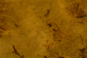
Several fairy shrimp in the larger Snowmelt Swales Pond. Shadows under and slightly to the left make some fairy shrimp more visible.
April 18, 2019
A big change after 3 weeks: the ponds are much smaller and grass is growing around them. I found more ponds east of “Alkali Lake”.
- The larger northern pond is now less than 15 m across and less than 10 cm deep.
- Water is clear.
- Dense population of 25-30 mm long, brownish-gray fairy shrimp and less common smaller ones maybe 15 mm long; larger females have whitish-yellow or greenish-white eggs in more than one row in long (3/4 length of abdomen) ovisacs which have a mid-length bulge.
- Rare black diving beetles.
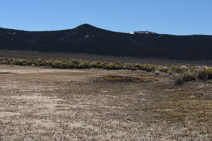
The larger Snowmelt Swales Pond in the same view as photograph Snowmelt Swales Ponds 2019-03-25, #02. There is still enough water for a thriving fairy shrimp population but it is now rather crowded.
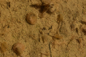
2 size classes of fairy shrimp in the northern Snowmelt Swales Pond. A smaller fairy shrimp is swimming over a larger female with eggs below center. There is another smaller fairy shrimp near the bottom edge of the photograph. Antennae II can be seen on males at lower left, to right of center, and at upper right. They are so long, they cross over the centerline of the body. The spherical object is a rabbit turd for scale.
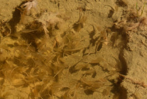
Abundant fairy shrimp in the deeper water of a hoof print in the larger Snowmelt Swales Pond. Most are males of the larger generation but there are a few smaller ones too.
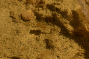
A large and a small fairy shrimp in the larger Snowmelt Swales Pond. The distal segments of the larger male’s antennae II appear to be tubular with pointed ends. Microscopic examination of male antennae II is commonly used to identify species (Belk, 1975; References page).
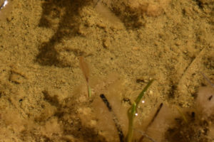
A female in the larger Snowmelt Swales Ponds. It has numerous very pale green eggs in an ovisac that is about 3/4 the length of the abdomen.
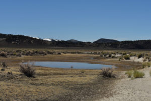
A southern Snowmelt Swales Pond east of the sand ridge east of “Alkali Lake”. This is a view to the south with “Alkali Lake” off the right edge of the photo.
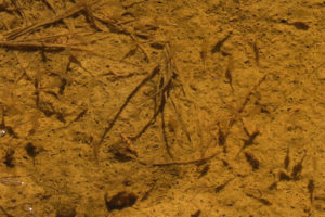
Fairy shrimp in the Snowmelt Swales Pond east of “Alkali Lake”. These look like those in the larger Snowmelt Swales Pond north of the lake. The shadows are easier to see than the fairy shrimp.
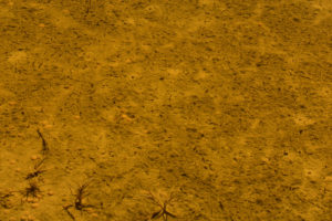
The ghost fairy shrimp of Alkali Valley! The dark apostrophe-like features on the floor of this Snowmelt Swales Pond east of “Alkali Lake” are the shadows of pale pinkish-gray fairy shrimp, which are very difficult to see. The farther the fairy shrimp is above the bottom of the pond, the more prominent the shadow and the farther the shadow is away from the fairy shrimp. In many cases, I can’t find the fairy shrimp causing the shadow. They’re ghosts.
June 19, 2019
All the Snowmelt Swales Ponds are gone but the grass and rabbitbrush are green.
- Dry.
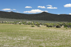
Approximately the same view of the larger Snowmelt Swales Pond north of “Alkali Lake” as photographs Snowmelt Swales Ponds 2019-03-25, #02, and Snowmelt Swales Ponds 2019-04-18, #08.
This year’s fairy shrimp probably lived for 1 1/2 – 3 months. They probably hatched in early or mid-March as they were already 6-8 mm size when I found them on March 25. They were still there in mid-April and there was then sufficient water for at least another week or 2. If they survived all the way through May, that would be about 3 months. It was a prolific hatch so there are plenty of eggs waiting for the next wet spell.
April 2, 2021
Too late or there wasn’t enough snow this year.
- Dry.
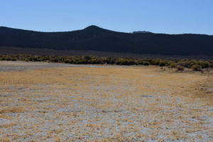
The larger Snowmelt Swales pond north of “Alkali Lake” in approximately the same view as Snowmelt Swales Ponds 2019-03-25, #02, and Snowmelt Swales Ponds 2019-04-18, #08. No water now and maybe none earlier either. The soil is coated with white mineral dust. There is no water in “Alkali Lake” either.
July 6, 2023
I came down for the water I had seen from a distance in “Alkali Lake”. The May and June thunderstorms were evidently not enough for these ponds.
- Dry.
March 14, 2024
The weather has been warming up but not enough for these ponds. Ponds north and ponds east of “Alkali Lake” both have thick ice.
- 20 m x 70 m; depth probably more than 10 cm including ice.
- Clear water; 100% ice cover 1-2 cm thick at 1130.
- No fairy shrimp.
- No other animals observed.
Although the hike down to the ponds was quite pleasant, the hike into the north wind back to my vehicle was quite chilly.
April 16, 2024
I had hoped to get here earlier but couldn’t make it. However, my rough calculations indicated the ponds could survive to about this date.
- Dry.
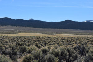
Looking east at Snowmelt Swales Ponds from the road as it approaches “Alkali Lake”. The largest and most reliable of the ponds is in the grassy bay at left. The grassy bay at right is also covered by water during snowmelt but it is shallower and more discontinuous. When I got to the pond at left, I found considerable white mineral precipitates on the dried grass. “Alkali Lake” is a ways off the right edge of the photograph.
“Burkham Tank” Pond (Bridgeport Ranger District, Humboldt-Toiyabe National Forest)
“Burkham Tank” is a name on the Mt. Hicks 7.5-minute quadrangle and the Humboldt-Toiyabe National Forest’s recreation map of Bridgeport Ranger District but it is not on the 1:100,000-scale BLM map. There is a pond about 100 m (330′) northeast of a small collapsed cabin off road #158 north of “Alkali Lake”. It was probably dug as a stock pond. This is presumed to be the location of the “Burkham Tank” on the maps.
Access is the same as for “Alkali Lake”.
Elevation: 2,157 m (7,075′)
March 25, 2019
On foot and headed to “Alkali Lake”, I stopped at the cabin for a look at the relics of abandoned human aspirations and found a pond too.
- Less than 10 m across; depth not estimated.
- Water is clear and reddish-brown.
- No fairy shrimp.
- No other aquatic animals.
What Can We Learn from the Ponds in Alkali Valley?
In Alkali Valley, fairy shrimp occur in both a relatively high-TDS playa lake and in small puddles among the sand dune swales that form from winter and early spring precipitation. An anthropogenic pond appears to lack fairy shrimp.
Different TDS concentrations for “Alkali Lake” and the inter-dune swale ponds are indicated by different abundances of mineral precipitates in the adjacent soils. These different habitats could have different species of fairy shrimp. Macroscopically, fairy shrimp in both habitats look similar and are not a species of Artemia.
In the wet years of 2019 and 2024, fairy shrimp were present in “Alkali Lake” in April or in April-May but not in mid- or late-June, respectively. In both years, the populations died out before the pond dried up, possibly due to increasing TDS or temperature. Increasing TDS did not cause the hatching of a more TDS-tolerant Artemia species in 2019 and 2024. In the very wet 2023, fairy shrimp were present in July.
Fairy shrimp eggs in “Alkali Lake” hatch without being dried. The lake apparently had abundant water for all of 2023 and eggs hatched by April of 2024.
“Alkali Lake” is downwind from “Mono Lake” so thousands if not billions of resting eggs of the fairy shrimp Artemia monica are likely in the soil even without considering what the gulls may have been pooping. Gulls are known to eat the fairy shrimp in “Mono Lake”. When fairy shrimp have been found in “Alkali Lake”, they did not look like a species of the genus Artemia. If there are Artemia eggs in “Alkali Lake”, they may only hatch when the initial spring filling of the lake has a relatively small volume of water that has high TDS due to dissolution of mineral crusts left by the previous lake.
The “Snowmelt Swales Ponds” in Alkali Valley have clear water. These ponds are a good place to photograph fairy shrimp, if only you can get there when they have water. In “Alkali Lake”, high and very low (i.e., salt crust phase) water levels favor clear water while high winds favor opaque water.