The base map is provided by OpenTopoMap’s volunteer servers.
Wheeler Peak Pond
South Sister Aquamarine Pond
South Sister Dead Cow Pond
South Sister Southwest Pond
South Sister Hidden Camp Pond
South Sister Trough Pond
What Can We Learn from the Ponds in the Sweetwater Mountains?
The Sweetwater Mountains are mostly in California but a small part crosses the border into Nevada. Using Jackass Creek as the northern boundary with the Wellington Hills and the 2,000-meter (6,560′) contour north of “Bridgeport Reservoir” as the southern boundary, the Sweetwater Mountains are 31 km (19 miles) long. From the West Walker River Canyon on the west to the 2,250-meter (7,380′) contour on the east, the range is 17-20 km (10.5-12.5 miles) wide. “Lobdell Reservoir”, on the western slope, has been stocked with fish but there do not appear to be any other bodies of water capable of supporting fish except, perhaps, the lower more perennial reaches of the larger streams. Although in the rain shadow of the Sierra Nevada, the Sweetwater Mountains get more snow than ranges farther east so ponds are probably more regularly filled than those in west-central Nevada. The steep east side of the range is not good for ponds but the range is mostly rolling hills west of the crest. A few ponds are shown on the Mt. Patterson 7.5-minute topographic quadrangle.
The foot of the Sweetwater Mountains is at about 2,000 m (6,560′) on the west and south and 2,250 m (7,380′) on the east. Most of the range is above 2,500 m (8,200′). Wheeler Peak is the highest peak, at 3,555 m (11,660′).
The Sweetwater Mountains have pinyon-juniper woodlands and sagebrush on the lower slopes. The wetter canyons have Jeffrey and perhaps other pines. Drier slopes locally have mahogany. Groves of limber or white pine take over at the middle elevations. The upper elevations are devoid of trees and brush but there are plenty of flowers, mosses, and lichens among the rocks.
The Sweetwater Mountains are within the Bridgeport Ranger District of the Humboldt-Toiyabe National Forest. Sweetwater Flat, east of the mountains, is mostly private land but there are only a few private in-holdings within the mountains. There are several parcels of private land along Swauger, Mack, and Harvey creeks and even up Mt. Jackson in the southern part of the range. There is also a large block of patented mining claims extending 3 km (2 miles) from upper Silverado Canyon south to Ferris Canyon to the west of the “Tiger Mines” (as shown on the recreation map) east of Mt. Patterson. A few other isolated parcels occur near the head of Sweetwater Canyon north of the creek and in the southwestern hills north of Fales Hot Springs.
There are few visitors to the Sweetwater Mountains. There are no hiking trails, the vehicle trails are in very poor condition, and popular wilderness areas in the Sierra Nevada are only a short distance to the west.
Wheeler Peak Pond (Bridgeport Ranger District, Humboldt-Toiyabe National Forest)
___This map is a screenshot of The National Map (Go to The National Map). The U.S. Geological Survey generally does not copyright or charge for its data or reports (unless printed). A pond location is indicated by an “X”, which corresponds to the coordinates given in the data spreadsheet. Labels in quotations are from 7.5-minute topographic quadrangles.
___Red lines are the U. S. National Grid with a spacing of 1,000 m and intersection labels consisting of the UTM zone (e.g., 11S, 12T), a 2-letter 100-km square designation (e.g., LC, XN), and a 4-digit number. The first 2 digits of the number represent the 1,000-meter Easting and the second 2 digits the 1,000-meter Northing, as seen in the example Easting and Northing. Unlike latitude and longitude, the National Grid is rectilinear on a flat map, the units of abscissa and ordinate have equal lengths, and the units (meters) are measurable on the ground with a tape or by pacing.
___Gray shading represents private land as traced from the PAD-US 2.0 – Federal Fee Managers layer of The National Map. Other lands are public.
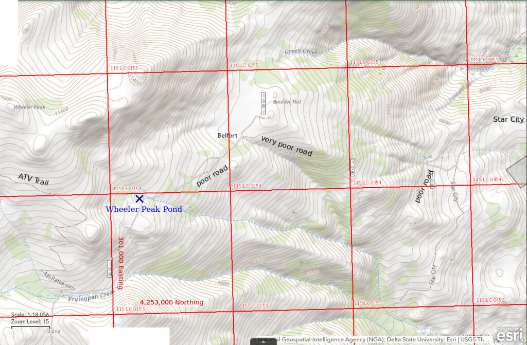
Wheeler Peak Pond is approximately 18 km (11 miles) north of Bridgeport. The pond is not shown on 1:100,000-scale BLM maps or on the Humboldt-Toiyabe National Forest’s recreation map of the Bridgeport Ranger District. It is shown without a name on The National Map. It is 1,230 m (4,000′) southeast of the highest point on Wheeler Peak, according to The National Map. The pond is fed by a stream of snowmelt but may dry up late in low-snow years. It is at an elevation with groves of limber or white pine.
The pond is only about 30 m (100′) from National Forest road 32198 but that road is terrible. It is very rocky and may be washed out in places across Sweetwater Flat. On the steep climb from Star City up to Boulder Flat (place names on the Humboldt-Toiyabe National Forest’s recreation map for the Bridgeport Ranger District), the road is deeply rutted in places and is covered with loose rock and gravel that makes traction difficult. Forget about turning around or passing another vehicle on that climb. Beyond Boulder Flat it may be blocked by snow into July. Nonetheless, ATV drivers and hardcore 4-wheelers still use it. It connects to a spectacular route over Mount Patterson and the crest of the Sweetwater Mountains (not shown on the 1:100,000-scale BLM map).
To reach road 32198, turn west off Nevada 338 at Sweetwater Ranch about 15 miles north of Bridgeport, California. Travel west for about 1 mile on a very good road and then turn south through a gate onto 32198. You have to drive at least another mile to get off the private land. After that, it just depends on how much bouncing you can stand and whether your vehicle holds together. I have parked where road 32198A forks to the south off 32198 and hiked from there. The pond is about 6.5 km (4 miles) away by road but short-cuts up the hill may be preferable for some. A route directly up the hill from Star City can miss most of the heavy brush. The elevation gain is about 900 m (3,000′).
Elevation: 3,241 m (10,635′)
June 24, 2016
A snowbank above Boulder Flat still blocks the road to Wheeler Peak Pond. I searched for fairy shrimp in the pond but didn’t record my observations.
- Size and depth not estimated.
- Water probably clear.
- No fairy shrimp.
July 19, 2019
Road 32198 is not blocked by a snowbank above Boulder Flat and although late in the year, there are still snowbanks on east-facing slopes not far above the pond.
- About 60 m x 80 m; could be deeper than 100 cm but probably less than 200 cm.
- Very clear water.
- No fairy shrimp.
- Water boatmen (sub-order Heteroptera, family Corixidae), black diving beetles; heard frogs.
The Sweetwater Mountains are within the known distribution area of the Pacific tree frog (Pseudacris regilla) but I don’t know if that is what I heard.
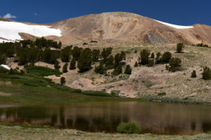
Wheeler Peak Pond below the east ridge of Wheeler Peak. It would be a nice pond for fairy shrimp. The frogs may be a problem.
July 27, 2023
It felt like time to take a higher elevation hike to get out of the heat and I also checked on the pond. Road 32198 on Sweetwater Flat has been considerably damaged. Floods eroded any channels crossing the road and left piles of angular rock. On the road within the National Forest, the ruts have been cut deeper. But people are still driving it. Somebody tried driving up the road from Belfort but didn’t make it past the snowbanks. Most of the snow on the south-facing slopes of Wheeler Peak has melted off but there is still plenty in shadier spots. The pond is full with vigorous flow at the outlet.
- Paced off 90 m x 100 m; probably at least 100 cm deep.
- Very clear water.
- No fairy shrimp.
- Water boatmen (sub-order Heteroptera, family Corixidae), backswimmers (sub-order Heteroptera, family Notonectidae), black diving beetles.
I spent considerable time searching for fairy shrimp. Although the waves made it hard to see what’s in the water at times, the chances I missed any fairy shrimp are low. Importantly, I did not see tadpoles or hear any frogs. If that means the frogs hadn’t hatched yet, fairy shrimp hatching earlier could have survived. So it seems that fairy shrimp really are absent from this pond and this pond is not a case of fairy shrimp being present but disappearing due to frog predation by mid-summer.
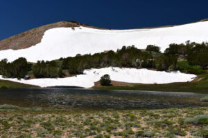
Large snowbanks above Wheeler Peak Pond in late July.
South Sister Aquamarine Pond (Bridgeport Ranger District, Humboldt-Toiyabe National Forest)
___This map is a screenshot of The National Map (Go to The National Map). The U.S. Geological Survey generally does not copyright or charge for its data or reports (unless printed). A pond location is indicated by an “X”, which corresponds to the coordinates given in the data spreadsheet. Labels in quotations are from 7.5-minute topographic quadrangles.
___Red lines are the U. S. National Grid with a spacing of 1,000 m and intersection labels consisting of the UTM zone (e.g., 11S, 12T), a 2-letter 100-km square designation (e.g., LC, XN), and a 4-digit number. The first 2 digits of the number represent the 1,000-meter Easting and the second 2 digits the 1,000-meter Northing, as seen in the example Easting and Northing. Unlike latitude and longitude, the National Grid is rectilinear on a flat map, the units of abscissa and ordinate have equal lengths, and the units (meters) are measurable on the ground with a tape or by pacing.
___There is no private or state land on this map. All the lands are public.
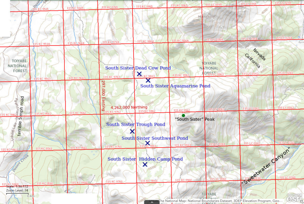
South Sister Aquamarine Pond is 27 km (17 miles) north of Bridgeport and about 1,600 m (5,250′) northwest of the peak of South Sister. It is shown, barely, on the Humboldt-Toiyabe National Forest’s recreation map of the Bridgeport Ranger District but not on the 1:100,000-scale BLM map. The pond is about 70 m across on the 7.5-minute topographic quadrangle. South Sister Aquamarine Pond is about 250 m (820′) southeast of South Sister Dead Cow Pond. When first seen from South Sister peak, the pond had a bluish-green color that differed markedly from the color of Dead Cow Pond.
The easiest approach is from Risue Road (National Forest Road #42050), which goes around the north end of the Sweetwater Mountains. The east end intersects Nevada 338 north of Sweetwater Summit and the west end intersects US 395 south of “Topaz Lake”. Although heavily used, Risue Road is poorly, or not, maintained. I have driven at less than 10 mph at times because of the jarring bumps. About 3 miles west of Nevada 338, turn south onto National Forest Road 42050E (not labeled on recreation map). This is a poor bumpy track. Past a spring and stock tank within about a mile of Risue Road, it becomes impassable in my opinion although I have seen recent tire tracks. In places, it is covered with loose, angular, cantaloupe- to watermelon-size rocks with a few pointy boulders poking up through the jumble.
The Motor Vehicle Use Map of the Bridgeport Ranger District shows road 42050E ending at the spring (i.e., driving beyond the spring is not allowed) but the older Humboldt-Toiyabe National Forest recreation map for the Bridgeport Ranger District and The National Map show a trail continuing from the end of the road. The trail is helpful for hiking over the ridge into Little Smith Valley but then it turns west toward Desert Creek at about the California-Nevada border (not marked). Hike through the sagebrush to the southwest from there.
On the broad ridge where the pond is located, there are a couple of vehicle tracks but they are not shown on the current Motor Vehicle Use Map (i.e., motor vehicle use is not allowed) and I don’t know where they come from. One is shown on The National Map and can be followed from South Sister Dead Cow Pond to near South Sister Hidden Camp Pond. On one hike, I came across an ATV stuck in a snowdrift on this track. We had to stuff tree limbs under the wheels to get it out.
Elevation: 2,962 m (9,720′)
August 30, 2019
Although the season is so late that fairy shrimp would not be expected at this elevation, there’s a chance the insects haven’t killed them off so down I go from South Sister peak.
- About 30 m x 40 m; depth not estimated.
- Water somewhat murky but not visibly colored up close, in spite of the pale green appearance from afar.
- No fairy shrimp.
- A few big black diving beetles.
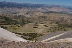
Looking down on South Sister Aquamarine Pond and the darker South Sister Dead Cow Pond from South Sister. Antelope Valley with West Fork Walker River and “Topaz Lake” (not visible) is in the middle distance.
May 2, 2020
Water level is low but the small snowbank on the south side suggests the timing is good.
- 25 m x 30 m; depth not estimated.
- Clear water.
- No fairy shrimp.
- Saw 1 black diving beetle.
June 22, 2022
The water is definitely not aquamarine today. It is surprisingly cloudy compared to the clear water of Dead Cow Pond.
- 35 m x 55 m; depth greater than 20 cm.
- Cloudy, pale greenish-brown water; 16 C at 1300.
- No fairy shrimp.
- Abundant copepods less than 2 mm, water boatmen (small very fast swimmers I couldn’t get a good look at and two about 15 mm long) (sub-order Heteroptera, family Corixidae), wriggly larvae, killdeer.
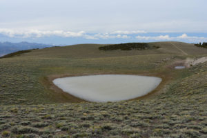
South Sister Aquamarine Pond, looking northwest with Sierra Nevada in distance at left. This is not its aquamarine phase. The road on the hill at right goes to Dead Cow Pond, which is obscured by the topography.
South Sister Dead Cow Pond (Bridgeport Ranger District, Humboldt-Toiyabe National Forest)
South Sister Aquamarine Pond map
South Sister Dead Cow Pond is about 1,800 m (5,910′) northwest of South Sister peak and 250 m (820′) northwest of South Sister Aquamarine Pond. It is shown on the Humboldt-Toiyabe National Forest’s recreation map for the Bridgeport Ranger District but not on the 1:100,000-scale BLM map. On the 7.5-minute topographic quadrangle, the pond is almost 100 m across. When first visited, there was a dead cow on the shoreline.
For access, see South Sister Aquamarine Pond.
Elevation: 2,959 m (9,710′)
August 30, 2019
As with South Sister Aquamarine Pond, I didn’t expect fairy shrimp but WIDLA. As I approached, I saw 2 dead cows on the shoreline. Then, one of them raised its head and turned out to be a bear. I was quite close by then but, fortunately, the bear ran first and I had time to take a look into the pond. As I was leaving the pond about an hour later, I saw the bear coming back. It must have had second thoughts about leaving the carcass. The pond has a lot of vegetation on the bottom. Organic acids may contribute to the dark color. Cattle use is much heavier at South Sister Dead Cow Pond than at South Sister Aquamarine Pond as indicated by the abundance of cow pies. This may account for the more abundant aquatic vegetation and darker water color of Dead Cow Pond.
- About 65 m x about 85 m; depth not estimated.
- Clear water but wide bands of algae on the surface make viewing difficult.
- No fairy shrimp.
- Lots of water boatmen (sub-order Heteroptera, family Corixidae), bear.
For a good view of the pond see photograph South Sister Aquamarine Pond and South Sister Dead Cow Pond 2019-08-30, #13, above.
May 2, 2020
A low water level is indicated by a sagebrush-free band a few meters wide around the edge of the water. Nonetheless, there is a small snowbank on the shaded southeast side that could provide a little more.
- About 60 m x 75 m; depth not estimated.
- Clear water.
- No fairy shrimp.
- Saw 2 black diving beetles.
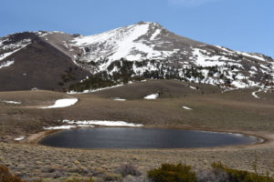
View southeast across South Sister Dead Cow Pond with South Sister in the distance. South Sister Aquamarine Pond is in the hollow below the 2 small snow banks in the middle distance but is not visible.
The timing looks good but no fairy shrimp. I have also seen a bear at Bald Mountain Big Dry Lake and tracks at Bald Mountain “Dry” VABM Saddle Pond (Pine Grove Hills). Both those ponds have fairy shrimp, when water is present. That suggests bears could be important dispersal agents for fairy shrimp eggs. A bear previously visited this pond on August 30, 2019. Bald Mountain Big Dry Lake is only about 20 km (12.5 miles) away, an easy day’s jaunt for a bear. Why haven’t bears brought fairy shrimp eggs here?
June 22, 2022
I saw recent bear tracks on the hike in but that is no longer a surprise. This time I was presented with a new hazard: sheep. Although I made a wide detour to stay well away from the flock, a big white dog came after me. I picked up a branch just in case. The dog got uncomfortably close but didn’t attack. It followed me as I continued hiking well past the flock. Then, about 5 border collie-type dogs came barking and charging through the sagebrush even though the big white dog had lost interest by then. The dog pack encircled me. I kept spinning around to discourage them from lunging for my legs while I wasn’t looking. After too long, the sheepherder whistled them away.
- 55 m x 70 m; depth greater than 20 cm.
- Clear water with slight brown tint; 16 C at 1215.
- Common greenish-gray fairy shrimp 20-25 mm long; white eggs.
- Abundant dark brown copepods 2 mm or maybe more long as well as animals less than 1 mm that could be copepods or something else, very fast swimmers about 5 mm long may be water boatmen (sub-order Heteroptera, family Corixidae) but I didn’t get a good look, giant black beetle about 25 mm long possibly a dytiscid, round possible water mites smaller than the big copepods, blackbird.
I guess May is just too early here. The ponds in the Bodie Hills are only about 400 m (1,310′) lower and fairy shrimp hatch there by early May. I shouldn’t have excoriated the bears on May 2, 2020. Maybe they did drop some fairy shrimp eggs here, or picked some up and took them somewhere else.
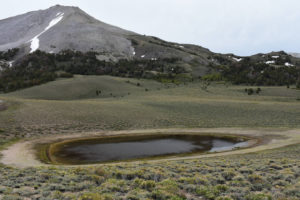
South Sister Dead Cow Pond and South Sister (upper left). The water level is noticeably lower than in May 2020. There is no longer a cow carcass on the far shore or even any bits of bone or skin. The bear probably dragged it off.
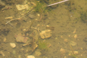
Single male fairy shrimp in South Sister Dead Cow Pond.
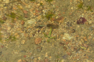
Single female fairy shrimp in South Sister Dead Cow Pond. There are greenish-white eggs in its ovisac. The blur at upper left is due to a small wave on the water surface.
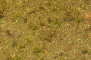
Several fairy shrimp swimming in South Sister Dead Cow Pond. They are all males; they have big antennae II and lack ovisacs.
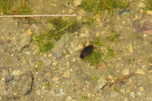
A big beetle in South Sister Dead Cow Pond. It is about 25 mm long, like the fairy shrimp above and to the left of it. This could be a dytiscid beetle, which eats fairy shrimp, but I don’t know if it could also be another kind of beetle.
South Sister Dead Cow Pond Fairy Shrimp Video 2022-06-22b-r, Sweetwater Mountains.
For a 1-minute 7-seconds video of fairy shrimp swimming in South Sister Dead Cow Pond, click on the video player above. There is no audio. The light is fading due to clouds but I decided to stop for a video on the hike out. The battery got run down by the video at South Sister Hidden Camp Pond and numerous photographs but it’s not dead yet. The fairy shrimp are rather widely spaced so I follow one female as it swims around. A few male fairy shrimp come into view toward the end. There are also numerous dark brown animals greater than 2 mm long that may be copepods swimming rapidly in and out of view. There are speck-like animals less than 0.5 mm long that may be copepods, too. Dark, spherical animals about 1 mm across may be water mites.
South Sister Southwest Pond (Bridgeport Ranger District, Humboldt-Toiyabe National Forest)
South Sister Aquamarine Pond map
South Sister Southwest Pond is 2.0 km (1.2 miles) south of South Sister Dead Cow Pond and about 1,300 m (4,270′) southwest of the top of South Sister. A narrow speck of blue marks the pond on the Mt. Patterson 7.5-minute topographic quadrangle. It is on the east side of National Forest Road 089B shown on the Humboldt-Toiyabe National Forest’s recreation map for the Bridgeport Ranger District. It is a narrow pond in an odd gully with steep sides.
For access, see South Sister Aquamarine Pond.
Elevation: 3,071 m (10,075′)
May 2, 2020
The scattered snowbanks are encouraging so there may be more ponds to find after checking out South Sister Aquamarine and Dead Cow ponds.
- Size not estimated due to ice cover; depth maybe up to 100 cm.
- Clear water.
- No fairy shrimp.
- Several brownish-black beetles with paler spots less than 5 mm long swimming near bottom close to shore.
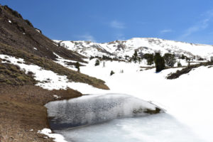
South Sister Southwest Pond, looking south with Mt. Patterson in distance (summit not visible). The evidently cold water has beetles so why not fairy shrimp?
June 22, 2022
The bright green grass and rushes around the pond are a sharp contrast with the surrounding sagebrush slopes.
- 6 m x 35 m; depth greater than 15 cm.
- Clear water; 20 C at 1615.
- Almost invisible pale gray fairy shrimp mostly 10-12 mm long but some smaller ones may be about 8 mm; no eggs.
- Copepods, dytiscid larvae, beetles 5 mm long.
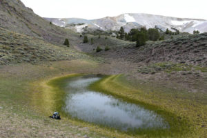
View to south of South Sister Southwest Pond. It has become rather shallow and green rushes are growing in the water.
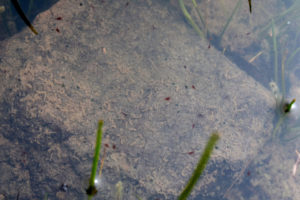
Fairy shrimp and copepods in South Sister Southwest Pond. The fairy shrimp are almost invisible (contrast has been enhanced but they are still hard to see) but there is a large one just above center and 2 small, more out-of-focus fairy shrimp below and to the right of the green stem at left. The many very small reddish-brown ovals are copepods.
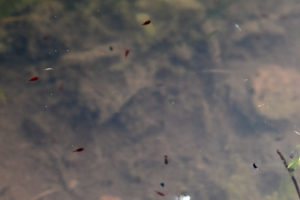
This is a closer view of the copepods in South Sister Southwest Pond. The 2 unbranched swimming antennae at the top of the head of the animal near the top indicate that these animals are copepods, or at least not cladocerans. The vertically oriented copepod below center has symmetrical bulges near the end of its abdomen which are likely the characteristic copepod egg sacs. There are 2 black animals at lower right and near the bottom which have shapes different than the copepods. They may be cladocerans even though cladocerans are commonly larger than copepods.
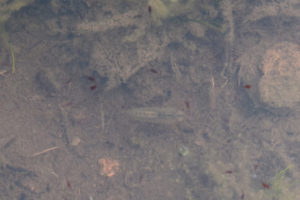
The long pale gray animal at center is a dytiscid larva in the water of South Sister Southwest Pond. Its head, with barely visible pincers, is at right and its abdomen tapers to the left. Dytiscid larvae usually have a dark color so maybe this one just molted. The photograph also has several reddish brown copepods that are swimming and blurred due to the slow shutter speed.
South Sister Hidden Camp Pond (Bridgeport Ranger District, Humboldt-Toiyabe National Forest)
South Sister Aquamarine Pond map
South Sister Hidden Camp Pond is 600 m (1,970′) south of South Sister Southwest Pond and about 1,850 m (6,070′) southwest of South Sister peak. On the 7.5-minute topographic quadrangle, the pond is about 60 m (200′) across. It is a broad pond with conifers to its west and a gravelly ridge of low sagebrush to the east. There is no inlet or outlet but there is an overflow channel on the north end. South Sister Hidden Camp Pond is 100-200 m (330-660′) southeast of a trailer and camping area in the trees. It is west of, and on the opposite side of the stream from, National Forest Road 089B on the Humboldt-Toiyabe National Forest’s recreation map of the Bridgeport Ranger District. It may be near the spring shown in section 11 (T7N, R24E) on that map.
For access, see South Sister Aquamarine Pond.
Elevation: 3,095 m (10,150′)
May 2, 2020
No ice on the water but there is a snowbank along most of the water’s edge. Too much snow to continue the search for ponds up higher.
- About 75 m across; depth not estimated.
- Clear water.
- No fairy shrimp.
- Few brownish-black beetles with paler spots less than 5 mm long swimming near bottom close to shore.
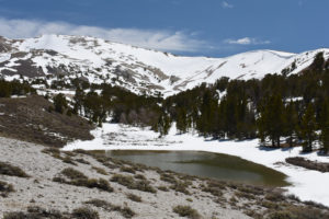
South Sister Hidden Camp Pond with east ridge of Mt. Patterson in the distance to the south.
June 22, 2022
The pond looks nearly full but is still below the overflow. From a distance, the murky water resembles the previously characteristic color of Aquamarine Pond. There is minor green algae floating in the water that may be contributing to the color.
- 40 m x 75 m; depth greater than 20 cm.
- Murky gray water; 14 C at 1500.
- Rare fairy shrimp about 15 mm long, possibly with eggs but didn’t get good look.
- Copepods mostly less than 1 mm but a few about 2 mm, 5 mm and 10 mm beetles, 15 mm water boatman (sub-order Heteroptera, family Corixidae) and numerous 5 mm speedsters that may also be water boatmen, wriggly larvae.
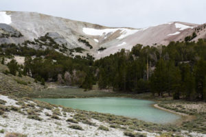
South Sister Hidden Camp Pond with part of Mt. Patterson in the background. The water color is reminiscent of the characteristic color of South Sister Aquamarine Pond, which doesn’t have that color today. The water level looks relatively high compared to South Sister Dead Cow Pond but that could be partly due to banks with steeper slopes.
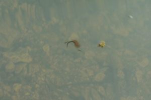
A female fairy shrimp in South Sister Hidden Camp Pond doing a back flip. Its sex can be determined by the apparently empty ovisac extending to the left of the dark abdomen. The blur is due to the slow shutter speed.
South Sister Hidden Camp Pond Fairy Shrimp Video 2022-06-22a-f, Sweetwater Mountains.
For a 34-seconds video of a fairy shrimp swimming in South Sister Dead Cow Pond, click on the video player above. There is no audio. This shows one female fairy shrimp in a rather unusual swimming pattern with common vertical loops. Due to the rippling water surface and bouncing sunlight reflections, I have a hard time following the fairy shrimp. The murky water doesn’t help. Nonetheless, this shows some of the complexity of fairy shrimp swimming behavior.
South Sister Trough Pond (Bridgeport Ranger District, Humboldt-Toiyabe National Forest)
South Sister Aquamarine Pond map
South Sister Trough Pond is 1,600 m (5,250′) south of South Sister Dead Cow Pond and about 1,600 m (5,250′) west of the top of South Sister. It is easy to find because it is adjacent to a sharp bend in National Forest Road 089B, which is shown on the Humboldt-Toiyabe National Forest’s recreation map for the Bridgeport Ranger District. On the 7.5-minute topographic quadrangle, it is a speck of blue. South Sister Trough Pond is an odd, narrow trough on a ridge of rubble. It is similar to a glacial pothole but the Sweetwater Mountains generally lack signs of glaciation.
For access, see South Sister Aquamarine Pond.
Elevation: 3,005 m (9,860′)
June 22, 2022
I had seen the pond in May 2020 – you can’t miss it if you follow the vehicle track from Dead Cow Pond – but I wasn’t having any luck with the other ponds then so I skipped it. The brown water doesn’t look very appealing but if Dead Cow Pond has fairy shrimp today maybe this one does too.
- 15 m x 50 m; depth greater than 20 cm, could be more than 50 cm.
- Murky brown water; 15 C at 1400.
- Nearly invisible, pale gray fairy shrimp 16-20 mm long; white eggs.
- Copepods, fast swimming water boatmen (sub-order Heteroptera, family Corixidae) which were more reliably identified in other South Sister ponds today, caddisfly larvae cases but none had tracks or were moving.
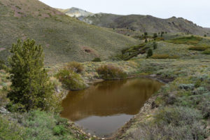
View to southeast of South Sister Trough Pond. Just a trough in the dirt.
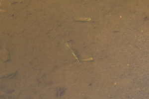
A female fairy shrimp in South Sister Trough Pond. It has what may be a thin string of pale eggs (not individually visible) to the left of the abdomen and also pale food material at the end of the thicker intestine. There is a caddisfly larva case near the top but neither this one nor the others I saw have larvae pulling them around. Nonetheless, there are probably larvae which I didn’t see.
What Can We Learn from the Ponds in the Sweetwater Mountains?
The Sweetwater Mountains do not have well developed pond-friendly glacial features like the Sierra Nevada does but they do have some ponds. The ponds do not show up on the small scale 1:100,000 maps but the 1:24,000-scale 7.5-minute quadrangles show the smallest ones I found.
My experience here illustrates how important timing is. After not finding fairy shrimp in any of 4 ponds in May 2020, I concluded there weren’t any. I didn’t expect to find fairy shrimp during my June 2022 hike but they were living in 4 of the 5 ponds I visited.
Amphibians in the Sierra Nevada might account for the lack of fairy shrimp there due to predation (see “Fish-stocking Zooicide” East Central Sierra Nevada). The frogs I heard at Wheeler Peak Pond could explain the lack of fairy shrimp there and frogs could be a risk for fairy shrimp in other Sweetwater Mountains ponds.
Like the Pine Grove Hills, the Sweetwater Mountains have bears. They also have sheep and aggressive sheep dogs.