The base map is provided by OpenTopoMap’s volunteer servers.
Glaciation
Fish-stocking Zooicide
Previous Reports of Fairy Shrimp
Virginia Divide Double Ponds
Virginia Creek Pale Green Pond
Lundy Pass Ponds
Dunderberg North Pond
Lower “Par Value Lake”
Upper “Par Value Lake”
“Par Value” 2nd West Pond
“Par Value” Long Pond
“Par Value” Keyhole Pond
“Par Value” Northwest Pond
“Par Value” North Ridge Pond
“Bergona Lake”
“Burro Lake”
Burro Cirque Pond
Shepherd Crest South Pond
“Maul Lake”
“Spuller Lake”
Above Spuller Pond
Marmot Dropping Pond
“Alpine Lake”
Lost Conness Pond
Dunderberg Upper Snowbank Pond
What Can We Learn from the Ponds in the East-Central Sierra Nevada?
I have looked for fairy shrimp in only a small part of the Sierra Nevada between highways 108 (over Sonora Pass) and 120 (over Tioga Pass) and east of the crest of the range. The distance between Sonora and Tioga passes is only about 56 km (35 miles). To avoid giving the impression that I have visited ponds throughout the range, I use the term East-Central Sierra Nevada but this term could well encompass a larger area in many people’s minds. The Sierra Nevada is much steeper on the east side than the west side so the area east of the crest is much smaller than the area to the west. For example, it is about 12 km (7.5 miles) from Lee Vining to Tioga Pass but another 48 km (30 miles) to El Portal.
Where I have hiked in the East-Central Sierra Nevada, elevations range from about 2,250 m (7,380′) on the eastern flank to highs of around 3,150 m (10,330′) along the crest (e.g., at “Summit Lake”). The peaks, of course, are higher. Mt. Warren is 3,757 m (12,330′), Dunderberg Peak is 3,772 m (12,370′), and Matterhorn Peak is 3,738 m (12,260′).
Vegetation in the East-Central Sierra Nevada includes sagebrush, pine, aspen, fir, and alpine tundra. I don’t know many of the species.
The Sierra Nevada are a recreational wonderland due in large part to the nearly complete coverage by public lands managed by the National Park Service or by the U.S. Forest Service. However, there are private in-holdings along many of the access roads and the Marine Corps Mountain Warfare Training Center east of Sonora Pass should also be avoided. There are many reasonably well-maintained hiking trails in the east-central Sierra Nevada. The trailheads are accessible on bumpy roads from US 395 to the east, California 108 to the north, and California 120 to the south. The towns of Bridgeport and Lee Vining are nearby on US 395.
Glaciation
Like the Wind River Mountains in Wyoming, glaciation in the Sierra Nevada has created an abundance of lakes and ponds. The lakes and ponds, however, haven’t always been there due to multiple episodes of glacial advances and retreats. There have been times when they have been covered by snow or ice. The last major glacial advance in the Sierra Nevada occurred about 20,000 years ago (Wesnousky and others, 2016; see the References page). Deglaciation was probably complete by 15,000 years ago but then the Recess Peak advance occurred 14,000-13,000 years ago. Glacier elevations remained well above those of the earlier glacial maximum. Since then, glaciers have retreated to ever higher elevations. However, there are small moraines perched at the heads of some canyons that indicate some glacial activity during the Little Ice Age between 1350 and 1850. Even if the higher elevation ponds were covered by snow until 1850, that leaves over 150 years for fairy shrimp colonization of those ponds and even longer for colonization of lower elevation ponds.
East-Central Sierra Nevada – top
Fish-stocking Zooicide
What Is Fish-stocking?
Why Is Fish-stocking Needed?
Why Is Fish-stocking Important to Fairy Shrimp?
How Extensive Has Fish-stocking Been in the Western United States?
How Extensive Has Fish-stocking Been in the Sierra Nevada?
What is the Experimental Evidence of the Effects of Fish-stocking
What Have the Effects of Fish-stocking Been on Invertebrates in the Sierra Nevada?
What Have the Effects of Fish-stocking Been Beyond the Sierra Nevada?
What Have the Effects of Fish-stocking Been on Vertebrates?
Zooicide in the Sierra Nevada
What Is Fish-stocking?
Fish-stocking is the dropping of 1 or more live fish into a body of water. Fish management agencies typically dump a couple hundred to a few thousand, small (7-18 cm, 2-7″) fish at a time into a mountain lake from a helicopter. The dumped fish are species that people like catching and are usually obtained from a state-supported fish hatchery. They are exotic to the receiving lake unless the fish management agency is trying to restore a native species that was wiped out by exotic fish. Larger fish that don’t need to grow as much before they become “catchable” are dumped in some cases. Most mountain lakes that are currently being stocked in the western United States are stocked repeatedly on periodic (e.g., every 2-4 years) or irregular schedules because the fish populations don’t reproduce. Individuals have also stocked lakes on their own initiative using the means at their disposal. Before helicopters, this included packing large cans of water with fish on horses. Individuals have also dumped bait fish, such as minnows, into lakes rather than carry them home or back to their water body of origin.
The effects of fish-stocking extend beyond the lakes where the fish were dropped. If one lake in a basin with several lakes above the fish-blocking topography were stocked, the fish would move to adjacent lakes through connecting streams to the extent possible. Those lakes could also be considered “stocked”.
Back to Fish-stocking Zooicide
Why Is Fish-stocking Needed?
Most of the high mountain lakes and ponds in the Sierra Nevada are above topographic barriers like waterfalls or rapids that prevent natural access by fish. Some people get bored in the mountains and want something to do other than climbing, hiking around, or just admiring the scenery and natural plants and animals. Fishing gives them something else to do. For that to be possible, somebody has to put fish in the mountain lakes. If the introduced fish population doesn’t reproduce, then the lakes have to be stocked again. More importantly, fishing is a well regarded recreational activity that is good for advertising. State and local governments and businesses in towns near the mountains can use photos of lakes and the possibility of fishing to attract tourists who may rent rooms, buy meals, buy gas, buy stuff at sporting goods stores, and maybe even hire an outfitter. To those fishing the mountain lakes, the fish seem free. What better draw than free food? The cost of a fishing license is not connected to the economic or environmental costs of stocking a lake with fish. There is no sign that says that a lake has been stocked. Those fishing at an alpine lake don’t know what animals were there before. Even if they did, they would probably consider large aquatic invertebrates creepy creatures that the lake is better without.
Back to Fish-stocking Zooicide
Why Is Fish-stocking Important to Fairy Shrimp?
Fish eat fairy shrimp. The 2 animals have been found in the same body of water in only a very few instances (“Fish Predators” on the Predators of Fairy Shrimp page) and those instances did not suggest that fairy shrimp populations can co-exist with adult fish for several years. Fish use their visual senses to find prey. Adult fairy shrimp are easily visible. They are not brightly colored but they are large in the context of aquatic invertebrates, generally longer than 10 mm (0.4″).
Size preferences of rainbow trout and yellow perch were tested in 2 lakes in Michigan. By collecting zooplankton samples and examining the contents of fish stomachs, Galbraith (1966) found that both species ate larger than average cladocerans of the genus Daphnia (Branchiopoda: order Anomopoda, family Daphniidae). 96% of the Daphnia eaten by trout and 82% of those eaten by perch were longer than 1.3 mm (0.05″) even though 58% of Daphnia in 1 lake and 46% of those in the other were smaller than this. The range of Daphnia sizes was 0.4-2.9 mm (0.016-0.11″). The good news is fish eat animals as small as 1.3 mm and that could mean reduced predation pressure on fairy shrimp. The bad news is those were the biggest prey available and the preference for larger prey could apply across the spectrum of prey sizes.
The fishing industry knows this. I would wager that it doesn’t make lures smaller than 2 mm (0.08″). Many lures have bright colors and reflective surfaces. Many of the millions of people who fished in fresh waters over the past several millennia also knew this.
Other aquatic animals use various strategies to avoid predators. Some cladocerans, which are also branchiopods, migrate down to deep, dark water during the day so predators can’t see them. They return to shallow water at night for feeding on non-migrating algae. I haven’t read of daily vertical migrations by fairy shrimp.
Most amphipod populations survive in the presence of fish. Amphipods are crustaceans, like fairy shrimp, that live in lakes, streams, and oceans. Some species grow to be as big as fairy shrimp. Amphipods have stiff exoskeletons that make them less palatable but that doesn’t stop fish, or ducks, from eating lots of them if they can. Amphipods can recognize predators using chemical cues and use various methods to avoid them but responses differ between species. Pontogammarus robustoides recognizes predators by the presence of its fellow species in their feces (Jermacz and Kobak, 2018). Dikerogammarus villosus (DV), a very successful invasive amphipod, recognizes all the fish species it has been tested with, even tropical fish from a different continent (Jermacz and Kobak, 2018). In what may be a unique or uncommon adaptation, DV distinguishes between hungry and satiated predators. It avoids the hungry ones but may move toward the satiated ones in anticipation of feeding on fish feces or on the prey the fish is feeding on (Jermacz and Kobak, 2018). In contrast, Gammarus minus reduced its swimming activity in the presence of bluegills and striped shiners even though striped shiners didn’t eat the amphipods (Wooster, 1998). I have not read of fairy shrimp detecting fish or other potential predators chemically.
DV uses a few simple strategies to avoid predators. It spends most of its time sheltering on the river or lake bottom (Jermacz and Kobak, 2018). If the bottom has good stony (or comparable) shelter, DV stays there more than 80% of its time even in the absence of hungry predators. In other experiments with evidently less appealing shelter, DV reduced its swimming in the water column from 55% of its time to 20% in the presence of predators (Jermacz and Kobak, 2018). On a sandy bottom without shelter, DV swims away from a predator rather than seeking shelter. Alternatively, DV forms aggregates on the bottom with other DV when no shelter is available. Due to the stiff exoskeletons and strong clinging abilities of DV, aggregates are hard to eat. Some fish species (e.g., racer goby) avoided aggregated DV and preferred eating singletons (Jermacz and Kobak, 2018). I have not read of fairy shrimp taking refuge in vegetation or rocky pond bottoms and doubt that it would be feasible.
The lack of obvious defense mechanisms may make fairy shrimp seem ecologically incompetent but that is not the case. The order Anostraca has survived for more than 300 million years (Taxonomy and Origin of Anostraca page) not by engaging in a predator-prey arms race but by adapting to ponds where fish can’t survive. This strategy must have been adopted early as there are fish fossils in non-marine sediments as old as the earliest known fairy shrimp ancestors. Fairy shrimp populations aren’t utterly helpless. They seem to co-exist fine with invertebrate predators, such as dytiscids, backswimmers, and amphipods and with birds. You can find numerous examples in the pond descriptions on this web site. Whether they need, or have, specific defense mechanisms for such co-existence is an open question. If fairy shrimp were ultimately eliminated from all alpine lakes globally due to human recreational preferences, they would carry on as usual in many other fishless environments.
It may be possible for fairy shrimp to survive fish predation if the pond has abundant alternative prey that fish like. In theory, a fairy shrimp population could hatch and produce eggs in a short time before alternate prey is depleted by predation. Maturity would take longer in cold alpine ponds but the fairy shrimp may not have to live all summer long in order for the population to persist. Thus, it is worth looking at the fates of other aquatic animals that have been victimized by fish-stocking. If populations of other large invertebrates can survive fish-stocking, maybe there is hope for fairy shrimp.
Back to Fish-stocking Zooicide
How Extensive Has Fish-stocking Been in the Western United States?
A 1988 compilation of estimates supplied by fish and wildlife agencies in the western United States (Colorado and states west) indicated that of approximately 16,000 mountain lakes, 60% (9,600) have fish but less than 5% (800) had fish before fish-stocking began (Bahls, 1992). Even lakes with native fish have been stocked. Fish and wildlife managers thought that only 1% (160) of lakes have only native fish. Larger lakes are more likely to sustain populations of exotic trout. Fish and wildlife managers guessed that less than 5% of lakes larger than 2 hectares (5 acres) and deeper than 3 m (10′) remained free of fish.
Back to Fish-stocking Zooicide
How Extensive Has Fish-stocking Been in the Sierra Nevada?
Fish-stocking in the Sierra Nevada started earlier than in most mountains of the western United States. Gold and silver miners could have started stocking alpine lakes in the Sierra Nevada as early as the 1850s. Native cutthroat trout populations in “Lake Tahoe” were severely depleted to feed the Comstock silver boom near Reno in the 1860s and finally extirpated in the 1930s after relentless predation by stocked lake trout and competition with stocked brown trout and rainbow trout (Truckee River Basin Recovery Implementation Team, 2003). Within the Truckee River watershed upstream of Pyramid Lake, native cutthroat populations have survived only in “Independence Lake”.
Knapp and Marine Science Institute (1996) discussed evidence that the percentage of lakes with fish in the Sierra Nevada above 1,800 m (5,910′) in elevation and greater than 1 hectare (2.5 acres) in area has increased from less than 1% before the mid-1800s to about 63% in the 1990s. This does not include “Lake Tahoe”, the upper Truckee River watershed, or other areas which are outside the inferred fishless area in Figure 2 of Knapp and Marine Science Institute (1996). Of 649 lakes within a California Department of Fish and Game database for Region 5 in the central Sierra Nevada, all were originally fishless but 85% now contain fish (Knapp and Marine Science Institute, 1996). California Department of Fish and Game regularly stocked 46% of the lakes at the time of the report. For better and worse fish-stocking in the Sierra Nevada has been pervasive.
Back to Fish-stocking Zooicide
What is the Experimental Evidence of the Effects of Fish-stocking
Experiments which put fish and fairy shrimp, or other large invertebrates, in the same body of water provide evidence for what would happen when fish are added to a lake with fairy shrimp. The few that I have found are summarized in “Fish-stocking Zooicide” on the Wind River Mountains page. Trying to extrapolate the results of experiments to the Sierra Nevada is not necessary because several studies have documented the post-fish-stocking faunal differences between stocked and not stocked lakes.
Back to Fish-stocking Zooicide
What Have the Effects of Fish-stocking Been on Invertebrates in the Sierra Nevada?
After-the-fact comparisons of fish-stocked and fishless lakes in the Sierra Nevada offer considerable insight into the effects of fish-stocking. Such studies provide correlations between various invertebrate species populations and the presence of fish but are not proof of what fish-stocking actually did. Nevertheless, if similar results are obtained by many studies, then the effects of fish-stocking can be ascertained with high confidence.
Zooplankton in Central and Southern Sierra Nevada:
Copepods (Crustacea: class Maxillopoda, subclass Copepoda)
Cladocerans (Crustacea: class Branchiopoda, orders Anomopoda, Ctenopoda, Onychopoda, Haplopoda)
The relatively large copepods Diaptomus shoshone and Diaptomus eiseni and the cladoceran Daphnia middendorffiana have a strong negative correlation with fish across the 75 lakes in the Sierra Nevada sampled by Stoddard (1987). 58 of those lakes had fish. These species were present in only 8, 7, and 14 lakes, respectively. It’s possible one or more of these species never occurred with fish but Stoddard (1987) did not publish presence-absence data by lake. D. shoshone is commonly 2.5-3.5 mm (0.10-0.14″) long (Wilson, 1953). Conversely, smaller zooplankton such as the cladocerans Daphnia rosea and Bosmina longirostri and the copepod Diaptomus signicauda, were positively correlated with the presence of fish. Their small sizes offer some protection against fish predation and they likely benefited from the absence of large copepod and cladoceran predators. Their presence in fish-hosting lakes further supports a fish preference for large prey.
Chaoborids (Insecta: order Diptera, family Chaoboridae) in Central and Southern Sierra Nevada
The phantom midge, Chaoborus americanus, is usually common in high-elevation lakes but was not found in any of Stoddard’s (1987) 75 lakes. Chaoborid larvae are morphologically similar to mosquito larvae and are 4-20 mm (0.16-0.79″) long (Borkent, 1979, p. 136). However, they are unlikely to be detected in visual surveys because they are transparent (en.wikipedia.org/wiki/Chaoborus). I have never seen one. Predation by the copepod Diaptomus shoshone could partly explain the absence of C. americanus but it was found in only 8 of the lakes. The highest elevation lakes surveyed may have been too cold for C. americanus but there were only a few of those. The most likely explanation for the absence of C. americanus is that all populations, whether a few or many, were eliminated by fish.
Fairy Shrimp in in Central and Southern Sierra Nevada
2 of the lakes in Stoddard’s (1987) survey had the fairy shrimp Branchinecta dissimilis. Was there something special about those lakes or did fish eliminate fairy shrimp from all other lakes where the species had lived? Stoddard (1987) grouped the observed zooplankton into communities and put B. dissimilis in a community with Daphnia middendorffiana and Diaptomus eiseni that occurred in 6 ponds (evidently at least 2 species in each). On average, the ponds were small and shallow: area 0.9 hectare (2.2 acres) and depth 2.7 m (9′), on average. The standard deviations of only 0.3 hectare (0.7 acres) and 1.3 m (4.3′) suggest none were big. Were these species incapable of surviving in the generally larger, deeper lakes that were stocked with fish? Shallow depth doesn’t seem to be a requirement as the presence of D. middendorffiana has a significant positive correlation with depth. Although, I have observed fairy shrimp in ponds that looked deeper than 3 m to me, I didn’t measure the depths of any. Area is probably not an issue. A different species of fairy shrimp occurs in alpine ponds larger than 2 hectares (5 acres) in the Wind River Mountains (i.e., Bivouac Lake, Upper and Lower Indian Basin Lakes, and “Island Lake” Pond #2). The mean surface areas and depths of all 75 lakes were 0.3 to 578 hectares (0.7-1,430 acres) and 0.5 to 90 m (1.6-295′). The fact that these species were present only in small lakes could mean all populations in larger lakes were eliminated by fish and it was only the larger lakes that were stocked.
Zooplankton and Benthic Invertebrates in Kings Canyon National Park and John Muir Wilderness
Bradford and others (1998) and Knapp and others (2001) considerably extended the comparisons of large invertebrates in fishless and fish-bearing lakes, as shown in the table “Occurrences and Abundances of Invertebrates in Fishless and Fish-Hosting Lakes in the Sierra Nevada”, below. The table does not include fairy shrimp. Bradford and others (1998) didn’t mention them. Knapp and others (2001) explicitly ignored rare species. The table below does not include Bradford and others’ (1998) results for 8 lakes with pH less than 6.0. None of those acidic lakes had fish. Thus, “fishless” for Bradford and others’ (1998) results in the table means non-acidic lakes without fish. Of the non-acidic lakes, 7 had fish and 16, 17, or 18 did not (according to the caption of Figure 3). Including the acidic lakes, the 33 surveyed lakes of Bradford and others (1998) had areas of 0.12-30.5 hectares (0.3-75 acres) (median=1.4 hectares, 3.5 acres), maximum depths of 0.3-10.0 m (1-33′) (median=2.6 m, 8.5′), and elevations of 3,130-3,672 m (10,270-12,050′) (median=3,470 m, 11,385′). Bradford and others (1998) also published means and standard deviations of pH and major ion concentrations.
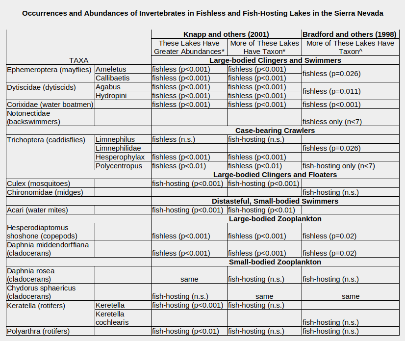
*Previously stocked lakes without fish at time of survey not included; “fishless lakes” were never stocked.
^Only lakes with pH > 6.0.
n.s. – not significant (p > 0.05 for Knapp and others (2001) and p > 0.10 for Bradford and others (1998))
same – bars for fishless and fish-hosting lakes in the graphs have about the same height.
Bradford, D. F., Cooper, S.D., Jenkins, T.M., Kratz, K., Sarnelle, O., and Brown, A.D., 1998, Influences of natural acidity and introduced fish on faunal assemblages in California alpine lakes: Canadian Journal of Fisheries and Aquatic Sciences, v. 55, p. 2478-2491.
Knapp, R.A., Matthews, K.R., and Sarnelle, O., 2001, Resistance and resilience of alpine lake fauna to fish introductions: Ecological Monographs, v. 71, no. 3, p. 401-421.
Back to Fish-stocking Zooicide
Knapp and others (2001) distinguished between “never-stocked”, “stocked-fish-present”, and “stocked-now-fishless” lakes. The “stocked-now-fishless” results are not included in the table as the presence of species in such cases is controlled by recolonization as much as by original presence. Thus, “fishless” for Knapp and others’ (2001) results in the table means “never-stocked”. Their benthic macroinvertebrate (those that spend at least part of their time on the bottom) samples were from 67 “never-stocked” lakes and 100 “stocked-fish-present” lakes. Their zooplankton samples were from 62 “never-stocked” lakes and 89 “stocked-fish-present” lakes. The surveyed lakes of Knapp and others (2001) had areas of at least 0.5 hectare (1.2 acres), depths of at least 3 m (10′), and elevations of 2,870-3,600 m (9,420-11,810′).
Potentially confounding variables were considered. Knapp and others (2001) looked at elevation, area, depth, solar input (important for estimating damage by ultraviolet light), sampling day, and percent silt and, because of their interest in amphibians, the numbers of other lakes within 1 km (0.6 mile) and of other ponds within 250 m (820′). Bradford and others (1998) considered elevation, area, and depth along with pH, conductivity, and the concentrations of major ions. Although there were some significant differences in these variables between fishless and fish-hosting lakes, “the strong effects of lake category [e.g., never-stocked] on faunal assemblage structure were independent of the confounding influences of habitat variables” (Knapp and others, 2001). Bradford and others (1998) found that fishless lakes had smaller areas and shallower depths, on average, than lakes with fish but did not discuss relations between these variables and the presence of invertebrate species. pH was an important control on the absence of fish and tadpoles from acidic lakes and on the distributions of some invertebrates but acidic lakes are not included in the results in “Occurrences and Abundances of Invertebrates in Fishless and Fish-Hosting Lakes in the Sierra Nevada”. The mean pH of both fishless and fish-hosting lakes was 6.9.
Neither Bradford and others (1998) nor Knapp and others (2001) published their data but they did show bar graphs of the percentages of lakes with various taxa (species groups) and of the average abundances (individuals of a taxon per the number of net sweeps for the samples) in the lakes along with levels of statistical significance, or p values. The negative correlation between fish and large zooplankton found by Stoddard (1987) was confirmed. Both Hesperodiaptomus shoshone and Daphnia middendorffiana were much more commonly found in fishless lakes than in lakes with fish. Those sampled were commonly longer than 2 mm (Bradford and others, 1998). D. middendorffiana wasn’t found by Bradford and others (1998) in any lakes with fish. Daphnia rosea and Chydorus sphaericus were shorter than 1 mm (Knapp and others, 2001) and weren’t significantly affected by fish predation. Rotifers are even smaller and the genera Keratella and Polyarthra were significantly more abundant in fish-hosting lakes. Because fish eat most of the large copepod predators, rotifers can proliferate.
Both Bradford and others (1998) and Knapp and others (2001) demonstrated that more fishless lakes have mayfly larvae, dytiscids, water boatmen, and backswimmers than fish-hosting lakes do. Although quite low, the p values don’t do justice to the visual impact of the bar graphs. On the graphs of Bradford and others (1998), the percentages of fishless lakes that have mayfly larvae and water boatmen is about 50% and 85%, respectively, while the percentages of fish-hosting lakes that do looks like 0%. The contrast isn’t quite as dramatic for dytiscids. Bradford and others (1998) also reported that they found backswimmers only in fishless lakes. The abundance data of Knapp and others (2001) complements the percentage of lakes data and indicates that some invertebrate populations that are free from fish predation are much, much larger than those in lakes with fish.
Knapp and others (2001) were surprised to find that the great preponderance of caddisfly larvae were found in fishless lakes. Caddisfly larvae are protected by cases they construct of local materials like sand or small bits of vegetation. Some such cases are good camouflage. Caddisfly larvae can also crawl between pebbles and rocks to hide from fish. Nonetheless, they generally weren’t present in fish-hosting lakes. Smaller size can’t account for Limnephilus’s more common presence in fish-hosting lakes as it is about 10 mm long, the same size as Polycentropus and smaller than Hesperophylax (Knapp and others, 2001). Limnephilus may have some behavioral advantage compared to the other caddisfly larvae collected but maybe its apparent advantage is due to some idiosyncrasy of the lakes where it was collected. Bradford and others (1998) found that an unspecified species of the same family was rarely found in fish-hosting lakes.
Mosquito larvae, genus Culex, are not relatively small but Knapp and others (2001) offered an explanation for their common presence in fish-hosting lakes. They suggested that Culex could better hide from fish than the other large invertebrates because they prefer to hang out in aquatic vegetation. Moreover, they could benefit from the near disappearance of large insect predators such as dytiscids. A similar explanation might apply to chironomids.
The more common presence of Acari in fish-hosting lakes was expected by Knapp and others (2001). They taste bad. Water mites can also be smaller than 1 mm. A tiny graph in Knapp and others (2001) suggests that those collected were less than 2 mm and possibly less than 1 mm long, on average.
It is not that there is some physical or chemical characteristic in the fish-hosting lakes that is inimical to aquatic invertebrates. Some caddisfly species and small-bodied cladocerans and rotifers do have similar distributions in fishless and fish-hosting lakes. Either fish predation is the cause of the different distributions or it is a coincidence. The statistics prove it is not a coincidence at the 99.9% confidence level (for the larger data set of Knapp and others, 2001). Strong correlations between the large-bodied invertebrates also rule out a coincidence. The coincidence would have to affect mayflies, water boatmen, and dytiscids similarly. These species have similar correlations of 0.44, 0.48, and 0.63 with the principal component axis 1 for macroinvertebrates derived by Bradford and others (1998). It would also have to affect Hesperodiaptomus shoshone and Daphnia middendorffiana similarly. They have correlations of 0.78 and 0.80 with the principal component axis 2 for zooplankton.
Back to Fish-stocking Zooicide
Zooplankton and Benthic Invertebrates in Lassen Volcanic National Park
Like Bradford and others (1998) and Knapp and others (2001), Parker (2008) sampled a large variety of aquatic animals to determine fish impacts. He surveyed 32 fishless lakes and 10 lakes with fish in Lassen Volcanic National Park in the northern Sierra Nevada. Lake areas ranged from less than 1 to 256 hectares (less than 2.5 to 632 acres), depths from 2 m to greater than 64 m (6.5′ to greater than 210′), and elevations from 1,700-2,700 m (5,580′-8,860′). Fishless lakes were no deeper than 32 m (105′) or larger than 32 hectare (79 acres), probably because all the bigger lakes had been stocked. Fish-bearing lakes did not occur above 2,500 m (8,200′). Data by lake were not published but the dragonfly Sympetrum, giant water bugs of the family Belostomidae, the water scorpion Ranatra brevicola, 5 species of dytiscid, a Gyrinux whirligig beetle, a Tropisternus water scavenger beetle, the cladoceran Holopedium gibberum, mosquitoes, the copepod Hesperodiaptomus kenai, the chironomid Chaoborus americanus, and the fairy shrimp Streptocephalus sealii (sic?) were absent from lakes with fish but present in fishless lakes. With the possible exception of H. gibberum, these are all large-bodied species. H. kenai is typically 2 mm (0.08″) long (Wilson, 1953).
Parker (2008) presented bar graphs of macroinvertebrate densities (individuals per net sweep) by lake type, either vegetated, with fine sediment bottom, or with coarse sediment bottom. The table “Densities of Invertebrates in Fishless and Fish-Hosting Lakes in Lassen Volcanic National Park”, below, shows results similar to those for Knapp and others (2001) except for mayflies. Some species of mayfly can maintain stable populations in the presence of fish even if the populations would be larger without fish (e.g., Caudill, 2005).
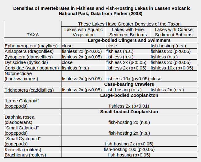
“fishless” lakes include an unknown number of lakes that were stocked but don’t currently have fish.
For other taxa that were completely absent from fish-hosting lakes, see text.
2x, 10x – heights of bars for fishless and fish-hosting lakes look at least 2 or 10 times different.
n.s. – not significant (p > 0.05).
close – bars for fishless and fish-hosting lakes have somewhat different heights in the graph.
Parker, M. S., 2008, Comparison of limnological characteristics and distribution and abundance of littoral macroinvertebrates and zooplankton in fish-bearing and fishless lakes of Lassen Volcanic National Park: National Park Service, Natural Resource Technical Report NPS/KLMN/NRTR—2008/116, 26 p.
Dragonflies, damselflies, dytiscids (except those in vegetated lakes), water boatmen, and backswimmers (except those in coarse-sediment lakes) were more abundant in fishless lakes, although not always significantly so. Caddisflies were more abundant in fishless lakes that were vegetated or had coarse sediment but not in those with fine sediment. The pattern for zooplankton also fits the expected consequences of fish predation with large-bodied species more abundant in fishless lakes and small-bodied species more abundant in lakes with fish.
Parker’s (2008) data could have underestimated the negative effects of fish on large-bodied invertebrates. Fish-stocking in the park was stopped in the 1970s. Records of previous fish-stocking are incomplete but Parker (2008) inferred that all the lakes surveyed had been stocked. Because of that, populations of some species may still be lacking or have low densities in fishless lakes and consequently appear to differ less from fish-hosting lakes.
Confirmation that Fish Diets Include Benthic Invertebrates
Finlay and Vredenburg (2007) used a different approach but their results also support the conclusion that fish predation reduces or eliminates populations of large invertebrates. They surveyed 20 fishless lakes and 21 lakes stocked with fish in Kings Canyon National Park at elevations of 3,000-3,500 m (9,840-11,480′). They stated “invertebrate predators, common only in fishless lakes” but didn’t report populations by lake. The predators were “primarily” dytiscids (order Coleoptera, family Dytiscidae) and corixids (sub-order Heteroptera, family Corixidae – water boatmen). As Finlay and Vredenburg (2007) were interested in the food competition between fish and frogs for Ephemeroptera, they didn’t determine fish effects on invertebrate predators. Instead, they used carbon and nitrogen isotopic ratios to demonstrate that the prey of introduced fish consisted entirely of “benthic grazers”, “primarily” Ephemeroptera (mayflies) and Trichoptera (caddisflies). Small-bodied cladocerans and copepods were eaten very sparingly or not at all.
Wrap-Up Sierra Nevada
Knapp and Matthews (2000) summarized the effects of fish on benthic invertebrates by stating “large conspicuous species are eliminated, while burrowing or otherwise inconspicuous species are relatively unaffected”. As a result, “several conspicuous taxa of mayfly larvae (Ephemeroptera), caddisfly larvae (Trichoptera), aquatic beetles (Coleoptera) and true bugs (Corixidae)” dominate fishless lakes but “are rare or absent in lakes with introduced trout”. Similarly, for water-column invertebrates, fish-stocking “shifts the zooplankton community from one dominated by large-bodied species to one dominated by smaller-bodied species”. If fish predation has had such large impacts on so many invertebrate species in the Sierra Nevada, it must also have impacted fairy shrimp populations for the worse. How many populations were eliminated will never be known.
Back to Fish-stocking Zooicide
What Have the Effects of Fish-stocking Been Beyond the Sierra Nevada?
Negative correlations between fish and various invertebrate taxa would be more convincing if they were seen in other areas and in other ecosystems.
in Utah
Stocked trout in the mountains of Utah severely reduced populations of large-bodied invertebrates there. “Densities of large benthic (e.g., caddis larvae, Hemiptera, and amphipods) and planktonic (Chaoborus and some Diaptomidae) taxa were 3- to 7-times less abundant in lakes with trout than without” (Carlisle and Hawkins, 1998, abstract only). There was nothing wrong with the water. The small cladoceran Daphnia rosea and cyclopoid copepods did fine in the trout lakes. The differences in invertebrate densities could not be explained by different sand, cobble, or vegetation bottom types. Trout ate them: “differences in habitat did not appear to mediate effects of trout predation on benthic invertebrate assemblages”.
in Maine
A comprehensive study of 16 fishless and 18 fish-hosting lakes in the Eastern Lowlands and Foothills and in the Central and Western Mountains in Maine documented major differences in the aquatic communities with or without fish (Schilling and others, 2009). As shown in the table “Mean Abundances of Invertebrates in Fishless and Fish-Hosting Lakes in Maine”, below, the fishless lakes had significantly greater abundances of some dragonflies, some damselflies, some whirligig beetles, some water boatmen (Cenocorixa was more abundant in fish-hosting lakes), and some backswimmers, which are all relatively large. Tellingly, the water boatman genus Callicorixa, the backswimmer Notonecta insulata, the dytiscid Graphoderus liberus, and Chaoborus americanus were widespread in fishless lakes but absent from lakes with fish. An additional 7 species were absent from fish-hosting lakes but inhabited only a few fishless lakes. There wasn’t much difference in the distribution of mayflies. Water striders of the family Gerridae were only found on lakes with fish. Overall, Schilling and others (2009) found that “Fish presence or absence was a stronger determinant of community structure in our study lakes than differences in lake origin and physiography”. Schilling and others (2009) did not identify any of the fish-hosting lakes as stocked. Whether the fish were native or not, the results indicate that the long-term presence of fish drives the composition of compatible aquatic communities far from those found in fishless lakes and completely excludes some species, which would likely include fairy shrimp.
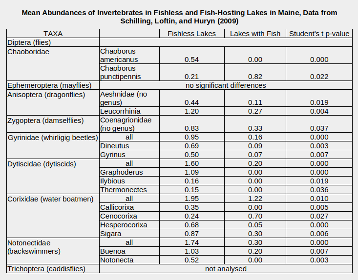
Fishless and fish-hosting lakes have mean areas of 2.8 and 3.8 hectares (6.9 and 9.4 acres) and depths of 6.3 and 6.7 m (20.7′ and 22.0′), respectively, and are from both the Eastern Lowlands and Foothills and the Central and Western Mountains.
Only the taxa with significant differences between fishless and fish-hosting lakes are listed.
Schilling, E.G., Loftin, C.S., and Huryn, A.D., 2009, Macroinvertebrates as indicators of fish absence in naturally fishless lakes: Freshwater Biology, v. 54, p. 181-202.
in the Tatra Mountains, Poland
Cladocerans and most copepod species have been extirpated from stocked lakes in the Tatra Mountains of Poland while smaller rotifers have increased in abundance over several decades (Gliwicz and Rowan, 1984). The cladocerans Daphnia pulicaria and Holopedium gibberum are abundant in a fishless lake in the same region. These cladocerans are certainly larger than rotifers but their sizes were not given. They are likely larger than the copepod Cyclops abyssorum tatricus, which continues to survive in lakes with fish. The mean body length of that cyclopoid is 0.77 mm (0.03″). Samples of fish stomachs indicated Cyclops abyssorum tatricus accounted for less than 1% of food over most of the year. However, copepods bearing more visible dark eggs became a major food item when they appeared in April. As a result, fish diets changed to about 40% copepods (but with a huge standard deviation). This is the same story of fish predation severely reducing populations of more visible zooplankton.
in the Alps, Slovenia
In the Alps of Slovenia, the relatively large copepod Arctodiaptomus alpinus was eliminated within 7 years of the introduction of alpine charr into a previously fishless lake (Brancelj, 1999).
In a study of copepods in a wide variety of 160 lakes and ponds of the Alps of Italy, Slovenia, and Austria, Jersabek and others (2001) stated that stocked fish “normally excluded the occurrence of calanoid copepods”. Specifically for Arctodiaptomus alpinus, the “different intensity of fish-stocking” “reflected” its distribution. Calanoids are commonly larger than cyclopoids but sizes weren’t given. Moreover, “the distribution pattern of all planktonic species, including C. abyssorum tatricus, was negatively associated with that of fish.”
Back to Fish-stocking Zooicide
in the Alps, Italy
The zooplankton in 12 alpine lakes of a national park in the western Alps of Italy have low species diversity and most species are little affected by the presence of fish (Magnea and others, 2013). The exception is Daphnia gr. pulicaria. It was the only species with an average body length greater than 2 mm (0.08″). It was present in 4 of 6 fishless lakes and in none of the 6 lakes with fish. Smaller species were widespread. The calanoid copepod Arctodiaptomus alpinus (average body length 1.25 mm, 0.05″), the cyclopoid copepod Cyclops abyssorum (1.26 mm, 0.05″), and the cladoceran Daphnia gr. longispina (1.15 mm, 0.045″) occurred in 5 or all of the fishless lakes and in 5 or all of the lakes with fish. Very small rotifers (0.12 mm, 0.005″) inhabited all of the fishless and fish-hosting lakes. The small cladoceran Chydorus sphaericus (0.34 mm, 0.013″) was more common in lakes with fish (5 of 6) than in fishless lakes (2 of 6) (Magnea and others, 2013).
Fish predation on zooplankton by species was elucidated by a different sampling of trout stomachs from 7 lakes (Tiberti and others, 2014). Rotifers were not found in the stomachs. Smaller fish ate all the copepod and cladoceran species but fish longer than 20 cm (7.9″) ate only the largest, i.e., Daphnia gr. longispina and Cyclops gr. abyssorum. Although only about 6% of the stomachs of large trout had zooplankton, that was nevertheless sufficient to reduce the densities of the largest species. 3,100 Daphnia gr. longispina individuals were found in the stomach of a single trout (Tiberti and others, 2014).
An analysis of the ecological impact of fish in the same area of Italy found the “local extinction in stocked lakes of both more vulnerable taxa (in particular Ditiscidae, Corixidae, Tricoptera, and Acari), as well as, entire groups of organisms sharing the same modes of existence, such as clinger and swimmer macroinvertebrates” (Tiberti and others, 2013). In contrast, burrowing species such as chironomids and oligochaetes were more abundant in lakes with fish.
in the Pyrenees, Spain
In the face of fish predation, not all dytiscids are created equal. The 4 most common dytiscid species found in 45 lakes (17 fishless) in the Pyrenees were Agabus bipustulatus, Platambus maculatus, Hydroporus foveolatus, and Boreonectes ibericus (De Mendoza and others, 2012). Percentages of host lakes that were fishless were 86% (12 of 14 lakes) for Agabus, 0% for Platambus (0 of 7), 43% for Boreonectes (3 of 7), and 47% (9 of 13) for Hydroporus. Due to strong correlations of temperature, fish, and vegetation with altitude and, hence with each other, the data were analyzed using canonical correspondence analysis, which generated some nice splatter diagrams. Further, generalized additive models demonstrated that fish presence explained more of the variance than temperature for Agabus but the opposite was true for the other species. Vegetation was most important for Boreonectes and somewhat important for the other species.
Mean body lengths seem to explain most of the differences in dytiscid distributions but were not tested statistically. Mean lengths were 9.6 mm for Agabus, 7.6 mm for Platambus, 4.0 mm for Boreonectes, and 3.4 mm for Hydroporus (not measured but citing Ribera and Nilsson, 1995; probably of adult beetles rather than of larvae). The negligible impact of fish on Boreonectes and Hydroporus and strong effect on Agabus could be attributed to the fish dietary preference for larger prey. Moreover, a temperature control on the distribution of Agabus doesn’t make sense because it also occurs at lower elevations and higher temperatures elsewhere in Spain (De Mendoza and others, 2012). The occurrence of Platambus only in lakes with fish cannot be a result of size-selective predation because it is almost as big as Agabus (assuming sizes are the same as those in the cited work). Platambus occurs in streams as well as lakes and is a poor swimmer whereas Agabus is a good swimmer (De Mendoza and others, 2012). A tendency to cling to the bottom and swim less may reduce its chances of being eaten by fish. It may also benefit if fish eliminate competition or predation by Agabus (my suggestion). Platambus does not occur in any lakes that have Agabus.
in Patagonia, Argentina
For lakes of the Patagonian steppe, 1 figure says it all, almost. For the 6 lakes with fish (5 stocked, 1 natural), the medians and 10th and 90th percentiles of body lengths of the dominant cladoceran species are all less than 1.0 mm (0.04″) (Reissig and others, 2006, Figure 5). For 12 fishless lakes, they are all greater than 1.7 mm (0.07″) except for 2 lakes which lacked any large cladoceran. The gap between sizes in fishless and fish-hosting lakes was not as clear for copepods because the fishless lakes had 2-4 species ranging from the smallest to the largest and 1 lake with fish had the 2 largest species as well as 2 smaller ones (Reissig and others, 2006, Figures 3 and 4). Even so, the difference of the maximum sizes of copepods between lakes with and without fish was significant (p = 0.005). The small rotifers were considerably more abundant in lakes with fish than those without. Reissig and others (2006) also noted that the largest copepod had been extirpated from 1 lake.
Fish have also affected the phytoplankton in Patagonian lakes. Stocked lakes have much higher concentrations of phytoplankton than fishless lakes: 102,642-5,493,620 cells per milliliter compared to 226-7,603 cells per milliliter (Reissig and others, 2006). The ratio of phytoplankton less than 0.02 mm to that greater than 0.02 mm is far lower in stocked lakes: 0.0003-0.0338 compared to 0.6964-2.3037. The types of phytoplankton also differ dramatically. By volume, stocked lakes have mostly Cyanophyceae and “others” whereas fish-free lakes are dominated by Chlorococcales and Zygnematales with smaller amounts of Cryptophyceae + flagellated Chrysophyceae less than 0.02 mm. The 1 lake with native fish is in a phytoplankton class by itself. The predominance of cyanobacteria in stocked lakes may be a result of fish feces recycling phosphorus or to the elimination of the cladoceran genus Daphnia, which has high phosphorus requirements, or both (Reissig and others, 2006). The preponderance of phytoplankton less than 0.02 mm in fishless lakes could be due to the preferences of larger omnivorous or herbivorous copepods that have been eliminated in lakes with fish.
Data summarized above indicate that the effects of fish-stocking observed in the Sierra Nevada are not the result of unique local conditions.
Back to Fish-stocking Zooicide
What Have the Effects of Fish-stocking Been on Vertebrates?
Amphibians in the Sierra Nevada
Except for Stoddard (1987), the Sierra Nevada studies summarized above were not supported by a specific interest in entomology or a general interest in aquatic biology. They were supported by alarm over decreasing numbers of mountain yellow-legged frogs. A 1994 resurvey of the Sierra Nevada lakes surveyed in 1915 found that only 15% of the lakes previously reported to have the frogs still had the frogs (Pacific Southwest Research Station, 2003). During the Sierra Lakes Inventory Project’s 1995-2002 survey, mountain yellow-legged frogs were found in 566 lakes and fish in 662 lakes. Of the lakes with mountain yellow-legged frogs, 86% lacked fish and 14% had fish. It is thanks to the frogs we now also know that many invertebrate populations have disappeared.
A “dramatic decline and possible extinction” in populations of Cascades frog in Lassen Volcanic National Park “and the surrounding region” was reported by Parker (2008), citing previous studies. Parker (2008) observed that his study “clearly showed a negative association between fish and certain amphibian species within all lentic [lake] habitats”.
Amphibians in the Cascade Mountains, Oregon and Washington
Concern about amphibians has been global. Negative effects of fish-stocking have been documented for the Cascade frog in Washington; the Pacific tree frog in California and Oregon; the long-toed salamander in Idaho, Oregon, and Washington; the northwestern salamander in Washington; and the tiger salamander in Colorado (Dunham and others, 2004, Table 2). In the North Cascade National Park Service Complex, larvae of long-toed salamander were significantly less abundant in lakes with fish than in lakes without fish on the east slope of the Cascade Mountains (Liss and others, 1995). On the west slope, tiger salamander is more common and survives in some lakes with fish but larvae are less abundant than in lakes without fish.
Amphibians in the Cantabrian Mountains, Spain
Stocked fish affect the distributions of several amphibian species in the Cantabrian mountains of northern Spain. Of 8 “large and permanent pools and lakes” with fish, 3 lakes had no amphibian species, 3 had 1 species, and 2 had 2 species (excluding Ercina, which was reportedly stocked but lacked fish) (Braña and others, 1996). 7 fishless lakes each have 3-5 species of amphibians. Rana temporaria was the only amphibian which occurred in more than 1 stocked lake (excluding Ercina). 6 species were found only in fishless lakes although some of these were found on land within 500 m (1,640′) of lakes with fish. All fishless lakes had some amphibians but 3 lakes with fish didn’t (excluding Ercina). Another study found that the toads Bufo bufo and Alytes obstetricans were widespread regardless of fish but the newts Triturus helveticus, Triturus alpestris, and Triturus marmoratus were negatively affected by introduced fish (Orizaola and Braña, 2006, abstract only). Bufo bufo and Alytes obstetricans had been found only in fishless lakes in Braña and others (1996).
Amphibians in the Neila Mountains, Spain
In the Neila Mountains of central Spain, the 4 species Triturus helveticus, Triturus marmoratus, Bufo calamita, and Hyla arborea were found only in the 3 fishless lakes (Martínez-Solano and others, 2003). These 4 species were also found in 2 temporary ponds. The exclusion of these species from lakes with fish is at least partly due to preferences for shallow lakes or ponds with submerged vegetation and muddy bottoms. Lakes favored by trout tend to be deep and rocky. The 3 fishless lakes each have 6-7 species of amphibians. Bufo bufo and Alytes obstetricans inhabit both fishless and fish-hosting lakes and are joined there by the frog Rana perezi. Salamandra salamandra was found in 5 fishless lakes (2 had no other amphibians) and 1 lake with fish in 1981, in 2 fishless lakes in 1991, and in no lakes or temporary ponds in 2001 (Martínez-Solano and others, 2003). Populations of S. salamandra in other areas of Spain have also disappeared. Stocked fish are likely partly responsible for the disappearances (Martínez-Solano and others, 2003).
Amphibians in the Alps, Switzerland
The newt Ichthyosaura alpestris (previously Triturus alpestris) in the Alps of southern Switzerland is strongly affected by fish predation but has the resilience to bounce back (Denoël and others, 2016). Fish were present in “Pianca Lake” in 1972 and newts were absent. In 1989, newts were present but fish were absent. The lake was again stocked with fish in 2009, 2011, and 2012. Newts were not found in the lake in 2014. However, at that time they were found in a smaller nearby lake without fish. They were also present in another lake that had a low density of minnows but not in another lake with abundant brook trout (Denoël and others, 2016). The key to newt persistence in the presence of fish was small, shallow pools near the lakes acting as refuges. However, persistence is not guaranteed. Pool populations are much smaller than those of lakes and more sensitive to drought.
Reptiles in the Sierra Nevada
The effects of fish-stocking extend from the aquatic realm to the terrestrial and avian realms. This is important for fairy shrimp because such effects can bounce back to impair the ability of fairy shrimp to colonize new ponds. Terrestrial animals and birds serve as dispersal agents for fairy shrimp eggs.
Mountain garter snakes feed on mountain yellow-legged frogs, among other species. Of about 1,000 lakes in Kings Canyon National Park, where there has been no fish-stocking since 1970, garter snakes were found in 62. Among a similar number of lakes in the John Muir Wilderness, where fish-stocking continues, no mountain garter snakes were found (Pacific Southwest Research Station, 2003).
Finches in the Sierra Nevada
Fish-stocking has negative effects on some bird populations. The food gray-crowned rosy finches use to feed their young in the Sierra Nevada is “primarily” insects (Epanchin and others, 2010) and much of that is mayflies. Fish eat mayfly larvae. In the study area, all 12 fishless lakes had mayfly larvae but only 2 of 12 lakes with fish did. Moreover, the densities of larvae were about a factor of 10 less in the 2 lakes with fish than in the lakes without fish. Rosy finches were 4 to 10 times more abundant at fishless lakes than at lakes with fish during mayfly hatches (for the lakes with fish and no mayflies, timing of hatching was determined by a nearby fishless lake). Whether fish-stocking reduced populations of rosy finches or not was beyond the scope of Epanchin and others’ (2010) study.
Back to Fish-stocking Zooicide
Lesser Scaup in southern Saskatchewan, Canada, and the upper Midwest, U.S.A.
2 studies have identified strong links between the numbers of migrating lesser scaup and the densities of amphipods, a dominant food, at wetlands on the prairies north and south of the Canada – United States border (Lindeman and Clark, 1999; Anteau and Afton, 2009). Fish eat amphipods. A 3rd study in the region found strong negative correlations between amphipod densities and fish densities and referred to a decades long decline in lesser scaup numbers (Carleen and others, 2024). Due to climatic and human factors, fish have become much more common over the same time frame and threaten to turn North America’s “duck factory” into a “fish factory” (McLean and others, 2016).
Ducks in Norway
In Norway, goldeneyes were found more often at lakes without fish than at lakes with fish (Eriksson, 1979, abstract only). Experimental removal of fish from 1 lake increased numbers of mayfly larvae, Odonata larvae (e.g., damselflies, dragonflies), water bugs (e.g., water boatmen, backswimmers), dytiscids and Chaoborus larvae. Ducks subsequently increased their use of the experimental lake.
Ducks in Finland
A survey of 38 lakes in Finland found a negative correlation between the numbers of common goldeneyes and green-winged teals at a lake and the abundance of yellow perch in the lake (McParland, 2005). The same did not hold true for mallards.
Ducks in Sweden
Mallards were most common at Swedish lakes with low fish densities and mallard ducklings were able to eat the most invertebrates at lakes with the fewest fish (McParland, 2005).
Flamingos in the Andes, Peru
Surveys of the flamingo, fish, and zooplankton populations in 20 high-elevation lakes of southern Peru found a negative relation between flamingos and fish (Hurlbert and others, 1986). At the 8 lakes without fish, the numbers of flamingos (total visual counts) ranged from 0 (4 of 14 surveys) to 4,457 with an average (average of mean and median) of 245 per survey. At the 12 lakes with fish (either native or exotic), the range was 0 (10 of 24 surveys) to 205 birds with an average of 25 per survey. The reason flamingos prefer lakes without fish is that these lakes have much greater abundances of the large zooplankton that they eat, specifically calanoid copepods and cladocerans (commonly Daphnia in fishless lakes). The average (average of mean and median) biomass of calanoids in fishless lakes was 1,292 micrograms per liter and in lakes with fish it was 54 micrograms per liter. In all surveys of fishless lakes (other than 2 saline lakes inhabited by fairy shrimp of the genus Artemia), close to 100% of the copepods were calanoids. In most surveys that found fish, close to 0% of copepods were calanoids but a minority of surveys had 50-100% calanoids. Conversely, the small species of cyclopoid copepods and rotifers were more abundant in lakes with fish by factors of 17 and 6, respectively.
Fish diets overlap with those of flamingos. Native fish of the genus Orestias “feed primarily on cladocerans, copepods, amphipods, and insect larvae, but also on fish eggs, filamentous algae, and phytoplankton” (Hurlbert and others, 1986). Introduced Basilichthys bonariensis have a similar diet but larger individuals also eat other fish. Introduced rainbow trout mostly eat other fish but they also eat amphipods, insects, snails, tadpoles, copepods, and cladocerans (Hurlbert and others, 1986).
Coots and Swans in Patagonia, Argentina
In “Laguna Blanca” National Park in northern Argentina, there is a negative relation between the presence of fish and the abundance of black-necked swans and coots (Ortubay and others, 2006). Fish were introduced in 1965 to “Laguna Blanca”. Bird densities were not quantified but the effects of fish on aquatic communities were determined by comparing benthic macroinvertebrate populations in the large, eutrophic, fish-hosting “Laguna Blanca” with those in 3 much smaller, shallower, fishless ponds nearby. Graphically (Ortubay and others, 2006, Figure 2), amphipods (genus Hyalella) and copepods were much more abundant in the fishless ponds than in “Laguna Blanca”. Ostracods were more abundant in “Laguna Blanca” and the smallest, most saline fishless pond than in the other 2 fishless ponds. Acari (mites) were present only in “Laguna Blanca”. “Laguna Blanca” had the least benthic biomass. Percichthys colhuapiensis fish collected from “Laguna Blanca” ate abundant snails (Planorbidae), copepods, chironomid larvae, amphipods (May only), cladocerans (March only), and ostracods (January only) in addition to terrestrial insects (March only) (Ortubay and others, 2006, Figure 4). The size of the ostracods was not given but the other prey species were probably large. Other possibly fish-related impacts include the disappearance of the amphibian Atelognathus patagonicus between 1984 and 1986 and of tadpole shrimp (Notostraca) more recently than 1991. Negative effects across populations of birds, amphibians, amphipods, copepods, and notostracans are most easily explained by fish predation.
Back to Fish-stocking Zooicide
Zooicide in the Sierra Nevada
Most alpine fairy shrimp are as large as, or larger than, the amphipods, water boatmen, dytiscids, backswimmers, and caddisfly larvae and much larger than the cladocerans and copepods that suffered from fish predation in the studies summarized above. Making matters worse, fairy shrimp don’t hide in vegetation, don’t cling to the pond bottom (except for brief feeding), swim slowly, and are always available to be eaten by visual predators because they swim throughout the daylight hours. Consequently, the effects of fish on pre-stocking fairy shrimp populations would be at least as bad as those on the benthic macroinvertebrates and zooplankton considered above. My guess is that fish extirpated every population of fairy shrimp they were introduced to.
Summing up, the stocking of fish in the Sierra Nevada has exterminated or drastically reduced some unknown number of populations of amphibians, large-bodied insects, amphipods, cladocerans, and copepods. The examples above demonstrate that these effects are not unique to the Sierra Nevada or to alpine lakes in the western United States. Even ignoring fairy shrimp, the effects have been geographically and biologically far-reaching. Fish-stocking is a human choice. The intentional, extensive elimination of a species (analogous with human ethnic group) from lakes (analogous with country) or the reduction of populations to less than half of what they were before is what I call “zooicide”. Exterminating numerous populations of several species at the same time is more zooicide. Continuing to stock lakes with fish and thereby preventing previously eliminated species from recolonizing their homelands is long-term zooicide.
Back to Fish-stocking Zooicide
East-Central Sierra Nevada – top
Previous Reports of Fairy Shrimp
3 species of fairy shrimp were recorded in the Sierra Lakes Inventory Project (Knapp and others, 2020): Branchinecta coloradensis, Branchinecta oriena, and Streptocephalus seali. The survey has a few records of “Branchinecta sp.”, where only the genus was identified. Eng, Belk, and Eriksen (1990) listed 2 occurrences of Branchinecta coloradensis in the Sierra Nevada at elevations of 3,050 m (10,010′) and 3,500 m (11,480′), 9 occurrences of Branchinecta dissimilis between Lake Tahoe and Bishop at elevations of 2,440-3,506 m (8,010-11,500′), and 35 occurrences of Streptocephalus seali in coniferous forest from Lassen Volcanic National Park to Mammoth Mountain at elevations of 2,100-3,032 m (6,890-9,950). The Branchinecta dissimilis occurrences may include the 2 of Stoddard (1987). Some of the fairy shrimp identified as B. dissimilis may have been misidentified B. oriena (Belk and Rogers, 2002, abstract only).
There are no doubt reports by others of fairy shrimp in the Sierra Nevada but I haven’t found them online.
How common fairy shrimp are in the Sierra Nevada has not been well determined.
Stoddard (1987) found fairy shrimp in 2 of 17 fishless lakes, or 12%. Stoddard (1987) claimed his 75-lake sample was “representative of the geological and ecological diversity of the Sierra Nevada”. Surface areas ranged from 0.3 to 578 hectares (0.7-1,430 acres) and depths from 0.5 to 90 m (1.6-295′). Elevations ranged from 1,900 m to higher than 3,000 m (6,230 to >9,840′).
Bradford and others (1998) didn’t see fairy shrimp in the 18 fishless lakes they surveyed. This implies an occurrence rate of less than 5.5%. Bradford and others’ (1998) 33 surveyed lakes were in Kings Canyon National Park. They had areas of 0.12 to 30.5 hectares (0.3-75 acres), depths of 0.3 to 10.0 m (1-33′), and elevations of 3,130 to 3,672 m (10,270-12,050′).
In Lassen Volcanic National Park in the northern Sierra Nevada, the fairy shrimp Streptocephalus sealii [sic?] occurred in 1 of 32 fishless lakes, for an occurrence rate of 3.1% (Parker, 2008).
The Sierra Lakes Inventory Project (Knapp and others, 2020; database available online at doi.org/10.6073/pasta/d835832d7fd00d9e4466e44eea87fab3) surveyed 7,863 lakes in Yosemite, Kings Canyon, and Sequoia National Parks and the John Muir Wilderness in the central and southern Sierra Nevada. The survey was designed to detect the presence of amphibians and fish but also collected zooplankton samples with vertical tows of a plankton net (not effective for fairy shrimp) and benthic macroinvertebrates. Surveyors were also instructed to “be on the look out for schools of fairy shrimp”. Fairy shrimp were found at 258 locations (3.6% of fishless lakes). However, 16 of the fairy shrimp locations had fish. It is more likely that for these locations, the fairy shrimp were found in ponds near lakes with fish rather than in the same water body. The survey protocol called for recording fairy shrimp if they are in “lake-associated pools” within 2 m of the lake or in “other locations”. The Sierra Lakes Inventory Project survey is strongly biased toward large lakes. Only 1% of the lakes were smaller than 36 hectares (89 acres).
The above surveys indicate fairy shrimp aren’t common in fishless lakes of the Sierra Nevada. They are half as common in all lakes given that more than 60% of lakes there have fish (Knapp and Marine Science Institute, 1996). Too few fairy shrimp populations have been found (i.e., less than 300) and described (i.e., none) to say with any confidence where the best places to look are.
East-Central Sierra Nevada – top
Virginia Divide Double Ponds (Bridgeport Ranger District, Humboldt-Toiyabe National Forest; Hoover Wilderness)
___This map is a screenshot of The National Map (Go to The National Map). The U.S. Geological Survey generally does not copyright or charge for its data or reports (unless printed). A pond location is indicated by an “X”, which corresponds to the coordinates given in the data spreadsheet. Labels in quotations are from 7.5-minute topographic quadrangles.
___Red lines are the U. S. National Grid with a spacing of 1,000 m and intersection labels consisting of the UTM zone (e.g., 11S, 12T), a 2-letter 100-km square designation (e.g., LC, XN), and a 4-digit number. The first 2 digits of the number represent the 1,000-meter Easting and the second 2 digits the 1,000-meter Northing, as seen in the example Easting and Northing. Unlike latitude and longitude, the National Grid is rectilinear on a flat map, the units of abscissa and ordinate have equal lengths, and the units (meters) are measurable on the ground with a tape or by pacing.
___There is no private or state land on this map. All the lands are public.
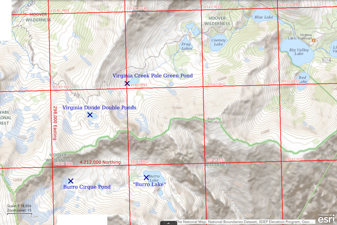
Virginia Divide Double Ponds are a little more than 24 km (15 miles) southwest of Bridgeport. They are in a low spot on the broad ridge that forms the drainage divide between Virginia Creek and East Fork Green Creek. There are 2 ponds which are close together and a couple hundred meters south of the hiking trail. They are not on the Humboldt-Toiyabe National Forest’s recreation map for the Bridgeport Ranger District but are on the 7.5-minute topographic quadrangle. The slope to the west of the ponds probably collects a lot of snow.
Access is the hiking trail from the “Virginia Lakes” trailhead. There is an elevation gain of about 450 m (1,480′) but the distance is less than 5 km (3 miles).
Elevation: 3,376 m (11,075′)
September 8, 2016
Water levels are well below the high-water mark but it may not be too late for fairy shrimp.
- Bigger pond is 20 m x 40 m, smaller one is less than 20 m both ways; depths not estimated.
- Water clear.
- No fairy shrimp.
- Caddisfly larvae (Trichoptera).
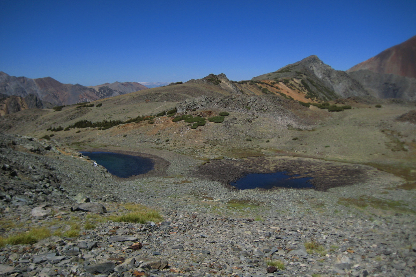
Virginia Divide Double Ponds, looking north along the ridge between East Fork Green Creek Canyon (left) and Virginia Creek Canyon (right). The hiking trail can be seen faintly to the left of the rocky knoll at center.
August 26, 2021
Stopped by on the way to “Burro Lake”. It’s been another dry year but there is some water.
- Bigger pond is 15 m x 40 m and up to 50 cm deep; smaller pond less than 15 m across and less than 15 cm deep.
- Clear water.
- No fairy shrimp.
- Sparse backswimmers (sub-order Heteroptera, family Notonectidae), few caddisfly larvae (Trichoptera), rare mayfly larvae (Ephemeroptera).
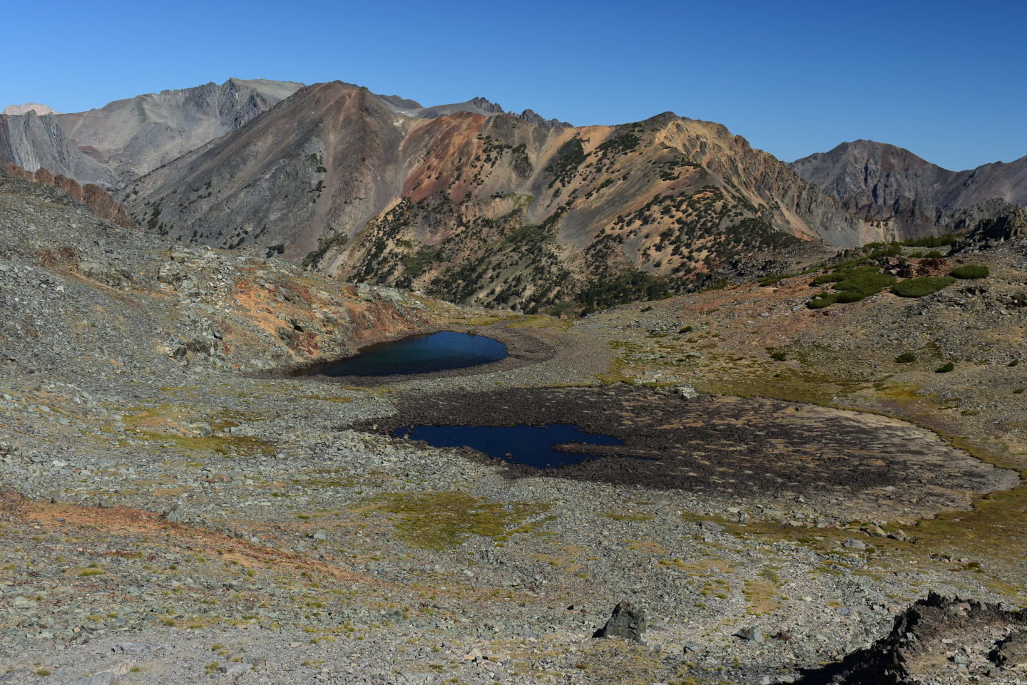
Virginia Divide Double Ponds. This view is looking more to the northwest across East Fork Green Creek canyon than photograph Virginia Divide Double Ponds 2016-09-08, #38.
October 4, 2022
There were no early snows so I took a late hike and stopped to look in these ponds. There is ice around the shores of the ponds and the water levels are quite low.
- Size not estimated; greater than 10 cm deep between the rocks.
- Clear water; thin ice on surface at 0930.
- No fairy shrimp.
- Rare backswimmers (sub-order Heteroptera, family Notonectidae) 10-12 mm long, very rare caddisfly larvae (Trichoptera).
East-Central Sierra Nevada – top
Virginia Creek Pale Green Pond (Bridgeport Ranger District, Humboldt-Toiyabe National Forest; Hoover Wilderness)
Virginia Divide Double Ponds map
Virginia Creek Pale Green Pond is approximately 24 km (15 miles) southwest of Bridgeport. Virginia Creek Pale Green Pond is at the upper end of Virginia Creek about 1 km (0.6 miles) southwest of several ponds next to the label “Frog Lakes”. The recreation map shows a pond here, the 1:100,000-scale BLM map does not. Virginia Creek Pale Green Pond is 130 m (430′) long on the 7.5-minute topographic quadrangle. This pond has a striking pale green color that was present on both my 2016 and 2021 visits. The pond is at least 100 m (330′) off the hiking trail above “Virginia Lakes”. It is easily seen while descending from the East Fork Green Creek – Virginia Creek divide but harder to spot while hiking up the trail.
Access is the hiking trail from the “Virginia Lakes” trailhead. The distance is less than 4 km (2 1/2 miles).
Elevation: 3,244 m (10,645′)
September 8, 2016
I had seen fish while hiking past “Frog Lakes” and the creek between “Frog Lakes” and Virginia Creek Pale Green Pond does not look like much of an obstacle for fish. In spite of the long odds, the shallow water provides some hope so WIDLA.
- 80 m x 130 m based on the 7.5-minute quadrangle; probably less than 100 cm deep as the bottom is easily visible throughout.
- Water clear.
- No fairy shrimp.
- Backswimmers (sub-order Heteroptera, family Notonectidae), black diving beetles; didn’t see fish.
Looking south across Virginia Creek Pale Green Pond with cliffs west of Black Mountain in the background. The grassy turf bordering the pond was very comfortable.
August 26, 2021
Stopped by on the way back from “Burro Lake”. Looks about the same size and depth as in 2016 and the water is still pale green. I paced off the length this time.
- 80 m x 150 m (this length is slightly more than that shown on the 7.5-minute quadrangle); probably no more than 100 cm deep.
- Water clear.
- No fairy shrimp.
- Backswimmers (sub-order Heteroptera, family Notonectidae) of various sizes, water boatmen (sub-order Heteroptera, family Corixidae), caddisfly larvae (Trichoptera), few black diving beetles, numerous young frogs, some still have tails.
I was very confused about whether the pond had backswimmers, like last time, or water boatmen. They are hard to tell apart when swimming. Both tend to swim away from an approaching human. A helpful clue is that water boatmen always cling to the bottom between swimming bouts. Backswimmers sometimes do but they more commonly hang in the water about 1 cm below the water surface if they are not excited. I eventually saw enough of both behaviors to realize the pond had both heteropterans.
Virginia Creek Pale Green Pond, looking down Virginia Canyon from the hiking trail with one of “Frog Lakes” above and to left of center. The pale green color isn’t as striking from this angle but it’s still there.
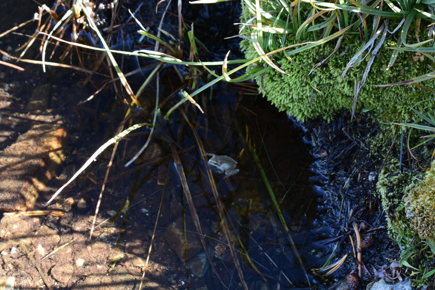
Small frog at Virginia Creek Pale Green Pond. The grass was veritably hopping with frogs in places. Based on the black eye stripe, my guess is that these frogs are Pacific tree frogs (Pseudacris regilla), which are widely distributed from British Columbia south through California and east into Utah and Montana (see amphibiaweb.org). They are small and have long legs. The presence of frogs and abundant backswimmers suggest the pond doesn’t have fish but there is no waterfall between here and the fish in “Frog Lakes” (see previous photograph). If fish can swim to this pond, why haven’t they? Or have they?
October 4, 2022
I was curious to see if there are any ponds among the moraines, talus, and snowbanks at the base of the north face of Black Mountain. I didn’t find any standing water or depressions with water-stained rocks. I took a quick look in this pond on the way by.
- Size not estimated; greater than 20 cm deep.
- Clear water.
- No fairy shrimp.
- Backswimmers (sub-order Heteroptera, family Notonectidae), water boatmen (sub-order Heteroptera, family Corixidae), saw 1 frog which still had a bit of tail.
East-Central Sierra Nevada – top
Lundy Pass Ponds (Inyo National Forest; Hoover Wilderness)
___This map is a screenshot of The National Map (Go to The National Map). The U.S. Geological Survey generally does not copyright or charge for its data or reports (unless printed). A pond location is indicated by an “X”, which corresponds to the coordinates given in the data spreadsheet. Labels in quotations are from 7.5-minute topographic quadrangles.
___As of May 2025, the National Grid overlay with red lines in UTM coordinates does not load in The National Map.
___There is no private or state land on this map. All the lands are public.
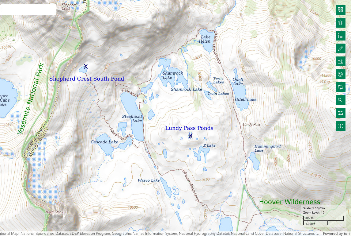
Lundy Pass Ponds are in a broad basin with low relief between Tioga Crest and the crest of the Sierra Nevada 12.5 km (7.8 miles), more or less, northwest of Lee Vining. Ponds of many sizes are south of the lip of Lundy Canyon and north of “Saddlebag Lake” and “Greenstone Lake”. Larger lakes, such as “Steelhead”, “Twin”, “Odell”, and “Hummingbird”, have probably been stocked with fish. Any streams connected to these lakes or “Saddlbag Lake” also likely have fish. However, the undulating terrain has numerous smaller ponds that appear to be isolated from the main streams and likely haven’t been stocked.
There are recreational facilities south of Lundy Pass. “Saddlebag Lake” is almost 2 km (1.2 miles) long and has a boat ramp, campgrounds, and people fishing.
Closest access is from the “Saddlebag Lake” trailhead, off California 120 east of Tioga Pass. This is also the easiest as the ponds are no more than 150 m (490′) higher than “Saddlebag Lake”. Lundy Pass can also be reached after a steep climb from the Lundy Canyon trailhead off US 395 by “Mono Lake”. The upper part of the Lundy Canyon trail has a steep snowbank that persists well into the summer and could pose a challenge. An ice axe should be considered. The attraction of the Lundy Canyon route is the waterfalls on Mill Creek.
Elevation: 3,207 m (10,520′)
July 30, 2019
Fabulous wildflower display presents lots of photo opportunities but I’m not forgetting the fairy shrimp.
- Various ponds less than 10 m to more than 50 m across, maybe some up to 100 m long; depths 10 cm to greater than 100 cm.
- Water clear.
- No fairy shrimp in any of 20 or so ponds I looked in.
- Of the 20 or so ponds, I saw a big diving beetle in one, a big diving beetle and a water boatman (sub-order Heteroptera, family Corixidae) in another, and a caddisfly larva (Trichoptera) in a third; gull near “Odell Lake”; lots of mosquitoes.
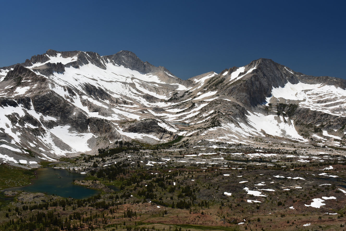
Lundy Pass Ponds, looking west from hill east of Lundy Pass. “Greenstone Lake” is at left and the ponds are amongst the scattered snowbanks to the right. They don’t show up well in the photo because they aren’t reflecting the sunlight. North Peak is at right and Mt. Coness at left.
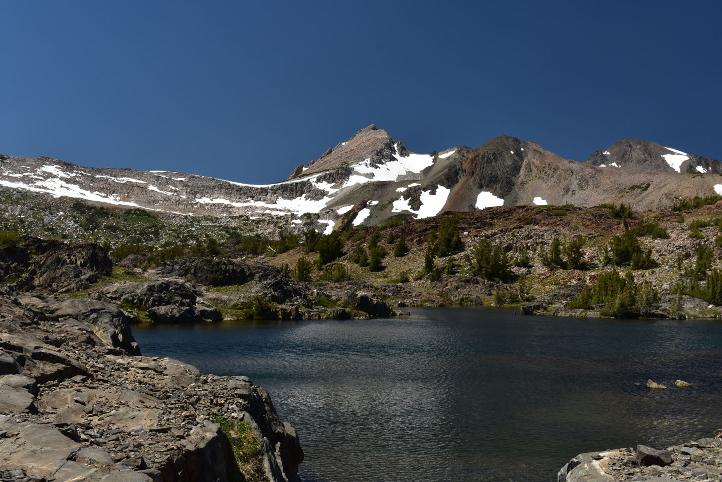
View northwest across large pond in area of Lundy Pass Ponds. This pond has fish and could be “Z Lake”. Shepherd Crest is in the distance.
East-Central Sierra Nevada – top
Dunderberg North Pond (Bridgeport Ranger District, Humboldt-Toiyabe National Forest)
___This map is a screenshot of The National Map (Go to The National Map). The U.S. Geological Survey generally does not copyright or charge for its data or reports (unless printed). A pond location is indicated by an “X”, which corresponds to the coordinates given in the data spreadsheet. Labels in quotations are from 7.5-minute topographic quadrangles.
___As of May 2025, the National Grid overlay with red lines in UTM coordinates does not load in The National Map.
___There is no private or state land on this map. All the lands are public.
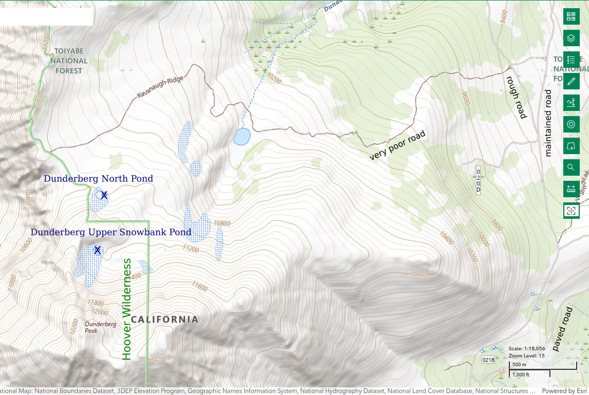
Dunderberg North Pond is on the north side of Dunderberg Peak next to a prominent and persistent snowbank, which is shown on The National Map. The pond is south of, and well up the hill from, the road up to Kavanaugh Ridge. Dunderberg Peak is approximately 21.5 km (13.3 miles) southwest of Bridgeport. Dunderberg North Pond is not the pond at the head of Dunderberg Creek shown on the Humboldt-Toiyabe National Forest’s recreation map of the Bridgeport Ranger District. That pond is much bigger, accessible to vehicles, and has fish.
The easiest access is via the Kavanaugh Ridge road. This is “trail” 22317 on the Motor Vehicle Use Map of “Hoover Canyons (Sheet 6 of 10)” for the Bridgeport Ranger District. It is not shown on the Humboldt-Toiyabe National Forest’s recreation map for the Bridgeport Ranger District. 22317 can be reached by turning north off the “Virginia Lakes” road onto Mono County 20 (gravel) and then turning left onto National Forest road 32178 after 1.5-2 miles. 22317 is less than .5 mile from that intersection. The first part of 22317 is steep and challenging due to big rocks and tree roots that can’t be avoided. It shouldn’t be attempted without 4-wheel drive, a low-range transmission setting, and high clearance. 22317 could also be reached by a longer route from the north via Mono County 20. Alternatively, one could park amongst the trees along road 32178 and hike from there, whether along 22317 or not.
Elevation: 3,353 m (11,000′)
August 22, 2019
Found a nice snowbank-fed pond while descending the north side of Dunderberg Peak toward Kavanaugh Ridge. NPPWOPII.
- Less than 20 m across to edge of snowbank; depth not estimated.
- Water clear
- No fairy shrimp.
- Other animals not noted.
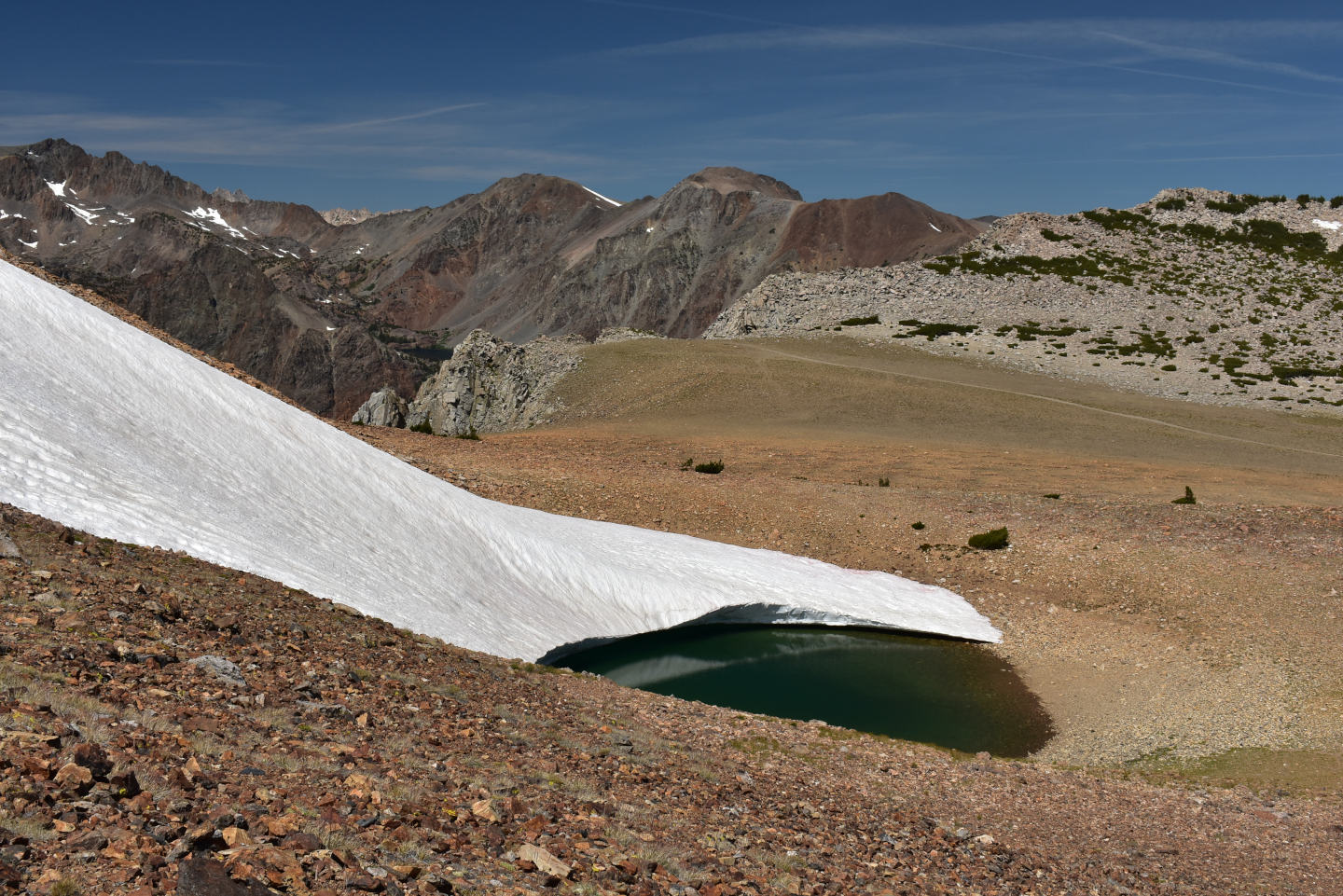
Looking north across Dunderberg North Pond, with deep canyon of East Fork Green Creek looming at left. “Trail” 22317 can be seen terminating at the lip of Kavanaugh Ridge in the middle distance.
September 10, 2024
Looks like the pond might be down 1-2 m (3-6′) from last year. However, the snowbank covering the pond has shrunk so the area of water is actually greater than on my previous visit.
- 40 m x 40 m, not including snowbank cover; greater than 100 cm deep.
- Clear water; 12 C at 1315 in 3 cm water.
- No fairy shrimp.
- No aquatic animals observed.
Importantly, the pond at the head of Dunderberg Creek, which had people fishing on August 22, 2019, no longer has fish. The water level has dropped a lot, maybe enough to freeze solid in winter. Instead of fish, the pond has large backswimmers (sub-order Heteroptera, family Notonectidae) and smaller water boatman (sub-order Heteroptera, family Corixidae). Water boatmen are shown in the video below. I didn’t see fairy shrimp in the pond.
Top of Dunderberg Creek Pond Water Boatmen Video 2024-09-10cr2
East-Central Sierra Nevada – top
Lower “Par Value Lake” (Bridgeport Ranger District, Humboldt-Toiyabe National Forest; Hoover Wilderness)
___This map is a screenshot of The National Map (Go to The National Map). The U.S. Geological Survey generally does not copyright or charge for its data or reports (unless printed). A pond location is indicated by an “X”, which corresponds to the coordinates given in the data spreadsheet. Labels in quotations are from 7.5-minute topographic quadrangles.
___Red lines are the U. S. National Grid with a spacing of 1,000 m and intersection labels consisting of the UTM zone (e.g., 11S, 12T), a 2-letter 100-km square designation (e.g., LC, XN), and a 4-digit number. The first 2 digits of the number represent the 1,000-meter Easting and the second 2 digits the 1,000-meter Northing, as seen in the example Easting and Northing. Unlike latitude and longitude, the National Grid is rectilinear on a flat map, the units of abscissa and ordinate have equal lengths, and the units (meters) are measurable on the ground with a tape or by pacing.
___There is no private or state land on this map. All the lands are public.
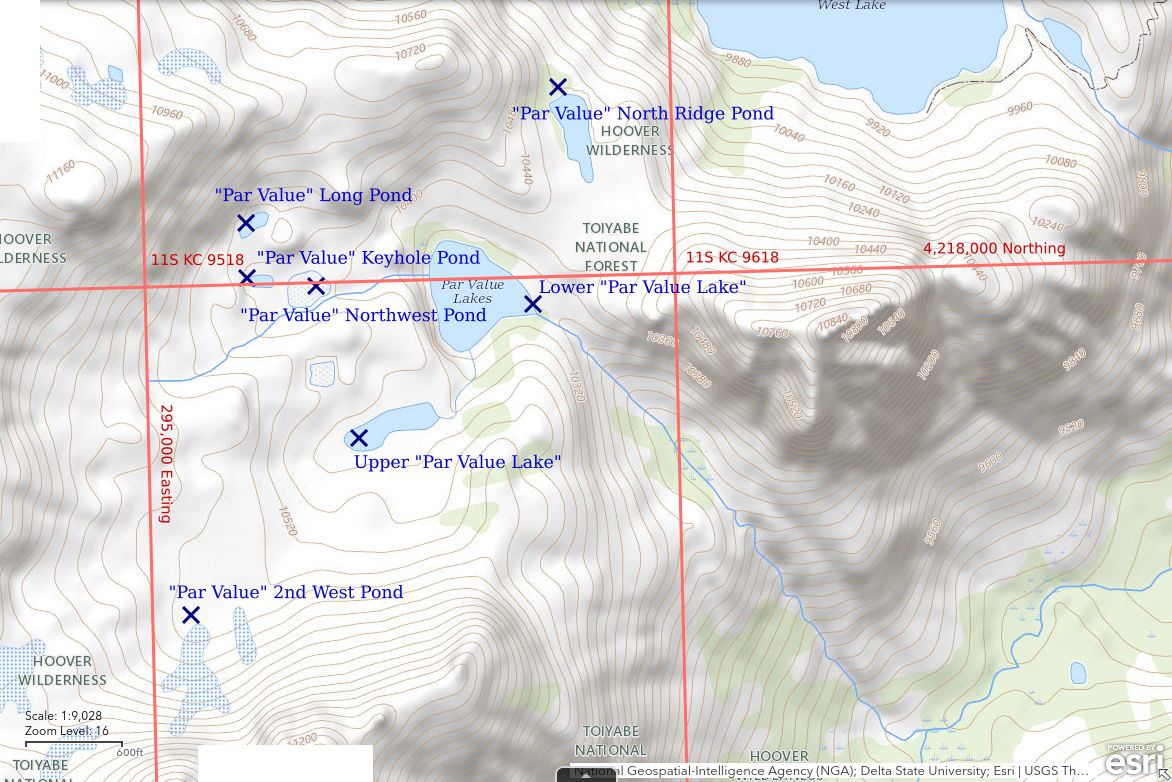
Lower “Par Value Lake” is about 21 km (13 miles) southwest of Bridgeport. There are 2 “Par Value Lakes” shown on the 1:100,000-scale BLM map and they are labeled but only 1 is shown on the Humboldt-Toiyabe National Forest’s recreation map for the Bridgeport Ranger District. Lower “Par Value Lake” is the larger one downstream of the smaller one. Lower “Par Value Lake” is 200 m x 170 m (660′ x 560′) on the 7.5-minute topographic quadrangle. The outlet of Lower “Par Value Lake” on the north side of Glines Canyon is too steep for fish. The small size and out-of-the-way location of the lake and the lack of a trail up the canyon wall suggests the lake may have escaped the fish-stocking frenzy.
Access is from the Green Creek Trailhead and the well traveled trail to “Green Lake”. There is a trail shown on the 1:100,000-scale BLM map around the west side of “Green Lake” and up Glines Canyon as far as the outlet creek of “Par Value Lakes”. Oddly, this trail is not shown on the more detailed National Map. There is a little used trail there but it is unmarked and is easily lost in the dense shrubbery along “Green Lake”. However, once into the pine forest near the inlet on the west side of the lake, the trail is easy to follow as far as the remains of a mill on the outlet creek of “Par Value Lakes”. I don’t know if the trail continues up Glines Canyon from there. The climb from the mill to “Par Value Lakes” is steep with loose rock in places but poses no technical challenges. There are indications of human foot traffic in places.
Elevation: 3,140 m (10,300′)
August 19, 2021
There are still some wildflowers blooming although this has been a dry winter-spring-summer. The very sparse evidence for human traffic to “Par Value Lakes” has me hopeful that no one has bothered to stock them with fish.
- 170 m x 200 m based on the 7.5-minute quadrangle; depth greater than 200 cm.
- Water clear.
- No fairy shrimp.
- Fish.
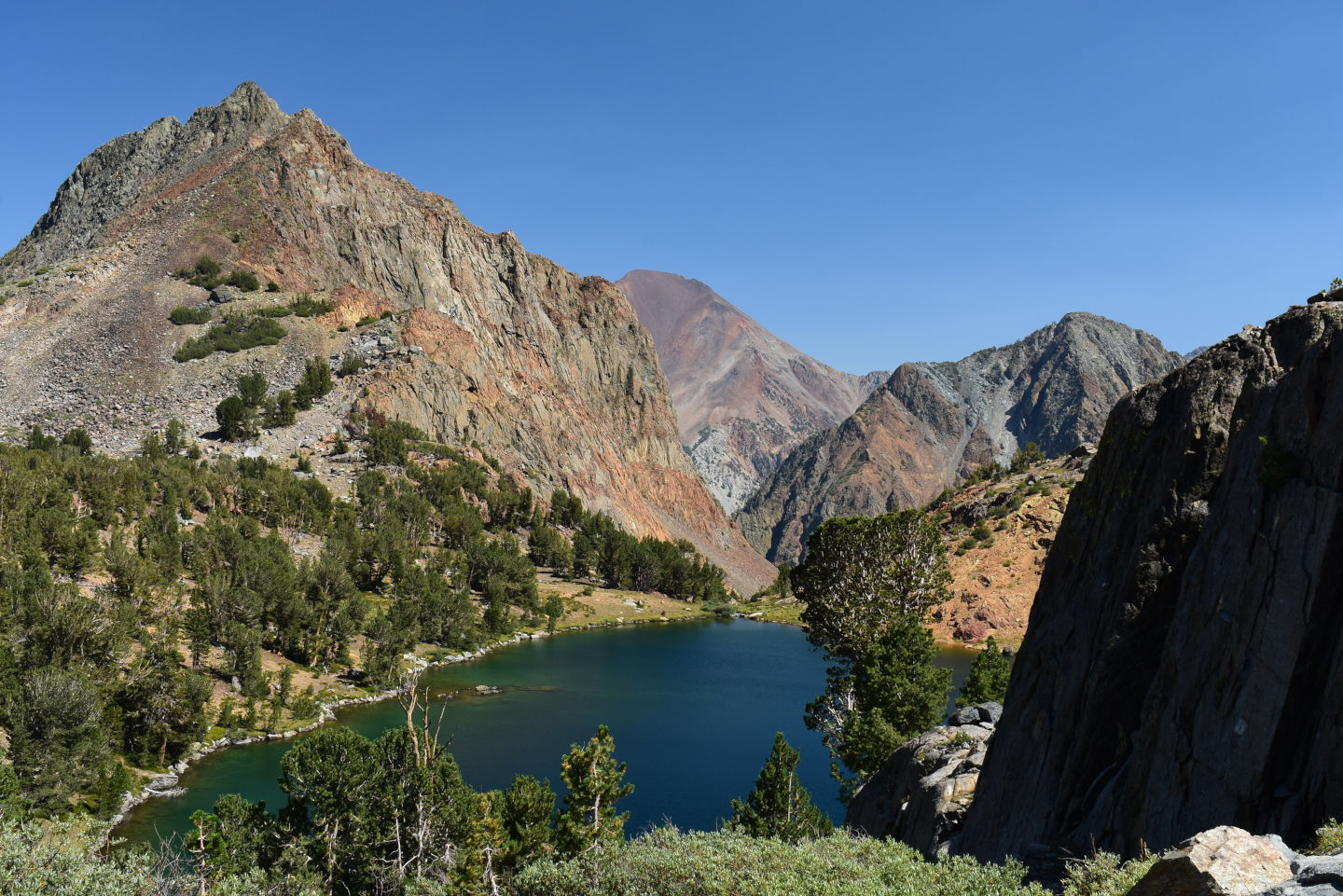
View southeast across Lower “Par Value Lake”, with Dunderberg Peak in distance at center. The outlet is at the far end of the lake and drops off steeply into Glines Canyon.
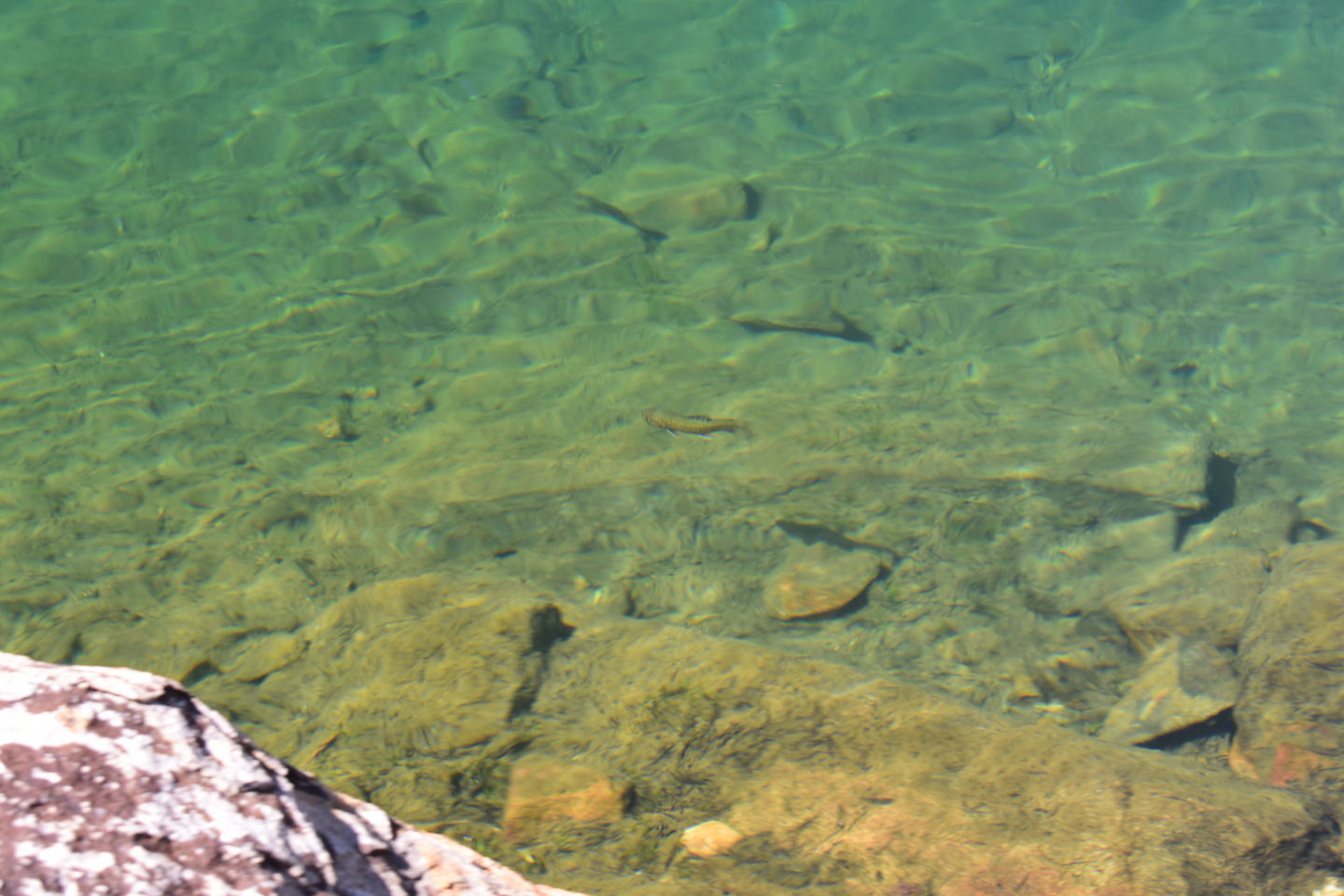
A fish in Lower “Par Value Lake”. There is a non-native trout at center.
East-Central Sierra Nevada – top
Upper “Par Value Lake” (Bridgeport Ranger District, Humboldt-Toiyabe National Forest; Hoover Wilderness)
Upper “Par Value Lake” is about 150 m (490′) southwest of Lower “Par Value Lake”. On the 7.5-minute topographic quadrangle, Upper “Par Value Lake” is 170 m x 50 m (560′ x 165′). There is a short, steep cascade at the outlet but that might not be enough to stop fish. The 2 “Par Value Lakes” are so close that it seems likely Upper “Par Value Lake” would have been stocked too.
For access, see Lower “Par Value Lake”. It is a short, easy hike from Lower to Upper “Par Value Lake”.
Elevation: 3,181 m (10,435′)
August 19, 2021
The water level in the lake is clearly down from normal levels but the lake is still large with plenty of water.
- 50 m x 150 m; depth more than 100 cm.
- Clear water.
- No fairy shrimp.
- Lots of caddisfly larvae (Trichoptera), common mayfly larvae (Ephemeroptera) less than 7 mm, occasional backswimmers (sub-order Heteroptera, family Notonectidae); garter snake near the outlet.
An abundance of visible zooplankton indicate Upper “Par Value Lake” doesn’t have fish. Maybe winter freezes keep the fish out.
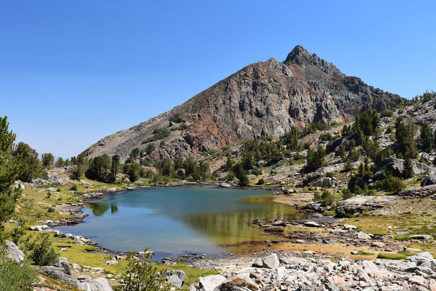
Upper “Par Value Lake”, looking northeast toward the outlet and Lower “Par Value Lake”. The shoreline has clearly pulled back from its normal extent.
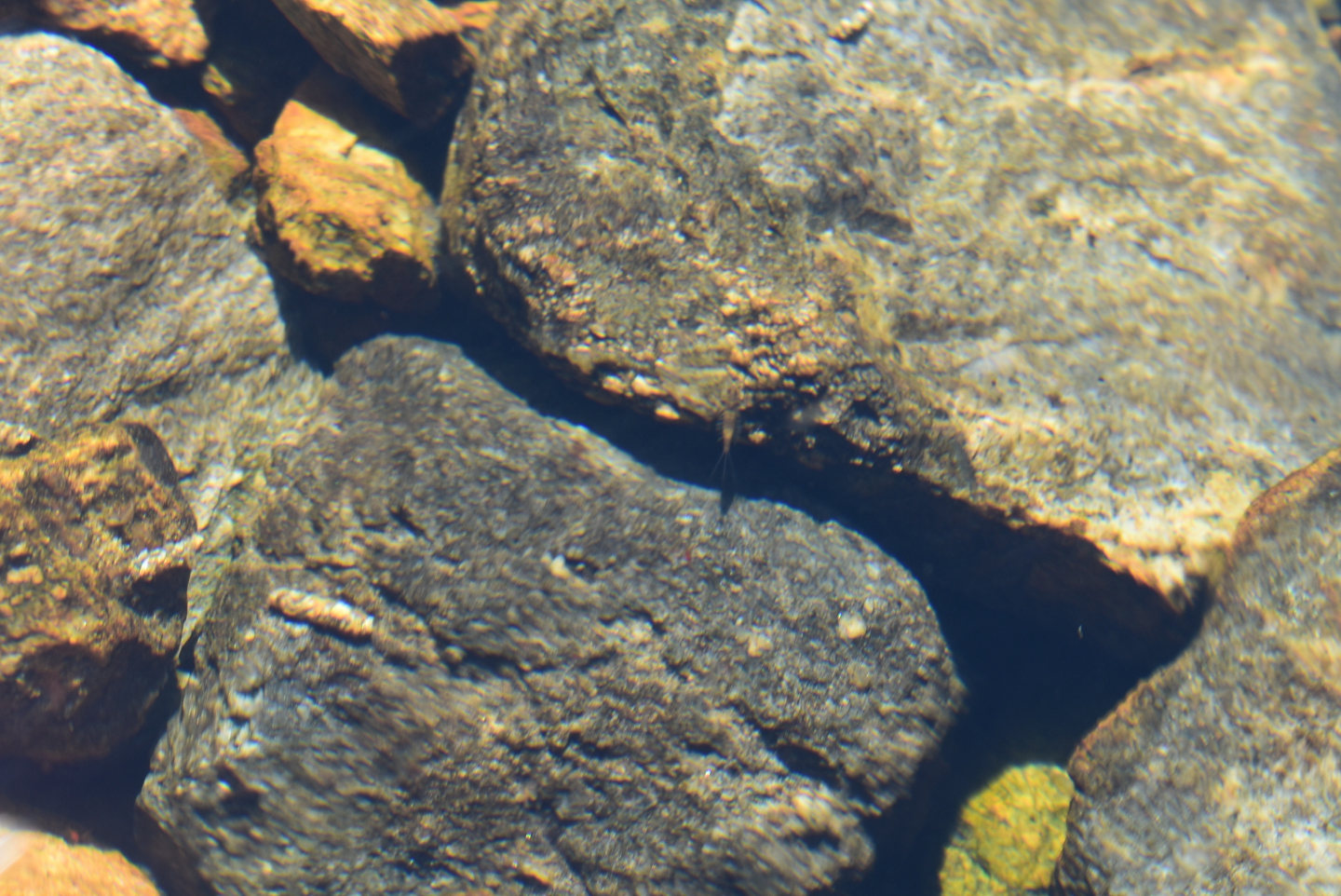
Macroinvertebrates in Upper “Par Value Lake”. Although slightly out of focus, the external gills on the abdominal segments and the 3 tail-like filaments extending from the end of the abdomen of the mayfly larva (order Ephemeroptera) at center can be seen against the shadow. The 2 pale tubular objects to the left of center are caddisfly (order Trichoptera) larval cases constructed of sand grains. The caddisfly larvae are quite active and frequently roll off the steep rock surfaces only to climb them again. The mayfly larvae make short, fast swims with a prominent wiggling of the abdomen that is helpful in distinguishing them from other insect larvae.
East-Central Sierra Nevada – top
“Par Value” 2nd West Pond (Bridgeport Ranger District, Humboldt-Toiyabe National Forest; Hoover Wilderness)
“Par Value” 2nd West Pond is the second pond southwest of, and up hill from, Upper “Par Value Lake”. It is smaller than the area of 1st West Pond, which is dry. “Par Value” 2nd West Pond is 400-500 m (1,310-1,640′) southwest of Upper “Par Value Lake”. It is in a trough bounded by boulder rubble to the northwest and boulder talus to the southeast.
For access, see Lower “Par Value Lake”. It is a short, easy hike from Upper “Par Value Lake”.
Elevation: 3,229 m (10,595′)
August 19, 2012
This pond is less than a third of its normal size, based on rock staining.
- 10 m x 20 m but probably 20 m x 60 m in normal years; depth less than 20 cm.
- Clear water.
- No fairy shrimp.
- Several backswimmers (sub-order Heteroptera, family Notonectidae) greater than 10 mm long.
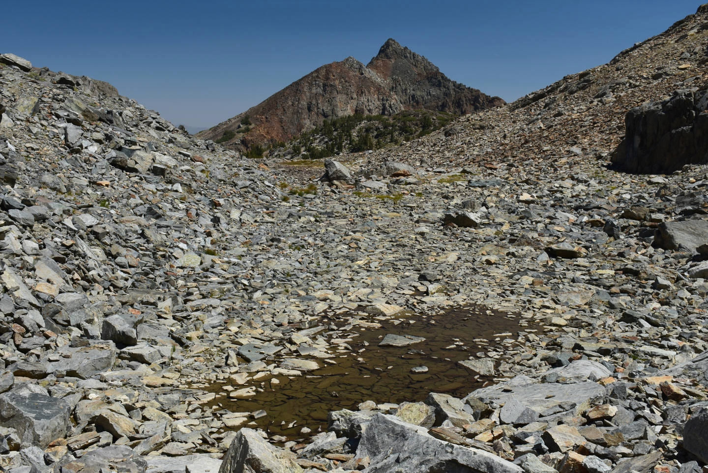
View northeast across puddle remaining in “Par Value” 2nd West Pond. This is looking down the drainage toward Upper “Par Value Lake”.
East-Central Sierra Nevada – top
“Par Value” Long Pond (Bridgeport Ranger District, Humboldt-Toiyabe National Forest; Hoover Wilderness)
“Par Value” Long Pond is perched in a small trough at the base of the steep slope on the ridge northwest of Lower and Upper “Par Value Lakes”. It is shown on the 7.5-minute topographic quadrangle with dimensions of about 60 m x 20 m (200′ x 66′).
For access, see Lower “Par Value Lake”. The shortest route is likely to loop around the north end of Lower “Par Value Lake”. It could also be reached by hiking north from Upper “Par Value Lake”.
Elevation: 3,207 m (10,520′)
August 19, 2021
It was just luck that I saw this pond in my wanders over the boulder rubble looking for other ponds above Upper “Par Value Lake”. The pond has steep sides so it hasn’t shrunken much in area but the high-water mark is about 20 cm above the current water level. There are sparse cloud-like clumps of green algae near the pond bottom.
- 15 m x 60 m; depth probably up to 200 cm.
- Clear water.
- No fairy shrimp.
- Common mayfly larvae (Ephemeroptera) less than 7 mm long, garter snake.
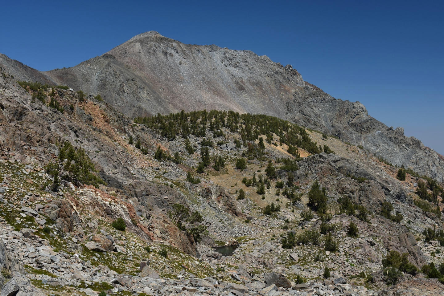
View to northeast at “Par Value” Long Pond (below center) with Monument Ridge on the far side of “West Lake” drainage in the distance.
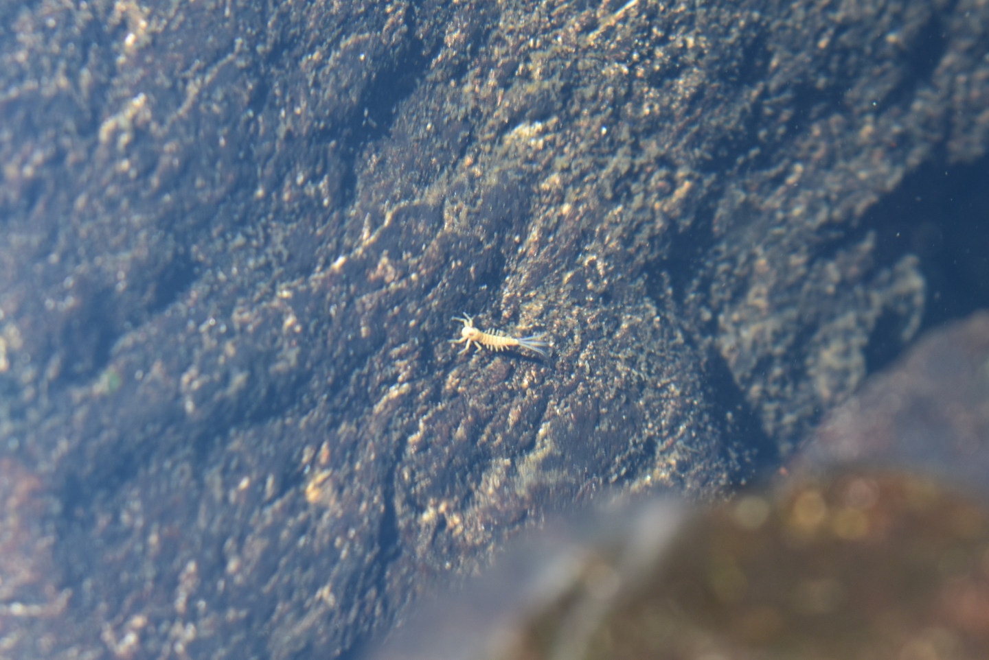
Mayfly larva (order Ephemeroptera) in “Par Value” Long Pond. In this view, the gills sticking out from the abdomen and the 3 filaments at the end of the abdomen the larva can be seen easily against the dark rock. The pale color suggests this is a molted exoskeleton rather than a live larva.
East-Central Sierra Nevada – top
“Par Value” Keyhole Pond (Bridgeport Ranger District, Humboldt-Toiyabe National Forest; Hoover Wilderness)
“Par Value” Keyhole Pond is below “Par Value” Long Pond and west of “Par Value” Northwest Pond so I found it while walking between the 2. The pond is very small on the 7.5-minute topographic quadrangle. The irregular shape of the outline of the shrunken pond have a slight resemblance to a keyhole.
For access, see Lower “Par Value Lake”. As for “Par Value” Long Pond, the shortest route is likely to loop around the north end of Lower “Par Value Lake”. It could also be reached by hiking north from Upper “Par Value Lake”.
Elevation: 3,195 m (10,480′)
August 19, 2021
The pond has a small area but it is surprisingly deep between the boulders. This pond has sparse cloud-like clumps of green algae near the pond bottom.
- 10 m x 30 m; depth probably up to 50 cm.
- Clear water.
- No fairy shrimp.
- Backswimmers (sub-order Heteroptera, family Notonectidae) longer than 10 mm, rare caddisfly larvae (Trichoptera).
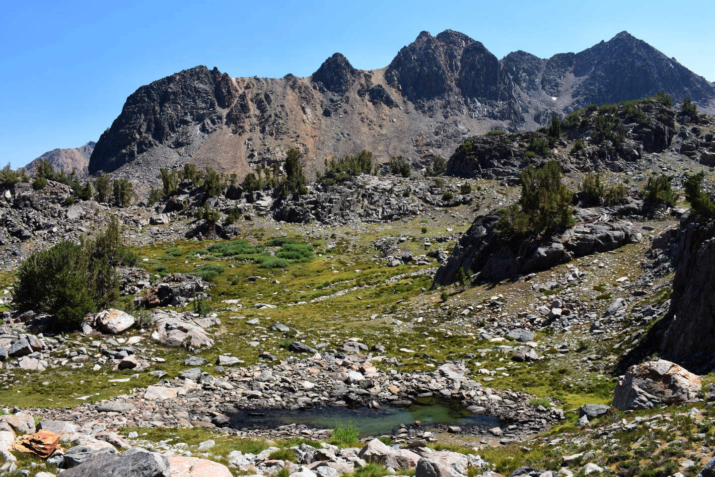
View to south at “Par Value” Keyhole Pond (below center). The craggy ridge in the distance is southwest of Upper “Par Value Lake”.
East-Central Sierra Nevada – top
“Par Value” Northwest Pond (Bridgeport Ranger District, Humboldt-Toiyabe National Forest; Hoover Wilderness)
“Par Value” Northwest Pond is northwest of Lower “Par Value Lake” in a separate drainage from Upper “Par Value Lake”. Its outlet drains into the northwest end of Lower “Par Value Lake” and is separated from it by a waterfall more than 3 m (10′) high. On the 7.5-minute topographic quadrangle, “Par Value” Northwest Pond is about 100 m x 70 m (330′ x 230′). It is represented by an intermittent lake symbol rather than by a perennial one.
For access, see Lower “Par Value Lake”. The shortest route is likely to loop around the north end of Lower “Par Value Lake”. It could also be reached by hiking north from Upper “Par Value Lake”.
Elevation: 3,181 m (10,435′)
August 19, 2021
This would normally be a rather large pond but the water level is so low I can walk across the middle on protruding rocks.
- 40 m x 80 m but probably 60 m x 120 m in normal years; depth less than 30 cm.
- Clear water.
- No fairy shrimp.
- Lots of caddisfly larvae (Trichoptera), some mayfly larvae (Ephemeroptera).
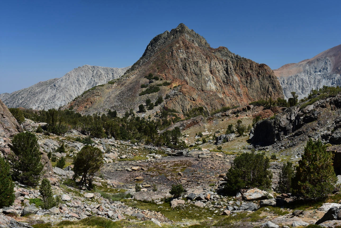
View to east at “Par Value” Northwest Pond from below “Par Value” Long Pond.
East-Central Sierra Nevada – top
“Par Value” North Ridge Pond (Bridgeport Ranger District, Humboldt-Toiyabe National Forest; Hoover Wilderness)
“Par Value” North Ridge Pond seems out of place. It is large and relatively deep but sits in a saddle on the ridge between the “Par Value Lakes” and “West Lake”. The ridge has a low, gradual rise from the “Par Value Lakes” side and a steep, cliffy drop on the “West Lake” side. The pond drains toward “West Lake”. “Par Value” North Ridge Pond has dimensions of 160 m x 60 m (520′ x 200′) on the 7.5-minute topographic quadrangle.
For access, see Lower “Par Value Lake”. It is an easy hike to the northeast from Lower “Par Value Lake”.
Elevation: 3,156 m (10,355′)
August 19, 2021
A long stretch of dry, discolored rocks along the inlet reflects the dry weather but much of the pond has steep sides and is relatively deep.
- 60 m x 150 m (maybe 200 m long in a normal year); depth probably greater than 200 cm.
- Clear water.
- No fairy shrimp.
- Lots of backswimmers (sub-order Heteroptera, family Notonectidae) of various sizes (including greater than 10 mm and less than 7 mm long), some mayfly larvae (Ephemeroptera), a few black beetles.
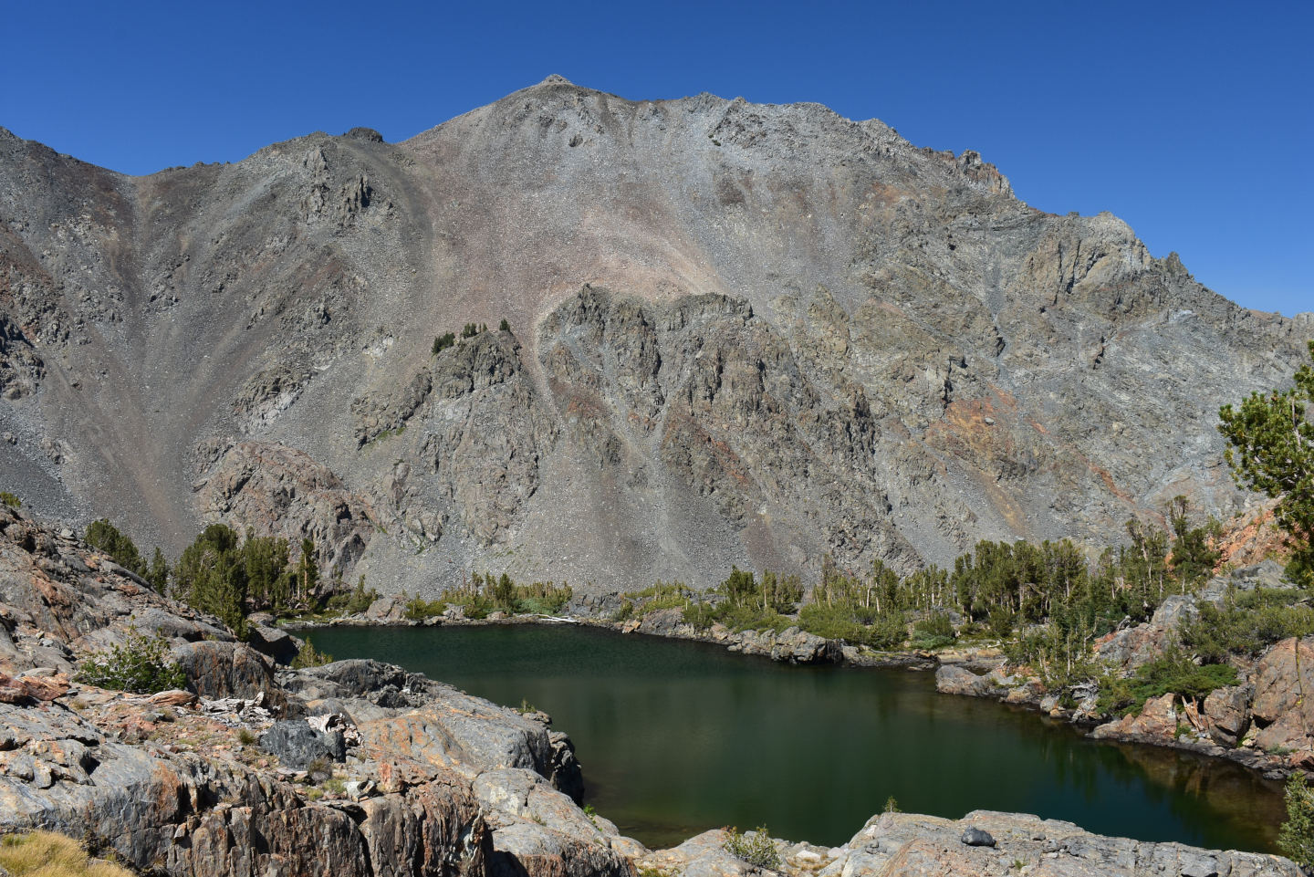
View to north across “Par Value” North Ridge Pond. The outlet is in the pine trees at left and Monument Ridge is in the distance across the “West Lake” canyon.
East-Central Sierra Nevada – top
“Bergona Lake” (Bridgeport Ranger District, Humboldt-Toiyabe National Forest; Hoover Wilderness)
___This map is a screenshot of The National Map (Go to The National Map). The U.S. Geological Survey generally does not copyright or charge for its data or reports (unless printed). A pond location is indicated by an “X”, which corresponds to the coordinates given in the data spreadsheet. Labels in quotations are from 7.5-minute topographic quadrangles.
___Red lines are the U. S. National Grid with a spacing of 1,000 m and intersection labels consisting of the UTM zone (e.g., 11S, 12T), a 2-letter 100-km square designation (e.g., LC, XN), and a 4-digit number. The first 2 digits of the number represent the 1,000-meter Easting and the second 2 digits the 1,000-meter Northing, as seen in the example Easting and Northing. Unlike latitude and longitude, the National Grid is rectilinear on a flat map, the units of abscissa and ordinate have equal lengths, and the units (meters) are measurable on the ground with a tape or by pacing.
___There is no private or state land on this map. All the lands are public.
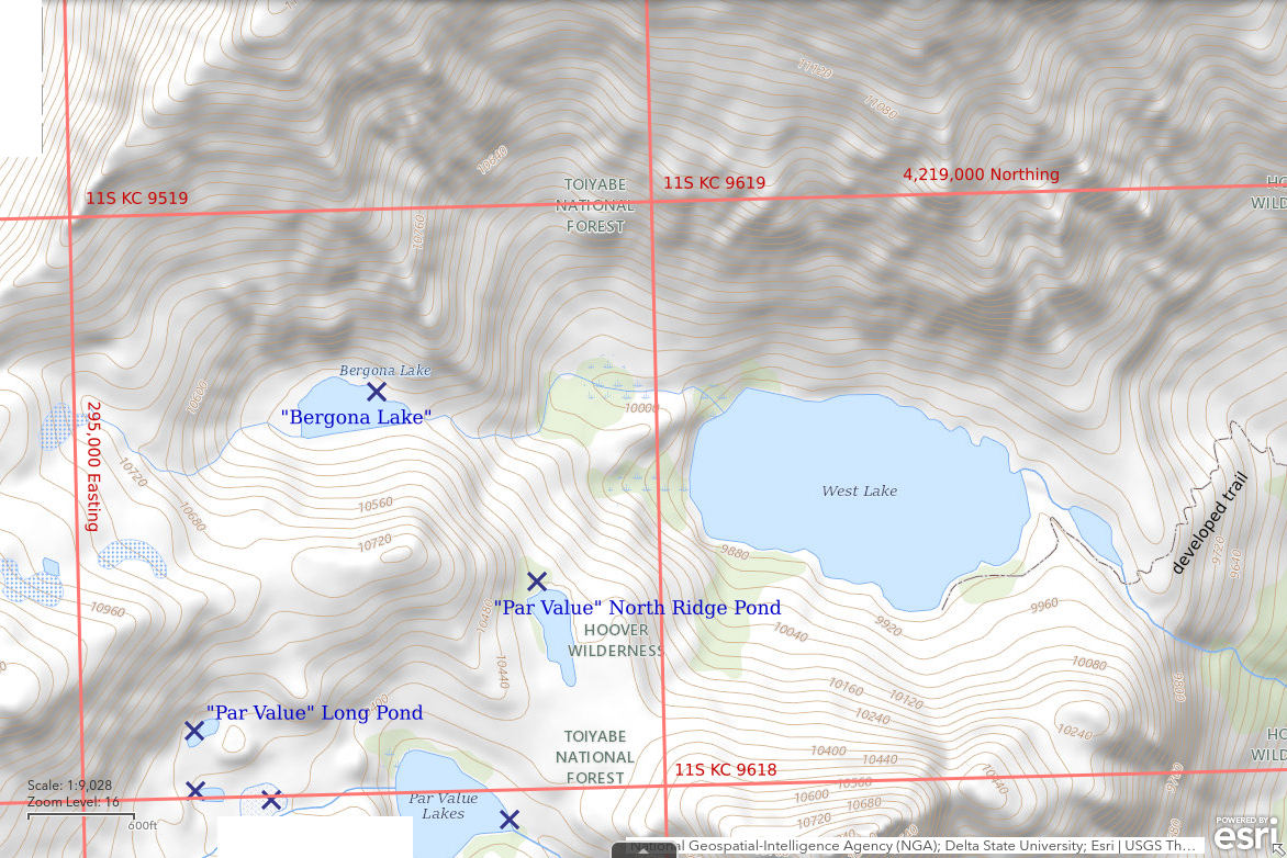
“Bergona Lake” is 20.5 km (12.7 miles) southwest of Bridgeport. “Bergona Lake” is not shown on the 1:100,000-scale BLM map but is shown and labeled on the Humboldt-Toiyabe National Forest’s recreation map for the Bridgeport Ranger District. On the 7.5-minute topographic quadrangle, the lake is 200 m x 80 m (660′ x 260′).
“Bergona Lake” is close to and upstream from “West Lake”, which is accessible by a constructed trail. That suggests some people could be interested in stocking and fishing it. However, when I peered over the edge from “Par Value” North Ridge Pond, I saw that the outlet descends a series of cliffs in a narrow gorge that would be quite a challenge for people to climb. Certainly, no fish could. Maybe it hasn’t been stocked; WIDLA.
The easiest access is probably from Lower “Par Value Lake” but that is longer than the route from “West Lake”. From Lower “Par Value Lake”, hike up to “Par Value” North Ridge Pond. There is a wide shelf between lower and upper cliffs that extends from “Par Value” North Ridge Pond to the upper part of the “Bergona Lake” outlet. Rather than take that long route back, I decided to make a shortcut to the hiking trail at “West Lake”. My descent from “Bergona Lake” to “West Lake” proved to be harrowing. I stayed close to the outlet gorge and at one point wedged down a thankfully almost dry section of waterfall. I would definitely not recommend that route. Maybe there is a better route on the steep slope east of “Bergona Lake” and south of the creek. At least there are bits of trail on the north shore of “West Lake”.
Elevation: 3,155 m (10,350′)
August 19, 2021
The lake appears to be only slightly smaller due to the drought and could be deep.
- 100 m x 200 m; depth greater than 200 cm.
- Clear water.
- No fairy shrimp.
- Complete absence of visible zooplankton suggests fish are present although I didn’t see any.
View west across “Bergona Lake” from the almost dry outlet.
East-Central Sierra Nevada – top
“Burro Lake” (Bridgeport Ranger District, Humboldt-Toiyabe National Forest; Hoover Wilderness)
Virginia Divide Double Ponds map
“Burro Lake” is perched high on the north side of Lundy Canyon 25 km (15.5 miles) southwest of Bridgeport. On the 7.5-minute topographic quadrangle, the lake is 300 m x 220 m (980′ x 720′).
“Burro Lake” is so difficult to get to that it seems unlikely to have been stocked with fish.
For access, I followed the hiking trail from the “Virginia Lakes” Trailhead to the Green Creek – Virginia Creek divide and then turned south to cross about 500 m (1,640′) of rolling upland to the top of the steep slopes that drop down into the “Burro Lake” basin. The descent over talus of more than 150 m (490′) vertically was difficult but at least I didn’t end up in a chute with not even slip-slidey footing. My later ascent to the northeast from Burro Cirque Pond was easier but there was still a lot of slip-slidey talus. Access from Lundy Canyon would involve a steep but probably not technical climb.
Elevation: 3,214 m (10,545′)
August 26, 2021
“Burro Lake” has a remarkable blue color that shows up even in some satellite images. There is apparently something in the water as rocks in the stream above the lake have a grayish-white coating. Unlike Virginia Divide Double Ponds today and the “Par Value” ponds a couple of weeks ago, the water level doesn’t appear to be any lower than normal.
- 200 m x 300 m; could be deeper than 200 cm.
- Clear water.
- No fairy shrimp.
- Fish, no visible zooplankton.
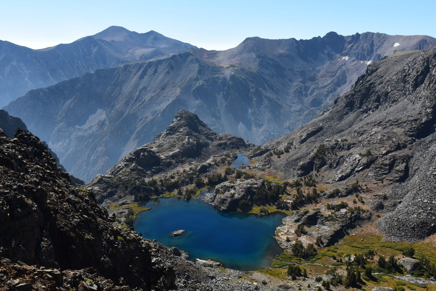
Looking down and to the south at “Burro Lake”. The outlet drops off steeply into Lundy Canyon, in the middle distance. The blue color is apparent but not quite so striking from this angle.
East-Central Sierra Nevada – top
Burro Cirque Pond (Bridgeport Ranger District, Humboldt-Toiyabe National Forest; Hoover Wilderness)
Virginia Divide Double Ponds map
Burro Cirque Pond is on the massive jumble of moraine 1,000 m (3,280′) west of “Burro Lake”. It is an oval with dimensions of about 80 m x 60 m on the 7.5-minute topographic quadrangle. There is a 5 m (16′) waterfall on the stream between the pond and “Burro Lake” that would prevent fish access but it turns out the pond doesn’t have a surface outlet. The pond doesn’t sit on bedrock; it drains through the moraine for a few hundred meters before there is visible surface water.
On the August 2021 visit, there was a smaller pond less than 50 m (160′) south of Burro Cirque Pond that is likely connected at high water. It was then only about 20 m (65′) across and had the same aquatic fauna as Burro Cirque Pond. This smaller pond is indicated by an intermittent lake symbol on the 7.5-minute quadrangle. It is not described separately here.
There is another cirque a couple hundred meters above Burro Cirque Pond that was carved out more recently. It is also floored by a massive jumble of moraine but does not have a pond.
For access, see “Burro Lake”. Burro Cirque Pond is an easy hike from “Burro Lake” but the problem is getting into and out of the “Burro Lake” basin.
Elevation: 3,327 m (10,915′)
August 26, 2021
Burro Cirque Pond is below its normal extent, as indicated by rock staining, but it is not quite as bad as Virginia Divide Double Ponds.
On hiking up to the pond, I also looked for 2 small ponds shown on the 7.5-minute topographic quadrangle about halfway between “Burro Lake” and Burro Cirque Pond. They were essentially dry but with a trickle of water flowing over the rocks. Even if there are ponds there at times, they likely get flushed by spring run-off and that would be problematic for retaining fairy shrimp eggs.
- 50 m x 70 m; depth less than 100 cm.
- Water clear.
- No fairy shrimp.
- Lots of 2 mm long cladocerans, smaller possible copepods, rare backswimmers (sub-order Heteroptera, family Notonectidae) less than 5 mm, rare caddisfly larvae (Trichoptera), 2 10-12 mm long larvae that might be dragonfly larvae, also saw molts more than 20 mm long of something that might be a dragonfly floating on the surface of the water, lots of sparrow-like birds hanging around the water and coloring the rocks white – are they eating the cladocerans?
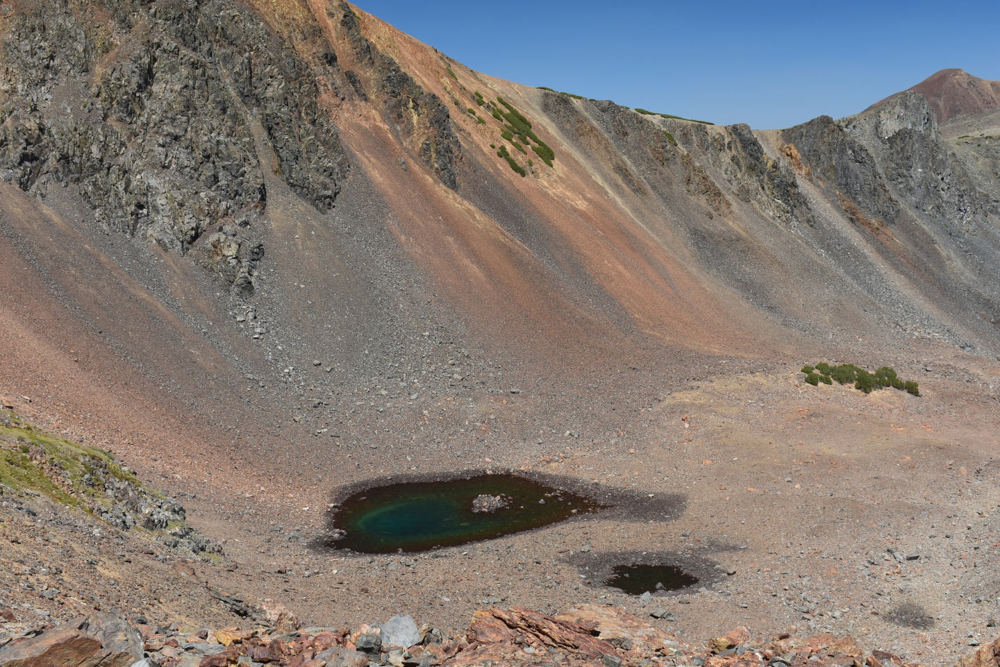
View northeast across Burro Cirque Pond and its smaller companion pond. There is no surface water outlet but water leaks out toward the upper right. The pond doesn’t drain to the lower right, which would be the most direct route to the stream above “Burro Lake”. To get back to the “Virginia Lakes” hiking trail, I climbed up the reddish-brown talus at center with the green krummholz at the top. The trees provided reassuring hand holds but didn’t help much.
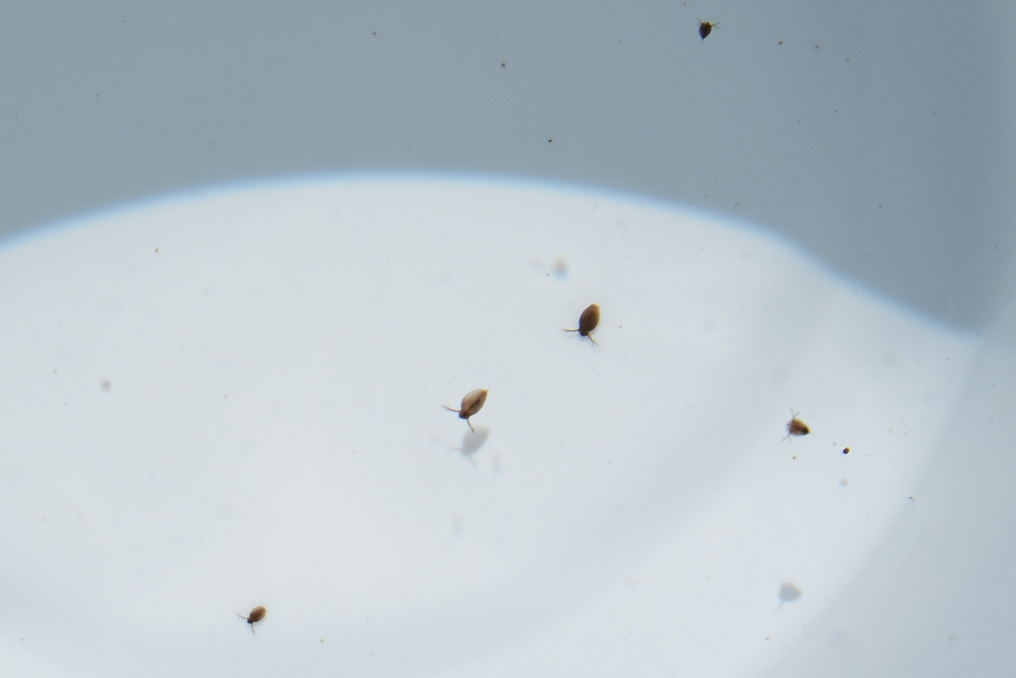
Cladocerans from Burro Cirque Pond in white container. The ovoid animals have a prominent pair of swimming antennae, which are branched, and a brown carapace which covers all but the head. They are about 2 mm long. They swim with a jerky, stop-and-go motion. I am confident they are cladocerans but am not really qualified to say.
East-Central Sierra Nevada – top
Shepherd Crest South Pond (Inyo National Forest; Hoover Wilderness)
Lundy Pass Ponds map
Shepherd Crest South Pond is 29.5 km (18 miles) south-southeast of Bridgeport. It is in the Mill Creek – Lundy Canyon drainage above the Lundy Pass Ponds. It is a rather round pond with dimensions of 75 m x 110 m (250′ x 360′) on the 7.5-minute topographic map. Shepherd Crest South Pond is perched on a bench about 90 m (300′) below the Pacific divide. The pond is named Shepherd Crest South Pond to distinguish it from “Shepherd Lake”, which is north of Shepherd Crest.
Shepherd Crest South Pond is closest to the “Saddlebag Lake” trailhead off California 120 west of Lee Vining. Follow the trail along the west side of “Saddlebag Lake” to “Steelhead Lake”. Instead of continuing along the east shore of “Steelhead Lake”, cross the creek and head up the hill. Just above “Steelhead Lake”, I met 3 backpackers trying to follow an informal trail over the crest to “Upper McCabe Lake” in Yosemite National Park. If such a trail is continuous, it would pass to the south (down hill) and west of Shepherd Crest South Pond. The National Map does not show that trail and I doubt that the trail that it does show to Shepherd Crest South Pond is real. It looks more like a creek. The climb is steep but without serious obstacles. Alternatively, the pond can be reached from the Lundy Canyon trailhead by following the trail up the south wall of the canyon, where it may be under a snowbank, to “Lake Helen”. Cross the outlet creek and follow a trail which is not on the 7.5-minute topographic quadrangle (but is on the Bridgeport Ranger District recreation map and The National Map) around the north sides of “Lake Helen” and “Shamrock Lake” to the north end of “Steelhead Lake”. Start up the hill from there or continue to the south end of the lake, cross the inlet and use the informal trail for part of the climb.
Elevation: 3,207 m (10,520′)
August 25, 2022
Shepherd Crest South Pond is a small pond way up the hill from the lakes in the Lundy Pass area that have been stocked with fish. Maybe . . .
- Size about 60 m x 80 m; greater than 100 cm deep.
- Clear water; 20 C at 1130.
- No fairy shrimp.
- Backswimmers (sub-order Heteroptera, family Notonectidae) less than 10 mm long, water boatmen (sub-order Heteroptera, family Corixidae) up to about 6 mm long, 1-2 mm copepods, black beetles 10-15 mm, rare caddisfly larvae (Trichoptera).
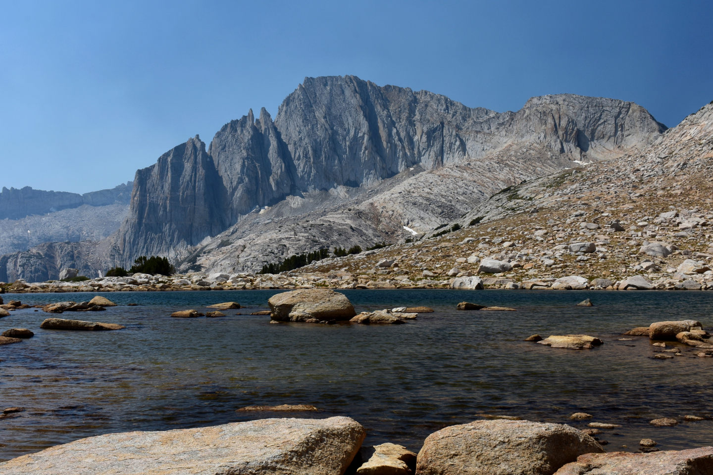
Looking south across Shepherd Crest South Pond, to the dramatic north wall of North Peak. The water level is somewhat lower than normal.
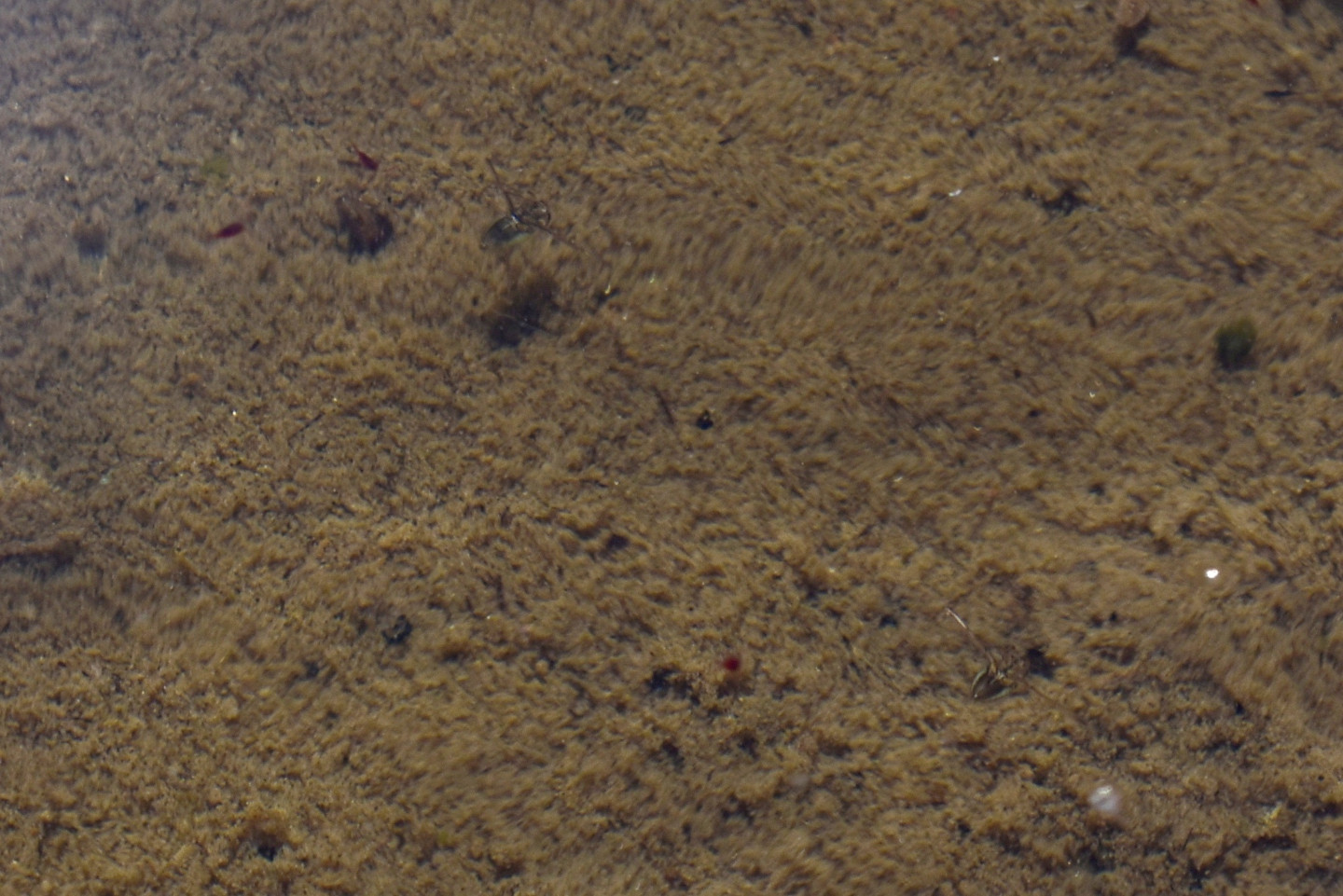
2 backswimmers in Shepherd Crest South Pond – 1 toward the upper left and 1 toward the lower right. They are about the same color as the pond bottom but with glints of reflected light. Their long, oar-like legs are sticking straight out from their bodies. They are floating with their backs down.
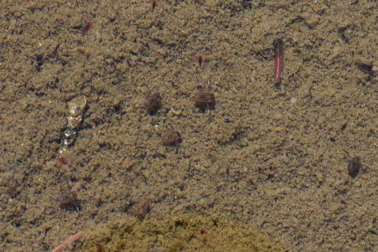
A few water boatmen on the bottom of Shepherd Crest South Pond. 3 are near the center with light glinting off their oar-like legs and 3 others are below center and farther left and right. Their backside-up posture and locations on the pond bottom rather than floating close to the surface distinguish them from backswimmers. The abundance of backswimmers and water boatmen in the pond indicate that there are no fish.
There is a small cirque-lake feature at the eastern end of the narrow ridge of Shepherd Crest to the north of Shepherd Crest South Pond but the 7.5-minute topographic quadrangle does not show a pond there. The climb didn’t look bad and I had the time so I took a look anyway. I didn’t see any water but didn’t go all the way to the headwall.
After visiting Shepherd Crest South Pond, I looked at 10-15 small rock pools and ponds between “Steelhead Lake” and “Cascade Lake” and almost as far south as “Wasco Lake”. All were less than 50 m (160′) across, less than 100 cm deep, and had clear water. Water marks indicated those I looked at were well below their maximum water levels of the year and others had dried up. Water boatmen (sub-order Heteroptera, family Corixidae) (generally less than 6 mm long) were the most common aquatic animals. Some pools also had backswimmers (sub-order Heteroptera, family Notonectidae) of various sizes up to about 8 mm long. Copepods, caddisfly larvae, black beetles, and smaller brown and black beetles less than 5 mm were uncommon. I saw a dytiscid larva in 1 pond. A few ponds had big tadpoles and I saw 2 small frogs between ponds. I didn’t see fairy shrimp.
East-Central Sierra Nevada – top
“Maul Lake” (Inyo National Forest; Hoover Wilderness)
___This map is a screenshot of The National Map (Go to The National Map). The U.S. Geological Survey generally does not copyright or charge for its data or reports (unless printed). A pond location is indicated by an “X”, which corresponds to the coordinates given in the data spreadsheet. Labels in quotations are from 7.5-minute topographic quadrangles.
___As of May 2025, the National Grid overlay with red lines in UTM coordinates does not load in The National Map.
___There is no private or state land on this map. All the lands are public.
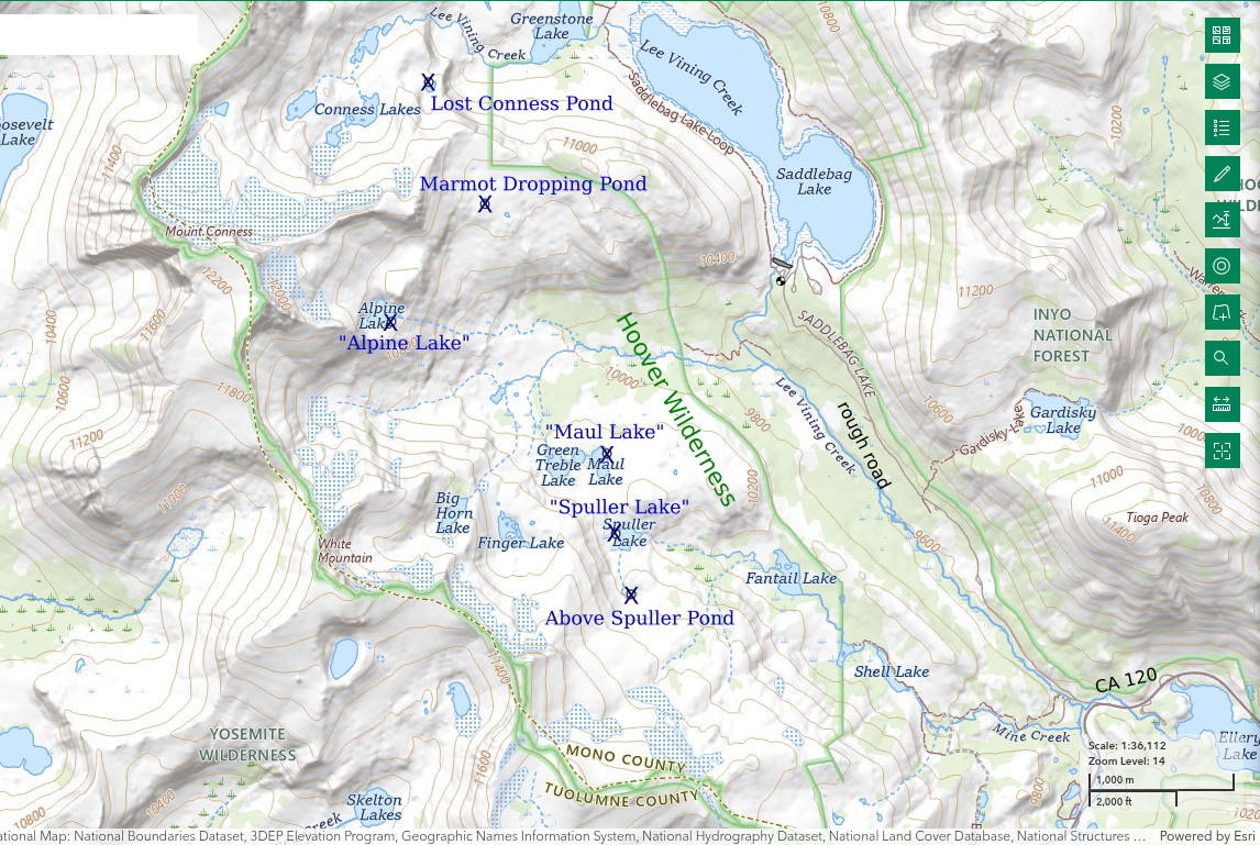
“Maul Lake” is 15 km (9 miles) due west of Lee Vining and 1,800 m (5,910′) southwest of “Saddlebag Lake” dam. With “Green Treble Lake”, it is on sort of a flat-topped spur ridge about half way between White Mountain and Lee Vining Creek. There are sparse conifers around the lake. On the 7.5-minute topographic map, “Maul Lake” is 210 m long and 100 m wide (690′ x 330′).
The 7.5-minute topographic quadrangle shows a trail from Sawmill Campground, on the road to “Saddlebag Lake”, and the Carnegie Institute Experimental Station, which is north of “Maul Lake”. However, parking at Sawmill Campground is for tent campers only so it is better to park at the “Saddlebag Lake” trailhead. Cross Lee Vining Creek below the dam and head southwest down the hill. It is not worth following the trail to the Experimental Station, which is just an old building. The west branch of Lee Vining Creek is mostly more than 2 steps wide and in a meadow so you might have to get your feet wet. It is a moderate slope with scattered timber from there up to “Maul Lake”.
Elevation: 3,119 m (10,232′) N.B. On the provisional 1986 7.5-minute topographic quadrangle, the water level has an elevation of 10,221 feet.
August 20, 2024
The water has not receded much from the low banks cut through the turf bordering the lake. It doesn’t appear that the lake is normally connected to the adjacent “Green Treble Lake”. The currently dry outlet misses that lake but there might be overflow in high-water years. That suggests “Maul Lake” could be free of fish even if “Green Treble Lake” has fish.
- 110 m x 210 m on the 7.5-minute topographic map; greater than 100 cm deep.
- Clear water; 13 C at 0915 in 3 cm water.
- No fairy shrimp.
- Backswimmers (sub-order Heteroptera, family Notonectidae), water boatmen (sub-order Heteroptera, family Corixidae), rare amphipods (Amphipoda) about 10 mm long, hatched mayflies (Ephemeroptera).
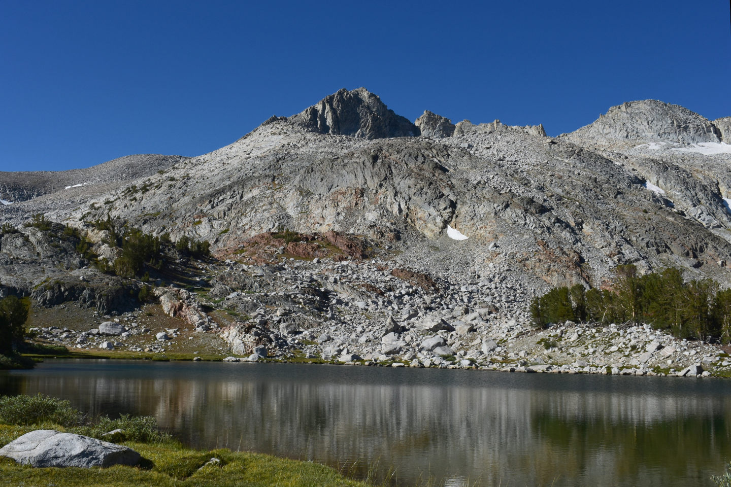
View to the southwest across “Maul Lake”.
East-Central Sierra Nevada – top
“Spuller Lake” (Inyo National Forest; Hoover Wilderness)
“Maul Lake” map
“Spuller Lake” is 400 m (1,310′) south of “Maul Lake” on the south side of the spur ridge. It is about 140 m by 150 m (460′ x 490′) on the 7.5-minute topographic quadrangle. The outlet to “Fantail Lake” is too steep for fish.
For access, see “Maul Lake”. There is a poorly defined trail between the 2 lakes but one isn’t really needed.
Elevation: 3,133 m (10,279′) N.B. On the provisional 1986 7.5-minute topographic quadrangle, the water level has an elevation of 10,273 feet.
August 20, 2024
Elephanthead flowers are drying up but the yellow monkeyflowers near the inlet and white daisies are still going strong.
- 140 m x 150 m on the 7.5-minute topographic map; greater than 100 cm deep.
- Clear water.
- No fairy shrimp.
- Dead mayflies (Ephemeroptera) on water surface, immobile caddisfly larvae (Trichoptera) cases on lake bottom.
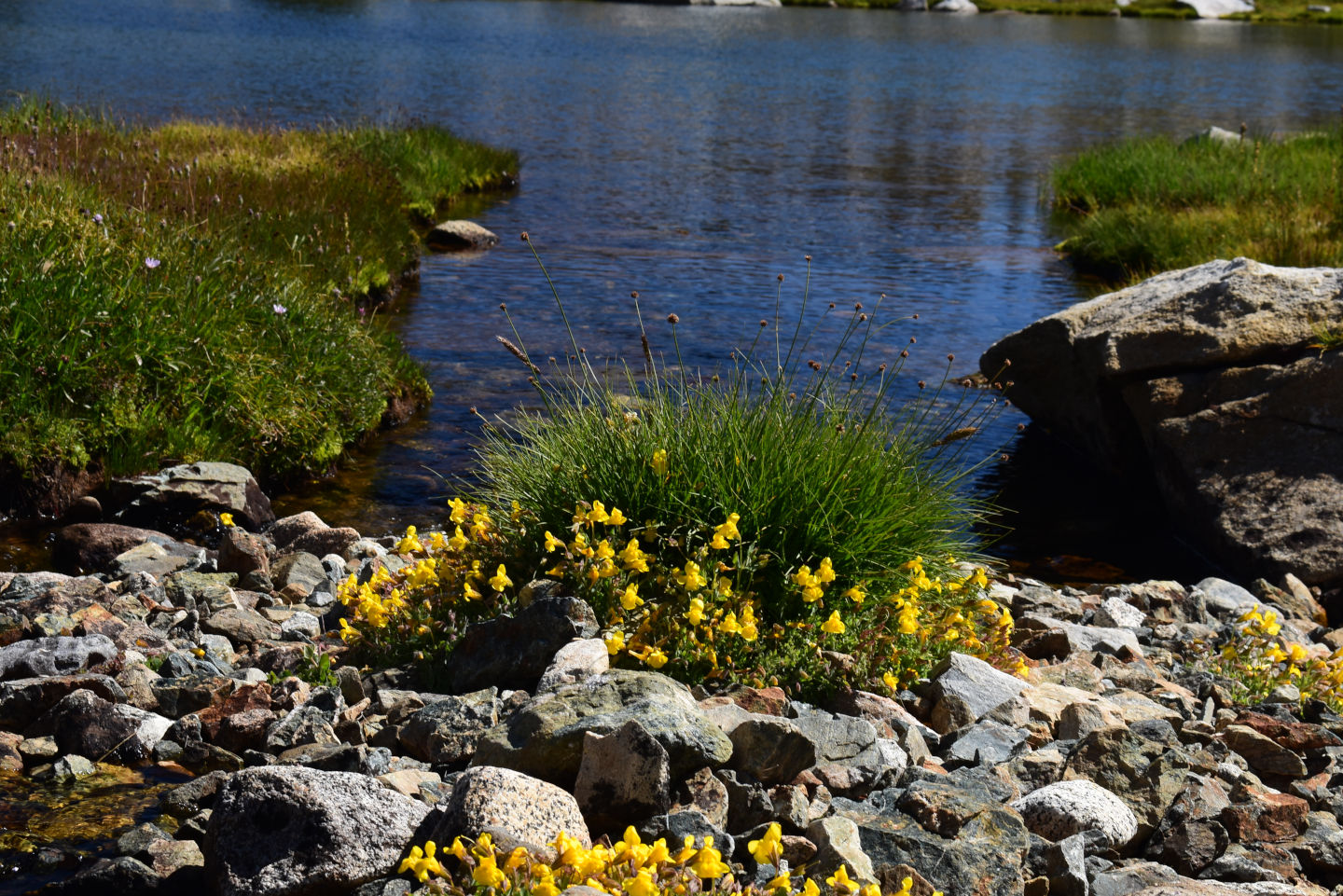
Yellow monkeyflowers on the shore of “Spuller Lake”.
East-Central Sierra Nevada – top
Above Spuller Pond (Inyo National Forest; Hoover Wilderness)
“Maul Lake” map
Above Spuller Pond is 800 m (2,620′) south of “Maul Lake” and 300 m (980′) south of “Spuller Lake”. It is in a cul-de-sac above “Spuller Lake”. Above Spuller Pond is shown as an intermittent pond on The National Map with dimensions of 40 m by 70 m (130′ x 230′).
For access, see “Spuller Lake”
Elevation: 3,168 m (10,390′)
August 20, 2024
The short, moderate climb from “Spuller Lake” has bigger rocks but is not hard. This is above all the trees.
- 40 m x 80 m visual estimate is probably too great as the 7.5-minute topographic quadrangle shows 40 m x 70 m and the water level looks a bit low; greater than 50 cm deep.
- Clear water; 9 C at 1015 in 5 cm water.
- No fairy shrimp.
- Mayfly larvae (Ephemeroptera), lots of caddisfly (Trichoptera) cases but only a few have live larvae.
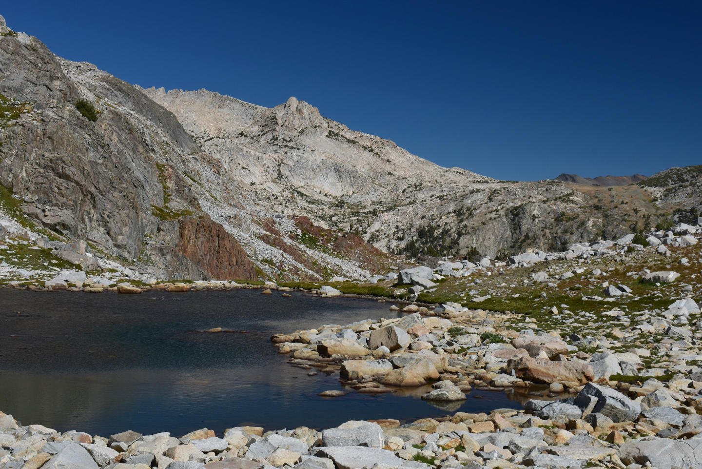
Looking north from the south shore of Above Spuller Pond. Marmot Dropping Pond is on the flat ridge in the distance at center. “Alpine Lake” is below and to the left of the white granite knob to the left of center.
East-Central Sierra Nevada – top
“Alpine Lake” (Inyo National Forest; Hoover Wilderness)
“Maul Lake” map
“Alpine Lake” is 2,700 m (8,860′) west of “Saddlebag Lake” dam and high on the eastern flank of Mount Conness. It has an irregular shape up to 200 m across from the southern shore to the northern tip and up to 180 m across from the northern tip to the northeastern edge (660′ x 590′). The outlet cascades down about 150 m (490′) of steep slopes that no fish could climb.
For access, see “Maul Lake”. Instead of crossing the west branch of Lee Vining Creek, follow the trail past the Experimental Station and stay to the north of the big, boggy meadow west of the Experimental Station. From there, pick your way up the hill to the lake. Thick willows make a route close to the outlet stream difficult and the other choice is clambering up big rocks with small, discontinuous patches of grass.
Elevation: 3,362 m (11,030′) N.B. On the provisional 1986 7.5-minute topographic quadrangle, the water level has an elevation of 11,033 feet.
August 20, 2024
The climb was difficult but that gives me confidence that this lake is probably too much trouble for fishing. There is some krummholz around the lake but no real trees.
- 180 m x 200 m on the 7.5-minute topographic map; greater than 100 cm deep.
- Clear water.
- No fairy shrimp.
- Fish, marmots.
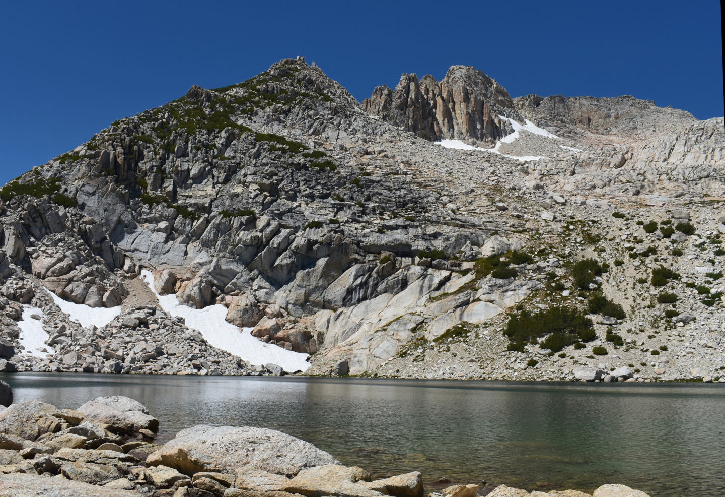
“Alpine Lake” with the east end of Mount Conness above. It looks like a great place for fairy shrimp but somebody thought it would be a better place for fish.
East-Central Sierra Nevada – top
Marmot Dropping Pond (Inyo National Forest; Hoover Wilderness)
“Maul Lake” map
Marmot Dropping Pond is 1,000 m (3,280′) northeast of “Alpine Lake” and 2,000 m (6,560′) west-northwest of the “Saddlebag Lake” dam. It is on a rather flat-topped ridge extending east from the crags of Mount Conness. On the 1:24,000-scale topographic map, it is shown as an intermittent water body. It lacks inlet and outlet. The name is a failure of my imagination. I couldn’t think of anything distinctive about the pond but for some dried marmot feces on one of the rocks.
For access, see “Maul Lake”. Instead of crossing the west branch of Lee Vining Creek to go to “Maul Lake”, stay on the north side and follow the trail to Carnegie Institute Experimental Station. In hiking from “Alpine Lake” to Marmot Dropping Pond, I crossed a trail leading up the south slope of the flat-topped ridge. I don’t know where it went; it might have come from the Experimental Station.
Elevation: 3,330 m (10,930′)
August 20, 2024
Clumps of purple rock fringe between pale granite boulders were quite colorful on the hike over here. The large area of water-stained rocks around the pond indicates a lot of water has evaporated this summer. But there is still enough left for fairy shrimp and other invertebrates.
- 11 m x 14 m; probably 30 cm deep in some places but it’s hard to tell with the big rocks on the bottom.
- Clear water; 14 C at 1400 in 4 cm water.
- No fairy shrimp.
- Big backswimmers, small water boatmen, brown and black beetles less than 5 mm long, copepods less than 1 mm long, caddisfly larvae (Trichoptera), mayfly larvae(?) (Ephemeroptera).
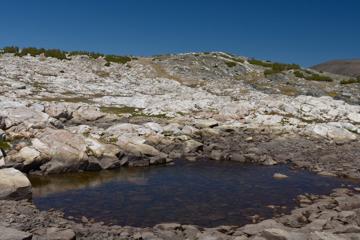
Marmot Dropping Pond amid water-stained rocks, on the ridge east of Mount Conness.
An orange-brown water boatman less than 5 mm long on the bottom of Marmot Dropping Pond. The insects made it up here somehow but not the fairy shrimp. Ripples on the water surface have distorted the appearance of the bottom.
East-Central Sierra Nevada – top
Lost Conness Pond (Inyo National Forest; Hoover Wilderness)
“Maul Lake” map
Lost Conness Pond is 2,650 m (8,690′) northwest of the “Saddlebag Lake” dam and 1,300 m (4,670′) west-southwest of the trail junction east of “Greenstone Lake” and north of “Saddlebag Lake”. On The National Map (topo and imagery), Lost Conness Pond is almost round with a diameter of 70 m (230′) but on the 7.5-minute topographic quadrangle it is somewhat elongate. Although the pond is close to the large valley with the several “Conness Lakes”, it is actually not in that drainage. It is in its own hanging valley above the cliffs west of “Greenstone Lake”. Those hiking to the “Conness Lakes” will never find it. In that sense, it is lost.
To reach Lost Conness Pond, drive up the rough road from California 120 to the “Saddlebag Lake” trailhead. Hike up the west side of the lake. At the trail junction north of “Saddlebag Lake”, turn northwest toward “Steelhead Lake”. Look for an informal trail to the west from the north end of “Greenstone Lake”. Although there is a tall waterfall on the outlet of the lowermost of the “Conness Lakes”, the informal trail to the “Conness Lakes” provides a walkable route up the scarp. Continue following the trail along the north shore of the lowest “Conness Lake” and cross the bog and inlet at the west end of the lake. If you find the informal trail, follow it up the hill to the south or make your own way. From the outlet of the middle of the “Conness Lakes”, hike at least a few hundred meters (300s of feet) along the eastern shore. From the informal trail, aim for the low spot at the north end of the ridge to the east to reach Lost Conness Pond.
Elevation: 3,228 m (10,590′)
August 20, 2024
This pond feels like it’s in its own world and thankfully lost to those fishing in the Sierra Nevada. The depth and clarity of the water are striking. The outlet is poorly defined and is flowing only slightly, if at all.
- 100 m x 120 m; certainly more than 200 cm and possibly 500 cm deep.
- Clear water; 16 C at 1530 in 5 cm water.
- No fairy shrimp.
- Black diving beetles, copepods 1-2 mm long, mayfly larvae (Ephemeroptera).
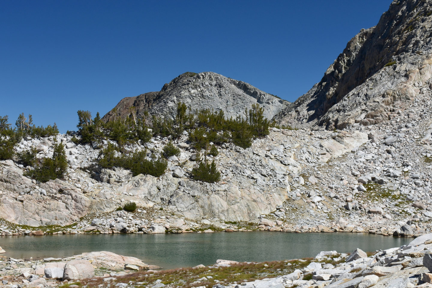
Looking southeast across Lost Conness Pond with peak 11,239′ (3,426 m) in the distance.
East-Central Sierra Nevada – top
Dunderberg Upper Snowbank Pond (Bridgeport Ranger District, Humboldt-Toiyabe National Forest; Hoover Wilderness)
Dunderberg North Pond map
Dunderberg Upper Snowbank Pond is 430 m (1,410′) due south of, and up hill from, Dunderberg North Pond. The snowbank feeding Dunderberg Upper Snowbank Pond is bigger than the one above Dunderberg North Pond. On The National Map, the snowbank is 180 m by 300 m (590′ x 980′). However, the most recent image shows it 60-70 m (200′ x 230′) smaller than that in both directions. The Dunderberg Peak 7.5-minute, 1:24,000-scale, topographic map was made from 1985 aerial photographs and does not show water bodies adjacent to either snowbank. That suggests the ponds are a recent development.
For access, see Dunderberg North Pond.
Elevation: 3,413 m (11,200′)
September 10, 2024
The snowbank rests on the pond bottom and has a nice bluish-green color through the water.
- 23 m x 26 m to edges at snowbank or gravel; less than 100 cm deep.
- Clear water; 5 C at 1230 in 4 cm water with a little ice on the surface.
- No fairy shrimp.
- No aquatic animals observed.
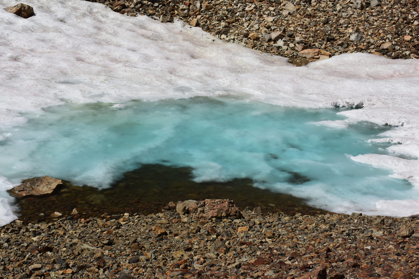
Dunderberg Upper Snowbank Pond and its snowbank. It’s probably not yet ready for fairy shrimp. The pond is bigger than it looks in the photograph.
East-Central Sierra Nevada – top
What Can We Learn from the Ponds in the East-Central Sierra Nevada?
There is a remarkable lack of fairy shrimp in what would seem to be good habitat. When I tried to record every pond visited rather than just those with fairy shrimp in the Wind River Mountains, I found fairy shrimp in 10% or 16% of ponds in 2 different areas. On the 1 day in the Snowy Range when I tried to record all ponds, I found fairy shrimp in 31%. In the East-Central Sierra Nevada, I am 0 for 22, not individually counting more than 2 dozen ponds I looked at in the Lundy Pass area and below Shepherd Crest South Pond between “Cascade Lake” and “Steelhead Lake”. That is worse than the frequency found in the Sierra Lakes Inventory Project survey. It recorded fairy shrimp in only 3.3% of lakes but this number is biased low by the focus on large lakes. Only 5 of the 7,863 surveyed lakes were less than 5 hectares (12.4 acres). A square with dimensions of 100 m (330′) is 1 hectare. One would expect a higher percentage of water bodies with fairy shrimp if a greater proportion of smaller ponds had been surveyed. Perhaps there are other parts of the Sierra Nevada where fairy shrimp are more common.
The lack of fairy shrimp can’t be due solely to extirpation by fish. Most of the ponds I visited are too small or too shallow to have ever had fish and are not connected to streams. Of these, Burro Cirque Pond, Shepherd Crest South Pond, Marmot Dropping Pond, Virginia Divide Double Ponds, “Par Value” Long Pond, “Par Value” Keyhole Pond, “Par Value” Northwest Pond, and “Par Value” North Ridge Pond have macroinvertebrate populations which suggest that there are no physical or chemical limitations to fairy shrimp colonization. The cladocerans in Burro Cirque Pond, in particular, are filter feeders like fairy shrimp. This suggests that dispersal agents have been lacking or inadequate.
Another possible explanation for the lack of fairy shrimp is predation by frogs. The Wind River Mountains have more common fairy shrimp and don’t have frogs. As discussed in Fish-stocking Zooicide, fairy shrimp are more common in lakes without frogs than in lakes with frogs in the Sierra Lakes Inventory Project results but the difference is not statistically significant. Fairy shrimp do co-exist with frogs in some lower elevation areas such as Northern Washoe County and the Antelope Hills. On the other hand, fairy shrimp appear to be completely absent from alpine areas of the Jarbidge Mountains and Ruby Mountains, which have frogs.
The East-Central Sierra Nevada is a great place to visit but don’t go for the fairy shrimp.